Presented at Within Our Reach 2012 by:
CARL SHRECK - Professor and Leader, Oregon Cooperative Fishery Research Unit, Oregon Dept. of Fish & Wildlife
GABE SCHEOSHIPS - Columbia River Intertribal Fish Commission
CYNDI BAKER - Fisheries Biologist, Confederated Tribes of the Warm Springs
LANCE WYSS - Faculty Research Assistant, Willamette River Basin Lamprey Project, Oregon State University
BRIAN McILRAITH - Pacific Lamprey Project Lead, Columbia River Inter-Tribal Fish Commission
This study investigates the potential for using isotope proxies from salt marsh sediments and foraminifera to reconstruct past sea level variability in the South Atlantic Ocean. Surface and core samples were collected from three salt marshes in Argentina. Bulk sediment isotopes (δ13C, δ15N) and foraminifera isotopes (δ13C, δ18O) were analyzed along elevation transects and down core to examine relationships with sea level. Preliminary results show bulk sediment δ13C values between C3 and C4 plant ranges, possibly due to mixing of sources. δ15N values are elevated potentially due to denitrification. Foraminifera isotopes are also examined as sea level proxies. Reconstructing a
Reconstructing Water Levels in the Lake Michigan Basin from Embayed LakesSERC at Carleton College
This document discusses reconstructing past water levels in the Lake Michigan basin from sediment cores taken from embayed lakes. Lake level histories can be determined from geomorphic evidence like stranded shorelines and submerged forests, as well as sedimentological evidence like layers of sand, peat, marl, and gyttja in cores. Cores from small embayed lakes can preserve records of fluctuations in large lake levels over thousands of years. Comparing data from multiple sites allows development of a composite lake level curve for the region.
This document provides a lesson summary on coastal landscapes and processes for a GCSE Geography exam. It outlines several key topics: 1) constructive and destructive coastal processes and the landforms they create, 2) erosion, transportation, and deposition processes that modify coastlines, and 3) common coastal features and how to identify them on maps. It also discusses human interactions with coasts including tourism, erosion issues, and various management strategies like defenses and sustainable development. Case studies are provided to help students understand real-world examples.
This book provides archaeological evidence for early human settlement on San Clemente Island dating back 9,000 years ago. This challenges assumptions that large-scale open water voyages only occurred later with more advanced watercraft. The book documents expert dolphin hunting, one of the earliest dwellings in western North America, and trade connections between San Clemente Island and the mainland as well as Santa Catalina Island, indicating the island peoples were part of a wider regional network. The book establishes San Clemente Island as an important location for understanding early maritime settlement and seafaring along the Pacific coast.
Salmon in the Deschutes by Don RatliffDesLandTrust
Large, ocean-going salmon historically returned annually to the Deschutes River and many of its tributaries. Today salmon and steelhead are coming back to their home waters after an absence of nearly 50 years. Join retired fisheries biologist Don Ratliff for an illustrated overview of salmon and steelhead in the Deschutes River basin. Learn about their historic and present distributions, their life histories, and how they fit into the extremely diverse river system that is the Deschutes River.
This document summarizes a study on Pacific lamprey in the Willamette River basin. It discusses the project objectives of determining lamprey migration patterns, overwintering locations, and use of tributaries for spawning. It provides data on the number of lamprey tagged from 2008-2012 and the number of fixed monitoring sites. It also lists additional future study objectives such as determining if lamprey spawn in the mainstem river, quantifying juvenile rearing habitat, and incorporating lamprey needs into floodplain restoration.
DY Atagi MSc Thesis Estuarine Use by Juvenile Coho Salmon ubc_1994-0362Dana Atagi
This thesis examines whether estuarine use is a viable life history strategy for juvenile coho salmon. The author studied juvenile coho salmon in the Salmon River estuary on Vancouver Island. Key findings include:
1) Juvenile coho salmon were present in the upper intertidal portion of the estuary from May through November, with peak abundance in August.
2) Coho salmon densities and residence times were similar between an experimental tidal channel and a natural one, indicating estuarine habitat use.
3) Estuarine coho salmon grew rapidly and some young-of-the-year fish reached sizes of yearling coho by late summer.
4) Estuarine
In December 2014 WRT held a Catchment Based Approach and Catchment Restoration Fund Conference in Exeter. The University of Exeter's Andy King and Jamie Stevens gave an overview of their work on fish genetics.
Spawning Behavior of Trout and Utility of Redd Countsrobertvierck
Presented by Dr. Robert F. Carline at the November 2016 Meeting of the Spring Creek Chapter of Trout Unlimited, this presentation details the spawning behavior of trout in streams. It also addressed the value of utilizing Redd Counts to determine the health of stream.
This document provides an updated assessment of the population status of smooth skate in the Funk Island Deep designatable unit in Newfoundland and Labrador waters. Survey indices show declines in both abundance and distribution since the 1980s. A Bayesian surplus production model is used to project population response to different levels of fishing mortality over time to inform conservation strategies under Canada's Species at Risk Act. The population was designated endangered by COSEWIC due to its substantial and prolonged decline.
This document summarizes a study on the effects of navigational dams on the feeding morphology of two predatory fish species in the Ohio River. Measurements of mouth morphology, such as jaw length and gape width, were collected from specimens of freshwater drum (Aplodinotus grunniens) and bluegill (Lepomis macrochirus) caught from different pools. Principal component analysis found the freshwater drum from the glaciated valley pool had differing mouth morphology compared to those from alluvial valley pools, indicating differences in available prey. Jaw length was the most influential morphological measurement and varies between life stages and prey selection. Further research is needed to better understand differences in diet between populations.
A talk on OSL and U-series dating of the burial site and skeleton of Kiacatoo Man presented to a meeting of the Riverina branch of Soil Science Australia at Mathoura on 31 Aug 2018 by Dr Tim Pietsch, Griffith University (https://experts.griffith.edu.au/9627-tim-pietsch/about).
This document provides the 2013 annual report for the Okanogan Basin Monitoring and Evaluation Program (OBMEP). Some key findings from the report include:
- Steelhead spawning estimates in the Okanogan subbasin have increased since 2005 and are approaching recovery goals. Abundance of juveniles remains low in the mainstem but is higher in tributaries.
- Recent studies using electrofishing, PIT tagging and mark-recapture provide improved estimates of juvenile steelhead abundance compared to past methods. Data from Omak Creek show high juvenile numbers.
- Habitat modeling found capacity for steelhead is reduced from historical levels, with high temperatures limiting mainstem habitat. Tributaries like Salmon
- Barriers like weirs and culverts were inhibiting fish migration, preventing access to spawning habitats. Fish passes, weir removals, and gravel additions below dams could help.
- Poor habitat management from lack of woody debris and vegetation led to homogeneous channels without shelter. Coppicing trees, adding woody debris and vegetation could help.
- Diffuse pollution from farming practices was degrading water quality through sediments and chemicals, negatively impacting fish and invertebrate communities. Better land management was needed.
- Unnamed weirs and eroded banks were further de
OLA 2009 -- 25 years-- a silver lined anniversaryPaul Robertson
Twenty-five years of lake management on Devils Lake in Oregon was celebrated as a silver anniversary. The lake has faced many challenges over the decades from excessive algae and weed growth due to sewage and agricultural runoff. In the 1980s, grass carp were introduced to control the weeds, which led to the total eradication of submerged plants but also harmful algae blooms. Today, the Devils Lake Water Improvement District continues efforts like water quality monitoring, septic system improvements, and native plant revegetation to improve the lake's health.
This document summarizes research on juvenile Chinook salmon use of small streams in Whidbey Basin. Key findings include:
- Juvenile Chinook from multiple populations use small streams, sometimes residing for months.
- Restoration increased Chinook presence in one stream, suggesting preference for low salinity habitat early in year.
- Ongoing research is examining Chinook patterns, growth, and origins in more small streams to understand their importance.
- Proper protection of these small streams and watersheds as Chinook habitat is questioned given their vulnerability and importance.
Nourishment and Nursery Habitats: Dietary and Habitat-Use Biomarkers in the Saltmarsh
Created by Kathryn Brinegar @ University of North Carolina at Charlotte
This study analyzed the stomach contents and stable isotope ratios of over 960 juvenile fish and their potential food sources from pelagic and littoral habitats in the tidal freshwater region of the San Francisco Estuary. The results showed evidence of two predominant food web pathways. Pelagic fish and some littoral fish relied on a zooplankton-phytoplankton trophic pathway, while the majority of littoral fish had diets and carbon isotope ratios consistent with energy from submerged aquatic vegetation and epiphytic macroalgae. Analysis with a mixing model revealed that littoral fish obtained the overall majority of their nutrition from consuming grazer amphipods. Examining both stable isot
The document discusses the declining salmon populations in the Columbia and Snake Rivers and how breaching the four lower Snake River dams could help recovery efforts. It notes that over $2 billion has been spent on failed efforts to improve fish passage around the dams, while breaching the dams was identified as the preferred alternative in the Corps' 2002 EIS. Breaching could be done quickly and relatively inexpensively compared to estimates, freeing up funds for other restoration work. Removing the dams would significantly increase available salmon habitat and have economic benefits for fishing and local communities.
The document discusses the declining salmon populations in the Columbia and Snake Rivers and the impact of the lower Snake River dams. It summarizes that breaching the four lower Snake River dams is the preferred environmental alternative according to the Corps of Engineers' 2002 EIS. Breaching the dams would restore salmon habitat, benefit orca populations that rely on salmon, and be cheaper than the billions already spent on failed efforts to improve fish passage around the dams.
1. This document describes a study that developed a protocol using underwater videography to quantify trout populations. Video recordings were taken and analyzed from multiple cameras suspended in pools in Pauma Creek, part of the San Luis Rey River system in Southern California. This provided more accurate population data than other survey methods and was less detrimental to the imperiled fish populations.
2. The goal was to establish a lightweight camera system that could be easily deployed in remote areas to survey trout populations in less than an hour, as an alternative to electrofishing, netting, or snorkel surveys which can stress or harm the fish. The study focused on quantifying the native trout population in Pauma Creek, which historically contained coastal steelhead
This document summarizes several stories from the Northwest Indian Fisheries Commission News publication. It discusses the Puyallup Tribe opening an elders-only fishery for spring Chinook salmon due to increasing runs. It also discusses the Port Gamble S'Klallam Tribe acquiring new tidelands for shellfish harvesting and studying plankton in Puget Sound to monitor environmental health. Additionally, it describes education programs bringing students to learn about watersheds, pollution, and habitat restoration at sites like Dungeness Bay and the Skokomish Tribe's tidelands.
This document summarizes research on coastal cutthroat trout populations in South Puget Sound, Washington. It finds that coastal cutthroat trout in the region:
1) Support important sport fisheries but have declined due to overharvesting historically.
2) Have an "unknown" status due to limited data, variable life histories, and lack of baseline information.
3) Appear stable based on initial index surveys and acoustic tagging research that found low mortality rates and limited movement outside of South Puget Sound. More long-term research is still needed to understand population trends.
This presentation is given to the Snohomish County Beach Watcher Training Class every year. It covers salmon life cycle, cultural and social benefits of salmon, salmon habitat and stewardship.
This report analyzes the historical landscape and ecology of Coyote Creek watershed before intensive human modification to understand how the area has changed and to identify opportunities for restoration. The report finds that historically the watershed contained a diverse mosaic of habitats including native grasslands, oak savanna, wet meadows, and freshwater wetlands. However, drainage intensification, agriculture, and development have significantly altered the watershed's hydrology and habitats. Understanding these historical conditions provides a basis for more appropriate restoration goals that consider recovering locally-adapted habitat types and restoring natural watershed functions.
The document discusses progress and challenges in restoring the Willamette River floodplain over the past 15 years. It outlines four key efforts that have influenced restoration: the Willamette Basin Task Force (1997), which focused on governance, funding, monitoring and data, and outreach; the Willamette Restoration Strategy (2001), which identified focus areas, actions and measures; the Willamette River Basin Planning Atlas (2002), which modeled trajectories of conservation and development; and the Willamette Special Investment Partnership (2008), which established common ecological priorities and an informal implementation network. Enduring challenges include governance, sustained funding, comprehensive data management, and effective outreach.
The document discusses tribal resources and land conservation by the Confederated Tribes of Grand Ronde. It provides historical context on tribal land management practices prior to treaty signing, including active landscape management to encourage resource production and an extensive trade network. It presents challenges to conservation like invasive species and habitat degradation. The tribal vision involves connection to land from time immemorial and viewing natural resources as cultural. Solutions discussed include outreach, education, long-term conservation and restoration partnerships. Examples provided are Rattlesnake Butte and Chahalpam Wildlife Area conservation projects.
More Related Content
Similar to Lamprey Research Update - Schreck, et al.
Spawning Behavior of Trout and Utility of Redd Countsrobertvierck
Presented by Dr. Robert F. Carline at the November 2016 Meeting of the Spring Creek Chapter of Trout Unlimited, this presentation details the spawning behavior of trout in streams. It also addressed the value of utilizing Redd Counts to determine the health of stream.
This document provides an updated assessment of the population status of smooth skate in the Funk Island Deep designatable unit in Newfoundland and Labrador waters. Survey indices show declines in both abundance and distribution since the 1980s. A Bayesian surplus production model is used to project population response to different levels of fishing mortality over time to inform conservation strategies under Canada's Species at Risk Act. The population was designated endangered by COSEWIC due to its substantial and prolonged decline.
This document summarizes a study on the effects of navigational dams on the feeding morphology of two predatory fish species in the Ohio River. Measurements of mouth morphology, such as jaw length and gape width, were collected from specimens of freshwater drum (Aplodinotus grunniens) and bluegill (Lepomis macrochirus) caught from different pools. Principal component analysis found the freshwater drum from the glaciated valley pool had differing mouth morphology compared to those from alluvial valley pools, indicating differences in available prey. Jaw length was the most influential morphological measurement and varies between life stages and prey selection. Further research is needed to better understand differences in diet between populations.
A talk on OSL and U-series dating of the burial site and skeleton of Kiacatoo Man presented to a meeting of the Riverina branch of Soil Science Australia at Mathoura on 31 Aug 2018 by Dr Tim Pietsch, Griffith University (https://experts.griffith.edu.au/9627-tim-pietsch/about).
This document provides the 2013 annual report for the Okanogan Basin Monitoring and Evaluation Program (OBMEP). Some key findings from the report include:
- Steelhead spawning estimates in the Okanogan subbasin have increased since 2005 and are approaching recovery goals. Abundance of juveniles remains low in the mainstem but is higher in tributaries.
- Recent studies using electrofishing, PIT tagging and mark-recapture provide improved estimates of juvenile steelhead abundance compared to past methods. Data from Omak Creek show high juvenile numbers.
- Habitat modeling found capacity for steelhead is reduced from historical levels, with high temperatures limiting mainstem habitat. Tributaries like Salmon
- Barriers like weirs and culverts were inhibiting fish migration, preventing access to spawning habitats. Fish passes, weir removals, and gravel additions below dams could help.
- Poor habitat management from lack of woody debris and vegetation led to homogeneous channels without shelter. Coppicing trees, adding woody debris and vegetation could help.
- Diffuse pollution from farming practices was degrading water quality through sediments and chemicals, negatively impacting fish and invertebrate communities. Better land management was needed.
- Unnamed weirs and eroded banks were further de
OLA 2009 -- 25 years-- a silver lined anniversaryPaul Robertson
Twenty-five years of lake management on Devils Lake in Oregon was celebrated as a silver anniversary. The lake has faced many challenges over the decades from excessive algae and weed growth due to sewage and agricultural runoff. In the 1980s, grass carp were introduced to control the weeds, which led to the total eradication of submerged plants but also harmful algae blooms. Today, the Devils Lake Water Improvement District continues efforts like water quality monitoring, septic system improvements, and native plant revegetation to improve the lake's health.
This document summarizes research on juvenile Chinook salmon use of small streams in Whidbey Basin. Key findings include:
- Juvenile Chinook from multiple populations use small streams, sometimes residing for months.
- Restoration increased Chinook presence in one stream, suggesting preference for low salinity habitat early in year.
- Ongoing research is examining Chinook patterns, growth, and origins in more small streams to understand their importance.
- Proper protection of these small streams and watersheds as Chinook habitat is questioned given their vulnerability and importance.
Nourishment and Nursery Habitats: Dietary and Habitat-Use Biomarkers in the Saltmarsh
Created by Kathryn Brinegar @ University of North Carolina at Charlotte
This study analyzed the stomach contents and stable isotope ratios of over 960 juvenile fish and their potential food sources from pelagic and littoral habitats in the tidal freshwater region of the San Francisco Estuary. The results showed evidence of two predominant food web pathways. Pelagic fish and some littoral fish relied on a zooplankton-phytoplankton trophic pathway, while the majority of littoral fish had diets and carbon isotope ratios consistent with energy from submerged aquatic vegetation and epiphytic macroalgae. Analysis with a mixing model revealed that littoral fish obtained the overall majority of their nutrition from consuming grazer amphipods. Examining both stable isot
The document discusses the declining salmon populations in the Columbia and Snake Rivers and how breaching the four lower Snake River dams could help recovery efforts. It notes that over $2 billion has been spent on failed efforts to improve fish passage around the dams, while breaching the dams was identified as the preferred alternative in the Corps' 2002 EIS. Breaching could be done quickly and relatively inexpensively compared to estimates, freeing up funds for other restoration work. Removing the dams would significantly increase available salmon habitat and have economic benefits for fishing and local communities.
The document discusses the declining salmon populations in the Columbia and Snake Rivers and the impact of the lower Snake River dams. It summarizes that breaching the four lower Snake River dams is the preferred environmental alternative according to the Corps of Engineers' 2002 EIS. Breaching the dams would restore salmon habitat, benefit orca populations that rely on salmon, and be cheaper than the billions already spent on failed efforts to improve fish passage around the dams.
1. This document describes a study that developed a protocol using underwater videography to quantify trout populations. Video recordings were taken and analyzed from multiple cameras suspended in pools in Pauma Creek, part of the San Luis Rey River system in Southern California. This provided more accurate population data than other survey methods and was less detrimental to the imperiled fish populations.
2. The goal was to establish a lightweight camera system that could be easily deployed in remote areas to survey trout populations in less than an hour, as an alternative to electrofishing, netting, or snorkel surveys which can stress or harm the fish. The study focused on quantifying the native trout population in Pauma Creek, which historically contained coastal steelhead
This document summarizes several stories from the Northwest Indian Fisheries Commission News publication. It discusses the Puyallup Tribe opening an elders-only fishery for spring Chinook salmon due to increasing runs. It also discusses the Port Gamble S'Klallam Tribe acquiring new tidelands for shellfish harvesting and studying plankton in Puget Sound to monitor environmental health. Additionally, it describes education programs bringing students to learn about watersheds, pollution, and habitat restoration at sites like Dungeness Bay and the Skokomish Tribe's tidelands.
This document summarizes research on coastal cutthroat trout populations in South Puget Sound, Washington. It finds that coastal cutthroat trout in the region:
1) Support important sport fisheries but have declined due to overharvesting historically.
2) Have an "unknown" status due to limited data, variable life histories, and lack of baseline information.
3) Appear stable based on initial index surveys and acoustic tagging research that found low mortality rates and limited movement outside of South Puget Sound. More long-term research is still needed to understand population trends.
This presentation is given to the Snohomish County Beach Watcher Training Class every year. It covers salmon life cycle, cultural and social benefits of salmon, salmon habitat and stewardship.
This report analyzes the historical landscape and ecology of Coyote Creek watershed before intensive human modification to understand how the area has changed and to identify opportunities for restoration. The report finds that historically the watershed contained a diverse mosaic of habitats including native grasslands, oak savanna, wet meadows, and freshwater wetlands. However, drainage intensification, agriculture, and development have significantly altered the watershed's hydrology and habitats. Understanding these historical conditions provides a basis for more appropriate restoration goals that consider recovering locally-adapted habitat types and restoring natural watershed functions.
Similar to Lamprey Research Update - Schreck, et al. (20)
The document discusses progress and challenges in restoring the Willamette River floodplain over the past 15 years. It outlines four key efforts that have influenced restoration: the Willamette Basin Task Force (1997), which focused on governance, funding, monitoring and data, and outreach; the Willamette Restoration Strategy (2001), which identified focus areas, actions and measures; the Willamette River Basin Planning Atlas (2002), which modeled trajectories of conservation and development; and the Willamette Special Investment Partnership (2008), which established common ecological priorities and an informal implementation network. Enduring challenges include governance, sustained funding, comprehensive data management, and effective outreach.
The document discusses tribal resources and land conservation by the Confederated Tribes of Grand Ronde. It provides historical context on tribal land management practices prior to treaty signing, including active landscape management to encourage resource production and an extensive trade network. It presents challenges to conservation like invasive species and habitat degradation. The tribal vision involves connection to land from time immemorial and viewing natural resources as cultural. Solutions discussed include outreach, education, long-term conservation and restoration partnerships. Examples provided are Rattlesnake Butte and Chahalpam Wildlife Area conservation projects.
The Willamette Biological Opinion Implementation document provides an update on progress implementing actions from the 2008 biological opinions on operations of the 13-dam Willamette Project. Key actions include improving upstream and downstream fish passage, water quality including temperature control and total dissolved gas, instream flows, hatchery improvements, and habitat restoration. Updates are given on specific projects and studies underway on the McKenzie, Middle Fork Willamette, North Santiam, and South Santiam rivers to address fish passage and water quality requirements for ESA-listed salmon and steelhead.
This document summarizes recovery efforts for Upper Willamette River Chinook salmon and steelhead. It discusses the key challenges facing these species, including blocked passage, changed water temperatures, pre-spawning mortality, and reduced habitat complexity and water quality. The recovery efforts focus on protecting and increasing diverse habitat types, off-channel areas, shallow water habitat, floodplain connectivity and water quality through partnerships. Specific actions include implementing the Willamette Project Biological Opinion, coordinated research, hatchery and harvest reform, and prioritizing actions to reduce pre-spawning mortality, improve passage, rearing and migration conditions, and monitor progress.
The Willamette Wildlife Mitigation Program is a $157 million agreement signed in 2010 to conserve and restore wildlife habitat in the Willamette Basin over 15 years. It will acquire 16,880 acres of land by 2025 for the Oregon Department of Fish and Wildlife. The program established an advisory group and defines how projects can provide dual benefits for fish and wildlife. It is consistent with regional conservation plans and objectives. In 2013, the program recommended 2621 acres for purchase, with 14 projects totaling that amount, of which 6 provide dual credits.
The document summarizes the Confederated Tribes of Warm Springs Reservation of Oregon's (CTWSRO) experience acquiring and managing lands for mitigation through the Bonneville Power Administration's Willamette Basin Wildlife Mitigation Program. Specifically, it discusses four areas totaling over 35,000 acres that have been acquired and are managed by CTWSRO for wildlife mitigation. It outlines CTWSRO's mission and goals in partnering with BPA on the mitigation program to acquire ecologically beneficial lands and provide cultural resources and harvest opportunities. Upcoming plans include continuing to build partnerships to actively pursue additional properties that would benefit the mitigation program.
TRaCK research is providing science to support sustainable management of northern Australia's tropical rivers and estuaries. Three projects are modeling future development scenarios over 30 years, finding that 5% agriculture increases Indigenous income by 6% but reduces fish habitat and harvest by 11%, while 5% government investment increases Indigenous income 45% while reducing these impacts. TRaCK2 will focus on interdisciplinary problem-solving projects co-developed with stakeholders.
Large scale river restoration programs require bringing science into both planning and implementation. Two successful projects, the Kissimmee River Restoration and Healthy Waterways Initiative in Australia, established rigorous monitoring programs to evaluate outcomes. The California Delta faces challenges of balancing water exports and habitat restoration, requiring an adaptive approach incorporating the best available science. Institutional challenges to large river restoration include uncertainty, the transition from planning to action, effective communication, and integrating synthesized data.
This document lists the names of 14 individuals and 3 organizations that were dedicated members of Team Willamette. The individuals include William J. Finley, Fred Merryfield, R.E. Dimick, Tom McCall, Robert Straub, Gail Achterman, Jim Sedell, Peter Kenagy, Pam Wiley, Dave Hulse, and Ken Bierly. The 3 organizations are Meyer Memorial Trust, University of Oregon, and Oregon Watershed Enhancement Board.
This document summarizes key uncertainties and context around Pacific lamprey biology. It identifies several areas of critical uncertainty, including lamprey biology, population structure, habitat use and requirements, ecology, monitoring methods, and conservation and management approaches. The document also notes that while there are many uncertainties, lampreys provide an opportunity to explore scientific questions at multiple scales, from basic biology to population trends to integrating mechanisms with patterns. Overall, the document outlines open questions and a need for further lamprey research and monitoring to address uncertainties.
The document discusses a water quality report card for Oregon. It outlines several elements that could be included in the report card such as water chemistry, contact recreation, groundwater quality, biology, and fish consumption indicators. It provides examples of data sources and spatial scales. Tables show example data and issues for the Lower Willamette Sub Basin. The report card aims to assess and communicate water quality to various audiences in an easy to understand format.
The document discusses the development of environmental report cards to communicate information about ecosystem health. It provides examples of existing report cards for the Chesapeake Bay and Great Barrier Reef. A five step process is outlined for creating report cards: 1) create a conceptual framework, 2) choose indicators, 3) define thresholds, 4) calculate scores, and 5) communicate results. Report cards work by leveraging peer pressure and synthesizing large amounts of data into an easily understandable format based on a common experience with educational report cards.
The Natural Areas Program has grown from managing zero acres to over 16,000 acres in 20 years through two bond measures that provided $363 million. While land acquisition was relatively straightforward, ongoing ecological and land management challenges require expertise in areas like invasive species control, hydrology, forestry, monitoring, and more. Securing long-term funding for management has been difficult, with bond funds only covering acquisition and limited annual budgets restricting work. A permanent funding source, even at a modest level, is needed to better care for the natural areas portfolio.
The document discusses the Oregon Parks and Recreation Department's natural resource stewardship program. It outlines the department's mission to protect natural, scenic, cultural, historic and recreational sites. It also discusses some of the program's strategies, challenges, and solutions, including the need for partnerships, large-scale weed surveys, and addressing funding issues. The final section covers additional uncertainties like dam operations, climate change, and potential new invasive species.
This document discusses a twinning partnership program between watershed groups in the Siuslaw Basin of Oregon and regions of the Russian Far East aimed at salmon habitat restoration and community engagement. It provides an overview of exchanges between 2004-2012, including student blog projects, workshops on planning and restoration, and establishing public salmon councils in Russia. It outlines successes of the program as well as challenges such as language/cultural barriers, government cooperation, and funding. The document advises on carefully selecting twinning partners by considering similarities/differences in needs, assets, and levels of experience.
The document discusses establishing "twinning" partnerships between the Willamette river restoration groups and other groups facing similar challenges. It proposes that the Willamette groups offer their expertise to help other groups restore rivers efficiently and sustainably. Criteria for compatible twinning partnerships include a personal relationship, high motivation levels in the other group, matching skills, and public and financial support. The document outlines what is needed to propose such a partnership, including a business plan and Memorandum of Understanding, and notes assistance that can be provided by the International RiverFoundation.
The document presents a 30-year vision for open space along the Willamette River between Eugene and Springfield, Oregon. It identifies opportunities for river-oriented mixed-use development and redevelopment of industrial sites, with an emphasis on ecological design and public access to the river. Specific opportunity areas mentioned include the EWEB site in Eugene and the Glenwood Refinement Plan area in Springfield.
Milwaukie Riverfront Park is a proposed park along the Willamette River in Milwaukie, Oregon. The city adopted a downtown riverfront plan in 2000 and selected a designer in 2006. Since then, the city has submitted land use and permit applications and received local approvals, but still needs to address access from McLoughlin Boulevard, complete permitting, and secure funding to move forward with the park project.
The document summarizes an upcoming 90-minute breakout session discussing river health in cities along the Willamette River. The session will include a quick introduction, a 20-30 minute panel featuring representatives from three cities, a 50 minute Q&A and discussion period, and a 5 minute wrap-up. The panelists will discuss how cities are improving river health, key restoration challenges, and messages for the wider community about city-related opportunities and limitations regarding balancing economic, development, and natural resource needs.
The document discusses developing and implementing environmental flows in the Willamette River Basin. It describes the 13 dams and reservoirs built by the USACE that altered flows. A process was used to analyze pre- and post-dam hydrology and flows needed to support salmon, riparian vegetation, and other species. Initial recommendations call for fall, winter, and spring high flow events of varying magnitudes on the South Santiam River. Benefits of restored flows include vegetation growth, fish migration, and floodplain habitat. Policy considerations include balancing flows with other dam purposes and population distribution. The TNC and USACE collaborate on sustainable rivers projects worldwide.
Willamette Sustainable Rivers Project - Taylor, Bach, & Budai
Lamprey Research Update - Schreck, et al.
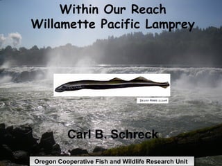
1. Within Our Reach
Willamette Pacific Lamprey
Carl B. Schreck
Oregon Cooperative Fish and Wildlife Research Unit
2. Japanese Arctic Lamprey
Harvest from Ishikari River
Data from 2007 Ishikari River Arctic Lamprey
Cultural Conservation & Restoration Project Report
5. Pacific Lamprey
Gabe Sheoships – CRITFC/OSU
Lawrence Schwabe - Grande Ronde
Cyndi Baker - Warm Springs
Brian McIlraith - CRITFC
Lance Wyss - OCFWRU/F&W, OSU
Ben Clemens – OSU/ODFW
Siletz & FWS
6. Indigenous Management & Traditional
Ecological Knowledge of Pacific
Lamprey (Entosphenus tridentatus) in
the Willamette River Basin.
Gabe Sheoships
Within Our Reach 2012
9. Origin story: Winner takes all
As the legend goes, the lamprey
and sucker fish placed a wager
over a swimming race. The
lamprey lost, and thus lost all of
it’s scales and bones to the
sucker.
10. Seven Drum Washat’ Longhouse
Religion
The creator designated the Ksuyus’ as a
food source for the people, by the
seven gill slits on it’s body.
12. Traditional Usage of Ksuyus’
First food honored each year in
ceremony.
Biotherapy.
Omega 3 oils beneficial for hair, skin
tone, many other things.
Fertility promoting qualities.
14. Willamette Falls TEK
Tribes practiced selective seasonal harvest
management of Willamette Run.
Juvenile freshwater inhabitants
outmigration related to lunar activity.
Adult fish were known to return to the Falls
when precipitation declined.
Adult returns have always been “patchy” or
highly variable.
17. Past traditional harvest sites:
Celilo Falls (Inundation)
Fifteenmile Creek (Poor returns)
Kettle Falls/Columbia River
(Inundation)
Sherars Falls/Deschutes River (Poor
returns)
Savage Rapids Dam/Rogue River
(Poor returns)
Winchester Dam/Umpqua River (Poor
returns)
21. Issue
Declining abundance of lamprey in Columbia River
Abundance of Pacific lamprey in the Willamette Basin
was first estimated in 2010
Willamette Falls provides a opportunity for capturing
and tagging lamprey at fish ladders and inspecting
lamprey at fish ladders and through lamprey harvest
But the area also presents a challenge…large area,
high volume of water, and uncertainties of lamprey
behavior through the falls/ladders
22. Harvest
Lack of
opportunity
in
Columbia
River brings
tribes from
Idaho to
coast
Typically
occurs late
June and
July
23.
24.
25. Mark Recapture - Abundance
Capture lamprey in fish ladder April –September
Mark with PIT tags and visible dart tag
Lamprey are released about 1 mile downstream
Inspecting lamprey for tags (“recaptured fish”) occurs
during tagging
Estimate is made using the number marked (tagged),
recaptured and inspected for tags that had none
26. Year Ladder Horseshoe
2010 22,000 to 34,000 37,000
2011 40,000 to 62,000 58,000
29. Subsistence
Spiritual
Medicinal
Trade & Gift Giving
Way of Life
“Skakwal” is Chinook Jargon (also known
as chinuk wawa)
30. Project Objectives:
1. Determine timing and movement patterns during upstream
migrations
2. Identify over-wintering locations
3. Determine relative use of primary tributaries for spawning
4. Formulate management recommendations
31. Tagging Summary
2008 (CTGR) 111 tagged lamprey were above the Falls.
Tracked by boat & by 11 fixed telemetry sites.
2009 (CTGR, CRAMER, PGE,OSU) 209 Tagged Lamprey were above the Falls
Tracked by Boat, Plane and 22 fixed telemetry sites.
2010 (CTGR, CRAMER,OSU) 219 tagged lamprey were above the Falls
Tracked by boat, plane and 22 fixed
telemetry sites.
2011-2012 (CTGR) 120 tagged lamprey above the
Falls. Tracking by boat and 22 fixed
sites.
32. Fixed Site Locations
River Mile Mainstem Tributary Organization
24 Clackamas CFS
Willamette Falls
West Linn
26 CTGR
28 Tualatin CTGR
30 Rock Island CFS
37 Molalla CTGR
37 Pudding CFS
46 Champoeg Park CFS
54 Evergreen CTGR
55 Yamhill CTGR
87 Eola CFS
106 Buena Vista CFS
108 Santiam CTGR
108 NF Santiam CFS
108 Luckiamute CTGR
119 Calapooia CTGR
131 Corvallis CFS
133 Mary's CTGR
148 Long Tom CFS
161 Harrisburg CFS
175 Mckenzie CTGR
180 Eugene CTGR
187 Coast Fork CFS
33.
34.
35.
36.
37.
38. Determine if lamprey
spawn in the mainstem
Willamette River.
Quantify the amount
and quality of juvenile
rearing habitat.
Monitor and quantify
lamprey response to
floodplain restoration
work.
Identify and incorporate
habitat needs for pacific
lamprey into floodplain
restoration design.
42. Collaborative Lamprey
Conservation and
Restoration
• Columbia River Basin Lamprey
Technical Workgroup
• Lamprey Summit III
• June 2012
• Lamprey Conservation Agreement
• Willamette River Management 42
Unit
43. CRITFC Tribal Pacific
Lamprey Restoration Plan
• Mainstem Passage and Habitat
• Tributary Passage and Habitat
• Supplementation/Augmentation
• Contaminants and Water Quality
• Public Outreach and Education
• Research, Monitoring, and
43
Evaluation
44. CRITFC Tribal Pacific
Lamprey Restoration Plan
• Mainstem Passage and Habitat
• Tributary Passage and Habitat
• Supplementation/Augmentation
• Contaminants and Water Quality
• Public Outreach and Education
• Research, Monitoring, and
44
Evaluation
45. Collaborative Lamprey
Conservation and
Restoration
• Other guiding documents
• USACE Pacific Lamprey Passage
Improvements Implementation Plan
• CRITFC Tribal Pacific Lamprey Restoration
Plan for the Columbia River Basin
• USFWS Pacific Lamprey Assessment and
Template for Conservation Measures 45
46. Monitoring Pacific Lamprey Relative
Abundance and Distribution in the
Willamette River Basin
Lance Wyss, Ben Clemens, Luke Schultz, Gabe Sheoships,
Carl Schreck
Provide information to fill critical knowledge gaps identified
through the recovery and restoration planning processes
I VE FI
AT SH
R
E
E
P
R
O
Y
CO
R ESEAR
ON
ES
ES
us
G
Cat
S em p e r os t om
RE
C
O
H
H
H
UN I T
59. Lamprey Critical Uncertainties
• Moser et al. 2007 Rev. Fish Biol. Fish.
• Mesa et al. 2009
• Luzier et al. 2009
• Clemens et al. 2010 Fisheries
• Lamprey Tech. Workgroup 2005-2011
• U.S. F& WS 2011
• CRITFC 2011
*We are certain that we are uncertain!
Problem with each phase of the life cycle -Juvenile feeding on all -Top of the food chain (feeds on everything out there in the ocean) -marine fish stock depletion
Willamette Falls circa 1913 (Crow).
Questions
The plan is a group effort of CRITFC and its member tribes: Yakama Warm Springs Umatilla Nez Perce Focused on the entire Columbia River basin and centered around the entire life history of Pacific lamprey
Mainstem passage and habitat: Primary initial focus—the most urgent problem-facing lamprey in the CRB Improving passage at all mainstem dams in the Columbia, Snake, and Willamette Rivers Improving migration and rearing habitat in mainstem and estuary areas Focused on adult AND juvenile lamprey---upstream and downstream movers Adult mainstem passage Juvenile mainstem passage Mainstem and estuary habitat