Route 28 Widening: Citizens Information Meeting - April 3, 2018
•Download as PPTX, PDF•
3 likes•2,610 views

Route 28 Widening: Citizens Information Meeting - April 3, 2018

Recommended
Recommended
More Related Content
What's hot
What's hot (20)
Similar to Route 28 Widening: Citizens Information Meeting - April 3, 2018
Similar to Route 28 Widening: Citizens Information Meeting - April 3, 2018 (20)
More from Fairfax County
More from Fairfax County (20)
Recently uploaded
Recently uploaded (20)
Route 28 Widening: Citizens Information Meeting - April 3, 2018
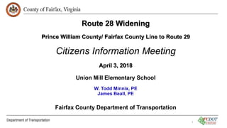
- 1. Route 28 Widening Prince William County/ Fairfax County Line to Route 29 Citizens Information Meeting April 3, 2018 Union Mill Elementary School W. Todd Minnix, PE James Beall, PE Fairfax County Department of Transportation 1
- 2. Introductions • District Supervisors’ and Staff • Sully District – Supervisor Kathy Smith • Springfield District – Supervisor Pat Herrity • Fairfax County Department of Transportation (FCDOT) • Fairfax County Department of Public Works & Environmental Services (DPWES) • Consultants • Prince William County • VDOT • Others Route 28 Widening
- 3. PURPOSE The purpose of tonight’s meeting is to provide information to and solicit feedback, comments, and suggestions from the Community on the status of the proposed widening of Route 28 from the Prince William/Fairfax County Line to Route 29 including: 1. Scope and Design Elements of the project 2. Environmental Impacts/Issues 3. Method of Project Delivery/Schedule 4. Any other items of Community importance and/or concern related to the Project 3
- 4. Route 28 Widening Agenda • Background • Current Tasks Completed/Underway • Noise Barriers 101 • Traffic Analysis • Right-of-Way Requirements • Cost Estimates/Funding • Project Schedule/Delivery Method • Next Steps • Feedback and Questions 4
- 5. Route 28 Widening 5 End Project Begin Project
- 6. Background • Original Scope called for widening Route 28 to 6-Lanes from the bridge over Bull Run to the Route 28/29 Interchange • Endorsed by Fairfax County Board of Supervisors as part of the County’s Transportation Priorities Plan (TPP) on January 28, 2014 (TPP ID#62) • Initial Work on project began in 2016 • County’s Comprehensive Transportation Plan describes Route 28 as 8 lanes with High Occupancy Vehicle (HOV) lanes, and a future interchange at New Braddock Road • Project as proposed does not preclude future HOV or a future interchange at New Braddock Road • Route 28, from Compton Road northward, is designated as a Limited Access Highway 6 Route 28 Widening
- 7. 7 Current Tasks Completed/Underway: • Topographic Survey • Utility Designation (above and below ground) • Soils Investigations • Initial Environmental Investigations: • Preliminary Environmental Inventory (PEI) • NEPA Document Concurrence from VDOT and FHWA (Documented Categorical Exclusion (CE)) – Resubmitted with Revised Scope and approved by FHWA • Wetland and Stream Delineation • Cultural Resources – Archeology, Architectural and Historic Resources • Threatened and Endangered Species • Noise and Air Quality • Traffic Analysis (No-Build, 2040, Alternative Alignments/Lane Configuration) Route 28 Widening
- 8. 8 Current Tasks Completed/Underway: • Preliminary Design (15% Plans) • 4 Options for Ordway Rd./Compton Rd./Old Centreville Rd./Route 28 • Current Configuration with Added Lanes • Realign Ordway Road to align with Old Centreville Road, w/Traffic Signal • Realign Ordway Road to align with Old Centreville Road, w/Roundabout • Realign Old Centreville Road to “T” intersection w/Ordway Road, w/Traffic Signal • 8-Lane configuration on Route 28 – “worst case” • 6-7-8 Lane Hybrid – Current “Preferred Option” • Will be revised based upon final traffic analysis and optimized lane configuration once approved by VDOT (see Traffic Analysis) Route 28 Widening
- 9. Bifurcated Profiles • Elevation difference between northbound (NB) and southbound (SB) roadway profiles will require median retaining walls • SB Roadway does not meet current sight distance criteria; two possible solutions: • Overlay pavement on either side of crest vertical curves • Regrade and lower existing roadway • Final design could affect utility relocations and Maintenance of Traffic which could require additional easements beyond those shown on the plans. 9 Route 28 Widening
- 10. Noise Barriers 101 • Federal law requires FCDOT to evaluate noise levels on federally funded projects to comply with the National Environmental Protection Act (NEPA) • Where project noise levels are projected to exceed established criteria, FCDOT will be required to propose noise mitigation • Sound Barriers will be constructed only if the people who are directly benefitted vote for them • Noise Analysis • Computer model calibrated to existing conditions • Based on design year traffic volumes (2040) • Loudest hour – AM or PM on Route 28 10 Route 28 Widening
- 11. 11 Route 28 Widening Example Noise Barrier Voting
- 12. Traffic Analyses: Prepared for several options to determine optimal lane configuration on Route 28 based upon projected traffic volumes in 2040: • 6-Lanes (3 lanes in each direction) • 7-Lanes (4 NB Lanes, 3 SB Lanes) • 8-Lanes (4 lanes in each direction) • 6-7-8-Lane Hybrid (3 NB lanes from Bull Run Bridge to just south of New Braddock Road, 4-lanes from there northward; 4-lanes SB from Route 29 to Compton Road, 3-lanes SB tapering to 2-lanes at Bull Run Bridge) – Preferred Option based upon initial traffic analysis data • Revised Existing Conditions Model submitted to VDOT for review on February 7, 2018. • Detailed future conditions analysis expected to be complete late spring 2018 12 Route 28 Widening
- 13. Route 28 Widening 13 6-7-8 Lane Hybrid “Preferred Option”
- 14. Traffic Analyses (cont.) • Improvements at ALL existing signalized intersections by adding turn lanes and/or one or more additional lanes on side streets to eliminate split-phase signal operations and improve overall intersection operations. (Examples) • Dual Left turn lanes on NB Route 28 at New Braddock (may not be needed/required) • Dual Left turn lanes on NB Route 28 at Machen Road • Triple Left turns from Westbound (WB) New Braddock to SB Route 28 • Adding one lane on WB Compton Road • Adding one lane on EB Compton Road • Adding one lane on EB Old Mill Road • Adding one lane on WB Old Centreville Road (north end of project) • Proposed removal of selected existing median crossovers (unsignalized) 14 Route 28 Widening
- 16. Traffic Alternatives Comparison Route 28 Widening Intersection AM PM AM PM AM PM AM PM AM PM Upperridge/Old Centreville Avg. Intersection Delay 45 64 65 38 29 41 32 35 39 34 LOS D E E D C D C C D C Machen Road Avg. Intersection Delay 31 76 28 54 28 47 23 27 19 27 LOS C E C D C D C C B C New Braddock Avg. Intersection Delay 101 89 85.3 58 64 62 61 42 61 44 LOS F F F E E E E D E D Old Mill/Green Trails Avg. Intersection Delay 27 59 22 65 22 75 38 27 19 26 LOS C E C E C E D C B C Compton Road Avg. Intersection Delay 73 78 92 72 52 66 78 45 50 44 LOS E E F E D E E D D D Travel Time (Min:Sec) AM PM AM PM AM PM AM PM AM PM NB - Bull Run Bridge to I-66 On Ramp 12:23/15.2 5:54/31.9 09:56 06:19 07:06 05:31 08:10 05:27 07:00 05:17 SB - I-66 on Ramp to Bull Run Bridge 5:16/35.6 10:07/18.5 06:04 08:22 05:50 09:01 05:03 05:53 05:10 05:54 Note: These are planning-level results from VISUM/Synchro, which can provide optimistic results compared with the more detailed VISSIM simulation which is calibrated against the existing conditions model. Actual simulation/operational analysis will give a more accurate indication of operations/queuing, which may be worse than shown above. The results will provide a comparison of alternative operations. 2040 6-Lanes 7-Lanes (4 NB, 3 SB) 6/7/8-Lanes (3/4 NB, 4 SB) 8-Lanes 2016 2040 2040 2040
- 17. AM Travel Time Comparison Route 28 Widening 00:00 02:00 04:00 06:00 08:00 10:00 12:00 14:00 4-Lanes (2016) 6-Lanes 7-Lanes (4 NB, 3 SB) 6/7/8-Lanes (3/4 NB, 4 SB) 8-Lanes Time NB - Bull Run Bridge to I-66 On Ramp SB - I-66 on Ramp to Bull Run Bridge Estimated 20402016
- 18. PM Travel Time Comparison Route 28 Widening 00:00 02:00 04:00 06:00 08:00 10:00 12:00 14:00 4-Lanes (2016) 6-Lanes 7-Lanes (4 NB, 3 SB) 6/7/8-Lanes (3/4 NB, 4 SB) 8-Lanes Time NB - Bull Run Bridge to I-66 On Ramp SB - I-66 on Ramp to Bull Run Bridge Estimated 20402016
- 33. Route 28 Widening 33 ROW Requirements Based Upon Preliminary 8-Lane Plans (worst case): Number of Parcels Total parcels affected ROW and Easement Easement only RT 28 Roadway 36 13 23 SWM 6 (5 total takes) 6 0 Compton Ordway Option 1 2 0 2 Option 2 8 (1 total take) 8 0 Option 3 7 (1 total take) 7 0 Option 4 9 (1 total take) 3 6 Total 44 to 51 19 to 27 23 to 29 No demolition or removal of residential or commercial structures. Utility relocations may require additional easements Route 28 Widening
- 34. 34 Total Project Estimates (Rounded) Lane Configuration Option Design-Bid-Build Design-Build 6-Lanes (3 NB, 3 SB) $68,400,000 7-Lanes (4 NB, 3 SB) $83,900,000 $86,610,000 6-7-8-Lanes (3-4 NB, 3-4 SB) $90,500,000 $91,100,000 8-Lanes (4 NB, 4 SB) $96,900,000 $97,430,000 Route 28 Widening
- 35. Current Project Funding • FY16/17 NVTA 70% Funds - $10,000,000 • FY17 State Revenue Sharing (RS) - $3,076,035 • FY18 State Revenue Sharing (RS) - $5,500,000 • VDOT SmartScale Funding (awarded June 2017): • Federal Demonstration Funds* - $9,407,418 • FY18-FY21 SmartScale Funds* - $23,422,582 • Total Current Funding = $51,406,035 *Due to Change in Scope and Estimated Total Cost, project must be re-scored! 35 Route 28 Widening
- 36. Future/Pending Funding Applications submitted for the following: • FY19 State Revenue Sharing - $1,423,965 • FY18-23 NVTA 70% - $38,270,000 • Total Future Funding = $39,693,965 • Grand Total Current & Future = $91,100,000 Note: Final approval of funding anticipated in June 2018. 36 Route 28 Widening
- 37. 37 Project Schedule Two Options: 1. Design-Bid-Build – standard process for implementing transportation projects. Design progresses to approx. 75-80% at which time Right-of- Way (ROW) acquisition begins. Following ROW acquisition, utility relocation begins and design plans are finalized. Once utility relocation is complete and final plans are approved, the project is advertised for Construction. 2. Design-Build – Allows for more rapid implementation of projects by combining and overlapping the Design, ROW, Utility relocation and Construction phases. Many tasks are completed concurrently, rather than in the standard linear process. Route 28 Widening
- 38. Route 28 Widening 38 Preliminary Design-Bid-Build Schedule (6-7-8 Lane Option) • 30% Plans – Late Spring 2018 • Complete Value Engineering – Late Spring 2018 • Draft Environmental Documents – Fall 2018 • Design Public Hearing – Late Summer 2019 • 75% Plans (RW Plans) – Late Fall 2019 • Begin Right-of-Way Acquisition – Winter 2019/2020 • Complete RW Acquisition – Winter 2020/2021 • Begin Utility Relocation – Winter 2020/2021 • End Utility Relocation – Winter 2021/2022 • Final Plans Approved – Late Spring 2022 • Advertise for Construction – Late Summer 2022 • Start Construction – Winter 2022/2023 • Substantial Completion – Estimated Summer 2025 (Assumes funding is secured)
- 39. Route 28 Widening 39 Preliminary Design-Build Schedule (6-7-8 Lane Option) • 30% Plans – Late Spring 2018 • Advertise Request for Qualifications (RFQ) – Late Summer 2018 • Draft Environmental (NEPA) Document – Late Summer 2018 • Design Public Hearing – Late Fall 2018 • Advertise Request for Proposals (RFP) – Winter 2018/2019 • Notice to Proceed (NTP) to Design-Build Team – Late Summer 2019 • 60% Plans – Winter 2019/2020 • Start RW Acquisition – Late Spring 2020 • Start Construction – Summer 2020 • Begin Utility Relocation – Fall 2020 • Complete RW Acquisition – Fall 2021 • Complete Utility Relocation – Winter 2021/2022 • Substantial Construction Completion – Estimated Spring 2023 (Assumes funding is secured)
- 40. Route 28 Widening 40 Why Use Design-Build? Maximize the Use of Available Funding – Federal Demonstration and Smart Scale funding can be quickly applied. Benefit to the Traveling Public – As traffic congestion continues to increase, Design Build provides a solution as soon as possible. Safety and Operational Improvements can be more quickly provided. Expedited Schedule – Concurrent activities allows project completion two+ years sooner than using the traditional Design-Bid-Build method.
- 41. Route 28 Widening 41 Disadvantages of Design-Build? DB trades speed of delivery for certainty in some design elements. Design Builder has option to modify design within constraints set by RFP. Design Builder could change ROW requirements; any increase in ROW needs would require an update of the NEPA Document and a ROW Public Hearing. DB costs are usually higher than DBB, since risk is transferred from the Owner (County) to the Contractor. However, speed of delivery can offset potential inflation impacts in total project cost associated with DBB delivery. Design Build delivery requires that the County be prepared to use eminent domain for land acquisition, if necessary.
- 42. Next Steps 42 • Finding of Public Interest (FOPI) – Authorization to proceed with Design-Build Delivery method - Spring 2018 • SmartScale Rescoring – Spring 2018 • Preliminary Plans (30%) – Summer/Fall 2018 • Draft Environmental Document – Fall 2018 • Location/Design Public Hearing – Late Fall 2018 • Advertise Request for Qualifications (D-B Contract) – Late Fall 2018 • Advertise Request for Proposals (D-B Contract) – Winter/Spring 2019 • Notice to Proceed to D-B Contractor – Late Summer 2019 • 60% Plans – Winter 2019/2020 • ROW Public Hearing – Spring 2020 • Construction Start - Spring 2020 • Substantial Completion – Estimated Spring 2023 Route 28 Widening
- 43. Land Acquisition Process • Will begin after ROW Public Hearing and approval of Final NEPA Document. (Spring/Summer 2020) • Plats will be prepared showing easements and/or right-of-way needed. • Land Acquisition Agent will contact property owners to negotiate. • Land Acquisition Agents are here tonight to answer any questions you may have about the process. Route 28 Widening
- 44. Construction • County and Contractor will coordinate with property owners well in advance. • Work hours are set by VDOT. • Night work is likely • Contractor must maintain traffic and signals during construction. • No lane closures will be allowed during peak travel hours. Route 28 Widening
- 45. Project Website https://www.fairfaxcounty.gov/transportation/projects/route28-widening Website will be updated monthly or as more information/data becomes available. How Do I submit Comments/Concerns regarding the project: 1. Email via Project Website 2. Email to Project Manager – James.Beall@fairfaxcounty.gov 3. Mail Comment Sheet via US Mail 4. Fill out comment sheet and hand it in tonight FCDOT is requesting comments related to tonight’s meeting be submitted by May 4, 2018. Route 28 Widening
- 46. Specific Items of the project that we are soliciting comments from the Community include, but are not limited to: 1. Design Elements a) Median Width between intersections – reduce median width to reduce RW and environmental impacts? Should the median look like Route 28 north of Upperridge Road and north of I-66 (shoulders w/concrete barrier)? Or should the Project keep the grass median? b) Existing Median Breaks – should one or more be closed or remain open c) Compton Rd/Ordway Road Intersection Options d) Pedestrian/Bicycle Facilities e) Landscaping f) Street Lights 2. Environmental Issues/Items 3. RW Impacts/Issues 46
Editor's Notes
- Kirsten Munz, Latesa Turner, Maggie Qi, Dennis Cate, Lisa Glass
- Introduce Dennis Cate, Lisa Glass
- Work hours 930-330