This document discusses topographically sensitive urbanism and re-envisioning earthwork terracing in suburban development. It summarizes how some cities like Hong Kong, Rio de Janeiro, Sydney, and San Francisco have responded to steep topography with site-specific strategies that integrate the natural terrain. However, at expanding city peripheries, suburban sprawl is increasingly encroaching onto hilly areas and re-grading natural slopes into flat terraced lots, disrupting the balance between urban form and topography. The document examines how prevailing 20th century urban models of modernism, ecological planning, and traditional urban design have had limited influence over this process of mechanized suburban transformation on sloped lands.
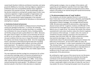
![frame on concrete-slab construction, with rendered chipboard
exteriors. From an international perspective, Western Australia is
more unique, with standard building methods comprising mostly
single story, load-bearing double clay-brick cavity walls on concrete-
slab construction. Despite these differences in height and building
methods, establishing the slab determines the site-works in both
cases, with cost-sensitive contractors mandating a flat layout area
larger than the final footprint of the house. As a result, the pervasive
use of the concrete pad and its construction contingencies contribute
significantly to the practice of suburban benching.
Running in parallel to the popular legacy of the ‘grounded’ California
Bungalow and its post-war derivatives is the alternate architectural
vision of buildings on framed sub-structures that seek to ‘touch the
ground lightly.’ By avoiding remodelling the ground plane, this ethos
tacitly avoids disturbing the ecological and/or spiritual sacredness
attributed to the earth. To be sure, levitating as a means of leaving
the lay-of-the-land intact was a core tenet—and later core criticism—
of modern urbanism. Additionally, touching the ground lightly has
been questioned from a landscape design point of view. In an
influential textbook Norman Booth (1983, 65) defines the “level
terraced site” as the landform “that makes a building appear stable
and most strongly connected to the site.” In contrast, buildings
appear the “least stable and comfortable when located on sloped
sites.” Done without care, placing buildings on sloped sites readily
devolves into what Banham (1971, 86) lamented as the ill-conceived
perching of “standard developer’s tract-homes […] in mid-air on steel
uprights.”
These caveats notwithstanding, regional modernist movements
operating at the residential scale have produced significant legacies of
site-sensitive structures designed in tune with the landform. From
the late 1930s, proponents of the California modernist school created
numerous houses that used appropriate lightweight construction, and
careful layout and positioning to harmonize with their steep sites.
Extant examples by Harwell Hamilton Harris and Vernon de Mars in
the Berkeley Hills epitomize this school of thought (see Serraino
2006). In the 1970s and 80s in Australia, a locally adapted modern
‘bush vernacular’ that also valued sensitivity toward the site emerged
in the work of architects Richard Leplastrier, Glenn Murcutt, Peter
Stutchbury and others (Paolella and Quattrone 2008).
Although many of these regionally adapted examples hold potential
lessons for everyday suburban design, they have tended to remain
bespoke residences for privileged clients on generously proportioned
lots. In this regard, forging affordable templates for everyday
suburban design is a more encompassing undertaking than the
refinement or revolution of building technology and design. Given
the complex interwoven economy of skills, supplies and real-estate
norms that have accrued over time around a particular mode of
construction, viable alternatives must confront the hegemony of
entrenched perceptions and practices. Without such a
comprehensive approach, the best architectural intentions and
innovations in site-sensitive building design will remain exclusive
experiments with little impact on the industry of levelling landscapes
for suburbia.
2. Diversity of lot sizes and housing types
The preference for uniformity and repetition in subdividing land was
originally perfected by the Romans through centuriation,
rediscovered in the Enlightenment and later refined by the modern
professions of surveying and cartography (see Romano 2003; Rykwert
1976). When parcelling off land, the equal division of lots suited the
Cartesian idea of space as inert and uniform and accommodated
emerging societal ideals of equality. These ideals were most vividly
registered in the 1-mile (1.6km) Jeffersonian grid that parcelled out
farmland and town-sites with remarkable consistency across the
American Mid-West and West (Corner and MacLean 1996). In the
design of neighbourhoods, uniformity was also embraced with
historical consistency, with eighteenth century row-housing, high-](https://image.slidesharecdn.com/researchpaper3r-230307125407-cef1dae1/85/research-paper-3-R-pdf-13-320.jpg)