RBWM and QGIS
•Download as PPT, PDF•
1 like•795 views

This document provides information about geographic information systems (GIS) including commonly used software programs (QGIS, ESRI), data formats (.shp, .tab), standards (WGS 84), and types of spatial data (vectors, rasters, open data sources). It discusses the benefits of migrating from a proprietary GIS (ESRI) to an open source one (QGIS) in terms of reduced costs and increased access. An example is given of savings of £15,000 in license fees alone for one local authority that switched to QGIS. The document promotes the use of free and open source GIS tools.

Recommended
Recommended
More Related Content
What's hot
What's hot (19)
Viewers also liked
Similar to RBWM and QGIS
Similar to RBWM and QGIS (20)
Recently uploaded
Recently uploaded (20)
RBWM and QGIS
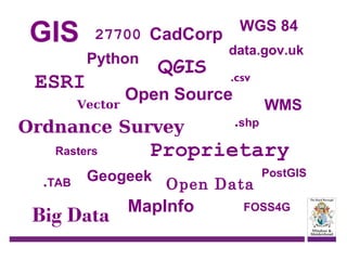
- 1. GIS 27700 CadCorp Python ESRI Vector QGIS .TAB .csv .shp WMS Proprietary Geogeek Big Data data.gov.uk Open Source Ordnance Survey Rasters WGS 84 Open Data MapInfo PostGIS FOSS4G
- 2. Who is this man & why is he here! Name: Simon Miles Job title: GIS Developer Current Employer: Royal Borough of Windsor & Maidenhead Geogeek: YES! Describe your role: I create maps from data, scripts and code; and help 80+ other staff to roughly the same thing! Why are you here: To sell you free GIS!
- 3. Routes into GIS? Astun Technology QGIS Data Open-Source Goodies
- 4. What is QGIS? Open-Source GIS solution = Licence Free <0.5 million downloads as of version 1.8 UK Local Authority uptake growing! www.qgis.org RBWM migrated from a proprietary to open source GIS last year Yr 1 savings of £15,000 in just licence costs Increased our GIS user base to over 80
- 5. Why migrate? ? Spend more with ESRI ? ? Go Open-Source ? ? Alternative GIS vendor ? Image - http://abrampoon.files.wordpress.co/2010/08/at-cross-roads3.jpg ESRI (Proprietary GIS vendor) Costing a fortune Locked in data No real means of scaling up GIS
- 6. Savings? £15,000 in ESRI Licence costs Yr 1 Reduction in Hardware upgrades, Memory, cpu’s etc Server consolidation More GIS for less Further savings in ESRI Licence costs of £7000 Yr 2 Image -http://www.q4.com/savings-accounts/
- 7. What do we do with GIS? Lots! Over 700 datasets in our database Some staff…. Just view data Create data Analysis data
- 8. Data - PostGIS 750 odd GIS datasets From Dog bins to CCTV camera coverage
- 9. Data - Rasters Ordnance Survey supplied data, Vector Map Local 1:50,000 map etc We purchase… Aerial Photography Historic Maps Image:http://clayman5.deviantart.com/art/raster-man-reggae-music-296533472
- 10. Data – Raw GIS formats • Supplied by contractors • Created in-house • Downloads from data.gov.uk ONS Environment Agency Image:http://images.flatworldknowledge.com/campbell/campbell-fig04_008.jpg
- 11. Black & White Bit of 3D Colour Master Map – look and feel
- 12. Master Map – Urban Grain
- 13. 2001 census data
- 14. Crime data
- 15. imd 2010 – Living Environment
- 16. VML + QGIS + Inkscape =
- 17. Me! – Simon Miles simon.miles@rbwm.gov.uk @geosmiles http://ukqgis.wordpress.com/