RADAR & NAVIGATION
•Engineering is Applied Science
• Many areas of science and
mathematics are applied to solve the
problems associated with Radar and
Navigation
4.
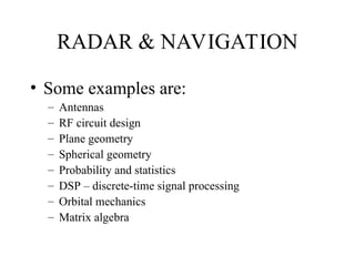
RADAR & NAVIGATION
•Some examples are:
– Antennas
– RF circuit design
– Plane geometry
– Spherical geometry
– Probability and statistics
– DSP – discrete-time signal processing
– Orbital mechanics
– Matrix algebra
5.
NAVIGATION
• The firsthalf of the course will cover
NAVIGATION, in particular,
• aircraft navigation
6.
NAVIGATION
• The scienceof determining the position
of a vehicle relative to the position of
its destination
7.
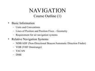
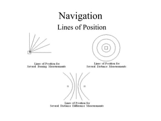
NAVIGATION
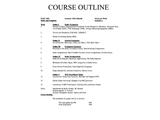
Course Outline (1)
•Basic Information
– Units and Conventions
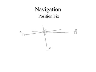
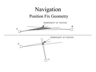
– Lines of Position and Position Fixes – Geometry
– Requirement for air navigation systems
• Relative Navigation Systems
– NDB/ADF (Non-Directional Beacon/Automatic Direction Finder)
– VOR (VHF Omnirange)
– TACAN
– DME
8.
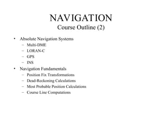
• Absolute NavigationSystems
– Multi-DME
– LORAN-C
– GPS
– INS
• Navigation Fundamentals
– Position Fix Transformations
– Dead-Reckoning Calculations
– Most Probable Position Calculations
– Course Line Computations
NAVIGATION
Course Outline (2)
International
• ICAO (InternationalCivil Aviation Organization)
• An organization of the United Nations
• Responsible for recommending standards for civil
aviation systems and procedures
•(SARPs STANDARDS AND RECOMMENDED
PROCEDURES)
• NOTE: Responsibility for implementation rests with
individual countries.
Countries may elect not to follow recommended
procedures and if they do so will file an exception
11.
National
• USA -FAA
• Canada – Transport Canada and Nav Canada
• Transport Canada (government)
– Develops and Enforces Rules and Regulations
• Nav Canada (not-for profit)
– Installs/maintains navigation aids and air traffic radars
– Operates air traffic control system
12.
Industry
• ARINC (AeronauticalRadio Incorporated)
– Develops standards for interchangeability of
avionics equipment
• Equipment chassis, mounting racks and and
connectors (ATR
• Digital Data bus standards (ARINC 429, 469)
13.
Industry
• RTCA (RadioTechnical Committee for
Aeronautics)
– Made up of representatives from avionics and
airline industries and government agencies
– Develops functional specifications for avionics
equipment
• NOTE: FAA usually uses RTCA documents
form basis of certification of equipment
14.
NAVIGATION
Units and Conventions
•Distance: Nautical Mile (NM) = 1832m exactly
• Speed: Knot (kt) – 1 NM/hour
• Angle: degrees measured Clockwise from North and is
always expressed as three digits e.g. 090, 006.
Note: zero is pronounced zero
15.
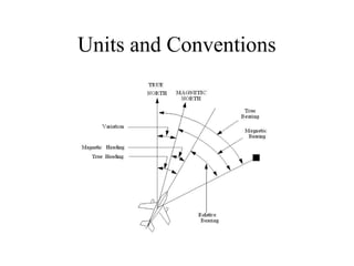
North
• Two mainNorth references:
– True (T) : the geographical North Pole
(the point at which the earth’s spin axis
intersects the earth’s surface in the Northern
hemisphere)
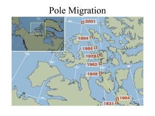
– Magnetic (M) : the North magnetic pole
– VARIATION is the difference
between True and Magnetic North
16.
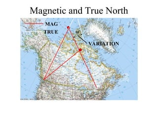
North
Conversion from Magneticto True and Vice Versa
Variation is usually given as West or East
depending on whether the Magnetic Pole appears to
be West or East of the True Pole
East Variation is considered positive (+)
True direction = Magnetic direction + Variation
Units and Conventions(Continued)
• Heading: The angle between the longitudinal axis of a
vehicle and the North reference (can be either Magnetic or
True)
• Relative Bearing: The angle between the longitudinal axis
of the vehicle and a line joining the vehicle and the point
in question
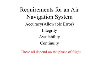
Requirements for anAir
Navigation System
Accuracy(Allowable Error)
Integrity
Availability
Continuity
These all depend on the phase of flight
25.
Phases of Flight
•Enroute – least restrictive
– Usually at cruising altitude - no obstacles
stable situation, no conflicting traffic
• Terminal Area – more restrictive
– Lower altitude – possible obstacles
less stable situation, probable conflicting traffic
• Approach and Landing – most restrictive
– Very low altitude – obstacles present
– on collision course with the ground - must make sure it
is the runway!!
26.
Accuracy
• Two maintypes of ERROR
– Flight Technical Error
The difference between the actual position of
the aircraft and the
– System Error
27.
Requirements for Accuracy
(95%)
•Enroute
– 12.4NM (Oceanic), 2.0 NM (Continental)
• Terminal Area
– 0.4 NM
• Landing
– Category I
(Limits of 200Ft ceiling and ½ NM visibility)
– 16. m laterally and 8 m vertically
28.
Integrity
• The abilityof the system to warn the pilot when an
out-of-tolerance condition is detected
• Enroute
– 5 minutes
• Terminal Area
– 30 seconds
• Landing
– Category I - 6 seconds
– Category II and III – 1 second
Continuity
• The probabilitythat the required navigation
is available for the duration of a procedure
once the procedure has been started
• Enroute/Terminal
– 10-5/hr
• Landing
– 10-6/15sec (Cat I)
Editor's Notes
#15 Variation is plotted on most maps so it is fairly easy to determine True North
Also there are algorithms which compute variation if rough position is known