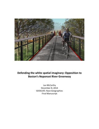
Defending	
  the	
  white	
  spatial	
  imaginary:	
  Opposition	
  to	
  
Boston’s	
  Neponset	
  River	
  Greenway	


Lev	
  McCarthy	
  
December	
  8,	
  2014	
  
GEOG195:	
  Race	
  Geographies	
  
Final	
  Manuscript	


1	
  
Introduction	


We	
  visually	
  denote	
  neighborhood	
  boundaries	
  and	
  town	
  lines	
  with	
  street-­‐side	
  
signs	
  and	
  business	
  names.	
  Crossing	
  from	
  Milton,	
  my	
  hometown	
  suburb,	
  into	
  the	
  
adjacent	
  Mattapan	
  neighborhood	
  of	
  Boston,	
  signage	
  dictates	
  that	
  you	
  are	
  entering	
  
the	
  city	
  of	
  Boston,	
  and	
  Mattapan	
  House	
  of	
  Pizza	
  announces	
  its	
  neighborhood.	
  
Beyond	
  these	
  physical	
  differences,	
  and	
  the	
  municipal	
  change,	
  how	
  does	
  the	
  
intangible	
  geography	
  shift	
  when	
  we	
  pass	
  from	
  city	
  to	
  suburb,	
  and	
  what	
  historical	
  
features	
  have	
  enforced	
  these	
  socioeconomic	
  and	
  demographic	
  differences?	


  In	
  his	
  seminal	
  novel	
  on	
  racial	
  geography,	
  How	
  Racism	
  Takes	
  Place,	
  George	
  
Lipsitz	
  writes	
  that	
  white	
  spatial	
  imaginary	
  is,	
  “based	
  on	
  exclusivity	
  and	
  augmented	
  
exchange	
  value	
  forms	
  the	
  foundational	
  logic	
  behind	
  prevailing	
  spatial	
  and	
  social	
  
policies	
  in	
  cities	
  and	
  suburbs	
  today”,	
  and	
  that	
  “It	
  is	
  inscribed	
  in	
  the	
  physical	
  
contours	
  of	
  the	
  places	
  where	
  we	
  live,	
  work,	
  and	
  play,	
  and	
  it	
  is	
  bolstered	
  by	
  financial	
  
rewards	
  for	
  whiteness”	
  (p28).	
  This	
  paper	
  interrogates	
  Lipsitz’s	
  white	
  spatial	
  
imaginary	
  by	
  putting	
  his	
  ideas	
  in	
  conversation	
  with	
  a	
  racially	
  imbued	
  contemporary	
  
situation	
  at	
  the	
  physical	
  convergence	
  of	
  urban	
  and	
  suburbia	
  in	
  metropolitan	
  Boston.	
  
Over	
  the	
  past	
  two	
  decades	
  the	
  City	
  of	
  Boston’s	
  Metropolitain	
  District	
  Commission	
  
(MDC)	
  has	
  been	
  overseeing	
  construction	
  of	
  a	
  city-­‐spanning	
  greenway	
  corridor	
  that	
  
runs	
  along	
  the	
  shore	
  of	
  the	
  Neponset	
  River.	
  The	
  final	
  piece	
  of	
  this	
  project,	
  yet	
  to	
  be	
  
realized,	
  is	
  a	
  bridge,	
  which	
  would	
  connect	
  the	
  southern	
  segment	
  of	
  the	
  greenway	
  to	
  
the	
  northern	
  segment.	
  This	
  bridge	
  would	
  span	
  the	
  river,	
  cross	
  the	
  Boston	
  city	
  
border,	
  and	
  open	
  a	
  route	
  between	
  the	
  predominantly	
  black	
  Boston	
  neighborhood	
  of	
  
Mattapan	
  and	
  the	
  majority	
  white	
  suburb	
  of	
  Milton.	


   Since	
  the	
  bridge	
  was	
  first	
  proposed	
  in	
  the	
  early	
  2000s,	
  there	
  has	
  been	
  a	
  small	
  
but	
  forceful	
  vocal	
  opposition	
  by	
  Milton	
  residents	
  who	
  live	
  in	
  the	
  neighborhood	
  
adjacent	
  to	
  the	
  bridge	
  site.	
  These	
  residents	
  have	
  expressed	
  concern	
  that	
  if	
  the	
  
bridge	
  is	
  built,	
  the	
  civic	
  issues	
  that	
  Mattapan	
  is	
  infamous	
  for	
  would	
  begin	
  to	
  
proliferate	
  in	
  their	
  Milton	
  neighborhood	
  (Rosso,	
  2014;	
  Ring,	
  2010;	
  Seltz,	
  2010;	
  
Irons,	
  2010).	


   This	
  opposition	
  has	
  roots	
  in	
  historical	
  instances	
  of	
  people	
  defending	
  physical	
  
2	
  
spaces	
  characterized	
  by	
  whiteness.	
  Toni	
  Morrison,	
  renown	
  for	
  her	
  examination	
  of	
  
the	
  black	
  experience	
  in	
  America,	
  suggested	
  that	
  “Whiteness”	
  is	
  the	
  appropriation	
  of	
  
the	
  generalized	
  American	
  culture	
  by	
  white	
  identity	
  (Morrison,	
  1992).	
  George	
  Lipsitz	
  
writes	
  that,	
  “Whiteness	
  never	
  has	
  to	
  speak	
  its	
  name,	
  never	
  has	
  to	
  acknowledge	
  its	
  
role	
  as	
  an	
  organizing	
  principle	
  in	
  social	
  and	
  cultural	
  relations”(Lipsitz,	
  2011).	
  This	
  
invisible	
  racial	
  category	
  allows	
  people	
  to	
  make	
  whiteness	
  synonymous	
  with	
  being	
  
American,	
  and	
  thereby	
  making	
  other	
  racial	
  identities	
  a	
  distinct	
  Other,	
  deserving	
  of	
  
being	
  segregated	
  and	
  differential	
  treatment.	


  I	
  speculate	
  that	
  Milton	
  residents’	
  resistance	
  to	
  the	
  bridge,	
  announced	
  in	
  
commentary	
  in	
  local	
  newspapers	
  and	
  news	
  websites,	
  is	
  rooted	
  in	
  defense	
  of	
  the	
  
white	
  spatial	
  imaginary.	
  The	
  resistance	
  is	
  disguised	
  as	
  NIMBYism,	
  an	
  acronym	
  for	
  
Not	
  In	
  My	
  Back	
  Yard,	
  which	
  is	
  used	
  to	
  describe	
  opposition	
  to	
  development	
  in	
  one’s	
  
own	
  neighborhood,	
  and	
  it	
  normally	
  implies	
  that	
  the	
  residents	
  acknowledge	
  the	
  
development’s	
  importance,	
  but	
  do	
  not	
  want	
  it	
  near	
  them.	
  	
  This	
  veneer	
  facilitates	
  the	
  
conflict’s	
  dismissal	
  as	
  an	
  issue	
  of	
  economics	
  and	
  safety,	
  but	
  there	
  are	
  racial	
  
underpinnings	
  that	
  this	
  paper	
  attempts	
  to	
  reveal	
  and	
  confront.	


Mattapan	
  and	
  Milton:	
  the	
  Perceived	
  Racial	
  Dichotomy	


   Milton	
  and	
  Mattapan	
  have	
  historically	
  interlocked	
  racial	
  formations.	
  In	
  the	
  
first	
  half	
  of	
  the	
  20th	
  century,	
  Mattapan	
  was	
  a	
  neighborhood	
  predominantly	
  
populated	
  by	
  middle-­‐income	
  Jewish	
  families.	
  In	
  1950	
  the	
  Census	
  reported	
  that	
  there	
  
were	
  about	
  70,000	
  Jews	
  in	
  Roxbury,	
  Dorchester	
  and	
  Mattapan	
  combined.	
  The	
  
1960’s	
  and	
  1970’s	
  saw	
  a	
  drastic	
  shift,	
  as	
  African	
  American	
  and	
  Caribbean	
  families	
  
moved	
  into	
  homes	
  that	
  had	
  been	
  left	
  by	
  the	
  white,	
  and	
  in	
  many	
  instances	
  Jewish,	
  
homeowners.	
  This	
  process	
  was	
  dually	
  enabled	
  by	
  realtors	
  “blockbusting”	
  white	
  
homeowners	
  who	
  would	
  sell	
  their	
  properties	
  at	
  bargain	
  prices,	
  and	
  financial	
  
redlining	
  directed	
  black	
  families	
  into	
  the	
  newly	
  vacated	
  homes.	
  There	
  have	
  been	
  
many	
  changes	
  to	
  the	
  neighborhood	
  that	
  accompanied	
  this	
  population	
  shift.	
  
Synagogues	
  were	
  changed	
  into	
  churches,	
  kosher	
  restaurants	
  turned	
  into	
  retail,	
  and	
  
the	
  reputation	
  of	
  the	
  area	
  has	
  largely	
  shifted	
  to	
  a	
  neighborhood	
  associated	
  with	
  
3	
  
violence	
  and	
  crime.	


   Many	
  of	
  the	
  white	
  people	
  who	
  left	
  Mattapan	
  in	
  the	
  1960’s	
  and	
  1970’s	
  
attempted	
  to	
  stay	
  nearby.	
  Finding	
  a	
  home	
  in	
  neighboring	
  Milton	
  meant	
  that	
  Jewish	
  
families	
  would	
  not	
  have	
  to	
  leave	
  their	
  synagogue	
  and	
  its	
  congregation.	
  Moving	
  down	
  
Blue	
  Hill	
  Ave	
  into	
  Milton	
  for	
  many	
  meant	
  a	
  slight	
  shift	
  instead	
  of	
  a	
  complete	
  change	
  
(Martin,	
  2010).	


Figure	
  1:	
  Total	
  Population	
  -­‐	
  Black	
  or	
  African	
  American	
  alone	


   Since	
  the	
  1970’s	
  the	
  racial	
  makeup	
  of	
  Mattapan	
  and	
  Milton	
  has	
  remained	
  
relatively	
  stable.	
  Through	
  examining	
  data	
  from	
  the	
  2010	
  U.S.	
  Census	
  and	
  the	
  2011	
  
American	
  Community	
  Survey	
  (ACS)	
  we	
  see	
  that	
  Mattapan	
  and	
  Milton,	
  although	
  they	
  
are	
  physically	
  adjacent,	
  have	
  polar	
  demographics.	
  The	
  media	
  discourse	
  framed	
  the	
  
issue	
  as	
  discord	
  between	
  Milton	
  and	
  Mattapan,	
  but	
  the	
  epicenter	
  has	
  been	
  the	
  two	
  
neighborhoods	
  on	
  either	
  side	
  of	
  the	
  proposed	
  connection.	
  Therefore	
  an	
  effective	
  
analysis	
  requires	
  that	
  we	
  compare	
  Milton	
  and	
  Mattapan,	
  while	
  focusing	
  on	
  the	
  
4	
  
census	
  tracts	
  adjacent	
  to	
  the	
  bridge.	
  	
  See	
  Table	
  1	
  for	
  the	
  relevant	
  Census	
  and	
  ACS	
  
data.	


Table	
  1	
  
Milton	
  and	
  Mattapan:	
  Race	
  and	
  Income	


   Milton	
   Mattapan	
  
	
   Milton	
  
Census	
  Tract	
  
4163	
  
Mattapan	
  
Census	
  Tract	
  
1010.02	
  
Race1	


   Black	
  or	
  African	
  
American	
  
14%	
   17.56%	
   79.9%	
   81.14%	
  
	
   White	
   77%	
   74%	
   8.6%	
   6.39%	


Median	
  Household	
  	
  
Income2	


$104,713	


$105,017	


$41,519	


$36,128	


Education2	


   High	
  School	
  	
   	
   91.82%	
   	
   72.33%	


Bachelor’s	
  Degree	
   	
   66.42%	
   	
   15.06%	
  
1.	
  2010	
  U.S.	
  Census	
  
2.	
  American	
  Community	
  Survey	
  2007-­‐2011:	
  (5-­‐year	
  estimates)	


   These	
  differences	
  in	
  race,	
  income,	
  house	
  value,	
  educational	
  achievement,	
  and	
  
household	
  income	
  are	
  drastic,	
  and	
  are	
  rooted	
  in	
  privileges	
  associated	
  with	
  
whiteness,	
  which	
  are	
  embedded	
  in	
  Milton’s	
  racialized	
  space.	
  Milton	
  has	
  benefited	
  
from	
  a	
  history	
  of	
  mortgage	
  redlining	
  and	
  steering	
  which	
  endowed	
  Milton	
  with	
  the	
  
benefits	
  of	
  the	
  white	
  spatiality	
  by	
  marginalizing	
  the	
  residents	
  of	
  Mattapan	
  and	
  
maximizing	
  the	
  exchange	
  value	
  of	
  Milton	
  homes.	
  The	
  defense	
  of	
  this	
  privilege	
  shows	
  
up	
  in	
  the	
  public	
  discourse	
  about	
  the	
  proposed	
  bridge,	
  which	
  would	
  physically	
  
connect	
  the	
  two	
  area’s	
  and	
  threaten	
  the	
  distinction	
  between	
  the	
  white	
  spatiality	
  of	
  
Milton	
  and	
  the	
  black	
  spatiality	
  of	
  Mattapan	
  less	
  than	
  10	
  yards	
  across	
  a	
  river.	


Neponset	
  River	
  Greenway	


   The	
  Neponset	
  River	
  was	
  used	
  to	
  determine	
  Boston’s	
  southern-­‐most	
  border,	
  
and	
  now	
  it	
  delineates	
  one	
  of	
  the	
  most	
  extreme	
  socioeconomic	
  and	
  racial	
  boundaries	
  
in	
  Metropolitan	
  Boston.	
  The	
  river	
  flows	
  northeast,	
  from	
  Foxboro	
  about	
  30	
  miles	
  
5	
  
south	
  until	
  it	
  lets	
  out	
  at	
  Dorchester	
  Bay	
  between	
  the	
  Boston	
  neighborhood	
  of	
  
Dorchester	
  and	
  the	
  City	
  of	
  Quincy.	
  Moving	
  northeast,	
  the	
  river	
  forms	
  the	
  border	
  of	
  
Boston	
  at	
  Hyde	
  Park,	
  Mattapan	
  and	
  Dorchester.	
  	
  Along	
  its	
  route	
  it	
  physically	
  divides	
  
the	
  city	
  from	
  the	
  suburb,	
  and	
  in	
  many	
  areas	
  it	
  denotes	
  a	
  drastic	
  shift	
  in	
  
socioeconomic	
  and	
  racial	
  characteristics	
  of	
  residents.	


In	
  the	
  1880’s	
  the	
  Metropolitain	
  District	
  Commission	
  (MDC)	
  acquired	
  the	
  
Neponset	
  River	
  salt	
  marshes,	
  with	
  the	
  vision	
  of	
  a	
  publicly	
  owned	
  natural	
  corridor	
  
buffering	
  the	
  Neponset	
  River,	
  providing	
  natural	
  amenities	
  to	
  the	
  city	
  of	
  Boston	
  and	
  
its	
  neighboring	
  communities.	
  Over	
  the	
  years	
  since	
  this	
  initial	
  acquisition,	
  the	
  MDC	
  
has	
  acquired	
  over	
  750	
  acres	
  along	
  the	
  Neponset	
  River,	
  which	
  they	
  plan	
  to	
  
rehabilitate	
  as	
  parkland.	
  In	
  2003,	
  the	
  MDC	
  oversaw	
  the	
  completion	
  of	
  the	
  Lower	
  
Neponset	
  River	
  Trail,	
  which	
  provides	
  pedestrians	
  and	
  bicyclists	
  a	
  recreational	
  path	
  
along	
  Dorchester’s	
  riverside,	
  and	
  connects	
  the	
  southern	
  portions	
  of	
  the	
  
neighborhood	
  to	
  the	
  newly	
  constructed	
  66-­‐acre	
  Pope	
  John	
  Paul	
  II	
  Park.	
  The	
  Lower	
  
Neponset	
  Trail	
  was	
  the	
  first	
  of	
  a	
  series	
  of	
  trails	
  that	
  have	
  been	
  constructed	
  in	
  the	
  
following	
  years	
  by	
  the	
  MDC	
  in	
  an	
  attempt	
  to	
  create	
  The	
  Neponset	
  River	
  Greenway,	
  a	
  
6	
  
10-­‐mile	
  continuous	
  trail	
  from	
  the	
  mouth	
  of	
  the	
  Neponset	
  River	
  at	
  Dorchester	
  Bay	
  to	
  
the	
  Blue	
  Hills	
  Reservation	
  in	
  Milton	
  (Rosso,	
  2012).	


   The	
  process	
  has	
  been	
  piecemeal,	
  and	
  impeded	
  by	
  funding	
  deficiencies	
  and	
  
public	
  resistance.	
  In	
  an	
  article	
  for	
  the	
  Boston	
  Globe	
  on	
  March	
  12,	
  2012,	
  Patrick	
  Rosso	
  
notes	
  that	
  there	
  were	
  still	
  three	
  sections	
  of	
  Neponset	
  River	
  Greenway	
  that	
  needed	
  to	
  
be	
  completed.	
  One	
  of	
  these	
  segments	
  runs	
  along	
  the	
  border	
  of	
  Boston’s	
  Mattapan	
  
neighborhood,	
  and	
  the	
  suburb	
  of	
  Milton.	
  Slated	
  to	
  be	
  the	
  most	
  expensive	
  of	
  the	
  three	
  
remaining	
  sections,	
  a	
  proposed	
  plan,	
  which	
  included	
  a	
  bridge	
  over	
  the	
  river	
  and	
  1.5	
  
miles	
  of	
  trail,	
  was	
  set	
  to	
  cost	
  more	
  than	
  $10	
  million.	
  Since	
  2010,	
  several	
  attempts	
  by	
  
the	
  state	
  to	
  garner	
  federal	
  funding	
  for	
  the	
  remaining	
  construction	
  have	
  failed	
  
(Rosso,	
  2010).	


  Articles	
  in	
  the	
  Boston	
  Globe	
  and	
  other	
  local	
  news	
  sources	
  followed	
  closely	
  
the	
  MDC	
  and	
  the	
  Massachusetts	
  Bay	
  Transit	
  Authorities’	
  repeated	
  denial	
  of	
  funding	
  
by	
  the	
  US	
  Department	
  of	
  Transportation.	
  The	
  lack	
  of	
  funding	
  became	
  the	
  primary	
  
story,	
  but	
  there	
  was	
  another	
  conflict	
  occurring	
  along	
  the	
  border	
  of	
  Milton	
  and	
  
Mattapan.	
  Socioeconomic	
  and	
  racial	
  differences	
  between	
  the	
  neighborhoods	
  were	
  
brought	
  to	
  light,	
  and	
  the	
  neighborhood	
  in	
  Milton	
  set	
  to	
  host	
  the	
  new	
  greenway	
  
vocalized	
  opposition	
  to	
  the	
  project,	
  and	
  their	
  arguments	
  against	
  a	
  physical	
  bridge	
  
which	
  would	
  connect	
  Mattapan	
  to	
  Milton	
  embodies	
  how	
  the	
  privileges	
  of	
  
contemporary	
  whiteness	
  have	
  been	
  embedded	
  in	
  white	
  spatial	
  imaginary.	
  The	
  
objection	
  of	
  Milton	
  residents	
  is	
  influenced	
  by	
  a	
  concern	
  that	
  their	
  privilege	
  will	
  be	
  
threatened	
  by	
  spatial	
  change.	
  “Racialized	
  space”	
  writes	
  Lipsitz,	
  “enables	
  the	
  
advocates	
  of	
  expressly	
  racist	
  policies	
  to	
  disavow	
  any	
  racial	
  intent.”	
  In	
  2010,	
  an	
  
article	
  in	
  the	
  Boston	
  Globe	
  reported	
  that	
  some	
  Milton	
  residents	
  felt	
  their	
  opposition	
  
had	
  been	
  misrepresented,	
  and	
  insisted	
  that	
  there	
  is	
  no	
  race	
  or	
  class	
  divide	
  between	
  
the	
  neighborhoods	
  across	
  the	
  Neponset	
  River.	
  These	
  Milton	
  residents	
  noted	
  that,	
  
“many	
  of	
  their	
  friends	
  and	
  neighbors	
  make	
  up	
  a	
  racially	
  and	
  economically	
  diverse	
  
community”	
  (Seltz,	
  2010).	


   Through	
  the	
  Neponset	
  River	
  Greenway,	
  the	
  DCR	
  is	
  establishing	
  a	
  pathway	
  as	
  
a	
  means	
  of	
  connecting	
  neighborhood	
  amenities,	
  encouraging	
  recreation,	
  and	
  
generating	
  public	
  spaces	
  where	
  people	
  throughout	
  the	
  Greenway’s	
  10-­‐mile	
  route	
  
7	
  
can	
  meet	
  and	
  build	
  community.	
  Although	
  it	
  is	
  not	
  an	
  explicit	
  intent	
  of	
  the	
  DCR	
  and	
  
its	
  partners..	
  By	
  generating	
  public	
  space	
  the	
  Neponset	
  River	
  Greenway	
  will	
  serve	
  as,	
  
“a	
  medium	
  through	
  which	
  identities	
  are	
  created,	
  constructed,	
  and	
  contested”	
  
(Lindsey	
  et	
  al.,	
  2001).	


  Residents	
  of	
  Milton	
  opposing	
  the	
  bridge,	
  I	
  argue,	
  that	
  they	
  feel	
  that	
  the	
  
middle	
  ground	
  between	
  the	
  two	
  connected	
  neighborhoods	
  would	
  be	
  a	
  loss	
  to	
  their	
  
own	
  privilege.	
  The	
  residents	
  in	
  Mattapan	
  and	
  Milton	
  who	
  support	
  the	
  project	
  focus	
  
on	
  the	
  opportunity	
  to	
  break	
  the	
  barriers	
  between	
  the	
  two	
  neighborhoods,	
  and	
  
provide	
  opportunity	
  for	
  the	
  residents	
  on	
  both	
  sides	
  of	
  the	
  border	
  to	
  enjoy	
  nature.	
  
The	
  Boston	
  Globe	
  reported	
  the	
  opinion	
  of	
  Mattapan	
  resident	
  and	
  activist,	
  Rodney	
  
Bender,	
  who	
  said	
  that	
  the	
  Neponset	
  River	
  Greenway	
  would	
  provide	
  a	
  chance	
  for	
  
safe	
  exercise,	
  pleasant	
  connection	
  to	
  public	
  transportation,	
  and	
  a	
  place	
  for	
  people	
  to	
  
bond	
  and	
  “clear	
  their	
  heads”	
  (Jackson,	
  2010).	


White	
  Spatial	
  Imaginary	
  and	
  ‘Safety’	
  
	
   Milton	
  residents’	
  opposition	
  to	
  the	
  proposed	
  bridge	
  which	
  would	
  connect	
  
Mattapan	
  and	
  Milton	
  is	
  a	
  contemporary	
  embodiment	
  George	
  Lipsitz’s	
  white	
  spatial	
  
imaginary	
  disguised	
  by	
  NIMBYism	
  and	
  perpetuated	
  by	
  supposed	
  post-­‐racialism.	
  
Defense	
  of	
  the	
  white	
  spatial	
  imaginary,	
  is	
  present	
  but	
  hidden	
  in	
  the	
  conflict	
  over	
  the	
  
Neponset	
  River	
  bridge.	


   In	
  the	
  opening	
  chapter	
  to	
  How	
  Racism	
  Takes	
  Place,	
  Lipsitz	
  outlines	
  several	
  
characteristics	
  that	
  define	
  and	
  enforce	
  the	
  white	
  spatial	
  imaginary	
  (Lipsitz,	
  2011).	
  
In	
  the	
  1940’s	
  and	
  1950’s,	
  homeownership	
  in	
  bourgeoning	
  suburbs	
  was	
  a	
  privilege	
  
reserved	
  for	
  whites,	
  and	
  staunchly	
  kept	
  away	
  from	
  black	
  people.	
  This	
  is	
  a	
  time	
  when	
  
the	
  idea	
  that,	
  “Blacks	
  moving	
  into	
  white	
  neighborhoods	
  constitutes	
  a	
  criminal	
  
transgression	
  of	
  its	
  own”.	
  I	
  do	
  not	
  imply	
  that	
  this	
  blatant	
  racism	
  is	
  rearing	
  its	
  head	
  
in	
  the	
  Neponset	
  River	
  discourse,	
  but	
  the	
  idea	
  that	
  white	
  neighborhoods	
  are	
  best	
  
when	
  they	
  are	
  homogenous	
  and	
  isolated	
  is	
  a	
  byproduct	
  of	
  this	
  historic	
  racial	
  
exclusivity.	
  Suburban	
  property	
  owners	
  view	
  themselves	
  as,	
  “individuals	
  whose	
  
wealth	
  grew	
  out	
  of	
  their	
  personal	
  and	
  individual	
  success”	
  while	
  Lipsitz	
  notes	
  that	
  
8	
  
many	
  suburban	
  homeowners	
  have	
  simply	
  benefited	
  financially	
  from	
  
institutionalized	
  forms	
  of	
  racial	
  exclusion.	


   In	
  the	
  case	
  of	
  the	
  Neponset	
  River	
  bridge,	
  the	
  immediate	
  effect	
  is	
  not	
  expected	
  
to	
  be	
  an	
  influx	
  of	
  new	
  residents.	
  No	
  one	
  on	
  either	
  side	
  of	
  the	
  discussion	
  expect	
  that	
  
people	
  from	
  Mattapan	
  will	
  begin	
  purchasing	
  homes	
  in	
  the	
  adjacent	
  Milton	
  
neighborhood	
  or	
  visa-­‐versa.	
  Defense	
  of	
  the	
  white	
  spatial	
  imaginary	
  is	
  not	
  restricted	
  
to	
  home	
  ownership.	
  The	
  residents	
  of	
  Milton	
  claim	
  to	
  be	
  fearful,	
  not	
  of	
  new	
  black	
  
homeowners,	
  but	
  of	
  crime.	


   In	
  the	
  Fall	
  of	
  2012,	
  Milton	
  Police	
  Chief	
  Richard	
  G.	
  Wells	
  Jr.	
  was	
  quoted	
  in	
  the	
  
Boston	
  Globe	
  saying,	
  “We	
  worry	
  about	
  opportunities	
  not	
  only	
  for	
  those	
  on	
  the	
  
bike	
  path	
  but	
  also	
  for	
  criminal	
  perpetrators	
  to	
  now	
  have	
  an	
  easy	
  
opportunity	
  to	
  cross	
  into	
  residential	
  areas	
  near	
  the	
  river	
  to	
  commit	
  crimes.	
  The	
  
police	
  chief,	
  echoing	
  the	
  concern	
  of	
  the	
  adjacent	
  Milton	
  neighborhood,	
  is	
  attributing	
  
the	
  negative	
  features	
  of	
  Mattapan’s	
  socioeconomic	
  framework	
  onto	
  its	
  
predominantly	
  black	
  residents.	
  Mattapan’s	
  black	
  residents	
  have	
  been	
  plagued	
  by	
  
decades	
  of	
  economic	
  marginalization	
  and	
  exclusion,	
  and	
  now	
  those	
  features	
  are	
  
being	
  projected	
  onto	
  their	
  blackness.	
  Defense	
  of	
  the	
  white	
  spatial	
  imaginary	
  is	
  being	
  
buffered	
  by	
  the	
  criminalization	
  of	
  the	
  blacks.	
  Milton	
  is	
  a	
  prime	
  example	
  of	
  Lipsitz’s	
  
“privileged	
  moral	
  geography”,	
  and	
  by	
  putting	
  the	
  contemporary	
  situation	
  in	
  
conversation	
  with	
  historical	
  examples	
  we	
  see	
  that	
  bridges	
  are	
  a	
  battleground	
  for	
  the	
  
white	
  spatial	
  imaginary.	


9	


Bibliography	


American	
  Community	
  Survey,	
  “Ancestry;	
  Haitian	
  alone:	
  2010”	
  	
  
http://www.socialexplorer.com/6f4cdab7a0/explore	
  (accessed	
  on	
  
November	
  3,	
  2014)	
  
Bischoff,	
  Annaliese.	
  "Greenways	
  as	
  Vehicles	
  for	
  Expression."	
  Landscape	
  and	
  Urban	
  
Planning	
  33,	
  no.	
  1–3	
  (10//	
  1995):	
  317-­‐25.	
  
Hoelscher,	
  Steven.	
  "Making	
  Place,	
  Making	
  Race:	
  Performances	
  of	
  Whiteness	
  in	
  the	
  
Jim	
  Crow	
  South."	
  Annals	
  of	
  the	
  Association	
  of	
  American	
  Geographers	
  93,	
  no.	
  3	
  
(2003/09/01	
  2003):	
  657-­‐86.	
  
Irons,	
  Meghan	
  E.	
  "Bike	
  Trail	
  Plan	
  Meant	
  to	
  Bridge	
  Runs	
  into	
  Divide."	
  Boston	
  Globe,	
  
2010	
  Nov	
  29	
  2010,	
  A.1.	
  
Jackson,	
  Derrick	
  Z.,	
  “A	
  Natural	
  Link	
  Between	
  Communities,”	
  Boston	
  Globe.	
  November	
  
30,	
  2010,	
  accessed	
  November	
  4,	
  2014,	
  
http://www.boston.com/bostonglobe/editorial_opinion/oped/articles/201
0/11/30/a_natural_link_between_communities/	
  
Lewis,	
  John,	
  Walking	
  With	
  the	
  Wind.	
  New	
  York:	
  Simon	
  &	
  Schuster,	
  1998.	
  
Lindsey,	
  Greg,	
  Maltie	
  Maraj,	
  and	
  SonCheong	
  Kuan.	
  "Access,	
  Equity,	
  and	
  Urban	
  
Greenways:	
  An	
  Exploratory	
  Investigation."	
  The	
  Professional	
  Geographer	
  53,	
  
no.	
  3	
  (2001/08/01	
  2001):	
  332-­‐46.	
  
Lipsitz,	
  George.	
  How	
  Racism	
  Takes	
  Place.	
  Philidelphia:	
  Temple	
  University	
  Press,	
  
2011.	
  
Martin,	
  Phillip.	
  “Blue	
  Hill	
  Avenue:	
  If	
  A	
  Street	
  Could	
  Speak,”	
  WGBH.	
  October	
  25,	
  2010,	
  
accessed	
  November	
  3,	
  2014,	
  
http://wwe.wgbh.org/articles/index.cfm?cmstype=BODY&tempid=736&ud=
E230734A-­‐2219-­‐56F5-­‐6654CCA547214105&cmsStatusAdmin=0	
  
Morrison,	
  Toni.	
  Playing	
  in	
  the	
  dark:	
  Whiteness	
  and	
  the	
  literary	
  imagination.	
  
Cambridge,	
  MA:	
  Harvard	
  University	
  Press,	
  1992.	
  
Ring,	
  Richard	
  E.	
  "Between	
  Mattapan	
  and	
  Milton."	
  Boston	
  Globe,	
  2010	
  Dec	
  04	
  2010.	
  
Rosso,	
  Patrick	
  D.,	
  “Neponset	
  River	
  Greenway	
  Trail	
  Again	
  Denied	
  US	
  Funding,”	
  
Boston	
  Globe,	
  June	
  28,	
  2012,	
  accessed	
  November	
  1,	
  2014,	
  
http://www.bostonglobe.com/metro/regionals/south/2012/06/27/nepons
et-­‐greenway-­‐trail-­‐again-­‐denied-­‐funding-­‐complete-­‐unfinished-­‐
sections/Cp33rCcfSS2QaHDVvMLRrK/story.html	
  
Seltz,	
  Johanna,	
  “Keep	
  bike	
  trail	
  near	
  Neponset	
  River,	
  selectmen	
  urge.”	
  Boston	
  Globe,	
  
August	
  24,	
  2010,	
  accessed	
  November	
  11,	
  2014,	
  
http://www.boston.com/yourtown/news/milton/2010/08/keep_bike_trail_
near_neponset.html	
  
Solecki,	
  William	
  D.,	
  and	
  Joan	
  M.	
  Welch.	
  "Urban	
  Parks:	
  Green	
  Spaces	
  or	
  Green	
  Walls?".	
  
Landscape	
  and	
  Urban	
  Planning	
  32,	
  no.	
  2	
  (6//	
  1995):	
  93-­‐106.	
  
Talen,	
  Emily.	
  "Visualizing	
  Fairness:	
  Equity	
  Maps	
  for	
  Planners."	
  Journal	
  of	
  the	
  
American	
  Planning	
  Association	
  64,	
  no.	
  1	
  (1998/03/31	
  1998):	
  22-­‐38.	
  
10	
  
U.S.	
  Census	
  Bureau,	
  “Total	
  Population	
  Race:	
  Black	
  or	
  African	
  American	
  Alone:	
  2000”	
  
http://www.socialexplorer.com/6f4cdab7a0/explore	
  (accessed	
  November	
  3,	
  
2014).	
  
U.S.	
  Census	
  Bureau,	
  “Total	
  Population	
  Race:	
  White	
  Alone:	
  2010”	
  
http://www.socialexplorer.com/6f4cdab7a0/explore	
  (accesses	
  November	
  3,	
  
2014)	
  
U.S.	
  Census	
  Bureau,	
  “Total	
  specified	
  ancestries	
  tallied:	
  Irish:	
  2000”	
  
http://www.socialexplorer.com/6f4cdab7a0/explore	


Race Geography_McCarthy

  • 1.
                    Defending  the  white  spatial  imaginary:  Opposition  to   Boston’s  Neponset  River  Greenway       Lev  McCarthy   December  8,  2014   GEOG195:  Race  Geographies   Final  Manuscript                        
  • 2.
    1   Introduction       We  visually  denote  neighborhood  boundaries  and  town  lines  with  street-­‐side   signs  and  business  names.  Crossing  from  Milton,  my  hometown  suburb,  into  the   adjacent  Mattapan  neighborhood  of  Boston,  signage  dictates  that  you  are  entering   the  city  of  Boston,  and  Mattapan  House  of  Pizza  announces  its  neighborhood.   Beyond  these  physical  differences,  and  the  municipal  change,  how  does  the   intangible  geography  shift  when  we  pass  from  city  to  suburb,  and  what  historical   features  have  enforced  these  socioeconomic  and  demographic  differences?        In  his  seminal  novel  on  racial  geography,  How  Racism  Takes  Place,  George   Lipsitz  writes  that  white  spatial  imaginary  is,  “based  on  exclusivity  and  augmented   exchange  value  forms  the  foundational  logic  behind  prevailing  spatial  and  social   policies  in  cities  and  suburbs  today”,  and  that  “It  is  inscribed  in  the  physical   contours  of  the  places  where  we  live,  work,  and  play,  and  it  is  bolstered  by  financial   rewards  for  whiteness”  (p28).  This  paper  interrogates  Lipsitz’s  white  spatial   imaginary  by  putting  his  ideas  in  conversation  with  a  racially  imbued  contemporary   situation  at  the  physical  convergence  of  urban  and  suburbia  in  metropolitan  Boston.   Over  the  past  two  decades  the  City  of  Boston’s  Metropolitain  District  Commission   (MDC)  has  been  overseeing  construction  of  a  city-­‐spanning  greenway  corridor  that   runs  along  the  shore  of  the  Neponset  River.  The  final  piece  of  this  project,  yet  to  be   realized,  is  a  bridge,  which  would  connect  the  southern  segment  of  the  greenway  to   the  northern  segment.  This  bridge  would  span  the  river,  cross  the  Boston  city   border,  and  open  a  route  between  the  predominantly  black  Boston  neighborhood  of   Mattapan  and  the  majority  white  suburb  of  Milton.         Since  the  bridge  was  first  proposed  in  the  early  2000s,  there  has  been  a  small   but  forceful  vocal  opposition  by  Milton  residents  who  live  in  the  neighborhood   adjacent  to  the  bridge  site.  These  residents  have  expressed  concern  that  if  the   bridge  is  built,  the  civic  issues  that  Mattapan  is  infamous  for  would  begin  to   proliferate  in  their  Milton  neighborhood  (Rosso,  2014;  Ring,  2010;  Seltz,  2010;   Irons,  2010).         This  opposition  has  roots  in  historical  instances  of  people  defending  physical  
  • 3.
    2   spaces  characterized  by  whiteness.  Toni  Morrison,  renown  for  her  examination  of   the  black  experience  in  America,  suggested  that  “Whiteness”  is  the  appropriation  of   the  generalized  American  culture  by  white  identity  (Morrison,  1992).  George  Lipsitz   writes  that,  “Whiteness  never  has  to  speak  its  name,  never  has  to  acknowledge  its   role  as  an  organizing  principle  in  social  and  cultural  relations”(Lipsitz,  2011).  This   invisible  racial  category  allows  people  to  make  whiteness  synonymous  with  being   American,  and  thereby  making  other  racial  identities  a  distinct  Other,  deserving  of   being  segregated  and  differential  treatment.      I  speculate  that  Milton  residents’  resistance  to  the  bridge,  announced  in   commentary  in  local  newspapers  and  news  websites,  is  rooted  in  defense  of  the   white  spatial  imaginary.  The  resistance  is  disguised  as  NIMBYism,  an  acronym  for   Not  In  My  Back  Yard,  which  is  used  to  describe  opposition  to  development  in  one’s   own  neighborhood,  and  it  normally  implies  that  the  residents  acknowledge  the   development’s  importance,  but  do  not  want  it  near  them.    This  veneer  facilitates  the   conflict’s  dismissal  as  an  issue  of  economics  and  safety,  but  there  are  racial   underpinnings  that  this  paper  attempts  to  reveal  and  confront.       Mattapan  and  Milton:  the  Perceived  Racial  Dichotomy       Milton  and  Mattapan  have  historically  interlocked  racial  formations.  In  the   first  half  of  the  20th  century,  Mattapan  was  a  neighborhood  predominantly   populated  by  middle-­‐income  Jewish  families.  In  1950  the  Census  reported  that  there   were  about  70,000  Jews  in  Roxbury,  Dorchester  and  Mattapan  combined.  The   1960’s  and  1970’s  saw  a  drastic  shift,  as  African  American  and  Caribbean  families   moved  into  homes  that  had  been  left  by  the  white,  and  in  many  instances  Jewish,   homeowners.  This  process  was  dually  enabled  by  realtors  “blockbusting”  white   homeowners  who  would  sell  their  properties  at  bargain  prices,  and  financial   redlining  directed  black  families  into  the  newly  vacated  homes.  There  have  been   many  changes  to  the  neighborhood  that  accompanied  this  population  shift.   Synagogues  were  changed  into  churches,  kosher  restaurants  turned  into  retail,  and   the  reputation  of  the  area  has  largely  shifted  to  a  neighborhood  associated  with  
  • 4.
    3   violence  and  crime.           Many  of  the  white  people  who  left  Mattapan  in  the  1960’s  and  1970’s   attempted  to  stay  nearby.  Finding  a  home  in  neighboring  Milton  meant  that  Jewish   families  would  not  have  to  leave  their  synagogue  and  its  congregation.  Moving  down   Blue  Hill  Ave  into  Milton  for  many  meant  a  slight  shift  instead  of  a  complete  change   (Martin,  2010).         Figure  1:  Total  Population  -­‐  Black  or  African  American  alone         Since  the  1970’s  the  racial  makeup  of  Mattapan  and  Milton  has  remained   relatively  stable.  Through  examining  data  from  the  2010  U.S.  Census  and  the  2011   American  Community  Survey  (ACS)  we  see  that  Mattapan  and  Milton,  although  they   are  physically  adjacent,  have  polar  demographics.  The  media  discourse  framed  the   issue  as  discord  between  Milton  and  Mattapan,  but  the  epicenter  has  been  the  two   neighborhoods  on  either  side  of  the  proposed  connection.  Therefore  an  effective   analysis  requires  that  we  compare  Milton  and  Mattapan,  while  focusing  on  the  
  • 5.
    4   census  tracts  adjacent  to  the  bridge.    See  Table  1  for  the  relevant  Census  and  ACS   data.         Table  1   Milton  and  Mattapan:  Race  and  Income         Milton   Mattapan     Milton   Census  Tract   4163   Mattapan   Census  Tract   1010.02   Race1               Black  or  African   American   14%   17.56%   79.9%   81.14%     White   77%   74%   8.6%   6.39%     Median  Household     Income2     $104,713     $105,017     $41,519     $36,128     Education2             High  School       91.82%     72.33%     Bachelor’s  Degree     66.42%     15.06%   1.  2010  U.S.  Census   2.  American  Community  Survey  2007-­‐2011:  (5-­‐year  estimates)           These  differences  in  race,  income,  house  value,  educational  achievement,  and   household  income  are  drastic,  and  are  rooted  in  privileges  associated  with   whiteness,  which  are  embedded  in  Milton’s  racialized  space.  Milton  has  benefited   from  a  history  of  mortgage  redlining  and  steering  which  endowed  Milton  with  the   benefits  of  the  white  spatiality  by  marginalizing  the  residents  of  Mattapan  and   maximizing  the  exchange  value  of  Milton  homes.  The  defense  of  this  privilege  shows   up  in  the  public  discourse  about  the  proposed  bridge,  which  would  physically   connect  the  two  area’s  and  threaten  the  distinction  between  the  white  spatiality  of   Milton  and  the  black  spatiality  of  Mattapan  less  than  10  yards  across  a  river.             Neponset  River  Greenway         The  Neponset  River  was  used  to  determine  Boston’s  southern-­‐most  border,   and  now  it  delineates  one  of  the  most  extreme  socioeconomic  and  racial  boundaries   in  Metropolitan  Boston.  The  river  flows  northeast,  from  Foxboro  about  30  miles  
  • 6.
    5   south  until  it  lets  out  at  Dorchester  Bay  between  the  Boston  neighborhood  of   Dorchester  and  the  City  of  Quincy.  Moving  northeast,  the  river  forms  the  border  of   Boston  at  Hyde  Park,  Mattapan  and  Dorchester.    Along  its  route  it  physically  divides   the  city  from  the  suburb,  and  in  many  areas  it  denotes  a  drastic  shift  in   socioeconomic  and  racial  characteristics  of  residents.         In  the  1880’s  the  Metropolitain  District  Commission  (MDC)  acquired  the   Neponset  River  salt  marshes,  with  the  vision  of  a  publicly  owned  natural  corridor   buffering  the  Neponset  River,  providing  natural  amenities  to  the  city  of  Boston  and   its  neighboring  communities.  Over  the  years  since  this  initial  acquisition,  the  MDC   has  acquired  over  750  acres  along  the  Neponset  River,  which  they  plan  to   rehabilitate  as  parkland.  In  2003,  the  MDC  oversaw  the  completion  of  the  Lower   Neponset  River  Trail,  which  provides  pedestrians  and  bicyclists  a  recreational  path   along  Dorchester’s  riverside,  and  connects  the  southern  portions  of  the   neighborhood  to  the  newly  constructed  66-­‐acre  Pope  John  Paul  II  Park.  The  Lower   Neponset  Trail  was  the  first  of  a  series  of  trails  that  have  been  constructed  in  the   following  years  by  the  MDC  in  an  attempt  to  create  The  Neponset  River  Greenway,  a  
  • 7.
    6   10-­‐mile  continuous  trail  from  the  mouth  of  the  Neponset  River  at  Dorchester  Bay  to   the  Blue  Hills  Reservation  in  Milton  (Rosso,  2012).       The  process  has  been  piecemeal,  and  impeded  by  funding  deficiencies  and   public  resistance.  In  an  article  for  the  Boston  Globe  on  March  12,  2012,  Patrick  Rosso   notes  that  there  were  still  three  sections  of  Neponset  River  Greenway  that  needed  to   be  completed.  One  of  these  segments  runs  along  the  border  of  Boston’s  Mattapan   neighborhood,  and  the  suburb  of  Milton.  Slated  to  be  the  most  expensive  of  the  three   remaining  sections,  a  proposed  plan,  which  included  a  bridge  over  the  river  and  1.5   miles  of  trail,  was  set  to  cost  more  than  $10  million.  Since  2010,  several  attempts  by   the  state  to  garner  federal  funding  for  the  remaining  construction  have  failed   (Rosso,  2010).        Articles  in  the  Boston  Globe  and  other  local  news  sources  followed  closely   the  MDC  and  the  Massachusetts  Bay  Transit  Authorities’  repeated  denial  of  funding   by  the  US  Department  of  Transportation.  The  lack  of  funding  became  the  primary   story,  but  there  was  another  conflict  occurring  along  the  border  of  Milton  and   Mattapan.  Socioeconomic  and  racial  differences  between  the  neighborhoods  were   brought  to  light,  and  the  neighborhood  in  Milton  set  to  host  the  new  greenway   vocalized  opposition  to  the  project,  and  their  arguments  against  a  physical  bridge   which  would  connect  Mattapan  to  Milton  embodies  how  the  privileges  of   contemporary  whiteness  have  been  embedded  in  white  spatial  imaginary.  The   objection  of  Milton  residents  is  influenced  by  a  concern  that  their  privilege  will  be   threatened  by  spatial  change.  “Racialized  space”  writes  Lipsitz,  “enables  the   advocates  of  expressly  racist  policies  to  disavow  any  racial  intent.”  In  2010,  an   article  in  the  Boston  Globe  reported  that  some  Milton  residents  felt  their  opposition   had  been  misrepresented,  and  insisted  that  there  is  no  race  or  class  divide  between   the  neighborhoods  across  the  Neponset  River.  These  Milton  residents  noted  that,   “many  of  their  friends  and  neighbors  make  up  a  racially  and  economically  diverse   community”  (Seltz,  2010).         Through  the  Neponset  River  Greenway,  the  DCR  is  establishing  a  pathway  as   a  means  of  connecting  neighborhood  amenities,  encouraging  recreation,  and   generating  public  spaces  where  people  throughout  the  Greenway’s  10-­‐mile  route  
  • 8.
    7   can  meet  and  build  community.  Although  it  is  not  an  explicit  intent  of  the  DCR  and   its  partners..  By  generating  public  space  the  Neponset  River  Greenway  will  serve  as,   “a  medium  through  which  identities  are  created,  constructed,  and  contested”   (Lindsey  et  al.,  2001).      Residents  of  Milton  opposing  the  bridge,  I  argue,  that  they  feel  that  the   middle  ground  between  the  two  connected  neighborhoods  would  be  a  loss  to  their   own  privilege.  The  residents  in  Mattapan  and  Milton  who  support  the  project  focus   on  the  opportunity  to  break  the  barriers  between  the  two  neighborhoods,  and   provide  opportunity  for  the  residents  on  both  sides  of  the  border  to  enjoy  nature.   The  Boston  Globe  reported  the  opinion  of  Mattapan  resident  and  activist,  Rodney   Bender,  who  said  that  the  Neponset  River  Greenway  would  provide  a  chance  for   safe  exercise,  pleasant  connection  to  public  transportation,  and  a  place  for  people  to   bond  and  “clear  their  heads”  (Jackson,  2010).       White  Spatial  Imaginary  and  ‘Safety’     Milton  residents’  opposition  to  the  proposed  bridge  which  would  connect   Mattapan  and  Milton  is  a  contemporary  embodiment  George  Lipsitz’s  white  spatial   imaginary  disguised  by  NIMBYism  and  perpetuated  by  supposed  post-­‐racialism.   Defense  of  the  white  spatial  imaginary,  is  present  but  hidden  in  the  conflict  over  the   Neponset  River  bridge.       In  the  opening  chapter  to  How  Racism  Takes  Place,  Lipsitz  outlines  several   characteristics  that  define  and  enforce  the  white  spatial  imaginary  (Lipsitz,  2011).   In  the  1940’s  and  1950’s,  homeownership  in  bourgeoning  suburbs  was  a  privilege   reserved  for  whites,  and  staunchly  kept  away  from  black  people.  This  is  a  time  when   the  idea  that,  “Blacks  moving  into  white  neighborhoods  constitutes  a  criminal   transgression  of  its  own”.  I  do  not  imply  that  this  blatant  racism  is  rearing  its  head   in  the  Neponset  River  discourse,  but  the  idea  that  white  neighborhoods  are  best   when  they  are  homogenous  and  isolated  is  a  byproduct  of  this  historic  racial   exclusivity.  Suburban  property  owners  view  themselves  as,  “individuals  whose   wealth  grew  out  of  their  personal  and  individual  success”  while  Lipsitz  notes  that  
  • 9.
    8   many  suburban  homeowners  have  simply  benefited  financially  from   institutionalized  forms  of  racial  exclusion.       In  the  case  of  the  Neponset  River  bridge,  the  immediate  effect  is  not  expected   to  be  an  influx  of  new  residents.  No  one  on  either  side  of  the  discussion  expect  that   people  from  Mattapan  will  begin  purchasing  homes  in  the  adjacent  Milton   neighborhood  or  visa-­‐versa.  Defense  of  the  white  spatial  imaginary  is  not  restricted   to  home  ownership.  The  residents  of  Milton  claim  to  be  fearful,  not  of  new  black   homeowners,  but  of  crime.         In  the  Fall  of  2012,  Milton  Police  Chief  Richard  G.  Wells  Jr.  was  quoted  in  the   Boston  Globe  saying,  “We  worry  about  opportunities  not  only  for  those  on  the   bike  path  but  also  for  criminal  perpetrators  to  now  have  an  easy   opportunity  to  cross  into  residential  areas  near  the  river  to  commit  crimes.  The   police  chief,  echoing  the  concern  of  the  adjacent  Milton  neighborhood,  is  attributing   the  negative  features  of  Mattapan’s  socioeconomic  framework  onto  its   predominantly  black  residents.  Mattapan’s  black  residents  have  been  plagued  by   decades  of  economic  marginalization  and  exclusion,  and  now  those  features  are   being  projected  onto  their  blackness.  Defense  of  the  white  spatial  imaginary  is  being   buffered  by  the  criminalization  of  the  blacks.  Milton  is  a  prime  example  of  Lipsitz’s   “privileged  moral  geography”,  and  by  putting  the  contemporary  situation  in   conversation  with  historical  examples  we  see  that  bridges  are  a  battleground  for  the   white  spatial  imaginary.                                        
  • 10.
    9     Bibliography             American  Community  Survey,  “Ancestry;  Haitian  alone:  2010”     http://www.socialexplorer.com/6f4cdab7a0/explore  (accessed  on   November  3,  2014)   Bischoff,  Annaliese.  "Greenways  as  Vehicles  for  Expression."  Landscape  and  Urban   Planning  33,  no.  1–3  (10//  1995):  317-­‐25.   Hoelscher,  Steven.  "Making  Place,  Making  Race:  Performances  of  Whiteness  in  the   Jim  Crow  South."  Annals  of  the  Association  of  American  Geographers  93,  no.  3   (2003/09/01  2003):  657-­‐86.   Irons,  Meghan  E.  "Bike  Trail  Plan  Meant  to  Bridge  Runs  into  Divide."  Boston  Globe,   2010  Nov  29  2010,  A.1.   Jackson,  Derrick  Z.,  “A  Natural  Link  Between  Communities,”  Boston  Globe.  November   30,  2010,  accessed  November  4,  2014,   http://www.boston.com/bostonglobe/editorial_opinion/oped/articles/201 0/11/30/a_natural_link_between_communities/   Lewis,  John,  Walking  With  the  Wind.  New  York:  Simon  &  Schuster,  1998.   Lindsey,  Greg,  Maltie  Maraj,  and  SonCheong  Kuan.  "Access,  Equity,  and  Urban   Greenways:  An  Exploratory  Investigation."  The  Professional  Geographer  53,   no.  3  (2001/08/01  2001):  332-­‐46.   Lipsitz,  George.  How  Racism  Takes  Place.  Philidelphia:  Temple  University  Press,   2011.   Martin,  Phillip.  “Blue  Hill  Avenue:  If  A  Street  Could  Speak,”  WGBH.  October  25,  2010,   accessed  November  3,  2014,   http://wwe.wgbh.org/articles/index.cfm?cmstype=BODY&tempid=736&ud= E230734A-­‐2219-­‐56F5-­‐6654CCA547214105&cmsStatusAdmin=0   Morrison,  Toni.  Playing  in  the  dark:  Whiteness  and  the  literary  imagination.   Cambridge,  MA:  Harvard  University  Press,  1992.   Ring,  Richard  E.  "Between  Mattapan  and  Milton."  Boston  Globe,  2010  Dec  04  2010.   Rosso,  Patrick  D.,  “Neponset  River  Greenway  Trail  Again  Denied  US  Funding,”   Boston  Globe,  June  28,  2012,  accessed  November  1,  2014,   http://www.bostonglobe.com/metro/regionals/south/2012/06/27/nepons et-­‐greenway-­‐trail-­‐again-­‐denied-­‐funding-­‐complete-­‐unfinished-­‐ sections/Cp33rCcfSS2QaHDVvMLRrK/story.html   Seltz,  Johanna,  “Keep  bike  trail  near  Neponset  River,  selectmen  urge.”  Boston  Globe,   August  24,  2010,  accessed  November  11,  2014,   http://www.boston.com/yourtown/news/milton/2010/08/keep_bike_trail_ near_neponset.html   Solecki,  William  D.,  and  Joan  M.  Welch.  "Urban  Parks:  Green  Spaces  or  Green  Walls?".   Landscape  and  Urban  Planning  32,  no.  2  (6//  1995):  93-­‐106.   Talen,  Emily.  "Visualizing  Fairness:  Equity  Maps  for  Planners."  Journal  of  the   American  Planning  Association  64,  no.  1  (1998/03/31  1998):  22-­‐38.  
  • 11.
    10   U.S.  Census  Bureau,  “Total  Population  Race:  Black  or  African  American  Alone:  2000”   http://www.socialexplorer.com/6f4cdab7a0/explore  (accessed  November  3,   2014).   U.S.  Census  Bureau,  “Total  Population  Race:  White  Alone:  2010”   http://www.socialexplorer.com/6f4cdab7a0/explore  (accesses  November  3,   2014)   U.S.  Census  Bureau,  “Total  specified  ancestries  tallied:  Irish:  2000”   http://www.socialexplorer.com/6f4cdab7a0/explore