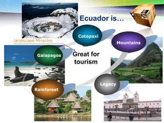
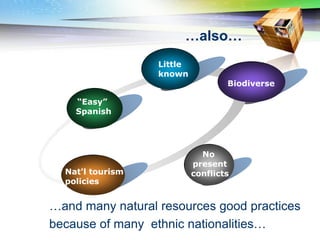
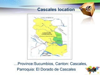
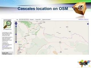
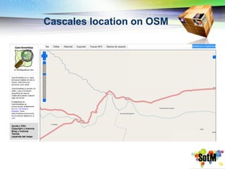
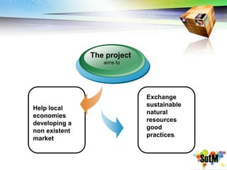
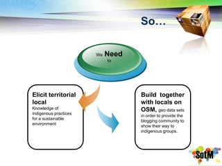
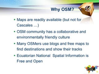
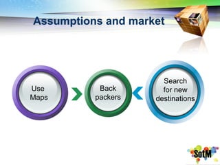
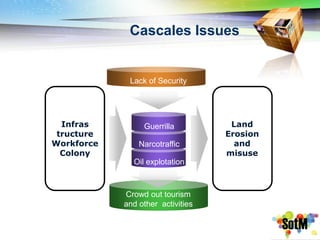
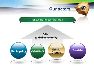
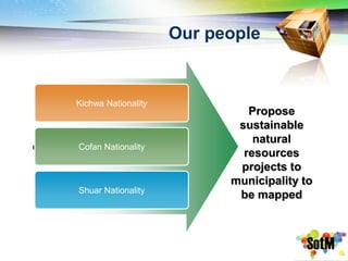
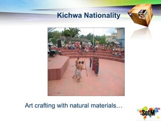
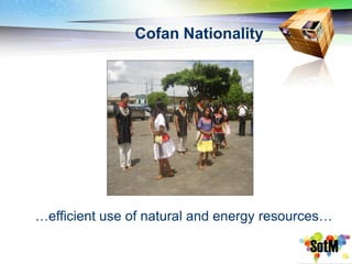
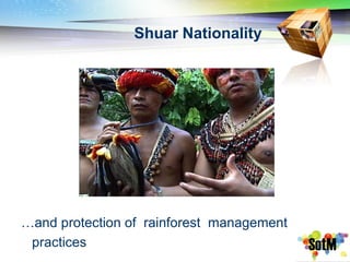
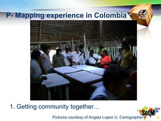
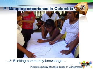
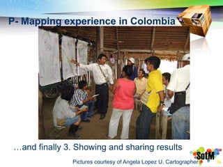
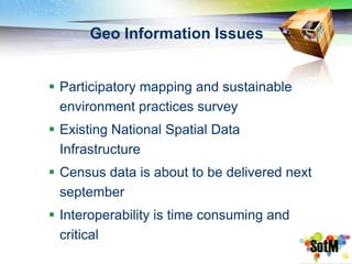
Putting Cascales on the
World Map
Contents

1   Putting Ecuador on the Map


2       Cascales Issues

        Our people / actors
3


4   Participatory Mapping experience


5     Q & A for the project
Ecuador is…

                         Cotopaxi
…landscape Miracles
                                             Mountains


            Galapagos   Great for
                        tourism


                                    Legacy
          Rainforest
…also…
                  Little
                  known
                                   Biodiverse

    “Easy”
    Spanish


                             No
                           present
  Nat'l tourism            conflicts
  policies


…and many natural resources good practices
because of many ethnic nationalities…
Cascales location


…Province:Sucumbios, Canton: Cascales,
 Parroquia: El Dorado de Cascales
Cascales location on OSM
The project
                  aims to


                             Exchange
                             sustainable
Help local
                             natural
economies
                             resources
developing a
                             good
non existent
                             practices.
market
So…

                       We   Need
                            to


Elicit territorial                 Build together
local                              with locals on
Knowledge of                       OSM, geo data sets
indigenous practices
                                   in order to provide the
for a sustainable
                                   blogging community to
environment
                                   show their way to
                                   indigenous groups.
Why OSM?

 Maps are readily available (but not for
  Cascales …)
 OSM community has a collaborative and
  environmentally friendly culture
 Many OSMers use blogs and free maps to
  find destinations and show their tracks
 Ecuatorian National Spatial Information is
  Free and Open
Assumptions and market


                      Search
Use        Back       for new
Maps      packers   destinations
Cascales Issues


             Lack of Security


  Infras         Guerrilla          Land
 tructure                          Erosion
Workforce       Narcotraffic         and
  Colony                           misuse
              Oil explotation


            Crowd out tourism
            and other activities
Our actors

               Put Cascales on the map


                        OSM
                  global community


                             Ethnic      Tourists
Municipality   Volunteers
                             Groups
Our people


    Kichwa Nationality
                                  Propose
                                sustainable
                                   natural
e   Cofan Nationality
                                 resources
                                projects to
                               municipality to
    Shuar Nationality
                                be mapped
Kichwa Nationality


Art crafting with natural materials…
Cofan Nationality


…efficient use of natural and energy resources…
Shuar Nationality


…and protection of rainforest management
 practices
P- Mapping experience in Colombia


 1. Getting community together…
               Pictures courtesy of Angela Lopez U. Cartographer
P- Mapping experience in Colombia


 …2. Eliciting community knowledge…
              Pictures courtesy of Angela Lopez U. Cartographer
P- Mapping experience in Colombia


 …and finally 3. Showing and sharing results
                Pictures courtesy of Angela Lopez U. Cartographer
Geo Information Issues


 Participatory mapping and sustainable
  environment practices survey
 Existing National Spatial Data
  Infrastructure
 Census data is about to be delivered next
  september
 Interoperability is time consuming and
  critical
Project planning


Send layers to Back
packers
Blog
Community                      G-Tag practices
Transfer OSM
Know How
                       Environment Practices


Load to OSM           Thematic Maps
Get Nat'l GDB

                  Base Maps
Opportunities and Challenges


         1                     2                    3
 New locations and     Little funding is    We need support to
 valuable knowledge    needed to produce    train our people on
 is produced… are      base and thematic    OSM … how can we
 there others OSMers   maps but still not   work together?
 working on similar    available…how can
 cases?                we find sponsors?
for ANY comments

Jotacarranza
jotacarranza@gmail.com

Putting Cascales On The World Map

  • 1.
    Putting Cascales onthe World Map
  • 2.
    Contents 1 Putting Ecuador on the Map 2 Cascales Issues Our people / actors 3 4 Participatory Mapping experience 5 Q & A for the project
  • 3.
    Ecuador is… Cotopaxi …landscape Miracles Mountains Galapagos Great for tourism Legacy Rainforest
  • 4.
    …also… Little known Biodiverse “Easy” Spanish No present Nat'l tourism conflicts policies …and many natural resources good practices because of many ethnic nationalities…
  • 5.
    Cascales location …Province:Sucumbios, Canton:Cascales, Parroquia: El Dorado de Cascales
  • 6.
  • 7.
  • 8.
    The project aims to Exchange sustainable Help local natural economies resources developing a good non existent practices. market
  • 9.
    So… We Need to Elicit territorial Build together local with locals on Knowledge of OSM, geo data sets indigenous practices in order to provide the for a sustainable blogging community to environment show their way to indigenous groups.
  • 10.
    Why OSM?  Mapsare readily available (but not for Cascales …)  OSM community has a collaborative and environmentally friendly culture  Many OSMers use blogs and free maps to find destinations and show their tracks  Ecuatorian National Spatial Information is Free and Open
  • 11.
    Assumptions and market Search Use Back for new Maps packers destinations
  • 12.
    Cascales Issues Lack of Security Infras Guerrilla Land tructure Erosion Workforce Narcotraffic and Colony misuse Oil explotation Crowd out tourism and other activities
  • 13.
    Our actors Put Cascales on the map OSM global community Ethnic Tourists Municipality Volunteers Groups
  • 14.
    Our people Kichwa Nationality Propose sustainable natural e Cofan Nationality resources projects to municipality to Shuar Nationality be mapped
  • 15.
    Kichwa Nationality Art craftingwith natural materials…
  • 16.
    Cofan Nationality …efficient useof natural and energy resources…
  • 17.
    Shuar Nationality …and protectionof rainforest management practices
  • 18.
    P- Mapping experiencein Colombia 1. Getting community together… Pictures courtesy of Angela Lopez U. Cartographer
  • 19.
    P- Mapping experiencein Colombia …2. Eliciting community knowledge… Pictures courtesy of Angela Lopez U. Cartographer
  • 20.
    P- Mapping experiencein Colombia …and finally 3. Showing and sharing results Pictures courtesy of Angela Lopez U. Cartographer
  • 21.
    Geo Information Issues Participatory mapping and sustainable environment practices survey  Existing National Spatial Data Infrastructure  Census data is about to be delivered next september  Interoperability is time consuming and critical
  • 22.
    Project planning Send layersto Back packers Blog Community G-Tag practices Transfer OSM Know How Environment Practices Load to OSM Thematic Maps Get Nat'l GDB Base Maps
  • 23.
    Opportunities and Challenges 1 2 3 New locations and Little funding is We need support to valuable knowledge needed to produce train our people on is produced… are base and thematic OSM … how can we there others OSMers maps but still not work together? working on similar available…how can cases? we find sponsors?
  • 24.