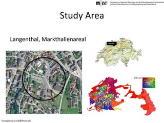
hansjoerg.stark@fhnw.ch
Including a Social Perspective into
Urban Planning using Visualisations
based on Self-Organising Maps
Hans-Jörg Stark*, Tanja Klöti**, Daria Hollenstein*, Susanne Bleisch***, Carlo Fabian**
* Institute of Geomatics Engineering, School of Architecture, Civil Engineering and Geomatics, University of Applied Sciences and Arts
Northwestern Switzerland FHNW
** Institute for Social Planning and Urban Development, School of Social Work, University of Applied Sciences and Arts Northwestern
Switzerland FHNW
*** Department of Infrastructure Engineering, University of Melbourne, Australia
hansjoerg.stark@fhnw.ch
Introduction
Starting position…
Urban planning very technical process
(maximum building heights, gross floor space,
type of use etc.)
Very controllable and measurable, most of all
financially! (ROI)
hansjoerg.stark@fhnw.ch
Introduction
Goal:
Support the development of liveable and
socially sustainable environments
Means:
Integration of social factors into the rather
technical urban planning process
hansjoerg.stark@fhnw.ch
Social Sustainability
= an integrated view of societal developments
• taking into account economic, ecological and
social aspects for future decisions
• on every level of society (global, national,
regional, local).
(World Commission on Environment and Development 1987)
hansjoerg.stark@fhnw.ch
Introduction
BUT…
Social factors are highly multidimensional and
thus very complex
Approach: Application of Self-Organising Maps
(SOM)
hansjoerg.stark@fhnw.ch
Socially Sustainable Urban Planning
Rieselfeld, Freiburg i.B. (Germany)
Solar-City, Linz (Austria)
1990ies: First urban
development projects in Europe
termed socially sustainable
Key dimensions are
• social equity
• sustainability of community
(Drilling 2013)
hansjoerg.stark@fhnw.ch
Indicators for Socially Sustainable
Urban Planning
Social Structure Which social groups live here and how can their
community life be enhanced?
Usage What kind of (social) infrastructure is needed and
where should it be located?
Design for All How can the accessibility of buildings, public spaces
and mobility be improved and ensured?
Mobility How are living spaces, workplaces, leisure activities,
supply infrastructure and educational institutions
spread over the area and how are they connected to
each other?
Participation How can residents participate in the planning and
decision making process?
Soziale Nachhaltigkeit in der Siedlungsentwicklung (Drilling & Weiss 2012)
hansjoerg.stark@fhnw.ch
Social Aspects in Urban Planning
Process
Visualisation of
• social structure
• spacial structure
• building structure
need for action
review of basic knowledge
problem description
task definition
 Provision of a socially sensitive view of the planning
problem
Planning Process
hansjoerg.stark@fhnw.ch
SOM in Urban Planning
Fundamental assumption: relation between the living
place and the socio-economic level of an individual
(Neme et al. 2011; Niemelä & Honkela 2009; Harris et al. 2005)
Neighbourhood Effects: correlation of numerous
variables to a person’s residence (Harris et al. 2005)
SOM are a special form of artificial neural network
(Kohonnen 2001)
hansjoerg.stark@fhnw.ch
SOM in Urban Planning
SOM use algorithms to faciliate the self-organisation of
the multidimensional input data through a series of
iterations
Result: multidimensional attribute space is reduced to a
2D space
Why SOM?  The development of urban areas is seen
as a self-organising organism!
hansjoerg.stark@fhnw.ch
Study Area
Langenthal, Markthallenareal
hansjoerg.stark@fhnw.ch
Study Area
Software
• Socially sensitive planning must visualize the actual
distribution of all variables
• Quickly and easily model different planning scenarios
(i.e. change the original dataset / variables)
• Apply SOM to show the planner the effect in
attribute-space of the modeled changes
hansjoerg.stark@fhnw.ch
Results
1. Compute Streetblocks
2. Aggregate attributes
3. Run SOM
hansjoerg.stark@fhnw.ch
Results
hansjoerg.stark@fhnw.ch
Results
hansjoerg.stark@fhnw.ch
Results
Software Urban ROI Designer (URD) by tsquare
hansjoerg.stark@fhnw.ch
Conclusion
• SOM proved to be a valid tool for planning scenarios
(technically)
• SOM must be evaluated as valid tool for planners
• Integration of SOM into URD currently in progress
• Study Area (City of Langenthal) is currently verifying

Including a social perspective into urban planning using visualisations based on self-organising maps

  • 1.
    hansjoerg.stark@fhnw.ch Including a SocialPerspective into Urban Planning using Visualisations based on Self-Organising Maps Hans-Jörg Stark*, Tanja Klöti**, Daria Hollenstein*, Susanne Bleisch***, Carlo Fabian** * Institute of Geomatics Engineering, School of Architecture, Civil Engineering and Geomatics, University of Applied Sciences and Arts Northwestern Switzerland FHNW ** Institute for Social Planning and Urban Development, School of Social Work, University of Applied Sciences and Arts Northwestern Switzerland FHNW *** Department of Infrastructure Engineering, University of Melbourne, Australia
  • 2.
    hansjoerg.stark@fhnw.ch Introduction Starting position… Urban planningvery technical process (maximum building heights, gross floor space, type of use etc.) Very controllable and measurable, most of all financially! (ROI)
  • 3.
    hansjoerg.stark@fhnw.ch Introduction Goal: Support the developmentof liveable and socially sustainable environments Means: Integration of social factors into the rather technical urban planning process
  • 4.
    hansjoerg.stark@fhnw.ch Social Sustainability = anintegrated view of societal developments • taking into account economic, ecological and social aspects for future decisions • on every level of society (global, national, regional, local). (World Commission on Environment and Development 1987)
  • 5.
    hansjoerg.stark@fhnw.ch Introduction BUT… Social factors arehighly multidimensional and thus very complex Approach: Application of Self-Organising Maps (SOM)
  • 6.
    hansjoerg.stark@fhnw.ch Socially Sustainable UrbanPlanning Rieselfeld, Freiburg i.B. (Germany) Solar-City, Linz (Austria) 1990ies: First urban development projects in Europe termed socially sustainable Key dimensions are • social equity • sustainability of community (Drilling 2013)
  • 7.
    hansjoerg.stark@fhnw.ch Indicators for SociallySustainable Urban Planning Social Structure Which social groups live here and how can their community life be enhanced? Usage What kind of (social) infrastructure is needed and where should it be located? Design for All How can the accessibility of buildings, public spaces and mobility be improved and ensured? Mobility How are living spaces, workplaces, leisure activities, supply infrastructure and educational institutions spread over the area and how are they connected to each other? Participation How can residents participate in the planning and decision making process? Soziale Nachhaltigkeit in der Siedlungsentwicklung (Drilling & Weiss 2012)
  • 8.
    hansjoerg.stark@fhnw.ch Social Aspects inUrban Planning Process Visualisation of • social structure • spacial structure • building structure need for action review of basic knowledge problem description task definition  Provision of a socially sensitive view of the planning problem Planning Process
  • 9.
    hansjoerg.stark@fhnw.ch SOM in UrbanPlanning Fundamental assumption: relation between the living place and the socio-economic level of an individual (Neme et al. 2011; Niemelä & Honkela 2009; Harris et al. 2005) Neighbourhood Effects: correlation of numerous variables to a person’s residence (Harris et al. 2005) SOM are a special form of artificial neural network (Kohonnen 2001)
  • 10.
    hansjoerg.stark@fhnw.ch SOM in UrbanPlanning SOM use algorithms to faciliate the self-organisation of the multidimensional input data through a series of iterations Result: multidimensional attribute space is reduced to a 2D space Why SOM?  The development of urban areas is seen as a self-organising organism!
  • 11.
  • 12.
    hansjoerg.stark@fhnw.ch Study Area Software • Sociallysensitive planning must visualize the actual distribution of all variables • Quickly and easily model different planning scenarios (i.e. change the original dataset / variables) • Apply SOM to show the planner the effect in attribute-space of the modeled changes
  • 13.
  • 14.
  • 15.
  • 16.
  • 17.
    hansjoerg.stark@fhnw.ch Conclusion • SOM provedto be a valid tool for planning scenarios (technically) • SOM must be evaluated as valid tool for planners • Integration of SOM into URD currently in progress • Study Area (City of Langenthal) is currently verifying