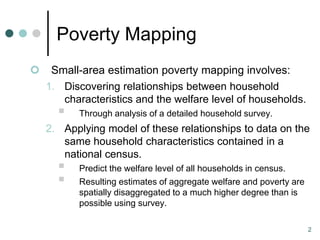
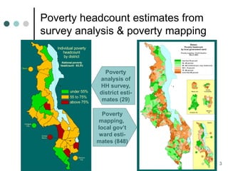
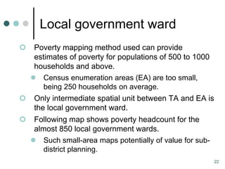
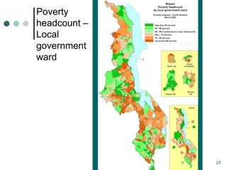
Poverty mapping involves using household survey data and census data to estimate welfare levels and poverty rates at small geographic areas. It relates household characteristics from the survey to welfare levels, then uses those relationships to predict welfare for all households in the census based on their characteristics. This allows for spatially disaggregated poverty estimates. The document describes applying this method to Malawi using a 1997 household survey and 1998 census, generating poverty estimates for districts and wards. It outlines the key steps of variable harmonization, model development, and applying the model to census data.
![Poverty Mapping
An overview of methods,
based on a Malawi analysis
Todd Benson
International Food Policy Research Institute
June 2009 [t.benson@cgiar.org]](https://image.slidesharecdn.com/povertymappingmalawitoddbenson-091211011812-phpapp01/85/Poverty-Mapping-An-overview-of-methods-based-on-a-Malawi-analysis-1-320.jpg)
![Poverty Mapping
An overview of methods,
based on a Malawi analysis
Todd Benson
International Food Policy Research Institute
June 2009 [t.benson@cgiar.org]](https://image.slidesharecdn.com/povertymappingmalawitoddbenson-091211011812-phpapp01/75/Poverty-Mapping-An-overview-of-methods-based-on-a-Malawi-analysis-1-2048.jpg)