Physiology of karnataka
•Download as PPTX, PDF•
5 likes•2,725 views

Karnataka has three main physical zones - the coastal strip along the western coast, the Western Ghat mountain range inland from the coast, and the Deccan Plateau comprising the central region. The state has a population of over 61 million and its geography is defined by its location between the Western Ghats and the Deccan Plateau. It has a variety of mineral, forest, and water resources and experiences different climates across its zones including winter, summer, monsoon, and post-monsoon seasons. Major rivers include the Kaveri, Krishna, and several west-flowing rivers along the western coast.

Recommended
More Related Content
What's hot
What's hot (20)
Similar to Physiology of karnataka
Similar to Physiology of karnataka (20)
Recently uploaded
Recently uploaded (20)
Physiology of karnataka
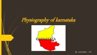
- 1. Physiography of karnataka By : sunil patil …..!!!!!
- 2. Introduction. Karnataka is situated on the western edge of the Deccan Peninsular region of India. It is located approximately between 11.5° North and 18.5° North latitudes and 74° East and 78.5° East longitudes. Karnataka comprises the Deccan Plateau, the Western Ghats Mountain Range and the Coastal Plains. Karnataka is part of two well-defined regions of India: the Deccan Plateau and the Coastal plains and Islands
- 3. Land forms of karnataka The state has three principal physical zones The coastal strip, called Karavalli, between the Western Ghats and the Arabian Sea, which is lowland, with moderate to high rainfall levels. This strip is around 320 km in length and 48–64 km wide. The Western Ghats, called Malenadu, a mountain range inlans from the Arabian Sea, rising to about 900 m average height, and with moderate to high rainfall levels. The Deccan Plateau, called Bayalu Seeme, comprising the main inland region of the state, which is drier and verging on the semi-arid. The humidity in these plains or maidans never exceeds 50%. Karnataka has one of the highest average elevations of Indian states at 1,500 feet. The highest recorded temperature was 45.6 °C (114.08 °F) at Raichur on May 23, 1928. The lowest recorded temperature was 2.8 °C (37.04 °F) at Bidar on December 16, 1918.
- 5. Population & people of karnataka Karnataka has a total land area of 1,91,791 km² and accounts for 5.83% of the total area of the country (measured at 3,288,000 km²). This puts it in seventh place in terms of size. With a population of 6,11,30,704, it occupies eighth place in terms of population. The population density which stands at 319 persons per km² is lower than the all-India average of 382.
- 6. Climate Karnataka has the following four seasons in the year: The winter season from January to February The summer season from March to May The monsoon season from May to September The post-monsoon season from October to December.
- 7. Mineral resources Karnataka is rich in its mineral wealth which is distributed fairly evenly across the state. Rich deposits of, bauxite, chromite, dolomite, gold, iron ore, limestone, magnesite, Manganese and silica sand and many more are found in the state Karnataka has two major centers of gold mining in the state at Kolar and Raichur. These mines produce about 3000 kg of gold per year which accounts for almost 84% of the country's production. Most of the iron ores are concentrated around the Bellary-Hospet region
- 8. Soil types the soil types are divided into six types Red lateritic (lateritic soil is found in bidar and kolar district) black alluvio-colluvial forest coastal soils Red coastal soils alluvio-colluvial black lateritic
- 9. Water Resources With a surface water potential of about 102 kilometers, Karnataka accounts for about six percent of the country's surface water resources. Around 60% of this is provided by the west flowing rivers while the remaining comes from the east flowing rivers.
- 10. Rainfall The southwest monsoon accounts for almost 80% of the rainfall that the state receives. The annual rainfall across the state ranges from low 50 cm to max 350 cm. The districts of Bijapur, Raichur, Bellary and Southern half of Gulbarga experience the lowest rainfall ranging from 50 to 60 cm while the west coastal region and Malenadu enjoy the highest rainfall.
- 11. Forests About 20% of Karnataka's geographic are covered by forests. The forests are classified as reserved (28.611 km²) protected (3,932 km²), unclosed (5,748 km²), village (124 km²) and private (309 km²) forests. Karnataka is known for its valuable timbers from the evergreen forests in the Western Ghat region, notably Teak and Rosewood,
- 13. Waterfalls in karnataka Lot of WaterFalls in Karnataka. kadambi Falls Kalhatti Falls Anashi Falls Chakra River Vibhooti Falls Onake Abbi Falls Hanumangundi Falls chelavara Falls Kadra Falls gootlu Falls hidlumane Falls Godchinamalaki Falls Abbey Falls Bandaje Falls Barkana Falls Chunchanakatte Falls Devaragundi Falls Gokak Falls Hebbe Falls Irupu Falls Jaladurga Falls Jog Falls Kalhatti Falls Kunchikal Falls Magod Falls Mallalli Falls Muthyalamaduvu Falls Sathodi Falls Shivanasamudra Falls Shivganga Falls Sirimane Falls Vajrapoha Falls Varapoha Falls Unchalli Falls
- 15. East flowing rivers 26 east-flowing rivers. Amarja Arkavathy River Bhadra River Chakra River Dandavathi Ghataprabha River Hemavati River Honnuhole River Kabini River Kaveri River Kedaka River Krishna River Kubja River Lakshmana Tirtha River Malaprabha River Palar River Panchagangavalli River Penner River Ponnaiyar River Shimsha South Pennar River Tunga River Tungabhadra River Varada Vedavathi River Vrishabhavathi River
- 17. West flowing rivers 10 west-flowing rivers, providing 60% of state's inland water resources. Gangavalli River Aghanashini River Kali River Kumaradhara River Shambavi Varahi River Souparnika River Sharavathi River Netravati River Gurupura River seethanadhi river
- 19. Lakes Lakes in Davangere (Shanthisagara biggest lake in India) Lakes in Bangalore Mysore city lakes Unkal lake, Hubli Belgaum Fort Lake Heggeri Lake, Haveri Hagari Jalashaya , Malavi
- 20. Thanking you all….!!!! by:- $uNiL .R. p@TiL