
Recommended
Recommended
More Related Content
What's hot
What's hot (17)
Viewers also liked
Similar to Personas como sensores; personas como actores.
Similar to Personas como sensores; personas como actores. (20)
Recently uploaded
Recently uploaded (20)
Personas como sensores; personas como actores.
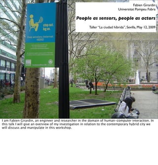
- 1. Fabien Girardin Universitat Pompeu Fabra People as sensors, people as actors Taller “La ciudad híbrida”, Sevilla, May 12, 2009 I am Fabien Girardin, an engineer and researcher in the domain of human-computer interaction. In this talk I will give an overview of my investigation in relation to the contemporary hybrid city we will discuss and manipulate in this workshop.
- 2. new urban actors The starting point of my research, is the increasing presence of new urban actors that now populate our cities.
- 3. From hard to soft infrastructures These new urban actors support a soft inftrastrucre that has become as important as the built infrastructure in the experience of the space. Soft infrastructures are not necessarly new (presence of the radio). However, there is now shift from the analog to the digital soft infrastructure (these antennas will disappead some to leave the place to their digital counterparts, the TDT in Spain).
- 4. deeply intertwined... further increasing our interactions with both soft and hard infrastructures. A patchy blend that create new types of access to the space
- 5. ... with sliding frictions ... not alwalys in a seamless, intelligent maner
- 6. ... frustrations ... to the point of failing us (and when it fails we sometimes deeply notice it!). Because soft infrastructure rely on code with imperfections that have become the routine part of the convenience of computers
- 7. ... perpetual maintenance ... Also because of the hard infrastructure that support the soft. Here the nidrogen tanks in Manhanttan installed by Verizon to dry their underground cables. This perpetual maintenance has now become part of the hybrid
- 8. ... and upgrades has much as the regular infrastructure updates
- 9. Current technology requires information to be served from somewhere and delivered to somewhere. Heisenberg’s uncertainty principle not withstanding, at geographic scales a bit always has an associated location in real geographic space. (Goodchild 1997) Goodchild, M. F. (1997). Towards a geography of geographic information in a digital world. Computers, environment and urban systems, 25(6):377–391. this presence of hard infrastructure that support the hybrid city is at the root of my exposé. Indeed, the presence of hard technology means that a bit is always anchored within the “real” geographic space. Goodchild, M. F. (1997). Towards a geography of geographic information in a digital world. Computers, environment and urban systems, 25(6):377–391.
- 10. Visualization Study of the NSFNET,by Donna Cox and Robert Patterson from the NCSA in 1991 Maps revealed this “geography of bytes” already 20 years ago, at the infency of the Internet. Here the visualization of inbound traffic measured in billions of bytes on the NSFNET T1 backbone for September 1991. The traffic volume range is depicted from purple (zero bytes) to white (100 billion bytes). See the Martin Dodge’s Atlas of Cyberspaces for more on that http:// personalpages.manchester.ac.uk/staff/m.dodge/cybergeography/atlas/atlas.html
- 11. Massive amount of spatio-temporal data • Data produced through people's interactions with digital systems and infrastructures • Bottom-up , decentralized nature • Capture a sample of human, social or environmental state (individuals act as sensors) The presence of soft infrastrures in mobile settings (e.g. GSM for mobile phones, digital cameras and Flickr, WiFi and netbooks) generates a new “geography of bytes” with spatio-temporal data produced through peoples interactions with digital systems, with individuals acting as sensors. We will see that the bottom-up, decentralized nature of these data allow to capture samples of human, social and environmental state.
- 12. Digital shadows • Records of implicit interactions with these new urban actors in the physical space with digital means • Examples: RFID card (bike sharing, metro), tangible sensors, wireless networks (GSM, Wi-Fi), fidelity cards, credit cards, etc I categorize 2 types of data generated by people interactions with soft infrastructures. Frist digital shadows are implicitely generated, without we notice and wish them.
- 13. Digital footprints • Explicit user-generated content with geographic anchor: “from shoeboxes to digital footprints” • Fall of prices to store data • Raise of online social networks and ‘new cartography’ as ways to map and visualize the city through images and narrative descriptions Second there is an emergence of digital footprints, that people produce explicitly through the recent availability of social netwroks and new types of cartography.
- 14. “The consequences for the social sciences will be enormous: they can finally have access to masses of data that are of the same order of magnitude as that of their older sisters, the natural sciences.“ (Latour, 2007) Latour, B. (2007). Beware, your imagination leaves digital traces, Times Higher Education Supplement, April 2007. The access to these massive amounts of spatio-temporal data have a consequence on social sciences (including urban studies)
- 15. “When many individual diagrams are aggregated to the level of cities and regions, these visualizations may provide geographers, for the first time, with truly dynamic maps of dynamic human processes. One might imagine them as twenty-first century “weather maps” of social processes”. (Zook et al., 2004) Zook, M., Dodge, M., Aoyama,Y., and Townsend, A. (2004). New digital geographies: Information, communication, and place. Geography and Technology, pages 155–176. also perceived in the world of (Human/Urban) Geography and Geographic Information Science. Besides Zook et al. (2004), see for instance Craglia, M., Goodchild, M., Annoni, A., Camara, G., Gould, M., Kuhn, W., Mark, D., Masser, I., Maguire, D., Liang, S., and Parsons, E. (2008). Next- generation digital earth. a position paper from the vespucci initiative for the advancement of geographic information science. International Journal of Spatial Data Infrastructure Research, 3:146– 167.
- 16. Urban informatics 1. Urban data gathering (What can be sensed?) 2. Urban data analysis (What can we do with what is quantitativly sensed and qualitativly observed?) 3. Information visualization (What can we communicate?) 4. Designing urban technologies and services (How to design to improve?) The convergeance of technological developments/achievements, challenge for interaction designers for their integrations within the human context, the opportunities for social and urban studies and the observations of geographers creates a crossroad of investigations often called “urban informatics”. I see 4 main exploration avenues (data collection, analysis, visualization and design/ integration). Even though they are often deeply intertwined, I will try to touch 2. (analyis - people as sensors) and 4. (integration - people as actors)
- 17. The methods to collect information on urban dynamics have barely changed since the 70s (see William Whyte for instance). as these photos taken a in New York last year can testify. The city regularly sends employees to perform manual counts of traffic.
- 18. Evidence-based urbanism • Map and analyze the distribution of the use of space • Planning was about predicting and accommodating and it becomes more observing and improving • Feedback loop (provide immediate information that can be acted upon) With the presence of soft infrastructure and its digital footprints and shodows we contemplate the opportunity to change this rudementary understanding of the urban and built space.
- 19. For instance, this unique presence of a bike in a Vélib rack in Paris can have a meaning on the state of its environment (e.g. less attractive compared to others at that specific time of the day, it is a residential area with little activity?)
- 20. Velib We can now observe this kind of evidences at the scale of the intrastructure (bike stations as hard infrastructure, lending system as soft infrastructure, RFID card as connector). Each biker interaction with the station is logged and the number of bikes per stations is made public through the infrastructure provider’s web site.
- 21. Paris Through Velib’ Fabien Girardin, Universitat Pompeu Fabra Revealing Paris Through Velib’ Data: http://www.girardin.org/fabien/tracing/velib/ The resulting animation give a glimpse at the spatio-temporal state of the system (and city) and the mobility patterns of its users (movements from empty areas to peak areas)
- 22. Sunny Sunday in BCN Same dynamics in Barcelona that reveal the movement to the beach area in the afternoon and back to the city in the evening (on a sunny Sunday).
- 23. Spatial clustering from bike mobility patterns Kaltenbrunner, A., Meza, R., Grivolla, J., Codina, J., and Banchs, R. E. (2008). Bicycle cycles and mobility patterns - exploring and characterizing data from a community bicycle program. CoRR, abs/0810.4187. The analysis of this type of public data from a bike-sharing system Colleague can help clustering according to its dynamic over time. This view of spatio-temporal distribution can complement the classif top down definition of space use.
- 24. Nowadays tourists leave digital footprints behind them that reveal their presence In another project, we worked with the Province of Florence in Italy. Florence has difficulties in understanding the tourist dynamics that takes place in the region, because tourist mainly come to the Province for the day and do not stay. They prefer to sleep in the nearby cities. In consequence tourists leave very little traces of their presence and activities. Surveys are very expensive to perform and only provide a snapshot. We collected and analysis georeferenced photos publicaly available on the photo-sharing web platform Flickr.
- 25. A view of photographs activity and flows in Summer 2007 in Spain and Portugal. Project currently featured at the Disseny Hub Barcelona. http://senseable.mit.edu/worldseyes/ This visualization shows that in 2007,Iberian Penninsula clearly splits between Portugal and Spain with Barcelona constantly acting as main hub connecting people to Madrid, the Balearic Islands, Andalucia and the Cantabrian Sea in the North.
- 26. Between “info-porn” and “intelligent” maps • Visualization as part of a process • Maps to engage not to solve a problem (microscopes and telescopes) Lately, voices have raised to consider these types of visualization as “info-porn”. In response, it is important to note that these type of work is part of a process. It aims at attracting attention, stimulate the dialogue and stretch the imagination. Yet, this is only the tip of the iceberg of the work produced at UPF or MIT that strongly relies on the experience and data generated during the demos to produce scientific content. On the other, I do not consider that this type of work lead to the development of “intelligent maps” as described by others. The opacity of the research review process and publication venues, does not often allow to get a glimpse of the research outcomes. Following, I will present some of these works.
- 27. Digital footprinting Girardin, F., Dal Fiore, F. , Ratti, C., and Blat, J. (2008). Leveraging explicitly disclosed location information to understand tourist dynamics: A case study. Journal of Location-Based Services 2, 1, 41–54. In the process we call “digital footprinting”, tourists take photos and upload them to Flickr with georeferences. Our system collects these data and with data-mining techniques extract the photo and user information and infers the types of tourists from their behaviors. The visualization of this basic analysis generates activity and flow maps as well as temporal signatures.
- 28. 2 years (2005-2007) Region Photos Photographers Barcelona 154,106 5818 Province of Florence 81,017 4280 Rome 144,501 6018 We collected Flickr data for multiple cities. For the province of Florence, we analyzed 81,000 photos shared by 4280 photographers.
- 29. Scales The basic mapping of this data enables to uncovers the density of tourists at very different scales, such as region, citiy and point of interest. While cities are interested in understanding tourist dynamics within their boundaries, we found out that they were equaly interested in understand how the “competitive” cities perform. This type of data allows comparaisons.
- 30. Act of communication Unlike the automatic capture of traces, the manual location disclosure embedded in the act of geotagging of photo provides additional qualities Positioning photo on a map is not simply adding information on its location, it can be considered as an act of communication containing what people estimate as being relevant for themselves and others. In that sense, a specific richness of this dataset arises in the intentional weight people put in disclosing their photos. We show that they have a tendency to select the highlights of their discovery of the city and discarding the downtimes.
- 31. Tourists traces in Switzerland in 2007. Fabien Girardin, UPF http://www.flickr.com/photos/drremulac/464000368/in/set-72157600018368138/ Each photo contains a timestamp the digital cameras embeds when the photo is taken. So not only can we analyse the location of the photo but also its temporal context. With both location and time data we build a sequence of photos that forms the trails the tourists follow. The mapping these traces reveals main flows. In the case of Switzerland, it touristic areas such as Interlakend and Zermatt have an equal importance as the main cities.
- 32. Types of visitors Tourists and locals can be recognized from their practice 60% of users disclose their home country Flickr lets the opportunity to its users to set their home city or country. We found out that 60% of the users discolsed their home coutry. Taking advantage of this information, we were able to map the traces of american (left) and italian (right) visitors in Tuscany and its proximity. The fact that no American reports a trip to the Island of Elba does not mean they avoid this part of the country, but rather that they do not find relevant to report about it.
- 33. Flows Girardin, F., Calabrese, F., Dal Fiore, F. , Ratti, C., and Blat, J. (2008). Digital footprinting: Uncovering tourists with user-generated content. IEEE Pervasive Computing, 7(4):36–43. With the data revealing the main points of interested, it is possible to aggregated this traces into flows. Once again the difference between italian (top) and american (bottom) visitors in Rome. And once again, it does not mean the Americans visit less areas of the city, but rather they report only on a few points of interest.
- 34. Space and visitors activities Girardin, F., Blat, J., Calabrese, F., Dal Fiore, F. & Ratti, C. (2008) Digital Footprinting: Uncovering Tourists with User-Generated Content. IEEE Pervasive Computing, October/November 2008, pp. 36-43. In Rome, we were able to compare the density of tourists from their digital footprints (i.e. georeference photos) and digital shadows (i.e. aggregated cellular network traffic) they generate when visiting Rome. The spatio-temporal analysis revealed that georeference photo were a good proxy to capture the presence of tourists in their sightseeing activites. On the other hand cellular network traffic data were good indicators of space where tourists are on the move or in their accomodations.
- 35. NYC Waterfalls In summer 2008 around the New York City Waterfall public exhibit, we performed further studies on the charactristics of explicit (georeferenced photos) and implicit (aggregated cellular network traffic data) digital footprints to define indicators that measure the evolution of urban attractiveness.
- 36. Evolution of urban attractivenes Girardin, F.,Vaccari, A., Gerber, A., Biderman, A., and Ratti, C. (2009). Towards estimating the presence of visitors from the aggregate mobile phone network activity they generate. In 11th International Conference on Computers in Urban Planning and Urban Management. The proposition of indicators that help to compare the evolution of the attractiveness and popularity of points of interests demanded the development of technique to map the relative density of digital footprints to the urban space. It implied the creation of a radio map based on a propagation model and an interpolation model of network activity to map network statistics with wireless coverage areas to the closest fidelity to ground truth as possible. This effort of precision was particularly necessary because the study took place on a neighbourhood scale. This work allowed mapping the spatial distribution of locals and visitors and comparing the evolution of the presence of digital footprints as evidences of the positive impact of the New York City Waterfalls on the attractiveness of the waterfront.
- 37. To explore the impact of the event at a neighborhood scale and the evolution of the attractiveness of the surrounding areas, we defined the major attractions in the proximity of the Waterfalls such as the World Trade Center site, Wall Street, City Hall, and the Brooklyn Bridge
- 38. Comparative Relative Strength Girardin, F.,Vaccari, A., Gerber, A., Biderman, A., and Ratti, C. (2009). Quantifying urban attractiveness from the distribution and density of digital footprints. International Journal of Spatial Data Infrastructure Research, We hypothesized that the density of the digital footprints that visitors leave behind gives an indication of the importance of places that, for instance, have beneficial features for work, social interaction, or sightseeing purposes. Therefore, we developed several indicators to compare the evolution of the attractiveness of different areas around the waterfront and of areas of interest in proximity of the exhibit, based on their Comparative Relative Strength (CRS).
- 39. Centrality (PlaceRank) We assessed the popularity of an area of interest by studying its ties with other areas in the city. The stronger the ties, the more frequently an area is accessible from other places as it becomes part of a popular route. This was measured by applying network analysis techniques to study the connectivity of a network in which the nodes represent areas of interest and the arches represent flows of people between them. Flows were estimated by analyzing concecutive time stamps tagged to Flickr photos in conjunction with the reported location at which a photo was taken. The PlaceRank indicator, inspired by the PageRank indicator developed by Google to order the importance of Web pages, determines the centrality of a location within a set of areas of interest based on the amount of digital footprints generated in each area and the traces that connect them. In particular, if more visitors visit place A than place B, then we can say that the former is more popular than the latter in the network of tourist destinations.
- 40. Real-time Rome An important aspect of digital footprints/shadows are their real-time availability to allow to instantenously map some urban dynamics, as featured by the Real-time Rome project
- 41. Ratti, C., Pulselli, R. M., Williams, S., and Frenchman, D. (2006). Mobile landscapes: Using location data from cell-phones for urban analysis. Environment and Planning B: Planning and Design, 33(5):727 – 748. Real-time Rome aggregated data from cell phones to better understand urban dynamics in real time. By revealing the pulse of the city, the project aims to show how technology can help individuals make more informed decisions about their environment. In the visualizations of Real Time Rome we synthesize data from various real-time networks to understand patterns of daily life and special events in Rome. MIT SENSEable City Lab, Real-Time Rome: http://senseable.mit.edu/ realtimerome/
- 42. Cellular census Reades, J., Calabrese, F., Sevtsuk, A. & Ratti, C. (2007) Cellular Census: Explorations in Urban Data Collection. IEEE Pervasive Computing, 6, 3, pp. 30-38. Once again, the analysis aggregate cell phone network traffic data show new ways of looking at the city as a holistic, dynamic system. Colleagues at the SENSEable City Lab clustered the spatio- temporal signature of cellular network traffic characterize areas on the basis of flows and dynamics rather than on the basis of comparatively static physical or demographic features. (Similar approach as with my colleague at UPF with Bicing data)
- 43. New human-time relationship The ability to log interactions calls for the end of our ephemeral relation with space. Indeed, only a few years ago, the possibility to produce fully dynamic time-space diagrams from the fusion of human activities data and novel forms of geovisualization, was only discussed in the conditional. We have now the ability to “replay the city” (at least some of its dynamic aspects). In addition we can observe some of these dynamics in real-time. Current limitation is that we only capture the dynamics that are “cheap” to capture. In addition, The emerging patterns of the data tend to reduce this perception of uncertainty as erroneous data get masked by the mass of valuable data ; this considering that the techniques to analyze the data (i.e. interpolation) do not distort the phenomena under observation!
- 44. We become a “world of witnesses” with a the production of myriads of little stories – a messy infinity of ‘Little Sisters’ rather than one omniscient ‘Big Brother’ “pues va a ser que no”? I. gathering data from people without their knowledge? II. the risk to reveal individuals from anonymized and aggregated sensor data? III. how much are people willing to give to get a service in return? The distribution of the sensors and user-generated content produce a myriad of little stories moving from the vision of the omniscient “Big Brother” to a “world of witness” where everybody plays the role of “Little Sister”. The collection, access, analysis and disclosure of these data do not come without creating social and ethical issues. My research participates to the debat in creating positive value to these data. As a society, we will need to chose how much we are willing to give to get a service in return? The success of fidelity cards in chains of supermarkets is an example of the trade-off privacy vs. value.
- 45. 5min break
- 46. Feedback loop Before the break I set the discourse on privacy around the trade-off between chose how much we are willing to give to get a service in return. The project displayed was a pioneer in that domain. WikiCity Rome http://senseable.mit.edu/wikicity/rome/. The project has been projected live on screen during the Notte Bianca in Rome. Overlaid on the map of Rome, you see different dynamic real time data as a fast forward view of that night. This created the intriguing situation that the map is drawn on the basis of dynamic elements of which the map itself is an active part. 'How do people react towards this new perspective upon their own city while they are determining the city's very own dynamic?' Not only people act as sensors, they are also actors of this type of feedback loop.
- 47. People as actors Hybrid cities are not only about technology, they are also about interaction designs, about taking into account the wider context of organization, systems and people, and even business models, legal and political contexts, belief systems and social and cultural fabric. If we do not understand these aspects, we are prone to make the same mistakes as those originated by past visions that relied on the fascination around the hard infrastructures and reducing cities to systems Studying this integration of real-time information on the dynamics of the city necessite taking into account the wide context of the hybrid city, its built space and its soft infrastructure, the social, legal, political contexts. In the remainder of this presentation, I will discuss some aspects of this context based on my investigation.
- 48. Study the hybrid city of the present • Consider the implications of the presence of this patchy informational layer • Avoid a techno-determinism and utilitarian approach that talks of new technologies in hyperbolic terms • Technologies are not drivers of urban change, but are rather caught up in complex networks (or ’socio-technical assemblages’) I particularly focused on the integration of this patchy informational layer into people’s practices (remember the first slides of this presentation?) away from any hyperbolic term or notion that technologies are sole drivers of the urban change.
- 49. Taxi drivers in BCN I exploited the market success of in-car navigation system that creates the opportunity to learn from a real-world interaction with location-aware systems in conjunction and their geoinformation. Using an ethnographicallyinformed study with a community of early adopters, the taxi drivers in Barcelona, we explore questions related to the evolution of the practice of driving and navigating.
- 50. Integration into practices Girardin, F. and Blat, J. (2008). The co-evolution of taxi drivers and their in-car navigation systems. Situating Sat Nav session at the 2008 Association of American Geographers Annual Meeting, April 2008. The navigation system completes an arrangement of artefacts providing layers of geoinformation to support the job. There are real-time information sources such as the satnav system, dispatched radio, electronic booking system, mobile phone and radio. In contrast, other artefacts provide asynchronous information to keep the knowledge of events and activities in the city up to the day (e.g. newspaper, scribbled list of “unofficial” points of interest and the street and map directory of Barcelona.
- 51. Example of a driver mixing use of a navigation system with the “Guia” (Street directory of Barcelona). The wayfinding practice takes place in phases. There is a “to go” phase in which the driver takes the proper direction and the “to arrive” phase that necessitates different geoinformation at a different granularity drop off location (the number of the street, a monument, a corner). There is a consensus that a satnav is an unbeatable tool when it comes to reaching a specific destination in a village and leaving it and it is a strong reason for purchase. The reason to purchase is to feel more serene in appropriately performing the job rather than being more productive.
- 52. Automation • Co-evolution • Social implications (customers as key source of information) • Aspects of imperfections as the routine part of the convenience of computers: Strategies to assess the uncertainty in the information We have identified areas where social interactions are relevant and connected them with learning the city and its environments and the communication of the uncertainties; and thus suggested losses and opportunities that might arise. The integration of location-aware technologies has not created a distinct sphere of practice despite the access to a digital representation of a physical space, but the knowledge acquisition evolves with people using systems in ways unanticipated.
- 53. CatchBob! CatchBob! • - frictions, not a seamless world, design failures We particularly investigate the different roles played by the technological infrastructure (e.g. wireless access points, web servers, network modules on the mobile devices) as source of uncertainty in ubiquitous geoinformation perceived by the players of the pervasive game CatchBob! http://craftwww.epfl.ch/research/catchbob/ .
- 54. Video description of the experiment http://craftsrv1.epfl.ch/research/catchbob/videos/ catchbob_full.mov . The main features we found important for players were the visibility of certain locations, known places (through their name and function), the topography, and the dynamic nature of space (through weather, light conditions, technical instability and the presence of people in space). Each of these features corresponds to different affordances, which supported three roles in this location-based game
- 55. Affordances (topology) Players reported how the main shape of the game field, defined by the paths and buildings, is a 3- branch. Starting from the main plaza, there are three obvious directions that afford a potential strategy in a spatial task such as CatchBob! Subsequently, this star structure also helped them infer where the partners were heading: “I saw him on the map here [pointing the center of the campus] and assumed he would go north because I went east and she went south” someone reported in the post-game interview.
- 56. Affordances (weather) Nova, N. and Girardin, F. (2009). Framing the Issues for the Design of Location-Based Games, chapter Digital Cityscapes: Mergining digital and urban playspaces. Peter Lang Publishers We did not explicitly focus on how weather could influence the game, but given that our field study was carried out in February and March, trials have been carried out under different weather conditions. Winter times in Switzerland often bring the presence of snow on campus, but also frequent sunny days without rain. The presence of snow sometimes restricted the game field
- 57. Underwhelming effect of automation • Players without a location awareness tool took better advantage of the annotation feature • Automatic location-awareness ≠ Giving a location (act of communication carrying intentions) Nova, N., Girardin, F., and Dillenbourg, P. (2006). The underwhelming effects of automatic location-awareness on collaboration in a pervasive game. In International Conference on the Design of Cooperative Systems. We found that automating the location-awareness of participants made them more passive. Indeed automating the interaction is different than sending one’s position in space. This fact raises an important issue regarding communication and spatial information: compared to automatic positioning in which location is just information, self-declared positioning is both a information and an act of communication. If A tells B where he or she is located, not only does B know A’s location but he or she also knows that A considers that it is useful for B to know it. This is important for players in order to better coordinate themselves on the field.
- 58. Uncertainty • Various players reactions to uncertainty: Believing, not understanding, overcoming • Seamful design (reveal the limitations of the technology) Girardin, F. and Nova, N. (2006). Getting real with ubiquitous computing: the impact of discrepancies on collaboration. e-Minds International Journal on Human-Computer Interaction, 1(1):60–64. An inherent spatial uncertainty embedded in mobile and location systems creates a social-technical gap that constantly challenges the coexistence of digital and physical spaces. In the context of CatchBob!, we were able to highlight that the quality of the ubiquitous geoinformation influences the user experience and the infrastructures must be consciously attended, as they are unevenly distributed, unevenly available.nding the way the technologies imperfectly work.
- 59. Mixed research method A “Replay tool” allowed us to confront the players to a replay of their path after the game, as well as the actions they performed. With all the players’ explicit (e.g. annotations, refresh of others’ positions,) and implicit interactions (e.g. positions, connection loss) logged on each game mobile devices and server, the tool provided a richer appreciation of the recorded data with a fast overview of the recorded events. This type of tool shows potential to help social scientists analyzing data from field studies involving user interactions with ubiquitous technologies.
- 60. Proposal for the design of the hybric space • Human-/data-based urbanism • Mixing quantitative and qualitative analysis In consequence, return to our hybrid city, these different works suggest the the need for research and practitioners to develop a coherent understanding of the traces of the activity: both qualitative (e.g. audio and video recordings of action and interviews) and quantitative (e.g. logfiles).
- 61. Example: Post- occupency evaluations The cloud of Wi-Fi signal that envelops central Salt Lake City, UT, New urban practice. Getting access to the could of Wi-Fi generated by ~1700 access points. Courtesy of Paul Torrens iWith significant data on actual use of the space, we can perform new types of “Post-Occupancy Evaluations” often overlooked in the practice of urban design and architecture. For example, Dan Hill proposes multiple perspectives in analyzing the spatial usage patterns in a post-occupancy evaluation of wireless service in public buildings. It implies the collection of photo-essays, videos and in-depth interviews with users, and relating to this idea of making the invisible, visible. As a result, with the extraction of usage patterns from various quantitative and qualitative perspectives, some analysis can be performed on how the presence of wi-fi maps with the informal use of buildings
- 62. Traps • Techno-determinism • Solve a problem but worthen the underlying situtuation (New Songdo,Venus project, city as a hotel, effective and asssisted) • Desirability of instantaneity and speed • The utopian of the seamless. Frictions are part of the hybrid city. Throughout this presentation, I have attempted to show that for every enabling technology we embrace, we should require of ourselves to consider their implications and the strategies individuals and designers develop to appropriate them. Indeed, technological force and social counter-force technology pushers too often fail to recognize the difference between solving a problem and contributing to the health of society. When failing to notice the messiness of everyday life, the design of a technical device or procedure can solve problem X while worsening an underlying condition much more serious than X.
- 63. Next steps • Transdisciplinary practices (we are meant to meet again!) • New language There is no research domain defined for the type of work I have presented. Only recently the techno-deterministic approach to the hybrid city has been challenged through the influence of designers (Greenfield and Shepard, 2008) social scientists (Anne Galloway, 2008), and geographers (Hubbard, 2006; Crang and Graham, 2007). Their influence generates the emergence of a new language that computer scientists and experts of the built space can integrate in their research and work, forging transdisciplinary practices. In consequence, it is noticeable that now social considerations go beyond privacy issues and touch the domains of the user experience, the impact of the research (e.g. positive change of practices) and the design for its appropriation (e.g. how to integrate ubiquitous technologies into citizen daily life or a city administrative decision process). This language could also influence another layer of practitioners: the one mostly concerned with the problems of those who rule space or those who want to change policies (e.g. associations, street corner lobbies, public institutions, think tanks). These people are more concerned by change (social change) and the use of technology to go beyond current practices.
- 64. Questions for this workshop • Who wins? Who looses? (confliciting visions) • How could it go very wrong? • How could we make it go right? Who is quot;wequot;, by the way?
- 65. Thank you Thank you. fabien.girardin@upf.edu and http://www.girardin.org/fabien