This study uses basin modelling to analyze the hydrocarbon potential of two Neogene sedimentary sub-basins in southern Hungary. The modelling simulated the subsidence and thermal maturation histories. It determined that the southern sub-basin reached greater depths and temperatures, resulting in gas generation from source rocks beginning 11.6 million years ago. Oil generation in the northern sub-basin began more recently around 6.8 million years ago. While hydrocarbons migrated upward along faults, accumulations have only formed so far in the southern sub-basin within anticline structures in carbonate formations. The complex geological evolution and thermal anomalies revealed by the modelling provide new perspectives for hydrocarbon exploration in the area.
Distinguishing gas bearing sandstone reservoirs within mixed siliciclastic-ca...Ahmed Hafez
Seismic AVO analysis of the mixed clastics and carbonate sequences to distinguish the gas sandstone in the Nile Delta basin, offshore Mediterranean Sea. Rock physics analysis is also included. Extended elastic impedance inversion also applied. Nile Delta seismic reservoir characterization workflow
The document provides information on reservoir mapping techniques and workflows. It discusses constructing structure maps, isopach maps, net pay maps, and fault maps to characterize reservoirs based on well log and seismic data. The maps are used for well placement, reserves calculations, and reservoir performance monitoring. Key steps include reservoir correlation, defining flow units, determining fluid contacts, and integrating geological and petrophysical data. The results provide insights into reservoir properties and geometry to promote optimal field development.
Introduction first starts by explaining sedimentation of reservoir rocks. Then it moves on to trap elements and responsibilities of a reservoir engineer.
This study focuses on determining rock properties, trap integrity, and fluid presence in the Hammerfest Basin to lower exploration risk. Seven different play models in the basin were evaluated using well log analysis, AVI seismic inversion, and lithology/fluid prediction from a regional seismic dataset. The plays include Permian, Triassic, Jurassic, and Cretaceous reservoirs, with the main risks being adequate source and migration, and intact traps. Absolute acoustic impedance and Poisson's ratio were mapped throughout the basin to better understand the rock properties of different plays and aid future exploration.
Hydrocarbon Trapping mechanism and petrophysical analysis of Afam field, offs...David Oyeyemi
This document discusses the structural trapping mechanism and petrophysical analysis of reservoirs in the Afam oil field, located offshore Nigeria in the Niger Delta. Seismic reflection data and well logs from three wells were used to map four hydrocarbon-bearing reservoirs and identify structural and stratigraphic traps. The main structural trap is an anticlinal structure at the center of the field, assisted by faults. Additional traps include fault-related closures. Petrophysical analysis of the reservoirs in two wells revealed porosity ranging from 21-31% and 1050-11,777 mD, indicating productive reservoirs. Water saturation was generally low at 3-20% with corresponding high hydrocarbon saturation of 80-97%, proving the reservoirs to
This document discusses sedimentary basins, including their definition, formation, and analysis. Key points:
- Sedimentary basins form in low areas of the crust where sediments accumulate due to tectonic activity that creates relief. They range in size from hundreds of meters to ocean basins.
- Tectonics is the primary control on sedimentation, affecting factors like sediment supply and depositional environment. Sedimentation also influences tectonics by increasing lithospheric loading.
- Basins can be formed by processes including faulting, thermal subsidence of extended lithosphere, and flexural subsidence caused by loading of the lithosphere.
- Analyzing features of sedimentary
Research Inventy : International Journal of Engineering and Science is published by the group of young academic and industrial researchers with 12 Issues per year. It is an online as well as print version open access journal that provides rapid publication (monthly) of articles in all areas of the subject such as: civil, mechanical, chemical, electronic and computer engineering as well as production and information technology. The Journal welcomes the submission of manuscripts that meet the general criteria of significance and scientific excellence. Papers will be published by rapid process within 20 days after acceptance and peer review process takes only 7 days. All articles published in Research Inventy will be peer-reviewed.
The glaciation of the North Sea Basin and its implications for Carbon Capture and Storage sites - presentation by Tom Bradwell (BGS/University of Stirling) at the UKCCSRC Glacistore meeting "Impact of glacial advances and retreats on the strata overlying prospective North Sea CO2 storage sites", 27 February 2015
The content defines geophysics and focuses on roles of seismic on exploration, well planning. It provides insights on integration of various disciplines.
Artificial Recharge to Alluvial Aquifer, Northeastern Nuba Mountains, Sudan.IJRES Journal
Many engineering geology and structural geology aspects have been used in this study, to point out the suitability of the site for artificial recharge to alluvial aquifer, such as; rocks and soil types, seepage rate, structures and lineaments. The area is under lied by basement rocks with considerable thickness (10 to 15 m) of alluvial deposit. Overall soil type is sandy soil and its seepage rate is 34.56 Liter per hour. The most existing lineaments are trending toward NW direction while rocks foliation dipping toward WWN direction. The site is satisfied to be artificial recharge.
Bagherpour and Vaziri-2012-Facies, paleoenvironment, carbonate platform and f...borhan bagherpour
This article discusses facies, paleoenvironment, and carbonate platform changes across the Paleocene-Eocene boundary in the Taleh Zang Formation in southwest Iran. Facies analysis of two sections identified 9 microfacies types in the Late Paleocene dominated by algae and corals, and 10 types in the Early Eocene dominated by larger foraminifera. The formation represents deposition on a carbonate ramp environment. Deepening trends show increased perforate foraminifera while shallowing trends show imperforate foraminifera and lack of fossils in tidal flats. Three stages of platform development are proposed: 1) algal and coral colonies (coralgal platform), 2) coralgal reefs giving way
This geotechnical site exploration report summarizes the findings of subsurface exploration for a construction site in Debrecen, Hungary. Two boreholes were drilled to depths of up to 10 meters, encountering localized fills over bedrock. Groundwater was found between 3.5 to 5.8 meters deep. Based on field and laboratory testing, the report recommends drilled shaft foundations to support proposed signal poles and dewatering may be required for deeper excavations due to permeable sandy soils.
Evidence of Geological Control on Reservoir Petrophysical Properties of “Beta...Premier Publishers
Geological controls on the reservoir petrophysical properties of “BETA Field” have been carried out using suites of wireline logs. Stratigraphic relationship among the reservoir sand bodies including their geometrical architectures, and their stacking patterns were also established. Exponential regression analysis of some of the petrophysical parameters were carried out to establish any relationship with depositional processes as well as depositional environments of the reservoir sand bodies in the field. The main factor controlling petrophysical properties and thickness for these reservoirs is the type of sandstone facies. The petrophysical evaluation of both reservoirs (K and Q) depicts porosity range from fair to very good across wells (i.e 11% to 25%). From the evaluated reservoirs porosity, there is no significant reduction of porosity with depth increase. The values obtained for the permeability of both reservoirs (K and Q) varied widely and inconsistent across the wells in the study field. The various depositional environments established in BETA field include fluvial, tidal channel, mouth bars, delta front, and the reservoir sands occurring in different depositional settings, resulting from different depositional processes, which had a wide range of petrophysical properties.
The document summarizes the natural and human-induced geological processes affecting the Cardona Diapir salt outcrop in northeastern Spain. It describes the formation and geological structure of the salt deposit. Underground mining for potassium salt from 1930 to 1990 caused significant changes, including the accumulation of mine waste that dammed drainage and induced sinkhole formation. In 1998, the interception of an underground salt conduit by a mine gallery dramatically altered the hydrology and caused river water and debris to flow into the mine.
This paper discusses geophysical imaging techniques for mapping sub-basalt strata, which remains an important but under-explored frontier for hydrocarbon exploration. Modern seismic acquisition and processing, along with integrated interpretation of multiple geophysical data sets, has improved imaging below basalt layers and revealed several productive sub-basalt reservoirs worldwide. The paper reviews key basins studied, technological advances enabling sub-basalt exploration, and presents examples of deepwater seismic sections demonstrating imaging capabilities.
The document discusses the Malampaya gas field located offshore the Philippines. It provides details on the geological setting and depositional environment of the field. The Malampaya reservoir consists of Oligocene-Miocene carbonates deposited during the drifting stage in a reef environment along the continental margin. Stratigraphic correlations of well data using diagenetic units revealed heterogeneity in the reservoir porosity and permeability.
In the past decade, particularly since the last summary of the
subject (Calvet, 2004), the Quaternary glaciation of the Pyrenees
has been the focus of new research. Unequal progress
has been achieved on three aspects: mapping the extent of
the Pyrenean ice field, quantifying the geomorphological
impact of glaciation on the preglacial landscape and refining
the chronology of the glacial fluctuations.
CO2-Driven Enhanced Gas Recovery and Storage in Depleted Shale Reservoir- A N...Steve Wittrig
1) The document discusses using numerical simulation to analyze CO2-enhanced gas recovery and storage in depleted shale gas reservoirs. It aims to maximize methane production while delaying CO2 breakthrough and maximizing CO2 storage.
2) Different injection scenarios are defined based on modifications to well patterns, reservoir characteristics, fracture properties, sorption parameters, and operational constraints. The scenarios vary the spacing between injection and production wells.
3) The best injection practice will be proposed based on analyzing different scenarios to enhance methane recovery and minimize CO2 production from the reservoir while storing more CO2.
The document is a geotechnical site exploration report for a site located at Rakoczi utca 1-5 in Debrecen, Hungary. It was prepared for Abu-Alkhail For Construction Managements Co. by Abu-Alkhail Construction Labs. The site investigation found localized fills less than 20 feet deep over bedrock. Groundwater was encountered between 3.5 and 5.8 meters below ground surface. Based on soil testing and properties, the report recommends drilled shaft foundations to support design loads for any structures. Dewatering will likely be required for deeper excavations due to the permeable sandy soils encountered.
This document summarizes research on evidence of Quaternary tectonics in the Insubria region located between Lakes Como and Maggiore in Northern Italy. The researchers mapped two major structures, the Gonfolite backthrust east of Como and the Albese con Cassano anticline west of Como, that both show signs of recent deformation. For the Gonfolite backthrust, new field mapping suggests it offsets Pliocene and possibly younger deposits, in contrast to previous interpretations of late Miocene age. For the Albese con Cassano anticline, studies confirm it has accumulated around 200 meters of vertical displacement since the Middle Pleistocene and growth has been accompanied by strong local earthquakes. Overall
2015 CDA-Frederickhouse Erosion Controlshiqiang Ye
This document summarizes the bank erosion control measures implemented at the Frederickhouse Dam in Ontario. Significant erosion was undercutting the 28m high left bank downstream of the dam due to turbulent discharge. Monitoring after a large landslide identified the need to stabilize the slope. Tests were conducted to determine soil properties, and a Flow-3D model was used to simulate flow patterns and evaluate design options. The final design included a stabilizing berm and armourstone riprap to arrest further erosion and meet safety standards, with construction completed in 2014.
This document summarizes a hydrogeophysical investigation using self-potential and resistivity surveys at Hidden Dam in California to better understand seepage patterns and subsurface geology. 512 self-potential measurements identified known seepage areas and a potential new area, while two 2,500 foot resistivity profiles indicated a sediment channel that may be a significant seepage pathway. Numerical modeling of subsurface flow correlated with geophysical data and confirmed a focusing of seepage in low-lying areas downstream, consistent with past observations. The integrated approach provides a framework for improved understanding of seepage conditions at the site.
Developing Conceptual Aquifer Geometry, Structural Geological Control and Pos...iosrjce
IOSR Journal of Applied Geology and Geophysics (IOSR-JAGG) is a double blind peer reviewed International Journal that provides rapid publication (within a month) of articles in all areas of Applied Geology and Geophysics. The journal welcomes publications of high quality papers on theoretical developments and practical applications in Applied Geology and Geophysics. Original research papers, state-of-the-art reviews, and high quality technical notes are invited for publications.
The document summarizes research on the petrophysical properties of different formations in the Indus Basin. It discusses five research papers that analyzed porosity and permeability in formations like the Khewra Sandstone, Warchha Sandstone, Habib Rahi Limestone, Sui Main Limestone, and Wargal Limestone. The results found that the Warchha Sandstone had very high porosity ranging from 26.75-34.5%, while the Habib Rahi Limestone had very low porosity of 0.21%. Porosity in the Wargal Limestone ranged from 0.483-23.547% depending on the location. The document concludes by evaluating the petrophysical properties of reservoirs
Surface and subsurface investigations for groundwaterPrabinBimali
This document describes various geological and geophysical methods used for groundwater exploration, including remote sensing, surface geophysical methods, and sub-surface geophysical well logging techniques. It discusses geomorphological mapping of surface features indicative of groundwater such as stream junctions. Electromagnetic, electrical resistivity, seismic, and gravity methods are described. The principles, equipment, and applications of each method are explained in detail. Well logging techniques including electric, radioactive, induction, sonic, and fluid logs are also summarized.
This document summarizes a geology dissertation on South Raasay, Scotland. Nine sedimentary and three igneous formations were mapped in the area. The sedimentary basement consists of braided river sandstones and conglomerates from the Torridonian period, unconformably overlain by shallow to deep marine Jurassic mudstones and sandstones. Two marine transgressions and regressions are proposed. The succession has been intruded by a granophyre sill, microgabbro sill, and basaltic dykes associated with the North Atlantic Igneous Province. During the Tertiary, regional extension resulted in prominent normal and strike-slip faults. Recent glaciation is evident from erratics and till.
Sedimentary basins form in distinct tectonic settings and can be classified based on their formation mechanism and characteristics. The key basin types include rift basins, which form during continental breakup; foreland basins, which form during continent-continent collisions; and arc-trench basins, which form in subduction zones. Each basin type has features that make it suitable for trapping hydrocarbons, such as thick sediment sequences, varying thermal histories, and structural traps associated with the tectonic setting. Rift basins and foreland basin peripheral bulges in particular are highly prospective for oil and gas accumulations.
The document discusses variations in source rock facies and quality in the Late to Middle Jurassic source rock system in the South Viking Graben between 58oN and 60o15’N. It aims to assess variability through mapping thickness and generating maps of oil and gas potential. The thin post-rift section of the Draupne Formation is a rich oil source, while the thicker syn-rift section contains a mixture of oil and gas-prone organic matter. The underlying Heather Formation is generally a leaner gas-prone source. Biomarker and isotopic analyses support an increase in oil-prone organic matter upwards. Interpretation of maps and analyses suggest facies are controlled by factors like oxygenation,
Subsurface Miocene Sequence Stratigraphic Framework in the Nile Delta, Egypt....SaadTaman
This study examines the petrophysical properties and lithofacies distribution of the upper Miocene Abu Madi Formation, a major natural gas reservoir in the Nile Delta. Six lithofacies were identified from core analysis, including trough cross-bedded, parallel laminated and massive sandstones that serve as the primary reservoirs. The sandstones exhibit good porosity but variable permeability, with the trough cross-bedded and massive lithofacies having the best reservoir quality. Clay and silt-dominated lithofacies act as vertical permeability barriers. The depositional environment was interpreted as fluvial channels within incised valley-fills. The study provides insights into reservoir quality and exploration of fluvial channel deposits
The document summarizes research evaluating the Late Cretaceous-Cenozoic uplift of the eastern Barents Sea through 1D petroleum systems modeling of several wells. Key findings include: (1) Estimating 500m of Cenozoic erosion through well log analysis and maturity modeling; (2) Identifying multiple rifting events through subsidence analysis; (3) Concluding most oil and gas pools formed during the Mesozoic and ceased with Cenozoic uplift. Future work includes more detailed 2D and 3D modeling to better understand the basin's petroleum systems.
The document discusses the shale gas potential of the Ghadames Basin, located in parts of Tunisia, Algeria and Libya. It finds that the Early Silurian source rock (Tanezzuft shales) may have potential for shale gas exploration based on basin screening criteria. Basin modelling of two wells indicates that the source rock is in the wet gas to main gas window in parts of the basin and has not experienced significant tectonic activity since reaching maturity, suggesting potential for gas retention. The study identifies areas in the western and central basin as "sweet spots" warranting further shale gas exploration.
The document provides an overview of metalliferous basins in New South Wales that host lead-zinc and other base metal deposits. It discusses the Broken Hill basin, which contains the giant Broken Hill deposit, as well as other significant basins such as the Ponto Group, Girilambone District, and Cobar Basin. The Broken Hill deposit formed during the rift phase of basin development from exhalative and inhalative processes, aided by an elevated geotherm from magmatic underplating. Other examples like the Ponto Group contain smaller Besshi-type copper deposits that formed from seafloor exhalative processes in an oceanic fore-arc setting. The document analyzes factors important for
Cret seq strat_mid_Norway_London_Sept_2002 Charnock and CrittendenStephen Crittenden
This study presents a sequence stratigraphic framework for the Late Cretaceous interval in the offshore Mid-Norway area based on an extensive biostratigraphic review of wells. Key microfossil events are used to correlate sequence boundaries, transgressive surfaces, and surfaces of maximum marine transgression for integration with wireline logs and seismic data. Several periods of deep-water sandstone development within sequences are identified as potential reservoirs. Biostratigraphy played an important role in recognizing and correlating Late Cretaceous sequences in the region due to the predominantly claystone lithology masking stratigraphic breaks in wireline logs.
1) Quadrants 34, 35, and 36 in the Northern North Sea contain a large gas province with good exploitation potential based on analysis of existing well and seismic data from the area.
2) Seismic inversion and calibration against key wells revealed multiple large potential gas traps in both the Lower Cretaceous and Upper Jurassic formations defined by gas-bearing and water-bearing sand intervals.
3) Acoustic impedance data identified two potential high-porosity sand channels trending NW-SE that could contain several trillion cubic feet of gas, demonstrating the hydrocarbon potential remaining to be fully unlocked in the area through reexamination of the extensive existing dataset.
Surface Reflection Seismic Method: Coal Mines FieldAli Osman Öncel
This document summarizes a study that used seismic modeling and analysis of seismic data to interpret the stratigraphy of a shallow coal deposit in central Alberta, Canada. 1D and 2D modeling helped relate seismic reflection character to stratigraphic variations in the coal zone. Seismic lines from the study area were reprocessed and interpreted, finding that reflection character could be quantitatively related to coal zone stratigraphy. The study demonstrated that detailed seismic interpretation is possible by relating reflection seismic data to variations in density logs from wells.
The document discusses mud volcanoes in the South Caspian basin and estimates the depth of origin of their products. It finds that gases have the deepest roots between 7-15 km, which drive the formation and activity of mud volcanoes. Liquid products like oil are sourced from depths up to 5 km from destroyed petroleum accumulations. Solid products like mud are estimated to originate from depths between 3-4 km based on rock compaction criteria. The majority of mud volcanoes are associated with petroleum structures in the basin.
The integrated study characterized the reservoir quality and stratigraphy of the Mowry Shale and Muddy Sandstone in the Powder River Basin. Five depositional facies were identified in the Muddy Sandstone based on core and well log analysis, with the cleanest reservoir sands found in tidal inlet and channel deposits. The overlying Mowry Shale consisted of three parasequences deposited in a restricted shelf environment. Seismic inversion and lithofacies modeling were used to map the facies distributions across the 3D seismic volume. The results provide insights into the stratigraphic framework and reservoir characteristics of the two plays to better assess their exploration potential.
1) The document describes the geological evolution of the Porcupine Basin offshore Ireland, from initial Late Jurassic rifting through Early Cretaceous hyperextension and thermal subsidence.
2) During the Late Jurassic, rifting created fault-bounded sub-basins that were filled by fluvial-deltaic and later marine sediments. In the Early Cretaceous, the basin transitioned to hyperextension, forming structurally rotated depocentres perched on basin flanks.
3) Major unconformities reflect periods of erosion and mass wasting during basin evolution. Younger Cretaceous strata onlapped and buried the older rotated sequences.
1) The document discusses classification and thermal maturity of the Barnett Shale in Texas, a world-class shale gas play.
2) Technological advancements like FESEM and FIB have allowed for nano-scale analysis of shale composition and pore structure, improving understanding of gas generation and flow.
3) The Barnett Shale has optimal properties for gas production, including a depositional environment with high organic carbon content, low clay content making it brittle, and a thermal maturity resulting from maximum burial depth that generated gas from kerogen.
Delineation of Hydrocarbon Bearing Reservoirs from Surface Seismic and Well L...IOSR Journals
Hydrocarbon reservoir has been delineated and their boundaries mapped using direct indicators from 3-D seismic and well log data from an oil field in Nembe creek, Niger Delta region. Well log signatures were employed to identify hydrocarbon bearing sands. Well to seismic correlation revealed that these reservoirs tied with direct hydrocarbon indicators on the seismic section. The results of the interpreted well logs revealed that the hydrocarbon interval in the area occurs between 6450ft to 6533ft for well A, 6449ft to 6537ft for well B and 6629ft to 6704ft for well C; which were delineated using the resistivity, water saturation and gamma ray logs. Cross plot analysis was carried out to validate the sensitivity of the rock attributes to reservoir saturation condition. Analysis of the extracted seismic attribute slices revealed HD5000 as hydrocarbon bearing reservoir.
The document is a doctoral thesis that examines platinum-group element mineralization in the Nipissing Gabbro intrusions and River Valley intrusion in the Sudbury region of Ontario. It describes low-sulfide, copper-platinum rich mineralization found in the intrusions. Evidence suggests the sulfides formed in a "staging chamber" where primitive magma assimilated crustal material and became saturated in sulfur, precipitating sulfides and platinum-group elements. When new magma intruded, it transported the early-formed sulfides and fragments upwards, emplacing them in the intrusions where they now occur. The thesis presents detailed field, petrographic and geochemical data from the intrusions
This document summarizes the tectono-stratigraphic framework and paleogeography of Southeast Asia from the Gulf of Thailand to the South Vietnam shelf during the Tertiary period. The authors constructed regional paleogeography maps for the Oligocene and Miocene eras based on stratigraphic correlations. During the Oligocene, extensive freshwater lakes and swamps dominated deposition, with some basins experiencing brackish incursion later in the period. Widespread marine flooding occurred in the late Oligocene. During the Miocene, marine influence gradually expanded across the region, reaching peak transgression in the middle Miocene associated with high sea levels. By the late Miocene, open marine conditions prevailed across most of
A sequence of slides detailing a preliminary study for age dating (biostrat) the Enjefa Beach succession in Kuwait. The sedimentology of the cliff section is that of Dr Saifullah Khan Tanoli and acts as the framework. The description of the modern day Beach Rock is by S Crittenden
This document discusses using the gold content of ancient sedimentary pyrite grains to track changes in the gold concentration of oceans through time. The authors analyzed over 4000 pyrite grains from 308 sedimentary rock samples of various ages around the world using laser ablation-ICPMS. Their results suggest gold was enriched in oceans of the Archean and Proterozoic eons compared to today, reaching a maximum around 520 million years ago as oxygen levels rose. Variations in ocean gold levels may help explain cyclic periods of gold ore deposition through earth's history.
Similar to Pavel, Lemberkovics_Basin Modelling (20)
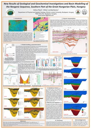
1. New Results of Geological and Geochemical Investigations and Basin Modelling of
the Neogene Sequence, Southern Part of the Great Hungarian Plain, Hungary
1 2
Edina Pável , Viktor Lemberkovics
1
Department of Physical and Applied Geology, Eötvös Loránd University, Budapest, Hungary
2
RAG Kiha Kft., Budapest, Hungary
pavel.edina1@gmail.com
References
Badics, B., Uhrin, A., Vető, I., Bartha, A., Sajgó, Cs, (2011): Medenceközponti földgáz-előfordulás elemzése a Makói-árokban. — Földtani Közlöny, 141, pp. 445-468.
Balázs, E., Nusszer, A. (1987): Magyarország medenceterületeinek kunsági (pannóniai s. str.) emeletbeli vulkanizmusa. — MÁFI Évkönyv, 69, pp. 95-104.
Haas, J., Budai, T., Csontos, L., Fodor, L., Konrád, Gy. (2010): Pre-Cenozoic geological map of Hungary, 1:500 000. — Geological Institute of Hungary, Budapest
Magyar, I., Radivojević, D., Sztanó, O., Synak, R., Ujszászi, K., Pócsik, M. (2013): Progradation of the paleo-Danube shelf margin across the Pannonian Basin during the Late Miocene and
Early Pliocene. — Global and Planetary Change, 103, pp. 168-173.
Pepper, A. S., Corvi, P. J. (1995): Simple kinetic models of petroleum formation: oil and gas generation from kerogen. — Marine and Petroleum Geology, 12/3, 291-319.
Tóth-Makk, Á., (2007): Late Miocene sequence stratigraphy of the Pannonian Basin fill (Kiskunhalas-Mélykút region, Hungary): how core, electric log and seismic data fit together? —
Geologica Carpathica, 58, pp. 353–366.
Acknowledgements
The research was supported by the RAG Kiha
Kft. We would like to express our thanks to
Katalin Lőrincz, Dénes Kisfürjesi, Orsolya Sztanó,
Balázs Badics, Katalin Milota, Lilla Tőkés, Ágnes
Tóth-Makk, Attila Balázs, János Csizmeg and
Enikő Várkonyi. Thanks Schlumberger GmbH for
PetroMod 2012.1 basin modelling software.
Fig.11. Maturity and migration history, potential accumulations of the study area
Pepper and Corvi (1995) TII (B)
Pepper and Corvi (1995) TIIIH (DE)
Pepper and Corvi (1995) TII (B)
Pepper and Corvi (1995) TIIIH (DE)
11.6 Ma
9.61 Ma
6.8 Ma
present days
present days
Fig.10. Subsidence history of the study area
16.3 Ma
15.3 Ma
12 Ma
9.61 Ma
7.8 Ma
present days
4. Subsidence history (Fig.10.)
5. Maturity and migration(Fig.11.)
6. Conclusion
The results of the modelling suggest that presently
the Badenian source rock is in the oil generation
zone in the northern and in the northern
part of the southern sub-basin. The oil generation
and migration started from around 6.8 MY. The oil
migrated upward along faults until the Szolnok
Sandstone Formation but accumulations could not
be formed yet. In the southern sub-basin significant
part of the lower and middle Karpatian source rocks
is in the gas generation zone, moreover the deepest
parts of them reached the overmature zone. The
hydrocarbon migration from the deepest part of the
Karpatian source rocks started around 11.6 MY, and
they started to form gas accumulations around 9.61
MY in the anticline structures of the Karpatian
sandstones. Hydrocarbon gas accumulations were
trapped in the Badenian carbonate formations too
but no accumulations can be observed in the
Pannonian sediments despite the possible upward
migration along the neo-tectonic fault elements.
It was concluded that one part of the southern sub-basin has either higher thermal
up-heating or more deeply buried in the past than its recent structural position. The
maturation of the source rock could reach the top of oil window in much shallower
depths near this anomaly. Better understanding of the spatial heterogeneity of this
complex geological and hydrocarbon system and the results of the basin modelling
process bring new exploration perspectives for explorationists in this matured area.
The subsidence history of the investigated sub-
basins was significantly different. The main
difference is the thickness of the Karpatian
formations. While in the northern sub-basin barely
100 m thickness can be supposed; in the southern
sub-basin it can reach 3500 m thickness based on
our interpretation. The Miocene sediments of the
southern sub-basin affected by a certain degree of
inversion, which could already start during Badenian
and continued in the Early Pannonian. Thickness of
the Pannonian sediments is significantly different in
the sub-basins too. In the southern basin the
Pannonian sediments above the Pre-Pannonian
formations are much thinner than in the northern
basin. All of these facts made the model very
complex along the 2D section.
3. Model building, parameterization
In the studied area the source rocks are organic matter rich parts of the Karpatian and Badenian
sediments. Based on the Hydrogen and Oxygen Index values the Badenian source rock contains type II,
the Karpatian source rocks contain mainly type III kerogens (Fig.3.). During modelling the
Pepper and Corvi (1995) TII (B) kinetic model has been applied in case of Badenian source rock in the
southern basin, while in the northern basin TII-S(A) model has been used because of the expectedly high
sulfur content of the source rock (based on oil samples, and evaporite presence). In case of Karpatian
source rocks the TIIIH (DE) kinetic model has been applied.
During maturation of source rocks the heat flow is one of the most important factors. The applied
heat flow profiles (Fig.5.) are the results of the calibration to the measured temperature and vitrinite
reflectance values in the 4 investigated wells.
Fig.3. Van Krevelen diagram of
Hydrogen and Oxygen Index
values measured in the Badenian
and Karpatian source rocks
During modelling some of the input parameters were estimated, such as the eroded sediment thickness
due to erosion events, the paleo water depth, the heat flow history, the role of faults during hydrocarbon
migration and the original organic geochemical parameters of source rocks.
Fig.5. Estimated heat flow history in the wells
Fig.6. Estimated paleo water depth in the wells
Fig.4. Detected eroded sediment thickness on the borehole logs of Well-2 compared to
Well-1. In Well-2 on the running of log curves a sudden change can be observed between
marl and silty claymarl, in Well-1 this transition is continuous
Three erosion events were considered during model building.
The first one happened on the boundary of Badenian and
Sarmatian stages about 13 MY ago with average 50 m estimated
eroded thickness.The next erosion event occurred at the end of
Sarmatian time in the inverted southern sub-basin, 50-100 m
eroded thickness was estimated. The third erosion event could
be detected at the boundary of the Pannonian prodelta marl and
silty claymarl approximately 50 m erosion is estimated based on
borehole logs of Well-2 (Fig.4.).
The investigated sub-basins had different evolution
histories, so different paleo water depths have been
determined along the section (Fig.6.). In the Pre-
Pannonian ages it was estimated based on literature
and paleontological investigations of wells. In Pannonian
it was estimated based on calculations of decompacted
sediment thicknesses. Fig.7. shows the supposed
connection between paleo water depth and sediment
accumulation.
Fig.7. Supposed connection between paleo
water depth and sediment accumulation
Based on vitrinite reflectance values measured in the 4 investigated wells we
could determine: the sediments in Well-2 reach the oil window in significantly
shallower depths than sediments in the other wells. Compared to the Well-1
this depth difference is around 800 m (Fig.8. and Fig.9.).
Fig.8. Vitrinite reflectance values
measured in Well-1 and Well-2
Fig.9. Vitrinite reflectance values measured in the investigated wells
2. Seismic interpretation
During seismic interpretation the Karpatian, Badenian, Sarmatian and Pannonian formations were interpreted based on
drilling results of the 5 wells along the section, analogies and literature (Balázs and Nusszer, 1987; Tóth-Makk, 2007;
Magyar et al., 2013). Assignment of the Karpatian source rocks was based on the TOC (Total Organic Carbon) and POT
(Potential; S1+S2) contents measured in Well-4; if these values reached the good classification (TOC ≥ 1 wt%,
POT ≥ 6 mg HC/g rock), we considered it as source rock. The southern sub-basin has been interpreted as a half-graben
with a normal fault on its eastern edge, started to sink in the early Karpatian age. During the Badenian - early Pannonian
ages this sub-basin had strong inversion phases. One of the result of this uplifting is the observed lateral facies change of
Szolnok Formation from north to south. The northern sub-basin started to form later in the Badenian, and does not show
significant inversion phenomena (Fig. 2.)
Fig.2. Interpreted seismic section on the study area
This study is focusing on a hydrocarbon exploration area in the southern part of Danube-Tisza
Interfluve, Hungary. The studied sub-basins (northern and southern) formed during
the syn-rift phase of the Pannonian basin development, along strike-slip zones – however
under different time and geological setting. During our work a two dimensional (2D) basin
model of subsidence and maturation history has been prepared for the Neogene sedimentary
succession. With the help of the numerical basin modelling we were able to simulate and
image the geological processes during the development of the two sedimentary sub-basins.
Our goals with the current modelling were to determine the hydrocarbon potential, the time of
hydrocarbon generation, the migration pathways of generated hydrocarbon and the potential
accumulations. The data for the modelling was derived from 3D seismic volume, drilling results
and literatures. The 2D basin model has been prepared along a selected 2D section from the
3D seismic data set (Fig.1.).
1. Introduction
Fig.1. Location of the interpreted and modelled
section (geological map after Haas et al., 2010)