Passive Seismology
•
1 like•390 views

This document discusses considerations for passive seismic acquisition based on the author's experience. It suggests that while passive seismic is gaining popularity, the equipment and understanding of practicalities may not be fully developed like they were in the early days of active 3D land seismic. The author examines important specifications for passive equipment, such as frequency response down to 1 Hz, high dynamic range, and universal applicability for both active and passive operations. Lessons from the evolution of active seismic technology are relevant to avoid potential pitfalls as passive seismic expands.

Recommended
More Related Content
Similar to Passive Seismology
Similar to Passive Seismology (20)
More from Ali Osman Öncel
More from Ali Osman Öncel (20)
Recently uploaded
Recently uploaded (20)
Passive Seismology
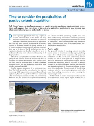
- 1. first break volume 29, July 2011 special topic Passive Seismic Time to consider the practicalities of passive seismic acquisition Bob Heath* casts a critical eye over current passive seismic acquisition equipment and opera- tions and suggests that experience with past new technology evolution in land seismic may offer some valuable lessons and pitfalls to avoid. P assive acquisition appears to be all the rage. Geophysical societies hold workshops on the theme and many magazine column inches are devoted to it. Some even say that it is the fastest growing sector in exploration. But is this field really ready for the big-time? Is the industry too. Like any new field, terminology is rather messy since there can be overlap between these operations; permanent monitoring projects can be passive operations also. In fact, in some people’s minds, anything which is not out-and-out active exploration comes under the heading of passive and I prepared to ‘do passive’ properly to get the most out of it? shall go along with that here. In some ways, passive only seems to be where active acqui- sition was at the dawn of the 3D land seismic era: lots of Passive reality expectation, theories, and ideas but rather less in terms of The potential benefits of recording without controlled hardware well suited to the job or an understanding of all sources appear to have taken some by surprise, including the practicalities. even a few oilfield service companies and geophysical This article is an attempt to convert the theoretical into contractors. This has lead to cases where survey planners getting the best from real projects. It discusses how choice of have not had time to get to grips with all the practicalities equipment and method of deployment affect passive acquisi- which can determine the operation’s success from both the tion today every bit as much as it did for active exploration economic and data quality points of view. After all, whereas a quarter century ago, and hopes that some of the same there’s a lot of different hardware available, not much of it mistakes can thus be avoided. was designed specifically for the purpose and some certainly So what is passive acquisition? At its most recent work- is not being used as per the user manual. In fact, devising shop, the EAGE provided a non-exhaustive list: reservoir equipment suited to a set of passive operations, which is far monitoring, CO2 sequestration, mining and geotechnical wider than anything encountered in active recording, has applications, hazards, and geothermal. I would add hazard/ been no simple matter. safety monitoring, microseismic recording and, as imperfectly So let us look at what is necessary to make sure that defined as it is, the related topic of permanent monitoring passive/permanent surveys pay the biggest dividends and as Passive recording includes mining and hazard eval- uation, (Sigma Observer software.) * rgheath@btconnect.com © 2011 EAGE www.firstbreak.org 91
- 2. special topic first break volume 29, July 2011 Passive Seismic to propagate through the bits of the planet we are generally interested in; so both made-for-active and made-for-passive products serve their causes well here. Yet when it comes to low frequencies, some hardware limits the response to 3 Hz, which is far from ideal for passive. There can be several reasons for this but generally it is either because few in active seismic care about anything this low, or because most man-made sources do not give out much energy in the long wavelength section of the seismic spectrum. This then engenders the attitude ‘if we can’t produce it, why make the extra effort to build an instrument which listens for it?’ However, much non-active work not only feels at home with lower frequency but positively excels there. For exam- Onsite training, Sigma passive operation, Texas 2011. ple, using sensors and instruments which are capable of <1 Hz allows us to tap into passive surface and body waves quickly as possible, and not make the mistake of the early to image the subsurface geology in a way which active land active recording 3D pioneers who took a decade or does not. Also, presence of partially saturated hydrocarbon more to learn things the hard way. reservoirs is associated with spectral anomalies in the range of 1–6 Hz in microtremors. When measured at the surface, Specifications the spectral energy is elevated above a hydrocarbon reser- Whereas all geoscientists are happy thinking in scientific voir compared with spectral energy measured at positions terms, the most important unit when it comes to this new away from a reservoir (1–3.5 or 1–6 Hz) and the spectral field is not velocity or frequency but is the dollar. In the past, ratio between vertical and horizontal components (V/H) passive equipment was often rather expensive to buy, costly can show anomalies in the presence of hydrocarbons. The to use, and generally designed for a few rather specific tasks. polarization of the waves might also provide information Fortunately, there is now hardware which can be considered about the time variability of the microtremor phenomena ‘universal’ (able to be used on almost all active and passive related to hydrocarbon reservoirs. So any recorder which operations), prices have dropped and with the right training, wants to describe itself as good for passive applications can be much lower cost to use too. So before we get too needs to have the functionality to cope with all this. carried away with the details of the technology, the fact that Let us also consider instantaneous dynamic range. This there is a new commercial reality is the first thing we can can be considered as the ratio of the smallest signal an celebrate. instrument can deal with to the largest one it can simul- Many may think that one set of seismic system specifica- taneously handle without over-scaling. In active recording tions is much the same as the next, and in active recording many insist on this being as high as possible while devising hardware there is a good deal of truth in this. A few decibels surveys which then fail to make full use of the range. But better here or microvolts there is not going to make much in passive/permanent monitoring the first of these values is difference on a land crew, especially compared to such simple especially important because such surveys may use sensors things as planting the geophones properly. Take a look at deployed in lower noise environments, buried or be part the specs of the designed-purely-for-active systems and you of a downhole tool, whose outputs are made available at might find it hard to fit a cigarette paper between them. This the surface. Then passive operations often have to accept is partly because many manufacturers use the same chip sets high level inputs where sensors output high voltages due and partly because developers know that these figures are to vehicular traffic. There are also some advantages to con- accepted as both sufficient for the industry and obtainable necting multiple geophones in series to increase the output with most decent engineers. Why bother with anything more? of the array. Both extremes of signal must be sampled well In passive recording equipment, specifications and at the same time so one can be removed while the other is functionality differ between systems far more and these processed. differences can most definitely affect the final result in Typical 24-bit over-sampling based instruments struggle greater ways than in active recording. Take for example the with this but at least one recorder, Sigma from iSeis, can han- frequency range of an instrument. While Nyquist’s theorem dle the task as it has a 32-bit convertor with the necessary (sample rate) sets the upper limit of recoverable frequency, characteristics. One may thus conclude that when planning a I know of no hardware which has the slightest difficulty in passive rather than an active survey, specifications do make digitizing the highest frequencies which mother earth deigns a definite difference. 92 www.firstbreak.org © 2011 EAGE
- 3. first break volume 29, July 2011 special topic Passive Seismic There is also a lot of work underway in regard to sensors, get larger. The most extensive such operation this author is both single and multi-component, and so far it seems that the familiar with is about five times larger than the biggest live simple analogue variety offers the most benefits to this field. patch ever switched on for an active land survey. Addition- These include their much superior performance especially in ally, passive work often takes place in areas of much higher terms of noise, the ability to use different recording systems cultural activity and this presents an extra set of problems and to be used in arrays, better cost, and robustness. Also, in terms both of initial equipment deployment and ongoing as passive generally requires use of cableless recorders where operations. power is at a premium, any transducer such as a MEMS However, it is not just the survey’s physical extent accelerometer which requires extra power, should also be or terrain challenges but also the lower average channel seen as a distinct drawback. density of passive recording and the totally irregular layout patterns which make life awkward. This is because sym- Extent of operations metrical geometries and, within certain limits, high channel Before we go further investigating what other features densities make it far simpler for most hardware to work well are important for perfecting passive, we must think about nowadays, compared to sparsely or irregularly deployed the different sort of environments where these various equipment. Indeed, there are some systems which can only operations may take place. Few would claim that the average work when the layout is neat and regular. So if we want active crew has life easy but compared to the extremes where to perform surveys in wide expanses of tricky terrain with passive may have to perform, it is definitely active recording almost random and low channel densities it is clear that our which gets the easier ride. hardware options are going to be limited. Let us consider the simple areal extent of passive and The traditional land market is monopolized by instru- permanent surveys. Here, the terrain across which deployed ments which rely on twisted pair digital telemetry spread equipment may have to be continuously monitored, main- cables. Although now stretched to the limit of what they can tained, and perhaps even provide real time data has already achieve in engineering terms, cable-based recording has been reached hundreds of square kilometres and is only going to perfected enough such that logistically simple active surveys Accidents happen. needs Passive hardware needs to be more robust than active Sensor testing with Wifi pass-by download. recording hardware. Very large stationary array over difficult terrain with RTR capability. Google Earth imagery can be used for planning purposes. © 2011 EAGE www.firstbreak.org 93
- 4. special topic first break volume 29, July 2011 Passive Seismic can be undertaken with an amount of drama which most especially low. However, through recent enhancements of contractors have learned to cope with. And because of cable’s the protocol and occasionally some judicious use of simple dominance, for some it was originally the technology of MRN relays, it has become much more passive-friendly. choice for passive too. But it is obvious that the component What MRNs offer in terms of communications bandwidth is which makes such hardware viable in active recording – the still rather limited and cannot be used for sending back the spread cable – is what makes it unsuited for routine pas- full seismic record in real-time. The technology for doing so sive/permanent jobs and thus cabled systems are the first will be considered later. equipment type to drop off the list in this new frontier. In Enhanced MRNs are already quite capable of providing fairness they were never designed for this sort of work so our remote control functionality and the throughput to monitor expectations should never have been too great. That leaves large numbers of channels and multiple test functions, such us with cableless, cablefree, or wireless technologies (the as sensor, GPS reception (which can come and go in some terms can be synonymous here) and the features they offer places, which is why it is essential to have some alternative for passive’s progress. when GPS reception is not available), ground unit i-tests, battery power, and so on. These are all things which the Monitoring passive operator needs to know. Indeed, some recent opera- So what type of cableless kit is ideal to take on all that tions demonstrated that they are of inestimable benefit to the passive has to throw at it? That may be easier to answer passive environment. The alternative is to see nothing and by considering what is inappropriate. The problem is, while keep one’s fingers crossed. none of these systems by definition rely on cable telemetry, If we are still considering systems with no real time most wireless product developers made no attempt to design recording option, the final issue in this section is how much in any feature which would allow the smallest amount of data data storage each ground unit needs; especially taking into to be returned from remote units deployed across even small account that passive often uses fairly high sample rates. To survey areas. Such limited hardware, which can also not ‘hear’ put some rough figures on this, a single channel sampling commands from the central system, is often referred to as every millisecond, operating 24/7 for a month and output- ‘shoot blind’. ting 4 bytes per sample, plus some overhead, will take up For very short-term or limited areal extent passive work a significant fraction of a 16 GB memory card. A three this may not be much of a hindrance. But to avoid potential component survey under the same conditions is going to embarrassment elsewhere these shortcomings tend to mark use up close on 40 GB. Many of us get rather blasé about out such equipment as unsuitable. Experience has already data capacity as mobile phones with dozens of gigabytes revealed that it can be disastrous not to know what is happen- storage are common but some seismic instruments run out of ing ‘out there’ when operations call for leaving out equipment memory address space at 2 or 4 GB. This used to be enough for days, if not months, or indefinitely. On an active survey for many types of active survey but clearly not sufficient to it is not considered a luxury to be sure that ground units, take on much else. power supplies, and sensors are always working properly and neither should it be necessary in passive, where there is no Data handling (harvesting) second chance to log an event. Traversing huge areas on foot We have looked at some of the features that passive needs in inappropriate and noisy vehicles just to assure oneself the compared to active, and how they impose greatly differing job is being done properly is somewhat impractical. requirements on the hardware and its deployment. It has It may be true that shootblind hardware used to be the been seen that cableless systems with high memory capacity lower cost route but this is mostly no longer the case. In and an ability to remotely control/monitor at least system terms of hardware purchase and even more so in operational basics are the best tool for the job. We now jump forward savings, ‘doing things cost effectively’ now means using a few hours, or days, or months confident that everything equipment which can remotely monitor what’s going on by has been working well during this time, and realize that we use of built-in mesh radio networking (MRN). These MRNs need to get our hands on some of this data. At this stage we only have to get their ‘messages’, which include QC, status, assume that if real-time recording is an option offered for and remote control commands, to an adjacent ground unit that particular cableless system, it was not being used, and which then passes them along, disseminating over the entire we have to go about data collection in some other way. operation using the licence-free 2.4 GHz band. In active work, equipment fairly regularly gets picked up MRNs are the opposite of what earlier wireless systems by the line crew and moved forward. For such surveys using were in land seismic, where they had to transmit the entire some types of cableless equipment, this is when ground units width of the spread, requiring lots of power. Even so, off- have to be rounded up in some staging area and data down- the-shelf MRN technology in the past was not well suited loaded. Not only does this require more equipment – ground to some passive operations where channel densities were units cannot simultaneously be in harvest mode at some 94 www.firstbreak.org © 2011 EAGE
- 5. first break volume 29, July 2011 special topic Passive Seismic exposure, data collection must be flexible too. Some recorders allow the user to plug a laptop or tablet PC directly into the ground unit and copy the data, while it is still deployed and acquiring data. Some users prefer not to have to carry computers into the field and want to harvest via removable USB stick, also without disturbing acquisition. Both can be accommodated. Some surveys can be more efficient by not having to touch the ground box at all and make use of internal omni-directional Wi-Fi for transmitting data to the harvesting device as it passes by. The downside of this is that range can be rather limited, and data rate is affected by quality of connection which is in turn governed by range. So the option of an external Wi-Fi, either of omni- or semi-directional design permits further levels of harvesting flexibility which can make all the differ- ence considering passive data volumes and problems of access. As Wi-Fi can be power-hungry, so an MRN is useful to turn on/off the Wi-Fi when it is not needed, thus saving valuable battery energy. Even in something as obvious to exploration geophysics as data collection, we see some major differences between what is acceptable for passive versus active. Real‑time recording Wifi options for real-time recording, long distance transmission capabilities. It has been shown that cableless instruments are the only solution to many types of passive/permanent work. But what central location and recording on the line – but it delays if the user wants real-time recording (RTR) to be able to sit the time at which users get to see some data. If the ground in some central location, which may even be in a different units are limited in storage capacity this presents further country and have all data appear before him? The number of challenges to the operator who will have to collect them up cableless recorders with any sort of RTR option can just about merely to download data while deploying fresh boxes in the be counted on the fingers of one hand. However, almost all of same place. In permanent and passive, a rule is that accessing these were designed for active work and may struggle to cope the data should not interfere with on-going acquisition and in some passive operations, especially given the low channel fortunately there are a few cableless systems which do allow density, uneven geometries, and huge survey areas. data to be downloaded while it is being recorded, thus not Here, the first things to realize is that various types of messing with the monitoring process. passive/permanent recording now go on globally, so any However, different surveys call for different ideal methods hardware which must be useable around the world will have of harvesting so, for greatest efficiency, data security, and HSE to pay attention to various RF challenges. VHF communica- Real-time monitoring of deployed hardware and passive data in central location. © 2011 EAGE www.firstbreak.org 95
- 6. special topic first break volume 29, July 2011 Passive Seismic Stylised representation of universal hardware ideal for passive, permanent and active recording. tion would not be appropriate for the transmission task given old in the seismic domain. To ensure Wi-Fi connectivity over power requirements, bandwidth limitations, and licensing large distances with irregularly spaced data collectors, more difficulties. It seems that the 2.4 GHz band is the only truly modern technology must be used possibly along with some licence-free one anywhere on Planet Earth. Of course, this judiciously placed repeaters. However, the quantity can be band has its problems such as absorption which only gets fairly low with proper planning. Some systems now even allow worse by going to higher microwave frequencies. 2.4 GHz is Google Earth imagery to find lines of sight. Repeater tower the devil we know and it is what must be used to turn a cable- densities as low as one every 20–40 km2 may be achievable less system into an internationally capable real-time recorder. and even fewer if data can be hopped from station to station. Here, the same longer range omni-directional external This is not to say that all passive acquisition which Wi-Fi as used for pass-by downloading can be used for requires real-time recording happens over large distances. real-time, or something a bit more directional. Using Wi-Fi to The monitoring of fracing can take place over relatively small control remote equipment and return data is at least 10 years areas and here cableless equipment, which has the ability to be hardwired together for the purpose, enables one set of equipment to be easily adapted to take on all RTR roles. Such are the requirements of the ‘universal’ recorder. Future‑seismic Most who study novel instrumentation and the plethora of new geophysical techniques believe that we are currently in an era of very rapid change. What we may consider as state-of- the-art today almost certainly will become antiquated at a rate few have ever experienced before. Thus the notion of ‘future- seismic’ is something that should be of interest to us all and passive is starting to make its presence felt here too, though not in the way many predicted. Source control flexibility is one area where future-seismic aficionados have recently started looking resulting in, for example, a new generation of vibroseis controller; active- passive recording is probably next in line. There have already been surveys which used standard hardware to record actively during the day and are then left switched on at night to gather passive data, often with mixed results given the limitations of the hardware used. So can the latest generations of passive equipment help take geophysics further into the future? Use of Wifi for seismic system control and data retrieval, 2001 (SSC archive). Clearly, as passive systems have at last surpassed active record- 96 www.firstbreak.org © 2011 EAGE
- 7. first break volume 29, July 2011 special topic Passive Seismic operations tend to need a small crew of individuals who have been instructed in the essential differences between active and passive operations (system manufacturers should be able to say what these are) and who can also work as a small team. A few jacks-of-all-trades rather than dozens of masters-of-none. Daily logistics are everything to a passive crew because there is no source crew to manage, thereby controlling the data flow. The data simply arrive every moment of every day whether the crew is ready or not. To cope, battery manage- ment should be one of the things at the top of the daily to-do list, not necessarily because of fear of batteries running down – a good system lets you monitor this remotely – but Cableless equipment now offers hardwire options as universal system. to prevent surprises. And where RTR is not being used, it is good idea to set up a harvesting routine on a daily basis too ers in specifications and functionality, it may well be time for for the same reason. By using simple spreadsheets to manage geoscientists to consider what may be gained undertaking the logistics, it is possible to increase accountability and avoid active-passive job properly, and even more regularly. equipment-based panics. The operatives need to be well trained and better Field operations equipped, with their own tools and a workshop, which will Although the latest passive equipment may be employed on probably be larger than is found on many active operations almost any active or non-active survey, this does not mean that with similar channel counts. Workers may also need their the greatest crew efficiencies come from running all operations own transportation and ideally there should be a ‘field in the same way. As different as the ideal passive recorder is co-ordinator’ as well as a ‘shop co-ordinator’ to run things now from the generally used active recorder, field operations smoothly. These key people should understand such things differ even more. as budgeting, procurement, and scheduling in a way which Active seismic often needs armies of juggies who are there is not usually found on an active crew. This may be an extra to put down and a little while later pick up geophones and expense, and one which will be reduced by using more other hardware. Taking a line crew who may be expert at capable passive hardware, but do not expect to get the best traditional surveys and expecting them to do just as well first results without such a small core of qualified and properly time out on a passive operation is a lot to expect. Passive equipped staff. Table 1 Main differences between active and pas- sive systems, and operations considerations. © 2011 EAGE www.firstbreak.org 97
- 8. special topic first break volume 29, July 2011 Passive Seismic Passive/permanent may also require someone who is what is now possible the industry does not need to repeat concerned with maintenance nitty-gritty. As much as it the mistakes of the past. affects active operations, things like weather damage and animals pulling at cables can be on-going issues for non- Acknowledgements active, and this is why it is essential to have equipment I wish to offer my thanks to John Giles, Scott Burkholder and which can provide full spread monitoring whatever the Dan Braden of iSeis for their input and practical advice. I want terrain. There will also be various passive housekeeping to acknowledge the valuable input of Jim O’Donnell of BC duties which will not be so important to the active, for Geophysics and his personal communications about life at the example, where solar panels are used they need to be kept sharp end of passive, and Satish Pullammanappallil of Optim. clean from road dust, etc. Then there is the obvious: when Finally, I thank Delta Geophysical for their thoughts on and using passive systems with in-field data harvesting one must photos of advanced multi-disciplinary passive operations. consider how man-made noise can be controlled. Simple planning procedures can make a big difference. All-in-all, Further reading it is possible to use run-of-the-mill equipment and crews in Hanssen, P. [2011] Passive Seismic Methods for Hydrocarbon Exploration. a passive operation but do not expect to get the most from EAGE Third Passive Seismic Workshop, Athens, Greece. either. The main differences are summarized in Table 1 for Hauer, G. Hons, M. Stewart, R. and Spiewak, S. (2008) Laboratory Com- easy reference. parison of the Performance of Analog Geophones and MEMS Accel- There is no doubt that the proper use of the most erometers. 70th EAGE Conference & Exhibition. Extended abstracts. modern hardware offers immensely valuable and new Hons, M. Stewart, R. Hauer, G. Lawton, D. and Betram, M. [2008] opportunities for those who know how to take advantage, Accelerometer Versus Geophone Response, A Field Case History. 70th as well as hazards for those who are not so well prepared. EAGE Conference & Exhibition. Extended abstracts. As Alexander Pope said: ‘A little learning is a dangerous Heath, R. [2010] Weighing the role of cableless and cable-based systems in thing’; but by spending time to get better acquainted with the future of land seismic acquisition. First Break, 28(6), 69–77. Third EAGE CO2 Geological Storage Workshop Understanding the Behaviour of CO2 in Geologic Storage Reservoirs 26-27 March 2012 – Edinburgh, UK Geological storage of CO2 in the deep subsurface is probably the part of CCS which attracts the most attention from regulators as well as the public. There is some concern that especially in deep, saline aquifers CO2 injection may cause undue pressure build-up and problems with displacement of saline formation water. In order to properly monitor and predict the movement of a CO2 plume, it is important to understand the behaviour of CO2 at all scale-levels – from regional to pore scale and at different time scales from day-to-day operations through everal decades of operations to centuries or millennia of required storage residence time. In this workshop we plan to discuss all aspects of understanding the behaviour of CO2 in the subsurface, including monitoring, modelling, mapping, and predictions. For more information about this event, check our website (www.eage.org). www.eage.org Submit your abstract now! CGS12-V2H.indd 1 19-05-11 14:27 98 www.firstbreak.org © 2011 EAGE