This was presented at mySociety's TICTeC Show & Tell event, which was held virtually on 25 May 2021. More details on the event can be found here: https://tictec.mysociety.org/showandtells/2021
World Data Forum Session on Capacity building for modernization of institutions, governance and business processes: Fostering strong institutions and high-quality data processes - presented at the UN World Data Forum 2017
I’m a GIS Cartographer
I hold a Master’s degree in Geomatics .
I have over 14 years experience in the realization of project integrating component GIS and database, in collecting, processing and editing Geospatial data with Esri ArcGIS platform.
I collaborated with economists, developers and planners on diversified projects: energy, natural resources management, urban planning, mobility, land use and agriculture.
I’m also a GIS and computer graphics trainer ( ArcGIS, Illustrator ..) with strong background in quantitative geography and GIS analysis and fluent English and French.
Snap4City November 2019 Course: Smart City IOT Data Ingestion Interoperabilit...Paolo Nesi
• Data Ingestion Capabilities
• Data Ingestion Strategy
• Setting Up the Road Graph on Knowledge Base
• Data Set Load via Data Gate (plus how to load triples into Knowledge base)
• Data Ingestion and Transformation via ETL Processes
• Data Ingestion via IOT Brokers
• IOT Network: recall of basic concepts
• IOT Directory
• IOT Devices and IOT Brokers Registration
• Data Ingestion via IOT Applications
• Data Ingestion from API, External Services, Custom MicroServices
• Data Ingestion via Web Scraping
• Data Streams from Smart City API, participatory
• Data Streams from Mobile Devices
• Data Streams from Dashboards
• GIS Data Import and Export
• Social Media data collection and exploitation
• Acknowledgements
Europe is on its way to generate and make use of more data than ever. The project PrepDSpace4Mobility aims at contributing to the development of the common European mobility data space by supporting the creation of a technical infrastructure that will facilitate easy, cross-border access to key data for both passengers and freight. Given the enormous potential of data and digital technologies, the project is expected to have a positive impact on European competitiveness, society, and the environment.
Workshop gathered suppliers and users of data, relevant research institutes, associations, initiatives, politics, as well as technology and service providers in data spaces to ensure appropriate representation.
We had successful workshop, and greatly appreciate your practical field expertise and interactive contributions.
Check our Website and follow us on Linkedin.
Project PrepDSpace4Mobility is Funded by the European Union and coordinated by acatech (Germany), activities are carried out by Amadeus SAS (France), EIT Urban Mobility, an initiative of the European Institute of Innovation and Technology, a body of the European Union, (Spain), FIWARE (Germany), FhG (Germany), IDSA (Germany), iSHARE (Netherlands), TNO (Netherlands), USI (Germany), VTT (Finland), EMTA (France), Group ADP (France), KU Leuven (Belgium), ERTICO (Belgium), BAST (Germany), UIH (Hungary), and MDS (Germany).
Snap4City November 2019 Course: Smart City IOT Data AnalyticsPaolo Nesi
• Data Analytics: Examples from Snap4City
o Smart parking: Predictions
o User Behavior Analysis, via Wi-Fi, OD, Trajectories
o Recognition of Used Transportation means
o Traffic Flow Reconstruction, from Traffic Sensors Data
o Quality of Public Transport Service
o Origin Destination Matrices from: Wi-Fi, Mobile Apps, etc.
o Demand of Mobility vs Offer of Transportation
o Modal and Multimodal Routing for Navigation and Travel Planning
o Environmental Data Analysis and Predictions, early Warning
o Prediction of Air Quality Conditions
o Anomaly Detection
o What-IF Analysis
• Data Analytics: Enforcing and Exploiting
o Real Time Data Analytics: using R Studio Exploitation in IOT Applications
• Decision Support Systems, Smart DS and Resilience DS
• Twitter Vigilance: Social Media Analysis: Early Warning, Predictions
Geospatial solutions for creating a smart cityShristi Paudel
Smart city is a concept for sustainable cities. Geomatics/Geospatial technologies play a major role in creating a smart city; they act like the foundation for smart city. This presentation highlights the importance and role of different sectors of geospatial field in a smart city. The presentation was presented in an open presentation competition on the theme 'Applied engineering technology' and was awarded the first prize.
Open Urban Platform: Technical View 2018: Km4CityPaolo Nesi
Aggregate & integrate data
Multiple protocols from urban operators, ....
open data, IOT, sensors, internet of everything, cloud, mobile devices, Wi-Fi, social media, ...
Data Exploitation performing
predictions, reasoning, business intelligence, ..
users behavior analysis, decision support system, ..
Control Room, Real Time Monitoring tools, ….
Produce value from data enabling to
Stimulate virtuous behavior, influence City Users!
Put in action CITY Strategies
Snap4City has been created in response to Select4Cities PCP (http://www.select4cities.eu/) call as an open, standardized, data-driven, service-oriented, user-centric platform enabling large-scale co-creation IOT/IOE applications and services for Helsinki, Copenhagen and Antwerp.
Snap4City is 100% open source:
robust, scalable, easy to use solution, provides tools for co-creation of mixt data driven, stream and batch processing, GDPR, and city dashboards.
extending with IOT/IOE the semantic reasoner of Km4City https://www.km4city.org
Km4City has been validated in multiple devices (PC, Android, Raspberry, ..), and domains: mobility and transport, tourism, health, welfare, social and cities such as Florence, Pisa, Arezzo, and large area of millions on inhabitants as Tuscany and million of data per day.
The innovation is mainly related to semantic reasoning, IOT interoperability, microservices, automated dashboard production, .. thus
setting up smart city solutions in a snap
Serve as a City Dashboard, App User Interface, etc.
Real time and historical data, any device, sensors and actuators
Sensors, KPI, maps, data trends, real time data, charts, etc.
Referral / historical data, and Open Data:
shadow, access (API, storage, any protocol), production of OD, export
Data Driven Real Time communication & processing:
IOT Applications, IOT edge, multiple operating systems, embedded systems, MicroServices
in/out data driven from/to the field into: applications, notifications, etc.
Data Analytics: Machine Learning, statistics, reasoning, …
Serve as Living Lab: open innovation, coworking; collaborative work; sharing: data, processes, dashboard, experiences, solutions, ….
Experimented on large scale cases
Fernando Gil's master thesis: "The implementation of an Enterprise Geographic...Fernando Gil
Abstract
The processes of mobilization of land for infrastructures of public and private domain are developed according to proper legal frameworks and systematically confronted with the impoverished national situation as regards the cadastral identification and regularization, which leads to big inefficiencies, sometimes with very negative impact to the overall effectiveness.
This project report describes Ferbritas Cadastre Information System (FBSIC) project and tools, which in conjunction with other applications, allow managing the entire life-cycle of Land Acquisition and Cadastre, including support to field activities with the integration of information collected in the field, the development of multi-criteria analysis information, monitoring all information in the exploration stage, and the automated generation of outputs. The benefits are evident at the level of operational efficiency, including tools that enable process integration and standardization of procedures, facilitate analysis and quality control and maximize performance in the acquisition, maintenance and management of registration information and expropriation (expropriation projects). Therefore, the implemented system achieves levels of robustness, comprehensiveness, openness, scalability and reliability suitable for a structural platform.
The resultant solution, FBSIC, is a fit-for-purpose cadastre information system rooted in the field of railway infrastructures.
FBSIC integrating nature of allows: to accomplish present needs and scale to meet future services; to collect, maintain, manage and share all information in one common platform, and transform it into knowledge; to relate with other platforms; to increase accuracy and productivity of business processes related with land property management.
A Web of Things Based Eco-System for Urban Computing - Towards Smarter CitiesAndreas Kamilaris
Environmental awareness and knowledge may help people to take more informed decisions in their everyday lives, ensuring their health and safety. The Web of Things enables embedded sensors to become easily deployed in urban areas for environmental monitoring such as air quality, electromagnetism, radiation, etc. In this presentation, we propose an eco-system for urban computing which combines the concept of the Web of Things, together with big data analysis and event processing, towards the vision of smarter cities that offer real-time information to their habitants about the urban environment. We touch upon near real-time web-based discovery of sensory services, citizen participation, semantic technologies and mobile computing, helping people to take more informed everyday decisions when interacting with their urban landscape. We then present a case study where we demonstrate the feasibility and usefulness of this eco-system to the everyday lives of citizens.
This research has been supported by the P-SPHERE project, which has received funding from the European Union’s Horizon 2020 research and innovation programme under the Marie Skodowska-Curie grant agreement No 665919.
With growing, Car parking increases with the number of car users. With the increased use of smartphones and their applications, users prefer mobile phone-based solutions. This paper proposes the Smart Parking Management System (SPMS) that depends on Arduino parts, Android applications, and based on IoT. This gave the client the ability to check available parking spaces and reserve a parking spot. IR sensors are utilized to know if a car park space is allowed. Its area data are transmitted using the WI-FI module to the server and are recovered by the mobile application which offers many options attractively and with no cost to users and lets the user check reservation details. With IoT technology, the smart parking system can be connected wirelessly to easily track available locations.
With growing, Car parking increases with the number of car users. With the increased use of smartphones
and their applications, users prefer mobile phone-based solutions. This paper proposes the Smart Parking
Management System (SPMS) that depends on Arduino parts, Android applications, and based on IoT. This
gave the client the ability to check available parking spaces and reserve a parking spot. IR sensors are
utilized to know if a car park space is allowed. Its area data are transmitted using the WI-FI module to the
server and are recovered by the mobile application which offers many options attractively and with no cost
to users and lets the user check reservation details. With IoT technology, the smart parking system can be
connected wirelessly to easily track available locations.
With growing, Car parking increases with the number of car users. With the increased use of smartphones and their applications, users prefer mobile phone-based solutions. This paper proposes the Smart Parking Management System (SPMS) that depends on Arduino parts, Android applications, and based on IoT. This gave the client the ability to check available parking spaces and reserve a parking spot. IR sensors are utilized to know if a car park space is allowed. Its area data are transmitted using the WI-FI module to the server and are recovered by the mobile application which offers many options attractively and with no cost to users and lets the user check reservation details. With IoT technology, the smart parking system can be connected wirelessly to easily track available locations.
Similar to Open data for local self governance: learnings from five Ukrainian cities - Nadiia Babynska (OpenUp Ukraine) (20)
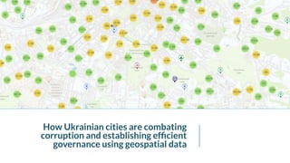
Regulating Access to Information - Alex Parsons, mySociety (UK)mysociety
This was presented at mySociety's TICTeC Show & Tell event, which was held virtually on 28 September 2021. More details on the event can be found here: https://tictec.mysociety.org/showandtells/2021
Watch this space (and pay for it): Alaveteli-driven exposure of the misuse of...mysociety
This was presented at mySociety's TICTeC Show & Tell event, which was held virtually on 28 September 2021. More details on the event can be found here: https://tictec.mysociety.org/showandtells/2021
What are the effects of OpenStreetMapping on the mappers themselves? - Aishwo...mysociety
This was presented at mySociety's TICTeC Show & Tell event, which was held virtually on 25 May 2021. More details on the event can be found here: https://tictec.mysociety.org/showandtells/2021
#PlanTech and the geospatial ecosystem - Ben Fowkes (Delib)mysociety
This was presented at mySociety's TICTeC Show & Tell event, which was held virtually on 25 May 2021. More details on the event can be found here: https://tictec.mysociety.org/showandtells/2021
Digital Champions: community led development monitoring in Tanzania - Janet C...mysociety
This was presented at mySociety's TICTeC Show & Tell event, which was held virtually on 25 May 2021. More details on the event can be found here: https://tictec.mysociety.org/showandtells/2021
Don’t build it: a practical guide for those building Civic Tech - Luke Jordan...mysociety
This was presented at mySociety's TICTeC Show & Tell event, which was held virtually on 20th April 2021. More details on the event can be found here: https://tictec.mysociety.org/showandtells/2021
It takes two: when citizens and Congress Members deliberate online - Samantha...mysociety
This was presented at mySociety's TICTeC Show & Tell event, which was held virtually on 20th April 2021. More details on the event can be found here: https://tictec.mysociety.org/showandtells/2021
Understanding the small hurdles that block community engagement, with behavio...mysociety
This was presented at mySociety's TICTeC Show & Tell event, which was held virtually on 20th April 2021. More details on the event can be found here: https://tictec.mysociety.org/showandtells/2021
Our COVID consultation journey: from a small initiative to the desk of the pr...mysociety
This was presented at mySociety's TICTeC Show & Tell event, which was held virtually on 20th April 2021. More details on the event can be found here: https://tictec.mysociety.org/showandtells/2021
Keeping track of open data in times of political change - David Zamora (Open ...mysociety
This was presented at mySociety's TICTeC Show & Tell event, which was held virtually on 23rd March 2021. More details on the event can be found here: https://tictec.mysociety.org/showandtells/2021
Civic tech vs. illicit pharmacies - Ibraheem Saleem (Code for Pakistan)mysociety
This was presented at mySociety's TICTeC Show & Tell event, which was held virtually on 23rd March 2021. More details on the event can be found here: https://tictec.mysociety.org/showandtells/2021
Find that Charity: a tool to help find charities and improve charity data - D...mysociety
This was presented at mySociety's TICTeC Show & Tell event, which was held virtually on 23rd March 2021. More details on the event can be found here: https://tictec.mysociety.org/showandtells/2021
Civic tech for smartphone beginners: is the future binary? - Arran Leonard (I...mysociety
This was presented at mySociety's TICTeC Show & Tell event, which was held virtually on 23rd March 2021. More details on the event can be found here: https://tictec.mysociety.org/showandtells/2021
How to monitor emergency procurement with open data: lessons from 12 countrie...mysociety
This was presented at mySociety's TICTeC Show & Tell event, which was held virtually on 23rd March 2021. More details on the event can be found here: https://tictec.mysociety.org/showandtells/2021
This was presented at mySociety's TICTeC 2020 conference, which was held virtually on 24th and 25th March 2020. More details on the conference can be found here: https://tictec.mysociety.org/2020
Openly available air quality data: not just blue-sky thinking - Sruti Modekur...mysociety
This was presented at mySociety's TICTeC 2020 conference, which was held virtually on 24th and 25th March 2020. More details on the conference can be found here: https://tictec.mysociety.org/2020
How to last in civic tech (especially now) - Matthew Stempeck & Micah L. Sifr...mysociety
This was presented at mySociety's TICTeC 2020 conference, which was held virtually on 24th and 25th March 2020. More details on the conference can be found here: https://tictec.mysociety.org/2020
Future of tech and democracy at the city of Reykjavík - Sigurlaug Anna Jóhann...mysociety
This was presented at mySociety's TICTeC 2020 conference, which was held virtually on 24th and 25th March 2020. More details on the conference can be found here: https://tictec.mysociety.org/2020
Lessons learned from building democracy’s database - Stacy Henderson (Cicero,...mysociety
This was presented at mySociety's TICTeC 2020 conference, which was held virtually on 24th and 25th March 2020. More details on the conference can be found here: https://tictec.mysociety.org/2020
Changing a constitution - Professor Jón Ólafsson (University of Iceland)mysociety
This was presented at mySociety's TICTeC 2020 conference, which was held virtually on 24th and 25th March 2020. More details on the conference can be found here: https://tictec.mysociety.org/2020
Let's dive deeper into the world of ODC! Ricardo Alves (OutSystems) will join us to tell all about the new Data Fabric. After that, Sezen de Bruijn (OutSystems) will get into the details on how to best design a sturdy architecture within ODC.
UiPath Test Automation using UiPath Test Suite series, part 3DianaGray10
Welcome to UiPath Test Automation using UiPath Test Suite series part 3. In this session, we will cover desktop automation along with UI automation.
Topics covered:
UI automation Introduction,
UI automation Sample
Desktop automation flow
Pradeep Chinnala, Senior Consultant Automation Developer @WonderBotz and UiPath MVP
Deepak Rai, Automation Practice Lead, Boundaryless Group and UiPath MVP
Epistemic Interaction - tuning interfaces to provide information for AI supportAlan Dix
Paper presented at SYNERGY workshop at AVI 2024, Genoa, Italy. 3rd June 2024
https://alandix.com/academic/papers/synergy2024-epistemic/
As machine learning integrates deeper into human-computer interactions, the concept of epistemic interaction emerges, aiming to refine these interactions to enhance system adaptability. This approach encourages minor, intentional adjustments in user behaviour to enrich the data available for system learning. This paper introduces epistemic interaction within the context of human-system communication, illustrating how deliberate interaction design can improve system understanding and adaptation. Through concrete examples, we demonstrate the potential of epistemic interaction to significantly advance human-computer interaction by leveraging intuitive human communication strategies to inform system design and functionality, offering a novel pathway for enriching user-system engagements.
Key Trends Shaping the Future of Infrastructure.pdfCheryl Hung
Keynote at DIGIT West Expo, Glasgow on 29 May 2024.
Cheryl Hung, ochery.com
Sr Director, Infrastructure Ecosystem, Arm.
The key trends across hardware, cloud and open-source; exploring how these areas are likely to mature and develop over the short and long-term, and then considering how organisations can position themselves to adapt and thrive.
State of ICS and IoT Cyber Threat Landscape Report 2024 previewPrayukth K V
The IoT and OT threat landscape report has been prepared by the Threat Research Team at Sectrio using data from Sectrio, cyber threat intelligence farming facilities spread across over 85 cities around the world. In addition, Sectrio also runs AI-based advanced threat and payload engagement facilities that serve as sinks to attract and engage sophisticated threat actors, and newer malware including new variants and latent threats that are at an earlier stage of development.
The latest edition of the OT/ICS and IoT security Threat Landscape Report 2024 also covers:
State of global ICS asset and network exposure
Sectoral targets and attacks as well as the cost of ransom
Global APT activity, AI usage, actor and tactic profiles, and implications
Rise in volumes of AI-powered cyberattacks
Major cyber events in 2024
Malware and malicious payload trends
Cyberattack types and targets
Vulnerability exploit attempts on CVEs
Attacks on counties – USA
Expansion of bot farms – how, where, and why
In-depth analysis of the cyber threat landscape across North America, South America, Europe, APAC, and the Middle East
Why are attacks on smart factories rising?
Cyber risk predictions
Axis of attacks – Europe
Systemic attacks in the Middle East
Download the full report from here:
https://sectrio.com/resources/ot-threat-landscape-reports/sectrio-releases-ot-ics-and-iot-security-threat-landscape-report-2024/
Builder.ai Founder Sachin Dev Duggal's Strategic Approach to Create an Innova...Ramesh Iyer
In today's fast-changing business world, Companies that adapt and embrace new ideas often need help to keep up with the competition. However, fostering a culture of innovation takes much work. It takes vision, leadership and willingness to take risks in the right proportion. Sachin Dev Duggal, co-founder of Builder.ai, has perfected the art of this balance, creating a company culture where creativity and growth are nurtured at each stage.
Accelerate your Kubernetes clusters with Varnish CachingThijs Feryn
A presentation about the usage and availability of Varnish on Kubernetes. This talk explores the capabilities of Varnish caching and shows how to use the Varnish Helm chart to deploy it to Kubernetes.
This presentation was delivered at K8SUG Singapore. See https://feryn.eu/presentations/accelerate-your-kubernetes-clusters-with-varnish-caching-k8sug-singapore-28-2024 for more details.
5. GIS layers for cities
Investment
proposals
Investment proposals
(Communal)
Investment proposals
(Private)
Communal
Property
leased
under privatisation
free to lease
for city’s needs
Land Cadastre
leased
under privatisation
free to lease
for city’s needs
Advertising
planes
Placements for
advertising facilities
Permits
Budget
Development budget
Participatory budget
6. 4. Legislation
development/ado
ption
2. Co-create ToRs
for equipment
procurement and
software
development
3. Software
development/testi
ng/production.
modified TDD
approach
1. Assessment
for each system:
organizational and
technical capacity;
legal framework
analysis, data quality
and completeness
GIS implementation
basis/
why guide
/how
platform
/where sustainability
/when/who