
Recommended
Recommended
More Related Content
What's hot
What's hot (13)
Similar to NEXUS 800 LiDAR UAV powered by HYPACK
Similar to NEXUS 800 LiDAR UAV powered by HYPACK (20)
Recently uploaded
Recently uploaded (20)
NEXUS 800 LiDAR UAV powered by HYPACK
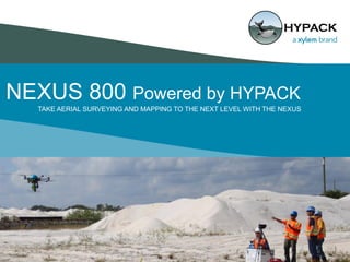
- 1. NEXUS 800 Powered by HYPACK 1 TAKE AERIAL SURVEYING AND MAPPING TO THE NEXT LEVEL WITH THE NEXUS
- 2. Vitad “V” Pradith Project Lead for Unmanned Systems Presenter
- 3. What you will learn from this webinar • Who is HYPACK? • LiDAR or Photogrammetry? DO BOTH! • HYPACK’s value added solutions • Why use HYPACK for Aerial systems? • How the NEXUS helps you work! 3
- 5. Multiplatform Support 5 • Maritime roots • Whales can fly?!? A natural pivot toward the air • Leverage 30+ years of sensor integration expertise • We KNOW multi-sensor platforms!
- 6. Hardware Driver Library 6 HYPACK has a robust library of hardware drivers for various sensors! •LiDAR •SONAR •Inertial Navigation Systems •Ancillary sensors: -Sound Velocimeters -Inclinometers -Pressure 400+ Total Drivers in HYPACK
- 7. HYPACK: An End to End Solution PLANNING • Project Creation • Mission Planning • Sensor Integration ACQUISITION • Real Time View • Targeting • Data Logging POST PROCESSING • Data Editing • Smart Filters • Point Cloud & Imagery Analysis DATA ANALYSIS • Surface Comparison • Volumetrics • Contouring PRODUCT CREATION • XYZ, LAS, PTS • DXF, KMZ, WebGL, STL • Contours, TIN
- 8. What is your time worth??? 8
- 9. 9
- 10. Product Design Philosophy… • Direct Georeferencing • Where time is critical • Streamline Data to Information process • Real Time Data Fusion NEXUS 800 powered by HYPACK
- 11. What the NEXUS can do that others can’t • Real time data acquisition / Real time telemetry / Streamlined data processing • True multi-sensor support • Future Upgradability • Full software pipeline • Industry leading support! 11
- 12. A Complete Pipeline Real-time Sensor Fusion and Georeferencing: Raw Data Sensor N…. Raw Sensor Raw Sensor 12 Information Imagery SONAR LiDAR
- 13. HYPACK NEXUS 800: Multi-Sensor Payload • HYPACK/HYSWEEP • Digital Camera • Thermal Camera (NEW!!!) • Inertial Navigation System • Laser Scanner/LiDAR • Onboard Hi-performance computing
- 14. The NEXUS SWAP-C Ratio: “Nexus: a connection or series of connections linking two or more things” • Velodyne Puck Lite (16 channel) • SBG Ellipse – D Dual GNSS Inertial Navigation System • Canon EOS SL1 (Upgradeable) • FLIR Vue Pro R • HYPACK/HYSWEEP Future Upgradability Ready for tomorrow’s technology
- 15. UAV Specs • Heavy Lifter ~8 lbs (3.7 kg) • Auto Takeoff/Landing • 10 – 15 minute flight time (12 min avg) • Hot swappable power (no shut down required) • Area coverage example: 200 x 200 meter area (40,000 square meters) covered in 5 minutes at 4 m/s and a 40 meter altitude. 15
- 16. Real Time Data Viewing 16
- 17. Flight ControllerAutonomy Module • DJI Industrial Flight Controller • Flight Planning occurs through using DJI’s Ground Station App (iOS only) • DJI Ground Station provides full autonomy to NEXUS Auto Take Off Auto Landing Return to Home 17
- 19. A tool for surveyors & engineers NEXUS 800:
- 20. Data Access 20 Onboard Computer Intel Core i7 16GB RAM/512GB SSD 128-bit AES encrypted Hi-Speed Datalink
- 21. Access Methods to Real Time Kinematic GNSS 21 GNSS Inertial Navigation System NTRIP Client Virtual Reference Station (VRS) Radio Modem 400/900 Mhz GNSS Base Station RTCM v3.x
- 22. NEXUS 800 Data Examples
- 24. Data Courtesy: SurvTech Solutions Inc. Tampa, FL
- 25. Performance Analysis Reference Dataset: GREEN NEXUS Dataset: RED
- 26. HYPACK TIN/Volumetrics Module Powerful Data Analytics Engine
- 27. TIN to TIN Differencing (Node Based) Data Subset
- 28. Performance Analysis Z (Vertical) Difference between Reference and NEXUS 0.18 feet = 2.16 inches = 5.486 cm
- 29. HYPACK Tools for UAV’s 29
- 30. FAA VFR Charts via WMS 30
- 32. LiDAR Correlation - Geotagging Images in MBMAX64 32
- 33. Data Products Portable Web Point Cloud Format Volumetrics Report
- 34. Cloud 64 – Point Cloud Viewer Colored by Elevation 34
- 35. LiDAR Point Cloud Colored by RGB Satellite Image Example 35
- 36. 3D Mesh - Poisson Reconstruction 36
- 38. Thank you! NEXUS 800 Webinar Contact Us: Unmanned@hypack.com facebook.com/hypackinc twitter.com/hypack linkedin.com/groups/1990404