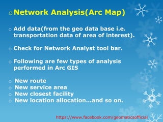
Network Analysis &
Geocoding.
Prepared by:Habiba Aziz.
Supervised by:Mr.Asif Turangzai.
https://www.facebook.com/geomaticsofficial
oNetwork Analysis(Path
Analysis)
Network Analysis is useful for planning roads,
pipelines, canals, and transmission lines.
Network Analysis can also be applied to other
types of movements. For example, in 1995
Hepner and Finco build a model of gas
dispersion using an impedance raster that
represents the products of surface distance,
slope impedance, and wind impedance.
Network Analysis has also been used for
extracting linear features such as roads and
rivers. Besides all this it perform many analysis
e.g. shortest path analysis, closest facility ,
allocation ,new location allocation and plays a
very vital role in urban transportation model.
https://www.facebook.com/geomaticsofficial
oNetwork Analysis…
o A network consist of links(linear
feature) & nodes(intersection b/w
links).
o Network analysis has a strong
theoretical basis in the
mathematical disciplines of graph
theory and topology.
https://www.facebook.com/geomaticsofficial
oNetwork Analyst Extension
in ARC GIS.
o There are many aspects while using
network analyst extension e.g. in Arc
GIS server, in its sight (or exposing in
desktop, web ,mobile etc.).
o Further categorize
o Network Tracing(finding a particular
path).
o Network Routing(optimal path).
o Network Allocation(designation of
portions).
https://www.facebook.com/geomaticsofficial
oHow to work with network
analysis ?
o There are basically two phases
o Creation of network dataset.
o Performing analysis with the respective
network data set.
https://www.facebook.com/geomaticsofficial
oNetwork data set creation.
o It is created in arc catalog , as it has its
own wizard .
o STEPS
o Start arc catalog .
o Check whether its extension is open or
not?
o Go to the specified folder(data present)
& create new Network dataset.
https://www.facebook.com/geomaticsofficial
Extension
check
New
network
dataset
creation
Arc catalog
environment
Name
Data
add
Network data
set wizard
o Specify name
o Data of our
interest
Cont….
1
2
oNetwork Analysis(Arc Map)
o Add data(from the geo data base i.e.
transportation data of area of interest).
o Check for Network Analyst tool bar.
o Following are few types of analysis
performed in Arc GIS
o New route
o New service area
o New closest facility
o New location allocation…and so on.
https://www.facebook.com/geomaticsofficial
Point
data
Newly
created
network
dataset
Tool bar
New
route
1
2
3
Allocation of
points
Run
New
service
area.
1
2
3
oGeocoding
o Geocoding refers to the process of assigning spatial
locations to data that are in tabular format but
have fields that describe their locations.
o The most common type of geocoding is address
geocoding, which plots street addresses as point
features on a map, also known as address
matching.
https://www.facebook.com/geomaticsofficial
How to perform Geocoding in
Arc GIS?
o We encounter two phases of Arc GIS
o Arc Catalog & Arc Map.
o Arc Catalog:
o Creation of new address locator, which is the
basic necessity as it converts the textual
description of locations into geographic
features.
https://www.facebook.com/geomaticsofficial
1
2
3 4
Creation of
address
locater
oArc Map
o The shape feature along with a table describing
value e.g. customer ,place aliases and alt name.
o Simply geocoding is performed by geocoding
toolbar or by right clicking at the database in
TOC.
o We have to specify the address locator and later
its fields e.g.ZIP code,CITY,STATE and all as input
for formulation of process.
o Geocoding also provides us results in form of
matched, tied and unmatched addresses.
https://www.facebook.com/geomaticsofficial
1
2
3
Geocoding
Indication of
commercial
addresses
oConclusion
o Network analysis and geocoding
although deal with streets & roads
features but they show different
aspects.
o Network analysis is very optimum for
route calculations, direction, facility
checking, traffic inquiry and so on.
o While on the other side Geocoding plays
important role in location based-
services .
https://www.facebook.com/geomaticsofficial
Have you any
question?
https://www.facebook.com/ge
omaticsofficial

Network analysis and Geocoding.

  • 1.
    Network Analysis & Geocoding. Preparedby:Habiba Aziz. Supervised by:Mr.Asif Turangzai. https://www.facebook.com/geomaticsofficial
  • 2.
    oNetwork Analysis(Path Analysis) Network Analysisis useful for planning roads, pipelines, canals, and transmission lines. Network Analysis can also be applied to other types of movements. For example, in 1995 Hepner and Finco build a model of gas dispersion using an impedance raster that represents the products of surface distance, slope impedance, and wind impedance. Network Analysis has also been used for extracting linear features such as roads and rivers. Besides all this it perform many analysis e.g. shortest path analysis, closest facility , allocation ,new location allocation and plays a very vital role in urban transportation model. https://www.facebook.com/geomaticsofficial
  • 3.
    oNetwork Analysis… o Anetwork consist of links(linear feature) & nodes(intersection b/w links). o Network analysis has a strong theoretical basis in the mathematical disciplines of graph theory and topology. https://www.facebook.com/geomaticsofficial
  • 4.
    oNetwork Analyst Extension inARC GIS. o There are many aspects while using network analyst extension e.g. in Arc GIS server, in its sight (or exposing in desktop, web ,mobile etc.). o Further categorize o Network Tracing(finding a particular path). o Network Routing(optimal path). o Network Allocation(designation of portions). https://www.facebook.com/geomaticsofficial
  • 5.
    oHow to workwith network analysis ? o There are basically two phases o Creation of network dataset. o Performing analysis with the respective network data set. https://www.facebook.com/geomaticsofficial
  • 6.
    oNetwork data setcreation. o It is created in arc catalog , as it has its own wizard . o STEPS o Start arc catalog . o Check whether its extension is open or not? o Go to the specified folder(data present) & create new Network dataset. https://www.facebook.com/geomaticsofficial
  • 7.
  • 8.
    Name Data add Network data set wizard oSpecify name o Data of our interest Cont….
  • 9.
  • 10.
    oNetwork Analysis(Arc Map) oAdd data(from the geo data base i.e. transportation data of area of interest). o Check for Network Analyst tool bar. o Following are few types of analysis performed in Arc GIS o New route o New service area o New closest facility o New location allocation…and so on. https://www.facebook.com/geomaticsofficial
  • 11.
  • 12.
  • 13.
  • 14.
    oGeocoding o Geocoding refersto the process of assigning spatial locations to data that are in tabular format but have fields that describe their locations. o The most common type of geocoding is address geocoding, which plots street addresses as point features on a map, also known as address matching. https://www.facebook.com/geomaticsofficial
  • 15.
    How to performGeocoding in Arc GIS? o We encounter two phases of Arc GIS o Arc Catalog & Arc Map. o Arc Catalog: o Creation of new address locator, which is the basic necessity as it converts the textual description of locations into geographic features. https://www.facebook.com/geomaticsofficial
  • 16.
  • 17.
    oArc Map o Theshape feature along with a table describing value e.g. customer ,place aliases and alt name. o Simply geocoding is performed by geocoding toolbar or by right clicking at the database in TOC. o We have to specify the address locator and later its fields e.g.ZIP code,CITY,STATE and all as input for formulation of process. o Geocoding also provides us results in form of matched, tied and unmatched addresses. https://www.facebook.com/geomaticsofficial
  • 18.
  • 19.
  • 20.
    oConclusion o Network analysisand geocoding although deal with streets & roads features but they show different aspects. o Network analysis is very optimum for route calculations, direction, facility checking, traffic inquiry and so on. o While on the other side Geocoding plays important role in location based- services . https://www.facebook.com/geomaticsofficial
  • 21.