WHAT IS ASITE
INVESTIGATION?
According to British Archaeoligical Jobs
and Resources.the process of the collection
of information, the appraisal of data,
assessment, and reporting without which the
hazards in the ground beneath the site
cannot be known.
According to RSA GEOTECHNICS LTD, Site
investigation is carried out in order to
enable a geotechnical and
geoenvironmental assessment of
the ground conditions and analysis of the
engineering and environmental
considerations related to the
proposed development.
3.
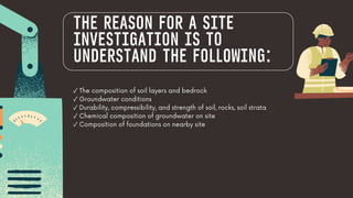
✓ The compositionof soil layers and bedrock
✓ Groundwater conditions
✓ Durability, compressibility, and strength of soil, rocks, soil strata
✓ Chemical composition of groundwater on site
✓ Composition of foundations on nearby site
THE REASON FOR A SITE
INVESTIGATION IS TO
UNDERSTAND THE FOLLOWING:
4.
BACKGROUND INFORMATION BEFORE
SUBSURFACEINVESTIGATION
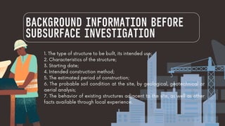
1. The type of structure to be built, its intended use;
2. Characteristics of the structure;
3. Starting date;
4. Intended construction method;
5. The estimated period of construction;
6. The probable soil condition at the site, by geological, geotechnical or
aerial analysis;
7. The behavior of existing structures adjacent to the site, as well as other
facts available through local experience.
5.
THE EXTENT OFSOIL
INVESTIGATION
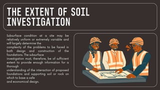
Subsurface condition at a site may be
relatively uniform or extremely variable and
will largely determine the
complexity of the problems to be faced in
both design and construction of the
foundations. The subsurface
investigation must, therefore, be of sufficient
extent to provide enough information for a
thorough
understanding of the interaction of proposed
foundations and supporting soil or rock on
which to base a safe
and economical design.
6.
DEPTH OF SITE
INVESTIGATION
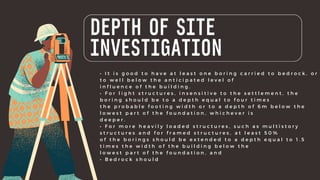
•I t i s g o o d t o h a v e a t l e a s t o n e b o r i n g c a r r i e d t o b e d r o c k , o r
t o w e l l b e l o w t h e a n t i c i p a t e d l e v e l o f
i n f l u e n c e o f t h e b u i l d i n g .
• F o r l i g h t s t r u c t u r e s , i n s e n s i t i v e t o t h e s e t t l e m e n t , t h e
b o r i n g s h o u l d b e t o a d e p t h e q u a l t o f o u r t i m e s
t h e p r o b a b l e f o o t i n g w i d t h o r t o a d e p t h o f 6 m b e l o w t h e
l o w e s t p a r t o f t h e f o u n d a t i o n , w h i c h e v e r i s
d e e p e r .
• F o r m o r e h e a v i l y l o a d e d s t r u c t u r e s , s u c h a s m u l t i s t o r y
s t r u c t u r e s a n d f o r f r a m e d s t r u c t u r e s , a t l e a s t 5 0 %
o f t h e b o r i n g s s h o u l d b e e x t e n d e d t o a d e p t h e q u a l t o 1 . 5
t i m e s t h e w i d t h o f t h e b u i l d i n g b e l o w t h e
l o w e s t p a r t o f t h e f o u n d a t i o n , a n d
• B e d r o c k s h o u l d
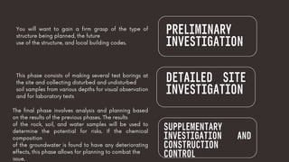
PRELIMINARY
INVESTIGATION
You will wantto gain a firm grasp of the type of
structure being planned, the future
use of the structure, and local building codes.
This phase consists of making several test borings at
the site and collecting disturbed and undisturbed
soil samples from various depths for visual observation
and for laboratory tests
DETAILED SITE
INVESTIGATION
SUPPLEMENTARY
INVESTIGATION AND
CONSTRUCTION
CONTROL
The final phase involves analysis and planning based
on the results of the previous phases. The results
of the rock, soil, and water samples will be used to
determine the potential for risks. If the chemical
composition
of the groundwater is found to have any deteriorating
effects, this phase allows for planning to combat the
issue.
9.
MINIMIZE DAMAGE
SAVES ONCOSTS
HELPS DETERMINE THE
CONSTRUCTION MATERIALS
INCREASES THE SAFETY OF THE
PROJECT
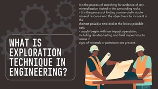
WHAT IS
EXPLORATION
TECHNIQUE IN
ENGINEERING?
Itis the process of searching for evidence of any
mineralization hosted in the surrounding rocks.
- It is the process of finding commercially viable
mineral resource and the objective is to locate it in
the
shortest possible time and at the lowest possible
cost.
- usually begins with low impact operations,
including desktop testing and field inspections, to
assess if
signs of minerals or petroleum are present.
12.
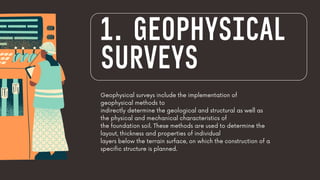
Geophysical surveys includethe implementation of
geophysical methods to
indirectly determine the geological and structural as well as
the physical and mechanical characteristics of
the foundation soil. These methods are used to determine the
layout, thickness and properties of individual
layers below the terrain surface, on which the construction of a
specific structure is planned.
1. GEOPHYSICAL
SURVEYS
GRAVITY SURVEYS
To quantifychanges in
rock density in the
Earth’s crust, a
gravimeter measures
the
gravity fiel
15.
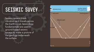
SEISMIC SUVEY
Seismic surveystrack
vibration as it travels across
the Earth’s crust. Seismology
fundamentals are used in
ground-based seismic
surveys to make a picture of
the geology underneath
the surface
16.
Magnetic surveys areused to track
changes in the Earth’s magnetic
field caused by magnetic minerals.
MAGNETIC
GEOPHYSICAL
SURVEY
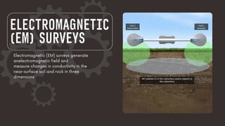
IP surveys establishan electric field in the
ground and measure the
chargeability and resistivity of the region
beneath the surface of the Earth
INDUCED
POLARIZATION
(IP) SURVEY
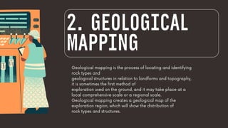
Geological mapping isthe process of locating and identifying
rock types and
geological structures in relation to landforms and topography,
it is sometimes the first method of
exploration used on the ground, and it may take place at a
local comprehensive scale or a regional scale.
Geological mapping creates a geological map of the
exploration region, which will show the distribution of
rock types and structures.
2. GEOLOGICAL
MAPPING
22.
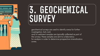
geochemical surveys areused to identify areas for further
investigation. Soil, rock
and/or sediment samples are typically collected as part of
the surveys. These samples are sent to a laboratory
for analysis in order to determine prospective mineralization
zones.
3. GEOCHEMICAL
SURVEY
23.
To retrieve soiland subsoil samples, hand tools
such as shovels, picks, and hand augers
are used. Samples are frequently collected on a
regular grid pattern and consist of small soul
samples.
SOIL
SAMPLING
24.
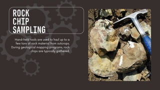
ROCK
CHIP
SAMPLING
Hand-held tools areused to haul up to a
few tons of rock material from outcrops.
During geological mapping programs, rock
chips are typically gathered.
25.
COSTEANING
(TRENCH SAMPLING)
is atype of geochemical
sampling that involves digging a shallow trench
and mapping, analyzing, and sampling the
exposed
rock, it entails digging a ‘costean’ or trench with
a backhoe or other comparable equipment
26.
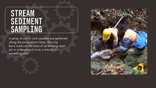
STREAM
SEDIMENT
SAMPLING
A series ofsoil or rock samples are gathered
along the excavation’s face. This may
be a road cut, the face of an existing open
pit or underground mine, a trench, or
something else
27.
CHANNEL
SAMPLING
A series ofsoil or rock samples are gathered
along the excavation’s face. This may
be a road cut, the face of an existing open
pit or underground mine, a trench, or
something else
28.
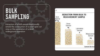
BULK
SAMPLING
Extraction of abulk sample traditionally
entails the construction of a small open cut
mine or the excavation of a small
underground operation