Download as PDF, PPTX


![PRINT REQUEST
{
"layout": "A4 Portrait",
"outputFormat": "pdf",
"attributes": {
"title": "Sample Print",
"map": {
"projection": "EPSG:3857",
"dpi": 72,
"center": [957352, 5936844],
"scale": 25000,
"layers": [
{ "type": "osm", "baseURL": "http://tile
]
}
}
}](https://image.slidesharecdn.com/mapfishprint3-160829125931/85/MapFish-Print-3-17-320.jpg)
![WE GOT STYLE!
Full GeoTools styling with SLD
JSON styling format
"[INTERSECTS(geometry, buffer(POLYGON (...), 200
"symbolizers": [
{
"strokeColor": "green",
"strokeWidth": 2,
"type": "line"
}
]
},](https://image.slidesharecdn.com/mapfishprint3-160829125931/85/MapFish-Print-3-20-320.jpg)
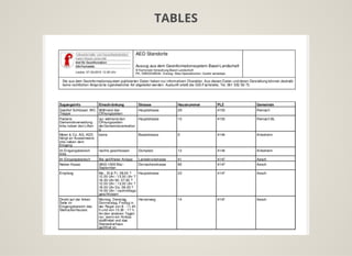
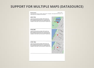
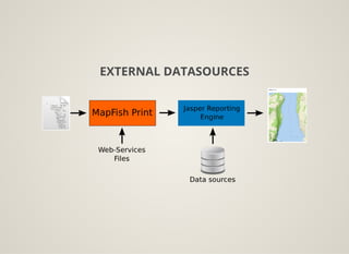
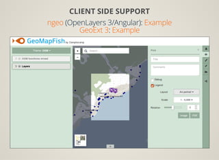
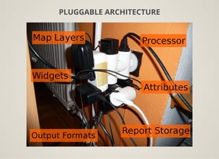


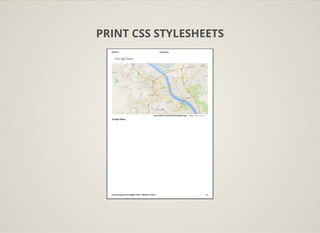
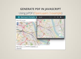
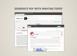
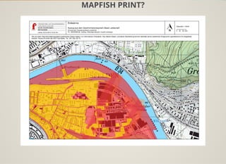
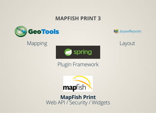
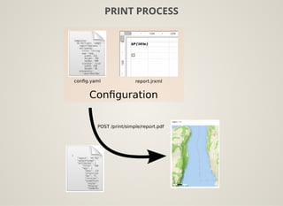
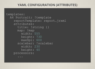
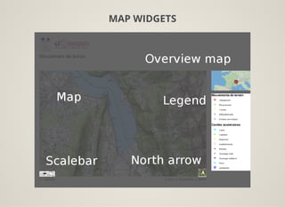
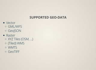
The document outlines features and specifications for Mapfish Print 3, including options for printing and exporting web maps into PDF format using various methods like jsPDF and wkhtmltopdf. It emphasizes the customizable layout through YAML configuration and supports various geo-data types for map representation. Additionally, the document mentions its integration with external data sources and a pluggable architecture, along with resources for further exploration on GitHub.


![[DSC Europe 23] Spela Poklukar & Tea Brasanac - Retrieval Augmented Generation](https://cdn.slidesharecdn.com/ss_thumbnails/spelapoklukarteabrasanacprez-231129000106-d6582d1b-thumbnail.jpg?width=640&height=640&fit=bounds)


![[EN]DSS23_tspann_Integrating LLM with Streaming Data Pipelines](https://cdn.slidesharecdn.com/ss_thumbnails/endss23tspannintegratingllmwithstreamingdatapipelines-231115161007-49510320-thumbnail.jpg?width=640&height=640&fit=bounds)


![[Geocom2017] geOrchestra and ngeo](https://cdn.slidesharecdn.com/ss_thumbnails/geocom2017camptocampgeorchestrangeo-170629083949-thumbnail.jpg?width=640&height=640&fit=bounds)
![[Geocom2017] Georchestra & monitoring](https://cdn.slidesharecdn.com/ss_thumbnails/geocom2017camptocampgeorchestramonitoring-170629082424-thumbnail.jpg?width=640&height=640&fit=bounds)


![谷歌留痕技术教程[ 𝙩𝙤𝙥 𝟮𝟯𝟯. 𝙘 𝙤𝙢 ]](https://cdn.slidesharecdn.com/ss_thumbnails/top233-260130173900-2eb784f9-thumbnail.jpg?width=640&height=640&fit=bounds)


