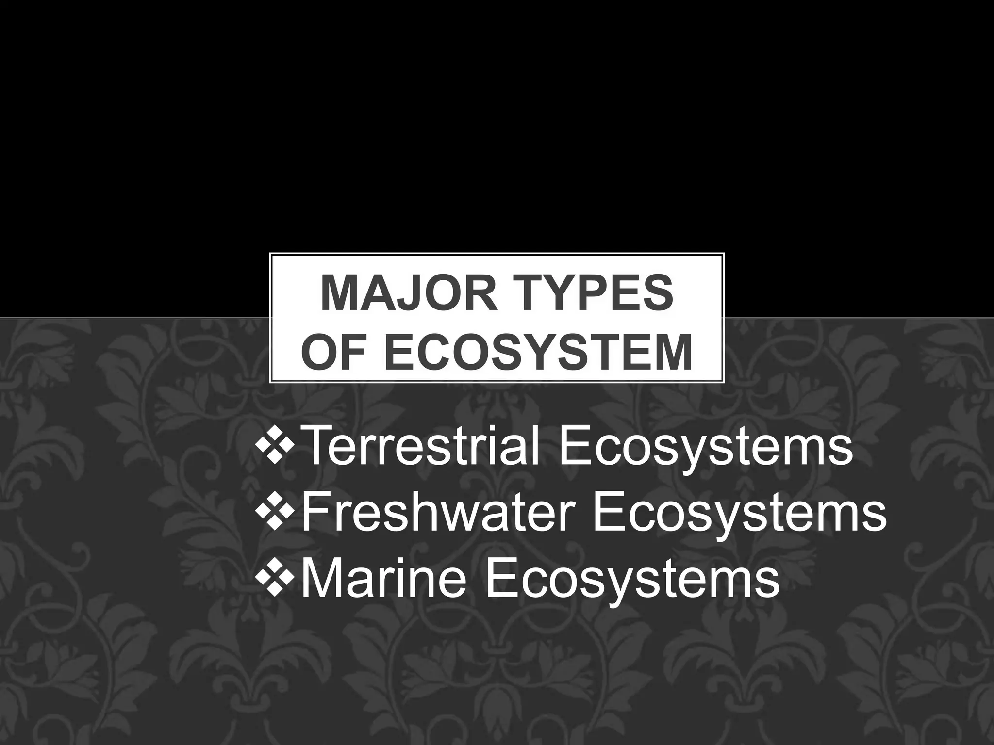
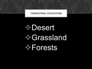
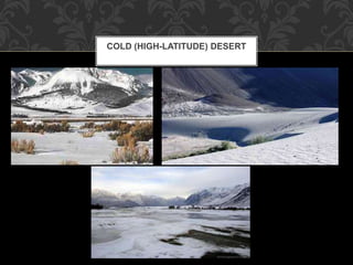
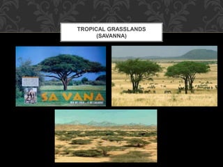
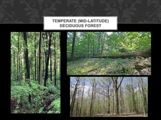
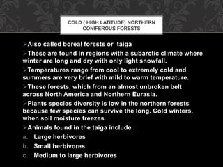
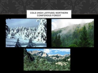
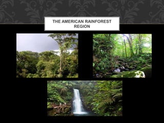
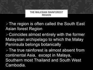
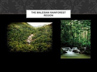
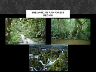
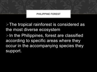
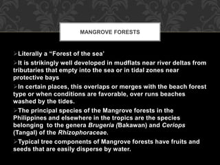
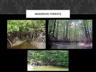
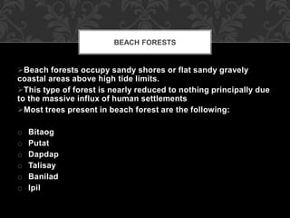
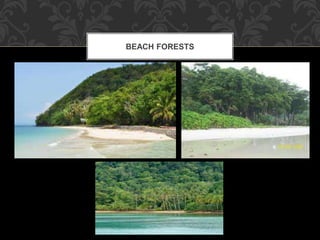
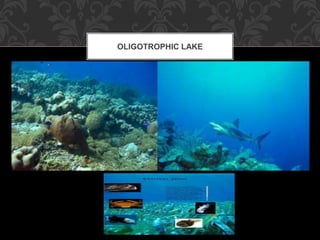
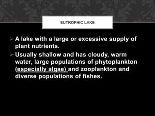
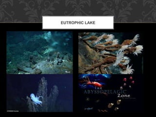
7. - More than one-third of the
earth’s land surface is covered with
deserts where average precipitation is
low (250mm or 10 inches per year)
and evaporation rates are high.
DESERT
9. These are found in southern Sahara and the
Namib in Africa , where day time temperatures
are hot year-round and nights are cold because
of lack of sufficient vegetation to regulate
extreme temperature. Dunes and consist
These are among the driest places on earth.
It make up about one-fifth of the world’s total
desert area and consist primarily of barren
sand dunes underlain by rocks.
The vegetation includes the widely scattered
thorny bushes and shrubs and succulents such
as cacti and small fast growing wild flowers
that bloom in spring or after a rare, brief
drenching rain.
TROPICAL DESERTS (SAHARA)
15. These can be found in flat or slightly rolling terrains
that cannot support large stand of trees.
They abound in regions where average precipitation is
average that ranges from 250 to 750 mm (10-30
inches) a year
This amount of precipitation is sufficient to grow grass
yet rainfall occurrences are so erratic that periodic
droughts and grassfires prevent the growth of large
stands of trees.
The grassland soils are thin and cannot store enough
water because of intense sunlight, high temperature
and evaporation rate.
GRASSLANDS
16. These are found in areas with high average
temperatures, very long dry seasons (about half of the
year) and abundant rains the rest of the year.
They are located in a wide belt on either side of the
equator between the tropics of Cancer and Capricorn.
Some of this biomes such as Africa’s Serengeti Plain,
consist of open plains covered with low or high
grasses; others contain grasses in varying number of
widely spaced, small, mostly deciduous trees and
shrubs.
TROPICAL GRASSLANDS
(SAVANNA)
17. Recent estimate show that there is an
approximate area of more than 6.5
Million hectares of grasslands. In the
Philippines, grassland areas are very
extensive and expansive.
In this Philippines Grassland areas are
very extensive and expensive.
TROPICAL GRASSLANDS
(SAVANNA)
19. Are mostly dominated by cogon especially in
newly opened areas due to logging, kaingin
and mining.
This grass are very prolific because its seeds
are carried by the wind.
It persist in an area because of its network of
underground rhizomes.
Samsong grass (Themeda Triandra)
Talahib (Saccharum spontaneum)
Rund (Miscanthus sinensis)
EXTENSIVE GRASSLAND
20. These are located in areas just below the arctic region of
perpetual ice and snow.
These areas are cold and they experience icy gale-like winds,
fairly low average annual precipitation during brief summer
periods and long winter darkness.
The wet Arctic tundra is covered with a thick spongy mat of
low-growing plants such lichens , sedges (grass-like plants
often growing in dense tufts in marshy places)mosses and
low woody shrubs.
PERMAFROST- water that is permanently frozen year- round
in thick layers of soil.
During the brief summer when sunlight persists almost round
– the –clock ,the surface layer of soil thaws and the biome is
turned into soggy landscape
•C.POLAR (HIGH
LATITUDE)GRASSLANDS OR ARCTIC
TUNDRAS
21. Dotted with shallow lakes , marshes , bogs and ponds.
The permafrost below prevents this surface water from
seeping into the lower soil.
The slow rate of decomposition , shallow soil and slow
growth rate of plants make the arctic tundra perhaps the
earth’s most fragile biome.
Vegetation destroyed by human activities can take decades
to grow back.
3.FORESTS
Undisturbed areas with an average precipitation of 750
millimeters(30 inches) or more a year tend to be covered with
forests, con
22. These are located in the large interior areas of the continents.
They have moderate average temperature and a more even
distribution of precipitation throughout the year than tropical
grasslands.
These areas have cold and winters with occasional snow
covering the ground, hot and dry summers and winds blowing
almost throughout the year.
EXAMPLE:
The tall-grass and low grass prairies of the Midwestern and
Western Unite States and Canada.
The pampas of South America
The veld of the Southern Africa
The steppes that stretch from Central Europe into Siberia.
TEMPERATURE(MID-LATITUDE)
GRASSLANDS
24. These are located in areas just below the
arctic region of perpetual ice and snow.
These areas are cold and they experience icy
gale-like winds, fairly low average annual
precipitation during brief summer periods and
long winter darkness
The wet Arctic tundra is covered with a thick
spongy mat of low-growing plants such lichens,
sedges (grass like plants often growing in
dense tufts in marshy places) mosses and low
woody shrubs.
POLAR (HIGH LATITUDE)
GRASSLANDS OR ARCTIC TUNDRAS
27. Water that is permanently frozen year – round
in thick layers of soil.
During the brief summer when sunlight
persists almost round the clock, the surface
layer of soil thaws and the biome is turned into
soggy landscape dotted with shallow lakes,
marshes, bogs and ponds.
The permafrost below prevents this surface
water from seeping into the lower soil.
The slow rate of decomposition, shallow soil
and slow growth rate of plants make the arctic
tundra perhaps the earth’s most fragile biome.
Vegetation destroyed by human activities can
take decades to grow back.
PERMAFROST
28. Undisturbed areas with an average
precipitation of 750 millimeters (30
inches) or more a year tend to be covered
with forests, consisting of various
species of trees and smaller woody forms
of vegetation.
FOREST
29. These are found in areas with moderate average
temperatures that change significantly during four
distinct seasons.
They have long summer, mild winters and
abundant precipitation spread fairly and evenly
throughout the year.
They dominated by a few species of broad-
leafed deciduous trees
The most dominant herbivore of most deciduous
forest in the Eastern United States is the most of
white tail deer, primarily because most of its
natural predators have been eliminated.
TEMPERATE (MID-LATITUDE)
DECIDUOUS FORESTS
31. Also called boreal forests or taiga
These are found in regions with a subarctic climate where
winter are long and dry with only light snowfall.
Temperatures range from cool to extremely cold and
summers are very brief with mild to warm temperature.
These forests, which from an almost unbroken belt
across North America and Northern Eurasia.
Plants species diversity is low in the northern forests
because few species can survive the long. Cold winters,
when soil moisture freezes.
Animals found in the taiga include :
a. Large herbivores
b. Small herbivores
c. Medium to large herbivores
COLD ( HIGH LATITUDE) NORTHERN
CONIFEROUS FORESTS
34. These are found near the equator in Central and South
America, Africa, Southeast Asia and some islands in the
Caribbean Sea and Pacific Ocean.
They are characterized by the presence of high amounts of
rainfall (200-500 centimeter per year) normally warm and
relatively constant temperature.
Often with low nutrients in the soil and mainly deciduous
woody vegetation.
The deciduous trees from a thick canopy, so dense that it is
impossible to see the ground from above the trees.
The main canopy level is usually 30 to 50 meters from the
ground.
There are trees 45 to 70 meters high and the forest stand is
rather isolated.
Trunks of the mature trees have a diameter of over 3
meters.
Most trees are slender in proportion to their heights, they
bear comparatively small crowns.
TROPICAL RAIN FORESTS
36. The American Rain Forest region
The Malaysian Rain Forest
Region
The African Rain Forest Region
3 MAJOR RAINFORESTS REGION
37. Situated on the South American Continent
It is subdivided into three rainforest subregions
a. Amazonia – the biggest rainforest subregion, because
it is so vast and must be considered as still largely
intact
b. A smaller region that lies west of the Andes and North
of the equator
c. Extending intermittently to Mexico – the smallest
region is a narrow street along the Atlantic Coast of
Brazil between 14˚ and 21˚S wherein only a few
remnants of it are still in existence.
THE AMERICAN RAIN FOREST
REGION
39. The region is often called the South East
Asian forest Region
Coincides almost entirely with the former
Malaysian archipelago to which the Malay
Peninsula belongs botanically
The true rainforest is almost absent from
continental Asia, except in Malaya,
Southern most Thailand and South West
Cambodia.
THE MALESIAN RAINFOREST
REGION
41. This consist of four regions, all partly destroyed,
along the Atlantic coast between approximately 10˚ N
and 5˚ S, and the Congo basin stretching East to the
mountains.
Outlier pockets in East Africa maybe regarded as
more or less true rainforest, but not the forest of
Madagascar.
The soil lying below this diverse masses of
vegetation are generally thin and deficient in
nutrients despite abundant rainfall because surface
run off tends to carry the nutrients that are not
immediately taken up by the plants.
THE AFRICAN RAINFOREST
REGION
43. The tropical rainforest is considered as
the most diverse ecosystem
In the Philippines, forest are classified
according to specific areas where they
occur in the accompanying species they
support.
PHILIPPINE FOREST
45. Literally a “Forest of the sea’
It is strikingly well developed in mudflats near river deltas from
tributaries that empty into the sea or in tidal zones near
protective bays
In certain places, this overlaps or merges with the beach forest
type or when conditions are favorable, over runs beaches
washed by the tides.
The principal species of the Mangrove forests in the
Philippines and elsewhere in the tropics are the species
belonging to the genera Brugeria (Bakawan) and Ceriops
(Tangal) of the Rhizophoraceae.
Typical tree components of Mangrove forests have fruits and
seeds that are easily disperse by water.
MANGROVE FORESTS
47. Beach forests occupy sandy shores or flat sandy gravely
coastal areas above high tide limits.
This type of forest is nearly reduced to nothing principally due
to the massive influx of human settlements
Most trees present in beach forest are the following:
o Bitaog
o Putat
o Dapdap
o Talisay
o Banilad
o Ipil
BEACH FORESTS
48. On sandy flood plains near riverbeds, pure
stands of Casuarina equisetifolia (agoho) may
develop.
In the vicinity of rich-bottoms patches, or
nearly pure stands of Terminalia catappa are
observed.
50. The molave forests is named because of the free dominance of
molave (vitex parviflora) in the area
It is also sometimes called the Limestone Forest because of the
underlying rock and limestone
The soil that develops harbors a plant formation characteristics
to limestone region
Alternately this forest type is known t some local botanist as
the leguminous species type
Trees found in this forest type are also commercially important
and are more accessible to exploitation together with small
erect or climbing bamboos.
Many of the tree species are short boled with irregular
spreading crowns
The molave forest has deciduous foliage, especially when it is
found in areas with pronounce dry season
MOLAVE FORESTS
52. In the Philippines the dipterocarp forest is by far the most important type for
timber production both for local and export uses
The dipterocarp forests is roughly 75% of the primary forest and harbors
between 85% and 95% of the standing timber in the country
All taxa of the Diptocarpaceae are giant trees reaching towering heights of 40-
50 m and dm of 100-150 cm
In 1978, the remaining forests cover in the country is between 74% and 77%
represents dipterocarp forest type
From 1934-1982, the total area of dipterocarp forest was reduce by 38%
The present distribution dipterocarp forest shows:
a. 32.6% - Luzon
b. 46.5% - Mindanao
c. 20.9% - Visayas
most of the dipterocarp in the Philippines are practically evergreen
species.
DIPTEROCARP FORESTS
54. A. Lauan or Philippine Mahogany Subtypes
The most succesful commercial forest in the Philippines
It is confined to regions with short or no dry season
It is best developed on the gentle slopes near bases of
mountain ranges and extends up to 300-400m elevation
At this point, it merge with tangile-oak of subtype.
When topography is rough, this subtypes rarely reaches a
dense stand composition
At a lower elevation and when near the sea, this subtype
overlaps with yakal-lauan subtype or the molave forest type.
DIPTEROCARP SUBTYPES
56. In terms of altitude and topographic conditions, the
lauan-apitong subtype is nearly similar to the lauan
subtype differing only in terms of regional climate
pattern.
This subtype occurs in regions with a pronounced
dry season.
Many of the species present in this subtype exhibit
regular loss of foliage is relatively open and an
undergrowth of climbing bamboos, woody lianas
and other minor plants are typical.
LAUAN-APITONG SUBTYPE
58. Is restricted to regions where there is
short or no dry season just like the
lauan subtype.
It only differs from the lauan by being
specifically found only in areas where
the water table is high or near the
surface.
HAGAKHAK-LAUAN SUBTYPE
60. The most extensively development on low coastal hills whwre
the underlying rock is volcanic and where the dry season is
relatively short.
It is sometime present in hills bordering large inner valleys or in
headlands projecting into the sea.
During the driest period of the year, this subtype exhibits slight
deciduousness.
On the ridges and exposed slopes, the most abundant species
are yakal and hopea spp.
In protected ravines and along banks of streams, the following
species are numerous
a. Shorea contorta
b. S. guiso
c. S.palosapis
d. Vatica manggachapoi
e. Parashorea malanonan.
YAKAL-LAUAN SUBTYPE
62. The tangile-oak subtype extends from the upper (400
elevation) of the luan and lauan-apitong subtypes to the the
lower limits (1,000 meters altitude) of he mossy forest type.
I practically encompasses all the high slopes of mountain.
As the name implies, the principal components species are
tangile (Shorea polysperma) and oaks (Lithocarpus spp.)
This forest formation an be found in certain mountains like
Mt. Halcon in Mindanao and Mt. Giting-giting in Sibuyan
Island.
TANGILE-OAK SUBTYPE
64. Considered as a dis climax or anthropogenic subclimax
formation.
It is believed that areas now extensively occupied by pine trees
were once a bastion of broad-leaved species.
Anthropogenic activities, such as collecting timber for house,
cleaning lands for shifting cultivation, accidental or
international setting of fires transformed these forest into open
and drier sites.
In the Philippines this vegetation type is at its peak
development in high plateaus and mountain range of Northern
Luzon particularly in the Mountain Province.
The greatest segment of this vegetation cover lies between 900
and 1, 500 meters I region where a distinct dry season occurs.
The undergrowth vegetation of pine forest cannot fully
development or advance ecologically
The two principal pine species found in the Philippines.
a. Pinus kesiya (Pinus insularis)
b. P. merkusii
PINE FOREST
66. Derives its name from the abundant growth of mosses and
liverworts on trunks of trees present in these areas.
In the , about 8% of the total land area is covered by the forest.
In many places, the topography of this forest type is rather
rough and steep (over 1,200 meters)
The combination of steep slopes and heavy rains result in
frequent landslide.
Generally, it is the type of forest where climatic conditions are
very moist due to low clouds.
Temperature is much lower than in coastal areas
Only in a few species belongs to the genera are found at lower
elevation.
MOSSY FOREST
69. A freshwater ecosystem whose physical nature is dominated by
the presence of water and supports a distinct set of producers
(plants) and consumers (animals)
The following are examples of freshwater ecosystem
a. Water system that is inland from the coast
b. Surface water (streams and rivers)
c. Standing water (lakes, reservoir. Ponds or wetland)
Factors affecting the type and numbers of organisms found in
fresh water are:
a. The amount or concentration of nutrients
b. The depth through which sunlight can penetrate
c. The amount of dissolved oxygen and water temp.
FRESHWATER ECOSYSTEM
72. The lake is a standing freshwater
ecosystem.
It is formed when water is collected from
direct precipitation, surface runoff, or
ground water flow.
Water fills the basin-like depression formed
fro volcanic activity, glaciation and impact
features of meteorites.
LAKES
75. Is found in the shallow, nutrients rich
water near the shore.
It contains rooted aquatic plants and
abundant aquatic life dependent on
plants.
LITTORAL ZONE
77. Is the open water surface layer that
receives sufficient sunlight for
photosynthesis and contain floating
phytoplankton's, plant-eating
zooplanktons and fish that depend on
such as kind of environment.
LIMNETIC ZONE
79. Zone of deep water , which is not
penetrated by sunlight.
Inhabited most by fish that are adapted
to its cooler, darker water and lower
levels of dissolved oxygen.
PROFUNDAL ZONE
86. Is the lower layer of colder, denser
water usually with a lower
concentration of dissolved oxygen.
THERMOCLINE
The main transition zone separating
these two layers.(epilimnion and
hypolimnion)
The temperature drops shraply
THE HYPOLIMNION
89. A lake with a low supply of plant
nutrients
Usually deep and has crystal clear
water, cool to cold temperatures and
relatively small populations of
phytoplankton and fishes.
OLIGOTROPHIC LAKE
91. A lake with a large or excessive supply of
plant nutrients.
Usually shallow and has cloudy, warm
water, large populations of phytoplankton
(especially algae) and zooplankton and
diverse populations of fishes.
EUTROPHIC LAKE
93. Which lakes receive inputs of plant
nutrients (mostly nitrates and phosphates)
from the surrounding land basin as a result of
natural erosion and runoff.
The input of nutrients near urban or
agricultural centers can be greatly accelerated
as a result of human activities.
EUTROPHICATION
95. the lakes that fall somewhere between
these two extremes of nutrient enrichment
MESOTHROPIC LAKES
96. Are fairly large and deep, human-created
bodies of standing fresh water.
Often build behind dams
They are build primarily for water storage
Unlike in lakes, the volume of water is
contained in reservoirs is determined by what is
required for hydroelectric power production,
irrigation or domestic consumptions.
RESERVOIR
98. Are small, shallow, usually human-created
impoundments of fresh watering
Used primarily for watering livestock, raising
freshwater fish or recreation especially fishing
Most ponds consist entirely of a littoral zone
covered with rooted plants from shore to shore
and do not have distinct temperature zones like
reservoirs or lakes.
POND
100. Stream – are relatively small and flowing bodies
of fresh water that empty into rivers.
STREAM AND RIVERS
101. Rivers – are wider and deeper than streams
and empty into oceans.
STEAM AND RIVERS
102. The entire land area that delivers the water,
sediment and dissolved substances via streams
to a major river and ultimately to the sea.
WATERSHED OR DRAINAGE BASIN
103. A. The Shallow Water Zone or Rapid Zone
- characterized by shallow water where the velocity of current is
enough to keep the bottom clean of silt and other loose materials
providing a firm substrate.
TWO MAJOR ZONES IN STREAMS
104. B. Deeper Water or Pool Zone
- has a reduced velocity of current silt and other loose
materials tend to settle in the bottom providing favorable condition to
the burrowing forms of animals.
TWO MAJOR ZONES IN STREAMS
105. Land that remains flooded with fresh water all or part of the year
and located away from coastal areas.
It include bogs, marshes, swamps and river-overflow lands that are
covered with fresh water and found inlands.
INLAND WETLAND
106. Examples of inland wetlands in the Philippines are:
a. Liguasan Marsh (Cotabato)
INLAND WETLAND
110. Distinguished from the freshwater ecosystem because of its higher
level of salinity usually at 35 parts per thousand
Examples of marine ecosystems are oceans, coastal wetlands,
estuaries and coral reefs.
MARINE ECOSYSTEMS
111. Refers to the concentration of dissolved salts like sodium chloride
in water
It is a limiting factor that affects the distribution and growth of
various aquatic plants and animals.
SALINITY
112. The relatively warm, nutrients – rich, shallow water zone
that extends from the high tide mark on land to the edge
of a shelflike extension of continental landmasses known
as the continental shelf.
It includes a number of different habitats
It represents less than 10% of the total ocean area it
contains 90% of all ocean plant and animal life
It is the site of most of the major commercial marine
fisheries
The sharp increases in the depth of the water at the
edge of the continental shelf marks the separation of the
neritic zone from the open sea
COASTAL OR NERITIC ZONE
113. Marine zone contains about 90% of the total surface
area of the ocean but only about 10% contains plant and
animal life
The huge open sea has a relatively low average net
primary productivity of plant life because light is available
only at its surface layer and most nutrients are found on
the bottom far below.
COASTAL OR NERITIC ZONE
114. 1. EUPHOTIC ZONE
- the surface layer through which enough sunlight can penetrate
for photosynthesis.
- it supports scattered populations of phytoplankton, which in turn
support commercially important herrings, sardines, anchovies
and other small fishes that feed at the surface and their large
predators such as tunas, mackerels and swordfishes.
OPEN SEA IS DIVIDED INTO THREE VERTICAL
ZONES OR STRATA
115. 2. BATHYAL ZONE
- a colder, darker layer where there is some penetration by
sunlight but not enough to support photosynthesis.
OPEN SEA IS DIVIDED INTO THREE VERTICAL
ZONES OR STRATA
116. 3. ABYSSAL ZONE
- a layer of deep, pitch-dark, usually near freezing water and
the ocean bottom.
- about 9 % of the ocean’s different species are decomposer
bacteria. Most survive by feeding on dead plants and animals
(scavengers) and their waste products which sink down from the
surface waters and by making daily migrations, usually near dusk, to
surface waters to feed.
OPEN SEA IS DIVIDED INTO THREE VERTICAL
ZONES OR STRATA
117. OPEN SEA IS DIVIDED INTO THREE
VERTICAL ZONES OR STRATA
119. are found along coastlines where fresh water from
rivers mixes with salty oceanic waters.
The saltiness of water changes with the tides ad flow of
water from the rivers.
Estuaries are productive ecosystems because of the
large amount of nutrients from the river
They serve as nursery sites for fish (Chanos-chanos)
and crustaceans
They also serve as barriers to pollution as they trap
sediments that prevents pollutants from reaching the
ocean.
ESTUARIES
121. Usually consist of a mix of bays, lagoons, salt marshes
where grasses are dominant vegetation
In tropical areas, we find mangrove swamps dominated
by mangrove trees
Coastal zones of warm tropical and subtropical oceans
often contain coral reefs
In many populated coastal areas, human activities are
increasingly threatening the abundance of plant and
animal life in estuaries and coastal wetlands.
COASTAL WETLANDS