SlideShare a Scribd company logo
1 of 260
The District situated in Northern and Northern
eastern part of H.P.
Tibet- East
Ladakh-North
South East – Kinnaur
Access :- The sole access to lahaul and
spiti lies over 3978m Rohtang pass and
now Atal tunnel.
The valley of Lahaul(Keylong) and
spiti(kaza) by kunzum pass(4520 m).
Tibet and Ladakh was trade route
between central Asia to Gatok and Lhasa
of tibet.
 Human Geography-
Formation – 1st Nov 1966
Distt Headquarter-- Keylong (Alt. 3165 m)
Population – 31,564 (show +6.17% Decadal
growth )
(last position in state among decadal growth)
Population Density – 2 person square km
Smallest in rank among all Distt of H.P
But Rank top in area and for 24.86% of state
area (Total area) – 13,835 sq.km
 entirely rural settlement i.e no urban
component
Sex Ratio:- 903 females per thousand’s Males
Infant sex ratio(child) – 1033/1000 highest in
India.
Total Population – 31564 (Male-16588 Female-
14976)
 Buddhist-19572
Hindu- 11649
christians-212
Muslim – 74
Sikh – 35
Literacy Rate – 76.81% (Male-85.69% Female-
66.84%)
Sub Divisions--Lahaul
Spiti
Udaipur
Tehsil – 2 (Lahaul, Spiti)
Sub Tehsil – 1 (Udaipur)
Panchayat – 41
Languages – Manchad, Bhoti, Sanskrit, Ghangsa,
Gaheri
Loksabha Seat- Mandi
V.S.Assembly Contituency-:
Lahual- Spiti. Reserved for ST.
Location-
76 46’ 29” to 78 41’ 34” East
Longitude …31 44’ 57” and 32 59’
57” (North)Latitude.
Passes-
Rohtang, Baralacha, Laluni Jot, Kunzum, Pin Parbati,
Duggi Jot, Ghunsarang, Manirang, Asha Gali, Sara
umga, Shakarof, Kugti, Shipting, Tarsalamu, Banghal,
Mulari jot, Zanskar, shing-dkon, chobu pass, shipkila,
tempola.
PEAKS-
Murkhilla, Manerang(6597 m),
Shringla(4999 m), parvati (6632m),
Murangla (5060m), Hargaran (3850m),
Lachalunga (5060m), Saltu Dapar (5650 m),
Sanak-deik Jot (6045m), Gepang-Goh
(6050), Shilla (6132), Ramabang (6135),
Shiker-bah (6200), Shigrilla (6230m),
BAIHALI JOT (6295m), Chauchau KangNilda
(6303m), Kangla Tarba (6315m),
Gyagar(6400m), Daharam Sura (6420m),
Papsura(6440m), mulkila(6520m), Kullu
Pumori (6553m), Udung kangri (6642m),
Gya(6794m)
Atal Tunnel Rohtang—all weather
road route
NH-3 Leh-Manali Highway(BRO)
SMEC- Snowy mountain Engineered
corporation(Australian company)
In eastern Pir Panjal.
Length- 9.02 km
North portal to south portal
Elevation -3100 m (10,171 ft)
Inaugration- N.Modi. 3 oct 2020 cost 3200 crore.
Width- 10 meter (33ft)
Operating speed- 40-60 km/h.
Longest highway single tube tunnel above 10,000ft
(3048m)
It is horse shoe shaped, single
tube double lane tunnel.
 The South Portal (SP) of Atal Tunnel
is located at a distance of 25 Km
from Manali at an altitude of 3060
Mtrs, while the North Portal (NP) of
the tunnel is located near village
Teling, Sissu in Lahaul Valley at an
altitude of 3071 Mtrs.
Manali to South portal-
PEAKS -
The average elevation of peaks in
“Lahaul Region” is between 5480-
6400 m.lowest point is 2,740m where
river Chenab makes its exit.
The average elevation of spiti terrain
is about 4570m and that of mountain
ranges is over 5,485 m.
lowest point is 3,350m.
Passes of Lahaul and spiti
Kunzum la Pass—4550m 0r 4520m
 Western gateway of spiti valley.
 highest motorable pass in H.P. (Gramphoo –
kaza- Sumdo road).
 It connect Batal in upper Chandra valley to
losar of spiti valley.
 Pass by foot--- May, June to october.
 Spiti area is seprated from Lahaul by great
kunzum range where the spiti river
originates.
Chak-Sachan-La pass (5250m)
 positioned on Eastern side of spiti valley.
 Situated between the bend of Lingti river.
 With an Eye bird view of Gyagar at its top.
GYAGAR DHAR
 Pin Parvati Pass:-5400m
 Himalayan trekkers fond of it.
pass that was not discovered by
locals.
 Founder -Louis Dane (1897).
 It connect Pin valley of spiti to Parvati
valley of kullu.
 First village in the pin valley of spiti is
Mud THEN Sangnam.
 Ghun Sarang la Pass (5600m)
 Locally called Ghulla-La.
 It connects Mane with ropa i.e spiti to
kinnaur.
 Lepcha-La Pass--
 Also known as Hangrang pass.
 Connects--south eastern end of spiti
valley to Shail-khar and chango of
Hangrang valley in kinnaur.
 Small trees, bushes and vegetation on
the pass offer a refreshing change to
the more barren regions of the district.
 Kuli-La Pass (4880m)
 Located on the west side of the Lingti river.
 It joins Lingti valley in west with syrma
valley in eastern spiti.
 Manirang Pass (5550m)
 connects Spiti valley with ropa valley in
kinnaur.
 Manirang Pass is a high pass consisting of
a 5km long stretch of snow-bed on the
Ropa valley side along with a 3km snow
covered route on the Spiti side. Travellers
approach this pass from the Mane
village which eventually leads to a steep
descent towards the Ropa valley via a very
narrow gorge.
MANE VILLAGE-
 North-Ratang-Col (5600m)-
 Situated on the Ratang tower peak.
 Can be approached to Ratang and
leads to Gyundi valley.
 SanUgba col (5400m)-
Ratang valley in west spiti also
neighbour a major side valley called
Sanugba valley.
One can reach Sanugba valley by
crossing Saungba col pass.
 Shij-Bang (4820m)-
 Lies in Lingti valley.
 It specifically lies ahead of the Lalung
village. Thus once you cross the Zingu
Top; a steep climb awaits you to cross
this pass and finally descend to the
tranquil Shijbang plains..
Lalung
village
 Parang-la-pass (5580m)-
 Adventurous and trekker.
 It connect spiti valley to Ladakh.
 Running alongside with Pari lungbi river.
 Syarma-La-pass-
 Links the kuli-la-pass in the Lingti valley
with Syarma valley.
 Shilla Jot (5670m)-
 This pass divide Langja valley and
Syarma Nala.
 Situated on the same ridge as Chau-
Chau and kang-Nilda.
 Trans-Himalayan Region.
 Takling La(5500m)
 An alternate pass to Parangla.
 Leads spiti to Ladakh.
 Taft khango/Bhaba pass(4865m):-
 There are two passes in south west of
pinvalley which connects spiti valley
with the Bhabha valley of kinnaur.
 When we cross the Taft Khango (also
known as Bhaba Pass (eastern pass))
from the Pin valley side, it allows us to
bypass the entire area of Kinnaur
district to the east of Wangtu.
 This pass is used as trade route
between the pin valley and Bhabha
valley.
Wangtu
 Yangzi Diwan (5890m)-
 Literly means New pass.
 Linking between upper Lingti Valley
and the parechu .
 It is near to Pari Lungbi peak.
Zingu Top (4510m)-
 Climb steeply from Lalung village in
the Lingti valley.
 Eastern side leads to shijbang pass.
LALUNG VILLAGE-
 Sara-umga pass (5010m)
 Kullu to spiti .
 Lies towards North east of Bhuntar.
 On the route of this pass one can see
Bara-Shigri Glacier.
 Shin kun-la-- Darcha to padum
 Nimish kango pass (4890m) :- Restricted
zone of spiti valley. Kaza to kalp.
 Pankti pass (4010m)- from RangBar (spiti
valley).
 Rohtang pass (3978m)-
 Main Gateway between Lahaul valley
and rest of the southern area of kullu-
Manali.
 World 2nd highest point upto Bara-
Lacha.
 The first Englishman reach at rohtang
pass was Moorecraft who called it
“Ritanka Jot” he was followed secondly
by Dr. J.G. Gerrard Lord Elgin.
 Baralacha (Para –latse- 4890 m) pass
with cross roads on summit.
 75km from keylong towards leh.
 The Road from zanskar,ladakh, spiti and
lahaul meets here.
 Gives origin to chandra, Bhaga and
yunan river.
 Tempola pass (4930m):-
 Lahaul and spiti.
 Started from yoche nallah.
 One has to pass koksar village to
reach here.
 Rangcha Pass(4400m) :-
 Trek by kardang (3500m) from keylong
to visit the historic old castle of thakur
at Gondhla fort.
 Rangcha pass lies between keylong
and khoksar.
 Local people believed that Guru
Ghantapa one of the 84sidhs of
Buddhism attain sidhi at this place.
 Banghal Pass- btw Lahaul and Bara
Bhangal.
 Shing-dkon-pass(shingola) :-
Tunnel has been planned from Darcha to
Leh by BRO.
 Pass where “wood is scare to grow”.
 connects lahaul to zanskar(17000ft).
 Regularly used by people of zanskar.
 Kugti pass:- (16,000 ft)
 Kugti means which make one
misereable(बहुत उदास )to reach it.
 connects Lahaul to bharmour.
 Gaddi Shephard use this pass.
 Chobu pass (4725m) or Chobia pass
 Connects Bharmour to Lahaul.
 Kalicho (4729m) -
 Abode of goddess Kali.
 connects Lahaul-Bharmour.
 It can behold pattan valley.
Duggi Jot (5060m)
 Connect Bharmour to Lahaul.
Asha-Gali (5030m)-
 Kangra-Chamba-Lahaul.
 Way to keylong, Manimahesh.
Shipkilla (4500m)
 Lahaul and spiti.
 Shipki La is a mountain pass and
border post with India-China border.
The river Sutlej, which is
called Langqên Zangbo in Tibet,
enters India (from Tibet) near this
pass.
 CHOBIA PASS-
 Pass stand between pangi range-lahual
and bharmour.
 Mulari Jot (4960 m) – Lahaul
 Shipting (4980m) :- Bharmour-Lahaul
 Shakarof (5022m)
 Lahaul and Spiti.
 Laluni Jot (5440m) :-
 Lahaul and spiti
 Hampta Jot Pass (4270m) :-
 Pir Panjal---kullu---L&S
 Valley of flowers.
 Pir Panjal Ranges.
 Small Corridor Between chandra valley
and kullu valley.
 Trade route.
 Name derived from Hampta village.
 Peaks with Ascending Order-
1. Hargaran-3850m L&S
2. Shringla -4999m L&S
3. Murangla -5060m L&S
4. Lach-al-unga-5060m L&S
5. Saltu Da Par-5650m L&S
6. Sanak-deik-Jot-6045m Chamba and
L&S
7. Gephang-gon-6050m L&S
8. Mukar Beh-6070m Kangra and
L&S
9. Shilla -6132m L&S
10. Ramabang -6135m L&S
11. Shikar bah–6200m L&S
12. Shigri la --6230 m L&S
13. Baihalijot -6295 m Chamba and
L&S
14. Chau Chau Kang Nilda- 6303m L&S
15. Kangla Tarbo 1 – 6315m L&S
16. Dharamsura -6420 m Kullu & L&S
17. Papsura -6440 m Kullu and
L&S
18. Mulkilla-6520 m L&S
19. Kullu Pumort- 6553m L&S
20. Manirang -6597m L&S and
Kinnaur
21. Parvati Parvat- 6632m L&S and
kullu
 22. Undung Kangri (6642m ) L&S
 23. Gya (6794m) L&S
 Peaks sharing boundary with---
 Kinnaur-Manirang
 Kullu-Dharmsura, Papsura, Parvati Parvat
 Chamba- Sanak-deik-Jot, Baihali Jot
 Kangra- Mukar Beh
 PEAKS-
 Total 75 Peaks in H.P. and 23 lies in L&S
or share boundry with others.
 Gya is 2nd highest peak with 6794m
height.
 Reo-purgyil ranks 1st highest peak in
H.P. with height 6816m and lies in
kinnaur.
PASSES SHARING
BOUNDARY WITH OTHER
DISTRICTS
L&S and Kullu:- Rohtang pass-3978m
Pin Parvati pass–
5319
5400m
Hampta pass – 4270m
Sar-Umga pass- 5010m
 L&S Chamba :- Kalicho pass-4729m
Chobia pass- 4934m
Kugti Pass- 4962m
Shipting- 4980 m
Duggi Jot- 5070m
 L&S Kangra:-
 Asha Gali- 5030m
 Lahaul and spiti-
 Ranjcha pass (4400m)
 Shipkilla (4500m)
 Kunjumla (4520m)
 Bara-lacha (4890m)
 Tempola (4930m)
 Mularijot (4960m)
 Shakrot (5020m)
 Lalunijot (5440m)
 Spiti and Kinnaur-
 Yangzi-Diwan- (5890m)
 Shilla Jot (5670m)
 North Ratang (5600m)
 South Ratang pass (5600m)
 Parang la pass (5580m)
 Manirang Pass (5550m)
 Talking la pass (5500m)
 Ghunsarang Pass (5500m)
 Sang-ugba (5400m)
 Pin Parvati (5400m)
 Chak Sachan Pass (5250m)
 Syarma-la-pass (5040m)
 Kuli-La pass (4880m)
 Bhaba Pass (4865m)
 Shijbang pass (4820m)
 Kunzun-la-pass (4550m)
 Zingru-tub (4510m)
 River system in Lahaul and Spiti-
 Chenab is a major river of India and
pakistan entering pakistan having flowed
through himachal pradesh and kashmir
Himalaya, subsequently joining satluj.
 Water of the chenab are allocated to the
pakistan under indus water treaty (world
Bank) 1960.
CHENAB RIVER-
 Chandra River :-
 from the Baralacha pass.
 Originates south to west direction of
Baralacha and take 180 degree cut in
spiti valley.
 Chandra river gets water from Bara-
shigri and shamudri glaciers.
 The important human settlement :-
koksar, sissu, Gondla along the river.
 Origin from chandartal.
 Meets at tandi with Bhaga and become
chandra and bhaga (chenab).
 Bhaga river:-
 It rises North to west from Baralacha .
 Origin is from surajtal (Lake of sun).
 Enter into Darcha village which is situated
near the junction of yoche nallah and
Zanskar-chu.
 Total length of river is 65 km.
 Famous village are keylong, khardang,
Gemur.
 Chu is main tributary of Bhaga river.
 The valley of lahaul is situated in south of
Ladakh for this very reason this place
derived its name. “Lho-yul” meaning
southern country.
 It meets with chandra river at Tandi and
then become chenab (or chandra
bhaga).
 An other river originates from Baralacha
i.e yunan river and Baralacha pass
divide water between Bhaga river and
yunan river.
LAKES IN LAHAUL AND
SPITI
 Suraj Tal/ Tso Kamsi lake-4833m
 Fed by Gangstang Glacier.
 Lies below the Baralacha pass.
 3rd highest lake in India.
 4km.
 Yunam River:
 toward sarchu plains (source is Suraj
Tal).
 Chandra Tal:-
 Tso Chigma or chandral (on samudra
tapu plateau).
 Source of chandra river.
 Usually associates with spiti but
geographically it is a part of lahauL.
 Max. Length-1km.
 Ramsar Wetland site.
 Designated (8th Nov 2005).
 Chinese traveller Hieun Tsang called this
lake Lohitya sarovar.
 Unam-so-lake-
Lahual valley
 Spiti River:-
 Pronounce as piti in Tibet means “middle
land”.
 Tributary of Satluj River.
 It originates from kunzum Range of
Himalaya in a way that divide Lahaul and
spiti.
 Pin river, Hansi river ,lingti river, Jeypo,
kabzian feed it.
 Many human settlement :- Tabo, Dhankar,
Kaza, Rangrik.
 Largest tributary to satluj.
 Meet satluj at Namgia (Kinnaur) or khab by
travelling 150km.
 River gets no rains .
 all water gain from melted glaciers.
 Its position across the main himalayan
ranges deprives it from the benefit of the
south-west monsoon.
 Right bank Tributary:- Chiamo, Gyundi,
rohtang, Ulah, Pin, Lungze, Mane, Surahal,
Pomograng, Mamdang Sumra.
 Left bank Tributary:- Thamar, Hanse,
Thumna, Tagting, Thumpa, Lumpa, shila,
kaza, lingti, Poh, Tabo, Karati, Gimdo,
Parechu.
 Lingti, Gimdo, Parechu which starts from
tagling la or parang La.
 Pin River:
 50km Long.
 Right bank tributary of spiti river..
 Kyoti :- Lasuma mountain in shrikhand
range.
 Right bank tributries- Polderchin,
polderchum, shang, ping.
 Left Bank tributries- Karve, Lavrang,
Madang, saguara, Gooling, seeling,
kis.
 The valley of the Pin River is ever
wider than that of the spiti which is
joined by pin at Dhankar.
 Tsarap River:
 After rising from its source, the Tsarap
River flows north-east up to Sarchu, a
camping site at the Leh-Manali Highway,
here the Tsarap River joins a confluence
of three rivers of Lingti, Yunan and
Sarchu River.
 Shangri La
 is the cold mountain desert located on
Tibetan Border.
 Tandi Village:-
 Tandi village has sacred importance
to lahaul people as haridwar to hindus
of the world.
 7km from keylong.
 It is said that Tandi was founded by “
Raja Rana chand Ram” under the
name of Chandi.
 Which over the years got corrupted
into Tandi.
 There are 3 mythological stories
connected with tandi----
 Tandi is believed:- Tan Dehi i.e giving
up the body.
 Associated with draupdi who left her
body at this place.
 Rishi vashishth -
 Water spring of manali.
 His body cremated at this confluence
i.e body consumed that’s why Tandi.
 Chandra and Bhaga -
 daughter of moon and son of sun god
respectively.
 They were in love with each other.
 Both met at Tandi to enter the wedlock.
TANDI VILLAGE
Chandra Valley :-
 Bara-Shigari glacier.
 It feeds chandra river.
Bhaga Valley:-
 Gangstang.
 Lady of keylong.
 Mulkila.
 Milang.
 Pattan valley:-
 ShilLa.
 Kugti or Sonapani.
 Lainghar.
 Doksha.
 Nikant.
 Neelkanth.
 Ulthampu.
 Karpat.
 Gora.
 Takdung.
 Gyephang:-
 Manimahesh of Lahaul.
 Total 249 lakes made from glacier in H.P.
 According to a study 1962-2001 total
1628 sq. km area decreases of glacier.
 Bara Shigri Glacier-
 Captain Harkot crossed the glacier in
1869.
 World 2nd largest glacier.
 Largest glacier in H.P.
 Located in Chandra valley and feeding
the river Chenab.
 3km wide and 25km long.
 1924:- Acc. to Hugh whistler “Shigri”
means “Par Excellence” (सर्वोत्क
ृ ष्ट).
 1836:- this glacier outburst and
damaged the Chandra valley.
 The glacier was first surveyed in 1906 by
H.Walker and E.H Pascoe of the
geological survey of India.
 1955:- Geological survey of India
sponsored an expedition to the glacier as
a part of international geophysical year
1956-57 in that no of glacier were
examined and their position was fixed.
 1956:- The glaciers was conquered by all
women mountaineers.
 1958:- Stephenson tracked it successful.
 1970 :- Maj. Baljit tracked it successful.
 1957- Geological Survey of India
undertook it and start major study under
G.N. Dutt and F.Ahmed.
 Lady of keylong:- (6061m)
 Which can be seen by keylong.
 It was named so by “Lady Elash-ingh-
day“during british Raj.
 It remained snow covered but in the
middle there is seen a dark bare patch
that looks like figure of the women walking
with load on her back.
 Geological Survey of India also called it as
lady of Keylong.
LADY OF KEYLONG
 MukKila Glacier:- 6478m (Bhaga
valley)
 Near to Milang and Gangstang Glacier.
 Sonapani GLACIER:-
 5 and half km.
 It was surveyed twice----
 1906:- surveyed by walker and pascoe.
 1957:- surveyed by Kurian and Munshi
of GSI.
 It is visible from Rohtang Pass.
 It is near to kulti nala.
 Perad Glacier:-
 Broken Rock Glacier (putiruni in local
language).
 It is small one and easily accessible.
 There is well marked ice cave.
Miyar Glacier:-
 Longest Glacier in Lahaul area.
 28 km long.
 Malung:-
 North west of Hansi .
 Origin of malung river but towards zanskar
range.
 Gangstang Glaciers:- 5480 m.
 Western border of Lahaul.
 streaming into shasha nallah which joins
in Chandrabhaga river.
 Gyephang Glacier:-
 6400m (manimahesh of Lahaul)
 Gyephang peak is some what like in
switzerland.
 Kulti Glacier:-
 Near koksar looks at crossing
rohtang.
 Milang Glacier:-
 Located between Darcha and khekrar in L&S.
 Milang is a picturesque glacier located in Lahaul
and Spiti District of Himachal Pradesh. It is
perched at an altitude of about 13,000 ft above
sea level in the Bhaga Valley.

 Mulkila Peak (6,517 m) lies at the head of Milang
Glacier.
 Yotche, Khoksar, Gramphu and Mukkila
Glacier are the nearby tourist destinations. It is
an ideal base for trekking. Milang can be easily
approached from Darcha.

 Taragiri Glacier:-
 Located Near Milang Glacier.
 Chotta Shigri Glacier:-
 East of the rohtang pass.
 13km
 JNU is monitoring the glacier for mass
balance.
 Gora Glacier:-
 Receded in the recent past due to
unstable mass balance.
 It lies in south.
 Regional Classification-
Pir Panjal:-
Most important physical feature is
Rohtang pass.
Greater Himalayan Range:-
Chandertal Glacier.
Suraj Tal Glacier.
Seprate spiti Basin.
Bara Shigri, Chhota shigri, Miyar,
Gungstang.
 Malung Basin-
 Climate condition are very severe.
 Terrain is very tough.
 Does not have any population and
vegetation.
 Spiti Basin:-
 South eastern part of distt.
 Pin, lingti, and spiti.
 Wild life park and sanctury in L&S-
 Pin valley National Park:- 3300-
6632m
 The Intention to constitute pin valley a
national park was declared in the year
1987, 9th jan.
 Only National park which is situated in
the cold desert area.
 67.5 sq.km as core zone.
 1150 sq km as buffer zone.
 Famous Gompa in the kungri village
which is situated in Buffer zone.
 Total Area:- 67,500 hectare.
 National park are established under
section 35(4) of wildllife protection Act
1972.
 Fauna :-
 20 species of animal and birds.
 Rare Animal----
1. wooly hare.
2. Tibetan gazelle.
3. Snow leopard ---scientific name –
panthera uncia.(endangered) .
Other Species-
1. IBEX 8. Snow cock
2. Bharal 9. Beareded vulture
3. Red Fox 10. Chukor
4. Marten 11. Golden Eagle
5. Weasel 12.Griffon
6. Pika 13. himalyan
Chough
7. Lunx 14. Marmat
 FLORA-
 Flora Characterised by alpine pasture or dry
alpine scrub forest.
 Juniper and birch trees are on the verge of
extinction.
 Valley bottom have regenerated naturally
with salix sp. And myricaria sp.
 Myricaria sp. Are eaten by snow leopard
during crucial winter season.
 400 plant species have been reported in this
area--
 Dry alpine.
 Scrub.
 Dwarf juniper scrub.
Salix and myricaria
Juniper and birch-
 KIBBER SANCTUARY-
 L&S linked with road Lalung, Langcha
and kibber.
 Only sanctuary in country which is
situated in the cold desert area.
 There are 3 monastries (kee, Tangyut,
Dhankar).
 Area----
 Fauna:- Blue sheeps, Ibex.
 View:- Shila peaks, parangla.
 FLORA
 Extreme medicinal Herb.
 C.P. Kala(TIBETAN MED.
PRACTTIONER) extensively surveyed
for distribution of plant.
 8 rare and endangered medicinal herb
was found.
IBEX AND BLUE SHEEP
 Forest cover in L&S
 Total Geographical area:- 13,841km sq.
 Area under forest cover- 160.35km sq.
 % of Geographical Area :- 1.16%
 Change wrt 2017:- -32.65%
 Scrub :- 15.37%
 According to physiographic and Dominant
tree type-
 1. Sub-Alpine and Alpine region
 Physiographic location:-
 Upper slope of middle and higher
Himalaya.
 And south facing slope of Trans Himalaya.
 Area :- L&S, Chamba, kangra, shimla,
Kinnaur.
 Maj. Forest type:-
 Moist alpine scrub.
 Spruce, older, birch.
 rhododendron.
 Blue pine.
 Trans Himalaya:-
 (Region Physiography)
 Inner dry valley of main Himalaya
 Trans Himalaya
 Upper parts of L&S,Kinnaur, Pangi.
 Major forest type-
 Alpine scrub
 Chilgoza.
 Neoza.
 Juniper.
 Climatic region in L&S
 Dry temporate Zone:- L&S, Pangi,
Bharmour
 Acc to Koppen Classification:-
 Humid continental:---
 Severe winter.
 Short warm.
 Moist all season.
 Soil in L&S
 Alpine Humus mountain skeletal soil.
 Found in Himalaya Highland.
 L&S, Kinnaur, Pangi.
 Where precipitation is low and temp is
rigid.
 Usually high in organic matter, and
neutral in reaction.
 Phosphorus and potassium are generally
medium to high.
 On the basis of taxonomy these soil can
be classified into 3 type---
 Haplu Dolls
 Eutroch repts
 Udor Hents
 Geology :-
 Found in great Himalaya or central zone.
 This zone represent metamorphic unit
 Mostly granite rock.
 Trans Himalya or Zanskar Range.
 Geology:- complete sequence of fossil
ferrous strate.
 Economy
 Primary source of economy is agriculture.
 Only 25% of total land mass is under
cultivation.
 Buckneat, barley, wheat, cauliflower,
cabbage, pulses, oilseeds.
 Cash crop:- Kuth, potato, Hops,
 “Sea Buck Thorn” the wonder plant found in
spiti with extreme range fom -40 to +40
Degree C.
 The sea buck thorn cultivation has been
started under DDP(Desert Dev Project)
 This plant has been adopted as one of the
priority species of afforestation
programme by forest department in the
valley.
 Potato and other vegetable were 1st
introduced by moravian missionaries at
keylong in 1857.
 Kuth cultivation was introduced in 1925.
 Moravian mission led by Mrs. and Mr. Hyde
was german in origin. But become
international in character and funds
exclusive came from England.
 Some of the missionaries had indeed done
a valuable historical, archeological, and
linguistic works in district.
 Lahul spiti has earned the distinction of
achieving the highest per hectare
production of potato by oversealing the
netherland with elevating range of 8000
to 11000 ft. above the mean sea level.
 Chief Medical Herbs:-
 Artimesia
 Ephedra
 Aconitum
 Podo
 Phyllum
 Karu
 Hyoscyamus niger
 Hippophae Rhamnoides:- is
recommended by lama in lung disease.
 Ratan jot is found in spiti valley
 Forest produce:- Karu, Patish, and kala
zira
 Fruit cum demonstration farm at Tabo-
Institute.
 Zo and zomo (male and female
respectively)-
 Is a progeny of a cross between cow
and yak.
 It is a believed that after six generation
of crossing of the cow with yak the
progency in back again to pure yak.
 Zomo milk a rich fat content.
 Lilium Lilies:- Another success story in the
flower market.
 6 Tribal villages-
 Mudgran
 Jagla
 Jalma
 Puda
 Sissu
 Kuth Bihal
 Misc-
 1869:- Branch post office was opened at
“keylong”.
 1935:- 2nd post office opened at “lote”
 1939:- at kaza.
 1861:- Mr and Mrs. Hyde opened 1st
primary school at keylong.
 Ist regular school was started by district
board kangra in 1919 with urdu as a
medium
 1932:- In spiti region 1st school till one
was established at kaza 1932.
 1960:- seed farm a reason unit was
established at “ Gorma” in pattan valley.
 Raisin grape research sub station was
established at thirot in pattan valley.
 Kuth and dry fruit research unit at
keylong.
 1978:- An additional deputy comm. Was
posted at kaza under single line
administration.
 A.D.C was vested with the power of
head of all departments in 1984.
 “Desert development programme” -
1978-
1. Afforestation.
2. Generation of substantial employment
opportunity
3. Promote psychological, physiological
and social dev. in children( project was
launched in spiti division.)
 1987:- Office of assistant manager SC/ST
development corporation was established
in kaza.
 1990:- Antodya programme was
launched.
HISTORY OF LAHUAL AND
SPITI-
 Tradition tells us that one of the
earliest ruler of land was Manu who
ruled between 3100BC-2550BC.
 Some text refers that , in the
ancient time, L&S must have been
either the part of “Kuluta” or
“Mandamati” territory but it is not
clear where this Mandamati
territory is.
 In 3rd century BC Himalayas was
part of Mauryan empire.
 During period of Kanishka(kushan
king) there was a great Janpad “ki-
pin” from Kashmir to Kafristan.
 It was ruled by Women and also
known as Kingdom of Women.
 A stupa is connected with Kanishka
named “Kanika-Chod-Ten” is found
in Zanskar.
 Before Hieun Tsang(635AD) visit
Lahaul was controlled by Kuluta,
Kunindas and Brahmpura(chamba).
 Hieun Tsang visited Kullu in 635AD
and noticed Lahaul as country by
name of “La-Hua-La”.
 Area of spiti was earliest ruled by
Sens and one of the earliest sen ruler
was Samudrasen.
 During the reign of Rajendra sen, Kullu
became tributary to Spiti for a short
period. He defeated Raja Rudra pal of
Kullu.
 During the reign of Chet Sen in 7th
century AD Spiti was annexed by
Ladakhi king Skyid-Lde-Ni-Mgon.
 It is said that during the strong rule of
Ladakh , Spiti was an integral part of
Ladakh and during weak rule it was
autonomous state.
 In 8th century AD , Raja of Chamba Ajia
Verman became Feudatory of Kashmir,
Thus Lahual too came directly under the
influence of Kashmir.
 Kashmiri Art can be traced at Mrikula,
Udaipur and Trilokinath.
 Two inscriptions in Sharda script have
been found inTinan which may belong to
900-1000AD.

 The rule of Ladakh over Lahual begin
since when king Lha-chen-Utpala(1080-
1110AD) of Ladakh attacked Kullu and raja
of kullu Sikender Pal promise to pay
tribute in kind of iron and
madsos/mdsos/mdso(Dzos also
pronounced as Zo).It is a cross breed
between Yak and Cow.
 Since Dzos do not found in Kullu region, it
is possible that at time lahual was also
conquered by him to bring Dzos.
 King Utpala was responsible for the
conversion of Marikula Devi temple
into shrine of Marachi Vajara Vahi.
 Kullu and Chamba always aspired
to make control over L&S. One
possible reason that strengthens
this belief is that in early time both
kullu and Chamba had their capital
nearest Lahaul “Nast” and
“Brahmpura”.
 It is said that when kullu succeeded to
acquire lahaul , Chamba was in
alliance with Kullu because three
daughter of Kullu raja was married to
Partap singh verman of Chamba who
was the son of Ganesh Verman.
 The image of Mrikula devi at Mrikul-
Udaipur was set up during the reign
of Chamba King Partap Singh Verman
by Thakur Himpal.
 It is said that architect who constructed Mrikula
devi Temple was Same who constructed
Hidimba(Doongri temple) in Manali during the reign
of Bahadur Singh in 1553.
 In order to prevent the artist ever making a
duplicate of Hidimba Temple, kullu Raja ordered to
cut the architcts right hand but the gifted artist
trained his left hand and executerd an even finer
piece of carving Mrikula.
 Since the reign of Bahadur Singh ,Kullu ruled over
Lahaul till both Kullu and Lahual were conquered
by the Sikh in 1840.
 Acc. to one tradition , Chamba
appears to have been ruling all over
Lahaul for some time. In the LhaRabs
(history of Gods), it is related that
one of the Gods went to Chamba to
demand half of his Kingdom from
Raja of that country.
 The earliest evidence of Kullu,s rule
over Lahaul after its occupation by
Ladakh is available in the reign of
Bahadur singh of kullu.
 The local chiefs were called as “Jos
And Ranas”.
 Jos was the title of village
headman as there were Jos in the
village of Hayar, Kardand ,Tino etc.
 Jesuit father ,Azavedo, while going
from Ladakh to Kullu and Punjab
plains in 1631 mentioned that lahual
was then subject to kullu.
 He called lahaul Carcia/Garzha.
 In1683 Ladakh was invaded by
“Qalaaqs”(Mangols), the cause of war
was a conflict inTibet between two
religious sects “Dugpa(Red-Hat)” and
“Gelugpa(yellow-Hat)”.
 Ladakh took the side of “Dugpas”.
 The Gelugpa inivited the Mangols for
their help and invaded ladakh.
 Simultaneously Mangol invaded
Lahual as its Lamas were followers of
Dugpa Sect.
 This invasion is remembered in Lahual
Spiti as Sog-Po(Mangol Invasion).
 Mangol army stayed in Lahaul for 2
years and acquired the fort of Keylong
and was then annihilated by Glacier
BIDHI SINGH OF KULLU (1672-
1688)-
 Bidhi Singh of kullu helped Mughals
when they were invited by the Ladakhis
under the leadership of “Fidai Khan”
against the Mongols.
 For this help Mughals rewarded Bidhi
Singh with the annexation of the upper
portion of upper Lahual.
 In Lahual “Thirot” remained the
boundary between Kullu and Chamba
which was decided during the reign of
Bidhi Singh.
RAJA MAAN SINGH OF
KULLU(1688-1719AD)-
 He fixed boundary with Ladakh at
Lingti.
 After Tibetan-Ladakhi and Mughal war
of 1681-83, Spiti was Nominally under
Ladakh.
 Raja Maan Singh took the advantage
of this and take control over Spiti and
forced him to pay tribute.
 Maan singh Built Gondhla Fort called
Rani ki Kothi.
RAJA TEDHI SINGH OF KULLU
-
 During his time, when no goldsmith
was able to manufacture golden palki
for Raghunathji.
 Then a goldsmith “Phuntson” was
called from Lahual.
PRITAM SINGH OF KULLU
(1767-1806)-
 During his time ,Lahaul army under
“Gepanghla” was supported against
Mandi at “Bajaura” and Mandi was
defeated in the battle.
MOORECRAFT (1820)-
 When Moorecraft passed through Lahaul
in 1820 he found that four villages i.e
Barkalanak, Mooling ,Shipting and Gus
were still paying revenue to Ladakh
which was stopped by Britishers in 1762.
 In those days Tandi was the capital of
Lahaul from where admin and
representastives of kullu raja govern
from.
 During this time “Baliram of Phurah” was
the judge who had his office at Tandi , he
did not fine the culprit but he tied them
with a tree and flogged.
TREATY OF AMRITSAR-
 In 1840, sikh army subjugated Mandi
state and Kullu raja was captured who
died in 1841 at “Shangri”. At that time
along with Kullu Lahaul also came under
direct control of Sikhs.
 When Cunningham visited lahaul in
1839, he found it already under sikh and
Zorawar Singh governor of Ladakh
controlled the trade between Lahaul and
ladakh.
 His tax system was very oppressive.
 In 1841, Zorawar singh attacked Tibet,
but could not stand powerful against
Tibet and was killed.
 In 1842, when Tibetan army moved
toward Ladakh but they were defeated
by forces of “Gulab Singh” in dec
1842 and their general “Sukhang” was
taken prisoner.
 In 1846 by the treaty of Amritsar,
between Gulab Singh and British, hill
area of Punjab was given to Gulab
Singh but area of Lahual and spiti
remained under British control.
 Area lying below “Thirot” remained under
Chamba , after the annexation of Lahual
to British territory.This area was Known
as “Chamba Lahual” and rest was called
British Lahaul.
 After annexation of Lahual and Kullu by
Britishers , Lahual was made part of
Kullu sub-division which was under the
charge of an assistant commissioner
who worked under the deputy
commissioner of Kangra whose HQ was
at Dharmshala.
 Highest officer of Lahaul was “Negi” who was
responsible to collect revenue.
 “Negi” had his HQ at Keylong where he
worked as an honorary Magistrate and
Jurisdiction was extended throughout Lahual.
 Negi was responsible for Arranging “Beggar”
and Forced Labour.
 Bali Ram was the first Negi of Lahual
appointed by Britishers and Thakur Tara
Chand of Khangsar was appointed Next
Negi. After this the post remained heridatory
till 1941when a Naib Tehsidar was appointed.
 In 1849 “Major Hay” Ass. comm. of Kullu
went to Spiti and took over the charge and
hereditary Wazir of Spiti was called Nono was
granted a jagir.
 In 1873, Nono was formally vested with
honorary magistrial power.
 During the First World War 1914-1918 ,Wazir
Amir Chand of Lahual helped the British
government and took command in person as
“Jamadar” for this valuable service he was
given the title of “Rai Bahadur” in 1917.
 In 1941 ,a sub-tehsil of Lahual and
spiti was created with HQ at Keylong.
 In1960,the govt of PB converted L&S
into a distt. With HQ at Keylong.
 In1966, it was transferred to HP.
CULTURAL ASPECTS OF
LAHAUL SPITI-
 Swanglas,Thakurs,Kanets,Bhots along with
several scheduled caste communities of
Chanals,Dombas,Hesis,and Lohars etc.
 In pattan valley, mostly Hindu people lives.
 People of Spiti and Pin valley are having
Mongoloid features.
 There is a Nala near Keylong Known as
Shakas Nala, which seems to have taken its
name after Shaka Tribe who are believed to
have settled at Bhaga valley.
 Mundas people have come to the
area from Bengal and central India
in Ancient times.
MALE DRESS/ORNAMENTS-
 Murki– Ear rings usually worn by
men.
 Kyanti--neck ring.
FEMALE DRESS
 Krikishti– an ornament made of Gold and Silver and is worn
on head.
 Dugpo– Ladies Gown.
 Poshal– an ornament meant for the forehead such as Bindi
and Tikka in plains.
 Dung kisti– worn around the Waist.
 Phuli– Nose ornament.
 Nyagthang– a chained silver ornament worn on the breast.
 In Spiti region, the women wear Yebzur or Beran .
FOOD HABITS-
 BREAKFAST ----Ken Tshema.
 LUNCH----Shad or Chhiken.
 DINNER--- Yangskin or Gongal.
STAPLE FOOD--
 Kalhu, Buckwheat(kutu) , Barley
and Wheat.
 They also consume a lot of Lugri or
Tsangti , Chhang(Beer) and salted
tea mixed with Butter.
 Arak/Local distilled Liquor is also
drunken ocassionally.
RELIGION-
 Pattan Valley– Hinduism dominates.
 Lower parts of Chandra and Bhaga-
- Both Hinduism and Buddhism
practiced.
 Spiti and upper reaches of Chandra
Bhaga –pure Buddhism is practiced.
TRIBAL DEITIES--
 Gyepang and Dabla are most popular
deities.
 Other Deities– Tanggur, Srowag , Zang-
Doulma, Mipusha and Kyulling Sall.
 There is only one Devta , with kullu type Rath
,who lived in Rwalling village of Lahual.
 Four Buddhist sects are there ,which are
Nying mapa, Kagyudpa, Shakyas and
Buzhens.(Buzhens are Lamas who entertain
people by acting plays and chanting
legends).
 Monasteries are locally called
Gompas.
 Main monastries of Lahual are:-
Khardang, Shashur, Gemur and Guru
Ghantal.
 Main monastries of Spiti:-Tabo,
kee/key and Dhankar.
 Dzeetha Dambargy– It is the worship
of God in Lahual. It is performed 1year
after the death of a person.
 Zimong Sringpo– Most popular
demon at Darcha.
MARRIAGE SYSTEM-
 3 types of marriages in Lahual--
 Tebagston or Mothebian– Arranged
marriage.
 Kowanchi Biah– Arranged but
performed very briefly.
 Kunmai Baghstan or Kunchi Biah–
Marriage where boy and girl elope
together.
 2 types of Marriage in Spiti—
 Arranged marriage.
 Khandum:- choice is made against
the wishes of their parents.
DIVORCE SYSTEM --
 Kupachacha or Tshud-Thwagsti-
 This is the ritual of divorce in Lahaul and
spiti.
 A simple woolen thread which is tied to
the little finger of both the companions is
pulled apart in the presence of some elder
persons and this decide the issue.
 Joint family system is prevalent in Lahaul.
 In the ancient times, are fraternal
polyandry was prevalent.
FAMOUS FAIRS-
 Ladarcha Fair– held in Kibber
village in July.
 Sissu Fair– common fair celebrated
all over the Buddhist Himalayas.
 At Shashur Gompa- in month of
June.
 At Gemur Gompa- in month of July.
 At Mani Gompa(Gondhla valley)- in
month of August.
 Phagli fair or Kun Fair- It is famous
fair of Pattan valley, held on
Amavasya in the month of February.
Pori Fair- held in Pattan valley at
Trilokinath temple in the month of
August. Like Nathwara temple of
Rajasthan , at Trilokinath a lamp is
burning in pure ghee.
FAMOUS FESTIVALS --
 Bumkhor – it is a religious festival
related to agriculture where people
believe that, if the religious books are
taken around the field there will be
bumper crops.
 Halda/Losar- it is a new year festival
in Lahaul (in jan).
 Halda enjoys same status as Deepawali
in rest of India.The festivities centers
around “Shikhara Apa”, goddess of
wealth in Lamastic Pantheon. The day
for Halda is fixed by Lamas.
 Pauri festival– celebrated on 3rd week of
August.
 People of all caste and creed gathers there
from Lahaul ,kullu and chamba.
 This festival is a combination of Pilgrimage
and festive activities .
 A day before the main celebration people
leave their homes and visit the holy shrine or
statue of Trilokinath or Avlokiteshwar as it is
regarded by Buddhists.
 The devotees parikrma the shrine clockwise
for 3 to 7 times with the chanting of “OM
MANI PADME HUM”.
 Gotsi/Gochi festival:-
 Celebrated in Chandra and Bhaga
valley in the month of Feb.
 It is celebrated at a house where a
son is born during the preceeding
year.

 Gyalto festival:-
 celebrated at the end of Dec where
people bid farewell to the old year.
 Chhishu/Shisha festival:-
 The festival is a symbolic of good times
in the region.
 It is celebrated on the 10th of every
month.
 Dachang festival:-
 It is the festival of arrows celebrated by
only the men in the month of Feb for 6
days.
 ThonThon festival:-
 It is celebrated in the month of april to
mark the end of Winter.
 Yane Festival:-
 It is celebrated in the 2nd week of
June.
 Here, God Trilokinath is
worshipped by old men and
women.
 Namgan Festival :-
 It is celebrated in the month of Sept
on the occasion of crop harvest.
 People dress up in the traditional attire
and worship God.
 In this festival , a horse race is
organised.
 Chho Thang festival:-
 In this festival, a Lama is called from
the Gompa who then reads “Tanjives”
consisting of 108 scriptures.
 Bhinger festival:-
 It is celebrated on the birth of a son
or first daughter.
 Gutor Festival:-
 it is celebrated in the month of Nov in
Spiti region at monasteries of key
,Tabo, Dhankar, pin.
 Here all lamas worshipped God
Chaugyal.
 People performs Chham Dance.
 Tabo monastery (in Tabo village,spiti)
is called “Ajanta of Himalayas”
because of its frescos(MURAL
PAINTINGS) and stucco paintings.
FRESCOS-
MURALS-
DIFF. BETWEEN MURALS
AND FRESCOS-
 A mural is any large painting on a
wall, ceiling or any other large
structure. There are many techniques
used to make them.
 A fresco, executed using water-
soluble paints on wet or dry
limestone, is one of the techniques
and probably the most popular.
 Jigjed Festival:-
 It is celebrated in the month of oct in
Spiti region at Thang Jayl monastery.
 Chakhr festival:-
 It is celebrated instead of Gutor or after
every 4 years.
 Lamas worship God Chik-Chait for 6
days and continue performing Chham
dance held in sept.
CHAMM DANCE-
 Sanchoti Festival:-
 It is celebrated after death ceremony.
 It is celebrated in Pin Valley in each
Khangchan once in every 6-7 years.
 Galten Amchaut festival:-
 It is festival of Diyas celebrated B/w
25th nov to 1st week of dec.
 It is celebrated on the birth day of
famous preacher of Buddhism -
J.Chaukava.
 Lachhang Festival:-
 It is celebrated to welcome the winter
season.
 Local deity is worshipped with the
hope that winters would be happy
and prosperous to the local people.
 Celebrated from 25th of 11th month of
local calender.
 Pingri festival:-
 it is celebrated to mark birthday of
anyone.
 Paklen festival:-
 It is celebrated at the time of
marriage.
 Fagli festival:-
 Locally called Kuns/Kus.
 It is an imp festival of Pattan valley on
Amavasya feb.
 House is decorated.
 A Baraza is setup, which consist of a
bamboo stick of 2 to 3 feet mounted
on the floor , around the stick is a
white cloth drapped.
 Baraza represents the angel ”Shikara
Appa”(Grand mother of the peak)and her
visit is considered to bring prosperity in
the house.
 Head couple of the family prepare
“Totu”and “kawari”.
 Totu is taken up to the roof and is
offered to the deities .
 Kawari is later thrown to the crows.
 Totu is then distributed among the family
members as Parsad.
 Then the couple goes to pay their gratitude and
acknowledged their cows and sheeps to express their
dependency on these animals.
 After breakfast they visit the elder man of the village to
seek his blessings then entire village assembled to pay
their respect to each house with Marchu/local puri.
 As field is cover with snow, so symbolic plouging is
done .
 This festival is celebrated on the advent of Spring.
 Name is derived from Phalgun month.
 It is imp in pattan valley as Shivratri in rest of the
country.
FAMOUS DANCES-
 Shehni- performed by both men and
women.
 Ghure- All dancers move in a circle
without linking their arms to one another.
 Gharphi- it is the oldest dance form of
Lahual Spiti in which movement of
participants are neither regular nor
arranged.
 Betas are the community of Professional
dancers . 7 diff. dances are performed
by them are Gar, Jabru , Mukna ,
Bukum , Shon,
 Bhuchan and devi dance.
 In 2011, HP language art and
culture academy found 600 year old
manuscripts in spiti Valley which deals
with Ayurvedic System of medicine.
This is written in Bhoti Language.
 Another manuscript written in golden
words was found in Tholang village
of Lahual valley.

More Related Content

Similar to Lahaul Spiti hp general knowledge hp.pptx

Trekking in India - Sikkim Adventure Enthusiasts Destinations
Trekking in India - Sikkim Adventure Enthusiasts DestinationsTrekking in India - Sikkim Adventure Enthusiasts Destinations
Trekking in India - Sikkim Adventure Enthusiasts Destinations
365Hops
 
The Ultimate Guide to Trekking In Nepal |
The Ultimate Guide to Trekking In Nepal |The Ultimate Guide to Trekking In Nepal |
The Ultimate Guide to Trekking In Nepal |
Himalayan Trek
 
Mongolia greg bowles
Mongolia   greg bowlesMongolia   greg bowles
Mongolia greg bowles
gregbowles
 

Similar to Lahaul Spiti hp general knowledge hp.pptx (20)

Langtang valley trek
Langtang valley trek Langtang valley trek
Langtang valley trek
 
Annapurna Circuit
Annapurna CircuitAnnapurna Circuit
Annapurna Circuit
 
Annapurna circuit
Annapurna circuitAnnapurna circuit
Annapurna circuit
 
Trekking in India - Sikkim Adventure Enthusiasts Destinations
Trekking in India - Sikkim Adventure Enthusiasts DestinationsTrekking in India - Sikkim Adventure Enthusiasts Destinations
Trekking in India - Sikkim Adventure Enthusiasts Destinations
 
Tsum Valley Trekking
Tsum Valley TrekkingTsum Valley Trekking
Tsum Valley Trekking
 
Tsum Valley Trek: Hidden Valley Trek in Manaslu
Tsum Valley Trek: Hidden Valley Trek in ManasluTsum Valley Trek: Hidden Valley Trek in Manaslu
Tsum Valley Trek: Hidden Valley Trek in Manaslu
 
Upper dolpo trek
Upper dolpo trekUpper dolpo trek
Upper dolpo trek
 
Upper dolpo trek, trekking in Dolpo Beni Dolpo trek
Upper dolpo trek, trekking in Dolpo Beni Dolpo trekUpper dolpo trek, trekking in Dolpo Beni Dolpo trek
Upper dolpo trek, trekking in Dolpo Beni Dolpo trek
 
Annapurna circuit trek
Annapurna circuit trekAnnapurna circuit trek
Annapurna circuit trek
 
Ladakh
LadakhLadakh
Ladakh
 
Tiji festival trek 2017
Tiji festival trek 2017Tiji festival trek 2017
Tiji festival trek 2017
 
The Ultimate Guide to Trekking In Nepal |
The Ultimate Guide to Trekking In Nepal |The Ultimate Guide to Trekking In Nepal |
The Ultimate Guide to Trekking In Nepal |
 
Everest base camp trek with us $ 1299 per person
Everest base camp trek with us $ 1299 per personEverest base camp trek with us $ 1299 per person
Everest base camp trek with us $ 1299 per person
 
Singilla trekking and tour itinerary for october 2011
Singilla trekking and tour itinerary for october 2011Singilla trekking and tour itinerary for october 2011
Singilla trekking and tour itinerary for october 2011
 
Samtengang trek
Samtengang trekSamtengang trek
Samtengang trek
 
Nepal adventure tour (6 nights 7 days)
Nepal adventure tour (6 nights 7 days)Nepal adventure tour (6 nights 7 days)
Nepal adventure tour (6 nights 7 days)
 
Upper mustang trek
Upper mustang trekUpper mustang trek
Upper mustang trek
 
Mongolia greg bowles
Mongolia   greg bowlesMongolia   greg bowles
Mongolia greg bowles
 
Simikot Kailash Lhasa Tour
Simikot Kailash Lhasa TourSimikot Kailash Lhasa Tour
Simikot Kailash Lhasa Tour
 
leh ladakh
leh ladakhleh ladakh
leh ladakh
 

Recently uploaded

Spellings Wk 4 and Wk 5 for Grade 4 at CAPS
Spellings Wk 4 and Wk 5 for Grade 4 at CAPSSpellings Wk 4 and Wk 5 for Grade 4 at CAPS
Spellings Wk 4 and Wk 5 for Grade 4 at CAPS
AnaAcapella
 
Call Girls in Uttam Nagar (delhi) call me [🔝9953056974🔝] escort service 24X7
Call Girls in  Uttam Nagar (delhi) call me [🔝9953056974🔝] escort service 24X7Call Girls in  Uttam Nagar (delhi) call me [🔝9953056974🔝] escort service 24X7
Call Girls in Uttam Nagar (delhi) call me [🔝9953056974🔝] escort service 24X7
9953056974 Low Rate Call Girls In Saket, Delhi NCR
 

Recently uploaded (20)

Towards a code of practice for AI in AT.pptx
Towards a code of practice for AI in AT.pptxTowards a code of practice for AI in AT.pptx
Towards a code of practice for AI in AT.pptx
 
Spellings Wk 4 and Wk 5 for Grade 4 at CAPS
Spellings Wk 4 and Wk 5 for Grade 4 at CAPSSpellings Wk 4 and Wk 5 for Grade 4 at CAPS
Spellings Wk 4 and Wk 5 for Grade 4 at CAPS
 
Call Girls in Uttam Nagar (delhi) call me [🔝9953056974🔝] escort service 24X7
Call Girls in  Uttam Nagar (delhi) call me [🔝9953056974🔝] escort service 24X7Call Girls in  Uttam Nagar (delhi) call me [🔝9953056974🔝] escort service 24X7
Call Girls in Uttam Nagar (delhi) call me [🔝9953056974🔝] escort service 24X7
 
Tatlong Kwento ni Lola basyang-1.pdf arts
Tatlong Kwento ni Lola basyang-1.pdf artsTatlong Kwento ni Lola basyang-1.pdf arts
Tatlong Kwento ni Lola basyang-1.pdf arts
 
REMIFENTANIL: An Ultra short acting opioid.pptx
REMIFENTANIL: An Ultra short acting opioid.pptxREMIFENTANIL: An Ultra short acting opioid.pptx
REMIFENTANIL: An Ultra short acting opioid.pptx
 
Sensory_Experience_and_Emotional_Resonance_in_Gabriel_Okaras_The_Piano_and_Th...
Sensory_Experience_and_Emotional_Resonance_in_Gabriel_Okaras_The_Piano_and_Th...Sensory_Experience_and_Emotional_Resonance_in_Gabriel_Okaras_The_Piano_and_Th...
Sensory_Experience_and_Emotional_Resonance_in_Gabriel_Okaras_The_Piano_and_Th...
 
latest AZ-104 Exam Questions and Answers
latest AZ-104 Exam Questions and Answerslatest AZ-104 Exam Questions and Answers
latest AZ-104 Exam Questions and Answers
 
Understanding Accommodations and Modifications
Understanding  Accommodations and ModificationsUnderstanding  Accommodations and Modifications
Understanding Accommodations and Modifications
 
TỔNG ÔN TẬP THI VÀO LỚP 10 MÔN TIẾNG ANH NĂM HỌC 2023 - 2024 CÓ ĐÁP ÁN (NGỮ Â...
TỔNG ÔN TẬP THI VÀO LỚP 10 MÔN TIẾNG ANH NĂM HỌC 2023 - 2024 CÓ ĐÁP ÁN (NGỮ Â...TỔNG ÔN TẬP THI VÀO LỚP 10 MÔN TIẾNG ANH NĂM HỌC 2023 - 2024 CÓ ĐÁP ÁN (NGỮ Â...
TỔNG ÔN TẬP THI VÀO LỚP 10 MÔN TIẾNG ANH NĂM HỌC 2023 - 2024 CÓ ĐÁP ÁN (NGỮ Â...
 
FICTIONAL SALESMAN/SALESMAN SNSW 2024.pdf
FICTIONAL SALESMAN/SALESMAN SNSW 2024.pdfFICTIONAL SALESMAN/SALESMAN SNSW 2024.pdf
FICTIONAL SALESMAN/SALESMAN SNSW 2024.pdf
 
Simple, Complex, and Compound Sentences Exercises.pdf
Simple, Complex, and Compound Sentences Exercises.pdfSimple, Complex, and Compound Sentences Exercises.pdf
Simple, Complex, and Compound Sentences Exercises.pdf
 
Beyond_Borders_Understanding_Anime_and_Manga_Fandom_A_Comprehensive_Audience_...
Beyond_Borders_Understanding_Anime_and_Manga_Fandom_A_Comprehensive_Audience_...Beyond_Borders_Understanding_Anime_and_Manga_Fandom_A_Comprehensive_Audience_...
Beyond_Borders_Understanding_Anime_and_Manga_Fandom_A_Comprehensive_Audience_...
 
Wellbeing inclusion and digital dystopias.pptx
Wellbeing inclusion and digital dystopias.pptxWellbeing inclusion and digital dystopias.pptx
Wellbeing inclusion and digital dystopias.pptx
 
dusjagr & nano talk on open tools for agriculture research and learning
dusjagr & nano talk on open tools for agriculture research and learningdusjagr & nano talk on open tools for agriculture research and learning
dusjagr & nano talk on open tools for agriculture research and learning
 
AIM of Education-Teachers Training-2024.ppt
AIM of Education-Teachers Training-2024.pptAIM of Education-Teachers Training-2024.ppt
AIM of Education-Teachers Training-2024.ppt
 
COMMUNICATING NEGATIVE NEWS - APPROACHES .pptx
COMMUNICATING NEGATIVE NEWS - APPROACHES .pptxCOMMUNICATING NEGATIVE NEWS - APPROACHES .pptx
COMMUNICATING NEGATIVE NEWS - APPROACHES .pptx
 
21st_Century_Skills_Framework_Final_Presentation_2.pptx
21st_Century_Skills_Framework_Final_Presentation_2.pptx21st_Century_Skills_Framework_Final_Presentation_2.pptx
21st_Century_Skills_Framework_Final_Presentation_2.pptx
 
Details on CBSE Compartment Exam.pptx1111
Details on CBSE Compartment Exam.pptx1111Details on CBSE Compartment Exam.pptx1111
Details on CBSE Compartment Exam.pptx1111
 
HMCS Vancouver Pre-Deployment Brief - May 2024 (Web Version).pptx
HMCS Vancouver Pre-Deployment Brief - May 2024 (Web Version).pptxHMCS Vancouver Pre-Deployment Brief - May 2024 (Web Version).pptx
HMCS Vancouver Pre-Deployment Brief - May 2024 (Web Version).pptx
 
How to setup Pycharm environment for Odoo 17.pptx
How to setup Pycharm environment for Odoo 17.pptxHow to setup Pycharm environment for Odoo 17.pptx
How to setup Pycharm environment for Odoo 17.pptx
 

Lahaul Spiti hp general knowledge hp.pptx

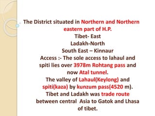
  • 1. The District situated in Northern and Northern eastern part of H.P. Tibet- East Ladakh-North South East – Kinnaur Access :- The sole access to lahaul and spiti lies over 3978m Rohtang pass and now Atal tunnel. The valley of Lahaul(Keylong) and spiti(kaza) by kunzum pass(4520 m). Tibet and Ladakh was trade route between central Asia to Gatok and Lhasa of tibet.
  • 2.
  • 3.  Human Geography- Formation – 1st Nov 1966 Distt Headquarter-- Keylong (Alt. 3165 m) Population – 31,564 (show +6.17% Decadal growth ) (last position in state among decadal growth) Population Density – 2 person square km Smallest in rank among all Distt of H.P But Rank top in area and for 24.86% of state area (Total area) – 13,835 sq.km
  • 4.  entirely rural settlement i.e no urban component Sex Ratio:- 903 females per thousand’s Males Infant sex ratio(child) – 1033/1000 highest in India. Total Population – 31564 (Male-16588 Female- 14976)  Buddhist-19572 Hindu- 11649 christians-212 Muslim – 74 Sikh – 35
  • 5. Literacy Rate – 76.81% (Male-85.69% Female- 66.84%) Sub Divisions--Lahaul Spiti Udaipur Tehsil – 2 (Lahaul, Spiti) Sub Tehsil – 1 (Udaipur) Panchayat – 41 Languages – Manchad, Bhoti, Sanskrit, Ghangsa, Gaheri
  • 6.
  • 7. Loksabha Seat- Mandi V.S.Assembly Contituency-: Lahual- Spiti. Reserved for ST. Location- 76 46’ 29” to 78 41’ 34” East Longitude …31 44’ 57” and 32 59’ 57” (North)Latitude.
  • 8.
  • 9. Passes- Rohtang, Baralacha, Laluni Jot, Kunzum, Pin Parbati, Duggi Jot, Ghunsarang, Manirang, Asha Gali, Sara umga, Shakarof, Kugti, Shipting, Tarsalamu, Banghal, Mulari jot, Zanskar, shing-dkon, chobu pass, shipkila, tempola.
  • 10. PEAKS- Murkhilla, Manerang(6597 m), Shringla(4999 m), parvati (6632m), Murangla (5060m), Hargaran (3850m), Lachalunga (5060m), Saltu Dapar (5650 m), Sanak-deik Jot (6045m), Gepang-Goh (6050), Shilla (6132), Ramabang (6135), Shiker-bah (6200), Shigrilla (6230m), BAIHALI JOT (6295m), Chauchau KangNilda (6303m), Kangla Tarba (6315m), Gyagar(6400m), Daharam Sura (6420m), Papsura(6440m), mulkila(6520m), Kullu Pumori (6553m), Udung kangri (6642m), Gya(6794m)
  • 11. Atal Tunnel Rohtang—all weather road route NH-3 Leh-Manali Highway(BRO) SMEC- Snowy mountain Engineered corporation(Australian company) In eastern Pir Panjal. Length- 9.02 km North portal to south portal Elevation -3100 m (10,171 ft) Inaugration- N.Modi. 3 oct 2020 cost 3200 crore. Width- 10 meter (33ft) Operating speed- 40-60 km/h. Longest highway single tube tunnel above 10,000ft (3048m)
  • 12.
  • 13.
  • 14.
  • 15. It is horse shoe shaped, single tube double lane tunnel.  The South Portal (SP) of Atal Tunnel is located at a distance of 25 Km from Manali at an altitude of 3060 Mtrs, while the North Portal (NP) of the tunnel is located near village Teling, Sissu in Lahaul Valley at an altitude of 3071 Mtrs.
  • 16.
  • 17. Manali to South portal-
  • 18. PEAKS - The average elevation of peaks in “Lahaul Region” is between 5480- 6400 m.lowest point is 2,740m where river Chenab makes its exit. The average elevation of spiti terrain is about 4570m and that of mountain ranges is over 5,485 m. lowest point is 3,350m.
  • 19. Passes of Lahaul and spiti Kunzum la Pass—4550m 0r 4520m  Western gateway of spiti valley.  highest motorable pass in H.P. (Gramphoo – kaza- Sumdo road).  It connect Batal in upper Chandra valley to losar of spiti valley.  Pass by foot--- May, June to october.  Spiti area is seprated from Lahaul by great kunzum range where the spiti river originates.
  • 20.
  • 21.
  • 22.
  • 23. Chak-Sachan-La pass (5250m)  positioned on Eastern side of spiti valley.  Situated between the bend of Lingti river.  With an Eye bird view of Gyagar at its top.
  • 24.
  • 26.  Pin Parvati Pass:-5400m  Himalayan trekkers fond of it. pass that was not discovered by locals.  Founder -Louis Dane (1897).  It connect Pin valley of spiti to Parvati valley of kullu.  First village in the pin valley of spiti is Mud THEN Sangnam.
  • 27.
  • 28.
  • 29.
  • 30.  Ghun Sarang la Pass (5600m)  Locally called Ghulla-La.  It connects Mane with ropa i.e spiti to kinnaur.
  • 31.
  • 32.
  • 33.  Lepcha-La Pass--  Also known as Hangrang pass.  Connects--south eastern end of spiti valley to Shail-khar and chango of Hangrang valley in kinnaur.  Small trees, bushes and vegetation on the pass offer a refreshing change to the more barren regions of the district.
  • 34.
  • 35.
  • 36.
  • 37.
  • 38.  Kuli-La Pass (4880m)  Located on the west side of the Lingti river.  It joins Lingti valley in west with syrma valley in eastern spiti.
  • 39.
  • 40.  Manirang Pass (5550m)  connects Spiti valley with ropa valley in kinnaur.  Manirang Pass is a high pass consisting of a 5km long stretch of snow-bed on the Ropa valley side along with a 3km snow covered route on the Spiti side. Travellers approach this pass from the Mane village which eventually leads to a steep descent towards the Ropa valley via a very narrow gorge.
  • 41.
  • 42.
  • 43.
  • 44.
  • 46.  North-Ratang-Col (5600m)-  Situated on the Ratang tower peak.  Can be approached to Ratang and leads to Gyundi valley.
  • 47.  SanUgba col (5400m)- Ratang valley in west spiti also neighbour a major side valley called Sanugba valley. One can reach Sanugba valley by crossing Saungba col pass.
  • 48.  Shij-Bang (4820m)-  Lies in Lingti valley.  It specifically lies ahead of the Lalung village. Thus once you cross the Zingu Top; a steep climb awaits you to cross this pass and finally descend to the tranquil Shijbang plains..
  • 50.  Parang-la-pass (5580m)-  Adventurous and trekker.  It connect spiti valley to Ladakh.  Running alongside with Pari lungbi river.
  • 51.
  • 52.  Syarma-La-pass-  Links the kuli-la-pass in the Lingti valley with Syarma valley.
  • 53.  Shilla Jot (5670m)-  This pass divide Langja valley and Syarma Nala.  Situated on the same ridge as Chau- Chau and kang-Nilda.  Trans-Himalayan Region.
  • 54.
  • 55.  Takling La(5500m)  An alternate pass to Parangla.  Leads spiti to Ladakh.
  • 56.  Taft khango/Bhaba pass(4865m):-  There are two passes in south west of pinvalley which connects spiti valley with the Bhabha valley of kinnaur.  When we cross the Taft Khango (also known as Bhaba Pass (eastern pass)) from the Pin valley side, it allows us to bypass the entire area of Kinnaur district to the east of Wangtu.  This pass is used as trade route between the pin valley and Bhabha valley.
  • 57.
  • 59.  Yangzi Diwan (5890m)-  Literly means New pass.  Linking between upper Lingti Valley and the parechu .  It is near to Pari Lungbi peak.
  • 60.
  • 61. Zingu Top (4510m)-  Climb steeply from Lalung village in the Lingti valley.  Eastern side leads to shijbang pass.
  • 63.  Sara-umga pass (5010m)  Kullu to spiti .  Lies towards North east of Bhuntar.  On the route of this pass one can see Bara-Shigri Glacier.
  • 64.  Shin kun-la-- Darcha to padum  Nimish kango pass (4890m) :- Restricted zone of spiti valley. Kaza to kalp.  Pankti pass (4010m)- from RangBar (spiti valley).
  • 65.
  • 66.  Rohtang pass (3978m)-  Main Gateway between Lahaul valley and rest of the southern area of kullu- Manali.  World 2nd highest point upto Bara- Lacha.  The first Englishman reach at rohtang pass was Moorecraft who called it “Ritanka Jot” he was followed secondly by Dr. J.G. Gerrard Lord Elgin.
  • 67.
  • 68.
  • 69.  Baralacha (Para –latse- 4890 m) pass with cross roads on summit.  75km from keylong towards leh.  The Road from zanskar,ladakh, spiti and lahaul meets here.  Gives origin to chandra, Bhaga and yunan river.
  • 70.
  • 71.  Tempola pass (4930m):-  Lahaul and spiti.  Started from yoche nallah.  One has to pass koksar village to reach here.
  • 72.
  • 73.  Rangcha Pass(4400m) :-  Trek by kardang (3500m) from keylong to visit the historic old castle of thakur at Gondhla fort.  Rangcha pass lies between keylong and khoksar.  Local people believed that Guru Ghantapa one of the 84sidhs of Buddhism attain sidhi at this place.
  • 74.
  • 75.  Banghal Pass- btw Lahaul and Bara Bhangal.
  • 76.  Shing-dkon-pass(shingola) :- Tunnel has been planned from Darcha to Leh by BRO.  Pass where “wood is scare to grow”.  connects lahaul to zanskar(17000ft).  Regularly used by people of zanskar.
  • 77.
  • 78.  Kugti pass:- (16,000 ft)  Kugti means which make one misereable(बहुत उदास )to reach it.  connects Lahaul to bharmour.  Gaddi Shephard use this pass.
  • 79.
  • 80.  Chobu pass (4725m) or Chobia pass  Connects Bharmour to Lahaul.
  • 81.  Kalicho (4729m) -  Abode of goddess Kali.  connects Lahaul-Bharmour.  It can behold pattan valley.
  • 82. Duggi Jot (5060m)  Connect Bharmour to Lahaul.
  • 84.
  • 85. Shipkilla (4500m)  Lahaul and spiti.  Shipki La is a mountain pass and border post with India-China border. The river Sutlej, which is called Langqên Zangbo in Tibet, enters India (from Tibet) near this pass.
  • 86.  CHOBIA PASS-  Pass stand between pangi range-lahual and bharmour.
  • 87.  Mulari Jot (4960 m) – Lahaul
  • 88.  Shipting (4980m) :- Bharmour-Lahaul
  • 89.  Shakarof (5022m)  Lahaul and Spiti.
  • 90.  Laluni Jot (5440m) :-  Lahaul and spiti
  • 91.  Hampta Jot Pass (4270m) :-  Pir Panjal---kullu---L&S  Valley of flowers.  Pir Panjal Ranges.  Small Corridor Between chandra valley and kullu valley.  Trade route.  Name derived from Hampta village.
  • 92.
  • 93.  Peaks with Ascending Order- 1. Hargaran-3850m L&S 2. Shringla -4999m L&S 3. Murangla -5060m L&S 4. Lach-al-unga-5060m L&S 5. Saltu Da Par-5650m L&S 6. Sanak-deik-Jot-6045m Chamba and L&S 7. Gephang-gon-6050m L&S 8. Mukar Beh-6070m Kangra and L&S 9. Shilla -6132m L&S 10. Ramabang -6135m L&S
  • 94. 11. Shikar bah–6200m L&S 12. Shigri la --6230 m L&S 13. Baihalijot -6295 m Chamba and L&S 14. Chau Chau Kang Nilda- 6303m L&S 15. Kangla Tarbo 1 – 6315m L&S 16. Dharamsura -6420 m Kullu & L&S 17. Papsura -6440 m Kullu and L&S 18. Mulkilla-6520 m L&S 19. Kullu Pumort- 6553m L&S 20. Manirang -6597m L&S and Kinnaur 21. Parvati Parvat- 6632m L&S and kullu
  • 95.  22. Undung Kangri (6642m ) L&S  23. Gya (6794m) L&S  Peaks sharing boundary with---  Kinnaur-Manirang  Kullu-Dharmsura, Papsura, Parvati Parvat  Chamba- Sanak-deik-Jot, Baihali Jot  Kangra- Mukar Beh
  • 96.  PEAKS-  Total 75 Peaks in H.P. and 23 lies in L&S or share boundry with others.  Gya is 2nd highest peak with 6794m height.  Reo-purgyil ranks 1st highest peak in H.P. with height 6816m and lies in kinnaur.
  • 97. PASSES SHARING BOUNDARY WITH OTHER DISTRICTS
  • 98. L&S and Kullu:- Rohtang pass-3978m Pin Parvati pass– 5319 5400m Hampta pass – 4270m Sar-Umga pass- 5010m
  • 99.  L&S Chamba :- Kalicho pass-4729m Chobia pass- 4934m Kugti Pass- 4962m Shipting- 4980 m Duggi Jot- 5070m
  • 100.  L&S Kangra:-  Asha Gali- 5030m
  • 101.  Lahaul and spiti-  Ranjcha pass (4400m)  Shipkilla (4500m)  Kunjumla (4520m)  Bara-lacha (4890m)  Tempola (4930m)  Mularijot (4960m)  Shakrot (5020m)  Lalunijot (5440m)
  • 102.  Spiti and Kinnaur-  Yangzi-Diwan- (5890m)  Shilla Jot (5670m)  North Ratang (5600m)  South Ratang pass (5600m)  Parang la pass (5580m)  Manirang Pass (5550m)  Talking la pass (5500m)  Ghunsarang Pass (5500m)  Sang-ugba (5400m)  Pin Parvati (5400m)
  • 103.  Chak Sachan Pass (5250m)  Syarma-la-pass (5040m)  Kuli-La pass (4880m)  Bhaba Pass (4865m)  Shijbang pass (4820m)  Kunzun-la-pass (4550m)  Zingru-tub (4510m)
  • 104.  River system in Lahaul and Spiti-  Chenab is a major river of India and pakistan entering pakistan having flowed through himachal pradesh and kashmir Himalaya, subsequently joining satluj.  Water of the chenab are allocated to the pakistan under indus water treaty (world Bank) 1960.
  • 106.
  • 107.
  • 108.  Chandra River :-  from the Baralacha pass.  Originates south to west direction of Baralacha and take 180 degree cut in spiti valley.  Chandra river gets water from Bara- shigri and shamudri glaciers.  The important human settlement :- koksar, sissu, Gondla along the river.  Origin from chandartal.  Meets at tandi with Bhaga and become chandra and bhaga (chenab).
  • 109.
  • 110.  Bhaga river:-  It rises North to west from Baralacha .  Origin is from surajtal (Lake of sun).  Enter into Darcha village which is situated near the junction of yoche nallah and Zanskar-chu.  Total length of river is 65 km.  Famous village are keylong, khardang, Gemur.  Chu is main tributary of Bhaga river.  The valley of lahaul is situated in south of Ladakh for this very reason this place derived its name. “Lho-yul” meaning southern country.
  • 111.  It meets with chandra river at Tandi and then become chenab (or chandra bhaga).  An other river originates from Baralacha i.e yunan river and Baralacha pass divide water between Bhaga river and yunan river.
  • 112.
  • 113.
  • 114. LAKES IN LAHAUL AND SPITI
  • 115.  Suraj Tal/ Tso Kamsi lake-4833m  Fed by Gangstang Glacier.  Lies below the Baralacha pass.  3rd highest lake in India.  4km.  Yunam River:  toward sarchu plains (source is Suraj Tal).
  • 116.
  • 117.  Chandra Tal:-  Tso Chigma or chandral (on samudra tapu plateau).  Source of chandra river.  Usually associates with spiti but geographically it is a part of lahauL.  Max. Length-1km.  Ramsar Wetland site.  Designated (8th Nov 2005).  Chinese traveller Hieun Tsang called this lake Lohitya sarovar.
  • 118.
  • 120.  Spiti River:-  Pronounce as piti in Tibet means “middle land”.  Tributary of Satluj River.  It originates from kunzum Range of Himalaya in a way that divide Lahaul and spiti.  Pin river, Hansi river ,lingti river, Jeypo, kabzian feed it.  Many human settlement :- Tabo, Dhankar, Kaza, Rangrik.  Largest tributary to satluj.  Meet satluj at Namgia (Kinnaur) or khab by travelling 150km.
  • 121.  River gets no rains .  all water gain from melted glaciers.  Its position across the main himalayan ranges deprives it from the benefit of the south-west monsoon.  Right bank Tributary:- Chiamo, Gyundi, rohtang, Ulah, Pin, Lungze, Mane, Surahal, Pomograng, Mamdang Sumra.  Left bank Tributary:- Thamar, Hanse, Thumna, Tagting, Thumpa, Lumpa, shila, kaza, lingti, Poh, Tabo, Karati, Gimdo, Parechu.  Lingti, Gimdo, Parechu which starts from tagling la or parang La.
  • 122.
  • 123.
  • 124.
  • 125.  Pin River:  50km Long.  Right bank tributary of spiti river..  Kyoti :- Lasuma mountain in shrikhand range.  Right bank tributries- Polderchin, polderchum, shang, ping.  Left Bank tributries- Karve, Lavrang, Madang, saguara, Gooling, seeling, kis.
  • 126.  The valley of the Pin River is ever wider than that of the spiti which is joined by pin at Dhankar.
  • 127.  Tsarap River:  After rising from its source, the Tsarap River flows north-east up to Sarchu, a camping site at the Leh-Manali Highway, here the Tsarap River joins a confluence of three rivers of Lingti, Yunan and Sarchu River.
  • 128.
  • 129.  Shangri La  is the cold mountain desert located on Tibetan Border.
  • 130.
  • 131.  Tandi Village:-  Tandi village has sacred importance to lahaul people as haridwar to hindus of the world.  7km from keylong.  It is said that Tandi was founded by “ Raja Rana chand Ram” under the name of Chandi.  Which over the years got corrupted into Tandi.
  • 132.  There are 3 mythological stories connected with tandi----  Tandi is believed:- Tan Dehi i.e giving up the body.  Associated with draupdi who left her body at this place.  Rishi vashishth -  Water spring of manali.  His body cremated at this confluence i.e body consumed that’s why Tandi.
  • 133.  Chandra and Bhaga -  daughter of moon and son of sun god respectively.  They were in love with each other.  Both met at Tandi to enter the wedlock.
  • 135. Chandra Valley :-  Bara-Shigari glacier.  It feeds chandra river. Bhaga Valley:-  Gangstang.  Lady of keylong.  Mulkila.  Milang.
  • 136.  Pattan valley:-  ShilLa.  Kugti or Sonapani.  Lainghar.  Doksha.  Nikant.  Neelkanth.  Ulthampu.  Karpat.  Gora.  Takdung.
  • 137.  Gyephang:-  Manimahesh of Lahaul.  Total 249 lakes made from glacier in H.P.  According to a study 1962-2001 total 1628 sq. km area decreases of glacier.
  • 138.  Bara Shigri Glacier-  Captain Harkot crossed the glacier in 1869.  World 2nd largest glacier.  Largest glacier in H.P.  Located in Chandra valley and feeding the river Chenab.  3km wide and 25km long.  1924:- Acc. to Hugh whistler “Shigri” means “Par Excellence” (सर्वोत्क ृ ष्ट).  1836:- this glacier outburst and damaged the Chandra valley.
  • 139.  The glacier was first surveyed in 1906 by H.Walker and E.H Pascoe of the geological survey of India.  1955:- Geological survey of India sponsored an expedition to the glacier as a part of international geophysical year 1956-57 in that no of glacier were examined and their position was fixed.  1956:- The glaciers was conquered by all women mountaineers.
  • 140.  1958:- Stephenson tracked it successful.  1970 :- Maj. Baljit tracked it successful.  1957- Geological Survey of India undertook it and start major study under G.N. Dutt and F.Ahmed.
  • 141.
  • 142.  Lady of keylong:- (6061m)  Which can be seen by keylong.  It was named so by “Lady Elash-ingh- day“during british Raj.  It remained snow covered but in the middle there is seen a dark bare patch that looks like figure of the women walking with load on her back.  Geological Survey of India also called it as lady of Keylong.
  • 144.
  • 145.  MukKila Glacier:- 6478m (Bhaga valley)  Near to Milang and Gangstang Glacier.
  • 146.  Sonapani GLACIER:-  5 and half km.  It was surveyed twice----  1906:- surveyed by walker and pascoe.  1957:- surveyed by Kurian and Munshi of GSI.  It is visible from Rohtang Pass.  It is near to kulti nala.
  • 147.  Perad Glacier:-  Broken Rock Glacier (putiruni in local language).  It is small one and easily accessible.  There is well marked ice cave.
  • 148. Miyar Glacier:-  Longest Glacier in Lahaul area.  28 km long.
  • 149.
  • 150.  Malung:-  North west of Hansi .  Origin of malung river but towards zanskar range.
  • 151.
  • 152.  Gangstang Glaciers:- 5480 m.  Western border of Lahaul.  streaming into shasha nallah which joins in Chandrabhaga river.
  • 153.  Gyephang Glacier:-  6400m (manimahesh of Lahaul)  Gyephang peak is some what like in switzerland.
  • 154.
  • 155.  Kulti Glacier:-  Near koksar looks at crossing rohtang.
  • 156.  Milang Glacier:-  Located between Darcha and khekrar in L&S.  Milang is a picturesque glacier located in Lahaul and Spiti District of Himachal Pradesh. It is perched at an altitude of about 13,000 ft above sea level in the Bhaga Valley.   Mulkila Peak (6,517 m) lies at the head of Milang Glacier.  Yotche, Khoksar, Gramphu and Mukkila Glacier are the nearby tourist destinations. It is an ideal base for trekking. Milang can be easily approached from Darcha. 
  • 157.  Taragiri Glacier:-  Located Near Milang Glacier.
  • 158.  Chotta Shigri Glacier:-  East of the rohtang pass.  13km  JNU is monitoring the glacier for mass balance.
  • 159.
  • 160.  Gora Glacier:-  Receded in the recent past due to unstable mass balance.  It lies in south.
  • 161.  Regional Classification- Pir Panjal:- Most important physical feature is Rohtang pass. Greater Himalayan Range:- Chandertal Glacier. Suraj Tal Glacier. Seprate spiti Basin. Bara Shigri, Chhota shigri, Miyar, Gungstang.
  • 162.  Malung Basin-  Climate condition are very severe.  Terrain is very tough.  Does not have any population and vegetation.
  • 163.  Spiti Basin:-  South eastern part of distt.  Pin, lingti, and spiti.
  • 164.  Wild life park and sanctury in L&S-  Pin valley National Park:- 3300- 6632m  The Intention to constitute pin valley a national park was declared in the year 1987, 9th jan.  Only National park which is situated in the cold desert area.  67.5 sq.km as core zone.  1150 sq km as buffer zone.  Famous Gompa in the kungri village which is situated in Buffer zone.  Total Area:- 67,500 hectare.
  • 165.  National park are established under section 35(4) of wildllife protection Act 1972.
  • 166.  Fauna :-  20 species of animal and birds.  Rare Animal---- 1. wooly hare. 2. Tibetan gazelle. 3. Snow leopard ---scientific name – panthera uncia.(endangered) .
  • 167. Other Species- 1. IBEX 8. Snow cock 2. Bharal 9. Beareded vulture 3. Red Fox 10. Chukor 4. Marten 11. Golden Eagle 5. Weasel 12.Griffon 6. Pika 13. himalyan Chough 7. Lunx 14. Marmat
  • 168.  FLORA-  Flora Characterised by alpine pasture or dry alpine scrub forest.  Juniper and birch trees are on the verge of extinction.  Valley bottom have regenerated naturally with salix sp. And myricaria sp.  Myricaria sp. Are eaten by snow leopard during crucial winter season.  400 plant species have been reported in this area--  Dry alpine.  Scrub.  Dwarf juniper scrub.
  • 171.  KIBBER SANCTUARY-  L&S linked with road Lalung, Langcha and kibber.  Only sanctuary in country which is situated in the cold desert area.  There are 3 monastries (kee, Tangyut, Dhankar).  Area----  Fauna:- Blue sheeps, Ibex.  View:- Shila peaks, parangla.
  • 172.  FLORA  Extreme medicinal Herb.  C.P. Kala(TIBETAN MED. PRACTTIONER) extensively surveyed for distribution of plant.  8 rare and endangered medicinal herb was found.
  • 173. IBEX AND BLUE SHEEP
  • 174.
  • 175.  Forest cover in L&S  Total Geographical area:- 13,841km sq.  Area under forest cover- 160.35km sq.  % of Geographical Area :- 1.16%  Change wrt 2017:- -32.65%  Scrub :- 15.37%
  • 176.  According to physiographic and Dominant tree type-  1. Sub-Alpine and Alpine region  Physiographic location:-  Upper slope of middle and higher Himalaya.  And south facing slope of Trans Himalaya.  Area :- L&S, Chamba, kangra, shimla, Kinnaur.
  • 177.  Maj. Forest type:-  Moist alpine scrub.  Spruce, older, birch.  rhododendron.  Blue pine.
  • 178.  Trans Himalaya:-  (Region Physiography)  Inner dry valley of main Himalaya  Trans Himalaya  Upper parts of L&S,Kinnaur, Pangi.  Major forest type-  Alpine scrub  Chilgoza.  Neoza.  Juniper.
  • 179.  Climatic region in L&S  Dry temporate Zone:- L&S, Pangi, Bharmour  Acc to Koppen Classification:-  Humid continental:---  Severe winter.  Short warm.  Moist all season.
  • 180.  Soil in L&S  Alpine Humus mountain skeletal soil.  Found in Himalaya Highland.  L&S, Kinnaur, Pangi.  Where precipitation is low and temp is rigid.  Usually high in organic matter, and neutral in reaction.  Phosphorus and potassium are generally medium to high.  On the basis of taxonomy these soil can be classified into 3 type---
  • 181.  Haplu Dolls  Eutroch repts  Udor Hents
  • 182.  Geology :-  Found in great Himalaya or central zone.  This zone represent metamorphic unit  Mostly granite rock.  Trans Himalya or Zanskar Range.  Geology:- complete sequence of fossil ferrous strate.
  • 183.  Economy  Primary source of economy is agriculture.  Only 25% of total land mass is under cultivation.  Buckneat, barley, wheat, cauliflower, cabbage, pulses, oilseeds.  Cash crop:- Kuth, potato, Hops,  “Sea Buck Thorn” the wonder plant found in spiti with extreme range fom -40 to +40 Degree C.
  • 184.  The sea buck thorn cultivation has been started under DDP(Desert Dev Project)  This plant has been adopted as one of the priority species of afforestation programme by forest department in the valley.  Potato and other vegetable were 1st introduced by moravian missionaries at keylong in 1857.  Kuth cultivation was introduced in 1925.
  • 185.  Moravian mission led by Mrs. and Mr. Hyde was german in origin. But become international in character and funds exclusive came from England.  Some of the missionaries had indeed done a valuable historical, archeological, and linguistic works in district.  Lahul spiti has earned the distinction of achieving the highest per hectare production of potato by oversealing the netherland with elevating range of 8000 to 11000 ft. above the mean sea level.
  • 186.  Chief Medical Herbs:-  Artimesia  Ephedra  Aconitum  Podo  Phyllum  Karu  Hyoscyamus niger
  • 187.  Hippophae Rhamnoides:- is recommended by lama in lung disease.  Ratan jot is found in spiti valley  Forest produce:- Karu, Patish, and kala zira  Fruit cum demonstration farm at Tabo- Institute.
  • 188.  Zo and zomo (male and female respectively)-  Is a progeny of a cross between cow and yak.  It is a believed that after six generation of crossing of the cow with yak the progency in back again to pure yak.  Zomo milk a rich fat content.
  • 189.  Lilium Lilies:- Another success story in the flower market.  6 Tribal villages-  Mudgran  Jagla  Jalma  Puda  Sissu  Kuth Bihal
  • 190.  Misc-  1869:- Branch post office was opened at “keylong”.  1935:- 2nd post office opened at “lote”  1939:- at kaza.  1861:- Mr and Mrs. Hyde opened 1st primary school at keylong.  Ist regular school was started by district board kangra in 1919 with urdu as a medium  1932:- In spiti region 1st school till one was established at kaza 1932.
  • 191.  1960:- seed farm a reason unit was established at “ Gorma” in pattan valley.  Raisin grape research sub station was established at thirot in pattan valley.  Kuth and dry fruit research unit at keylong.  1978:- An additional deputy comm. Was posted at kaza under single line administration.  A.D.C was vested with the power of head of all departments in 1984.
  • 192.  “Desert development programme” - 1978- 1. Afforestation. 2. Generation of substantial employment opportunity 3. Promote psychological, physiological and social dev. in children( project was launched in spiti division.)  1987:- Office of assistant manager SC/ST development corporation was established in kaza.  1990:- Antodya programme was launched.
  • 193. HISTORY OF LAHUAL AND SPITI-
  • 194.  Tradition tells us that one of the earliest ruler of land was Manu who ruled between 3100BC-2550BC.  Some text refers that , in the ancient time, L&S must have been either the part of “Kuluta” or “Mandamati” territory but it is not clear where this Mandamati territory is.
  • 195.  In 3rd century BC Himalayas was part of Mauryan empire.  During period of Kanishka(kushan king) there was a great Janpad “ki- pin” from Kashmir to Kafristan.  It was ruled by Women and also known as Kingdom of Women.  A stupa is connected with Kanishka named “Kanika-Chod-Ten” is found in Zanskar.
  • 196.  Before Hieun Tsang(635AD) visit Lahaul was controlled by Kuluta, Kunindas and Brahmpura(chamba).  Hieun Tsang visited Kullu in 635AD and noticed Lahaul as country by name of “La-Hua-La”.  Area of spiti was earliest ruled by Sens and one of the earliest sen ruler was Samudrasen.
  • 197.  During the reign of Rajendra sen, Kullu became tributary to Spiti for a short period. He defeated Raja Rudra pal of Kullu.  During the reign of Chet Sen in 7th century AD Spiti was annexed by Ladakhi king Skyid-Lde-Ni-Mgon.  It is said that during the strong rule of Ladakh , Spiti was an integral part of Ladakh and during weak rule it was autonomous state.
  • 198.  In 8th century AD , Raja of Chamba Ajia Verman became Feudatory of Kashmir, Thus Lahual too came directly under the influence of Kashmir.  Kashmiri Art can be traced at Mrikula, Udaipur and Trilokinath.  Two inscriptions in Sharda script have been found inTinan which may belong to 900-1000AD. 
  • 199.  The rule of Ladakh over Lahual begin since when king Lha-chen-Utpala(1080- 1110AD) of Ladakh attacked Kullu and raja of kullu Sikender Pal promise to pay tribute in kind of iron and madsos/mdsos/mdso(Dzos also pronounced as Zo).It is a cross breed between Yak and Cow.  Since Dzos do not found in Kullu region, it is possible that at time lahual was also conquered by him to bring Dzos.
  • 200.  King Utpala was responsible for the conversion of Marikula Devi temple into shrine of Marachi Vajara Vahi.  Kullu and Chamba always aspired to make control over L&S. One possible reason that strengthens this belief is that in early time both kullu and Chamba had their capital nearest Lahaul “Nast” and “Brahmpura”.
  • 201.  It is said that when kullu succeeded to acquire lahaul , Chamba was in alliance with Kullu because three daughter of Kullu raja was married to Partap singh verman of Chamba who was the son of Ganesh Verman.  The image of Mrikula devi at Mrikul- Udaipur was set up during the reign of Chamba King Partap Singh Verman by Thakur Himpal.
  • 202.  It is said that architect who constructed Mrikula devi Temple was Same who constructed Hidimba(Doongri temple) in Manali during the reign of Bahadur Singh in 1553.  In order to prevent the artist ever making a duplicate of Hidimba Temple, kullu Raja ordered to cut the architcts right hand but the gifted artist trained his left hand and executerd an even finer piece of carving Mrikula.  Since the reign of Bahadur Singh ,Kullu ruled over Lahaul till both Kullu and Lahual were conquered by the Sikh in 1840.
  • 203.  Acc. to one tradition , Chamba appears to have been ruling all over Lahaul for some time. In the LhaRabs (history of Gods), it is related that one of the Gods went to Chamba to demand half of his Kingdom from Raja of that country.  The earliest evidence of Kullu,s rule over Lahaul after its occupation by Ladakh is available in the reign of Bahadur singh of kullu.
  • 204.  The local chiefs were called as “Jos And Ranas”.  Jos was the title of village headman as there were Jos in the village of Hayar, Kardand ,Tino etc.
  • 205.  Jesuit father ,Azavedo, while going from Ladakh to Kullu and Punjab plains in 1631 mentioned that lahual was then subject to kullu.  He called lahaul Carcia/Garzha.
  • 206.  In1683 Ladakh was invaded by “Qalaaqs”(Mangols), the cause of war was a conflict inTibet between two religious sects “Dugpa(Red-Hat)” and “Gelugpa(yellow-Hat)”.  Ladakh took the side of “Dugpas”.  The Gelugpa inivited the Mangols for their help and invaded ladakh.
  • 207.  Simultaneously Mangol invaded Lahual as its Lamas were followers of Dugpa Sect.  This invasion is remembered in Lahual Spiti as Sog-Po(Mangol Invasion).  Mangol army stayed in Lahaul for 2 years and acquired the fort of Keylong and was then annihilated by Glacier
  • 208. BIDHI SINGH OF KULLU (1672- 1688)-  Bidhi Singh of kullu helped Mughals when they were invited by the Ladakhis under the leadership of “Fidai Khan” against the Mongols.  For this help Mughals rewarded Bidhi Singh with the annexation of the upper portion of upper Lahual.  In Lahual “Thirot” remained the boundary between Kullu and Chamba which was decided during the reign of Bidhi Singh.
  • 209. RAJA MAAN SINGH OF KULLU(1688-1719AD)-  He fixed boundary with Ladakh at Lingti.  After Tibetan-Ladakhi and Mughal war of 1681-83, Spiti was Nominally under Ladakh.  Raja Maan Singh took the advantage of this and take control over Spiti and forced him to pay tribute.  Maan singh Built Gondhla Fort called Rani ki Kothi.
  • 210. RAJA TEDHI SINGH OF KULLU -  During his time, when no goldsmith was able to manufacture golden palki for Raghunathji.  Then a goldsmith “Phuntson” was called from Lahual.
  • 211. PRITAM SINGH OF KULLU (1767-1806)-  During his time ,Lahaul army under “Gepanghla” was supported against Mandi at “Bajaura” and Mandi was defeated in the battle.
  • 212. MOORECRAFT (1820)-  When Moorecraft passed through Lahaul in 1820 he found that four villages i.e Barkalanak, Mooling ,Shipting and Gus were still paying revenue to Ladakh which was stopped by Britishers in 1762.  In those days Tandi was the capital of Lahaul from where admin and representastives of kullu raja govern from.  During this time “Baliram of Phurah” was the judge who had his office at Tandi , he did not fine the culprit but he tied them with a tree and flogged.
  • 213. TREATY OF AMRITSAR-  In 1840, sikh army subjugated Mandi state and Kullu raja was captured who died in 1841 at “Shangri”. At that time along with Kullu Lahaul also came under direct control of Sikhs.  When Cunningham visited lahaul in 1839, he found it already under sikh and Zorawar Singh governor of Ladakh controlled the trade between Lahaul and ladakh.  His tax system was very oppressive.
  • 214.  In 1841, Zorawar singh attacked Tibet, but could not stand powerful against Tibet and was killed.  In 1842, when Tibetan army moved toward Ladakh but they were defeated by forces of “Gulab Singh” in dec 1842 and their general “Sukhang” was taken prisoner.
  • 215.  In 1846 by the treaty of Amritsar, between Gulab Singh and British, hill area of Punjab was given to Gulab Singh but area of Lahual and spiti remained under British control.
  • 216.  Area lying below “Thirot” remained under Chamba , after the annexation of Lahual to British territory.This area was Known as “Chamba Lahual” and rest was called British Lahaul.  After annexation of Lahual and Kullu by Britishers , Lahual was made part of Kullu sub-division which was under the charge of an assistant commissioner who worked under the deputy commissioner of Kangra whose HQ was at Dharmshala.
  • 217.  Highest officer of Lahaul was “Negi” who was responsible to collect revenue.  “Negi” had his HQ at Keylong where he worked as an honorary Magistrate and Jurisdiction was extended throughout Lahual.  Negi was responsible for Arranging “Beggar” and Forced Labour.  Bali Ram was the first Negi of Lahual appointed by Britishers and Thakur Tara Chand of Khangsar was appointed Next Negi. After this the post remained heridatory till 1941when a Naib Tehsidar was appointed.
  • 218.  In 1849 “Major Hay” Ass. comm. of Kullu went to Spiti and took over the charge and hereditary Wazir of Spiti was called Nono was granted a jagir.  In 1873, Nono was formally vested with honorary magistrial power.  During the First World War 1914-1918 ,Wazir Amir Chand of Lahual helped the British government and took command in person as “Jamadar” for this valuable service he was given the title of “Rai Bahadur” in 1917.
  • 219.  In 1941 ,a sub-tehsil of Lahual and spiti was created with HQ at Keylong.  In1960,the govt of PB converted L&S into a distt. With HQ at Keylong.  In1966, it was transferred to HP.
  • 220. CULTURAL ASPECTS OF LAHAUL SPITI-  Swanglas,Thakurs,Kanets,Bhots along with several scheduled caste communities of Chanals,Dombas,Hesis,and Lohars etc.  In pattan valley, mostly Hindu people lives.  People of Spiti and Pin valley are having Mongoloid features.  There is a Nala near Keylong Known as Shakas Nala, which seems to have taken its name after Shaka Tribe who are believed to have settled at Bhaga valley.
  • 221.  Mundas people have come to the area from Bengal and central India in Ancient times.
  • 222. MALE DRESS/ORNAMENTS-  Murki– Ear rings usually worn by men.  Kyanti--neck ring.
  • 223. FEMALE DRESS  Krikishti– an ornament made of Gold and Silver and is worn on head.  Dugpo– Ladies Gown.  Poshal– an ornament meant for the forehead such as Bindi and Tikka in plains.  Dung kisti– worn around the Waist.  Phuli– Nose ornament.  Nyagthang– a chained silver ornament worn on the breast.  In Spiti region, the women wear Yebzur or Beran .
  • 224.
  • 225. FOOD HABITS-  BREAKFAST ----Ken Tshema.  LUNCH----Shad or Chhiken.  DINNER--- Yangskin or Gongal.
  • 226. STAPLE FOOD--  Kalhu, Buckwheat(kutu) , Barley and Wheat.  They also consume a lot of Lugri or Tsangti , Chhang(Beer) and salted tea mixed with Butter.  Arak/Local distilled Liquor is also drunken ocassionally.
  • 227.
  • 228. RELIGION-  Pattan Valley– Hinduism dominates.  Lower parts of Chandra and Bhaga- - Both Hinduism and Buddhism practiced.  Spiti and upper reaches of Chandra Bhaga –pure Buddhism is practiced.
  • 229. TRIBAL DEITIES--  Gyepang and Dabla are most popular deities.  Other Deities– Tanggur, Srowag , Zang- Doulma, Mipusha and Kyulling Sall.  There is only one Devta , with kullu type Rath ,who lived in Rwalling village of Lahual.  Four Buddhist sects are there ,which are Nying mapa, Kagyudpa, Shakyas and Buzhens.(Buzhens are Lamas who entertain people by acting plays and chanting legends).
  • 230.  Monasteries are locally called Gompas.  Main monastries of Lahual are:- Khardang, Shashur, Gemur and Guru Ghantal.  Main monastries of Spiti:-Tabo, kee/key and Dhankar.
  • 231.
  • 232.
  • 233.
  • 234.  Dzeetha Dambargy– It is the worship of God in Lahual. It is performed 1year after the death of a person.  Zimong Sringpo– Most popular demon at Darcha.
  • 235. MARRIAGE SYSTEM-  3 types of marriages in Lahual--  Tebagston or Mothebian– Arranged marriage.  Kowanchi Biah– Arranged but performed very briefly.  Kunmai Baghstan or Kunchi Biah– Marriage where boy and girl elope together.
  • 236.  2 types of Marriage in Spiti—  Arranged marriage.  Khandum:- choice is made against the wishes of their parents.
  • 237. DIVORCE SYSTEM --  Kupachacha or Tshud-Thwagsti-  This is the ritual of divorce in Lahaul and spiti.  A simple woolen thread which is tied to the little finger of both the companions is pulled apart in the presence of some elder persons and this decide the issue.  Joint family system is prevalent in Lahaul.  In the ancient times, are fraternal polyandry was prevalent.
  • 238. FAMOUS FAIRS-  Ladarcha Fair– held in Kibber village in July.  Sissu Fair– common fair celebrated all over the Buddhist Himalayas.  At Shashur Gompa- in month of June.  At Gemur Gompa- in month of July.  At Mani Gompa(Gondhla valley)- in month of August.
  • 239.  Phagli fair or Kun Fair- It is famous fair of Pattan valley, held on Amavasya in the month of February. Pori Fair- held in Pattan valley at Trilokinath temple in the month of August. Like Nathwara temple of Rajasthan , at Trilokinath a lamp is burning in pure ghee.
  • 240. FAMOUS FESTIVALS --  Bumkhor – it is a religious festival related to agriculture where people believe that, if the religious books are taken around the field there will be bumper crops.  Halda/Losar- it is a new year festival in Lahaul (in jan).  Halda enjoys same status as Deepawali in rest of India.The festivities centers around “Shikhara Apa”, goddess of wealth in Lamastic Pantheon. The day for Halda is fixed by Lamas.
  • 241.  Pauri festival– celebrated on 3rd week of August.  People of all caste and creed gathers there from Lahaul ,kullu and chamba.  This festival is a combination of Pilgrimage and festive activities .  A day before the main celebration people leave their homes and visit the holy shrine or statue of Trilokinath or Avlokiteshwar as it is regarded by Buddhists.  The devotees parikrma the shrine clockwise for 3 to 7 times with the chanting of “OM MANI PADME HUM”.
  • 242.  Gotsi/Gochi festival:-  Celebrated in Chandra and Bhaga valley in the month of Feb.  It is celebrated at a house where a son is born during the preceeding year.   Gyalto festival:-  celebrated at the end of Dec where people bid farewell to the old year.
  • 243.  Chhishu/Shisha festival:-  The festival is a symbolic of good times in the region.  It is celebrated on the 10th of every month.  Dachang festival:-  It is the festival of arrows celebrated by only the men in the month of Feb for 6 days.
  • 244.  ThonThon festival:-  It is celebrated in the month of april to mark the end of Winter.  Yane Festival:-  It is celebrated in the 2nd week of June.  Here, God Trilokinath is worshipped by old men and women.
  • 245.  Namgan Festival :-  It is celebrated in the month of Sept on the occasion of crop harvest.  People dress up in the traditional attire and worship God.  In this festival , a horse race is organised.
  • 246.  Chho Thang festival:-  In this festival, a Lama is called from the Gompa who then reads “Tanjives” consisting of 108 scriptures.  Bhinger festival:-  It is celebrated on the birth of a son or first daughter.
  • 247.  Gutor Festival:-  it is celebrated in the month of Nov in Spiti region at monasteries of key ,Tabo, Dhankar, pin.  Here all lamas worshipped God Chaugyal.  People performs Chham Dance.  Tabo monastery (in Tabo village,spiti) is called “Ajanta of Himalayas” because of its frescos(MURAL PAINTINGS) and stucco paintings.
  • 250. DIFF. BETWEEN MURALS AND FRESCOS-  A mural is any large painting on a wall, ceiling or any other large structure. There are many techniques used to make them.  A fresco, executed using water- soluble paints on wet or dry limestone, is one of the techniques and probably the most popular.
  • 251.  Jigjed Festival:-  It is celebrated in the month of oct in Spiti region at Thang Jayl monastery.  Chakhr festival:-  It is celebrated instead of Gutor or after every 4 years.  Lamas worship God Chik-Chait for 6 days and continue performing Chham dance held in sept.
  • 253.  Sanchoti Festival:-  It is celebrated after death ceremony.  It is celebrated in Pin Valley in each Khangchan once in every 6-7 years.  Galten Amchaut festival:-  It is festival of Diyas celebrated B/w 25th nov to 1st week of dec.  It is celebrated on the birth day of famous preacher of Buddhism - J.Chaukava.
  • 254.  Lachhang Festival:-  It is celebrated to welcome the winter season.  Local deity is worshipped with the hope that winters would be happy and prosperous to the local people.  Celebrated from 25th of 11th month of local calender.
  • 255.  Pingri festival:-  it is celebrated to mark birthday of anyone.  Paklen festival:-  It is celebrated at the time of marriage.
  • 256.  Fagli festival:-  Locally called Kuns/Kus.  It is an imp festival of Pattan valley on Amavasya feb.  House is decorated.  A Baraza is setup, which consist of a bamboo stick of 2 to 3 feet mounted on the floor , around the stick is a white cloth drapped.
  • 257.  Baraza represents the angel ”Shikara Appa”(Grand mother of the peak)and her visit is considered to bring prosperity in the house.  Head couple of the family prepare “Totu”and “kawari”.  Totu is taken up to the roof and is offered to the deities .  Kawari is later thrown to the crows.  Totu is then distributed among the family members as Parsad.
  • 258.  Then the couple goes to pay their gratitude and acknowledged their cows and sheeps to express their dependency on these animals.  After breakfast they visit the elder man of the village to seek his blessings then entire village assembled to pay their respect to each house with Marchu/local puri.  As field is cover with snow, so symbolic plouging is done .  This festival is celebrated on the advent of Spring.  Name is derived from Phalgun month.  It is imp in pattan valley as Shivratri in rest of the country.
  • 259. FAMOUS DANCES-  Shehni- performed by both men and women.  Ghure- All dancers move in a circle without linking their arms to one another.  Gharphi- it is the oldest dance form of Lahual Spiti in which movement of participants are neither regular nor arranged.  Betas are the community of Professional dancers . 7 diff. dances are performed by them are Gar, Jabru , Mukna , Bukum , Shon,  Bhuchan and devi dance.
  • 260.  In 2011, HP language art and culture academy found 600 year old manuscripts in spiti Valley which deals with Ayurvedic System of medicine. This is written in Bhoti Language.  Another manuscript written in golden words was found in Tholang village of Lahual valley.