
Recommended
More Related Content
What's hot
What's hot (20)
Similar to L7 ap located example
Similar to L7 ap located example (20)
More from andypinks
More from andypinks (20)
Recently uploaded
Recently uploaded (20)
L7 ap located example
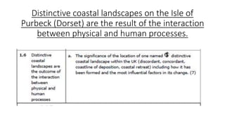
- 1. Distinctive coastal landscapes on the Isle of Purbeck (Dorset) are the result of the interaction between physical and human processes.
- 2. Located Example: Swanage Bay on the Isle of Purbeck
- 3. Lesson Objectives: • What is significant about the location of the Isle of Purbeck? • Explain how the landscape has been formed (physical processes and geology) • Explain how physical and human processes have changed the coastal landscape of the area
- 4. YOUR TURN • Today the PowerPoint with all the tasks on it are on showbie. • Put the subitile in at the right stage, they are underlined and lettered A-D to help you. • Your job is to work through it at your own pace and complete all the instructions (they are in blue). They are self explanatory. • You can use the Tomorrwos World text book as well as the resources on the powerpoint. • There is a sheet with some photos on it to help you. • If stuck do just put up a hand!
- 5. A. Whereabouts is the Isle of Purbeck in the UK? • Find and label it on your UK map • Use the information below to help you write a description of the location of the Isle of Purbeck “The Isle of Purbeck is located in the south of England in Dorset. Its area is approximately 200km2 and the south and east of the area are surrounded by sea (the English Channel). The north is divided by the River Frome and Poole Harbour. There is one town, Swanage, several villages and a seaside resort. Access to the Isle of Purbeck is provided via the A351 road which is linked to the Poole- Bournemouth conurbation (population 500,000).”
- 6. B. What is important about the location of the Isle of Purbeck in shaping its landscape? Physical Factor How it helps to shape the area Geology Prevailing winds and wind strength Fetch Power of waves Aspect (direction the area faces) Make a copy of the table and fill it in in answer to this question. Use the information on the next slide to help you.
- 7. What is important about the location of the Isle of Purbeck in shaping its landscape? Europe Wind Power Map Geology Fetch Location
- 8. C. How has Swanage Bay been formed? Explain how Swanage Bay and the headlands either side (Peveril Point and Ballard Point) have formed – draw an annotated diagram to help you (or stick in a relevant picture) Tip: Refer to physical processes (types of erosion by the sea) and the local geology (rock types) in your explanation. Make sure that you refer to place names (again use relevant maps/pictures) Use the information on p25 of Tomorrow’s Geography and your notes on concordant and discordant coastlines, headlands and bays to :
- 9. D. How have physical and human processes changed the coastal landscape of the area? Use the table on p. 24 Tomorrow’s Geography as a starting point, the following slides and some extra research to: 1. Explain how different physical processes have had an impact on the area around Swanage Bay. (Coastal erosion, mass movement). Find out some dates to highlight the most recent of these impacts. (see following slide for explanation on landslips but there are other processes) 2. Explain how different human processes have had an impact on the area around Swanage Bay. (Tourism, settlement, coastal defences) Try to find out some dates to highlight the most recent of these impacts (see the next slide for explanation on how human development affects landslips and the slide after for the impact of groynes on the area)
- 10. Rotational slides – BBC clip 22/12/2012 Human Development affects landslide activity in Swanage town: • Buildings add extra weight onto the underlying clay making it less stable (especially during very rainy conditions) • Building impermeable car parks and roads interferes with the natural drainage, again meaning landslides are more likely • The building of Banjo Pier and groynes has made the norther part of the Bay more prone to landslides Physical processes: Wealden clay makes up the main geology of Swanage Bay. Above the clay is a layer of permeable rock which allows rainwater to pass through to the clay below. When wet clay becomes very unstable and is prone to landslides. Wet clay is also easily eroded by the sea. Such undercutting of the cliffs promotes landslide activity. The mass movement takes the form of rotational slip as the unstable bottom clay lay pushes out in front and the top of the cliff drops down.
- 11. The impact of groynes on the landscape of Swanage Bay Longshore drift operates from south to north in the Swanage Bay area. The central part of Swanage Bay has 18 timber groynes which were reconstructed in 2005/06 at the same time as the beach was replenished. The groynes are there to stop the sand from being removed from the Bay to attract tourists. As a results the northern part of the Bay has had less beach material and so the beach is flatter. This means that the waves can directly attack the cliff. This photo of Swanage Bay was taken facing south. How can you tell?