SlideShare a Scribd company logo
MAY 15, 2020
Монголын Гео-мэдээллийн Холбоо
http://www.geomedeelel.mn
Co-host:
MAY 15
1. Remarks: Moderator Jiang Hao, Government affairs department of Navinfo
1. Dr. Yuguo Sun, President of China Association for Geospatial Information Society (CAGIS), (Founder of
Navinfo)
2. Hao Wei Na, Director of China Satellite Navigation Office, Academic Exchange Center
3. Introduction of Mongolian Geo-Spatial Association - Dr. B. Bayartungalag, Chairwomen of Mongolian
Geo-Spatial Association
2. CORS Application in Mongolia - A.Sumiya, The Agency of Land Administration and Management, Geodesy
and Cartography of Mongolia
3. An Introduction of NavInfo - Aimee Jia, Strategic planning department
4. Sixents Technology High Precision Positioning – Mason Li, Solution Manager
5. Location Big Data Promotes ITS – Zhao Jingrun, Manager
6. From 2D to 3D reality capture - Andrei Gorb, Mobile Mapping Segment Product Manager
BACKGROUND
FACTS
• 1,564,000 sq.km
• 3,250,000 people
• Language: Mongolian
• Main religions: Buddhist (53%), Shamanist
(3%), Muslims (3%), Christian (2%)
• GDP ~4,000$
• HDI 0.741
• Parliament democracy
• Government: 13 Ministries, 21 AgenciesSource: NSOPhotos: Alina Reyzelman
SPACE TECHNOLOGY IN MONGOLIA
• 1965: Space technology and application is
started under INTERCOSMOS program
• 1970: First Telecommunications satellite
data receiving station “ORBIT”
• 1970: World meterological satellite data
receiving ground station is established
/NRSC/
• 1981: J. Gurragchaa, the first cosmonaut of
Mongolia the 2nd Asian in the space.
• 2017: Mazaalai /CubeSAT/,the first satellite
in the space
Source: NRSC
SPACE TECHNOLOGY RELATED
ORGANIZATIONS
Source: www.zasag.mn
STRUCTURE OF THE ASSOCIATION
BOARD
EXECUTE /2/
CEO
Secretary
MEMBERS
Internal audit
TECHNICAL COMMISSIONS Principal Advisory*
9 MEMBERS
3 members
Photogrammetry and RS
GIS
Surveyor and GNSS
MEMBERS / COMMUNITIES
TYPE OF MEMBERS
• Student
• Regular
• Institution
• Honorary members*
• Advisory
PARTNERS
INTERNATIONAL ACTIVITIES
USA
U.A.E
MONGOLIA
Taiwan
PRC
South Korea
Philippines
Czech
Finland
India
Australia
Thailand
Turkey
JapanAzerbaijan
Netherlands
Fiji
ACTIVITIES
Geo-meeting
Geo-forumGIS day
Geo-workshops
Monthly Quarterly
Annual Annual
1500
10
Workshops
GEO-MEETING
Knowledge sharing and
Networking event
2 presentation about geo-spatial
technology and applications
Since
2014
8
times/
per year
Totally
40
GEO-INFORMATICS/ГЕО-МЭДЭЭЛЭЛ/
(ARCHIVES OF GEO-MEETING)
• This publication is a peer-reviewed journal for Mongolian geo-spatial, which
publishes presentations, reports, news, information and geo-activities of the
association.
• General requirements: One day the GIS DAY will be printed and distributed.
• The final date of the story: August 31, every year;
• The number of page sheets is not less than 6 at least 6;
• 20 mm from each side of the frame;
• Page size: B5;
• Editor-in-chief: B.Bayarkthalag, Ph.D: 95113264
• Contact: info@geomedeelel.mn, bayartungalag@geomedeelel.mn
GIS DAY
Every year since 2014
On average, over 200 specialists,
students, and users attend a meeting.
Speakers introduce new technologies,
their research, new approaches in the
geospatial technology.
The afternoon event was organized
jointly by Mongolian University of
Science and Technology, with the
support of MonMap LLC. The training
was organized by the Geo-Seminar:
ArcGIS Pro Software Introduction and
Application. / 2018 /
GEO-TRAINING/GEO-SEMINAR
• Remote sensing:
SENTINEL data
processing
• GIS: ArcGIS Pro
• GNSS:
GAMIT/GLOBK
training
GEO-FORUM: APPLICATIONS OF THE GNSS
In collaboration with Institute of Astronomy and Geophysics of the Mongolian Academy of Sciences, "Geo-
Forum: Applications of the GNSS" was successfully organized on April 17, 2019.
RESEARCH/PROJECTS
 “A Spatial Distribution Map For Risk Areas Of Forest And Steppe Fire”,
Ministry of Nature, Environment and Tourism, 2017;
 “SDI Cookbook Published In Mongolian Language”, Global SDI
Association’s Small Grant, 2017;
 “Establishing an Open Repository and Catalogue for Geospatial
Educational Resources”, ISPRS Education and Capacity Building
Initiatives 2018; URL: http://isprs.education
 Asia-Pacific Space Cooperation Organization (APSCO) International
GNSS Monitoring and Assessment” (iGMA) project, Since 2018.
21
ACTIVITIES OF 2020
15
January
19
February
18
March
13-17
April
20
May
4
September October
18
November
16
December
Гео-уулзалт
Geo-meeting
Гео-семинар
Geo-workshop
Гео-чуулган
Geo-forum
UN/Mongolia
Workshop on the
GNSS applications
Гео-уулзалт
Geo-meeting
/GeoBEER/
Гео-уулзалт
Geo-meeting
/GeoBEER/
Гео-уулзалт
Geo-meeting
GISday
Гео-семинар
Geo-workshop
CONTACT
QUESTIONS?

More Related Content

Similar to Intro mga 15may20

Flickr Geotagged and Publicly Available Photos: Preliminary Study of Its Adeq...
Flickr Geotagged and Publicly Available Photos: Preliminary Study of Its Adeq...Flickr Geotagged and Publicly Available Photos: Preliminary Study of Its Adeq...
Flickr Geotagged and Publicly Available Photos: Preliminary Study of Its Adeq...
Jacinto Estima
 
GeoSpace_GeoICT Journal
GeoSpace_GeoICT JournalGeoSpace_GeoICT Journal
GeoSpace_GeoICT Journal
Shital Dhakal
 
Prof. Dr. Ir. Hasanuddin Z. Abidin - Ka BIG SLF 2018.pdf
Prof. Dr. Ir. Hasanuddin Z. Abidin - Ka BIG SLF 2018.pdfProf. Dr. Ir. Hasanuddin Z. Abidin - Ka BIG SLF 2018.pdf
Prof. Dr. Ir. Hasanuddin Z. Abidin - Ka BIG SLF 2018.pdf
jancukbavarian
 

Similar to Intro mga 15may20 (20)

Geo meetingosm plm17feb2021
Geo meetingosm plm17feb2021Geo meetingosm plm17feb2021
Geo meetingosm plm17feb2021
 
Geocube: Promoting Geography
Geocube: Promoting GeographyGeocube: Promoting Geography
Geocube: Promoting Geography
 
Flickr Geotagged and Publicly Available Photos: Preliminary Study of Its Adeq...
Flickr Geotagged and Publicly Available Photos: Preliminary Study of Its Adeq...Flickr Geotagged and Publicly Available Photos: Preliminary Study of Its Adeq...
Flickr Geotagged and Publicly Available Photos: Preliminary Study of Its Adeq...
 
Remote Sensing of Nepal’s Forests and Trees: Ascertaining the Front Line of ...
Remote Sensing of Nepal’s Forests and Trees:  Ascertaining the Front Line of ...Remote Sensing of Nepal’s Forests and Trees:  Ascertaining the Front Line of ...
Remote Sensing of Nepal’s Forests and Trees: Ascertaining the Front Line of ...
 
Portfolio_Juvair Hossan_KU_BD.pdf
Portfolio_Juvair Hossan_KU_BD.pdfPortfolio_Juvair Hossan_KU_BD.pdf
Portfolio_Juvair Hossan_KU_BD.pdf
 
Geo4All: a successful OSGeo Initiative
Geo4All: a successful OSGeo InitiativeGeo4All: a successful OSGeo Initiative
Geo4All: a successful OSGeo Initiative
 
GeoSpace_GeoICT Journal
GeoSpace_GeoICT JournalGeoSpace_GeoICT Journal
GeoSpace_GeoICT Journal
 
GeoSpace 2012
GeoSpace 2012GeoSpace 2012
GeoSpace 2012
 
GI Learner: A project to develop geospatial thinking learning lines in second...
GI Learner: A project to develop geospatial thinking learning lines in second...GI Learner: A project to develop geospatial thinking learning lines in second...
GI Learner: A project to develop geospatial thinking learning lines in second...
 
Understanding the Volunteer in VGI
Understanding the Volunteer in VGIUnderstanding the Volunteer in VGI
Understanding the Volunteer in VGI
 
Prof. Dr. Ir. Hasanuddin Z. Abidin - Ka BIG SLF 2018.pdf
Prof. Dr. Ir. Hasanuddin Z. Abidin - Ka BIG SLF 2018.pdfProf. Dr. Ir. Hasanuddin Z. Abidin - Ka BIG SLF 2018.pdf
Prof. Dr. Ir. Hasanuddin Z. Abidin - Ka BIG SLF 2018.pdf
 
The future of (digital) geography education post-pandemic and the role of EUR...
The future of (digital) geography education post-pandemicand the role of EUR...The future of (digital) geography education post-pandemicand the role of EUR...
The future of (digital) geography education post-pandemic and the role of EUR...
 
Integrating Geotechnologies in European Education
Integrating Geotechnologies in European EducationIntegrating Geotechnologies in European Education
Integrating Geotechnologies in European Education
 
Think globally - 2015 MSPS Annual Meeting
Think globally - 2015 MSPS Annual MeetingThink globally - 2015 MSPS Annual Meeting
Think globally - 2015 MSPS Annual Meeting
 
Learning lines for geoSpatial thinking: GI Learner Project
Learning lines for geoSpatial thinking: GI Learner ProjectLearning lines for geoSpatial thinking: GI Learner Project
Learning lines for geoSpatial thinking: GI Learner Project
 
Why Openness and Capacity development are key for harnessing the potential of...
Why Openness and Capacity development are key for harnessing the potential of...Why Openness and Capacity development are key for harnessing the potential of...
Why Openness and Capacity development are key for harnessing the potential of...
 
Promoting Geospatial Education in Europe
Promoting Geospatial Education in EuropePromoting Geospatial Education in Europe
Promoting Geospatial Education in Europe
 
Research on technical solutions to build mineral resource management database...
Research on technical solutions to build mineral resource management database...Research on technical solutions to build mineral resource management database...
Research on technical solutions to build mineral resource management database...
 
Geospatial analytics data science sg meetup
Geospatial analytics   data science sg meetupGeospatial analytics   data science sg meetup
Geospatial analytics data science sg meetup
 
YouthMetre: Open Geographic Information and People Politics
YouthMetre: Open Geographic Information and People PoliticsYouthMetre: Open Geographic Information and People Politics
YouthMetre: Open Geographic Information and People Politics
 

More from GeoMedeelel

Developer community -remote-sensing.pptx
Developer community -remote-sensing.pptxDeveloper community -remote-sensing.pptx
Developer community -remote-sensing.pptx
GeoMedeelel
 
хиймэл дагуулын мэдээ ашиглан ойн биомассийг тооцох 12 25
хиймэл дагуулын мэдээ ашиглан ойн биомассийг тооцох 12 25хиймэл дагуулын мэдээ ашиглан ойн биомассийг тооцох 12 25
хиймэл дагуулын мэдээ ашиглан ойн биомассийг тооцох 12 25
GeoMedeelel
 
хиймэл дагуулын мэдээ ашиглан ойн биомассийг тооцох 12 25
хиймэл дагуулын мэдээ ашиглан ойн биомассийг тооцох 12 25хиймэл дагуулын мэдээ ашиглан ойн биомассийг тооцох 12 25
хиймэл дагуулын мэдээ ашиглан ойн биомассийг тооцох 12 25
GeoMedeelel
 

More from GeoMedeelel (20)

Intro mga mon_15mar22
Intro mga mon_15mar22Intro mga mon_15mar22
Intro mga mon_15mar22
 
Presentation 20220316 nandia
Presentation 20220316 nandiaPresentation 20220316 nandia
Presentation 20220316 nandia
 
Developer community -remote-sensing.pptx
Developer community -remote-sensing.pptxDeveloper community -remote-sensing.pptx
Developer community -remote-sensing.pptx
 
Intro mga mon_18feb22
Intro mga mon_18feb22Intro mga mon_18feb22
Intro mga mon_18feb22
 
Agriculture drone intro
Agriculture drone introAgriculture drone intro
Agriculture drone intro
 
Drone 20201216
Drone 20201216Drone 20201216
Drone 20201216
 
Intro mga 15dec2021 (1)
Intro mga 15dec2021 (1)Intro mga 15dec2021 (1)
Intro mga 15dec2021 (1)
 
Unisec global mongolia
Unisec global mongoliaUnisec global mongolia
Unisec global mongolia
 
Bayanmunkh geomeeting
Bayanmunkh geomeetingBayanmunkh geomeeting
Bayanmunkh geomeeting
 
Intro mga mon_19jan2021
Intro mga mon_19jan2021Intro mga mon_19jan2021
Intro mga mon_19jan2021
 
хиймэл дагуулын мэдээ ашиглан ойн биомассийг тооцох 12 25
хиймэл дагуулын мэдээ ашиглан ойн биомассийг тооцох 12 25хиймэл дагуулын мэдээ ашиглан ойн биомассийг тооцох 12 25
хиймэл дагуулын мэдээ ашиглан ойн биомассийг тооцох 12 25
 
Bayanmunkh geomeeting (1)
Bayanmunkh geomeeting (1)Bayanmunkh geomeeting (1)
Bayanmunkh geomeeting (1)
 
хиймэл дагуулын мэдээ ашиглан ойн биомассийг тооцох 12 25
хиймэл дагуулын мэдээ ашиглан ойн биомассийг тооцох 12 25хиймэл дагуулын мэдээ ашиглан ойн биомассийг тооцох 12 25
хиймэл дагуулын мэдээ ашиглан ойн биомассийг тооцох 12 25
 
Intro mga mon_19jan2021
Intro mga mon_19jan2021Intro mga mon_19jan2021
Intro mga mon_19jan2021
 
Chcnav moblie mapping solution2
Chcnav moblie mapping solution2Chcnav moblie mapping solution2
Chcnav moblie mapping solution2
 
5 d world_v5-19
5 d world_v5-19 5 d world_v5-19
5 d world_v5-19
 
Intro mga 18may2021
Intro mga 18may2021Intro mga 18may2021
Intro mga 18may2021
 
Intro mga 14apr2021
Intro mga 14apr2021Intro mga 14apr2021
Intro mga 14apr2021
 
Demonstration of super map ai gis technology
Demonstration of super map ai gis technology  Demonstration of super map ai gis technology
Demonstration of super map ai gis technology
 
Supermap gis 10i(2020) ai gis technology v1.0
Supermap gis 10i(2020) ai gis technology v1.0Supermap gis 10i(2020) ai gis technology v1.0
Supermap gis 10i(2020) ai gis technology v1.0
 

Recently uploaded

Search and Society: Reimagining Information Access for Radical Futures
Search and Society: Reimagining Information Access for Radical FuturesSearch and Society: Reimagining Information Access for Radical Futures
Search and Society: Reimagining Information Access for Radical Futures
Bhaskar Mitra
 

Recently uploaded (20)

Unsubscribed: Combat Subscription Fatigue With a Membership Mentality by Head...
Unsubscribed: Combat Subscription Fatigue With a Membership Mentality by Head...Unsubscribed: Combat Subscription Fatigue With a Membership Mentality by Head...
Unsubscribed: Combat Subscription Fatigue With a Membership Mentality by Head...
 
Measures in SQL (a talk at SF Distributed Systems meetup, 2024-05-22)
Measures in SQL (a talk at SF Distributed Systems meetup, 2024-05-22)Measures in SQL (a talk at SF Distributed Systems meetup, 2024-05-22)
Measures in SQL (a talk at SF Distributed Systems meetup, 2024-05-22)
 
Search and Society: Reimagining Information Access for Radical Futures
Search and Society: Reimagining Information Access for Radical FuturesSearch and Society: Reimagining Information Access for Radical Futures
Search and Society: Reimagining Information Access for Radical Futures
 
IOS-PENTESTING-BEGINNERS-PRACTICAL-GUIDE-.pptx
IOS-PENTESTING-BEGINNERS-PRACTICAL-GUIDE-.pptxIOS-PENTESTING-BEGINNERS-PRACTICAL-GUIDE-.pptx
IOS-PENTESTING-BEGINNERS-PRACTICAL-GUIDE-.pptx
 
Unpacking Value Delivery - Agile Oxford Meetup - May 2024.pptx
Unpacking Value Delivery - Agile Oxford Meetup - May 2024.pptxUnpacking Value Delivery - Agile Oxford Meetup - May 2024.pptx
Unpacking Value Delivery - Agile Oxford Meetup - May 2024.pptx
 
From Daily Decisions to Bottom Line: Connecting Product Work to Revenue by VP...
From Daily Decisions to Bottom Line: Connecting Product Work to Revenue by VP...From Daily Decisions to Bottom Line: Connecting Product Work to Revenue by VP...
From Daily Decisions to Bottom Line: Connecting Product Work to Revenue by VP...
 
To Graph or Not to Graph Knowledge Graph Architectures and LLMs
To Graph or Not to Graph Knowledge Graph Architectures and LLMsTo Graph or Not to Graph Knowledge Graph Architectures and LLMs
To Graph or Not to Graph Knowledge Graph Architectures and LLMs
 
Slack (or Teams) Automation for Bonterra Impact Management (fka Social Soluti...
Slack (or Teams) Automation for Bonterra Impact Management (fka Social Soluti...Slack (or Teams) Automation for Bonterra Impact Management (fka Social Soluti...
Slack (or Teams) Automation for Bonterra Impact Management (fka Social Soluti...
 
Salesforce Adoption – Metrics, Methods, and Motivation, Antone Kom
Salesforce Adoption – Metrics, Methods, and Motivation, Antone KomSalesforce Adoption – Metrics, Methods, and Motivation, Antone Kom
Salesforce Adoption – Metrics, Methods, and Motivation, Antone Kom
 
"Impact of front-end architecture on development cost", Viktor Turskyi
"Impact of front-end architecture on development cost", Viktor Turskyi"Impact of front-end architecture on development cost", Viktor Turskyi
"Impact of front-end architecture on development cost", Viktor Turskyi
 
Software Delivery At the Speed of AI: Inflectra Invests In AI-Powered Quality
Software Delivery At the Speed of AI: Inflectra Invests In AI-Powered QualitySoftware Delivery At the Speed of AI: Inflectra Invests In AI-Powered Quality
Software Delivery At the Speed of AI: Inflectra Invests In AI-Powered Quality
 
Custom Approval Process: A New Perspective, Pavel Hrbacek & Anindya Halder
Custom Approval Process: A New Perspective, Pavel Hrbacek & Anindya HalderCustom Approval Process: A New Perspective, Pavel Hrbacek & Anindya Halder
Custom Approval Process: A New Perspective, Pavel Hrbacek & Anindya Halder
 
Powerful Start- the Key to Project Success, Barbara Laskowska
Powerful Start- the Key to Project Success, Barbara LaskowskaPowerful Start- the Key to Project Success, Barbara Laskowska
Powerful Start- the Key to Project Success, Barbara Laskowska
 
Free and Effective: Making Flows Publicly Accessible, Yumi Ibrahimzade
Free and Effective: Making Flows Publicly Accessible, Yumi IbrahimzadeFree and Effective: Making Flows Publicly Accessible, Yumi Ibrahimzade
Free and Effective: Making Flows Publicly Accessible, Yumi Ibrahimzade
 
JMeter webinar - integration with InfluxDB and Grafana
JMeter webinar - integration with InfluxDB and GrafanaJMeter webinar - integration with InfluxDB and Grafana
JMeter webinar - integration with InfluxDB and Grafana
 
Key Trends Shaping the Future of Infrastructure.pdf
Key Trends Shaping the Future of Infrastructure.pdfKey Trends Shaping the Future of Infrastructure.pdf
Key Trends Shaping the Future of Infrastructure.pdf
 
10 Differences between Sales Cloud and CPQ, Blanka Doktorová
10 Differences between Sales Cloud and CPQ, Blanka Doktorová10 Differences between Sales Cloud and CPQ, Blanka Doktorová
10 Differences between Sales Cloud and CPQ, Blanka Doktorová
 
ODC, Data Fabric and Architecture User Group
ODC, Data Fabric and Architecture User GroupODC, Data Fabric and Architecture User Group
ODC, Data Fabric and Architecture User Group
 
Introduction to Open Source RAG and RAG Evaluation
Introduction to Open Source RAG and RAG EvaluationIntroduction to Open Source RAG and RAG Evaluation
Introduction to Open Source RAG and RAG Evaluation
 
Speed Wins: From Kafka to APIs in Minutes
Speed Wins: From Kafka to APIs in MinutesSpeed Wins: From Kafka to APIs in Minutes
Speed Wins: From Kafka to APIs in Minutes
 

Intro mga 15may20

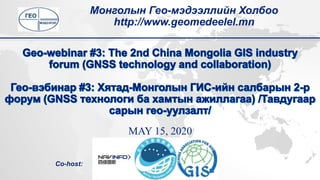
  • 1. MAY 15, 2020 Монголын Гео-мэдээллийн Холбоо http://www.geomedeelel.mn Co-host:
  • 2. MAY 15 1. Remarks: Moderator Jiang Hao, Government affairs department of Navinfo 1. Dr. Yuguo Sun, President of China Association for Geospatial Information Society (CAGIS), (Founder of Navinfo) 2. Hao Wei Na, Director of China Satellite Navigation Office, Academic Exchange Center 3. Introduction of Mongolian Geo-Spatial Association - Dr. B. Bayartungalag, Chairwomen of Mongolian Geo-Spatial Association 2. CORS Application in Mongolia - A.Sumiya, The Agency of Land Administration and Management, Geodesy and Cartography of Mongolia 3. An Introduction of NavInfo - Aimee Jia, Strategic planning department 4. Sixents Technology High Precision Positioning – Mason Li, Solution Manager 5. Location Big Data Promotes ITS – Zhao Jingrun, Manager 6. From 2D to 3D reality capture - Andrei Gorb, Mobile Mapping Segment Product Manager
  • 3. BACKGROUND FACTS • 1,564,000 sq.km • 3,250,000 people • Language: Mongolian • Main religions: Buddhist (53%), Shamanist (3%), Muslims (3%), Christian (2%) • GDP ~4,000$ • HDI 0.741 • Parliament democracy • Government: 13 Ministries, 21 AgenciesSource: NSOPhotos: Alina Reyzelman
  • 4. SPACE TECHNOLOGY IN MONGOLIA • 1965: Space technology and application is started under INTERCOSMOS program • 1970: First Telecommunications satellite data receiving station “ORBIT” • 1970: World meterological satellite data receiving ground station is established /NRSC/ • 1981: J. Gurragchaa, the first cosmonaut of Mongolia the 2nd Asian in the space. • 2017: Mazaalai /CubeSAT/,the first satellite in the space Source: NRSC
  • 6. STRUCTURE OF THE ASSOCIATION BOARD EXECUTE /2/ CEO Secretary MEMBERS Internal audit TECHNICAL COMMISSIONS Principal Advisory* 9 MEMBERS 3 members Photogrammetry and RS GIS Surveyor and GNSS
  • 7. MEMBERS / COMMUNITIES TYPE OF MEMBERS • Student • Regular • Institution • Honorary members* • Advisory
  • 11. GEO-MEETING Knowledge sharing and Networking event 2 presentation about geo-spatial technology and applications Since 2014 8 times/ per year Totally 40
  • 12. GEO-INFORMATICS/ГЕО-МЭДЭЭЛЭЛ/ (ARCHIVES OF GEO-MEETING) • This publication is a peer-reviewed journal for Mongolian geo-spatial, which publishes presentations, reports, news, information and geo-activities of the association. • General requirements: One day the GIS DAY will be printed and distributed. • The final date of the story: August 31, every year; • The number of page sheets is not less than 6 at least 6; • 20 mm from each side of the frame; • Page size: B5; • Editor-in-chief: B.Bayarkthalag, Ph.D: 95113264 • Contact: info@geomedeelel.mn, bayartungalag@geomedeelel.mn
  • 13. GIS DAY Every year since 2014 On average, over 200 specialists, students, and users attend a meeting. Speakers introduce new technologies, their research, new approaches in the geospatial technology. The afternoon event was organized jointly by Mongolian University of Science and Technology, with the support of MonMap LLC. The training was organized by the Geo-Seminar: ArcGIS Pro Software Introduction and Application. / 2018 /
  • 14. GEO-TRAINING/GEO-SEMINAR • Remote sensing: SENTINEL data processing • GIS: ArcGIS Pro • GNSS: GAMIT/GLOBK training
  • 15. GEO-FORUM: APPLICATIONS OF THE GNSS In collaboration with Institute of Astronomy and Geophysics of the Mongolian Academy of Sciences, "Geo- Forum: Applications of the GNSS" was successfully organized on April 17, 2019.
  • 16. RESEARCH/PROJECTS  “A Spatial Distribution Map For Risk Areas Of Forest And Steppe Fire”, Ministry of Nature, Environment and Tourism, 2017;  “SDI Cookbook Published In Mongolian Language”, Global SDI Association’s Small Grant, 2017;  “Establishing an Open Repository and Catalogue for Geospatial Educational Resources”, ISPRS Education and Capacity Building Initiatives 2018; URL: http://isprs.education  Asia-Pacific Space Cooperation Organization (APSCO) International GNSS Monitoring and Assessment” (iGMA) project, Since 2018.
  • 17. 21 ACTIVITIES OF 2020 15 January 19 February 18 March 13-17 April 20 May 4 September October 18 November 16 December Гео-уулзалт Geo-meeting Гео-семинар Geo-workshop Гео-чуулган Geo-forum UN/Mongolia Workshop on the GNSS applications Гео-уулзалт Geo-meeting /GeoBEER/ Гео-уулзалт Geo-meeting /GeoBEER/ Гео-уулзалт Geo-meeting GISday Гео-семинар Geo-workshop