SlideShare a Scribd company logo
1 of 13
Download to read offline
3D LASER SCANNING | 2D SURVEY | 3D MODELLING
OTETELESANU MANOR
G r a d i n a r i , R o m a n i a
3
International Partner Buro S.R.L.
Office:
www.ipartner.ro
office@ipartner.ro
+4 - 0722 998 663
Bucharest, Romania
PhD. Dipl.-Eng. Marian RăDOI
CEO - International Partner Buro S.R.L.
3D Laser Scanning & Survey specialist
Member of ICOMOS Romania
+ 4 - 0766 462 766
marian.radoi@ipartner.ro Otelelesanu Manor - exterior view
2D SURVEY4
3D POINT CLOUD
DIGITAL ORTHOPHOTOS
3D MODEL
360° panoramic view
ONLINE OR OFFLINE WEB PLATFORM
10
10
12
PORTFOLIO12
OTETELESANU MANOR
LOCATION:
Gradinari commune
Giurgiu district, Romania
3D Laser Scanning
Project purpose: 2D survey and 3D model
Built in 1929, Otetelesanu Manor from Gradinari, Giurgiu district,
is nowadays a historical monument. In order for the preservation and
rehabilitation works to be planned, it was decided that a detailed
documentation of the building’s current state was needed.
Taking all these facts into account, the survey has been carried out
using the 3D laser scanning method.
Faster data collection, as compared to conventional methods;
Very low risk of occupational accidents in a highly damaged building;
Non-invasive method of data collection;
Full, authentic and accurate 3D copy of reality, unsurpassed by any other means or method
of measurement;
2D and 3D documentation provided to architects and structural engineers;
Conversion of data into 2D and 3D models compatible with all CAD software;
Detailed mapping of the building’s damages - allows planning preservation and
rehabilitation works, as well as monitoring the intervention over time;
Structural details - complex documentation due to accuracy and large amount of data
collected through 3D laser scanning;
Restoration of complex architectural elements;
Conversion of the laser scans in digital orthophotos;
Perfect alternative to conventional measurement methods for preservation and restoration
of historical monuments.
The advantages of the survey obtained through this innovative measurement technique,
supporting the rehabilitation project of Otetelesanu Manor are:
54
These products are obtained based on
the3D laser scanning and are compatible
to CAD software, often exported as *dwg,
*dxf, *3ds, *pdf files etc.
DELIVERED PRODUCT:
2D SURVEY
Ground floor paln
First floor plan
Basement plan
Attic plan
Roof framing plan
Roof plan
Cross sections
Longitudinal sections
Façades
Advantages of the 2D survey obtained from 3D laser scanning:
Accurate survey, unsurpassed by any other measurement techniques;
Very efficient for historical monuments with no rectangular spaces, where surveying by
conventional means would require time consuming procedures and increased human resources;
Very good quality/cost/time ratio;
No need for returning to the site for additional measurements.
R o o f p l a n Fi r s t f l o o r p l a n C r o s s s e c t i o n
W e s t f a ç a d e
G r o u n d f l o o r p l a n
E a s t f a ç a d e
6
O t e t e l e s a n u M a n o r
3D Laser Scanning
2D survey based on the 3D
point cloud
Ground floor plan
7
98
O t e t e l e s a n u M a n o r
3D Laser Scanning
2D survey based on the 3D
point cloud
Attic plan
1110
O t e t e l e s a n u M a n o r
3D Laser Scanning
2D survey based on the 3D
point cloud
North façade
1312
DELIVERED PRODUCT:
3D MODEL
Exterior 3D volume
Interior 3D model
Roof framing 3D model
These products are obtained based on
the3D laser scanning and are compatible
to CAD software, often exported as *dwg,
*dxf, *3ds, *pdf files etc.
Advantages of the 3D model obtained from 3D laser scanning:
Allows measuring and viewing all architectural elements, even if they may not be
included in the 2D survey;
The 3D model may be used for volume measurements;
The roof framing model is an accurate 3D copy of the roof ’s framework, allowing structural
calculations for consolidation or addition works;
May be used for further editing in order to obtain realistic visualizations.
South-West view
South-East view North-West view - section of the ground floor plan
North-West view - section of the first floor
1514
IPB WebShare platform - interior view
IPB WebShare platform - exterior view
DELIVERED PRODUCT:
360° PANORAMIC
VIEW
ON ONLINE OR OFFLINE
WEB PLATFORM
WebShare online or offline
system for viewing scans
through panoramic views, with
the possibility of measuring
distances.
DELIVERED PRODUCT:
3D POINT CLOUD
DIGITAL
ORTHOPHOTOS
3D Point Cloud - South-East view
Digital orthophoto image obtained from 3D point cloud versus 2D survey
3D point cloud animations;
Simulations with insertion of a
proposed intervention on the
existing site achieved from the
3D point cloud;
Point cloud viewing system,
in free software, allowing
measuring distances and
exporting point clouds.
These products are obtained based on
the3D laser scanning and are compatible
to CAD software, often exported as *dwg,
*dxf, *3ds, *pdf files etc.
Advantages of the point clouds obtained from 3D laser scanning:
Point clouds are a full, authentic and accurate copy of reality, which cannont be obtained
by any other means or method of measurement;
The current state of the historical building can be thoroughly documented, based on the
3D point cloud;
3D point clouds allow exact measurements of distances and areas and they represent the
starting point for the 2D survey and the 3D model.
3D measurements
The general map offers the possibility of measuring distances and surfaces, and the 3D view allows
easy measurement of point-to-point distances.
360° panoramic view - on IPB WebShare platform or by means of free software - Scene LT.
Detailed panoramic display - each panoramic position provides a 360° view, including all the
details recorded.
Acces for authorized users
Authorized users may acces the original 3D data through the download option and may examine
data by using free software SCENE LT.
1716
Oradea Town Hall Palace
Construction year: 1902-1903
Oradea, Romania
- 3D laser scanning
- 2D survey execution - facades
- 2D plans - main entrance building
- Sections - main entrance building
- 2D plans and sections - roof framing
- Point cloud animations
National Museum of Romanian History
Construction year: 1894
Bucharest, Romania
- 3D laser scanning
- Full 2D and 3D survey execution
- Pointcloud and 3D model animations
- Gross building area: 23.551 sqm
- Number of scans performed: 2474
“Calea Eroilor” Monumental Ensemble, Constantin Brancusi
Targu Jiu, Romania
- 3D laser scanning for monitoring the sculptures
- Technical documentation for registering the monumental
ensemble designed by sculptor Constantin Brancusi in the
UNESCO world heritage.
Bucharest National Opera
Construction year: 1954
Bucharest, Romania
- 3D laser scanning
- 2D survey - main foyer and stage area
- 3D modelling of decorative elements
- Point cloud and 3D model animations
- Viewing on IPB WebShare
Bucharest University
building Panduri road, no. 90
Construction year: 1862
Bucharest, Romania
- 3D laser scanning
- 2D survey - facades and roof
- Point cloud animations
- Viewing on IPB WebShare
Eglise St. Nicolas d’Hampigny
Champagne–Ardenne
Aube, Hampigny, France
Construction period: 13th century
- 3D laser scanning
- Full 2D survey execution
- Full 3D model execution
- Point cloud export
Eglise St.-Jean-Baptiste de Villacerf
Regiunea Champagne–Ardenne
Aube, Villacerf, France
Construction period: 12th-16th century
- 3D laser scanning
- Full 2D survey execution
- Full 3D model execution
- Point cloud and 3D model animations
C a t h e d r a l e N o t r e - D a m e d e S t r a s b o u r g
Strasbourg, Alsace, France
Construction period: 1015-1439
- 3D laser scanning
- Point cloud animations
Eglise St. Martin d’Auve
Champagne–Ardenne
Marne, Auve, France
Construction period: 12th-15th century
- 3D laser scanning
- Full 2D survey execution
- Point cloud animations
Eglise de l’Assomption de la Vierge de Landreville
Champagne–Ardenne
Aube, Landreville, France
Construction period: 12th-16th century
- 3D laser scanning
- Full 2D survey execution
- Full 3D model execution
PORTFOLIO
1918
Adorjan I House
Construction year: 1903
Oradea, Romania
- 2D survey execution - facade
- Point cloud animations
- 2D facade superimposed over
orthorectified image obtained from
the 3D point cloud
Residential and commercial building
Construction year: 1903
Oradea, Romania
- 2D survey execution - facade
- Point cloud animations
- 2D facade superimposed over
orthorectified image obtained from the
3D point cloud
Residential and commercial building
Construction year: 1903
Oradea, Romania
- 2D survey execution - facade
- Point cloud animations
- 2D facade superimposed over
orthorectified image obtained from the 3D
point cloud
Residential and commercial building
Construction year: 1904
Oradea, Romania
- 2D survey execution - facade
- Point cloud animations
- 2D facade superimposed over
orthorectified image obtained from
the 3D point cloud
Residential and commercial building
Construction year: 1904
Oradea, Romania
- 2D survey execution - facade
- Point cloud animations
- 2D facade superimposed over
orthorectified image obtained from
the 3D point cloud
Residential and warehouse
building Andrenyi
Construction year: 1893
Oradea, Romania
- 2D survey execution - facade
- Point cloud animations
- 2D facade superimposed over
orthorectified image obtained from
the 3D point cloud
Adorjan II House
Construction year: 1903
Oradea, Romania
- 2D survey execution - facade
- Point cloud animations
- 2D facade superimposed over
orthorectified image obtained from
the 3D point cloud
Moskovits Palace
Construction year: 1905
Oradea, Romania
- 2D survey - facade details 1:20
- 2D plan and sections execution -
roof framing
- Point cloud animations
Rimanoczy
former hotel
and thermae
Year: 1892
Oradea, Romania
- 2D survey - facade
- Point cloud
animations
Rimanoczy Palace
Construction year: 1904 -1905
Oradea, Romania
- 2D survey execution - facade
- Point cloud animations
- 2D facade superimposed over
orthorectified image obtained from the
3D point cloud
Ullman Palace
Construction year: 1912 -1913
Oradea, Romania
- 2D survey execution - facade
- Point cloud animations
- 2D facade superimposed over
orthorectified image
Weiszlovits Lajos House
Construction year: 1910
Oradea, Romania
- 2D survey execution - facade
- Point cloud animations
- 2D facade superimposed over
orthorectified image obtained from
the 3D point cloud
Klobusiczky Palace
Construction year: 1925
Oradea, Romania
- 2D survey execution - facade
- Point cloud animations
- 2D facade superimposed over
orthorectified image
Apollo Palace
Construction year: 1912
Oradea, Romania
- 2D survey execution - facade
- 2D facade superimposed over orthorectified image
obtained from the 3D point cloud
- Point cloud animations
PORTFOLIO
2120
Otetelesanu Manor
Anul constructiei: 1929
Gradinari, Giurgiu county, Romania
- 3D laser scanning
- Full 2D survey
- Full 3D model
- Point cloud and 3D model animations
Mihai Viteazul
statue
Year: 1994
Oradea, Romania
- 3D laser scanning
- Po i n t c l o u d
a n i m a t i o n s
Historical buildings
roof framings
Targu Jiu, Romania
- 3D laser scanning
- 2D survey - roof framing
- 3D model - roof framing
- Point cloud and 3D
model animations
Moorish Hall in the Administrative Pallace
of Targu Jiu
Targu Jiu, Romania
- 3D laser scanning
- Point cloud animations
Great Synagogue of Iasi
Construction year: 1657-1671
Iasi, Romania
- 3D laser scanning
- Full 2D and 3D survey execution
- 2D facades superimposed over orthorectified image
- Point cloud and 3D model animations
Inter-war house
Braila, Romania
- 3D laser scanning
- 2D survey execution - facade
- Point cloud animations
Bucharest Shop
Construction year: 1929
Bucharest, Romania
- 3D laser scanning
- Full 2D survey
- Full 3D model (BIM-ready)
- Point cloud and 3D model
animations
House, Primaverii street
Bucharest, Romania
- 3D laser scanning
- 2D survey - facades
- 2D facades superimposed
over orthorectified image
obtained from the 3D point
cloud
- Point cloud animations
Mina Minovici Villa
Construction year: 1905
Bucharest, Romania
- 3D laser scanning
- 2D survey - roof
- 3D model - roof
- Point cloud and 3D model
animations
Inter-war house
Bucharest, Romania
- 3D laser scanning
- Full 2D and 3D survey execution
- Point cloud and 3D model animations
“Unirea Sfanta” Temple
History Museum of the Jewish Community
in Romania
Construction year: 1836
Bucharest, Romania
- 3D laser scanning
- Full 2D survey execution
- 2D facades superimposed over orthorectified
image obtained from the 3D point cloud
- Full 3D model execution
- Point cloud and 3D model animations
PORTFOLIO
22
C O N T A C T
Y O U R N U M B E R 1 O P T I O N
I N 3 D L A S E R S C A N N I N G
Merghindeal fortified church
Construction period: 13th century
Sibiu county, Romania
Windmill
Patrimony of the National Museum of the
Romanian Peasant, Bucharest, Romania
“Sf. Nicolae din Bejan” wooden church
Construction period: 18th century
Patrimony of the National Museum of the
Romanian Peasant, Bucharest, Romania
“Intampinarea Domnului”
wooden church
Grosii Noi, Arad, Romania
Construction year: 1807
Patrimony of the National
Museum of the Romanian
Peasant, Bucharest, Romania
“Adormirea Maicii Domnului” wooden church
Lunca Motilor, Hunedoara, Romania
Construction period: 17th century
Patrimony of the National Museum of the Romanian
Peasant, Bucharest, Romania
“Intrarea Maicii Domnului in biserica”
wooden church
Julita, Hunedoara, Romania
Construction period: 1787
Patrimony of the National Museum of the
Romanian Peasant, Bucharest, Romania
“Sfintii Trei Ierarhi” wooden church
Troas, Arad, Romania
Construction period: 1782
Patrimony of the National Museum of the
Romanian Peasant, Bucharest, Romania
“House within house” - wooden house
Patrimony of the National
Museum of the Romanian Peasant,
Bucharest, Romania
PhD Dipl.-Eng. Marian RADOI
CEO - International Partner Buro S.R.L.
3D Laser Scanning & Survey specialist
Member of ICOMOS Romania
International Council of Monuments and Sites
+ 4 - 0766 462 766
marian.radoi@ipartner.ro
OFFICE:
www.ipartner.ro
office@ipartner.ro
+ 4 - 0722 998 663
/ScanareLaser3D
/ipartner.ro
Bucharest, Romania
* International Partner Buro provides 3D laser scanning
services globally.
PORTFOLIO
3DLASERSCANNING
UAVFOTOGRAMMETRY
S U R V E Y
BIM
G I S
ARCHITECTURAL SURVEY
CONSTRUCTION SURVEY
ENGINEERING SURVEY
LAND SURVEY
3DBUILDINGMODELLLING
3DTERRAINMODELLING
2DDRAWINGS
CADASTRE
LANDREGISTRATION
www.ipartner.ro

More Related Content

Similar to en_project_survey_3d_laser_scanning_otetelesanu_manor_house

3DELING-red-24str-1-
3DELING-red-24str-1-3DELING-red-24str-1-
3DELING-red-24str-1-Marek Bascik
 
3DELING-color-small
3DELING-color-small3DELING-color-small
3DELING-color-smallPawel Dudek
 
Laser Scanning SOQ.PDF
Laser Scanning SOQ.PDFLaser Scanning SOQ.PDF
Laser Scanning SOQ.PDFVenugopal Raju
 
2012-09-13_Multiconsult and WSP European Task Force_BIM in infrastructure
2012-09-13_Multiconsult and WSP European Task Force_BIM in infrastructure2012-09-13_Multiconsult and WSP European Task Force_BIM in infrastructure
2012-09-13_Multiconsult and WSP European Task Force_BIM in infrastructureÅge Langedrag
 
SJ Geomatics Brochure
SJ Geomatics BrochureSJ Geomatics Brochure
SJ Geomatics BrochureSteve Jones
 
3D Laser Scanning for Oil & Gas Facilities
3D Laser Scanning for Oil & Gas Facilities3D Laser Scanning for Oil & Gas Facilities
3D Laser Scanning for Oil & Gas FacilitiesYasser Eldegwy
 
Anil Kumar_profile
Anil Kumar_profileAnil Kumar_profile
Anil Kumar_profileAnil Kumar L
 
R2 d introduction 3d laser scanning infrastructure 2014
R2 d introduction 3d laser scanning infrastructure 2014R2 d introduction 3d laser scanning infrastructure 2014
R2 d introduction 3d laser scanning infrastructure 2014Steven Couwels
 
KOHI Laser scanning 3 d modeling presentation
KOHI Laser scanning 3 d modeling presentationKOHI Laser scanning 3 d modeling presentation
KOHI Laser scanning 3 d modeling presentationBlessing .A. Sydney
 
2012 02-08 autodesk infrastructure event in stockholm-multiconsult projects
2012 02-08 autodesk infrastructure event in stockholm-multiconsult projects2012 02-08 autodesk infrastructure event in stockholm-multiconsult projects
2012 02-08 autodesk infrastructure event in stockholm-multiconsult projectsÅge Langedrag
 
Mason-Iowa-University-.ppt
Mason-Iowa-University-.pptMason-Iowa-University-.ppt
Mason-Iowa-University-.pptRaviShenker1
 

Similar to en_project_survey_3d_laser_scanning_otetelesanu_manor_house (20)

Instalatii_petroliere_02_EN
Instalatii_petroliere_02_ENInstalatii_petroliere_02_EN
Instalatii_petroliere_02_EN
 
Instalatii_petroliere_08_EN
Instalatii_petroliere_08_ENInstalatii_petroliere_08_EN
Instalatii_petroliere_08_EN
 
Instalatii_petroliere_01_EN
Instalatii_petroliere_01_ENInstalatii_petroliere_01_EN
Instalatii_petroliere_01_EN
 
Instalatii_petroliere_07_EN
Instalatii_petroliere_07_ENInstalatii_petroliere_07_EN
Instalatii_petroliere_07_EN
 
3D Laser Scaning FPSO Mystras
3D Laser Scaning FPSO Mystras3D Laser Scaning FPSO Mystras
3D Laser Scaning FPSO Mystras
 
3D Laser Scaning FPSO Mystras
3D Laser Scaning FPSO Mystras3D Laser Scaning FPSO Mystras
3D Laser Scaning FPSO Mystras
 
Instalatii_petroliere_03_EN
Instalatii_petroliere_03_ENInstalatii_petroliere_03_EN
Instalatii_petroliere_03_EN
 
3DELING-red-24str-1-
3DELING-red-24str-1-3DELING-red-24str-1-
3DELING-red-24str-1-
 
3DELING-color-small
3DELING-color-small3DELING-color-small
3DELING-color-small
 
3D Laser Scanning FPSO Mystras
3D Laser Scanning FPSO Mystras3D Laser Scanning FPSO Mystras
3D Laser Scanning FPSO Mystras
 
Laser Scanning SOQ.PDF
Laser Scanning SOQ.PDFLaser Scanning SOQ.PDF
Laser Scanning SOQ.PDF
 
2012-09-13_Multiconsult and WSP European Task Force_BIM in infrastructure
2012-09-13_Multiconsult and WSP European Task Force_BIM in infrastructure2012-09-13_Multiconsult and WSP European Task Force_BIM in infrastructure
2012-09-13_Multiconsult and WSP European Task Force_BIM in infrastructure
 
SJ Geomatics Brochure
SJ Geomatics BrochureSJ Geomatics Brochure
SJ Geomatics Brochure
 
3D Laser Scanning for Oil & Gas Facilities
3D Laser Scanning for Oil & Gas Facilities3D Laser Scanning for Oil & Gas Facilities
3D Laser Scanning for Oil & Gas Facilities
 
Anil Kumar_profile
Anil Kumar_profileAnil Kumar_profile
Anil Kumar_profile
 
R2 d introduction 3d laser scanning infrastructure 2014
R2 d introduction 3d laser scanning infrastructure 2014R2 d introduction 3d laser scanning infrastructure 2014
R2 d introduction 3d laser scanning infrastructure 2014
 
Laser Scanning: The Future Trend
Laser Scanning: The Future TrendLaser Scanning: The Future Trend
Laser Scanning: The Future Trend
 
KOHI Laser scanning 3 d modeling presentation
KOHI Laser scanning 3 d modeling presentationKOHI Laser scanning 3 d modeling presentation
KOHI Laser scanning 3 d modeling presentation
 
2012 02-08 autodesk infrastructure event in stockholm-multiconsult projects
2012 02-08 autodesk infrastructure event in stockholm-multiconsult projects2012 02-08 autodesk infrastructure event in stockholm-multiconsult projects
2012 02-08 autodesk infrastructure event in stockholm-multiconsult projects
 
Mason-Iowa-University-.ppt
Mason-Iowa-University-.pptMason-Iowa-University-.ppt
Mason-Iowa-University-.ppt
 

en_project_survey_3d_laser_scanning_otetelesanu_manor_house

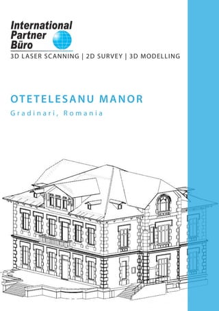
  • 1. 3D LASER SCANNING | 2D SURVEY | 3D MODELLING OTETELESANU MANOR G r a d i n a r i , R o m a n i a
  • 2. 3 International Partner Buro S.R.L. Office: www.ipartner.ro office@ipartner.ro +4 - 0722 998 663 Bucharest, Romania PhD. Dipl.-Eng. Marian RăDOI CEO - International Partner Buro S.R.L. 3D Laser Scanning & Survey specialist Member of ICOMOS Romania + 4 - 0766 462 766 marian.radoi@ipartner.ro Otelelesanu Manor - exterior view 2D SURVEY4 3D POINT CLOUD DIGITAL ORTHOPHOTOS 3D MODEL 360° panoramic view ONLINE OR OFFLINE WEB PLATFORM 10 10 12 PORTFOLIO12 OTETELESANU MANOR LOCATION: Gradinari commune Giurgiu district, Romania 3D Laser Scanning Project purpose: 2D survey and 3D model Built in 1929, Otetelesanu Manor from Gradinari, Giurgiu district, is nowadays a historical monument. In order for the preservation and rehabilitation works to be planned, it was decided that a detailed documentation of the building’s current state was needed. Taking all these facts into account, the survey has been carried out using the 3D laser scanning method. Faster data collection, as compared to conventional methods; Very low risk of occupational accidents in a highly damaged building; Non-invasive method of data collection; Full, authentic and accurate 3D copy of reality, unsurpassed by any other means or method of measurement; 2D and 3D documentation provided to architects and structural engineers; Conversion of data into 2D and 3D models compatible with all CAD software; Detailed mapping of the building’s damages - allows planning preservation and rehabilitation works, as well as monitoring the intervention over time; Structural details - complex documentation due to accuracy and large amount of data collected through 3D laser scanning; Restoration of complex architectural elements; Conversion of the laser scans in digital orthophotos; Perfect alternative to conventional measurement methods for preservation and restoration of historical monuments. The advantages of the survey obtained through this innovative measurement technique, supporting the rehabilitation project of Otetelesanu Manor are:
  • 3. 54 These products are obtained based on the3D laser scanning and are compatible to CAD software, often exported as *dwg, *dxf, *3ds, *pdf files etc. DELIVERED PRODUCT: 2D SURVEY Ground floor paln First floor plan Basement plan Attic plan Roof framing plan Roof plan Cross sections Longitudinal sections Façades Advantages of the 2D survey obtained from 3D laser scanning: Accurate survey, unsurpassed by any other measurement techniques; Very efficient for historical monuments with no rectangular spaces, where surveying by conventional means would require time consuming procedures and increased human resources; Very good quality/cost/time ratio; No need for returning to the site for additional measurements. R o o f p l a n Fi r s t f l o o r p l a n C r o s s s e c t i o n W e s t f a ç a d e G r o u n d f l o o r p l a n E a s t f a ç a d e
  • 4. 6 O t e t e l e s a n u M a n o r 3D Laser Scanning 2D survey based on the 3D point cloud Ground floor plan 7
  • 5. 98 O t e t e l e s a n u M a n o r 3D Laser Scanning 2D survey based on the 3D point cloud Attic plan
  • 6. 1110 O t e t e l e s a n u M a n o r 3D Laser Scanning 2D survey based on the 3D point cloud North façade
  • 7. 1312 DELIVERED PRODUCT: 3D MODEL Exterior 3D volume Interior 3D model Roof framing 3D model These products are obtained based on the3D laser scanning and are compatible to CAD software, often exported as *dwg, *dxf, *3ds, *pdf files etc. Advantages of the 3D model obtained from 3D laser scanning: Allows measuring and viewing all architectural elements, even if they may not be included in the 2D survey; The 3D model may be used for volume measurements; The roof framing model is an accurate 3D copy of the roof ’s framework, allowing structural calculations for consolidation or addition works; May be used for further editing in order to obtain realistic visualizations. South-West view South-East view North-West view - section of the ground floor plan North-West view - section of the first floor
  • 8. 1514 IPB WebShare platform - interior view IPB WebShare platform - exterior view DELIVERED PRODUCT: 360° PANORAMIC VIEW ON ONLINE OR OFFLINE WEB PLATFORM WebShare online or offline system for viewing scans through panoramic views, with the possibility of measuring distances. DELIVERED PRODUCT: 3D POINT CLOUD DIGITAL ORTHOPHOTOS 3D Point Cloud - South-East view Digital orthophoto image obtained from 3D point cloud versus 2D survey 3D point cloud animations; Simulations with insertion of a proposed intervention on the existing site achieved from the 3D point cloud; Point cloud viewing system, in free software, allowing measuring distances and exporting point clouds. These products are obtained based on the3D laser scanning and are compatible to CAD software, often exported as *dwg, *dxf, *3ds, *pdf files etc. Advantages of the point clouds obtained from 3D laser scanning: Point clouds are a full, authentic and accurate copy of reality, which cannont be obtained by any other means or method of measurement; The current state of the historical building can be thoroughly documented, based on the 3D point cloud; 3D point clouds allow exact measurements of distances and areas and they represent the starting point for the 2D survey and the 3D model. 3D measurements The general map offers the possibility of measuring distances and surfaces, and the 3D view allows easy measurement of point-to-point distances. 360° panoramic view - on IPB WebShare platform or by means of free software - Scene LT. Detailed panoramic display - each panoramic position provides a 360° view, including all the details recorded. Acces for authorized users Authorized users may acces the original 3D data through the download option and may examine data by using free software SCENE LT.
  • 9. 1716 Oradea Town Hall Palace Construction year: 1902-1903 Oradea, Romania - 3D laser scanning - 2D survey execution - facades - 2D plans - main entrance building - Sections - main entrance building - 2D plans and sections - roof framing - Point cloud animations National Museum of Romanian History Construction year: 1894 Bucharest, Romania - 3D laser scanning - Full 2D and 3D survey execution - Pointcloud and 3D model animations - Gross building area: 23.551 sqm - Number of scans performed: 2474 “Calea Eroilor” Monumental Ensemble, Constantin Brancusi Targu Jiu, Romania - 3D laser scanning for monitoring the sculptures - Technical documentation for registering the monumental ensemble designed by sculptor Constantin Brancusi in the UNESCO world heritage. Bucharest National Opera Construction year: 1954 Bucharest, Romania - 3D laser scanning - 2D survey - main foyer and stage area - 3D modelling of decorative elements - Point cloud and 3D model animations - Viewing on IPB WebShare Bucharest University building Panduri road, no. 90 Construction year: 1862 Bucharest, Romania - 3D laser scanning - 2D survey - facades and roof - Point cloud animations - Viewing on IPB WebShare Eglise St. Nicolas d’Hampigny Champagne–Ardenne Aube, Hampigny, France Construction period: 13th century - 3D laser scanning - Full 2D survey execution - Full 3D model execution - Point cloud export Eglise St.-Jean-Baptiste de Villacerf Regiunea Champagne–Ardenne Aube, Villacerf, France Construction period: 12th-16th century - 3D laser scanning - Full 2D survey execution - Full 3D model execution - Point cloud and 3D model animations C a t h e d r a l e N o t r e - D a m e d e S t r a s b o u r g Strasbourg, Alsace, France Construction period: 1015-1439 - 3D laser scanning - Point cloud animations Eglise St. Martin d’Auve Champagne–Ardenne Marne, Auve, France Construction period: 12th-15th century - 3D laser scanning - Full 2D survey execution - Point cloud animations Eglise de l’Assomption de la Vierge de Landreville Champagne–Ardenne Aube, Landreville, France Construction period: 12th-16th century - 3D laser scanning - Full 2D survey execution - Full 3D model execution PORTFOLIO
  • 10. 1918 Adorjan I House Construction year: 1903 Oradea, Romania - 2D survey execution - facade - Point cloud animations - 2D facade superimposed over orthorectified image obtained from the 3D point cloud Residential and commercial building Construction year: 1903 Oradea, Romania - 2D survey execution - facade - Point cloud animations - 2D facade superimposed over orthorectified image obtained from the 3D point cloud Residential and commercial building Construction year: 1903 Oradea, Romania - 2D survey execution - facade - Point cloud animations - 2D facade superimposed over orthorectified image obtained from the 3D point cloud Residential and commercial building Construction year: 1904 Oradea, Romania - 2D survey execution - facade - Point cloud animations - 2D facade superimposed over orthorectified image obtained from the 3D point cloud Residential and commercial building Construction year: 1904 Oradea, Romania - 2D survey execution - facade - Point cloud animations - 2D facade superimposed over orthorectified image obtained from the 3D point cloud Residential and warehouse building Andrenyi Construction year: 1893 Oradea, Romania - 2D survey execution - facade - Point cloud animations - 2D facade superimposed over orthorectified image obtained from the 3D point cloud Adorjan II House Construction year: 1903 Oradea, Romania - 2D survey execution - facade - Point cloud animations - 2D facade superimposed over orthorectified image obtained from the 3D point cloud Moskovits Palace Construction year: 1905 Oradea, Romania - 2D survey - facade details 1:20 - 2D plan and sections execution - roof framing - Point cloud animations Rimanoczy former hotel and thermae Year: 1892 Oradea, Romania - 2D survey - facade - Point cloud animations Rimanoczy Palace Construction year: 1904 -1905 Oradea, Romania - 2D survey execution - facade - Point cloud animations - 2D facade superimposed over orthorectified image obtained from the 3D point cloud Ullman Palace Construction year: 1912 -1913 Oradea, Romania - 2D survey execution - facade - Point cloud animations - 2D facade superimposed over orthorectified image Weiszlovits Lajos House Construction year: 1910 Oradea, Romania - 2D survey execution - facade - Point cloud animations - 2D facade superimposed over orthorectified image obtained from the 3D point cloud Klobusiczky Palace Construction year: 1925 Oradea, Romania - 2D survey execution - facade - Point cloud animations - 2D facade superimposed over orthorectified image Apollo Palace Construction year: 1912 Oradea, Romania - 2D survey execution - facade - 2D facade superimposed over orthorectified image obtained from the 3D point cloud - Point cloud animations PORTFOLIO
  • 11. 2120 Otetelesanu Manor Anul constructiei: 1929 Gradinari, Giurgiu county, Romania - 3D laser scanning - Full 2D survey - Full 3D model - Point cloud and 3D model animations Mihai Viteazul statue Year: 1994 Oradea, Romania - 3D laser scanning - Po i n t c l o u d a n i m a t i o n s Historical buildings roof framings Targu Jiu, Romania - 3D laser scanning - 2D survey - roof framing - 3D model - roof framing - Point cloud and 3D model animations Moorish Hall in the Administrative Pallace of Targu Jiu Targu Jiu, Romania - 3D laser scanning - Point cloud animations Great Synagogue of Iasi Construction year: 1657-1671 Iasi, Romania - 3D laser scanning - Full 2D and 3D survey execution - 2D facades superimposed over orthorectified image - Point cloud and 3D model animations Inter-war house Braila, Romania - 3D laser scanning - 2D survey execution - facade - Point cloud animations Bucharest Shop Construction year: 1929 Bucharest, Romania - 3D laser scanning - Full 2D survey - Full 3D model (BIM-ready) - Point cloud and 3D model animations House, Primaverii street Bucharest, Romania - 3D laser scanning - 2D survey - facades - 2D facades superimposed over orthorectified image obtained from the 3D point cloud - Point cloud animations Mina Minovici Villa Construction year: 1905 Bucharest, Romania - 3D laser scanning - 2D survey - roof - 3D model - roof - Point cloud and 3D model animations Inter-war house Bucharest, Romania - 3D laser scanning - Full 2D and 3D survey execution - Point cloud and 3D model animations “Unirea Sfanta” Temple History Museum of the Jewish Community in Romania Construction year: 1836 Bucharest, Romania - 3D laser scanning - Full 2D survey execution - 2D facades superimposed over orthorectified image obtained from the 3D point cloud - Full 3D model execution - Point cloud and 3D model animations PORTFOLIO
  • 12. 22 C O N T A C T Y O U R N U M B E R 1 O P T I O N I N 3 D L A S E R S C A N N I N G Merghindeal fortified church Construction period: 13th century Sibiu county, Romania Windmill Patrimony of the National Museum of the Romanian Peasant, Bucharest, Romania “Sf. Nicolae din Bejan” wooden church Construction period: 18th century Patrimony of the National Museum of the Romanian Peasant, Bucharest, Romania “Intampinarea Domnului” wooden church Grosii Noi, Arad, Romania Construction year: 1807 Patrimony of the National Museum of the Romanian Peasant, Bucharest, Romania “Adormirea Maicii Domnului” wooden church Lunca Motilor, Hunedoara, Romania Construction period: 17th century Patrimony of the National Museum of the Romanian Peasant, Bucharest, Romania “Intrarea Maicii Domnului in biserica” wooden church Julita, Hunedoara, Romania Construction period: 1787 Patrimony of the National Museum of the Romanian Peasant, Bucharest, Romania “Sfintii Trei Ierarhi” wooden church Troas, Arad, Romania Construction period: 1782 Patrimony of the National Museum of the Romanian Peasant, Bucharest, Romania “House within house” - wooden house Patrimony of the National Museum of the Romanian Peasant, Bucharest, Romania PhD Dipl.-Eng. Marian RADOI CEO - International Partner Buro S.R.L. 3D Laser Scanning & Survey specialist Member of ICOMOS Romania International Council of Monuments and Sites + 4 - 0766 462 766 marian.radoi@ipartner.ro OFFICE: www.ipartner.ro office@ipartner.ro + 4 - 0722 998 663 /ScanareLaser3D /ipartner.ro Bucharest, Romania * International Partner Buro provides 3D laser scanning services globally. PORTFOLIO
  • 13. 3DLASERSCANNING UAVFOTOGRAMMETRY S U R V E Y BIM G I S ARCHITECTURAL SURVEY CONSTRUCTION SURVEY ENGINEERING SURVEY LAND SURVEY 3DBUILDINGMODELLLING 3DTERRAINMODELLING 2DDRAWINGS CADASTRE LANDREGISTRATION www.ipartner.ro