SlideShare a Scribd company logo
1 of 7
Download to read offline
3D LASER SCANNING | 3D MODELLING
O I L I N S T A L L A T I O N S
R o m a n i a , E u r o p e a n U n i o n
1
O I L I N S TA L L AT I O N S
LOCATION:
Romania, European Union
NUMBER OF SCANS:
57 scans
PROJECT TERM:
1 week
Overview image of the objective
Short time of data acquisition and low cost, compared to other measurement technologies;
Very low risk of work accidents during the laser scanning process, as the laser can be operated
from a distance in dangerous environments;
Comparisons between the existing infrastructure and designed installations can be made much easier;
Complete, authentic and accurate 3D copy of reality, which cannot be obtained through any
other means or method of measurement;
Data can be captured on site and processed at the office, with various degrees of detail for
future design - for example in CAD applications;
Access to data can be done in real-time or after the processing, constraint and georeferencing
techniques;
High level of detail of acquired data, very useful for generating the 3D models;
Complete and complex method - millions, even billions of points result following the scanning
process, representing the position of all objects in the scanned area and there is no need for
additional visits on the site;
The result is a 3D representation of objects, which can be delivered fast, efficiently and accurately.
3D Laser Scanning | 3D Modelling
Compatibility with CAD - PDS - PDMS software
Taking in account the complexity of the pipes lines, the heights and
the limited access to interest elements, the traditional data collection
method in the field would have been difficult.
Therefore, the 3D laser scanning technology has been selected, in
order to obtain a complete and accurate 3D copy of the reality.
The final products provide the compatibility of the point clouds
obtained after scanning with specialized software (LFM Server, AVEVA
PDMS 3D si INTERGRAPH PDS). Also, the 3D products obtained following
the modeling based on point clouds are compatible with varioud CAD
software (AVEVA PDMS 3D and INTERGRAPH PDS).
Advantages of using the 3D laser scanning for oil installations:
3D POINT CLOUD
3D MODEL
360° PANORAMIC VIEW
ONLINE OR OFFLINE WEB PLATFORM
PORTFOLIO
2
4
6
8
International Partner Buro S.R.L.
Office:
www.ipartner.ro
office@ipartner.ro
+4 - 0722 998 663
Bucharest, Romania
PhD. Dipl.-Eng. Marian RăDOI
CEO - International Partner Buro S.R.L.
3D Laser Scanning & Surveying specialist
+ 4 - 0766 462 766
marian.radoi@ipartner.ro
2 3
Image during the scanning process 3D point cloud
3D point cloud - detail
3D point cloud - overview image
DELIVERED PRODUCT:
3D POINT CLOUD
Following the 3D laser scanning
there results a collection of
data called “point cloud”; its
location in space is known in a
3D coordinate system.
The 3D point clouds are
compatible with specific
software such as: LFM Server,
AVEVA PDMS 3D, INTERGRAPH
PDS etc.
Advantages of the point cloud obtained from the 3D laser scanning:
Point clouds are a complete, authentic and accurate 3D copy of reality, which cannot be obtained
through any other means or method of measurement;
A detailed study of the current state of equipments and installations can be carried out based
on 3D point clouds;
3D point clouds allow exact measurements of distances and areas and they are the starting
point in the process of 3D modelling.
4 5
DELIVERED PRODUCT:
3D MODEL
3D solid model detail - interior installation
3D model - overview image 3D solid model details
3D CAD models obtained
based on the point cloud are
compatible to CAD software
such as AVEVA PDMS 3D,
INTERGRAPH PDS etc.
The models are compatible and
can be used in a many software
due to the various formats
under which they are delivered:
.sat, .dwg, .dxf, .obj, .sat, .stl,
.fbx, .dae, .3ds, .dwf, .dgn.
Model 3D solid - instalatie
6 7
360° panoramic view - exterior image from Scene LT View from IPB WebShare platform
View from IPB WebShare platform
DELIVERED PRODUCT:
360° PANORAMIC
VIEW
ONLINE OR OFFLINE
WEB PLATFORM
WebShare online or offline
system for viewing scans
through panoramic views,
with the possibility of
measuring distances.
IPB WebShare is an online or offline web platform which provides
the user with the advantage of being an integrating part of a
virtual tour of the scanned area. No matter where the client is,
with an internet connection, he is able to visualize the project and
download the necessary data.
3D measurements
The general map offers the possibility of measuring distances and
surfaces, and the 3D view allows easy measurement of point-to-
point distances.
360° panoramic view
HD panoramic images on IPB WebShare platform or by means of free
software Scene LT.
Detailed panoramic display
Each panoramic position provides a 360° view, including all the
details recorded.
Acces for authorised users
Authorized users may acces the original 3D data through the
download option and may examine data by using free software
SCENE LT.
Advantages of using the IPB WebShare platform:
Instant access to the data obtained through 3D laser scanning;
Fast decisional factor and efficient collaboration;
Increased possibility to interpret the data, investigations and data attachement;
Multiuser possibility;
Reducing the number of visits on the scanned site.
8
PORTFOLIO
E X E C U T E D W O R K S :
■■ North trestle
■■ South trestle
■■ Tank steaming ramp CF
■■ Crude oil unloading ramp SA 25
■■ Gasoline unloading ramp
■■ Preheating crude oil RTC
■■ Truck check up ramp
■■ Liquid products automatic ramp
■■ LPG loading in CF tanks automatic ramp, no. 216 C
■■ White products unloading from broken tanks ramp no.216
■■ Tank trucks loading P1 ramp
■■ Oil Products Delivery Commercial Section ramp
■■ LPG tank truck ramp
■■ Crude oil ramp
■■ DRB Flare
■■ Old Flare Refinery
■■ DRB softening (DAPAC)
■■ Petrochemistry softening
■■ Refinery water filters
■■ RCI recirculated water station
■■ CC recirculated water station
■■ Refinery chemical station
■■ Brazi Colony thermical station
■■ DRB thermical station
■■ Refinery thermical station, zone 37
■■ No.2 condensation water station - DRB
■■ No.3 condensation water station
■■ No.1 condensation water station
■■ Hamon Tower
■■ Compressor station for producing compressed air - Atlas
Copco
■■ Regulation station for methane gas
■■ Methane gas distribution Colony - Gate no.3
■■ Boosting station
■■ 31 Areas
C O N T A C T
Y O U R N U M B E R 1 O P T I O N
I N 3 D L A S E R S C A N N I N G
PhD Dipl.-Eng. Marian RADOI
CEO - International Partner Buro S.R.L.
3D Laser Scanning & Survey specialist
+ 4 - 0766 462 766
marian.radoi@ipartner.ro
OFFICE:
www.ipartner.ro
office@ipartner.ro
+ 4 - 0722 998 663
/ScanareLaser3D
/ipartner.ro
Bucharest, Romania
* International Partner Buro provides 3D laser scanning
services globally.
3DLASERSCANNING
UAVFOTOGRAMMETRY
S U R V E Y
BIM
G I S
ARCHITECTURAL SURVEY
CONSTRUCTION SURVEY
ENGINEERING SURVEY
LAND SURVEY
3DBUILDINGMODELLLING
3DTERRAINMODELLING
2DDRAWINGS
CADASTRE
LANDREGISTRATION
www.ipartner.ro

More Related Content

Similar to 3D LASER SCANNING OF OIL INSTALLATIONS

3D Laser Scanning for Oil & Gas Facilities
3D Laser Scanning for Oil & Gas Facilities3D Laser Scanning for Oil & Gas Facilities
3D Laser Scanning for Oil & Gas FacilitiesYasser Eldegwy
 
3DELING-red-24str-1-
3DELING-red-24str-1-3DELING-red-24str-1-
3DELING-red-24str-1-Marek Bascik
 
en_project_survey_3d_laser_scanning_otetelesanu_manor_house
en_project_survey_3d_laser_scanning_otetelesanu_manor_houseen_project_survey_3d_laser_scanning_otetelesanu_manor_house
en_project_survey_3d_laser_scanning_otetelesanu_manor_houseMarian Radoi / 3D Laser Scanning
 
EXPERIENCE DURING ' AS-BUILT ' SERVICES IN INDUSTRIAL PROJECT USING LASER 3D ...
EXPERIENCE DURING ' AS-BUILT ' SERVICES IN INDUSTRIAL PROJECT USING LASER 3D ...EXPERIENCE DURING ' AS-BUILT ' SERVICES IN INDUSTRIAL PROJECT USING LASER 3D ...
EXPERIENCE DURING ' AS-BUILT ' SERVICES IN INDUSTRIAL PROJECT USING LASER 3D ...Behzad Katirachi
 
Photogrammetry Demo
Photogrammetry DemoPhotogrammetry Demo
Photogrammetry DemoWebs Now
 
KOHI Laser scanning 3 d modeling presentation
KOHI Laser scanning 3 d modeling presentationKOHI Laser scanning 3 d modeling presentation
KOHI Laser scanning 3 d modeling presentationBlessing .A. Sydney
 
New ScanStation Portfolio Intro
New ScanStation Portfolio IntroNew ScanStation Portfolio Intro
New ScanStation Portfolio IntroGreg Dolphin
 
DDI Dense Point Cloud Processing Presentation Oct2009
DDI Dense Point Cloud Processing Presentation Oct2009DDI Dense Point Cloud Processing Presentation Oct2009
DDI Dense Point Cloud Processing Presentation Oct2009Direct Dimensions, Inc.
 
DDI Dense Point Cloud Processing Presentation Oct 2009
DDI Dense Point Cloud Processing Presentation Oct 2009DDI Dense Point Cloud Processing Presentation Oct 2009
DDI Dense Point Cloud Processing Presentation Oct 2009Direct Dimensions, Inc.
 
Six D India Technical Detail
Six D India Technical DetailSix D India Technical Detail
Six D India Technical DetailSangiba Sangiba
 
Laser Scanning SOQ.PDF
Laser Scanning SOQ.PDFLaser Scanning SOQ.PDF
Laser Scanning SOQ.PDFVenugopal Raju
 
bro_geoslam-introduction.pdf
bro_geoslam-introduction.pdfbro_geoslam-introduction.pdf
bro_geoslam-introduction.pdfYoussefZghari
 

Similar to 3D LASER SCANNING OF OIL INSTALLATIONS (20)

EN_3DLS_Oil_Gas_Offshore
EN_3DLS_Oil_Gas_OffshoreEN_3DLS_Oil_Gas_Offshore
EN_3DLS_Oil_Gas_Offshore
 
3D Laser Scaning FPSO Mystras
3D Laser Scaning FPSO Mystras3D Laser Scaning FPSO Mystras
3D Laser Scaning FPSO Mystras
 
3D Laser Scaning FPSO Mystras
3D Laser Scaning FPSO Mystras3D Laser Scaning FPSO Mystras
3D Laser Scaning FPSO Mystras
 
3D Laser Scanning FPSO Mystras
3D Laser Scanning FPSO Mystras3D Laser Scanning FPSO Mystras
3D Laser Scanning FPSO Mystras
 
industrial_shed_en
industrial_shed_enindustrial_shed_en
industrial_shed_en
 
Eglise d'Hampigny EN
Eglise d'Hampigny ENEglise d'Hampigny EN
Eglise d'Hampigny EN
 
MNIR EN
MNIR ENMNIR EN
MNIR EN
 
3D Laser Scanning for Oil & Gas Facilities
3D Laser Scanning for Oil & Gas Facilities3D Laser Scanning for Oil & Gas Facilities
3D Laser Scanning for Oil & Gas Facilities
 
Vopak 3D Mapping
Vopak 3D MappingVopak 3D Mapping
Vopak 3D Mapping
 
3DELING-red-24str-1-
3DELING-red-24str-1-3DELING-red-24str-1-
3DELING-red-24str-1-
 
en_project_survey_3d_laser_scanning_otetelesanu_manor_house
en_project_survey_3d_laser_scanning_otetelesanu_manor_houseen_project_survey_3d_laser_scanning_otetelesanu_manor_house
en_project_survey_3d_laser_scanning_otetelesanu_manor_house
 
EXPERIENCE DURING ' AS-BUILT ' SERVICES IN INDUSTRIAL PROJECT USING LASER 3D ...
EXPERIENCE DURING ' AS-BUILT ' SERVICES IN INDUSTRIAL PROJECT USING LASER 3D ...EXPERIENCE DURING ' AS-BUILT ' SERVICES IN INDUSTRIAL PROJECT USING LASER 3D ...
EXPERIENCE DURING ' AS-BUILT ' SERVICES IN INDUSTRIAL PROJECT USING LASER 3D ...
 
Photogrammetry Demo
Photogrammetry DemoPhotogrammetry Demo
Photogrammetry Demo
 
KOHI Laser scanning 3 d modeling presentation
KOHI Laser scanning 3 d modeling presentationKOHI Laser scanning 3 d modeling presentation
KOHI Laser scanning 3 d modeling presentation
 
New ScanStation Portfolio Intro
New ScanStation Portfolio IntroNew ScanStation Portfolio Intro
New ScanStation Portfolio Intro
 
DDI Dense Point Cloud Processing Presentation Oct2009
DDI Dense Point Cloud Processing Presentation Oct2009DDI Dense Point Cloud Processing Presentation Oct2009
DDI Dense Point Cloud Processing Presentation Oct2009
 
DDI Dense Point Cloud Processing Presentation Oct 2009
DDI Dense Point Cloud Processing Presentation Oct 2009DDI Dense Point Cloud Processing Presentation Oct 2009
DDI Dense Point Cloud Processing Presentation Oct 2009
 
Six D India Technical Detail
Six D India Technical DetailSix D India Technical Detail
Six D India Technical Detail
 
Laser Scanning SOQ.PDF
Laser Scanning SOQ.PDFLaser Scanning SOQ.PDF
Laser Scanning SOQ.PDF
 
bro_geoslam-introduction.pdf
bro_geoslam-introduction.pdfbro_geoslam-introduction.pdf
bro_geoslam-introduction.pdf
 

3D LASER SCANNING OF OIL INSTALLATIONS

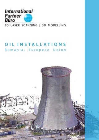
  • 1. 3D LASER SCANNING | 3D MODELLING O I L I N S T A L L A T I O N S R o m a n i a , E u r o p e a n U n i o n
  • 2. 1 O I L I N S TA L L AT I O N S LOCATION: Romania, European Union NUMBER OF SCANS: 57 scans PROJECT TERM: 1 week Overview image of the objective Short time of data acquisition and low cost, compared to other measurement technologies; Very low risk of work accidents during the laser scanning process, as the laser can be operated from a distance in dangerous environments; Comparisons between the existing infrastructure and designed installations can be made much easier; Complete, authentic and accurate 3D copy of reality, which cannot be obtained through any other means or method of measurement; Data can be captured on site and processed at the office, with various degrees of detail for future design - for example in CAD applications; Access to data can be done in real-time or after the processing, constraint and georeferencing techniques; High level of detail of acquired data, very useful for generating the 3D models; Complete and complex method - millions, even billions of points result following the scanning process, representing the position of all objects in the scanned area and there is no need for additional visits on the site; The result is a 3D representation of objects, which can be delivered fast, efficiently and accurately. 3D Laser Scanning | 3D Modelling Compatibility with CAD - PDS - PDMS software Taking in account the complexity of the pipes lines, the heights and the limited access to interest elements, the traditional data collection method in the field would have been difficult. Therefore, the 3D laser scanning technology has been selected, in order to obtain a complete and accurate 3D copy of the reality. The final products provide the compatibility of the point clouds obtained after scanning with specialized software (LFM Server, AVEVA PDMS 3D si INTERGRAPH PDS). Also, the 3D products obtained following the modeling based on point clouds are compatible with varioud CAD software (AVEVA PDMS 3D and INTERGRAPH PDS). Advantages of using the 3D laser scanning for oil installations: 3D POINT CLOUD 3D MODEL 360° PANORAMIC VIEW ONLINE OR OFFLINE WEB PLATFORM PORTFOLIO 2 4 6 8 International Partner Buro S.R.L. Office: www.ipartner.ro office@ipartner.ro +4 - 0722 998 663 Bucharest, Romania PhD. Dipl.-Eng. Marian RăDOI CEO - International Partner Buro S.R.L. 3D Laser Scanning & Surveying specialist + 4 - 0766 462 766 marian.radoi@ipartner.ro
  • 3. 2 3 Image during the scanning process 3D point cloud 3D point cloud - detail 3D point cloud - overview image DELIVERED PRODUCT: 3D POINT CLOUD Following the 3D laser scanning there results a collection of data called “point cloud”; its location in space is known in a 3D coordinate system. The 3D point clouds are compatible with specific software such as: LFM Server, AVEVA PDMS 3D, INTERGRAPH PDS etc. Advantages of the point cloud obtained from the 3D laser scanning: Point clouds are a complete, authentic and accurate 3D copy of reality, which cannot be obtained through any other means or method of measurement; A detailed study of the current state of equipments and installations can be carried out based on 3D point clouds; 3D point clouds allow exact measurements of distances and areas and they are the starting point in the process of 3D modelling.
  • 4. 4 5 DELIVERED PRODUCT: 3D MODEL 3D solid model detail - interior installation 3D model - overview image 3D solid model details 3D CAD models obtained based on the point cloud are compatible to CAD software such as AVEVA PDMS 3D, INTERGRAPH PDS etc. The models are compatible and can be used in a many software due to the various formats under which they are delivered: .sat, .dwg, .dxf, .obj, .sat, .stl, .fbx, .dae, .3ds, .dwf, .dgn. Model 3D solid - instalatie
  • 5. 6 7 360° panoramic view - exterior image from Scene LT View from IPB WebShare platform View from IPB WebShare platform DELIVERED PRODUCT: 360° PANORAMIC VIEW ONLINE OR OFFLINE WEB PLATFORM WebShare online or offline system for viewing scans through panoramic views, with the possibility of measuring distances. IPB WebShare is an online or offline web platform which provides the user with the advantage of being an integrating part of a virtual tour of the scanned area. No matter where the client is, with an internet connection, he is able to visualize the project and download the necessary data. 3D measurements The general map offers the possibility of measuring distances and surfaces, and the 3D view allows easy measurement of point-to- point distances. 360° panoramic view HD panoramic images on IPB WebShare platform or by means of free software Scene LT. Detailed panoramic display Each panoramic position provides a 360° view, including all the details recorded. Acces for authorised users Authorized users may acces the original 3D data through the download option and may examine data by using free software SCENE LT. Advantages of using the IPB WebShare platform: Instant access to the data obtained through 3D laser scanning; Fast decisional factor and efficient collaboration; Increased possibility to interpret the data, investigations and data attachement; Multiuser possibility; Reducing the number of visits on the scanned site.
  • 6. 8 PORTFOLIO E X E C U T E D W O R K S : ■■ North trestle ■■ South trestle ■■ Tank steaming ramp CF ■■ Crude oil unloading ramp SA 25 ■■ Gasoline unloading ramp ■■ Preheating crude oil RTC ■■ Truck check up ramp ■■ Liquid products automatic ramp ■■ LPG loading in CF tanks automatic ramp, no. 216 C ■■ White products unloading from broken tanks ramp no.216 ■■ Tank trucks loading P1 ramp ■■ Oil Products Delivery Commercial Section ramp ■■ LPG tank truck ramp ■■ Crude oil ramp ■■ DRB Flare ■■ Old Flare Refinery ■■ DRB softening (DAPAC) ■■ Petrochemistry softening ■■ Refinery water filters ■■ RCI recirculated water station ■■ CC recirculated water station ■■ Refinery chemical station ■■ Brazi Colony thermical station ■■ DRB thermical station ■■ Refinery thermical station, zone 37 ■■ No.2 condensation water station - DRB ■■ No.3 condensation water station ■■ No.1 condensation water station ■■ Hamon Tower ■■ Compressor station for producing compressed air - Atlas Copco ■■ Regulation station for methane gas ■■ Methane gas distribution Colony - Gate no.3 ■■ Boosting station ■■ 31 Areas C O N T A C T Y O U R N U M B E R 1 O P T I O N I N 3 D L A S E R S C A N N I N G PhD Dipl.-Eng. Marian RADOI CEO - International Partner Buro S.R.L. 3D Laser Scanning & Survey specialist + 4 - 0766 462 766 marian.radoi@ipartner.ro OFFICE: www.ipartner.ro office@ipartner.ro + 4 - 0722 998 663 /ScanareLaser3D /ipartner.ro Bucharest, Romania * International Partner Buro provides 3D laser scanning services globally.
  • 7. 3DLASERSCANNING UAVFOTOGRAMMETRY S U R V E Y BIM G I S ARCHITECTURAL SURVEY CONSTRUCTION SURVEY ENGINEERING SURVEY LAND SURVEY 3DBUILDINGMODELLLING 3DTERRAINMODELLING 2DDRAWINGS CADASTRE LANDREGISTRATION www.ipartner.ro