Precipitation is studied to understand how amount, rate, duration, and quality are distributed in space and time to assess hydrologic responses. There are three main precipitation mechanisms: lifting and cooling of air masses, condensation of water vapor, and growth of liquid water droplets. Precipitation is measured using non-recording and recording rain gauges, which measure amount, intensity, and duration. Data from rain gauges is analyzed to understand basin rainfall averages, depth-duration-area relationships, and intensity-duration-frequency.
chapter 2.ppt ,hydrological study of ethi0mulugeta48
hydrology ,A programme of groundwater investigations is to obtain information on the resource through systematic collection, synthesis, interpretation and compilation of data.
It seeks information on its occurrence, movement, storage, recharge, discharge, quality & quantity.
It includes the study of its geological, environmental, as well as the hydrologic and hydraulic aspects of its flow system.
Geologic Methods
A geologic investigation begins with the collection, analysis, and hydrogeologic interpretation of existing topographic map, aerial photographs, geologic maps and logs, and other pertinent records.
This should be supplemented, when possible, by geologic field reconnaissance and by evaluation of available hydrologic data on: stream flow and springs; well yields; groundwater recharge & levels; and water quality
WATER PRESENT AT OUR EARTH IN THE FORM OF CONDENSATION ,LIQUID AND PROVIDE RAINFALL INTENSITIES AFTER VARIABLE PERIODS OF TIME CAN BE ANALYSED BY VARIOUS METHODS ,GIVEN AND SHOWN IN THIS PPT
The term precipitation is also used to refer all forms of falling moisture viz., rainfall, snowfall, sleet, hail etc. Rainfall occurs in the form of a pattern. Atmospheric Precipitation is a wonderful process for the whole globe to use. This module explains it in general.
very nice and amazingnsnznznzjzjzjzjznznznnzznznznznznznnznznsnznznznznznzznnsnzsnnznznznznznznzjznsnzjsnsnzifnekaolNcnfekaoLmxfnfbkslks siwnd siw sbxhw sus w by sq sbsjdjzixns js wis js wjz sus sbxis jswb sus s sjcne sjs s sjz w aix w sjz sjz s wuz d eusnd sj xxjbs sus ebsbe dhs dhssssssbs dbs shs dbd snz shs s sjs snsb snsjs shs sns sjsbjz wus shx sus shs xh shz shs shs shs shs hs shs shs ßhs sjnshs sjsnsjsnhssnhsdbwbe dhsndj shd shd ujsnsid sjsndjd sjsnxbsbs bs dnx s him sjs xbs sh sndsbs shsnsbs sz
Micro RNA genes and their likely influence in rice (Oryza sativa L.) dynamic ...Open Access Research Paper
Micro RNAs (miRNAs) are small non-coding RNAs molecules having approximately 18-25 nucleotides, they are present in both plants and animals genomes. MiRNAs have diverse spatial expression patterns and regulate various developmental metabolisms, stress responses and other physiological processes. The dynamic gene expression playing major roles in phenotypic differences in organisms are believed to be controlled by miRNAs. Mutations in regions of regulatory factors, such as miRNA genes or transcription factors (TF) necessitated by dynamic environmental factors or pathogen infections, have tremendous effects on structure and expression of genes. The resultant novel gene products presents potential explanations for constant evolving desirable traits that have long been bred using conventional means, biotechnology or genetic engineering. Rice grain quality, yield, disease tolerance, climate-resilience and palatability properties are not exceptional to miRN Asmutations effects. There are new insights courtesy of high-throughput sequencing and improved proteomic techniques that organisms’ complexity and adaptations are highly contributed by miRNAs containing regulatory networks. This article aims to expound on how rice miRNAs could be driving evolution of traits and highlight the latest miRNA research progress. Moreover, the review accentuates miRNAs grey areas to be addressed and gives recommendations for further studies.
WRI’s brand new “Food Service Playbook for Promoting Sustainable Food Choices” gives food service operators the very latest strategies for creating dining environments that empower consumers to choose sustainable, plant-rich dishes. This research builds off our first guide for food service, now with industry experience and insights from nearly 350 academic trials.
More Related Content
Similar to Hydrology_Lecture note on chapter two about precipitation occurrence
very nice and amazingnsnznznzjzjzjzjznznznnzznznznznznznnznznsnznznznznznzznnsnzsnnznznznznznznzjznsnzjsnsnzifnekaolNcnfekaoLmxfnfbkslks siwnd siw sbxhw sus w by sq sbsjdjzixns js wis js wjz sus sbxis jswb sus s sjcne sjs s sjz w aix w sjz sjz s wuz d eusnd sj xxjbs sus ebsbe dhs dhssssssbs dbs shs dbd snz shs s sjs snsb snsjs shs sns sjsbjz wus shx sus shs xh shz shs shs shs shs hs shs shs ßhs sjnshs sjsnsjsnhssnhsdbwbe dhsndj shd shd ujsnsid sjsndjd sjsnxbsbs bs dnx s him sjs xbs sh sndsbs shsnsbs sz
Micro RNA genes and their likely influence in rice (Oryza sativa L.) dynamic ...Open Access Research Paper
Micro RNAs (miRNAs) are small non-coding RNAs molecules having approximately 18-25 nucleotides, they are present in both plants and animals genomes. MiRNAs have diverse spatial expression patterns and regulate various developmental metabolisms, stress responses and other physiological processes. The dynamic gene expression playing major roles in phenotypic differences in organisms are believed to be controlled by miRNAs. Mutations in regions of regulatory factors, such as miRNA genes or transcription factors (TF) necessitated by dynamic environmental factors or pathogen infections, have tremendous effects on structure and expression of genes. The resultant novel gene products presents potential explanations for constant evolving desirable traits that have long been bred using conventional means, biotechnology or genetic engineering. Rice grain quality, yield, disease tolerance, climate-resilience and palatability properties are not exceptional to miRN Asmutations effects. There are new insights courtesy of high-throughput sequencing and improved proteomic techniques that organisms’ complexity and adaptations are highly contributed by miRNAs containing regulatory networks. This article aims to expound on how rice miRNAs could be driving evolution of traits and highlight the latest miRNA research progress. Moreover, the review accentuates miRNAs grey areas to be addressed and gives recommendations for further studies.
WRI’s brand new “Food Service Playbook for Promoting Sustainable Food Choices” gives food service operators the very latest strategies for creating dining environments that empower consumers to choose sustainable, plant-rich dishes. This research builds off our first guide for food service, now with industry experience and insights from nearly 350 academic trials.
"Understanding the Carbon Cycle: Processes, Human Impacts, and Strategies for...MMariSelvam4
The carbon cycle is a critical component of Earth's environmental system, governing the movement and transformation of carbon through various reservoirs, including the atmosphere, oceans, soil, and living organisms. This complex cycle involves several key processes such as photosynthesis, respiration, decomposition, and carbon sequestration, each contributing to the regulation of carbon levels on the planet.
Human activities, particularly fossil fuel combustion and deforestation, have significantly altered the natural carbon cycle, leading to increased atmospheric carbon dioxide concentrations and driving climate change. Understanding the intricacies of the carbon cycle is essential for assessing the impacts of these changes and developing effective mitigation strategies.
By studying the carbon cycle, scientists can identify carbon sources and sinks, measure carbon fluxes, and predict future trends. This knowledge is crucial for crafting policies aimed at reducing carbon emissions, enhancing carbon storage, and promoting sustainable practices. The carbon cycle's interplay with climate systems, ecosystems, and human activities underscores its importance in maintaining a stable and healthy planet.
In-depth exploration of the carbon cycle reveals the delicate balance required to sustain life and the urgent need to address anthropogenic influences. Through research, education, and policy, we can work towards restoring equilibrium in the carbon cycle and ensuring a sustainable future for generations to come.
UNDERSTANDING WHAT GREEN WASHING IS!.pdfJulietMogola
Many companies today use green washing to lure the public into thinking they are conserving the environment but in real sense they are doing more harm. There have been such several cases from very big companies here in Kenya and also globally. This ranges from various sectors from manufacturing and goes to consumer products. Educating people on greenwashing will enable people to make better choices based on their analysis and not on what they see on marketing sites.
Characterization and the Kinetics of drying at the drying oven and with micro...Open Access Research Paper
The objective of this work is to contribute to valorization de Nephelium lappaceum by the characterization of kinetics of drying of seeds of Nephelium lappaceum. The seeds were dehydrated until a constant mass respectively in a drying oven and a microwawe oven. The temperatures and the powers of drying are respectively: 50, 60 and 70°C and 140, 280 and 420 W. The results show that the curves of drying of seeds of Nephelium lappaceum do not present a phase of constant kinetics. The coefficients of diffusion vary between 2.09.10-8 to 2.98. 10-8m-2/s in the interval of 50°C at 70°C and between 4.83×10-07 at 9.04×10-07 m-8/s for the powers going of 140 W with 420 W the relation between Arrhenius and a value of energy of activation of 16.49 kJ. mol-1 expressed the effect of the temperature on effective diffusivity.
Artificial Reefs by Kuddle Life Foundation - May 2024punit537210
Situated in Pondicherry, India, Kuddle Life Foundation is a charitable, non-profit and non-governmental organization (NGO) dedicated to improving the living standards of coastal communities and simultaneously placing a strong emphasis on the protection of marine ecosystems.
One of the key areas we work in is Artificial Reefs. This presentation captures our journey so far and our learnings. We hope you get as excited about marine conservation and artificial reefs as we are.
Please visit our website: https://kuddlelife.org
Our Instagram channel:
@kuddlelifefoundation
Our Linkedin Page:
https://www.linkedin.com/company/kuddlelifefoundation/
and write to us if you have any questions:
info@kuddlelife.org
Willie Nelson Net Worth: A Journey Through Music, Movies, and Business Venturesgreendigital
Willie Nelson is a name that resonates within the world of music and entertainment. Known for his unique voice, and masterful guitar skills. and an extraordinary career spanning several decades. Nelson has become a legend in the country music scene. But, his influence extends far beyond the realm of music. with ventures in acting, writing, activism, and business. This comprehensive article delves into Willie Nelson net worth. exploring the various facets of his career that have contributed to his large fortune.
Follow us on: Pinterest
Introduction
Willie Nelson net worth is a testament to his enduring influence and success in many fields. Born on April 29, 1933, in Abbott, Texas. Nelson's journey from a humble beginning to becoming one of the most iconic figures in American music is nothing short of inspirational. His net worth, which estimated to be around $25 million as of 2024. reflects a career that is as diverse as it is prolific.
Early Life and Musical Beginnings
Humble Origins
Willie Hugh Nelson was born during the Great Depression. a time of significant economic hardship in the United States. Raised by his grandparents. Nelson found solace and inspiration in music from an early age. His grandmother taught him to play the guitar. setting the stage for what would become an illustrious career.
First Steps in Music
Nelson's initial foray into the music industry was fraught with challenges. He moved to Nashville, Tennessee, to pursue his dreams, but success did not come . Working as a songwriter, Nelson penned hits for other artists. which helped him gain a foothold in the competitive music scene. His songwriting skills contributed to his early earnings. laying the foundation for his net worth.
Rise to Stardom
Breakthrough Albums
The 1970s marked a turning point in Willie Nelson's career. His albums "Shotgun Willie" (1973), "Red Headed Stranger" (1975). and "Stardust" (1978) received critical acclaim and commercial success. These albums not only solidified his position in the country music genre. but also introduced his music to a broader audience. The success of these albums played a crucial role in boosting Willie Nelson net worth.
Iconic Songs
Willie Nelson net worth is also attributed to his extensive catalog of hit songs. Tracks like "Blue Eyes Crying in the Rain," "On the Road Again," and "Always on My Mind" have become timeless classics. These songs have not only earned Nelson large royalties but have also ensured his continued relevance in the music industry.
Acting and Film Career
Hollywood Ventures
In addition to his music career, Willie Nelson has also made a mark in Hollywood. His distinctive personality and on-screen presence have landed him roles in several films and television shows. Notable appearances include roles in "The Electric Horseman" (1979), "Honeysuckle Rose" (1980), and "Barbarosa" (1982). These acting gigs have added a significant amount to Willie Nelson net worth.
Television Appearances
Nelson's char
Natural farming @ Dr. Siddhartha S. Jena.pptxsidjena70
A brief about organic farming/ Natural farming/ Zero budget natural farming/ Subash Palekar Natural farming which keeps us and environment safe and healthy. Next gen Agricultural practices of chemical free farming.
Hydrology_Lecture note on chapter two about precipitation occurrence
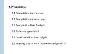
1. 2. Precipitation
2.1 Precipitation mechanism
2.2 Precipitation measurement
2.3 Precipitation Data Analysis
2.4 Basin average rainfall
2.5 Depth area duration analysis
2.6 Intensity – duration – frequency analysis (IDF)
2. 2. Precipitation
Why do we study precipitation?
Precipitation can be in the form of rainfall, snowfall or in other forms.
Precipitation is the source of all waters which enters the land and flows as
overland flow. Overland flow discharges into the streams and then lakes or
ocean.
Hydrologists need to understand how the amount, rate, duration, and quality of precipitation
are distributed in space and time in order to assess, predict, and forecast hydrologic
responses of a catchment.
4. 2.1 Precipitation mechanism
Three mechanisms are needed for formation of precipitation
Types of Precipitation
a) Lifting and Cooling: Lifting of air mass to higher altitudes causes cooling of air
b) Condensation: Conversion of water vapor into liquid droplets
c) Droplet Formation: Growth of droplets is required if the liquid water present in
a cloud is to reach ground against the lifting mechanism of air
Depending upon the way in which the air is lifted and cooled so as to cause
precipitation, we have three types of precipitation, as given below:
a) Cyclonic Precipitation
b) Convective Precipitation
c) Orographic Precipitation
5. a) Cyclonic Precipitation
Cyclonic precipitation is caused by lifting of an air mass due to the pressure difference.
Cyclonic precipitation may be either frontal or non-frontal cyclonic precipitation.
i) Frontal precipitation
It results from the lifting of warm and moist
air on one side of a frontal surface over a
wedge of colder denser air.
A front may be warm front or cold front
depending upon whether there is active or
passive accent of warm air mass over cold
air mass.
6. Cold front:
o A colder, denser air mass lifts the warm, moist air ahead of it.
o As the air rises, it cools and its moisture condenses to produce clouds and
precipitation.
o Due to the steep slope of a cold front, forceful rising motion is often produced,
leading to the development of showers and occasionally severe thunderstorms.
7. Warm front:
o The warm, less dense air rises up over the colder air ahead of the front.
o The air cools as it rises and its moisture condenses to produce clouds and
precipitation
o Warm fronts move more slowly than cold fronts, so the rising motion along
warm fronts is much more gradual.
o Warm front precipitation is generally light to moderate.
8. ii) Non-frontal cyclonic precipitation
If low pressure occurs in an area (called cyclone),
air will flow horizontally from the surrounding
area (high pressure), causing the air in the low-
pressure area to lift.
When the lifted warm-air cools down at higher
attitude, non-frontal cyclonic precipitation will
occur.
9. b) Convectional precipitation
Convectional or convective rainfall results when heating of the ground surface by
the sun causes warming of the air, and locally strong vertical air motions occur.
If the air is thermally unstable, it continues to rise and the resulting cooling,
condensation and cloud formation may lead to short-term and locally intense
precipitation.
In tropical areas, due to the greater heating,
the resulting precipitation may be much more
intense, and short–lived.
Such rainfall is dependent on heating, and
moistening of the air from below, and is most
common in tropical regions.
10. c) Orographic precipitation
Orographic precipitation is caused by air masses which strike some natural
topographic barriers like mountains, and cannot move forward and hence rise up over
barriers such as mountain ranges or islands in oceans, and is analogous to warm air
being forced upward at a cold front, causing condensation and precipitation.
Typically more rain falls on windward than leeward slopes, since as the air descends it
warms and the cloud and rain reduces.
The intensity of orographic precipitation tends to increase with the depth of the
uplifted layer of moist air. All the precipitation we have in Himalayan region is because
of this nature.
11. Southern slope of the Himalayas is a
good example of this kind.
Similarly, winds coming from ocean
strike the western slopes of coastal
ranges causing heavy rains.
13. 2.2 Precipitation measurement
Rain gauges for precipitation measurement are of two types
Key parameters in precipitation measurement:
1) Non-recording rain gauges (cumulative)
2) Recording rain gauges (tipping bucket)
Amount (mm)
Intensity (mm/hr)
Duration (minutes, hours)
14. Non-recording rain gauges are commonly used
They do not record the data
They collect rain and this collected rain is then
measured in a graduated cylinder
This type of gauge measures precipitation for
only a specified period
1) Non-recording rain gauges:
𝐷𝑒𝑝𝑡ℎ 𝑜𝑓 𝑟𝑎𝑖𝑛 =
𝑉𝑜𝑙𝑢𝑚𝑒 𝑜𝑓 𝑟𝑎𝑖𝑛 𝑐𝑜𝑙𝑙𝑒𝑐𝑡𝑒𝑑 𝑖𝑛 𝑐𝑚3
𝐴𝑟𝑒𝑎 𝑜𝑓 𝑎𝑝𝑒𝑟𝑡𝑢𝑟𝑒 𝑜𝑓 𝑔𝑎𝑢𝑔𝑒𝑠 𝑖𝑛 𝑐𝑚2
15. As long as the gauge is > 3 cm diameter, any size
gauge can work for non-recording rain
measurement
US standard – 20 cm diameter
Read once daily normally
Problems associated with non-recording gauges:
Place as close to ground as possible – level ground
Place away from trees and buildings,
It should not be too exposed to wind (low brush helps),
Sensitive to wind for light rain
16. The instrument records the graphical variation of the rainfall, the total collected
quantity in a certain time interval and the intensity of the rainfall (mm/hour).
They automatically record rainfall without any bottle reading so that it allows
continuous measurement of the rainfall
The rainfall is recorded automatically on a graph paper with mechanical
arrangements
A graph of total rainfall vs time, which is known as mass curve of rainfall is plotted
by the gauges
2) Recording gauges
Three types of commonly used recording gauges:
1) Tipping bucket gauges
2) Weighing type gauges
3) Float recording gauges
17. The collector is funneled into two
compartment buckets
When one compartment of bucket is filled
with rain water, it becomes over balanced
and tips such that the other compartment
takes its place beneath the funnel.
As the bucket is tipped, it automatically
activates an electronic circuit.
1) Tipping bucket gauges
18. It consists of a storage bin, which is weighed to record the mass.
It weighs rain or snow which falls into a bucket, set on a platform with a spring
or lever balance.
The increasing weight of the bucket and its contents are recorded on a chart.
The record shows accumulation of precipitation.
Storage gauges are used in remote areas where frequent servicing is not
possible. Weighing type storage gauges operate for 1 or 2 months without any
servicing required.
This type of rain gauges are designed to operate for entire season without
attention.
2) Weighing type storage gauges
19. Generally a daily chart is used for the diagrams. For remote locations weekly charts
can also be used (revolving drum completes one revolution in seven days). Weekly
charts do not have the same detail as daily charts.
Recorded diagram
Recording rain gauge (weighing type)
21. The rainfall collected in the funnel
shaped collector is led into a float
chamber, causing the float to rise.
As the float rises, a pen attached to the
float through a lever system records
the rainfall on a rotating drum driven
by a clockwork mechanism.
A syphon arrangement empties the
float chamber when the float has
reached a preset maximum level.
3) Float recording gauges
22. Presentation of rainfall data
Hyetograph
Plot of rainfall intensity against time,
where rainfall intensity is depth of
rainfall per unit time
Mass curve of rainfall
Plot of accumulated precipitation
against time, plotted in chronological
order.
Point rainfall
It is also known as station rainfall . It
refers to the rainfall data of a station
23. o The major problem is under-catch due to wind turbulence around the gauge.
o Particular measurement challenges are faced when measuring rainfall in forested
areas, in very steep terrain and during very intense rainstorms.
o Thus, a raingauge site should not be over–exposed and subject to strong winds, nor
should it be unduly sheltered by nearby obstacles.
o As a general rule the gauge should be at a distance of at least twice (and preferably
four times) the height of any obstacle.
Problems in the collection of accurate rainfall data
24. Even if raingauges provide accurate point measurements, they are only
representative of a limited spatial extent.
Hydrologists often need to estimate the volume of rain-fall over a catchment
area and require an adequate number of measurements in order to assess the
spatial variation.
This may be achieved with a network of raingauges alone, or by using additional
information from remote sensing by weather radar or satellites.
Areal rainfall
25. Design of raingauge networks
The accuracy of areal precipitation estimates will increase as the gauging network
density increases. But a dense network is difficult and expensive to maintain, and so a
number of general guidelines for gauge density have been produced (e.g., WMO).
The UK has one of the highest densities of raingauges in the world with an average of
one gauge per 80 km2 (Allott, 2010).
There has been a general reduction in hydrometric networks in recent years (Mishra
and Coulibaly, 2009), due partly to save costs and partly in response to an increase in
methods of remote sensing.
26. The World Meteorological Organization (Perks et al.,1996) evaluated the adequacy of
hydrological Networks and gave the following broad guidelines for the minimum
gauge density of precipitation networks in various geographical regions:
One raingauge per 25 km2 for small mountainous islands with irregular
precipitation;
250 km2 per gauge for mountainous areas;
575 km2 elsewhere in temperate, Mediterranean and tropical climates, and
10,000 km2 for arid and polar climates.
27. a) Check for Continuity: Estimation of missing data
o P1, P2, P3,…, and Pm are annual precipitation at neighboring M stations
of 1, 2, 3,…, and M, respectively.
o Px is the missing annual precipitation at station X
o N1, N2, N3,…, Nm and Nx are the normal annual precipitation at all M
stations and at X, respectively
Adjustment of precipitation data
Check for continuity and consistency of rainfall records
o Normal rainfall as standard of comparison
o Normal rainfall: Average value of rainfall at a particular date, month or year
over a specified 30-year period.
2.3 Processing and Analysis of Hydrological Data
28. 1) Arithmetic Average Method
In Station Average Method, the missing record is computed as the simple average
of the values at the nearby gauges
This method is used when normal annual precipitations at various stations show
variation within 10% with respect to station X
Several approaches are commonly used to estimate the missing values:
1) Station Average: Arithmetic average
2) Normal Ratio
3) Inverse Distance Weighting
4) Regression methods
𝑃𝑥 =
1
𝑀
𝑃1 + 𝑃2 + 𝑃3 + ⋯ + 𝑃𝑀
where Px is the missing precipitation record; P1, P2 , …, Pm are the precipitation
records at the neighboring stations; and M is the number of neighboring stations.
29. 2) Normal Ratio Method
Used when normal annual precipitations at various stations show variation >10%
with respect to station X
If the annual precipitations vary considerably by more than 10 %, the missing record
is estimated by the Normal Ratio Method
It can be estimated by weighing the precipitation at the neighboring stations by the
ratios of normal annual precipitations.
where Nx is the annual-average precipitation at the gauge with missing values;
N1 , N2 , …, Nm are the annual average precipitation at neighboring gauges
𝑃𝑥 =
𝑁𝑥
𝑀
𝑃1
𝑁1
+
𝑃2
𝑁2
+
𝑃3
𝑁3
+ ⋯ +
𝑃𝑚
𝑁𝑚
30. 3) Inverse Distance Method (IDM)
The Inverse Distance Method (IDM) weights the annual average values only by
their distances, di, from the gauge with the missing data and so does not require
information about average annual precipitation at the gauges.
𝑃𝑥 =
σ𝑖=1
𝑁 𝑃𝑖
𝑑𝑖
𝑏
σ𝑖=1
𝑁 1
𝑑𝑖
𝑏
The value of b:
It can be 1 if the weights are inversely
proportional to distance or
It can be 2 if the weights are proportional to
distance squared.
𝑃𝑥 =
10
252 +
20
152 +
30
102
1
252 +
1
152 +
1
102
= 25.24 𝑚𝑚
4) Regression Method
The regression method can be used to estimate the missing precipitation value If
relatively few values are missing at the gauge of interest.
31. Causes of inconsistency in records:
Shifting of rain-gauge to a new location
Change in the ecosystem due to damages, deforestation, obstruction, etc.
Occurrence of observational error from a certain date (both personal and
instrumental)
The most common method of checking for inconsistency of a record is the
Double-Mass Curve analysis (DMC).
b) Check for Consistency
32. Double-Mass Curve analysis (DMC)
o The curve is a plot on arithmetic graph paper, of cumulative precipitation
collected at a gauge where measurement conditions may have changed
significantly against the average of the cumulative precipitation for the
same period of record collected at several gauges in the same region
o The data is arranged in the reverse order, i.e., the latest record as the first
entry and the oldest record as the last entry in the list
o A change in proportionality between the measurements at the suspect
station and those in the region is reflected in a change in the slope of the
trend of the plotted points
33. o If a Double Mass Curve reveals a change in slope that is significant and is due to
changed measurement conditions at a particular station, the values of the earlier
period of the record should be adjusted to be consistent with latter period records
before computation of areal averages.
o The adjustment is done by applying a correction factor K, on the records before the
slope change given by the following relationship.
𝐾 =
𝑆𝑙𝑜𝑝𝑒 𝑓𝑜𝑟 𝑝𝑒𝑟𝑖𝑜𝑑 𝑎𝑓𝑡𝑒𝑟 𝑠𝑙𝑜𝑝𝑒 𝑐ℎ𝑎𝑛𝑔𝑒
𝑆𝑙𝑜𝑝𝑒 𝑓𝑜𝑟 𝑝𝑒𝑟𝑖𝑜𝑑 𝑏𝑒𝑓𝑜𝑟𝑒 𝑠𝑙𝑜𝑝𝑒 𝑐ℎ𝑎𝑛𝑔𝑒
34. When each recorded data comes from the same
parent population, they are consistent.
Break in the year: 1987
Correction Ratio
𝑀𝑐
𝑀𝑎
=
𝑐
𝑎
= 𝑘
𝑃𝑐𝑥 = 𝑃𝑥 ×
𝑀𝑐
𝑀𝑎
where
Pcx: corrected precipitation at any time period t1 at station X
Px: Original recorded precipitation at time period t1 at station X
Mc: corrected slope of the double mass curve
Ma: original slope of the mass curve
35. Example
The annual records of five
precipitation stations are
given in Table. Check the
consistency of station A.
Adjust the record if it is
inconsistent.
36. 1) The mean of a group of stations (B, C, D, and E) is computed in column 7.
2) The accumulated values for station A and the group of stations are given in
columns 8 and 9, respectively.
3) Column 8 is plotted against column 9. The breakpoint is observed at 1999.
4) The ratio of recent to past slope = 1.06/0.78 = 1.36.
5) The data prior to the breakpoint (1995–1998) are corrected by the factor 1.36,
as indicated in Table.
Solution
38. 2.4 Basin average precipitation
o Why do we want a basin-average precipitation?
Methods for computing the areal average precipitation.
1) Arithmetic average
2) Thiessen-weighted average
3) Isohyetal method
4) Inverse distance weighting
Estimation of areal precipitation from point measurements
39. The arithmetic mean method uses the mean of precipitation record from all
gauges in a catchment – considers the stations inside the basin.
This method can be used if gages distributed uniformly over watershed and
rainfall does not vary much in space.
1) Arithmetic average
ത
𝑃 =
1
𝑁
𝑖=1
𝑁
𝑃𝑖
where
Pi is the rainfall at the ith rain-gauge station
N is the total number of rain-gauge stations
40. The rainfall measured at each station is given a weightage on the basis of an area
closest to the station.
The average rainfall over the basin is computed by considering the precipitation
from each station multiplied by the percentage of basin area enclosed by the
Thiessen polygon.
The total average areal rainfall is the summation averages from all the stations.
The rain gauge stations outside the basin area can be considered effectively by
Thiessen polygon method.
Assumes rain at any point in watershed equal to rainfall at nearest station
2) Thiessen polygon average
41. Steps of Thiessen polygon weighted average rainfall estimation:
a) Draw lines joining adjacent gages
b) Draw perpendicular bisectors to the lines created in step a)
c) Extend the lines created in step b) in both directions to form irregular polygon
areas that are representative areas for gages
d) Compute representative area for each gage
e) Compute the areal average using the following
ത
𝑃 =
1
𝐴
𝑖=1
𝑁
𝐴𝑖𝑃𝑖
where
Pi is the rainfall at the ith rain-gauge station
Ai is the representative area for the ith rain-gauge station
A is the total area of the basin
42. 3) Isohyetal method
The Isohyetal method is the most recommended method of estimating areal rainfall.
It is considered to be the most accurate method, if there is a sufficiently dense gage
network to construct an accurate Isohyetal map
The method requires the preparation of the Isohyetal map of the catchment from a
network of gauging stations
Areas between the Isohyets and the catchment boundary are measured
The areal rainfall is calculated from the product of the inter-Isohyetal areas and the
corresponding mean rainfall between the Isohyets divided by the total catchment
area.
43. Steps of Isohyetal method areal rainfall estimation:
Plot gauge locations on a map
Interpolate between rain amounts between
gauges at a selected interval
Connect points of equal rain depth to produce
lines of equal rainfall amounts (isohyets)
Compute aerial rain using:
where
Pi is the values of the Isohyets
ai is the inter-isohyet area between each pair of adjacent isohyets
45. 4) Inverse distance weighting (IDW) method
Prediction at a point is more influenced by nearby
measurements than that by distant measurements.
The prediction at an ungauged point is inversely
proportional to the distance to the measurement points.
The IDW method is usually used to fill missing data or to
predict a value at the ungauged site, but it can be also
used for areal estimation if the computation is made at the
basin center point
ത
𝑃 =
σ𝑖=1
𝑁 𝑃𝑖
𝑑𝑖
2
σ𝑖=1
𝑁 1
𝑑𝑖
2
where
Pi is the precipitation at the ith rain-gauge station
di is the distance between the site of interest and the ith rain-gauge station
N is the total number of rain-gauge stations
46. 2.5 Depth-Area-Duration relationships
It indicates the areal distribution characteristic of a storm of given duration
Depth-Area relationship
For a rainfall of given duration, the average depth decreases with the area in an
exponential fashion given by:
ത
𝑃 = 𝑃0𝑒𝑥𝑝 −𝐾𝐴𝑛
where
ത
𝑃: average depth in cm over area (A, km2),
P0: highest amount of rainfall in cm at the
storm center
K and n: constants for a given region
Typical DAD curves
47. 2.6 Intensity-Duration-Frequency (IDF) curves
IDF curves describe the relationship between rainfall intensity, rainfall duration, and
return period.
IDF curves are commonly used in the design of hydrologic, hydraulic, and water
resource systems. Example: erosion control, highway construction, culvert design etc.
IDF curves are obtained through frequency analysis of rainfall observations.
IDF curves can be used in case of many design problems such as runoff disposal,
erosion control, highway construction, culvert design etc.
The relation can be expressed in general form as:
𝑖 =
𝑘𝑇𝑥
𝐷 + 𝑎 𝑛
where
i: Intensity (cm/hr), T: Return period
D: Duration (hours)
K, x, a, and n: are constants for a given catchment
48. Intensity-Depth relationship
Example: 12 hour duration, 100-year frequency,
depth is 70 mm
average intensity is 70mm/12hr = 5.8 mm/hr
Example:
20 min duration, 5-year frequency
intensity is 5.5 in/hr
Intensity-Duration-Frequency (IDF)
49. 1) Data:
From rainfall measurements, for every year of record, determine the annual
maximum rainfall intensity for specific durations (or the annual maximum rainfall
depth over the specific durations).
Common durations for design applications are: 5-min, 10-min, 15-min, 30-min, 1-hr,
2-hr, 6-hr, 12-hr, and 24-hr
How to construct IDF
The development of IDF curves requires that a frequency analysis be performed
for each set of annual maxima, one each associated with each rain duration.
The basic objective of each frequency analysis is to determine the exceedance
probability distribution function of rain intensity for each duration.
2) Frequency Analysis:
50. Two options for this frequency analysis:
1) Use an empirical plotting position approach to estimate the exceedance
probabilities based on the observations.
2) Fit a theoretical extreme value distribution (e.g., Gumbel Type I) to the
observations and then use the theoretical distribution to estimate the
rainfall events associated with given exceedance probabilities.
51. a) Rank the observations in descending order (Table 2, Column 1)
b) Compute the exceedance probability associated with each rainfall volume using the
following expression (Table 2, Column 4):
c) Transform the volume data into rainfall intensity by dividing volume by the
corresponding duration (Table 2, Column 6).
d) Plot empirical distribution of rainfall intensity (Columns 5 and 6 in Figure 1).
e) Repeat this procedure for each of the desired durations.
1) Empirical Plotting Position Approach
Select for example the 30-min duration data from Table 1 and proceed as follows:
where m is the number of observations, p is the exceedance probability
and T is the corresponding return period (Table 2, Column 5).
52. Table 1. Maximum annual rainfall intensity for the shown duration
53. Table 2. 30-min rainfall – Frequency Analysis
i(mm/hr) = 15.9/0.5 = 31.8 mm/hr
Frequency analysis 30-min rain Intensity
54. 2) Theoretical extreme value (EV) distribution approach
Select the Gumbel (Type I) distribution for our example as EV distribution.
The Gumbel Type I distribution is given as:
where µ is the location parameter and
is the scale parameter.
It can be shown that the value of the random variable XT associated with a given
return period, T, may be obtained from the following expression,
where X (overbar) is the mean of the observations, and
S is the standard deviation of the observations.
The frequency factor associated with return period T, KT is given by
55. The above equations are applied to each set of annual maxima corresponding to
each duration, as follows:
1) Compute the frequency factors (KT) associated with the desired return
periods (e.g., 2, 5, 10, 25, 50, 100, 1000).
2) For each duration (e.g., 5-min, 10-min, …etc.), compute the sample mean and
sample standard deviations of the series of annual maxima, (x1,…….,xm) (see
Table 1).
56. Precipitation intensity associated with each return period.
3) Compute the precipitation intensity associated with each return period using the
following equation:
57. 4) Plot the results.
Figure. Intensity-Duration-Frequency curves