3. AcknowledgementsOur team owes a tremendous debt of gratitude to Hunts Point residents and leaders who shared their time, networks and knowledge of
the community with us. In particular, we would like to thank Angela Tovar at Sustainable South Bronx (SSBx) for orienting us to Hunts
Point and guiding our work and recommendations. We thank the staff at SSBx, notably Ei Kyaw and Amilcar Laboy, for assisting us in our
fieldwork, and Case Wyse for facilitating our participation in environmental indicators research.
We are extremely grateful to our Advisory Committee for piloting our participatory vacant lot mapping exercise: Tanya Fields of the BLK
Projek, Wanda Salaman of Mothers on the Move, Nina Sander of Rocking the Boat, Kate Shackford of GRID Alternatives, and David
Shuffler of Youth Ministries for Peace and Justice.
The community meeting was made by possible by all the residents, community leaders and local politicians in attendance, by The Point
CDC, specifically Shukura McDavid, Dania Silvero, Rachelle Fernandez, and Alejandra Delfin for generously providing us with use of their
incredible space, and Blank Plate for catering a healthy and delicious meal.
We also owe gratitude to all of the individuals who took the time to share their insights and expertise with us and helped us get up to
speed on the issues and opportunities in the community: Assemblyman Marcos Crespo from the 85th Assembly for New York State; Maria
Carmen del Arroyo from NYC Council - District 17; Rafael Salamanca from Community Board 2; Susan McSherry from the DOT Hunts
Point Clean Trucks Program; Robin West from Urban Health Plan; Charlie Samboy, Julie Stein and Kate Van Tassel from NYC Economic
Development Corporation; Natasha Dwyer and Juan Camilo Osorio from the NYC Environmental Justice Alliance; Emily Walker and Lucy
Robson from New Yorkers for Parks; and Tawkiyah Jordan and Sarit Platkin from the Department of City Planning.
We could not have accomplished everything we did without the support of Hunter College, and the faculty members who put their faith in
us and provided useful feedback, including Professors Jochen Albrecht, Jill Gross, Owen Gutfreund, Matt Lasner, Lynn McCormick, and
William Milczarski, as well as our Program Coordinator, Melissa Haldeman. Thank you as well to the students outside of our studio, Justin
Rivera, Serge Del Grosso and Marco Castro, who volunteered their time to assist with our community meeting.
We also owe a big thank you to the media for helping to highlight our work, including the hosts of WHCR’s show Musical Pathways (DJ
Black Icon and Lady Scorpio) and the Hunts Point Express, notably Ajhani Ayres.
Finally, this would not have been possible without the guidance of our faculty advisor, Dr. Laxmi Ramasubramanian, whose strong passion
for empowering marginalized communities with alternative tactics and Participatory GIS helped us to think outside the box and create a
community-driven plan. Thank you for your wisdom, your guidance, and your willingness to let us find our own way.
4. contentsIntro 1
About Hunts Point Studio
About Sustainable South Bronx
Our Story
Study Area
Methodology 7
Contextual Research
Best Practices & Case Studies
Community Consultation
Field Research
Digital Presence
Planning Context 17
Past Plans and Studies
Existing Conditions Analysis 21
Geography and History
Demographic Profile
Land Use/Zoning
Community Health
Housing
Economics
Transportation & Connectivity
Crime
Field Research: Analyzing Quality
of Life in Hunts Point 39
Vacant Land
Connectivity to Parks & Open Space
Access to Healthy & Affordable Food
Recommendations 51
Vacant Land Toolkit
Food Restaurant Incubator
Urban Agriculture
Fresh Food Incentives for Bodegas
Placemaking and Design Interventions
Conclusion 73
Appendices 75
5. acronymscharts, graphs, and maps
CBO - Community Based Organization
CSA - Community Supported Agriculture
DSNY - New York City Dept. of Sanitation
NYC DCP - New York City Dept. of City Planning
NYC DEP - New York City Dept. of Environmental
Protection
NYC DCAS - New York City Dept. of Citywide
Administrative Services
NYC DOH - New York City Dept. of Health
NYC DOITT - New York City Dept. of Information
Technology and Telecommunications
NYC DOT - New York City Dept. of Transportation
NYC DPR - New York City Dept. of Parks and
Recreation
NYC EDC - New York City Economic Development
Corporation
NYC HPD - New York City Dept. of Housing
Preservation and Development
NYC OER - New York City Office of Environmental
Remediation
NYC OLTPS - New York City Office of Long-Term
Planning and Sustainability
NYC SBS - New York City Department of Small
Business Services
NYS DEC - New York State Dept. of Environmental
Conservation
NYS DOT - New York State Dept. of Transportation
SSBx - Sustainable South Bronx
USDA - United States Dept. of Agriculture
US EPA - United States Environmental Protection
Agency
YMPJ - Youth Ministries for Peace & Justice
Figure 1: Study Area Map 5
Figure 2: Outreach Chart 7
Figure 3: Community Preference Map 8
Figure 4: Past Plans Chart 16
Figure 5: Population Graph 23
Figure 6: Median Income Graph 23
Figure 7: Poverty Rate Graph 23
Figure 8: Educational Attainment Graph 24
Figure 9: Race Pie Chart 24
Figure 10: Land Use Map 25
Figure 11: Zoning Map 25
Figure 12: City-Designated Vacant Lots Map 25
Figure 13: Noxious Uses Map 26
Figure 14: Parks and Open Space Map 27
Figure 15: Park Accessibility Graph 28
Figure 16: Housing Type Pie Chart 31
Figure 17: Employment Graph 32
Figure 18: Public Transportation Map 34
Figure 19: Truck Route Map 34
Figure 20: Crime Graph 36
Figure 21: City-Designated Vacant Lots with Active Use Map 39
Figure 22: City-Designated Vacant Lots with Waste Map 42
Figure 23: Empty Vacant Lots Map 43
Figure 24: Vacant Buildings 44
Figure 25: Park Access Graph 1 46
Figure 26: Park Access Graph 2 46
Figure 27: Food Access Graph 1 48
Figure 28: Food Access Graph 2 48
Figure 29: Food Vendor Map 49
*All photos taken by studio membes unless otherwise noted.
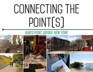
6. introduction
1
Introduction
about hunts point studio //
The Hunts Point Studio is a team of seven graduate students: Corey Clarke, Jocelyn Dupre, Leah Feder, Sarah Gelder, Nate Heffron,
Stephanie Printz, and Josh Thompson. The team worked with their academic advisor, Dr. Laxmi Ramasubramanian during the 2014-
2015 academic year. Léa Duget, an exchange student from France participated in studio activities during Fall 2014 as part of this team.
The Hunts Point Studio was commissioned by Sustainable South Bronx, a local community based organization, to carry out a study in the
Hunts Point neighborhood of the South Bronx.
Connecting the Point(s) — a community driven plan for the Hunts Point neighborhood — is the final outcome of a year-long planning
process that has resulted in actionable recommendations to positively impact the community in the near future. This planning process and
this report fulfill the capstone studio requirement for the Master of Urban Planning degree at Hunter College.
7. 2
planning principles
The team sought to create a plan
that is grounded in the following
principles:
1. Focus on engaging and
serving the residents of Hunts
Point at every stage of the
planning process
2. Make data and information
publicly available to empower
community members to continue
our work after the studio is over
3. Develop recommendations
that are actionable and small
scale
4. Ensure proposed projects
are financially feasible and non-
capital intensive
About Sustainable south bronx //
Founded in 2001, Sustainable South Bronx (SSBx) began out of a desire to advocate for parks
and green development in the South Bronx and to promote environmental justice. Over the past
10 years, SSBx has broadened its focus by linking environmental restoration to the economic
needs of low-income New Yorkers who are seeking a fresh start. Today, the mission of SSBx is
to address economic and environmental issues in the South Bronx – and throughout New York
City – through a combination of green job training, community greening programs, and social
enterprise.1
8. introduction
3
our story //
Hunts Point is a notoriously over-planned neighborhood. As the exploration of recent plans on page 15 illustrates, Hunts Point has been
both the beneficiary and victim of planning efforts that have left many in the community feeling over-surveyed with inadequate results to
show for it. Our client made it clear from the beginning that the community did not need another plan to sit on a shelf. Therefore, the team
chose to focus on small-scale, actionable interventions that could be implemented without significant capital outlays.
To this end, we began by conducting an analysis of existing conditions, investigating both the physical and social landscape of Hunts
Point in order to begin to identify opportunities for transformative action that can be taken on by local community groups. We interviewed
experts within and outside the community. We engaged residents in community preference mapping, gaining valuable information about
the key physical assets in the neighborhood, including an understanding of where local people felt safe or unsafe. Through this work, we
identified a number of challenges and opportunities.
Through decades of poor land use planning decisions, Hunts Point has become a community beset with vacant and underutilized land
and buildings. We chose to look at this as an opportunity: physical space that is not being used to its full potential offers the basic unit for
a process of reimagining. It can activate the potential of both the space itself and the community that lives and works around it. Lots and
buildings also lend themselves to piecemeal intervention: they can be imagined in connection with one another as a network or tackled
one by one — a community garden here, new housing there, a farmers’ market here, a community center there. They offer the opportunity
for small-scale intervention that adds up to large-scale transformation.
We conducted a vacant land survey in order to determine the scale of this resource and develop an up-to-date and accurate catalog of
vacant spaces in the area — a data set we are making publicly available to community stakeholders who are looking to take real, concrete
action around these spaces.
As we began the broader community outreach portion of our research, it was with the question of how to activate the potential already
existing within the community. We hosted a series of meetings in which we posed a question, first to a small Advisory Committee of key
community stakeholders (see page 8), and then to a larger forum of community members. We wanted to know what they wanted to see
done with the vacant land, anticipating that out of this work we would achieve at least two outcomes: concrete ideas for vacant space
repurposing, and a larger narrative about the most immediate concerns for Hunts Point residents.
To complement and quantify this research, we also conducted outreach around questions of connectivity. It is not enough simply to
activate spaces in isolation — in fact, Hunts Point has some beautiful newly-created park spaces, but many are outside of a reasonable
walking distance for most residents and require walking down industrial streets burdened with heavy truck traffic. We wanted to get a
sense of how residents perceive access to existing park spaces in order to facilitate recommendations on improving connections to these
amenities. Alongside this questionnaire, we conducted a GIS analysis showing the number of residents within a 5, 10 or 15 minute walk
of each of the neighborhood’s parks.
9. 4
The connectivity survey also included questions about access to healthy and affordable food. Given that food access had come up
throughout our research, we saw an opportunity to quantify residents’ perceptions of their access to food, while also developing a data
product that we could share with those seeking to advocate for food-based projects within the community. To complement this survey, we
aggregated information about food vendors in Hunts Point and compiled the data into an accessible and easy-to-use map.
We’ve been able to produce a vision for the spaces and places that could be reimagined in order to transform Hunts Point into a place
that better meets the needs of residents. We’ve also identified potential places to improve connectivity to neighborhood amenities, which
are currently cut off from the rest of the community. And we’ve developed recommendations on what form the transformation of spaces
could take, while developing datasets that can be used by others seeking to carry this work forward.
We are excited to share our work with you.
-The Hunts Point Studio, May 2015
10. introduction
5
study area //
Hunts Point is a 690-acre peninsula located in the
Southeast Bronx, bounded by the Bronx River, the East
River and the Bruckner Expressway.2
The entirety of the
peninsula, from the Bruckner Expressway to the water,
is within zip code 10474.
The neighborhood is home to a vibrant residential
community, while also serving as a hub of industry.
According to US Census Business Patterns for 2013,
there are over 12,000 residents, 14,000 workers,
and 667 businesses in Hunts Point.3
Over 74 percent
of Hunts Point residents identify as Hispanic. Key
indicators suggest that the community is economically
vulnerable, with a median income at half the New York
City average, and a poverty rate more than double.
The residents here bear more than their fair share of
undesirable land uses, including polluting industries
and waste transfer stations, along with heavy truck
traffic to and from the Hunts Point Food Distribution
Center. At the same time, these industries are crucial to
the infrastructure of the city, with the distribution center
supplying over 60 percent of the fresh food and produce
consumed in New York City. There is a tension between
the essential role of this neighborhood in providing regional services, while at the same time meeting the needs of the local community.
Due to this tension, this neighborhood has received a lot of attention in the past. Many plans and studies have looked to improve the
balance between the industry and the residential community through better land uses, the development of a greenway and improvements
to truck routes and highway connections. However, many of the proposed capital intensive and long term projects have not yet been
completed.
The civic institutions in Hunts Point are strong, with a long history of fighting for environmental justice and against the marginalization of
this low-income community of color. The community-based organizations (CBOs) and local politicians have paved the path forward for
community organizing and innovative solutions to the challenges the neighborhood faces. The community has had many wins, from the
transformation of former industrial sites into waterfront parks to the development of the South Bronx greenway. This social infrastructure
provides a solid foundation to develop a community-driven plan.
11. 6
// section endnotes //
1. “Our Mission,” Sustainable South Bronx, Last Modified 2013, http://www.ssbx.org/our-mission/
2. “Hunts Point Peninsula,” New York City Economic Development Corporation, Last Modified May 07, 2015, Date Accessed May 14, 2015, http://www.nycedc.com/project/hunts-point-
peninsula
3. U.S. Census Business Patterns, by zipcode, 2013.
12. METHODOLOGY
7
Methodology
contextual research //
In order to better understand the present conditions in Hunts Point and approach the neighborhood from an informed place, the studio
team consulted historical accounts, researched past plans and studies, and analyzed publicly available information, including census
data and relevant literature. The team also examined geographical data, including historical and present land use patterns, as well as the
impacts of unique events such as Hurricane Sandy. From this, the team derived a preliminary understanding of the existing conditions in
Hunts Point.
best practices and case studies //
In an attempt to explore creative solutions, the team analyzed
other communities that have faced or continue to face similar
obstacles to those found in Hunts Point, and investigated the
approaches and interventions they have used to tackle them.
Community consultation //
The team engaged with community members in a variety
of ways, from formal community meetings and surveys to
attending community board meetings and engaging in informal
conversations during field visits. Ultimately, the studio team
estimates that they connected directly with over 100 people
over the course of the year, and many more indirectly.
13. 8
Advisory
Commmittee
Members
Tanya Fields, BLK Projek
Wanda Salaman, Mothers on
the Move BX
Nina Sander, Rocking the
Boat
Kate Shackford, GRID
Alternatives
David Shuffler, Youth
Ministries for Peace and
Justice
Angela Tovar, Sustainable
South Bronx
participatory mapping
community preference mapping
The team conducted a community preference mapping exercise,
where they visited public places with a map of the area and spoke
with community members about which places they like and don’t
like in the neighborhood and where they feel safe or unsafe. Team
members spoke with 50 community members and collected 98
data points. These were all digitized into an interactive online map
which can be viewed at
http://wikimapping.com/wikimap/HuntsPointCommunityMap.html.
advisory committee
The team assembled an Advisory
Committeecomprisedofleadersfrom
Hunts Point organizations in order to
guide them as they moved their work
forward. On March 19th, 2015, this
group participated in a meeting at
which the team piloted an exercise
called “What Do You Want to See in
That Lot?” The team visualized the
vacant spaces in the community on
a large map, and asked committee
members to use coded stickers to
show what they would like to see in
these vacant spaces, and facilitated
discussion about these possibilities.
The committee also gave feedback
to help refine this exercise for use
at an open-invitation community
meeting one week later.
14. METHODOLOGY
9
community visioning session
On March 26th, 2015, the team hosted a public community
meeting at The Point CDC, located at 940 Garrison Avenue in
Hunts Point. There were approximately 30 community members
in attendance. This meeting was advertised via flyer, social
media, email, phone call, web, and word-of mouth, and included
one primary activity, “What Do You Want to See in That Lot?”
and one secondary activity, “Hunts Point Is…”
what do you want to see in that vacant lot?
Participants gathered around three tables, each of which had a 32” x 40” map of the community showing the vacant lots and buildings
identified in the vacancy survey. Facilitators then invited participants to talk about what they wanted to see done with the vacant spaces
and place color-coded drafting dots on the map to signify their preferred uses. Participants worked in groups and studio team members
facilitated discussion. Towards the end of the meeting, each table reported their results to the rest of the group. Studio members collected
and aggregated this data in order to gain a more robust picture of community members’ desires for the community.
15. 10
hunts point is...
As participants arrived at the meeting, they were directed
toward four poster boards hung on the wall inviting them to
recall and write down or illustrate a feeling or experience
within the neighborhood, a change they would like to see,
or something they love about the area. This was intended
to help facilitate conversation between residents and studio
members about daily life and in Hunts Point.
16. METHODOLOGY
11
interviewees
• Councilwoman Maria del Carmen
Arroyo
• State Assemblyman Marcos
Crespo
• Natasha Dwyer & Juan Camilo
Osorio, Environmental Justice
Alliance
• Tawkiyah Jordan & Sarit Platkin,
Department of City Planning
• Susan McSherry, Department of
Transportation, Hunts Point Clean
Trucks Program
• Rafael Salamanca Jr., District
Manager, Bronx Community Board
2
• Nina Sander, Rocking the Boat
• Kate Shackford, GRID Alternatives
• Charlie Samboy, Julie Stein
& Kate Van Tassel, Economic
Development Corporation
• Emily Walker and Lucy Robson,
New Yorkers for Parks
• Robin West, Urban Health Plan
stakeholder interviews
The team interviewed stakeholders to hear from them what they thought the key
challenges and opportunities are in the neighborhood and to glean their expertise on
key topic areas. Team members spoke with sixteen individuals from local nonprofits and
CBOs, the community board, and city agencies, as well as local politicians.
Food and park access questionnaire
The team crafted a Food and Park Access Questionnaire to better understand perceptions
of access to food and parks in the community. This 24-question survey assessed current
food purchasing and consumption habits in the community, current park usage, and
obstacles to both. Survey participants were recruited at the community meeting and via
tabling at strategic community locations, with a couple of more responses obtained via
the web. The survey yielded 46 respondents in total, 30 of whom were residents.
This questionnaire can be found in the apendix of this report.
field observations
field research //
After an initial briefing with Sustainable South Bronx, the team took a number of walking
tours through the community, documenting via notes and photography the physical
dimensions of the neighborhood. The team visited community centers and neighborhood
parks, while also experiencing firsthand the hindrances to pedestrian movement and the
noxious odors and pollutants that are openly released throughout the streets. As part of
these observations, the team participated in an AirCasting exercise whereby they walked
around the community with sensor devices and contributed air quality data to a crowd-
sourced map of environmental contaminants.
17. 12
vacant lot and building survey
The team found that existing data, including City data, on
vacant lots in Hunts Point was inconsistent and at times
unreliable. Therefore the group decided to conduct a large
scale vacancy survey. The team crafted and conducted the
survey in order to catalog the state of (1) city-designated
vacant lots, (2) lots that were not city-designated vacant but
which we found to be vacant, and (3) vacant buildings.
The team began by developing a working definition of a
vacant lot (“a parcel of land on which no lawful structure or
any active business or community use exists”) and one for
vacant buildings (“any structure with signage indicating that
it is ‘officially condemned’ or with a boarded front door”).
Team members then surveyed each vacant lot and building
in the residential core and the surrounding Special Zoning
district by walking down every block taking a survey of
each lot and photographing each lot and building that fit the
definitions.
The data collected was verified by multiple team members
using Zola (NYC Department of City Planning’s land use
database), Google maps, and field notes and photographs.
The data was then analyzed in ArcGIS. Results from this
survey can be found on page 39.
Food vendor survey
While conducting the vacancy survey, the team also
recorded data on the location of every supermarket, deli,
or bodega in the residential core and special zoning district.
The results of this survey can be found on page 49.
18. METHODOLOGY
13
Aircasting
On November 22, 2014, members
of the Hunts Point Studio team
participated in an AirCasting
session held at Sustainable South
Bronx. The AirCasting program
uses small air quality sensors that
are paired with a smartphone app
to record hyper-local air quality
measurements on the street level.
The data is then crowd-sourced
and mapped to display air quality
conditions at specific locations. The
devices capture data on particulate
matter and are sensitive to certain
polluting sources such as idling
trucks and open repair shops.
Although the data that is collected
is not as reliable as that collected
from more sophisticated air quality
measurement tools, the devices
we used were able to display more
fine-grained data on air quality
in specific areas. As one would
expect, air quality is much worse
near highly trafficked intersections
in the industrial areas of Hunts Point
and much better in parks, such as
Barretto Point Park. The AirCasting
initiative partners with local schools
in Hunts Point and throughout New
York City and also holds public air
quality measurement sessions. To
learn more about AirCasting or to
view maps of collected data, visit
aircasting.org.
digital presence //
In February 2015, the Hunts Point Studio launched a web presence at huntspointstudio.org,
showcasing the studio’s work. The team is also on Twitter @hunts_studio and maintains a
Facebook page to share news and events.
20. planningcontext
15
planning context
past plans and studies //
Since 2000, there have been seven studies and/or plans focused on Hunts Point. These plans addressed a number of issues facing the
community from the abundance of noxious land uses and heavy truck traffic to the availability of quality jobs and flood resiliency. While the
solutions proposed varied, many centered around a few common themes: improving land use and transportation; enhancing streetscapes
and pedestrian safety; creating new parks and open space; and developing new workforce opportunities. Although many aspects of these
plans have been implemented, other components have yet to be realized as of the date of this report.
hunts point vision plan (2004)
The Hunts Point Vision Plan was a multi-agency, NYC EDC-led
initiative that began as a task force of community leaders, business
owners, local constituents, elected officials, and government
agencies, focused on addressing critical issues facing the community.
Recommendations from this plan fall into four categories: optimizing
land use; implementing workforce solutions; creating connections;
and improving traffic safety & efficiency. Land use recommendations
from this plan led to DCP’s creation of a Special Hunts Point District
in 2008, designed “to encourage the growth and expansion of the
food industry sector on the Hunts Point peninsula, while creating a
buffer between the manufacturing district and adjacent residential
neighborhood.”1
In addition, the plan led to the initial phases of the
South Bronx Greenway, outlined below, and a new Workforce1
Center.2
Most of the Hunts Point Vision Plan recommendations have
been implemented or are currently underway through other plans
and initiatives. However, the development of an energy efficient fuel
station for trucks and upgrades to the wastewater treatment plant
are currently stalled and the new special zoning district has not
solved many of the land use issues. Some of these challenges will
be discussed in the recommendation section of this report.
22. planningcontext
17
south bronx greenway plan (2007)
The South Bronx Greenway Plan has led to the
creation of a number of new greenway connections
throughout the Hunts Point peninsula, from
landscaped medians and median upgrades to new
bicycle lanes, street trees and street furniture, as
well as fishing piers and recreational areas. Street
improvements on two main streets (Hunts Point
AvenueandLafayetteAvenue)throughtheresidential
core have been made and a new park (Hunts Point
Landing) has been built on the waterfront. Larger
projects from phase one, such as the Randall’s
Island connector, are still in progress.4
Many of our
recommendations around connectivity and access
to parks complement this plan. SSBx and other local
community organizations have played a key role in
advocating for the implementation of this plan.
new york state department of transportation truck study (2004)
The New York State Department of Transportation Truck Study was an effort by the NYS DOT in collaboration with hired engineering
consultants URS/Goodkind & O’Dea, Inc. to study truck movement in Hunts Point. As a part of the study, interviews and surveys were
conducted with company owners and truck drivers to look at how drivers for the distribution center were entering, exiting, and using the
truck routes in and out of the neighborhood. The study found that 45 percent of those surveyed listed traffic congestion as an issue. “No
Street Name Signs” and “Poor Signing on the Truck Route” were also identified as problems for drivers. This study was conducted prior
to the relocation of the Fulton Fish Market, however, so it would seem prudent to conduct a more updated survey to assess truck traffic in
the neighborhood.3
This study was also limited in that it lacked outreach to local residents. Truck idling and truck routes are still a major
issue in the community.
23. 18
special hunts point
zoning district report
(2008)
The Special Hunts Point District
was approved by the city planning
commission in 2008 and has led to the
rezoning of 70 blocks from M1-1, M2-
1, and M3-1 to M1-2. This has created
a buffer zone between the residential
core of the neighborhood and the
industrial area. Further it encourages
the development of other food-related
businesses in the neighborhood and
also prohibits new waste-related uses.5
As stated previously, the special zoning
has not solved many of the issues of
land use or connectivity in the Hunts
Point neighborhood to date.
The south bronx waterfront
brownfield opportunity
area nomination study
(2009)
The South Bronx Waterfront Brownfield Opportunity Area Nomination Study was a New York State-funded plan compiled by YMPJ, SSBx
and the Point CDC to “identify under-used land and buildings that have the potential to be transformed into community resources that can
benefit neighborhood residents.” The plans in the study are in the nomination phase currently waiting to receive funding for implementation.6
However, in conversations with local community members the team learned that funding on this initiative is currently stalled.
24. planningcontext
19
sheridan-Hunts Point land use and transportation study (2013)
The Sheridan Expressway-Hunts Point Land Use and
Transportation Study, is another multi- agency city effort,
aimed at striking “a balance between an increasingly
vibrant residential area and the need to maintain efficient
routes for traffic traveling to Hunts Point, the economic
and employment core of the area.”7
This study proposes
to build three new ramps on Oak Point Avenue in order to
better connect the Hunts Point Food Distribution center to
the Sheridan Expressway. The study also recommends
improving public access to parks along the Bronx River,
increasing the safety of the pedestrian network, changing
neighborhood zoning, and encouraging appropriate
mixed-use development. The main goal of this plan is to
remove the Sheridan Expressway completely. However,
this plan has not seen any implementation, primarily due
to both political and financial constraints.8
huntspoint/lifelines - rebuild by design (2013)
Hunts Point Lifelines, is one of the winning projects of the
Rebuild By Design competition, an initiative led by the
Federal Department of Housing and Urban Development
post-Hurricane Sandy to improve flood resilience. The
goalsofHuntsPointLifelinesaretocreateafloodprotection
system; improve access to a waterfront greenway; and
develop new energy generation and infrastructure to
ensure food supplies and distribution are operational in the
event of future storms.9
To date, the federal government
has committed $20 million in funding and Mayor Bill De
Blasio has promised over $25 million more; however, this
is only a small portion of the total funds needed to realize
this plan. Current efforts are underway to decide how to
spend this first portion of the funding.10
25. 20
1. City of New York, Zoning Resolution: Special Hunts Point District, Article X, Chapter 8.
2. New York City Economic Development Corporation, (2004) Hunts Point Vision Plan.
3. URS Goodkind & O’Dea, Inc., (2004) Hunts Point Truck Study. https://www.dot.ny.gov/regional-offices/region11/projects/project-repository/bese/pdf/hp_p1.pdf
4. South Bronx Greenway http://www.bronxriver.org/puma/images/usersubmitted/greenway_plan/
5. City of New York, (2008) Special Hunts Point District, Article X, Chapter 8.
6. Youth Ministries for Peace and Justice, Our Centers: Center for Community Development and Planning, Date Modified unknown, Date Accessed: May 14, 2015, http://www.ympj.
org/centers/development.html
7. New York City Department of City Planning, (2013) Sheridan-Hunts Point Land Use and Transportation Study.
8. Ibid
9. PennDesign/OLIN, (2014) Hunts Point / Lifelines, Rebuild By Design, http://www.rebuildbydesign.org/project/hunts-point-lifelines/
10. Cole Rosengren, “Funding against storms falls short, say planners,” Hunts Point Express, January 20, 2015. http://brie.hunter.cuny.edu/hpe/2015/01/20/funding-against-storms-
falls-short-say-planners/
// section endnotes //
26. existingconditions
21
existing conditions
geography and history //
Hunts Point is a low-lying, 690-acre peninsula located in the southeast Bronx. Much of the land is comprised of an industrial area, which
includes the largest food distribution center in the United States. The industrial portion of the neighborhood remains close to sea level until
inclining near what is now the residential core of Hunts Point. The highest point on the peninsula is 90 feet above sea level.1
During the late nineteenth and early twentieth centuries, Hunts Point was primarily a suburban retreat for well-to-do Manhattan residents.
A shift occurred with the establishment of Greater New York City in 1898 and the construction of the Pelham subway line in 1904. With its
position next to the East River, the neighborhood became a key location for industrial uses in the City, which led to an influx of working-
class residents — most of whom were Jewish, Irish and Italian immigrants.2
In the 1950s and 1960s, due to several decades of city abandonment and the outward migration of the white middle-class toward the
suburbs, Hunts Point transformed once more. The demographics shifted towards a population of mostly African-American and Puerto
Rican residents living in poverty, and many of the resources moved out of the area. Crime rates rose, much like in the rest of the South
Bronx, and many buildings were left vacant.3
During this time, Hunts Point was also becoming increasingly industrial, with the siting of large facilities, including the Hunts Point
Wastewater Treatment Plant, which opened in 1952. The construction of the Bruckner Expressway, a Robert Moses-era project that
opened in 1973, further isolated Hunts Point from the rest of the South Bronx, displacing residents and local businesses and decreasing
property values.4
Finally, in the latter half of the 20th century, the City’s municipal waste disposal system transformed from one that relied
on City-owned landfills and apartment incinerators into a privately-operated network of waste transfer stations; With this shift a number of
commercial waste transfer stations located in the Hunts Point.5
Hunts Point has made remarkable changes and progress over the past few decades. Efforts by nonprofits, community groups and
community development corporations (CDCs), as well as investments made by the public and private sectors have significantly improved
quality-of-life for residents in Hunts Point and the South Bronx.6
However, despite the significant drop in crime and the return of residents
and businesses to the area, the neighborhood still experiences numerous challenges, many of which are the result of the environmentally
noxious uses that were concentrated in the neighborhood during the mid- to late-20th
century.
27. 22
Nonprofits & CBOs
Hunts Point has a strong presence of
CBOs and nonprofits, with missions
ranging from environmental and
economic justice to the arts and public
health. Many of these organizations
also offer multi-purpose community
spaces and actively engage area
students. The following are the
organizations identified as key
stakeholders in the neighborhood:
• The BLK Projek
• GRID Alternatives
• Hunts Point Economic
Development Corporation
• Mothers on the Move
• The Point Community
Development Corporation
• Rocking the Boat
• SoBro
• Sustainable South Bronx
• Urban Health Plan
• Youth Ministries for Peace and
Justice
28. median income
population
poverty rate
existingconditions
23
demographic profile //
Hunts Point has an estimated residential population of 12,519,
according to the 2013 5-Year ACS estimates, which is up 10
percent from the year 2000, when the population was 11,354.
Population density is low, with roughly 7,929 people per square
mile (compared to 27,012 for New York City overall). This
corresponds with the land use patterns in the neighborhood,
with the vast majority of land dedicated to industrial uses and
only a small portion to housing.7
The population is relatively
young, at a median age of 28.9 years, when compared to the
Bronx, which has a median age of 32.7 years, and New York
City, which has a median age of 35.5 years.8
Hispanic residents make up 75 percent of the total population,
according to the 2013 5-Year ACS estimates. This percentage is
much higher than both the New York City average (28.6 percent)
and the Bronx average (53.5 percent). The remainder of the
neighborhood’s population is 23 percent African American and
1.1 percent white.9
According to the 2013 5-Year ACS estimates, the median
household income in Hunts Point is $23,363 per year, which is
roughly $10,000 less than the median income in the Bronx and
less than half of the median income in New York City. This is
further demonstrated by the population living below the poverty
line — 41.8 percent of Hunts Point families have incomes below
the poverty level compared to 29.8 percent in the Bronx and
20.3 percent citywide. Educational attainment is also lagging
behind, with over 50 percent of the population without a high
school diploma or equivalency degree, one of the highest rates
in NYC.10
Source: 2013 ACS 5-Year
Source: 2013 ACS 5-Year
Source: 2013 ACS 5-Year
29. educational attainment
race & ethnicity
identified issues &
assets from
stakeholder interviews
The team asked the 16 interviewees
to identify what they perceived as the
issues and assets in the community.
The interviewees identified many of the
issues that were found in the existing
conditions research conducted by the
team, including: truck traffic, lack of
accessibility to and awareness of parks,
a lack of follow through and funding
from some city initiatives, crime, poor
sidewalk conditions and lighting, and
a stigma of the neighborhood. They
also identified many of the assets that
the team observed, including: active
community based organizations, tight-
knit and engaged residents, quality
parkland, and ample waterfront space
for potential future reuse. This valuable
information further reinforced and
complemented the team’s findings.
24
Source: 2013 ACS 5-Year
Source: 2013 ACS 5-Year
30. land use
zoning
existingconditions
25
land use and zoning //
ThelanduseinHuntsPointisdominatedbyindustries,withalmost
90 percent of the total land area categorized as manufacturing.
These uses surround the small residential core, which makes
up almost eight percent, as well as parks, which make up nearly
three percent of the Hunts Point land area.11
The zoning further demonstrates this pattern. The residential
core is at the center of the peninsula, zoned R6, a medium-
density residential district. This area has one commercial overlay
along Hunts Point Ave, resulting in local retail. This is surrounded
by the “Special Hunts Point District,” which was approved by
the City Planning Commission in 2008 and rezoned 70 blocks
to M1-2, from M1-1, M2-1 and M3-1. This district provides a
buffer between the residential area and heavy industry. Within
this Special District overlay, there are two sub-districts: the
Residential Buffer Subdistrict and the Food Industry Subdistrict.12
The Residential Buffer Subdistrict allows for commercial uses
and community facilities “that promote local and regional arts
and culture, and provide options for communal activities on the
peninsula.”13
Examples of commercial uses that are allowed
include clothing stores, department stores, dry goods or fabric
stores, furniture stores, and household appliance stores.
Examples of community facilities that are allowed include
libraries, museums, community centers, and non-commercial
recreational centers.
In the Food Industry Subdistrict, the focus is on the prohibition of
certain new uses. Specifically, waste-related and heavy industrial
uses are prohibited “regardless of performance standards.”14
The perimeter of Hunts Point is zoned M3-1, which allows for
heavy manufacturing uses, that “generate noise, traffic, or
pollutants.”15
Source:MapPLUTOv14.2Source:MapPLUTOv14.2
31. noxious uses
city designated vacant lots
26
Vacant lots
There are over 70 city-designated vacant lots within the
residential core and special zoning district. Vacancies can have
a profound impact on quality of life. In a marginalized community
struggling against numerous structural barriers, vacant lots have
the potential to communicate a sense that a neighborhood is an
undesirable place in which to live. Furthermore, a number of these
lots are brownfields, which are sites that have previously hosted
hazardous substances, pollutants, or contaminants, and require
remediation before they can host any new uses. Recognizing this,
the New York State Department of Environmental Conservation
has designated Hunts Point, along with its surrounding
neighborhoods in the South Bronx, as a Brownfield Opportunity
Area.
noxious uses
Noxious uses are at the heart of the environmental justice (EJ)
issues in Hunts Point, with the neighborhood bearing an unequal
burden of the City’s undesirable land uses. In New York City,
commercial waste is handled by private companies through 63
waste transfer stations, 9 of which are located in Hunts Point.16
The EJ communities of the South Bronx and Newtown Creek,
Brooklyn bear the burden of managing over 60 percent of the city’s
total commercial waste, while making up only a small percentage
of the total population.17
Beyond commercial waste, there are
23 auto dismantlers and 11 scrap metal processors in Hunts
Point. One of the city’s largest wastewater treatment plants is
also located in Hunts Point, with 13 others located throughout the
city.18
The disproportionate concentration of noxious land uses
and heavy industry places an unjust environmental burden on
the community of Hunts Point, leading to an abundance of odors
and pollutants, as well as poorly maintained land throughout the
peninsula.
Source:MapPLUTOv14.2
Source:MapPLUTOv14.2
32. hunts point parks
existingconditions
27
resiliency
Along the periphery of the peninsula, the area is relatively flat until it hits a relative steep incline as one approaches the residential core.
The highest point on the peninsula is 90 feet above sea level.19
This geographical configuration leaves the peninsula at great risk of
flooding, particularly in the area occupied by the food distribution center at the southeastern end of the peninsula.
This vulnerability is made all the more acute by the fact that the Hunts Food Distribution Center is vital to the New York Metro Area food
distribution network, serving over 22 million people. Superstorm Sandy exposed the vulnerability of Hunts Point to flooding, as well as
power and fuel outages. According to future projections, Hunts Point will become increasingly at risk with the added impact of sea level
rise.20
Parks and open space
The parks of Hunts Point are among
the neighborhood’s most promising
assets. Barretto Point Park, Hunts Point
Landing and Hunts Point Riverside
Park all provide spectacular waterfront
views with well-maintained green space.
Julio Carballo Fields and Hunts Point
Playground provide facilities for physical
activity during all times of the year and
the Floating Pool Lady, a former barge
converted into a floating pool at Barretto
Point, provides residents a fun way to
cool off during the summer.
Source:MapPLUTOv14.2
33. distancE to parks
28
Despite these open space assets, Hunts Point does not meet the minimum standards for access to park space. As defined by New
Yorkers for Parks, 100 percent of residents should be within a five minute walk of a neighborhood park (a park between one and twenty
acres). 21
However, the four neighborhood parks in Hunts Point reach only half of the population within a five minute walk.
Further, it can be quite challenging to access some of these parks, either via foot or bicycle, from the neighborhood’s residential core.
Traveling to the parks often involves bypassing long stretches of heavily industrial areas and designated truck routes; further, idling trucks
can often be observed along the periphery of these open spaces, presenting another barrier. Improving access to Hunts Point’s parklands
is central to improving the quality of life in the neighborhood.
photos:MarcoCastro
Source: 2013 ACS 5-Year
34. existingconditions
29
COMMUNITY HEALTH //
According to NYC DOH, Hunts Point-Mott Haven
residents suffer disproportionately from high rates
of asthma and heart attack hospitalizations.22
The
asthma hospitalization rate among children less than
five years old is more than three times the New York
City average at 203 per 10,000 people, while it is 149
for the Bronx and 76 for New York City. Heart attack
hospitalizations among adults aged 65 or older is
also much higher than in the Bronx or New York City.
The heart attack hospitalization rates in Hunts Point-
Mott Haven are 144 per 10,000 residents versus 76
in the Bronx and 68 in New York City.23
A study funded by the United States EPA and
conducted in collaboration with the NYU School
of Medicine, the Robert F. Wagner School of
Public Service, and a number of local community
organizations, studied air quality in Hunts Point
starting in 2000. Their results showed that NYC
DEC air monitoring was inadequate for measuring
air quality at the human level and that low-income,
minority children are disproportionately attending
schools too close to highways and major roadways,
affecting their health and quality of life. The study
advocated pushing NYC DEC to monitor NO2
levels closer to ground level; it also suggested new
regulations to prevent schools from being built near
highways and the creation of more green spaces
near highways and industrial facilities.24
photos:MarcoCastro
35. 30
food access
The health struggles of Hunts Point and the surrounding area have been well-documented. The Bronx has New York City’s highest rate
of obesity, as well as the highest percentage of food insecure households.25
In 2009, 37 percent of residents of the 16th congressional
district, of which Hunts Point is part, said they lacked money to buy food at some point in the past 12 months. That is more than any other
congressional district in the country, and more than twice the national average.26
The New York Times has called this the “Bronx Paradox”,
a counterintuitive phenomenon where residents are both obese and hungry at the same time.27
This paradox is perpetuated by the fact
that there is a lack of sufficient food access in Hunts Point.
A 2008 study by the NYC Department of City planning mapped all of the supermarkets over 10,000 square feet in the city, and Hunts Point
had none. The one supermarket in the neighborhood is around 9,000 square feet in size and serves a population of over 12,000 people.
The NYC standard is three times this, recommending 30,000 square feet per 10,000 residents.28
There are also many wholesale distributors throughout the peninsula, in addition to the cooperative market — however, these do not
directly serve individuals and families in Hunts Point. From the Hunts Point Studio’s conversations with the community, the team learned
that there have been past efforts to connect the market’s wholesale distribution with a local distribution system, but nothing has come
to fruition. Lack of food access within the neighborhood, leads to residents either traveling outside of their neighborhood or relying upon
local delis and bodegas with limited options for fresh healthy food. This is further documented in the team’s food and park connectivity
questionnaire on page 45.
36. existingconditions
31
housing //
According to the 2013 5-YearAmerican Community Survey,
Hunts Point has approximately 4,100 housing units. Multi-
family apartment buildings with 20 or more units represent
the majority of the housing stock at 43 percent, with 3-4 unit
buildings making up the second most common housing
typology, at 15 percent. Buildings with 50 or more units
are also somewhat prevalent, as they make up 14 percent
of the housing stock, the third most common housing
typology in the neighborhood.29
Most residents in Hunts Point are renters, with 93.5
percent renter-occupied units, compared to 80.1 percent
in the Bronx and nearly 70 percent for New York City. The
median rent in Hunts Point is $970, according to the 2013
5-Year ACS, while in the Bronx, it was just over $1,000 and
in NYC, it was $1200.30
housing type
Source: 2013 ACS 5-Year
37. 32
local economic conditions
ECONOMICS //
As of 2013, there were 667 businesses
located in Hunts Point, one-third of which
are classified under wholesale trade.31
These
establishments provide nearly half of all the
jobs in the area, with the majority of those
jobs coming from the Meat and Meat Product
Merchant Wholesalers industry, the Fresh
Fruit and Vegetable Wholesalers industry, the
General Line Grocery Merchant Wholesalers
industry, and other food-related industries.
With over 155 public and private wholesalers
(including the Hunts Point Terminal Produce
Market, the Cooperative Meat Market and the
New Fulton Fish Market), the food production
center currently employs over 6,000 people,
according to a study done by the New York
City Economic Development Corporation.32
The transportation and warehouse sector
makes up the second highest percentage of employment at 16 percent. This sector consists of 61 establishments in total, with local
freight trucking industries accounting for 29 percent of all employment within that sector and School and Employee Bus Transportation
accounting for 33 percent.33
There are a number of government incentives for businesses to locate in Hunts Point, including the Hunts Point and Port Morris Empire
Zone, which offers a number of tax credits, zone capital credit and a new business refund. The Bronx Overall Economic Development
Corporation offers loan programs as the administrator of the Bronx Empowerment Zone, as well as tax-related incentives. There are also
a number of economic development organizations in the neighborhood, such as the Hunts Point Business Outreach Center and the Bronx
Women’s Business Resource Center.34
employment by trade
Source: 2013 U.S. Census Business Patterns
38. existingconditions
33
employment
As of 2013, the unemployment rate in Hunts Point was 18.2 percent, which was slightly higher than the 15.2 percent unemployment rate
of the Bronx and nearly double that of New York City (10.6 percent).35
The most common occupations for males 16 years and older are Construction and Extraction; Building and Grounds Cleaning and
Maintenance; and Office andAdministrative Support. For the female population, the most common occupations are Office andAdministrative
Support; Personal Care and Service; and Healthcare Support.
While the top employing industry on the peninsula is Wholesale Trade, the majority of jobs held by residents are in Construction and
Extraction, and Office and Administrative Support, for males and females respectively. This data suggests a disconnect between locally
available jobs and where residents are employed. Given this analysis, there is a potential opportunity to strengthen the local job pipeline
for residents who desire to work in the Wholesale Trade industry. This will be discussed further in the recommendations section of this
report.36
39. public transportation
34
transportation and connectivity //
public transportation
Hunts Point is fairly well served by public transit. The 2, 5, and
6 subway lines are all a short distance from the neighborhood’s
residential core. The peninsula is also served by two bus routes:
the Bx 6 and the Bx 46. On weekdays, the Bx 6 runs about every
six minutes.37
This route runs through the center of the peninsula
down Hunts Point Ave and terminates at the Hunts Point Market.
The Bx 46 is a relatively new bus route that provides an additional
connection to the market and Barretto Point Park. However, this
route only runs every 30 minutes.38
Among those commuting to
work, Hunts Point residents have high rates of public transit use,
and low rates of car usage as compared with the Bronx as a
whole.39
Truck traffic
Due to the industrial uses in Hunts Point, a large number of
trucks frequently travel to and throughout the area. The Bruckner
and Sheridan Expressways are important connections for truck
traffic to New York City and the rest of the region, and nearly
15,000 trucks travel through the peninsula on a daily basis.40
There are a number of designated truck routes on the peninsula;
however, the NYS DOT Truck Study found a significant amount
of usage taking place on non-designated truck routes. Over 62
percent of trucks exit on marked truck routes, including Tiffany
Street, Leggett Avenue, Edgewater Avenue. However, a number
of trucks also travel down residential streets. The main artery
of the residential district (Hunts Point Ave between Garrison
and Randall) was found to be used by trucks between 25 and
38 percent of the time, which is the highest rate among non-
truck routes.41
This can negatively impact the quality of life for
those living on those streets through exposure to noise and air
pollution, as well posing a risk to pedestrians and cyclists.
truck routes
Source:NYCOpenDataSource:NYCOpenData
40. existingconditions
35
Truck idling is also a pressing issue in Hunts Point, as the
team learned from SSBx and community members, as well
as via observation during visits to the neighborhood. With
the many large food distributors in the area that supply the
entire region, there are also a large number of refrigerator
trucks that park along streets overnight and keep their
engines running to preserve their loads. Truck idling
degrades the air quality of the neighborhood and obstructs
many pedestrian and bicycle thoroughfares.
pedestrian safety
Navigating Hunts Point can be challenging for pedestrians.
Abundant truck traffic, coupled with wide streets and noxious
land uses, makes day-to-day travel a challenge, and adds
barriers to accessing parks and neighborhood amenities.
The data portal for Vision Zero, New York’s campaign to
eliminate pedestrian and traffic deaths in the city, indicates
numerous accidents and traffic issues at the intersection
of Hunts Point Avenue and Bruckner Boulevard, a main
entrance point to the neighborhood. Vision Zero also
identified two corridors that fall within the neighborhood,
which rank in the top 10 percent for pedestrian crashes
in the Bronx. These corridors include Hunts Point Avenue
from Bruckner Boulevard to East Bay Avenue and Leggett
Avenue from Bruckner Boulevard to Truxton Street.42
photo:MarcoCastro
41. 36
crime //
Crime in Hunts Point has been decreasing dramatically since the mid- and late-1990s. According to NYPD CompStat data from the 41st
Precinct, murder is down 95.5 percent in 2013 from 1990, and robberies are down 70.1 percent.43,44
Like many neighborhoods in the South
Bronx, Hunts Point experienced high levels of crime during the 1960s, 70s and 80s. This was largely the result of rapid disinvestment
by the city and shifting demographics.45
The significant drop in crime is promising, but crime is still identified as a pressing quality of life
issue by the community. During the team’s interviews with stakeholders, it was found that there is still a strong public perception that the
neighborhood is unsafe. Further, during the community preference mapping, respondents cited issues of drug use and prostitution in the
neighborhood.
While crime is not the focus of this report, it is critical to quality of life. To this end, the recommendations included in this report around
improving land uses and connectivity in the neighborhood consider the implications of crime and perceptions of safety.
crime in Hunts POint
Source: NYPD 41st Precinct CompStat
42. existingconditions
37
// section endnotes //
1. Geographical data was gathered from the NYC Open Data Portal and rendered in ArcGIS.
2. Jill Jonnes, (2002) South Bronx Rising: The Rise, Fall and Resurrection of an American City, Chapter 1: It is a Veritable Paradise, Fordham University Press.
3. Michael Dorman, (1972) The Making of a Slum, Chapter 3, Delacourt Press.
4. Jill Jonnes, (2002) South Bronx Rising: The Rise, Fall and Resurrection of an American City, Chapter 35: South Bronx Rising 1985-2002, Fordham University Press.
5. Citizens Budget Commission, (2012) Taxes In, Garbage Out, The Need for Better Solid Waste Disposal Policies in New York City, pp. 4-5, http://www.cbcny.org/sites/default/files/
REPORT_SolidWaste_053312012.pdf
6. Ibid.
7. New York City Department of City Planning, BYTES of the Big Apple - PLUTO v14.2, Date Accessed May 14, 2015.
8. U.S. Census Bureau, (2013) 5-Year American Community Survey for 10474 ZCTA.
9. U.S. Census Bureau, (2013) 5-Year American Community Survey for 10474 ZCTA.
10. U.S. Census Bureau, (2013) 5-Year American Community Survey for 10474 ZCTA.
11. New York City Department of City Planning, BYTES of the Big Apple - PLUTO v14.2, Date Accessed May 14, 2015.
12. City of New York, (2008) Special Hunts Point District, Article X, Chapter 8.
13. Ibid.
14. Ibid.
15. Ibid.
16. Institute for Civil Infrastructure Systems NYU Wagner, (2003) South Bronx Environmental Health and Policy Study, http://www.icisnyu.org/south_bronx/wastetransferstations_000.
html
17. Citizens Budget Commission, (2012) Taxes In, Garbage Out, http://www.cbcny.org/sites/default/files/REPORT_SolidWaste_053312012.pdf
18. New York City Department of Environmental Protection, Hunts Point Waste Water Treatment Plant, Last modified: 2015, http://www.nyc.gov/html/dep/html/dep_projects/cp_hunts_
point_plant.shtml
19. Geographical data was gathered from the NYC Open Data Portal and rendered in ArcGIS.
20. PennDesign/OLIN, (2014) Hunts Point / Lifelines, Rebuild By Design, Date Accessed: November 24, 2014, http://www.rebuildbydesign.org/wordpress/wp-content/uploads/briefin
g/Penn__IP_Briefing_Book.pdf
21. New Yorkers For Parks, (2014) Mott Haven Open Space Index, http://www.ny4p.org/research/osi/Mott-Haven-OSI.pdf
22. The NYC Department of Health (DOH) does not provide data for Hunts Point specifically. Instead, it combines Hunts Point with the Mott Haven neighborhood that is located to the
southwest and faces similar challenges with regard to health.
23. New York City Department of Health & Mental Hygiene, Environment and Health Data Portal, Last Modified: 2013, http://a816-dohbesp.nyc.gov/IndicatorPublic/NewQuickView.
aspx.
24. Institute for Civil Infrastructure Systems, (2009) South Bronx Environmental Health & Policy Study http://www.icisnyu.org/south_bronx/reports.htm.
25. Sam Dolnick, “The Obesity-Hunger Paradox,” The New York Times. March 12, 2010, http://www.nytimes.com/2010/03/14/nyregion/14hunger.html
26. Food Research Action Center, (2010) Food hardship: A closer look at hunger, http://www.frac.org/pdf/food_hardship_report_2010.pdf
27. Sam Dolnick, “The Obesity-Hunger Paradox,” The New York Times. March 12, 2010, http://www.nytimes.com/2010/03/14/nyregion/14hunger.html
28. New York City Department of City Planning, Going to Market: New York City’s Neighborhood Grocery Store and Supermarket Shortage, Date Accessed April 2, 2015, http://www.
nyc.gov/html/misc/pdf/going_to_market.pdf
29. U.S. Census Bureau, 5 Year ACS for the 93, 115.02, & 117 Census Tracts, 2013
30. U.S. Census Bureau, 5 Year ACS for the 93, 115.02, & 117 Census Tracts, 2013
31. U.S. Census Bureau, (2013) Business Patterns by zipcode 10474
32. New York City Economic Development Corporation. (2014) “Neighborhood Trends & Insights: Exploring New York City Communities - Hunts Point & Longwood.” <https://www.
nycedc.com/sites/default/files/filemanager/Resources/Economic_Data/neighborhood_trends/Neighborhood_Trends_Hunts_Point_Longwood_July_2014.pdf>.
33. U.S. Census Bureau, Business Patterns, by zipcode, 2002 & 2012.
34. Ibid
35. U.S. Census Bureau, 5 Year ACS for the 10474 ZCTA, 2013
36. U.S. Census Bureau, 5 Year ACS for the 10474 ZCTA, 2012.
43. 38
37. MTA New York City Transit, (2015) Bx6 Local Service, Bus Timetable
38. MTA New York City Transit, (2015) Bx46 Local Service, Bus Timetable
39. U.S. Census Bureau, (2013) 5-Year American Community Survey, Table B08301
40. Hunts Point Alliance for Children, Hunts Point Neighborhood, Date Accessed: May 20, 2015, http://huntspoint.org/hunts-point-neighborhood/.
41. URS Goodkind & O’Dea, Inc. (2004) Hunts Point Truck Study, https://www.dot.ny.gov/regional-offices/region11/projects/project-repository/bese/pdf/hp_p1.pdf
42. City of New York, Vision Zero Online Portal, Date Accessed: May 20, 2015, http://www.nyc.gov/html/visionzero/pages/dialogue/map.html
43. City of New York Police Department, CompStat Report Covering the Week 5/4/2015 Through 5/10/2015, Date Accessed: May 20, 2015, http://www.nyc.gov/html/nypd/downloads/
pdf/crime_statistics/cs041pct.pdf
44. In this time, crime at the prison on nearby Rikers Island has been removed from the 41st Precinct’s statistics, playing a role in the dramatic decreases. Even taking this into account,
however, the community has seen an appreciable decrease in crime.
45. Michael Dorman, (1972) The Making of a Slum, Chapter 6, Delacourt Press.
44. fieldresearch
39
field research
vacant land //
Vacant lots can be found throughout New York — some are waiting for imminent development, while others have lain vacant for years,
whether due to lack of real estate value, environmental issues, or any number of other factors. As the city continues to grow and develop,
very little land is left for development, and what is done with existing vacant land will be critical to the future of the city’s neighborhoods.
Vacant land can also be seen an asset for communities. It has the potential to provide an opportunity to think about how space can be
redeveloped to meet an array of community needs, including access to affordable housing, fresh and healthy food, and green space.
vacant lot and building survey results
Initial investigation regarding vacant lots showed many
inconsistencies between data from the City and studio
observation. The team undertook an extensive vacant lot and
building survey, with the goal of developing a current and reliable
database of vacant lots and buildings that could later be shared
with the community.
The team began with a database of 70 city-designated vacant
lots in the Residential Core and the Special Hunts Point District.
During field research, the team found that a number of the 70
original lots were currently in use; in addition the team added
two lots that weren’t in the original database but were found to
be vacant through observation.
Through the team’s data collection and analysis of these lots,
they broke down the data into active uses and vacant lots, with
a number of subcategories to further delineate their status. In
total 50 of the lots were found to have active uses and only 22
were deemed to be vacant.
vacant lots with active uses
Source:MapPLUTOv14.2
45. 40
lots with active uses
Of the 70 City-designated vacant lots, 50 were found to have
active uses, including active businesses operating on the
sites, community parks and gardens, as well as lots with active
construction.
ACTIVE BUISNESS
Active business uses were observed on 43 lots, all found within
the special zoning district; these are defined as lots with either
clear signage of a business or use by a business adjacent to
the lot. In this heavily industrial area, many businesses lacked
signage and well-maintained fences, making it difficult to make
definitive determinations as to whether certain sites were active
businesses or lots being used for illegal dumping. Further
complicating the task of identifying active business uses, no
comprehensive database exists on industrial businesses in
the city. Where it was unclear whether there was an active
business use or not, the team erred on the side of recording
an active business use, so as to not penalize legally operating
businesses.
COMMUNITY USES
Four lots were being used by the community as parks and
community gardens within the residentially zoned area.
Given that these were not in the PLUTO database and
are not designated as park land, it will require dedicated
advocacy to ensure that these community uses are
sustained into the future.
46. 41
CONSTRUCTION
Three lots were found to be under construction.
These City-designated vacant lots with active uses
make up almost half a million square feet. This analysis
illustrates that there are many discrepancies between the
City’s PLUTO database and the on-the-ground reality.
Accurate public access to information on vacant spaces
is essential to empowering local residents to take control
of land in the community, as well as ensuring that once
the community does take control of these spaces they
are able to retain that control. When active uses are
recorded as vacancies, it makes it easier for local uses to
be undermined by outsiders — including developers and
real estate speculators — seeking to capture control of
the land; this is particularly true in the case of community
parks and gardens.
fieldresearch
47. vacant lots with waste
42
VACANT LOTS
In total, the team found 22 vacant lots, 20 of which were
designated to be vacant by the city. While these were all
deemed vacant, as no active use was observed, many of
these lots had some type of waste on the site. Therefore, we
created two sub-groups for vacant lots: “Lots with Waste” and
“Empty Lots.”
There were 15 lots in the special zoning district that had
waste on the site, amounting to 68 percent of all the vacant
lots. This is defined as any type of garbage, industrial waste,
or abandoned cars, but excludes any small debris, including
plastic bags or glass bottles. 100 percent of these lots were
found in the special zoning district.
These lots amounted to a total of almost 100,000 square
feet. They are a high priority for intervention, as they can be
disruptive to a sense of pedestrian connectivity, as well as
being eyesores emitting unpleasant odors. The widespread
nature of this issue shows that there are clear problems with
the enforcement and monitoring of dumping and waste on
these lots. Further, waste can be a barrier to reuse, especially
if this waste is leaking any toxic materials into the soil.
LOTS WITH WASTE ON SITE
Source:MapPLUTOv14.2
48. 43
Finally, the team found seven empty vacant lots, which were
observed as being completely empty and had no use or
waste on the site. Three of these are city-owned lots. These
high potential lots amounted to 376,000 square feet of land.
These lots are empty, and therefore have a high potential for
reuse. The three lots with public ownership are each owned
by different NYC agencies: the DEP, DPR, and DOT.
empty lots
fieldresearch
Empty Vacant Lots
empty lots
Source:MapPLUTOv14.2
49. 44
VACANT BUILDINGS
The team found 15 vacant buildings. The largest of
these buildings is the Spofford Detention Center,
located within the residentially zoned area. The
Spofford Detention Center is city-owned property and
under consideration for redevelopment. Two thirds of
the vacant buildings were found in the residentially
zoned area and one third were found in the special
zoning district.
This analysis shows a snapshot in time. While it
provides valuable information and insight, the Hunts
Point Studio team believes it is essential that:
• The City take action to update vacant lot data
• The community maintain and update this database
These recommendations will be further discussed as
a part of the Vacant Lot Toolkit recommendation on
page 52.
vacant buildings
Source:MapPLUTOv14.2
50. 45
CONNECTIVITY TO PARKS AND OPEN SPACE //
Parks and open space play a direct role in the public health of a community and its residents. Living near open spaces and parks has
many benefits, including: encouraging physical activity by providing opportunities to engage in exercise; providing an environmental
amenity through better air quality and water quality, as well as mitigating climate change; bringing positive benefits to mental health and
well-being; and providing a place to engage the community and serve as a common space for events and activities. Limited or no public
access, inadequate signage, public safety, and park maintenance can all result in inactive parks, contributing to unhealthy communities.
If parks and open space cannot be accessed or utilized by residents, those residents run a higher risk of developing long-term health
problems, such as obesity, diabetes, and asthma; these abandoned and underutilized open spaces also have the potential to attract
increased criminal activity.
PARK ACCESS QUESTIONNAIRE RESULTS
The studio team developed a food and parks access questionnaire to gather original data from Hunts Point residents. The portion of the
questionnaire relating to parks consists of five questions, which sought to determine which parks residents utilize, how they get there, and
their perceived barriers to visiting the parks. The survey also includes five questions that collect demographic information. The full survey
can be found in the Appendix of this report.
The survey resulted in 46 responses
completed by respondents at locations
around Hunts Point, including on the
sidewalk, in parks, and at The Point
CDC. From the 46 surveys collected, 30
respondents indicated that they live in
Hunts Point. The analysis focuses on these
30 surveys. Key findings are summarized
below.
When asked which parks they visit most
frequently, respondents indicated that
Hunts Point Riverside Park and Baretto
Point Park were visited most often, at
40 percent and 30 percent respectively.
fieldresearch
51. 46
Joseph Rodman Drake Park and Hunts Point Landing were
visited the least, with only three percent of respondents
indicating that they visited these parks most often. Almost
a quarter of respondents indicated that they visit a park
almost every day, while another quarter indicated that they
only visit a park a few times per year. When asked why they
do not visit the parks more often, 19 percent of respondents
reported that the parks are too far away, and an additional
19 percent reported that there are no activities in the parks
in which they want to participate. 23 percent indicated that
either the parks or the streets on the way to the parks are
unsafe. Another 23 percent of respondents reported that
it would be easier for them to visit the parks if there were
more transportation options.
Surveys were collected from respondents of all age ranges,
with 87 percent between the ages of 20 and 59. 67 percent
of the respondents were female, and 27 percent were
male. Three percent indicated they were White, 40 percent
indicated they were Black or African-American, and 43
percent identified as Hispanic or Latino.
This research has some clear limitations, the most
obvious being the small number of respondents. Although
the 30 responses are significant, a much more robust
understanding could be derived from data gathered from
a larger sample size. Because of this relatively small
sample size, a more in-depth statistical analysis was not
performed. The team recommends that further distribution
of the survey be undertaken, with results analyzed along
with the data already collected.
what stops you from going to the park?
how do you get to the park?
52. 47
access to healthy and affordable food //
While there is no standard definition of a “food desert,” the Center for Disease Control defines it as an area with little to no access to fresh,
healthy, quality food. Similarly, an area that has been inundated with processed and unhealthy food, with little-to-no fresh food available,
is considered a “food swamp.” These areas generally occur in low-income neighborhoods that are situated far from public transportation
or where residents cannot afford to travel to obtain fresh food. As explained in the existing conditions analysis, Hunts Point can be
characterized as such a community.
FOOD ACCESS QUESTIONNAIRE RESULTS
The studio team developed a food and parks access questionnaire to gather original data from Hunts Point residents. The portion of the
questionnaire relating to food consists of 13 questions. The first seven questions address where and how residents go food shopping,
as well as the challenges they face when food shopping. The next six questions address access to fresh fruits and vegetables and any
challenges residents may face when shopping for fresh produce. The results are summarized below.
43 percent of respondents indicated that they go food shopping within Hunts Point most often. 92 percent of respondents frequently go
food shopping at grocery stores, while almost one out of three frequently shop for food at bodegas or delis. From a crosstab analysis, the
team found that over half of those who get most of
their food from within Hunts Point frequently buy
food at bodegas or delis. Meanwhile, 60 percent
of respondents walk to go food shopping and 27
percent use a taxi or car service. One out of four
indicated that they also drive to go food shopping.
23 percent of respondents said it was very easy
to go food shopping, while 23 percent indicated
that the difficulty was a seven or higher on a scale
of 1 to 10, with 10 being the most difficult. 31
percent of respondents indicated that it would be
easier if groceries were more affordable, and 25
percent indicated that it would be easier if grocery
stores were closer to where they live. 17 percent
of respondents indicated that food shopping would
be easier if the streets on the way to the grocery
store were safer.
fieldresearch
53. 48
When asked about the ease of buying fresh fruits or
vegetables, 31 percent of the respondents indicated
a seven or higher on a scale of one to ten, with ten
being the most difficult. When asked what would
make it easier to buy fruits or vegetables, 42 percent
of respondents indicated that they would like to see
more fruits and vegetables in existing stores, and 42
percent indicated that they would like to see more
locations to shop for fruits and vegetables. 30 percent
indicated that would like to have more Community
Supported Agriculture (CSA) or similar programs.
When asked about growing food at home, 37 percent
of respondents indicated that they currently grow their
own fruits or vegetables, or they have grown them
in the past. Once food is purchased, 77 percent of
respondents indicated that they cook a meal at home
almost every day.
The results of this questionnaire were promising, and
the studio team recommends that it continue to be
administered in order to gain a larger sample size.
Questions could also be added to assess residents’
interest in participating in urban farming, or which
specific fruits and vegetables they would like to be
able to buy from local producers. For further analysis
of this instrument, see “Parks Survey.”
what would make it easier to buy fruits & vegetables?
where do you get your groceries?
54. 49
COMMUNITY MEETING RESULTS
The team hosted a community meeting centering on vacant land and space
in Hunts Point. This meeting served as a way to gain knowledge from the
people who live and work in the community, and gave community members
the opportunity to share what they wanted to see in the vacant spaces in
Hunts Point.
The team conducted an interactive mapping exercise, which revealed a
common set of desires for the community among participants. Requests for
affordable housing, healthy restaurant options, more local CSA programs,
communitygardensandurbanagriculturewereallinhighdemand.Participants
also cited the need for community facilities and spaces that could be built
in conjunction with new affordable housing and which would offer services
such as employment assistance and youth programs. Open space was also
a priority, particularly for youth participants, who had ideas for a skate park
and outdoor picnic area that could connect all of the Barretto Point Park land
parcels. Other ideas included the development of a parking structure for
trucks, and a community shuttle or trolley to improve transportation around
the peninsula.
The team identified five major areas of interest from the meeting:
• Affordable Housing
• Healthy Food and Restaurants
• Community Gardens and Urban Agriculture
• Community Spaces and programming
• Improvements to connectivity
These ideas from the community led directly to the development of the studio’s
recommendations.
fieldresearch
food vendor survey
While conducting the vacancy survey, the team also recorded data on the
location of every supermarket, deli, or bodega in the residential core and
special zoning district.
supermarkets and bodegas in hunts Point
55. 50
1. National Recreation and Park Association, (2009) Operating Ratio Study Agency Performance Report, Date Accessed: October 20, 2014, http://www.nrpa.org/uploadedFiles/
Explore_Parks_and_Recreation/Research/PRORAGIS.SampleReport.5
.2
.pdf
2. New York State Department of Health, (2005) New York State Strategic Plan for Overweight and Obesity Prevention, http://www.health.state.ny.us/prevention/obesity/strategic_plan/
docs/strategic_plan.pdf
// section endnotes //
56. recommendations
51
recommendationsThrough analysis of findings from community
outreach, observation, data aggregation and original
field research, the studio team devised a set of five
recommendations:
1. Develop a Vacant Land Toolkit to provide
opportunities for public control of vacant space.
2. Advocate for the creation of a Food Restaurant
Incubator to stimulate entrepreneurship and the
creation of new healthy food restaurants.
3. Develop a new Urban Farm to provide fresh healthy
produce to the community, while creating jobs and
stimulating the local economy.
4. Advocate for fresh food incentives for bodegas to
increase healthy options in neighborhood stores
where many Hunts Point residents shop.
5. Advocate for placemaking and design interventions
to allow the community to take ownership of
their streets, mitigate truck traffic and improve
connectivity.
Although these recommendations range in terms of the
capital, community organizing and time necessary for
their implementation, all of them can be spearheaded
by SSBx and are within reach in a 1-5 year timeline.
Each of these can play a role in transforming what
might currently appear as disuse or neglect into a
reflection of the vibrant, tight-knit community that lives
and has the potential to thrive in Hunts Point.
photo:MarcoCastro
57. 52
Under the right circumstances, vacant land can serve as an opportunity for the surrounding
community. With that in mind, the team recommends that SSBx develop a catalog of resources
to equip the Hunts Point community with tools that can aid them in taking more control of their
environment and improving their quality of life through the cleaning up and repurposing of
vacant land.
This “toolkit” would include:
• A digital portal through which community members can organize around specific lots
• Steps for alerting the appropriate City agencies of misuse (e.g. dumping)
• A guide to acquiring a lot
• Sample governance structures that could allow the lots to remain under community control
This toolkit is intended to provide a useful starting point to help empower the Hunts Point
community to navigate the complex process of activating vacant land, in addition to providing
strategies used in other cities that could be adopted by SSBx or other CBOs in Hunts Point.
vacant land toolkit // new orleans
New Orleans has developed
a comprehensive toolkit that
serves as one model for this
recommendation. Included in
their toolkit are instructions
for how a community can
organize to conduct their own
vacant lot survey; solutions
on how to approach blight
in neighborhoods; and a
comprehensive list of the legal
channels people could utilize to
activate blighted lots.
In order to develop a Vacant Lot Toolkit for Hunts Point, the studio
team recommends that SSBx follow the steps outlined below:
• Host a hackathon in the community to develop the digital portal
• Upload the existing vacant lot catalog to portal
• Work with a student group to develop additional research on
acquisition strategies for vacant land
• Organizeandtrainresidentsand/orstudentsfromthecommunity
to conduct a semi-annual vacant lot survey to maintain and
update the database
• Develop an internship program for local high school students to
monitor and maintain the digital portal
• Consult with City agencies and community partners to develop
relationships that can facilitate the use of vacant land by
community members in the future
action steps
58. recommendations
53
digital portal
To house and maintain the data collected by the Hunts Point Studio, the team proposes that SSBx establish and maintain a digital portal
with information on each vacant lot and building in Hunts Point. To help provide spatial context about where these lots and buildings are
located, this portal would have an interactive map that would allow users to view information on individual lots or buildings. While the
information provided would be left up to the discretion of SSBx, it is recommended that it include a link to a form or forum that could allow
users to share their knowledge about the lot or building and propose ideas for repurposing the space. This portal should also be set up
to incorporate data received via text message, so as to be more accessible to those who may have limited access to the internet. This
information could then be used as a basis for advocacy efforts.
An example of such a portal can be found in New Orleans, which partnered with Code for America (a nonprofit organization that specializes
in developing open-source projects for the benefit of local government) to develop an open-source web application called blightstatus.
nola.gov. Through this app, data including, but not limited to, inspections, code complaints, hearings, judgments, and foreclosures is
aggregated for each lot. This information is then displayed through an interactive map that allows users to either enter a specific address
or click on a lot of interest. The app also includes a
“watch list,” which allows users to keep tabs on lots
of interest via email and/or phone alerts. This app has
been met with so much success that cities like Dallas
and Palo Alto have signed on as clients of Code for
America, which has tailored the app to their specific
needs.1
The team recognizes that a significant number of
homes in Hunts Point may not have internet access.2
However, through partnerships with other CBOs, such
as The Point CDC, or the local library, this portal can be
made more widely available.
Furthermore, SSBx could create analog counterparts to
these digital tools, including printed copies of resource
guides, flyers around the community, and paper
feedback forms. SSBx could also host semi-annual
meetings where the most current data from the digital
toolkit — including ideas received for specific lots and
buildings — could be presented to the community for
feedback.
59. 54
reporting misuse of vacant land
The vacant lot toolkit would include ways to report the misuse of land by taking
advantage of a program that already exists in New York City. Through the Department
of Sanitation’s (DSNY) Illegal Dumping Tip Program, anyone who provides
information that leads the DSNY to catch someone in the act of illegal dumping is
eligible for a reward of up to 50 percent of any fine collected. Community members
can report illegal dumping by calling 311 and explaining what they have observed,
or via the 311 online portal or mobile application built by the NYC Department of
Information Technology and Telecommunications (DoITT). While the DSNY must
then catch the person(s) dumping waste in the act, resident reporting of this activity
is an important first step. While it is not always easy to identify dumping, the DSNY
definition provides a good starting point: “Illegal dumping is when one cubic yard
or more of material (about twice the size of a bathtub) is thrown out onto public or
private property.”3
SSBx could make information about how to report illegal dumping, and the rewards
available for reporting, available to residents on the digital portal, as well as through
flyers posted around the neighborhood.
acquiring vacant land
The toolkit would also include resources on how to take steps towards acquiring land that community members might wish to repurpose
into a new neighborhood park or community garden. One can look to gain access to public land through the Department of Citywide
Administrative Services (DCAS), which maintains a database of all City-owned property along with their current use or vacancy status
and the managing agency. Interested parties can either look into a short term lease that runs 30 days or less, or they could go through
the Public Lease Auction if they want to lease a lot for an extended period of time.4
The DEP, which owns one of the vacant lots identified in Hunts Point, also has a process for obtaining land on a temporary basis, in the
form of a Revocable Land Use Permit. While these permits are typically issued to public entities, they can also be obtained by nonprofit
organizations for “special projects such as recreational trails or ball fields.” Additionally, land owned by DEP can be used at no charge for
“short term and low impact activities, such as fund-raising events or scientific studies.” In order to take this step, interested parties have
to submit an application at least thirty days prior to the day on which the activity will be held. However, it is recommended that applications
be submitted much earlier as they can require a complex review process by a host of experts from various fields, including real estate and
engineering, with regard to a site’s feasibility. Nevertheless, this is one instance whereby land could be acquired and utilized at a low cost.5
photo:DSNY
60. photos:DudleyStreetNeighbors,Inc.&
NYCCommunityLandInitative
recommendations
55
Finally, once land is accessed, especially in the cases where it is acquired for long-term use, whoever is using the land will require a
governance structure to manage it. To this end, the toolkit would include possible governance structures to facilitate effective community
management and decision-making.
This could include information about community land trusts, a model of governance that can provide stability and community ownership.
The Dudley Neighbors, Inc. (DNI) in Boston is an example of a neighborhood with a large minority population in a dense urban environment
that has been plagued by the failed policies of urban renewal, dumping, and disinvestment, similar to Hunts Point. While its primary goal
is to establish housing that is permanently affordable, DNI has also been able to develop community spaces, such as a community
greenhouse, an urban farm, and a playground.
Our team also encourages SSBx to reach out to some New York City-based Land Trusts, as they are more familiar with the process
specific to New York. These include the Bronx Land Trust and the Brooklyn Queens Land Trust, both of which are supported by the Trust
for Public Land, and could prove to be valuable resources with regard to developing and preserving community gardens.
If SSBx decides to establish a Land Trust itself, the organization might seek support from the New York City Community Land Initiative
(NYCCLI), which is currently in the process of establishing a land trust in the El Barrio section of East Harlem.6
The Community Land Trust
Network is also an excellent resource, especially when it comes to funding, as they provide a comprehensive list of options, along with
the locations they serve and their respective application deadlines.7
community land governance structures
vacant buildings rehabilitation
There are a number of opportunities with regard to the vacant buildings in the
community as well. For starters, SSBX could organize a vacant building survey,
similar to the vacant lot survey mentioned earlier, as there is currently no regularly
maintained database that keeps such records. Furthermore, SSBX could extend
their current efforts at workforce development by designing a vacant building
rehabilitation program. Together, these two efforts could help prevent buildings
from falling into a state of disrepair, while also providing skills training.
If properly implemented, these recommendations would lead
to a physical environment that lends itself to an improved
quality of life that better meets the needs of the community.
61. photo:WHEDco
56
Community kitchens and food incubators provide a large, accessible commercial kitchen space that can be rented for a small fee by
community groups or aspiring restaurant owners who lack or cannot afford kitchen space. They have the potential to support local
entrepreneurs, create a pipeline to food-related jobs, provide cooking classes, and bring residents together from the community.8
They
can help disadvantaged small businesses by giving them the knowledge and space that they need to develop thriving businesses, while
also promoting healthier lifestyles by serving as venues for community dinners and classes that teach about healthy cooking.9
The studio team found from the food access questionnaire and through conversations at various points that there is a need and desire for
healthy restaurant options, reliable cooking space, and entrepreneurial opportunity in Hunts Point. Given the need to address unemployment
issues and the lack of healthy food options in the neighborhood, the team recommends that SSBx advocate for the development of a
community kitchen and food incubator in Hunts Point.
A community kitchen and food incubator could host programs that teach healthy cooking techniques that are tailored to the local culture
in the community. It could also help aspiring restaurateurs who may not have the space or resources to take an idea for a restaurant and
turn it into a reality. Programming at the kitchen could serve as a means to gather families from across Hunts Point and strengthen bonds
in an already tight-knit neighborhood. Additionally, the siting of the kitchen could make use of an underutilized space in the neighborhood,
such as the Spofford facility, and transform it into a community hub. Lastly, the kitchen could help to create a stronger pipeline to jobs at
the Hunts Point Food Distribution Center.
food restaurant incubator //
In order to develop a Food Restaurant Incubator in Hunts Point,
the studio team recommends that SSBx follow the steps outlined
below:
• Conduct a preliminary skills research and needs assessment
via a community survey
• Work with the local community to distribute the survey to as
many people as possible
• Identify and work with community partners who might wish to
develop, program and manage the incubator
• Seek public and private grant support to provide a clearer
basis for advocacy
• Advocate for the City to assist in the development of the food
restaurant incubator and community kitchen
action steps
62. 57
commercial kitchens
The Women’s Housing and
Economic Development Corporation
(WHEDco) in the Highbridge
neighborhood in the Bronx already
operates such a kitchen. The 4,000
square foot commercial kitchen can
be rented on a per diem or monthly
basis and is open 24 hours a day,
7 days a week. It is a fully licensed
space that provides numerous pieces
of restaurant-scale appliances
and a loading dock.10
The NYC
EDC has also started several food
business incubators for emerging
restaurateurs. Entrepreneur Space
in Long Island City, Queens has
a 5,000 square foot kitchen that
is also open 24/7. In addition to a
rentable commercial kitchen, there
is also 7,000 square feet of office
space and business support so that
entrepreneurs can not only expand
their operation, but become more
savvy business owners as well.11
Thorough research is needed to determine how many potential clients and community
members the kitchen will serve, and how they will use the space.12
This information is
key as it will determine the cost of renting the kitchen space, and how much funding will
be needed to support its ongoing operation. The studio recommends that SSBx launch a
detailed questionnaire to determine which skill sets exist within the community, as well as
the demand for a commercial kitchen, food business incubator, and related programming.
COMMUNITY NEEDS ASSESSMENT
SITE SELECTION
Once the specific needs of Hunts Point residents are determined, a site must be designated
for the kitchen. Using an existing space is one tactic to achieve a lower start-up cost for this
project. The studio team recommends that SSBx and the City of New York consider the
former Spofford Juvenile Facility, the Banknote Building, or a vacant commercial property
in a central location in Hunts Point to site the community kitchen.
SECURING FUNDING
Securing funding for the community kitchen is imperative for its success. Funding can
come in the form of grants and can be supplied either publicly or privately. The NYC EDC
helped to support Entrepreneur Space in Long Island City by providing a $170,000 grant
to start the incubator.13
SSBx should consider starting their search for grant support with
NYC EDC to cover the start up costs of the kitchen.
recommendations
63. photo:WHEDco
58
SEATTLE TILTH
PROGRAMMING PARTNERSHIPS
The programming that the community kitchen offers will be central to its ability to transform
the lives of Hunts Point residents. Collaborating with many partners can help to not only
ensure the kitchen’s success, but also to tighten the bonds within the community. SSBx
can work with the existing network of community gardens and urban agriculture, or partner
with the Hunts Point Food Distribution Center or other food distributors in Hunts Point.
The team’s economic analysis of existing conditions in Hunts Point (see page 32) showed
a weak pipeline for local residents to gain employment at the Hunts Point Food Distribution
Center. The kitchen could partner with the distribution center and supply skills training
opportunities, including Food Handling Certificates, which could help connect residents to
these local employment opportunities. The incubator could also lead to new businesses
from food trucks and mobile vending carts to restaurants, all with a healthy food focus.
Seattle, WA is home to a
kitchen with community-centric
programming. Seattle Tilth, a
nonprofit farming organization that
focuses on urban food systems and
organic farming, has a cooking and
nutrition education program called
Community Kitchens Northwest
(CKNW). These community
kitchens provide classes for after
school programs and also host
community dinners. Each kitchen
provides programming that is
tailored to the specific needs of the
community.14
photo:SeattleTilth
64. 59
URBAN AGRICULTURE //
Urban agriculture can be defined as growing fresh food within urban areas and cities.15
It can take many forms, including community
gardens, backyard farming, rooftop gardening, or the repurposing of urban vacant space to grow food. With the resulting local fresh food,
vendors, CSAs, farmers’ markets and food coops are often started in tandem with or shortly after urban agriculture projects as a response
to the consistent demand for fresh produce in an area. Goals of urban agriculture include:
1. Providing fresh food to residents and communities who have limited access
2. Fostering entrepreneurship and local commerce
3. Promoting safety and a general sense of community.16
Based on feedback from the community meeting, the studio team recommends that SSBx consider partnering with other local CBOs to
advocate for the repurposing of one or more vacant lots in Hunts Point to develop a for-profit urban farm.
More urban agriculture could have a profound effect on Hunts Point, bringing public health benefits and environmental and economic gains,
while strengthening community ties.17
Urban farms also contribute more green space, which can improve air quality while beautifying the
neighborhood. Finally, urban agriculture can foster a stronger sense of community, by bringing local community members together around
a common goal. Urban agriculture could grow local commerce, provide local skills training and employment opportunities, and supply
Hunts Point with an additional source of fresh, local, affordable food.
ACTION STEPS
In order to spearhead an urban agriculture project on
one of the vacant lots in Hunts Point, the studio team
recommends that SSBx follow steps outlined in the
vacant lot toolkit, including the following:
• Choose a site
• Ensure that brownfields are identified and remediated
• Create a budget, apply for grants, look for local
sponsors, obtain farming tools, and recruit volunteers
from the community
• Design a financial plan with the community and make
decisions about the pricing of products, what kinds of
produce should be planted, and potential local food
service programs in which to participate
recommendations