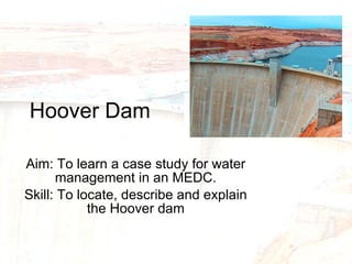
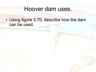
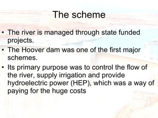
Hoover Dam Aim: To learn a case study for water management in an MEDC. Skill: To locate, describe and explain the Hoover dam
Starter: Using the map of the river Colorado basin (figure 3.67) describe the location of the Hoover Dam. A) globally B) regionally
Why was water transfer needed? Temperatures throughout the Colorado basin are high so water is lost through evaporation. The basin relies on snow melt from the Rockies, which relies on precipitation. The lower basin was liable to flooding. Urbanisation and population growth in the SW. Water needed for farming (cattle & irrigation). Use the 1991/1998 population table to describe how population has changed in the SW and why this has led to a need for water transfer.
Why was the area so suitable for a reservoir? The Colorado river flows across deeply dissected, level sandstone plateaus (canyons). (Ever heard of the Grand Canyon?) Canyons provide storage The underlying rocks are impervious and so less water would be lost through infiltration and percolation. The Hoover dam was built in the Black Canyon, which is over is 221 m high and 379m long. A narrow gorge so a narrow dam could be constructed therefore making the construction easier and cheaper. The area is largely desert and therefore few people had to be moved to make way for the reservoir.
Hoover dam uses. Using figure 3.70, describe how the dam can be used.
The scheme The river is managed through state funded projects. The Hoover dam was one of the first major schemes. Its primary purpose was to control the flow of the river, supply irrigation and provide hydroelectric power (HEP), which was a way of paying for the huge costs
So who benefited from the scheme? Towns and farms benefit from irrigation. Locals benefits from cheap electricity. Urban areas can develop without fear of flooding. Urban areas can develop in usually dry areas as they have a regular water supply e.g. Las Vegas. Locals and tourists can use the lakes for recreation purposes. Manufacturing industries and enables golf courses and gardens to thrive in areas where vegetation is normally very sparse
So who lost out from the scheme? Environmentalists and conversationalists who believe in the preservation of the wilderness in its original state. Flora and fauna from the surrounding ecosystems. Traditional Native Americans who live at sites along the river and are displaced. Settlements downstream of the river receive increased erosion as sediment trapped in lakes scours the channel. Using this information together with figure 3.75 explain the issues that have arisen in the Colorado basin.
Using an example of a dam you have studies describe explain the arguments for and against human interference in river flow to try to control flooding? A) Locate the dam B) Describe and explain why a dam was needed C) Describe and explain the advantages, (why it was so suitable). D) Describe and explain the disadvantages, (why it cause problems) 8 marks
Follow the command word Describe: Say what you see using observations, ideas and data. Explain: Say how or why giving as many reasons as you can. Underline key words and use specialist terms Categorise into social environmental economic factors (SEE factors) Talk about sustainability.
Mark Scheme Marked according to level of response. Level 1 Well applied case study, simple description or explanation, information communicated through brief statements.    (1-2) Level 2 More detailed description and explanation.  Communicates using a clear structure and begins to use specialist terms some errors in SPG.    (3-4) Level 3 Case study applied very well, provides a balanced account with specific description and explanation.    (5-6) Level 4 All of the above plus logical communication clear and well applied use of specialist terms very accurate SPG.  (7-8)

Hoover Dam2

  • 1.
    Hoover Dam Aim:To learn a case study for water management in an MEDC. Skill: To locate, describe and explain the Hoover dam
  • 2.
    Starter: Using themap of the river Colorado basin (figure 3.67) describe the location of the Hoover Dam. A) globally B) regionally
  • 3.
    Why was watertransfer needed? Temperatures throughout the Colorado basin are high so water is lost through evaporation. The basin relies on snow melt from the Rockies, which relies on precipitation. The lower basin was liable to flooding. Urbanisation and population growth in the SW. Water needed for farming (cattle & irrigation). Use the 1991/1998 population table to describe how population has changed in the SW and why this has led to a need for water transfer.
  • 4.
    Why was thearea so suitable for a reservoir? The Colorado river flows across deeply dissected, level sandstone plateaus (canyons). (Ever heard of the Grand Canyon?) Canyons provide storage The underlying rocks are impervious and so less water would be lost through infiltration and percolation. The Hoover dam was built in the Black Canyon, which is over is 221 m high and 379m long. A narrow gorge so a narrow dam could be constructed therefore making the construction easier and cheaper. The area is largely desert and therefore few people had to be moved to make way for the reservoir.
  • 5.
    Hoover dam uses.Using figure 3.70, describe how the dam can be used.
  • 6.
    The scheme Theriver is managed through state funded projects. The Hoover dam was one of the first major schemes. Its primary purpose was to control the flow of the river, supply irrigation and provide hydroelectric power (HEP), which was a way of paying for the huge costs
  • 7.
    So who benefitedfrom the scheme? Towns and farms benefit from irrigation. Locals benefits from cheap electricity. Urban areas can develop without fear of flooding. Urban areas can develop in usually dry areas as they have a regular water supply e.g. Las Vegas. Locals and tourists can use the lakes for recreation purposes. Manufacturing industries and enables golf courses and gardens to thrive in areas where vegetation is normally very sparse
  • 8.
    So who lostout from the scheme? Environmentalists and conversationalists who believe in the preservation of the wilderness in its original state. Flora and fauna from the surrounding ecosystems. Traditional Native Americans who live at sites along the river and are displaced. Settlements downstream of the river receive increased erosion as sediment trapped in lakes scours the channel. Using this information together with figure 3.75 explain the issues that have arisen in the Colorado basin.
  • 9.
    Using an exampleof a dam you have studies describe explain the arguments for and against human interference in river flow to try to control flooding? A) Locate the dam B) Describe and explain why a dam was needed C) Describe and explain the advantages, (why it was so suitable). D) Describe and explain the disadvantages, (why it cause problems) 8 marks
  • 10.
    Follow the commandword Describe: Say what you see using observations, ideas and data. Explain: Say how or why giving as many reasons as you can. Underline key words and use specialist terms Categorise into social environmental economic factors (SEE factors) Talk about sustainability.
  • 11.
    Mark Scheme Markedaccording to level of response. Level 1 Well applied case study, simple description or explanation, information communicated through brief statements. (1-2) Level 2 More detailed description and explanation. Communicates using a clear structure and begins to use specialist terms some errors in SPG. (3-4) Level 3 Case study applied very well, provides a balanced account with specific description and explanation. (5-6) Level 4 All of the above plus logical communication clear and well applied use of specialist terms very accurate SPG. (7-8)