The Great Dividing Range is a major mountain range located in eastern Australia. It extends over 3,500 kilometers (2,175 miles) from the northeastern tip of Queensland through New South Wales and into Victoria. It is one of Australia's most significant geographical features.
The document summarizes the major landforms of Australia. It describes four main landform regions: the coastal plains, eastern highlands, central lowlands, and western plateau. Each region has distinct characteristics that have been shaped by geological processes. Some iconic landforms highlighted include the Great Barrier Reef, Uluru, and Mount Kosciuszko, all of which have unique environmental and cultural significance. In conclusion, the document provided an overview of Australia's diverse geography and the natural features that define its different regions.
Scotland has varied geography ranging from the rugged Highlands in the north to the more fertile Central Lowlands. Wales also has diverse landscapes from coastal plains to mountainous regions like Snowdonia. Northern Ireland features lowlands, the Mourne Mountains, and Lough Neagh, the largest lake in the UK. The capitals are Edinburgh for Scotland, Cardiff for Wales, and Belfast for Northern Ireland.
Australia has several notable landmarks and tourist destinations. It has a diverse geography that includes the Outback, Great Barrier Reef, Blue Mountains, and Australian Alps. Australia's major cities are Sydney, Melbourne, Brisbane, Perth, Adelaide, and Canberra. The iconic Sydney Opera House and Bondi Beach attract many visitors to Sydney each year. The Great Barrier Reef and Willandra Lakes Region are popular natural attractions.
Australia is located in the southern hemisphere between latitudes 33'57 S and 151'11E. It has a land area of 7.686 million square kilometers and is composed of the Australian mainland as well as over 8,000 smaller islands. The topography is defined by plains, ranges, capes and deserts with the Great Dividing Range being the most significant geographic feature, dividing the coastal and inland zones. Some of the most important physical features include the Great Sandy Desert, Great Victoria Desert, Murray River, and Mount Kosciuszko, which is the highest peak in Australia.
Australia is a country located in Oceania between the Indian and South Pacific oceans. It has a population of around 25 million people and its capital and largest city is Canberra. Australia has a highly developed market economy and scores highly in quality-of-life, education, health, economic freedom, and human development. The country contains many natural landmarks and national parks, and its major industries include mining, manufacturing, tourism, and education.
Australia is the smallest continent located in the Southern Hemisphere between 10-44 degrees south latitude and 112-154 degrees east longitude. It was inhabited by Aboriginal Australians for over 40,000 years before being discovered by Europeans in the 17th century. Australia can be divided into three main physical regions - the Western Plateau, Central Lowlands, and Eastern Highlands. The Western Plateau covers most of Western and Central Australia and contains the famous Uluru rock formation. The Central Lowlands contain several inland river basins. The Eastern Highlands run along the eastern coast and contain the Great Dividing Range and highest point of Mt. Kosciuszko. Antarctica is located entirely in the Southern Hemisphere around the South Pole, covering
Australia is the smallest continent, located between 10-44°S and 112-154°E. It can be divided into the Western Plateau, Central Lowlands, and Eastern Highlands. The Great Barrier Reef off Australia's east coast is a major tourist spot. Primary occupations include agriculture like wheat farming, sheep herding, fishing, and industries such as aluminum production.
Week 32 day 4- unit 10- australia physical featuresmarypardee
Australia is located in Oceania between the Indian and South Pacific oceans. It has several notable physical features:
1. The Great Barrier Reef lies off the northeast coast of Queensland and is the world's largest coral reef system. It contains a large variety of marine life.
2. Ayers Rock, also known as Uluru, is a large sandstone rock formation located in the Northern Territory. It appears red due to its iron content.
3. The Great Victoria Desert stretches across South Australia and Western Australia. It receives little rainfall and has hot, dry conditions.
4. The Coral Sea lies off the northeast coast between Australia and New Caledonia. It helps support the Great Barrier
Australia is a country located in Oceania between the Indian and Pacific oceans. It covers an area of around 7.7 million square kilometers, making it the sixth largest country, and has diverse landscapes including eastern mountain ranges, central lowlands, and a western plateau. The central lowlands contain important river basins like the Murray-Darling, which supports agriculture, and Lake Eyre, a large salt lake. New Zealand is also located in Oceania and consists of two main islands, North and South, separated by Cook Strait. The South Island features high mountain ranges like the Southern Alps, while the North Island has lower volcanic mountains and peninsulas.
The document provides an overview of the geography of Oceania, including its varied physical features such as volcanic mountains, atolls, and lagoons that are home to unique wildlife. It then describes some of the key geographic regions of Australia, such as the Great Dividing Range, Western Plateau, Central Lowlands, and Outback. It also discusses the climate, rivers, reefs, and farming. The document concludes with descriptions of the types of islands found in Oceania and details about New Zealand's North and South Islands.
PowerPoint: Top 10 Australian Landforms
includes:
* Australian States and Territories and their Capital Cities;
* Answers: What is a 'Landform'?
* Answers: What is a 'Landmark'?
* Answers: What is a 'Landscape'?
From number 10 - Number 1 (countdown):
Katherine Gorge, The Twelve Apostles, Flinders Ranges, Horizontal Falls, The Three Sisters, Daintree Rainforest, Cradle Mountain, Bungle Bungle Ranges, Heart Reef, Uluru (Ayers Rock)
Worksheet for PowerPoint: Top 10 Australian Landforms at:
http://www.slideshare.net/yaryalitsa/worksheet-top-10-australian-landforms
Oceania is a geographic region that includes Australasia, Melanesia, Micronesia and Polynesia. Spanning the Eastern and Western Hemispheres, Oceania has a land area of 8,525,989 square kilometres (3,291,903 sq mi) and a population of over 41 million. When compared to continents, the region of Oceania is the smallest in land area and the second smallest in population after Antarctica.
Oceania has a diverse mix of economies from the highly developed and globally competitive financial markets of Australia, New Caledonia and New Zealand, which rank high in quality of life and human development index, to the much less developed economies such as Papua New Guinea, Indonesian New Guinea, Kiribati, Vanuatu and Tuvalu, while also including medium-sized economies of Pacific islands such as Palau, Fiji and Tonga.The largest and most populous country in Oceania is Australia, and the largest city is Sydney.
Australasia includes Australia, New Zealand, and surrounding islands. The region has diverse geography, including deserts, forests, and mountain ranges. Australia and New Zealand have developed economies based around agriculture, mining, and services. Major cities include Sydney, Melbourne, Brisbane, Perth, Adelaide, Auckland, Wellington, Christchurch and their populations are primarily concentrated along the coasts. The climate varies from tropical to temperate but natural disasters like floods and earthquakes occasionally occur. Tourism is an important industry focused on the natural scenery and environments.
The Outback is a remote, sparsely populated region of Australia that extends across northern, central, and southern areas of the country. It has a low population density and largely intact natural environment characterized by climatic zones ranging from tropical to temperate. Aboriginal peoples have lived in the Outback for over 50,000 years. The main industries in the Outback are pastoralism, mining, and tourism, with cattle grazing being the largest land use. The Outback has significant mineral resources and is a popular tourist destination known for its natural beauty and Indigenous culture.
Australia is the smallest of Earth's continents, with an area of 7.615 million km2. It has a diverse landscape including large deserts in the west and center, sweeping plains and plateaus in the center, and highlands in the east. Structurally, Australia was once part of the ancient supercontinent Gondwana. The climate is mostly tropical and subtropical, with low rainfall across much of the interior.
PowerPoint: Top 10 Australian Man-Made Landmarks Yaryalitsa
PowerPoint: Top 10 Australian Man-Made Landmarks
includes:
* Australian States and Territories and their Capital Cities;
* Answers: What is a 'Landform'?
* Answers: What is a 'Landmark'?
* Answers: What is a 'Landscape'?
From number 10 - Number 1 (countdown):
Broome, ANZAC Cove, Ballarat, Cape Byron Lighthouse, Parliament House, Barossa Valley, Q1, MCG (Melbourne Cricket Ground), Port Arthur, Sydney Opera House
Worksheet: PowerPoint: Top 10 Australian Man-Made Landmarks at:
http://www.slideshare.net/yaryalitsa/worksheet-powerpoint-top-10-australian-manmade-landmarks
The document provides information about key landmarks and geography of Australia. It describes the Sydney Opera House, built between 1959 and 1973 with a series of precast concrete shells, and the Sydney Harbour Bridge, constructed from 1923 to 1932 which is the longest steel arch bridge across Sydney Harbour. It also gives brief statistics about the size and dimensions of both landmarks.
The document summarizes the 6 major physical regions of Canada:
1. The Canadian Arctic is located within the Arctic Circle and has jagged mountains and flat snow covered terrain. Glaciers formed much of the landscape. The climate is harsh with below freezing winter temperatures and summer averages of 13°C. Polar bears are at risk of extinction due to shrinking Arctic ice.
2. The Interior Plains is located in western central Canada with hills, forests, and river valleys. It formed from sediments deposited in an ancient sea. It has short, cold winters and hot summers ideal for agriculture like wheat and cattle farming.
3. The Appalachian Highlands are located in northeast Canada with old
Wales has a varied geography ranging from coastal plains to mountainous regions like Snowdonia. It has over 1,300 km of coastline and many lakes and reservoirs used for tourism, leisure, and hydroelectricity. The main population centers are in south Wales, including the cities of Cardiff, Swansea, and Newport. Wales has a mild climate that is cloudy and rainy, especially in western mountain areas. Notable landmarks include Snowdon, the Seven Wonders of Wales, and many natural beauty spots that contribute to Wales' tourism industry. Maintaining this balance of conservation and sustainable use of natural resources will be important for Wales' future.
Australia is both a continent and a country located in the southern hemisphere, surrounded by the Pacific Ocean and Indian Ocean. It is home to the Great Barrier Reef, the world's largest coral reef off the northeast coast of Queensland, and Uluru, a massive red sandstone rock formation in the center of the continent. Most Australians live in urban areas along the eastern coast, which has a temperate climate, while the interior Outback region has a dry climate with few settlements. Australia has significant mining and agricultural industries that export resources and food around the world.
The final project for the Organic Architecture class asked us to look at a type of vernacular architecture of our choice and consider it in a contemporary context
1) Australia is divided into 6 states and 2 territories, with the largest state being Western Australia.
2) The Great Barrier Reef lies off the northeast coast of Queensland and is the world's largest coral reef system, home to thousands of marine species.
3) Central Australia has huge desert plains and a hot, dry climate, while milder climates exist along the southeast and southwest coasts where most Australians live.
Australia is an island continent located between the Indian and South Pacific oceans. It has a diverse landscape that includes deserts, rainforests, and the Outback interior. The population of over 24 million is predominantly urbanized along the eastern and southeastern coasts. Major cities include Sydney, Melbourne, Brisbane, Perth, and the capital Canberra. The majority of Australians have European ancestry and Christianity is the dominant religion, though irreligion is rising. The British monarch is the head of state, with an elected parliamentary government.
Australia - Physical and Political FeaturesHeatherP
1) Australia is divided into states and territories, with the largest and most populated being New South Wales, Queensland, and Western Australia.
2) Physically, Australia is the smallest continent and flattest country, characterized by vast desert plains in the interior and milder climates along the southeastern and southwestern coasts, where most Australians live.
3) Major physical features include the Great Barrier Reef, the world's largest coral reef system off the coast of Queensland, and Ayers Rock, a massive sandstone monolith in the country's center.
New Zealand is situated some 1,500 kilometres (900 mi) east of Australia across the Tasman Sea and roughly 1,000 kilometres (600 mi) south of the Pacific island areas of New Caledonia, Fiji, and Tonga. Because of its remoteness, it was one of the last lands to be settled by humans.
This document provides information on the geographic features of Australia. It describes how Australia is divided politically into multiple states and territories. It then gives overviews of each state and territory, describing their locations, key cities, and physical features. The document also summarizes Australia's physical geography, noting that the country is very dry with most of the population living along the southeast coast, and features like the Great Barrier Reef, Ayers Rock, and Great Victoria Desert.
This document summarizes key geographic features of Australia. It outlines that Australia is divided into 6 states and 2 territories, and describes some of the key physical attributes of each state/territory such as capital cities, population sizes, and geographic highlights. It then discusses Australia's physical features at a national level, including its climate, largest deserts, and natural landmarks like the Great Barrier Reef, Ayers Rock, and Great Victoria Desert.
Smart cities are the ones which use the latest technologies in order to improve the quality of life of its citizens and to minimize the consumption of natural resources in addition to reducing costs.
The Victoria Memorial is a large marble building in Kolkata built between 1906 and 1921 to commemorate Queen Victoria. It has an Indo-Saracenic architectural style that blends British and Mughal elements. The memorial has 25 galleries displaying artifacts and is one of the most popular tourist sites in Kolkata, receiving around 3.5 million visitors annually. Its 57-acre gardens surrounding the building are also a major attraction.
LITERATURE STUDY OF COLLEGE OF ARCHITECTUREJashanPreet56
This document provides requirements and guidelines for designing an architecture college building based on standards set by the Council of Architecture and Chandigarh Building Byelaws. It includes requirements for minimum land area, floor space, and facilities based on student intake. Key areas that must be included are studios, lecture halls, labs, library, staff rooms, and activity spaces. Dimensions and capacity guidelines are provided for different building components like classrooms, computer labs, and staircases to ensure accessibility.
The document discusses various topics related to urban and regional planning, including urban sociology, the relationship between sociology and urban planning, theories of urbanization, Karl Marx's theory of urbanization, economic uplift and backwardness, poverty alleviation, consumption of resources and production/maintenance of viable communities, and types of plans used in urban planning such as master plans, zonal plans, local area plans, sector plans, and neighborhood plans.
This document discusses the role of plants in building science from multiple perspectives. It begins by classifying different types of plants and their uses, such as decorative plants, edible plants, and plants that purify air. It then discusses how plants can provide environmental benefits like reducing energy needs, improving aesthetics, and improving air quality. Additional sections explore how plants help with health and well-being, managing stormwater, and their role as shading devices. The document concludes by summarizing the evolution of garden design over time from ancient to modern approaches. Overall, the document outlines the various ways plants can enhance buildings and landscapes from an environmental and scientific perspective.
Jahangir was the fourth Mughal ruler who succeeded Akbar and was known for his ambivalent stance on religion and love of art. Some of his most notable buildings constructed during his reign include the tombs of Akbar, Jahangir, and Itmad-ud-Daulah. Akbar's mausoleum featured an ornate entrance gate and was constructed on a grand scale within a walled garden. Jahangir's tomb was built in Lahore within a large formal garden and features red sandstone gateways and minarets. The tomb of Itmad-ud-Daulah, commissioned by Nur Jahan, was the first Mughal structure built entirely of marble and known for
This document provides information about the village of Giana in India. It discusses the village's population, climate, facilities provided by the government including a school, dispensary and grain market. It also describes religious buildings like the Gurudwara Parkaash Sahib and Dera Sadha Ram. Transport connections are highlighted as the village is located on the border of Punjab and Haryana. The architectural diversity of buildings is noted to be inspired by Sikhism.
This document summarizes several common hand tools used for woodworking joints:
- Coping saws cut intricate shapes and interior cutouts. Block planes efficiently slice end grain and remove thin shavings. Chisels cut wood when struck with a mallet. Jack planes perform some tasks of smoothing and jointer planes on smaller works. Marking knives and combination squares lay out angles and lines for cutting. Saws cut through wood by pushing and pulling blades. Marking gauges scribe lines parallel to edges for joinery.
This document provides information on colour theory and the principles and elements of design. It discusses colour theory, the colour wheel, warm and cool colours, and how colour impacts perception. It also covers the elements of design such as line, shape, texture, and scale. Finally, it discusses the principles of design including balance, emphasis, rhythm, and unity. Colour theory and understanding elements and principles of design are important for architects and designers to effectively use colour and design in their work.
A motel, short for "motor hotel," is a lodging facility designed for motorists, featuring rooms with exterior entrances for easy access from the parking lot. Typically situated along highways or in suburban areas, motels offer basic amenities, such as beds and bathrooms, often at a more affordable rate than hotels.
Discovering the Best Indian Architects A Spotlight on Design Forum Internatio...Designforuminternational
India’s architectural landscape is a vibrant tapestry that weaves together the country's rich cultural heritage and its modern aspirations. From majestic historical structures to cutting-edge contemporary designs, the work of Indian architects is celebrated worldwide. Among the many firms shaping this dynamic field, Design Forum International stands out as a leader in innovative and sustainable architecture. This blog explores some of the best Indian architects, highlighting their contributions and showcasing the most famous architects in India.
Best Digital Marketing Strategy Build Your Online Presence 2024.pptxpavankumarpayexelsol
This presentation provides a comprehensive guide to the best digital marketing strategies for 2024, focusing on enhancing your online presence. Key topics include understanding and targeting your audience, building a user-friendly and mobile-responsive website, leveraging the power of social media platforms, optimizing content for search engines, and using email marketing to foster direct engagement. By adopting these strategies, you can increase brand visibility, drive traffic, generate leads, and ultimately boost sales, ensuring your business thrives in the competitive digital landscape.
International Upcycling Research Network advisory board meeting 4Kyungeun Sung
Slides used for the International Upcycling Research Network advisory board 4 (last one). The project is based at De Montfort University in Leicester, UK, and funded by the Arts and Humanities Research Council.
Architectural and constructions management experience since 2003 including 18 years located in UAE.
Coordinate and oversee all technical activities relating to architectural and construction projects,
including directing the design team, reviewing drafts and computer models, and approving design
changes.
Organize and typically develop, and review building plans, ensuring that a project meets all safety and
environmental standards.
Prepare feasibility studies, construction contracts, and tender documents with specifications and
tender analyses.
Consulting with clients, work on formulating equipment and labor cost estimates, ensuring a project
meets environmental, safety, structural, zoning, and aesthetic standards.
Monitoring the progress of a project to assess whether or not it is in compliance with building plans
and project deadlines.
Attention to detail, exceptional time management, and strong problem-solving and communication
skills are required for this role.
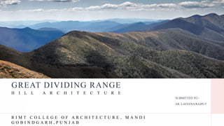
1. GREAT DIVIDING RANGE
SUBMITTED TO -
AR. LAVEENA RAJPUT
H I L L A R C H I T E C T U R E
R I M T C O L L E G E O F A R C H I T E C T U R E , M A N D I
G O B I N D G A R H , P U N J A B
2. THE GREAT
DIVIDING RANGE
The Great Dividing Range is a major mountain range located in eastern Australia. It
extends over 3,500 kilometers (2,175 miles) from the northeastern tip of Queensland
through New South Wales and into Victoria. It is one of Australia's most significant
geographical features.
The range plays a crucial role in Australia's geography and climate as it acts as a
watershed, separating the eastern coastal areas from the inland regions. Rainfall on
the eastern side of the range flows towards the Pacific Ocean, while the western side,
often referred to as the "rain shadow" side, is drier with less precipitation.
HILL ARCHITECTURE, SEM 9TH THE GREAT DIVIDING RANGE
2
The Great Dividing Range consists of a complex of mountain ranges,
plateaus, upland areas and escarpments.
COUNTRY : AUSTRALIA
STATES/DISTRICTS :New South Wales,
Queensland, Victoria and
Australian Capital Territory
COORDINATES : 25°S 147°E
HIGHEST POINT : MOUNT KOSCIUSZKO [2,228 m (7,310 ft]
3. HILL ARCHITECTURE, SEM 9TH THE GREAT DIVIDING RANGE
3
WHY IT IS CALLED AS GREAT DIVIDING
RANGE ?
The Great Dividing Range is called so because it serves as a significant
geographical feature that divides the eastern part of Australia from the
western inland regions. It acts as a watershed, determining the direction in
which water flows.
TOPOGRAPHICALLY, the Great Divide begins in
Queensland, where the elevation averages 600-900 meters. However, it
rises to over 1,500 meters in Bellenden Ker Range. Further south, the
range’s elevation averages 900 meters. The Australian Alps, straddling
the Victoria-New South Wales border, is Australia’s highest mountain
range, containing peaks rising over 2,000 meters above sea level. The
Alps is divided into Victorian Alps and Snowy Mountains. The Snowy
Mountains hosts the country’s five tallest peaks, including Mount
Kosciuszko (2,228 meters)
4. L O C A T I O N M A P
HILL ARCHITECTURE, SEM 9TH THE GREAT DIVIDING RANGE
4
C O U N T R Y : A U S T R A L I A
C O N T I N E N T: A U S T R A L I A
The Great Dividing Range is primarily located in
Australia, which is both a country and a
continent. It runs through several states of
Australia, including Queensland, New South
Wales, and Victoria.
5. The highest areas of the Australian continent are found in the Great Dividing Range,
which divides the east coast from the remainder of the less contoured and more barren
inland areas. There is a wide variety of vegetation throughout its length. Rainforests
provide home and shelter to a diversity of wildlife. Steep, wooded canyons fall below an
elevated sandstone plateau. The snowfields of the Australian Alps complete the tableau.
The Range was considered a formidable barrier to westward migration of European
settlers until 1813 when a suitable route was discovered by the pioneering party of
Gregory Blaxland. Following this the development of the agricultural districts of inland
New South Wales began. Today New South Wales is an area of rich resources
for agriculture, logging, and mining. Australia's principal rivers run through the Range.
The river system provides water for irrigation for drier lands on the range's western slope,
and power for hydroelectric power plants. Its great variety of mountain ranges, national
parks and skiing areas provide a major tourist industry. The Great Dividing Range
continues to play an important role in the development of the Australian nation.
INTRODUCTION HISTORY
The Great Dividing Range is a very long line of mountains in Australia. It was
created a very, very long time ago, around 300 million years ago. The
mountains formed when the land was pushed up because of the movement of
the Earth's plates.
Before European settlers arrived, Indigenous Aboriginal people lived in this
area and had a strong connection to the land. In the early 1800s, European
explorers like Gregory Blaxland crossed these mountains, which made it
easier for European people to settle in the lands on the other side.
The land on the eastern side of the range is very fertile, which means it's good
for farming. So, people started growing crops and raising animals there. It
played a big role in Australia's early agricultural history, especially in the
wool industry.
The Great Dividing Range is also home to many unique plants and animals
found only in this part of the world. It's important for protecting these special
species, so there are many national parks and protected areas in this region.
Today, the range affects the weather, water, and transportation in
Australia. It's a popular place for people to visit, with lots of
opportunities for hiking, camping, and enjoying the outdoors. So, in
simple words, the Great Dividing Range is a very old mountain range in
Australia with a long history of people living there and is now a great
place for nature and outdoor activities.
6.
7. CLIMATE
The Great Dividing Range in Australia has a varied climate. Coastal areas
have mild, temperate weather with consistent rainfall, while higher
elevations are cooler and may experience snow. The western side is drier
due to a rain shadow effect. The range exhibits distinct seasons, and
microclimates create diverse ecosystems and vegetation…
• In the coastal areas, temperatures can range from mild to warm, with
summer highs averaging around 25-30°C (77-86°F) and winter lows
around 10-15°C (50-59°F).
• At higher elevations, temperatures can be cooler, and snowfall is possible
during the winter months. Winter temperatures may drop below freezing,
especially at night.
8. THE GREAT DIVIDING RANGE -
ARCHITECTURAL STYLE
The Great Dividing Range is a prominent geographical feature in eastern Australia. It is a vast
mountain range that stretches roughly 3,500 kilometers (2,175 miles) from the northeastern tip of
Queensland, down through New South Wales, and into the northeastern part of Victoria. The
architecture style in the Great Dividing Range region varies significantly due to its vast expanse
and diverse landscapes.
TRADITIONAL AUSTRALIAN HOMESTEADS:
Many areas in the Great Dividing Range feature traditional Australian homesteads, which
are characterized by their practicality and adaptability to the environment. These structures
are often made of local materials and designed to withstand the sometimes harsh climate
and terrain. They typically have wide verandas, corrugated iron roofs, and are single-story,
reflecting a response to the hot, dry summers and the need for shade and protection from the
elements.
COLONIALAND FEDERATION STYLE:
In some parts of the Great Dividing Range, you'll find architectural influences from the
colonial and Federation eras. These styles incorporate Victorian and Edwardian design
elements, including ornate facades, decorative fretwork, and gabled roofs. Buildings from
this period often have a blend of local materials and imported architectural elements,
creating a unique fusion of styles.
ALPINE AND MOUNTAIN CHALETS:
In the higher elevations of the Great Dividing Range, particularly in the Snowy Mountains
of New South Wales and Victoria, you'll find alpine-style architecture. These buildings
often have steeply pitched roofs to shed snow, exposed timber framing, and cozy, warm
interiors to accommodate the cold winters. This style is reminiscent of European mountain
chalets.
Fig.1 Traditional Australian Homesteads
Fig.2 Colonial And Federation Style
9. THE GREAT DIVIDING RANGE -
ARCHITECTURAL STYLE
CONTEMPORARY AND SUSTAINABLE DESIGN:
In more recent years, there has been a growing trend toward contemporary and
sustainable architectural design. Many houses and structures in the Great Dividing
Range now incorporate eco-friendly materials, passive solar design, and energy-
efficient features to adapt to the region's environmental challenges.
RURAL AND AGRICULTURAL STRUCTURES:
Throughout the region, you'll find a wide variety of rural and agricultural buildings,
including barns, sheds, and silos. These structures are functional and utilitarian, often
constructed with local materials to serve the needs of the agricultural and farming
communities in the area.
BUSHFIRE-RESISTANT DESIGN:
Due to the increased risk of bushfires in the region, modern architectural designs often
incorporate bushfire-resistant features such as fire-resistant materials, ember-proofing,
and defensible space planning to protect homes and structures.
Fig. 3 Bushfire – Resistant Design
Fig.5
Bushfire-
Resistant
design
Fig.4
10. THE GREAT DIVIDING RANGE -
CONSTRUCTION TECHNIQUES
The construction techniques used in the Great Dividing Range, like in many other regions,
have evolved over time and vary depending on the specific purpose of the construction,
available resources, and environmental conditions.
TIMBER CONSTRUCTION:
Timber has been a popular building material in the Great Dividing Range due to the
abundance of forests in the region. Traditional timber construction techniques include
post-and-beam structures, log cabins, and timber-framed buildings. Local hardwoods,
such as eucalyptus, have been commonly used due to their durability and strength.
STONE MASONRY:
In areas where suitable stone resources are available, stone masonry has been a
prevalent construction technique. Dry stone walls and mortared stone buildings are
often found in the region. These structures provide good insulation and can withstand
the test of time, making them ideal for the harsh climate.
ADOBE AND RAMMED EARTH:
In some parts of the Great Dividing Range, particularly in the drier inland areas,
adobe and rammed earth construction techniques have been employed. These methods
involve using earth or clay mixed with straw to create durable walls. Adobe and
rammed earth structures offer natural insulation and are well-suited to the region's
climate.
Fig. Adobe And Rammed Earth
Fig. Stone Masonry
11. THE GREAT DIVIDING RANGE -
CONSTRUCTION TECHNIQUES
STEELAND METAL FRAMING:
Modern construction techniques in the Great Dividing Range often incorporate steel and metal
framing for structural support. Steel is used for the construction of large commercial and
industrial buildings, bridges, and other infrastructure projects.
BUSHFIRE-RESISTANT BUILDING TECHNIQUES:
Given the region's vulnerability to bushfires, construction techniques often include bushfire-
resistant features. These may involve using fire-resistant building materials, ember-proofing
measures, and creating defensible spaces around structures to reduce the risk of fire damage.
SUSTAINABLE AND ENERGY-EFFICIENT DESIGN:
In recent years, there has been an increasing focus on sustainable and energy-efficient
construction techniques. This includes the use of passive solar design, energy-efficient
insulation, and environmentally friendly building materials to reduce the ecological footprint
of buildings in the region.
EARTHQUAKE-RESISTANT CONSTRUCTION:
While Australia is not known for having high seismic activity, some areas within the Great
Dividing Range can be subject to minor earthquakes. In such cases, construction techniques
incorporate earthquake-resistant design and materials to enhance structural safety.
Fig. Earthquake-resistant
Construction
Fig. Sustainable And Energy-
efficient Design
12. HILL ARCHITECTURE, SEM 9TH THE GREAT DIVIDING RANGE
12
SYDNEY, NEW SOUTH WALES
Sydney is the capital city of the state of New South Wales, and the most populous city
in Australia., and it is situated on the eastern coast of the country, near the Great Dividing
Range.
LOCATION: Sydney is located in New South Wales, along the southeastern coast of Australia.
While it is not directly within the Great Dividing Range, it is relatively close to the foothills of
the range.
CLIMATE: The Great Dividing Range has a significant influence on Sydney's climate. The
range affects weather patterns and rainfall distribution, with the coastal side receiving more
moderate, temperate weather, while the western side of the range experiences a more arid
climate. Sydney enjoys a temperate maritime climate with mild winters and warm summers,
thanks in part to its coastal location influenced by the range.
Mean max temp Mean min temp Annual rainfall
22.8 °C
73 °F
14.7 °C
58 °F
1,149.7 mm
45.3 in
13. HILL ARCHITECTURE, SEM 9TH THE GREAT DIVIDING RANGE
13
The Great Dividing Range has
influenced the historical development of Sydney and
the surrounding region. Early colonial exploration and
settlement in Australia were shaped by the presence of
these mountains, as they presented both barriers and
opportunities for inland expansion.
In terms of recreation and tourism, the Great Dividing
Range provides numerous outdoor activities and
scenic vistas for Sydneysiders and visitors alike.
National parks, hiking trails, and other recreational
opportunities in the mountains are easily accessible
from the city, offering a natural escape from the urban
environment.
In summary, the Great Dividing Range's proximity to
Sydney has an impact on the city's climate, historical
development, and recreational opportunities, making
it an essential part of Sydney's geographical and
environmental context.
SYDNEY, situated in New South Wales, Australia, is a
vibrant and dynamic metropolis renowned for its stunning harbor,
iconic landmarks, and cultural diversity. With a rich history dating
back to its colonial origins in the late 18th century, the city boasts a
mix of architectural styles that include colonial, Victorian, Art Deco,
and modernist influences. Sydney's architectural tapestry spans from
the historic streets of The Rocks to contemporary skyscrapers that
define its skyline. The Sydney Opera House, a globally recognized
masterpiece of modern architecture, and the Sydney Harbor Bridge
symbolize the city's ingenuity and charm. With a thriving arts scene,
world-class dining, beautiful beaches, and a diverse multicultural
population, Sydney is a global city where history and innovation
seamlessly coexist.
14. HILL ARCHITECTURE, SEM 9TH THE GREAT DIVIDING RANGE
14
BRISBANE
BRISBANE is the capital city of the Australian state of QUEENSLAND and is located
near the eastern foothills of the Great Dividing Range. While Brisbane itself is not
situated directly within the range, it is close enough to be influenced by its geography
and climate.
1.LOCATION: Brisbane is situated in the southeastern part of Queensland, along the
eastern coast of Australia. The city is approximately 100 kilometers (about 62 miles)
from the eastern edge of the Great Dividing Range.
2.CLIMATE: The proximity to the Great Dividing Range has a notable impact on
Brisbane's climate. The mountains influence weather patterns, often leading to more
rainfall on the eastern side of the range. Brisbane experiences a subtropical climate with
warm, humid summers and mild winters, partly due to its location on the eastern side of
the mountains.
Mean max temp Mean min temp Annual rainfall
25.4 °C
78 °F
15.7 °C
60 °F
1,036 mm
40.8 in
15. Thank You
HILL ARCHITECTURE, SEM 9TH THE GREAT DIVIDING RANGE
15
SUBMITTED BY -
JASHANJIT KAUR
ANURAG SINGLA
B.ARCH – SEMESTER 9TH