GPR and Integrating Geophysical Methods at Portus
•Download as PPTX, PDF•
1 like•900 views

The document discusses using ground-penetrating radar (GPR) and integrating geophysical methods to study the Imperial Port of Rome. GPR was used to image subsurface features at the site from 2009 to present. Integrating multiple geophysical techniques, such as magnetometry, resistivity, and GPR, through graphical overlays and cluster analysis can provide more comprehensive subsurface information than a single method alone. However, challenges remain in applying these integration methods in 3 dimensions and using GPR at complex sites with issues of scale, resolution, topography, and accessibility.

Recommended
Recommended
More Related Content
Viewers also liked
Viewers also liked (10)
More from Jessica Ogden
More from Jessica Ogden (13)
GPR and Integrating Geophysical Methods at Portus
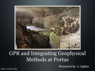
- 1. GPR and Integrating Geophysical Methods at Portus Presented by: J. Ogden Photo: Hembo Pagi
- 2. The Imperial Port of Rome
- 3. Motivations & Constraints Photos: Hembo Pagi
- 6. Ground-Penetrating Radar May 2008
- 7. Ground-Penetrating Radar 0-22cm 38-59cm 50-72cm 63-84cm 75-97cm 88-110cm 101-122cm 113-135cm
- 8. GPR: Within the Excavation September 2008
- 10. Ground-Penetrating Radar Photos: Hembo Pagi & Martin Millet September 2009
- 11. Ground-Penetrating Radar September 2009
- 13. Piro S., Mauriello, P., and Cammarano F. 2000. ‘Quantitative integration of geophysical methods for archaeological prospection.’ Archaeological Prospection, Vol. 7 pp. 203-213
- 15. Geophysical Data Integration ‘OR’
- 16. 2D Graphical Integration Red = Magnetometry Green = Resistivity Blue = GPR
- 18. Geophysical Data Integration Cluster Analysis MIN function Photo: Martin Millet
- 20. Topographic and Tilt Correction
- 21. AccessibilityPhoto: Hembo Pagi