Status and Perspectives of GIS Application in BANGLADESHBayes Ahmed
This is the final presentation of the course GIS Applications in Developing Countries. This course was a part of the Erasmus Mundus Master in Geospatial Technologies offered in Westfälische Wilhelms-Universität Münster (WWU), Institute for Geoinformatics (ifgi), Münster, Germany.
Policy Alignment for Climate Resilient Development in NepalNAP Global Network
Presentation by Dr. Maheshwar DHAKAL, Chief, Climate Change Management Division, Ministry of Forests and Environment, and Basanta PAUDEL, Nepal, as part of the webinar " Strengthening Alignment Between Adaptation to Climate Change – Disaster Risk Management – Sustainable Development", held on March 04, 2020.
An introduction to GIS Data Types. Strengths and weaknesses of raster and vector data are discussed. Also covered is the importance of topology. Concludes with a discussion of the vector-based format of OpenStreetMap data.
This is presentation is intended for middle school students. It provides a short introduction to GIS and how to use GIS in the real-world.
ArcGIS Explorer is the software used to demonstrate concepts.
45 minutes + 15 minutes demo
Download ArcGIS Explorer here...
http://www.esri.com/software/arcgis/explorer/
A geographic information system (GIS) is a system designed to capture, store, manipulate, analyze, manage, and present all types of geographical data. The acronym GIS is sometimes used for geographical information science or geospatial information studies to refer to the academic discipline or career of working with geographic information systems and is a large domain within the broader academic discipline of Geoinformatics. In the simplest terms, GIS is the merging of cartography, statistical analysis, and computer science technology.
GIM encompasses the management, leadership, structures and practices required for the successful operation of GIS within an entity, nationally, regionally or globally.
Perhaps the most important component of a GIS is in the part of data used in GIS. The data for GIS can be derived from various sources. A wide variety of data sources exist for both spatial and attribute data.
This is lecture of Advanced GIS (ITM 524), MSc in Information Technology for Natural Resources Management, Bogor Agricultural University.
This topics covered: Internet & World Wide Web, Web Mapping, Internet GIS, Web Mapping Services Model, Spatial Data Infrastructure.
GIS is commonly used in urban planning to assists with land use planning and development zoning maps. ... The use of GIS in environmental planning is increasingly being sought to address problems of spatial modelling.
Geographic Information Systems (GIS) play a pivotal role in military operations. The concept of Command, Control, Communication and Coordination in military operations is largely dependent on the availability of accurate, spatial information to arrive at quick decisions for operational orders.
In the present digital era, GIS is an excellent tool for military commanders in the operations. The use of GIS applications in military forces has revolutionised the way in which these forces operate and function.
GEO-N-VIRON webinar talk on Geospatial Technology in Sustainable EnvironmentAdityaAllamraju1
My special talk about 'Geospatial Technology in Sustainable Environment’ is a part of the GIS Day celebration 2020 webinar session called GEO-N-VIRON on December 5th, 2020 organized by NestAbide & GeoVin Solutions Pvt. Ltd. Thiruvananthapuram, Kerala.
How the polio eradication effort in Nigeria led to a quest for global geospat...MEASURE Evaluation
Presented by Vincent Seaman, Interim Deputy Director for the Strategy, Data and Analytics, Bill & Melinda Gates Foundation, at the 2017 GIS Working Group Annual Meeting.
INTEGRATION OF REMOTE SENSING DATA WITH GEOGRAPHIC INFORMATION SYSTEM (GIS): ...ijmpict
Remote Sensing and Geographic information System together comprise of Geographic Information Science (GIScience) which is a core research field that tries to emphasis on advanced geographic concepts in Geographic Information System and examines the impact of GIS on individuals and society as a whole and re-examines the themes with incorporation of most recent cognitive and Information Science. The Geographic Information System can be defined as a Computer based system and a tool, both hardware,
software and procedures, which manages geospatial data, solves spatial problems, and supports collection,
storage, transformation, analyzing, retrieving and display of data in a well desired manner. The integration
of GIS and Remote Sensing is a field of research and several implementations have been developed to gain
the maximum throughput out of these collective fields as these techniques have their own data analysis and
data representation methods. The application domain of remote sensing is from a base layer for GIS to the
development of thematic datasets, obtaining and extracting data from imagery and generation of unique
spatial datasets. In my paper I have focused on the integration of both the fields along with its usage in
Analysis and Modelling and also some models of error sources due to the integration of interface of the two
techniques. The paper also describes some error sources while integration as GIS and remote sensing both
are subject to errors and uncertainty. The paper has discussed some Change Detection Techniques used in
the modern sciences with their comparison.
Floods are among the most destructive natural disasters, which are highly com...vyoginet
Floods are among the most destructive natural disasters, which are highly complex to model. The research on the advancement of flood prediction models contributed to risk reduction, policy suggestion, minimization of the loss of human life, and reduction of the property damage associated with floods. To mimic the complex mathematical expressions of physical processes of floods, during the past two decades, machine learning (ML) methods contributed highly in the advancement of prediction systems providing better performance and cost-effective solutions. Due to the vast benefits and potential of ML, its popularity dramatically increased among hydrologists. Researchers through introducing novel ML methods and hybridizing of the existing ones aim at discovering more accurate and efficient prediction models. The main contribution of this project is to demonstrate the state of the art of ML models in flood prediction and to give insight into the most suitable models. This project presents the Flood prediction and Rainfall analysis using Machine Learning. The main goal of employing this application is to prevent impacts of flood. This application can be easily used by the common people or government to predict the occurrence of flood beforehand. Among many ML techniques, classification is a widely used one. We use multiple algorithms such as
World Bank funded Gis based web enabled environment database of GujaratMandar Mehta
75 manmonth World Bank funded project to create GIS based Web Enabled Gujarat’s Environment Database – the first and largest of its kind in India. The data was collected through in-depth study of specific components of Gujarat’s environment over a period of 5 years by some of the well-known Institutions of India. The project included environmental mapping of Gujarat State (more than 300 maps with around 2000 attribute tables) + Maps of 26 districts, 274 talukas, & 18000+ villages of Gujarat State
Applications of GIS in Public Health EngineeringVignesh Sekar
GIS is used to support decision making for planning and management of land use, natural resources, environment, transportation, urban facilities, and other administrative records. Remote sensing and GIS makes easier to get valuable information about the study area. GIS enables us to integrate different layers and to manage large database. It gives more accurate results when compared to conventional methods. Hence GIS is proved to be a powerful tool in managing spatial and non spatial databases in suitability evaluation.
Similar to GIS Data Availability in Bangladesh_Final (20)
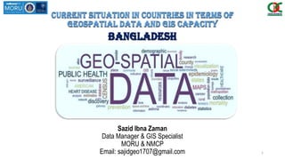
1. Current situation in countries in terms of
geospatial data and GIS capacity
BANGLADESH
Sazid Ibna Zaman
Data Manager & GIS Specialist
MORU & NMCP
Email: sajidgeo1707@gmail.com 1
2. content
1. Common & Project Specific
Dataset
2. Availability of Geospatial Dataset
in Bangladesh
3. Important Free GIS Data Websites
in Countryside
2
3. Project Specific Dataset (Malaria)
Common Datasets
Spatial Data with Coordinate
Administrative Boundaries (Level 1,2,3,4)
Populated Places (Settlements)
Transportation Network (roads, ports, etc.)
Hydrology (Streams, Waterbodies, etc.)
Spatial Data without Coordinate
Population Statistics (District, Upazila, Union, Village)
Common datasets are core sets of data needed to support
operations and decision-making.
Project Specified datasets are datasets required to support
multiple cluster/sector operations and more specific to a
particular sector.
Spatial Data with Coordinate
Health Facilities (Health Complex, Community Clinic)
Rural Extent
Vegetation (Forest)
Landuse (Agricultural Areas)
Population Migration inbound & outbound (Cell Data)
Mosquito Location Data
No of IRS
Topographic data (elevation)
Spatial Data without Coordinate
Malaria Cases (Daily, monthly, yearly)
Distribution of LLIN/ITN (Permanet, Duranet, Netprotect..)
Distribution of ACT Stock (Artemether/lumefantrine,
Cloroquine)
Population Migration inbound & outbound (Cell Data,
Questionniare)
Climate Data (Daily, monthly, yearly)
No of IRS
Occupation (forestry,agriculture,fisheries)
3
4. Availability of geospatial data
Administrative Unit
Division
District
Upazila/Thana
Union
Mouza/Parcel (Not Administrative unit)
Village/Para
What We Have
4
5. Availability of geospatial data
COMMON DATASETS
Administrative Boundaries
• Up to Upazila/Thana Level [Polygon]Local Government Engineering Department (LGED)
• Up to Union Level [Polygon] Comprehensive Disaster Management Program (CDMP)
• Mouza / Parcel (DLRS) [Polygon] Department of Land Record and Survey
• Mouza / Parcel (CEGIS) [Polygon] Center For Environmental and Geographic Information
Services
Spatial Data with Coordinate
Upazila Boundary
Union Boundary
Mouza Boundary
5
6. Availability of geospatial data
COMMON DATASETS
Populated Places (village, town, cities) [Point] GEOnet Names Server (GNS); ITOS-GIST
Transportation Network (roads, ports, etc.) [Polyline]
Local Government and Engineering Department (LGED), WFP-VAM
Transportation Network (railway etc.) [Polyline]
SWERA (Solar and Wind Energy Resource Assessment)
Spatial Data with Coordinate
Village/Para
Road Network
Railway
6
7. Availability of geospatial data
COMMON DATASETS
Hydrology (streams, waterbodies, etc.) [Polyline, Polygon]
Global Map Initiative
Spatial Data with Coordinate
River Network
Inland Water Network
7
8. Availability of geospatial data
COMMON DATASETS
Geocode List Bangladesh Bureau of Statistics (BBS)
Population Statistics (District, Upazila, Union, Village) Bangladesh Bureau of Statistics (BBS)
Spatial Data without Coordinate
8
9. Availability of geospatial data
Project Specific Dataset (Malaria)
Malaria Cases
• Up to Upazila/Thana Level [Point, Polygon] from 2010 to 2014 (Only total cases) National Malaria control Program
• Up to Upazila/Thana Level [Point, Polygon] from 2010 to 2014 (All info.) National Malaria control Program
• Up to Union Level [Point, Polygon] Monthly cases from 2013 to2014 National Malaria control Program
LLIN Distribution
• Up to Upazila/Thana Level [Point, Polygon] Monthly distribution from 2008 and 2010 to 2015 National Malaria control
Program
Spatial Data with Coordinate
Information regarding cases in 2013
Monthly cases in 2013 and 2014
Monthly distribution from 2008 and 2010 to 2015
9
10. Availability of geospatial data
Project Specific Dataset
ACT Distribution
• Up to District Level [Point, Polygon] Monthly distribution of ACT in 2014 National Malaria control Program
Population Distribution
• Up to Union Level [Point, Polygon] Population from Census 2011 Bangladesh Bureau of Statistics (BBS)
Spatial Data with Coordinate
Monthly distribution of ACT & Cases in 2014
Population from Census 2011
10
11. Availability of geospatial data
Project Specific Dataset
Topographic data (elevation, contour)
• Bangladesh Elevation [Polygon] The elevation of Bangladesh depicted
using polygons of equal elevation SWERA (Solar and Wind Energy
Resource Assessment)
Health Facilities
• Health Complex [Point] Location of Health complex
• Other Health Facilities [Map, Image] Location of Health
complex Local Government Engineering Department (LGED)
Spatial Data with Coordinate
https://www.google.com/fusiontables/DataSource?docid=1cLNvCv4wK1hENBaHKoqWgD91yRJQblpnljVevxs#map:id=3
11
12. Availability of geospatial data
Project Specific Dataset
Spatial Data without Coordinate
Malaria Cases [MIS Report/Upazila Statistician]
• Up to District Level from 2012 to 2015 National Malaria control Program
• Up to Upazila/Thana Level from 2007 to 2011 National Malaria control Program
Malaria Cases [Micro stratification Report]
• Up to Village/Para Level from 2013 to 2015 National Malaria control Program
12
13. Availability of geospatial data
Project Specific Dataset
Spatial Data without Geotag
LLIN Distribution
• Up to Upazila/Thana Level Monthly distribution from 2008 and 2010 to 2015 National Malaria control Program
ACT Distribution
• Up to Upazila/Thana Level Monthly distribution from 2012 to 2015 National Malaria control Program
Districts Upazila Jan-08 Feb-08 Mar-08 Apr-08 May-08 Jun-08 Jul-08 Aug-08 Sep-08 Oct-08 Nov-08 Dec-08 T_2008 Jan-10 Feb-10 Mar-10
Bandarban Bandarban Sadar 2,201 10,597 9,571 600 113 - - 7,000 11,500 - - - 41,582 - - -
Bandarban Alikadam 803 3,643 6,149 900 - - - 3,848 4,152 - - - 19,495 - - -
Bandarban Naikhongchhari 624 5,604 8,282 1,804 - - - 6,500 8,500 - - - 31,314 - - -
Bandarban Ruma 1,089 1,612 4,802 - - - - 2,553 5,247 1,200 - - 16,503 - - -
Bandarban Lama 1,524 5,657 16,303 211 - - - 5,371 6,629 - - - 35,695 - - -
Bandarban Rowangchhari 443 3,178 3,611 532 - - - 1,041 2,959 - - - 11,764 - - -
13
14. Availability of geospatial data
Project Specific Dataset
Spatial Data without Coordinate
Climate Data
• Daily climate data (Rainfall, Temperature, Humidity) from 2010 to 2015 (Bandarban station) ) Soil Resource
Development Institute (SRDI)
• Monthly & Minute climate data (Rainfall, Temperature, Humidity) of last 12 month (Khagrachhari, Bandarban)
Bangladesh Meteorological Department (BMD)
Data Timestamp Month
WS MAX
MS
WS MAX
KT
WS MAX
KM
TEMP
MIN DEG
TEMP MAX
DEG
RH MIN
%
RH MAX
%
DP MIN
%
DP MAX
%
QFE MIN
%
QFE MAX
%
QFF MIN
%
QFF MAX
%
SOIL MIN
%
SOIL MAX
%
IRAD SUM
JM2
IRAD SUM
MJM2
RAIN SUM
MM
2015-01-01 00:00:00 BDT January 6.5 12.6 23.4 19.5 27.6 59.9 100 17.6 26.7 1000.6 1005.3 1021.1 1025.8 20.5 21.8 5791340 5.79134 2.6
2015-01-02 00:00:00 BDT January 5 9.7 18 20 33 43 100 17.1 25.1 1002.1 1006.6 1021.7 1027 20.5 21.6 13522928 13.522928 0.4
2015-01-03 00:00:00 BDT January 5.8 11.3 20.9 19.4 34.9 37.1 100 17.2 26.6 1001.1 1005.6 1020.7 1025.6 20 21.5 16850730 16.85073 0
2015-01-04 00:00:00 BDT January 4.7 9.1 16.9 20.3 34 44.6 100 18 25 999.5 1003.8 1019.1 1023.9 20.1 21.7 15986290 15.98629 0
2015-01-05 00:00:00 BDT January 5.6 10.9 20.2 18 31.9 42.2 100 15.3 23.8 999.2 1003 1019 1023.4 20.8 21.8 13208023 13.208023 0
2015-01-06 00:00:00 BDT January 6.3 12.2 22.7 15.4 29.2 40.5 100 10.6 21.7 999.4 1004.3 1019.3 1024.8 20.1 21.4 16035646 16.035646 0.2
2015-01-07 00:00:00 BDT January 5.8 11.3 20.9 13.5 28.3 33.7 100 9.9 16.8 1000.4 1004.2 1020.4 1024.6 19.7 21.1 16617840 16.61784 0
14
15. Important Free spatial Data Websites
Local Government Engineering Department http://www.lged.gov.bd/ViewMap.aspx
Upazila & District Map as Jpeg & PDF
Road Database as Excel
Geo Planning for Advanced Development (GPAD) http://gpadbd.com/?page_id=89
Link of Free GIS and Population Census Data of Bangladesh
Banglapedia - the National Encyclopedia of Bangladesh http://en.banglapedia.org/index.php?title=Main_Page
Upazila & District Map as Jpeg & PDF
Bangladesh Meteorological Department(BMD) http://bmd.gov.bd/?/home
Climate data for last 12 month
15