GFD profile 2015 EN
•
0 likes•330 views

Green Field Consulting Ltd. is a research-based consulting firm providing services in natural resource management, GIS, remote sensing, and energy solutions in Vietnam. It has a team of experts and associates covering various disciplines. Services include natural resource management, GIS and remote sensing services, energy solutions, project development and baseline studies. Past projects include impact assessment, community forest management, surveys on firewood use, GIS mapping of businesses, ecosystem mapping, afforestation assessment, GIS training, and support for payment for forest environmental services programs.

Recommended
More Related Content
What's hot
What's hot (20)
Viewers also liked
Viewers also liked (11)
Similar to GFD profile 2015 EN
Similar to GFD profile 2015 EN (20)
More from Green Field consulting & development (GFD)
More from Green Field consulting & development (GFD) (11)
GFD profile 2015 EN
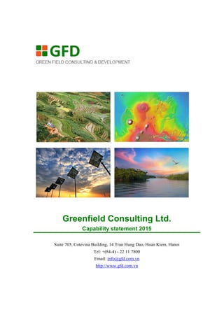
- 1. Greenfield Consulting Ltd. Capability statement 2015 Suite 705, Cotevina Building, 14 Tran Hung Dao, Hoan Kiem, Hanoi Tel: +(84-4) - 22 11 7800 Email: info@gfd.com.vn http://www.gfd.com.vn
- 2. Green Field Consulting Ltd. www.gfd.com.vn 1 About Service GreenField is a research-based company providing consulting services in natural resource management, GIS and remote sensing and, energy saving solution in Vietnam. With the strong academic background of a research team, we specializes in offering solutions for development project that are scientific-based, data driven and problem oriented. In addition, Green Field extensive experience in local knowledge, culture and business system allow us to craft practical and realistic solution that ensure the successful in project implementation of our clients. One of Green Field's outstanding strengths is our ability to bring together the right size team, with the right combination of skills, and in the right location, at the right time. We have an extensive network of multi-discipline experts and are very comfortable working in virtual team environments, with teams of employees and contractors, local and international crossing geographical boundary. GFD services are focused on 6 business areas: Natural Resources Management GIS and Remote sensing Energy saving solution Project development and base line study Natural resources management In developing countries, increasing population and growing welfare place pressure on the natural environment and result in problems such as deforestation, overgrazing, and the contamination of land and water resources. In turn, the depletion of natural resources frequently leads to land scarcity and to widespread changes in land use. Increasingly, also, we are aware that environmental issues may transcend national boundaries. As evidenced by various international agendas and agreements, natural resources management concerns us all. To address these problems and to understand the complexity of factors involved, resource managers must collect and interpret relevant data and work together with professionals from a wide range of disciplines. At GREEN FIELD, we employ modern tool in geosciences, modeling and quantitative assessment to assist our client addressing this challenging and important work. GREEN FIELD expertise on NRM include: • Forest resources management • GIS and Remote sensing • Biodiversity assessment
- 3. Green Field Consulting Ltd. www.gfd.com.vn 2 Service GIS & Remote sensing Geosciences is always a core expertise at Green Field. As an interdisciplinary consulting company, we firmly believe that spatial data can help us to unlock the interrelationship between environment process and the social process. Our approach toward GIS and Remote sensing is aiming at the understanding and quantification of geo-process through advance data acquisition, analysis and modeling. We offer our clients with a complete GIS and mapping circle: field survey, data analysis, Geodatabase development, design and production of quality cartographic map. We support most of current GIS technology Pitneybow MapInfo ESRI ArcGIS, ArcEngine and ArcSDE database Open source GIS: QuantumGIS, Geonetwork, Openlayer, Geoserver Our GIS mapping service includes Field survey for soil mapping, forest mapping and land use mapping Development of map database and software Land evaluation and site matching Land use planning map Production of paper map, and map book Map catalog on CD Web-based map solution Remote sensing services Arial photo interpretation Remote sensing image classification Hyperspectral images for nutrition modeling SAR and radar images for flood mapping and forest volume estimation Lidar processing Satellite Images and Aerial photograph Green Field provide a wide range of satellite imagery in various format, resolution, and processing level. With our large image archive covering most past of Vietnam, and close partnership with data provider, we are able to offer satellite images and aerial photograph with a very competitive price and customized imagery product. Contact us to discuss image acquisition option and pricing. Aerial photo: archive covering all Vietnam Very high resolution: QuickBird, Ikonos Medium resolution optical imagery: Landsat ETM+, ASTER, SPOT, IRS (India), ALOS (Japan) SAR: ENVISAT ASAR, RADARSAT
- 4. Green Field Consulting Ltd. www.gfd.com.vn 3 Service Energy saving solution Green Field specializes in developing solutions for rapid deployment of cost-effective, reliable, and environment-friendly energy systems. Green Field’s expertise in energy includes: Energy efficiency & demand reduction Energy network planning Clean energy solutions Technology & market assessments Energy project monitoring and evaluation Green Field has lead and participated in the feasibility, master planning of hydropower station, energy network as well as project in energy regulation. Project development and base-line study Project formulation and feasibility study Project identification and formulation Feasibility studies: Technical, financial and market survey Project appraisals and evaluation Technical assistance and advisory services for project implementation Base line surveying: market study, rural social economic surveying Most of GREEN FIELD market studies involve an element of quantitative market size and structure analysis as well as short and long-term forecasting. GREEN FIELD experts specialize in sample design, deploying tradition surveying campaign or online questionnaire, and delivering quality statistical analysis. All data result can be delivered in formats that are suitable for direct import into client's information databases or can be hosted on Green Field’s server as an online application. We work in close collaboration with a number of partners in IT industry to develop intelligent solution for data presentation and visualization in form of map, chart and interactive report.
- 5. Green Field Consulting Ltd. www.gfd.com.vn 4 Our Team Management Do Hong Anh, Director Hoang Xuan Ty, Founder, senior adviser Natural resources management, GIS/Remote Sensing Hoang Viet Anh, Ph.D. GIS & Remote Sensing Ha Hai Nam, Ph.D. Information Technology Vo Thanh Son, Ph.D Geography Nguyen Thi Thuc Anh, MSc. Photogrammetry and Geodesy Phung Dinh Trung, MSc. Forestry Pham Manh Dam, Geo-Informatics Le Thi Quynh Hoa, Geography Energy solution Do Minh Ly – Account manager Hoang Van Tuan – Thermal engineer Nguyen Tien Manh - Thermal engineer Nguyen Dac Huyen - Thermal engineer Nguyen Trong Loi – Mechanical engineer Nguyen Van Tuyen - Mechanical engineer Nguyen Trong Loi - Mechanical engineer Quyen Dinh Thinh - Electrical engineer Green Field also have a network of more than 500 research associates in a wide range of disciplines on which we regularly draw to provide technical assistance to our projects. They are leading expert working for university and research institutes with expertise in water resources, agriculture, energy and power, civil engineering, institutional development, infrastructure and urban planning. .
- 6. Green Field Consulting Ltd. www.gfd.com.vn 5 Projects Year Project Client Type of work 2014- 2015 Project Impact Monitoring and Assessment of the Vietnam Land Administration Project (VLAP) VLAP project / World Bank Conduct and independent assessment of the activities and effectiveness of VLAP, particular focusing on vulnerable group such as woman, ethnic minorities and the poor, providing feedback from beneficiaries and stockholders at the localities. 2014- 2015 Demonstration of sustainable community forest management in Thua Thien Hue, Quang Ngai, Binh Dinh province Forest sector development project/ WB3 i) assist the establishment of community-based forest management board; (ii) To assist in the development community-based regulations to protection and development of community forests, management of fund and benefit sharing; (iii) Preparation of training materials and conduct Capacity building for VFMB, technical training for farmers in key communities in sustainable forest management 2014 Assessment of Fire Wood and Cook Stove Use in Thanh Hoa and Nghe An Provinces Winrock International / Vietnam Forest and Delta Program To conduct a survey and analysis aiming to assess current situation and future trends of firewood consumption and exploitation, as well as to identify what are the key factors toward this deforestation in these areas. 2014 GIS Mapping of Micro, Small, Medium, and Large Enterprises (MSME) in Thanh Hoa Province SNV To produce a location map of existing MSME with SNV’s inputs on MSME’s attributes and co-coordinates. The information is available to end-users in a highly visual and interactive form. The task include development of a mobile mapping application running on Android device for surveyor to collect data in the field; and to develop a back end Web mapping application to display and manage SME information. 2014 Establish of ecosystem service map for Ke Go Nature Reserve, Ha Tinh province SNV/ ERICH Establish of ecosystem service map for Ke Go Nature Reserve, Ha Tinh province
- 7. Green Field Consulting Ltd. www.gfd.com.vn 6 2014 Mid-term assessment of afforestation project in Dien Bien JICA Mapping all afforestation sites in 4 district of Dien Bien for mid- term assessment. 2013 GIS Training for Forest Protection Department (FPD) in Ha Tinh province SNV/ ENRICH Training for 30 staff of Ha Tinh FPD in application of GIS and Remote sensing for forest management 2013 Support for the National Roll Out of Payment for Forest Environmental Services (PFES) and Benefit Sharing Mechanisms in Viet Nam ADB Develop method and provide training on forest mapping using remote sensing method for PFES. Training for 20 staff of Quang Nam DARD on application of GIS and RS for PFES mapping and forest management 2013 Establish map of forest status for Con Cuong State Forest Company (FSC) and Protection Forest Management Board (FMB) of Con Cuong. SNV Mapping of forest condition in Con Cuong using SPOT 5 image 2013 Use of Landsat time series images to establish coastal line map of province in Me Kong delta for coast line change detection. VIDAGIS Develop method for automated coastal line detection using Landsat data. Processed and map coastal line from 300 Landsat image from 1970 to 2013. 2013 Development of natural disaster database at local level in Vietnam SCMD II Development of natural disaster database at local level in Vietnam 2013 Development of integrated geodatabase for natural resources management in Da Nang city VIDAGIS Development of forest and natural resources database, rectification and integration of Quick Bird high resolution imagery in to the database, development of tools for data aggregation. 2012 Climate change adaptation, mitigation and development linkages, trade-offs and synergies in the links between adaptation and mitigation in coastal agriculture and flood water management in Namdinh Province - Vietnam Southampton University Joint research with Southampton University: An investigation of the evidence of benefits from climate compatible development – case study in Xuan Thuy national park
- 8. Green Field Consulting Ltd. www.gfd.com.vn 7 2012 Mapping of ecosystem services, Quang Tri and Ha Tinh Province SNV Using existing and available secondary national level data, produce maps clearly showing key ecosystem services in the two pilot areas, including carbon, biodiversity (using appropriate proxy measures), watershed areas and other measurable Ecosystem services 2012 Carbon and high biodiversity mapping for REDD+ in Vietnam SNV The project of Carbon and high biodiversity mapping for REDD+ in Vietnam is aimed at development of forest carbon estimation map of Vietnam for 2000, 2005 and 2010. n this project, GREEN FIELD provide services including: - Develop forest carbon estimation map of Vietnam for 2000, 2005 and 2010. - Generate species richness map using global data from WCMC and IUCN Red list spatial data at taxa level. - Identify and mapping hotspot for REDD+ activity in Vietnam. 2012 ADB TA 7262-VIE: Capacity building of renewable Energy Development in Vietnam ADB The project ADB TA 7262-VIE: Capacity building of renewable Energy Development in Vietnam is sponsored by ADB to support EVN, NPC, CPC and SPC review feasibility studies of small hydropower projects and grid system to meet the funding criteria of ADB. Feasibility study and preparation of technical design of 10 small hydropower projects and 2 transmission projects. Technical assistance in construction stage: procurement, construction and commissioning. Each stage will be subject to approval of EVN and ADB. 2011- 2015 Energy saving solution for Viet My paper company Viet My paper Ltd. Provide energy audit and long term energy saving solution for the coal fire boiler system
- 9. Green Field Consulting Ltd. www.gfd.com.vn 8 2011- 2015 Energy saving solution for Phuong Dong paper company Phuong Dong Ltd. Provide energy audit and long term energy saving solution for the coal fire boiler system 2011- 2015 Energy saving solution for Hung Loi paper company Hung Loi Ltd. Provide energy audit and long term energy saving solution for the coal fire boiler system 2011- 2015 Energy saving solution for Phong Khe paper company, Bac Ninh province Phong Khe Ltd. Provide energy audit and long term energy saving solution for the coal fire boiler system 2011 Provide remote sensing software IDRISI and training service for Coastal Forest and Ecosystems Management Project. GIZ/ Can Tho University Provide IDRIS image processing software. Prepare guideline to use IDRISI for forest resources management. Advance training of the software for land use change analysis and geostatistics. 2011 Mid-term review (MTR) for the Land Allocation for Social and Economic Development in Cambodia World Bank/ LASED Mid-term review for the Land Allocation for Social and Economic Development in Cambodia. The review was conducted at national level including donors, line ministries and at 3 project provinces: Kampong Cham, Kampong Thom, and Kratie. 2010 Strengthening Implementation of Labor Laws and Promotion of Sound Industrial Relations” (SIIR) USAID / DAI This project is to provide cconsultancy on SIIR project needs aassessment and harmonization of national and international project objectives, expected outcomes, and implementation procedures. 2010 Thematic global evaluation of European Commission support in the sector of ESI (employment and social inclusion) in partner countries. EC/ DRN The purpose of the evaluation is to assess to what extent the EC assistance has been relevance, effective and sustainable in providing the expected impact in the employment and social inclusion sector in Vietnam. In this project Green Field provide with DRN, the lead evaluator, the service for data collection in relevant agencies under MOLISA, carry out interview with focus group, preparation of the de-briefing to present at EC HQ.
- 10. Green Field Consulting Ltd. www.gfd.com.vn 9 2010 M&E for Ngoc Son Ngo Luong Natural Reserve Project AECID (Spanish Agency for International Cooperation and Development) The Ngoc Son – Ngo Luong project is a development project funded by AECID (Spanish Agency for International Cooperation and Development) and implemented by Foundation for Social Promotion of Culture Spain (FPSC) and Forest Protection Department (FPD-Hoa Binh). This project aims to sustainably protect and conserve the natural resources as well as improve living standards of the local people through its activities such as supports to implementation of the VDP (Village Development Plan) and development of community-based eco-tourism. 2010 Development of Geo-database for forest plantation management in Quang Nam, Quang Ngai, Binh Dinh, and Thua Thien-Hue World Bank The Forest Sector Development Project (FSDP) is a multilateral program, supported by the World Bank and other donors. The main objective of the FSDP is to achieve sustainable management of (plantation) forests and the conservation of biodiversity in special use forests to enhance the contribution of forestry to rural poverty reduction and global environmental protection. The aim of this geo-database development project are: i) To improve the speed of land use planning, land allocation, and site selection. ii) To create standards and procedures for map making and reporting that are consistence from province to province. iii) to integrate the use of the database as a tool into project monitoring and evaluation, iv) to design the database framework and standards so they can be transferred to benefit other plantation programs in the forest sector. 2010 Sustainable and Legal Timber Supply System in Vietnam Friend of the Earth, Japan The purpose of the study is to clarify the legality and certification system of forest management and timber production and to describe actual situation and challenges of forestry and wood circulation in Vietnam in order to contribute for establishment of legal and sustainable procurement of wood and wood products in Japan.
- 11. Green Field Consulting Ltd. www.gfd.com.vn 10 2010 ADB TA 7262-VIE: Capacity building of renewable Energy Development in Vietnam ADB Feasibility study and preparation of technical design of 6 hydropower projects. Technical assistance in construction stage: procurement, construction and commissioning. Each stage will be subject to approval of EVN and ADB. Grid extension and rehabilitation of distribution network serving poor communes. 2009 Mid-term review of the Information and Knowledge management Program (IKMP). Mekong River Commission Finnish Ministry of Foreign Affair / NIRAS IKMP was designed to provide fundamental database, information technology infrastructure as well as knowledge expertise and services needed to fulfil MRC's mission as a knowledge-based organization. In this Mid-term review Green Field provided NIRAS with expertise on GIS and Database management for the midterm review of the Information and Knowledge management Programe (IKMP) - Mekong River Commission. The review took place in Mekong River Commission head office in Lao, following with fieldwork in Vietnam, Thailand, and Cambodia. 2009 ADB RETA 6424: Enhancing Effective Regulation of Water and Energy Infrastructure and Utility Services ADB / IPA The impact of the RETA project is to improve the design and implementation of water and energy sector reforms by identifying institutional and technical factors that influence the effectiveness of regulatory reforms in selected developing member countries (DMCs). The RETA project will (i) carry out a literature review of issues pertaining to regulation; (ii) conduct research to compile case studies of formal and informal policy, institutions, and regulatory frameworks in several Asian Development Bank (ADB) DMCs; and (iii) identify successes and obstacles to effective regulation together with suggestions on how to overcome them.
- 12. Green Field Consulting Ltd. www.gfd.com.vn 11 2009 Greenhouse gas emission reduction scenario for forest sector and land use change in Vietnam in the period 2000-2030 MONRE This project is to support MONRE to prepare for the “2nd National statement for the UN Framework Convention on climate change (UNFCCC)”. This research project cover following activities: -Data collection: social economics data, land use change and forest cover change -Development of emission scenarios in forestry sector and land use change - Development of 7 emission reduction scenarios in Vietnam using COMAP model for the period 2000-2030 - Cost estimation of greenhouse gas emission reduction for 7 scenarios in Vietnam 2009- 2012 Development of Management Information Systems for the Forestry Sector (FOMIS) MARD / Finland Government The overall objective is to build the modern forest information system from central to local level, in order to provide accurate information for decision making for forest sector at all levels. The project contains the following main activities: - Establish regulations and procedures for managing, updating, and sharing of information between forestry units as basis for operations and for linking of forestry information systems; - Carry out design and establishment of forestry information systems databases and software; - Conduct training needs assessment, preparation of training materials, and data collection and ICT training courses in the selected provinces and at the central level; - Provide equipments (hardware, network, data collection equipment) and software.
- 13. Green Field Consulting Ltd. www.gfd.com.vn 12 2009 Evaluation of the European Commission’s Co- operation with Vietnam. EVA 2007/geo-non-ACP EU/ PARTICIP GmbH The evaluation of the Commission’s co-operation with Vietnam is part of the 2008 evaluation programme as approved by EU and aiming at ensuring accountability for the management of the allocated funds as well as promoting a lesson-learning culture throughout the organization. The main objectives of the evaluation are: i) to provide the relevant external co-operation services of the EC and the wider public with an overall independent assessment of the Commission’s past and current cooperation relations with Vietnam; ii) to identify key lessons in order to improve the current and future strategies and programmers of the Commission. 2009 Sustainable Public Procurement Preparedness Assessment in Vietnam IISD This project funded by International Institute of Sustainable Development (IISD) is aiming at: i) Explore the feasibility to introduce SPP pilot projects in Vietnam, ii) Build consensus and obtain buy in from key government authorities to provide leadership for SPP and iii) Build consensus across key stakeholder groups on the SPP business case. In this project Green Field conducted an in-depth literature review of law and regulation framework related to SPP and working with selected government agencies such as MARD, MoF, MOIT, MoIT to propose options on the design of pilot SPP programmers in the forestry sector in Vietnam 2008 Training course for new technology in forest surveying and mapping VIDAGIS Provide training course for new technology in surveying and mapping: VN2000 projection system; use of GPS in modern survey; mobile mapping in real time environment; geo-statistic; opportunity and challenges for GIS application in Rural Development sector.
- 14. Green Field Consulting Ltd. www.gfd.com.vn 13 2008 Water resources valuation for Dong Nai 2 Hydropower Station project (80 MW) Trung Nam Group Provide consulting service for hydrology system analysis, water resource valuation, and estimation of sediment deposition. 2008 Location-based Intelligent system PhucSinh Ltd. Phuc Sinh is a leading agricultural product trading company, that have an extensive network of brokers in Vietnam and shipping their product worldwide. In this project Green Field developed a system that allows tracking information of dealers, brokers, warehouse and shipping based on their location. The system was built on ArcSDE, ArcGIS server technology. 2007 GIS system for Dong Nai 2 Hydropower station project (80 MW) Trung Nam group Provide based map and GIS system for operational design and planning: topographic map 1:2000, road network, site 3D model, integrated CAD system. 2007 Development of GIS-based Rural Water Management System VIDAGIS Provide review and outline of integrated rural water management system. Design conceptual frame work for GIS-based water management system. Simulation of water supply / demand in different scenario of hydrology, land use system. 2007 Biodiversity assessment and database development for Huong Son conservation forest Ha Tay province, DARD The Service include: i) Biodiversity surveying and forest mapping; ii) Biodiversity assessment using quantitative method; iii) Develop integrated Geo-database for storage and management of surveying data, monitoring plot, and biodiversity profile 2007 Assessment of bamboo resources in Vietnam using remote sensing data OXFAM Service include: i) satellite image data acquisition and pre- processing; ii) development of data processing and classification method; iii) estimation of bamboo species, area, and stock 2007 Namla hydropower plant (27MW) in Sonla province Nam La PMU Provide consulting service for PUM to calculate and design to connect to National system
- 15. Green Field Consulting Ltd. www.gfd.com.vn 14 2007 Country Program Partnership for Sustainable forest land management, Vietnam. UNCCD The service provided include: i) Land management and land degradation profiles; ii) Institutional assessment of capabilities for sustainable land management; iii) Produce guidelines for best practice in forest land allocation and land use planning; iv) Produce guidelines/resource kit for the full range of possible· v) field level sustainable land management interventions 2006 Solar energy for remote areas in Quang Binh province Quang Binh PPC Provide training and supervise for the installation of electricity panels system at 66 villages in10 communes of Quang Binh province (20kW) 2006 Strengthening Institutional Capacity of Local Stakeholders for Implementation of Son La Livelihood and Resettlement Plan. TA-4690 (VIE) ADB The service include (i) assessing the master plan of resettlement sites in Son La, Lai Chau and Dien Bien /focus to Land use plan at resettlement sites (i) assessing training needs of stakeholders on Land use plan issue (iii) Preparing training modules on Micro-land use at household level and implementing TOT training of this topic for agriculture extension staffs in 3 provinces of project areas 2006 Vietnam Finland forestry co-operation Project in Bac Kan Province. Viettan consulting Ltd. Provide service on: survey of natural forest management system, critical review of legal and institutional framework. 2006 The Rural infrastructure Development & Living standard improvement project III - Afforestation Sector at Quang Nam, Quang Ngai, Phu Yen, TT Hue and Quang Tri provinces JBIC Provide institutional & environment consulting services: (i) project management and monitoring the progress (ii) develop a Benefit sharing regulation for forest plantations that established by JBIC funding in 5 provinces, Central Vietnam 2005 Assessment of wood resources in Bac Kan Province Viettan Ltd - Indufor Engineering Provide analysed information on the potential for appropriate small to medium scale mechanical forest industry development in the Province based on the available raw material. 2005 Khe Soong Hydro-power Plant at Quang Ninh province Khe Soong Hydro- power Plant The service include: building GPS network for monitoring the deformation of the dam; surveying and making topographical maps of reservoir bed and power plant
- 16. Green Field Consulting Ltd. www.gfd.com.vn 15 2005 Binh bridge Project, Hai Phong city Binh bridge PMU Service provided: consultant service for positioning bridge’s abutments and piles; leveling 2005 Integrated Rural Development in Northern Uplands Provinces, Vietnam. Viettan Ltd. Provide institutional and social research, include: i) poverty reduction, targeting especially the poorest people including those from the ethnic minority groups in the most remote areas taking fully into account the possible higher costs involved and related benefits; ii) targeting financially viable and environmentally sustainable activities for community development; iii) training and capacity building requirements in order to empower local institutions and rural people through a participatory approach 2005 Integrated Water management of pumped irrigation system in the Red River Delta of Vietnam ACIAR, Australia Project preparation, data collection and processing for computer- based management software development (Irrigation Main System Operation Program – IMSOP model) applied to La Khe Irrigation system in Ha Tay province. Monitoring system installation and monitoring data collection, training for software application to irrigation company staff. Model operation trials with different system operation scenarios. Took part in writing project annual report and project workshops’ organisation. Development of GIS database for the project management. Irrigation system asset evaluation and monitoring. 2005 Ngoi Duong small hydro-power plant in Lao Cai city - Feasibility study stage Lao Cai Mineral company (LAMICO) Provide consulting service for project feasibility study. Arrangement for field survey and data collection for setting up the project feasibility study. Responsible for general project report writing. Feasibility study was completed and had been approved by local Authority and EVN. 2005 Construction of Ngoi Duong small hydro-power plant in Lao Cai city (technical and construction design stage) Ngoi Duong small hydro-power plant in Lao Cai city Provide consulting service for project technical and construction design. Site visits, design of project layout, headwork and pressure
- 17. Green Field Consulting Ltd. www.gfd.com.vn 16 tank. Making arrangement for design staff to complete the project document. 2004 Strengthening the management capacity and raising awareness for biodiversity conservation at Dakrong Nature Reserve, Quang Tri province SNV i) Providing consultant in Land Use Planning -LUP and Forest Land Allocation -FLA activities at the 41 communes in the buffer zones of Cat Tien National Park and Chu Mom Ray Natural Reserve/ Central High Land. (ii) Analyzing and assessing the commune action plans in the project areas/ focus on new sustainable farming systems and agriculture/ forestry extension activities 2004 Forest Protection and Rural Development Project (FPRDP). WB The service include: (i) Providing consultant in Land Use Planning & Forest Land Allocation activities at the 41 communes in the buffer zones of Cat Tien National Park and Chu Mom Ray Natural Reserve/ Central High Land. (ii) Analyzing and assessing the commune action plans in the project areas/ focus on new sustainable farming systems and agriculture/ forestry extension activities