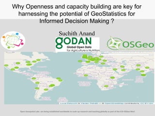
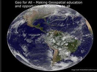
Why Openness and capacity building are key for
harnessing the potential of GeoStatistics for
Informed Decision Making ?
Suchith Anand
Open Geospatial Labs are being established worldwide to scale up research and teaching globally as part of the ICA-OSGeo MoU
Historical perspective on GeoStatistics
data acquisition / storage / exchange
conflation / data analysis / geocomputation
for general public / for practitioners /for researchers
Didier Leibovici et al
GLOBAL SOCIETAL PROBLEMS: accessGLOBAL SOCIETAL PROBLEMS: access
to water, sanitation, traffic congestions,to water, sanitation, traffic congestions,
economic sustainability, citizenseconomic sustainability, citizens’ health,’ health,
impact on environment …impact on environment …
Mapping is a critical component to help
understand and develop solutions
Proprietary software tools are very
expensive (hence unavailable) for
economically poor countries and
communities worldwide What is the point
of having all the open data if we do not
have access to the tools?
Why is Geoeducation & capacity
building important?
Kibera , Kenya
Dharavi, Mumbai
http://www.flickr.com/photos/56685562@N00/2340042701
http://www.flickr.com/photos/8485582@N07/7365580810
Integration of Geospatial and statistical tools play a key
role in helping find solutions to global societal challenges
alt.ac.uk
Why is Openness Important?
Geo for All - Making Geospatial education
and opportunities accessible to all
Image Credit: NOAA/NASA GOES Project
Need for Open Principles
• Open source software.
• Open data.
• Open standards.
• Open access to research publications.
• Open education resources
GeoForAll fundamentally is based on Open
Principles
Hunger
Poverty
Innovation
www.godan.info
Spatial Patterns in the genetic
variation of Bambara groundnut
8
Roberto Santos et al. 2016
Geospatial
Standards (for
ex. OGC spec.)
Maturity of open
source software (for
ex. OSGeo stack)
Open Data
Ability for showing the
operation of general laws
is fundamental for
scientific research
Unique convergence of many key developments
that made Open Geospatial Science possible
Science is NOT a Black Box
Open Geospatial Science builds upon the idea
of Open science that scientific knowledge of all
kinds are able to be develop more rapidly and in
a more productive manner if openly shared (as
early as is practical in the discovery process).
The key ingredients to make Open Geospatial
Science possible is Open Principles (open
source geospatial software, open data, open
standards and open access to research
publications) .
Open Geospatial Science key for harnessing the potential
of Data revolution
Vision 2030
Science should always be open
Geospatial Science should be fully build on Open Principles
Transparency of research is fundamental (no black boxes or proprietary barriers).
Geospatial Science = Open Geospatial Science
Open Geospatial Labs are being established worldwide to scale up research and
teaching globally as part of the ICA-OSGeo MoU
https://ec.europa.eu/digital-single-market/en/news/open-innovation-
open-science-open-world-vision-europe
UN Global Service centre, Brindisi, Italy 7-11 March 2016
Why Openness in Geostatistics?
 helps in harnessing the potential of
GeoStatistics for Informed Decision Making
• empowerment of staff and students
 capacity building
 developing creative and open minds in
students which is critical for building open
innovation
 contributes to building up Open Knowledge
for the benefit of the whole society and for
our future generations.
Thanks to all colleagues in the “Geo for All”
initiative
http://www.geoforall.org
Synergies of joining minds on a common mission makes the
seemingly “impossible” possible
Let us all join to eradicate extreme poverty and
enable shared prosperity for all
Geo for All – Empowering
communities for a better world

GeoStatistics for Informed decision making

  • 1.
    Why Openness andcapacity building are key for harnessing the potential of GeoStatistics for Informed Decision Making ? Suchith Anand Open Geospatial Labs are being established worldwide to scale up research and teaching globally as part of the ICA-OSGeo MoU
  • 2.
    Historical perspective onGeoStatistics data acquisition / storage / exchange conflation / data analysis / geocomputation for general public / for practitioners /for researchers Didier Leibovici et al
  • 3.
    GLOBAL SOCIETAL PROBLEMS:accessGLOBAL SOCIETAL PROBLEMS: access to water, sanitation, traffic congestions,to water, sanitation, traffic congestions, economic sustainability, citizenseconomic sustainability, citizens’ health,’ health, impact on environment …impact on environment … Mapping is a critical component to help understand and develop solutions Proprietary software tools are very expensive (hence unavailable) for economically poor countries and communities worldwide What is the point of having all the open data if we do not have access to the tools? Why is Geoeducation & capacity building important? Kibera , Kenya Dharavi, Mumbai http://www.flickr.com/photos/56685562@N00/2340042701 http://www.flickr.com/photos/8485582@N07/7365580810 Integration of Geospatial and statistical tools play a key role in helping find solutions to global societal challenges
  • 4.
  • 5.
    Geo for All- Making Geospatial education and opportunities accessible to all Image Credit: NOAA/NASA GOES Project
  • 6.
    Need for OpenPrinciples • Open source software. • Open data. • Open standards. • Open access to research publications. • Open education resources GeoForAll fundamentally is based on Open Principles
  • 7.
  • 8.
    Spatial Patterns inthe genetic variation of Bambara groundnut 8 Roberto Santos et al. 2016
  • 9.
    Geospatial Standards (for ex. OGCspec.) Maturity of open source software (for ex. OSGeo stack) Open Data Ability for showing the operation of general laws is fundamental for scientific research Unique convergence of many key developments that made Open Geospatial Science possible
  • 10.
    Science is NOTa Black Box
  • 11.
    Open Geospatial Sciencebuilds upon the idea of Open science that scientific knowledge of all kinds are able to be develop more rapidly and in a more productive manner if openly shared (as early as is practical in the discovery process). The key ingredients to make Open Geospatial Science possible is Open Principles (open source geospatial software, open data, open standards and open access to research publications) . Open Geospatial Science key for harnessing the potential of Data revolution
  • 12.
    Vision 2030 Science shouldalways be open Geospatial Science should be fully build on Open Principles Transparency of research is fundamental (no black boxes or proprietary barriers). Geospatial Science = Open Geospatial Science Open Geospatial Labs are being established worldwide to scale up research and teaching globally as part of the ICA-OSGeo MoU https://ec.europa.eu/digital-single-market/en/news/open-innovation- open-science-open-world-vision-europe
  • 16.
    UN Global Servicecentre, Brindisi, Italy 7-11 March 2016
  • 20.
    Why Openness inGeostatistics?  helps in harnessing the potential of GeoStatistics for Informed Decision Making • empowerment of staff and students  capacity building  developing creative and open minds in students which is critical for building open innovation  contributes to building up Open Knowledge for the benefit of the whole society and for our future generations.
  • 21.
    Thanks to allcolleagues in the “Geo for All” initiative http://www.geoforall.org
  • 22.
    Synergies of joiningminds on a common mission makes the seemingly “impossible” possible Let us all join to eradicate extreme poverty and enable shared prosperity for all Geo for All – Empowering communities for a better world

Editor's Notes

  • #8 Godan exists to respond to particular challenges and foster innovations to meet them