Download as PDF, PPTX


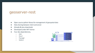
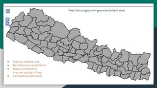


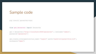


Geoserver is an open-source server written in Java that facilitates the sharing, processing, and editing of geospatial data, designed for interoperability with various spatial data sources. The document includes sample code for functions such as creating coverage stores, uploading styles, and publishing layers within Geoserver. It highlights the utility of the Geoserver REST API for managing geospatial data effectively.


![Web_GIS_GeoServer_OpenLayers [Autosaved].pptx](https://cdn.slidesharecdn.com/ss_thumbnails/webgisgeoserveropenlayersautosaved-260204124422-7c7d7853-thumbnail.jpg?width=640&height=640&fit=bounds)
![Web_GIS_GeoServer_OpenLayers [Autosaved].pptx](https://cdn.slidesharecdn.com/ss_thumbnails/webgisgeoserveropenlayersautosaved-260204125605-2388aabe-thumbnail.jpg?width=640&height=640&fit=bounds)


