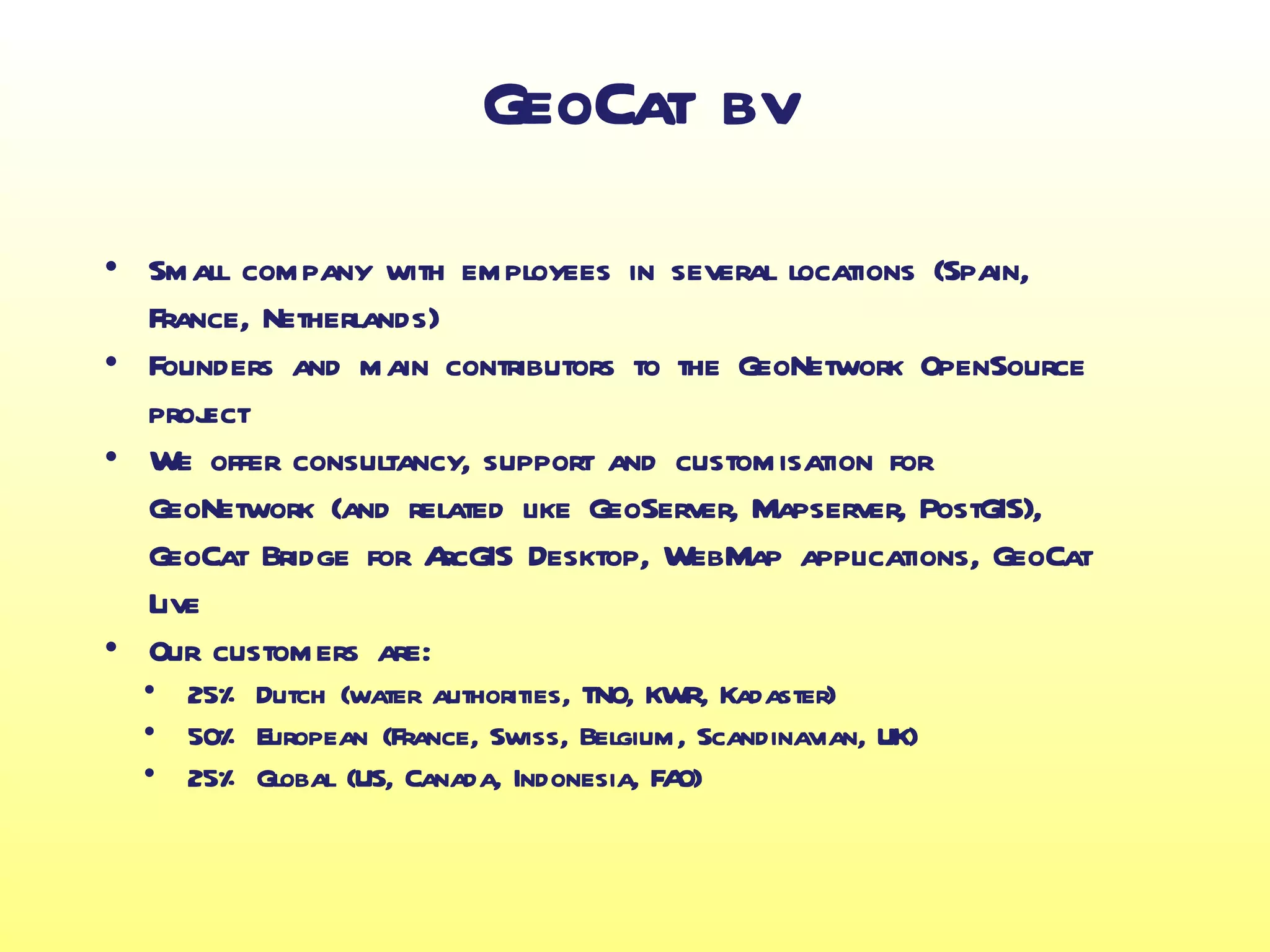
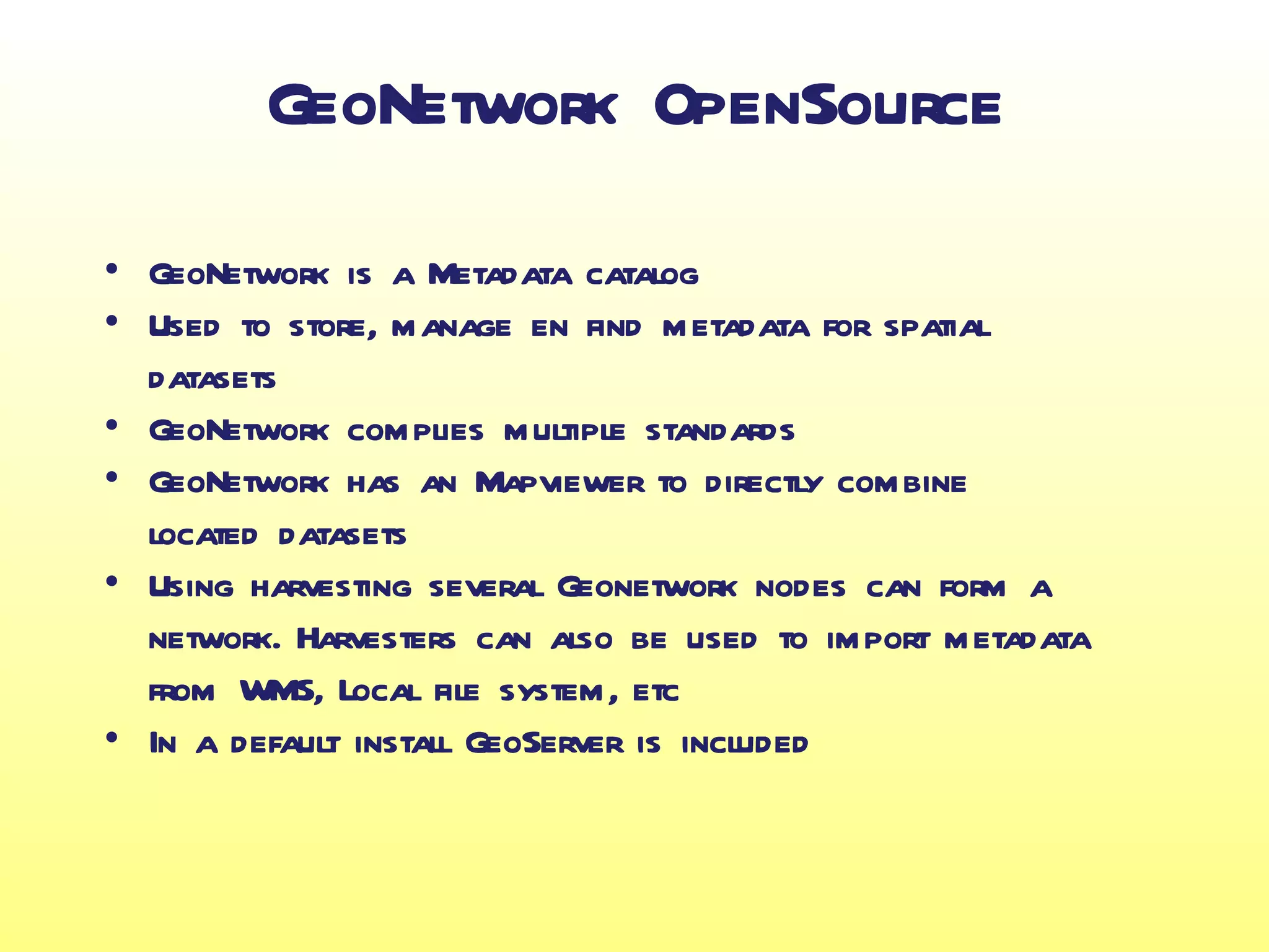
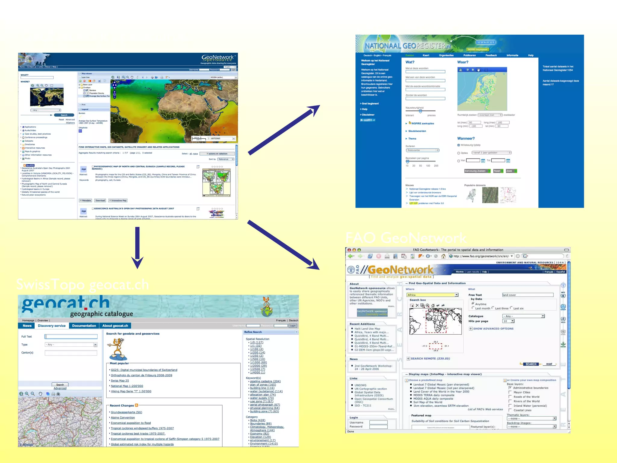
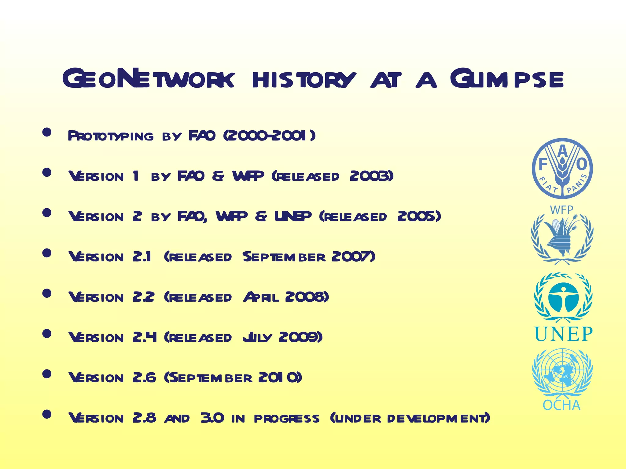
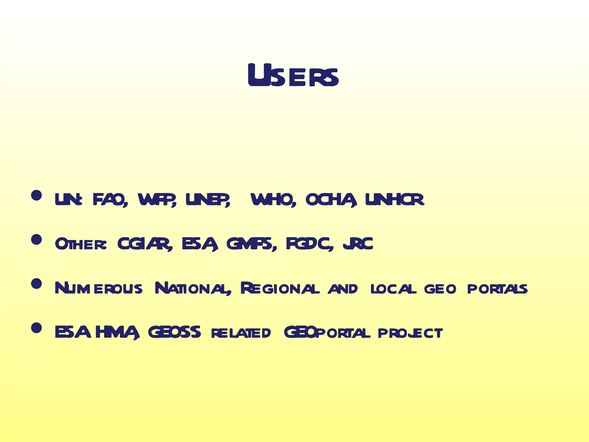
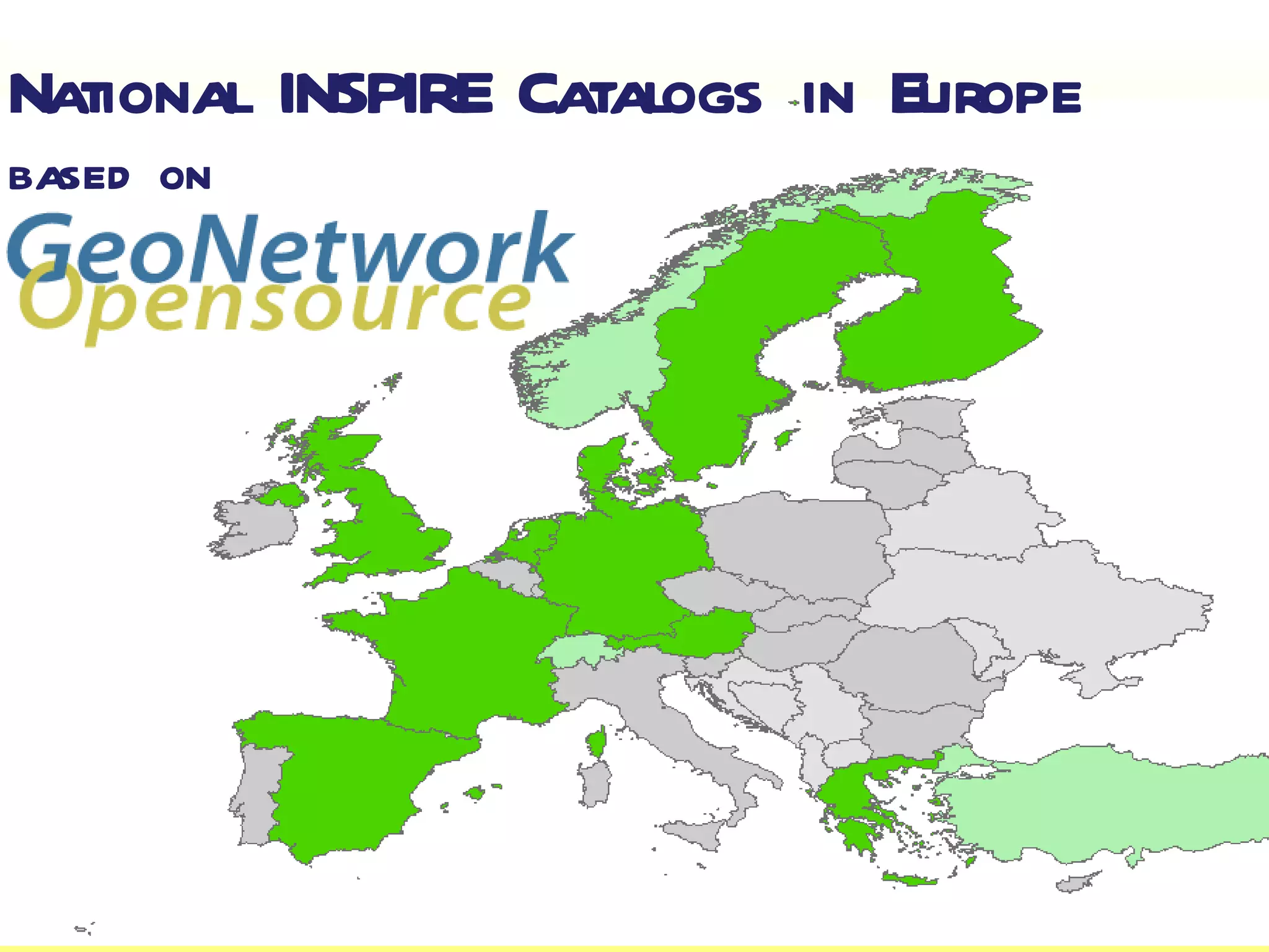
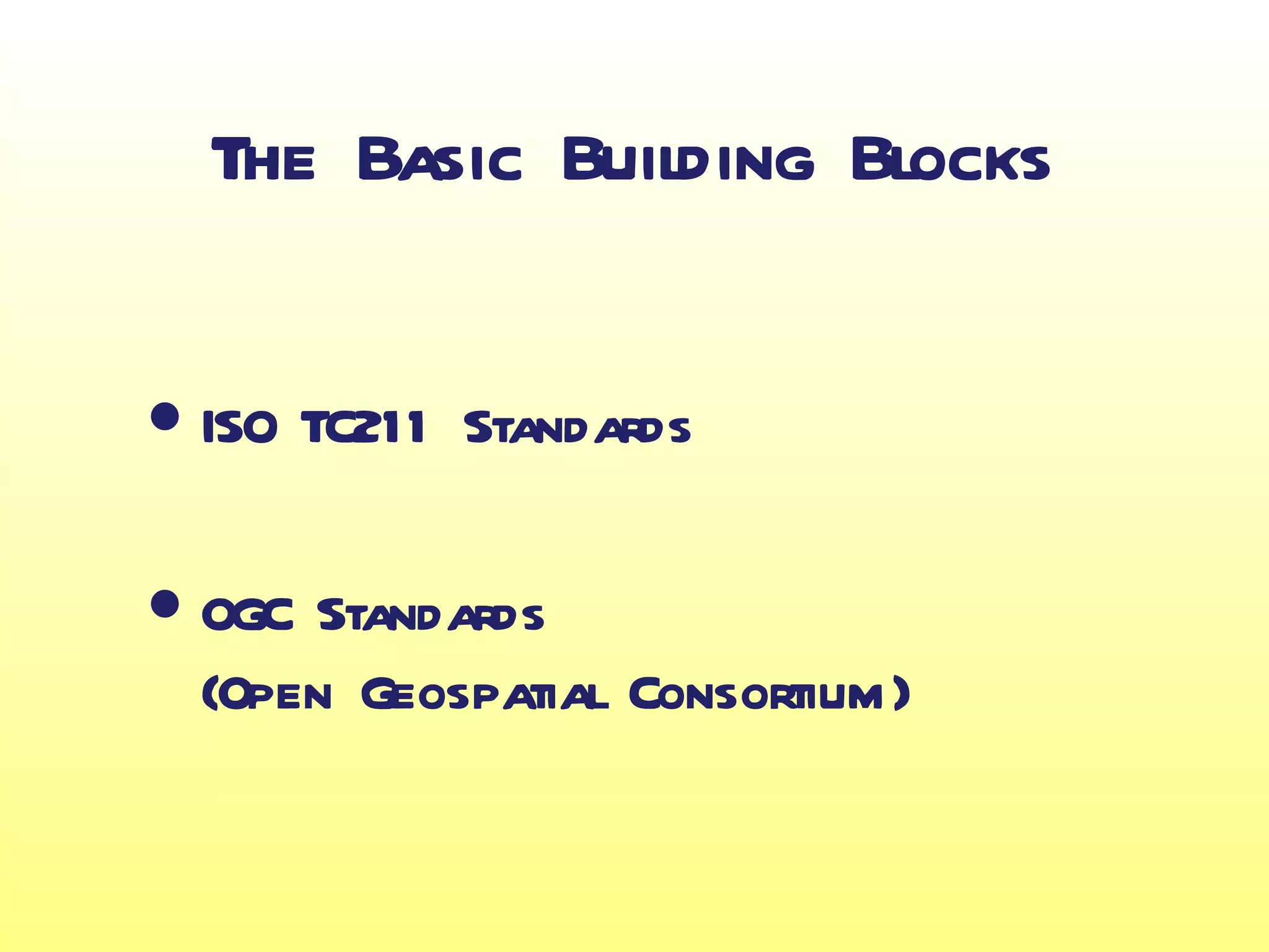
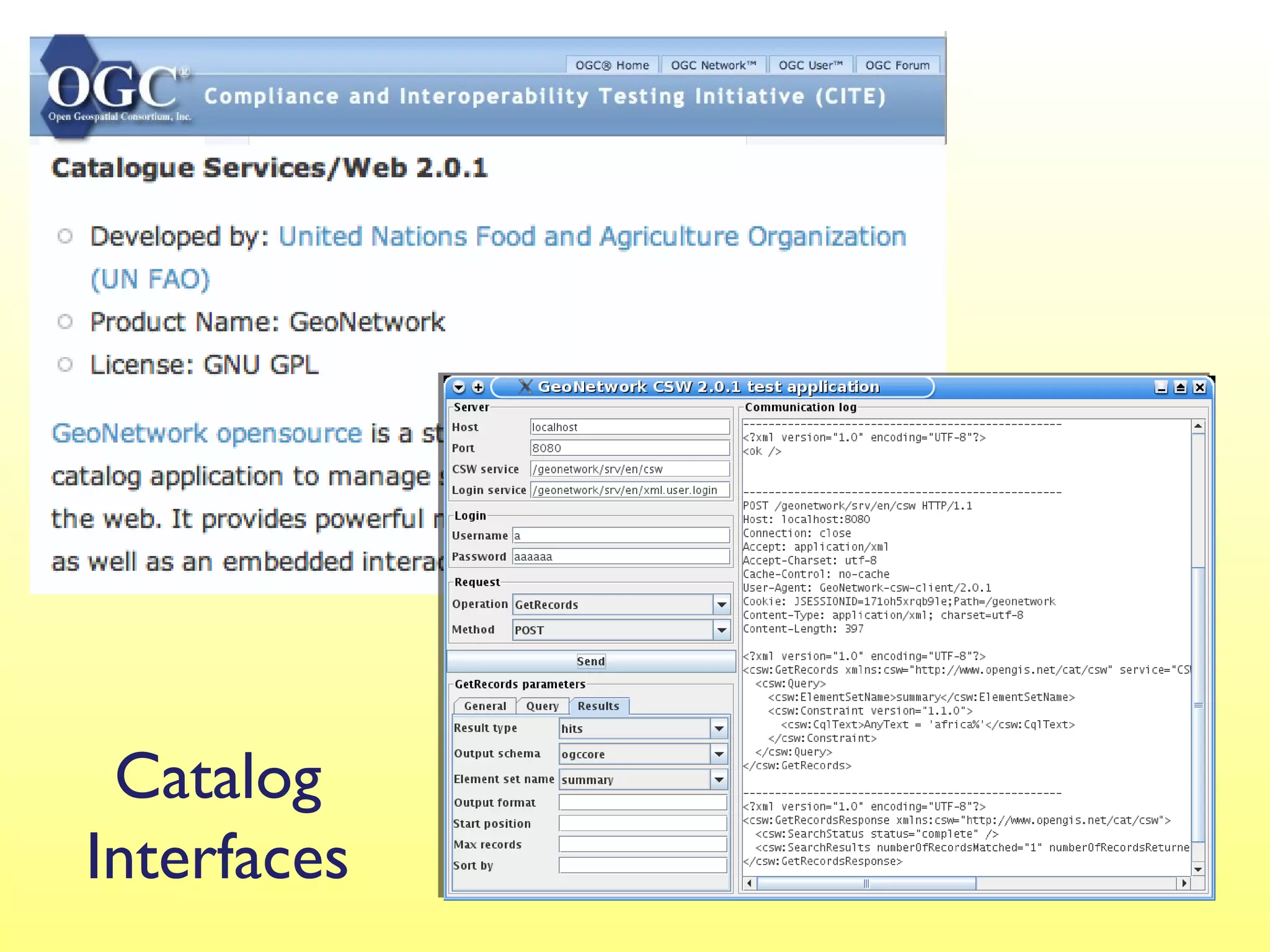
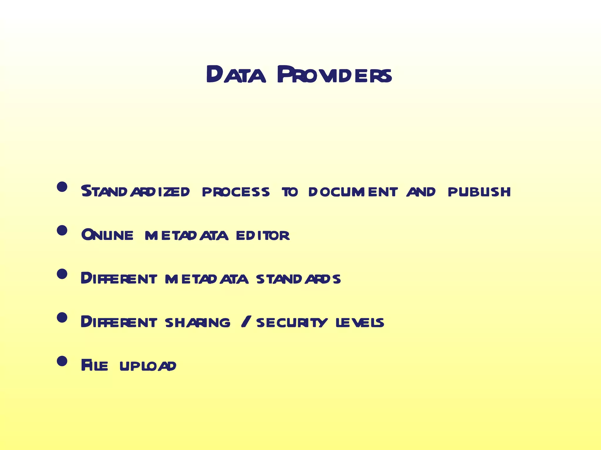
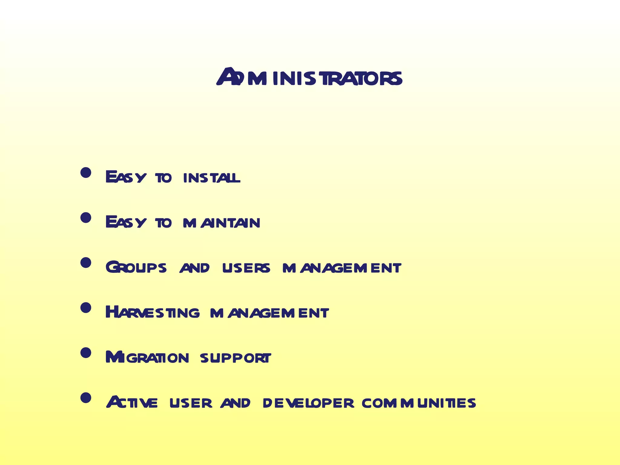
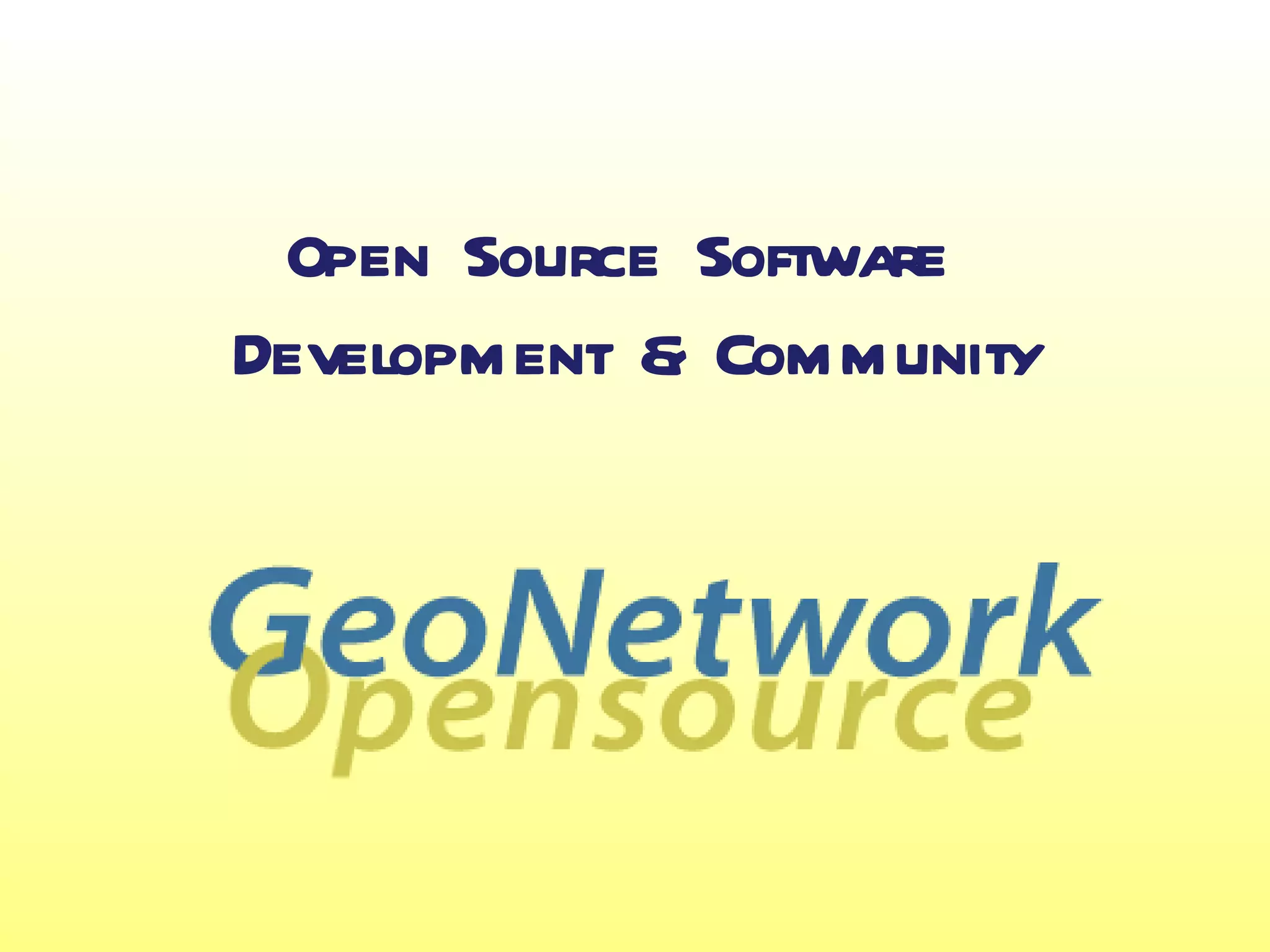
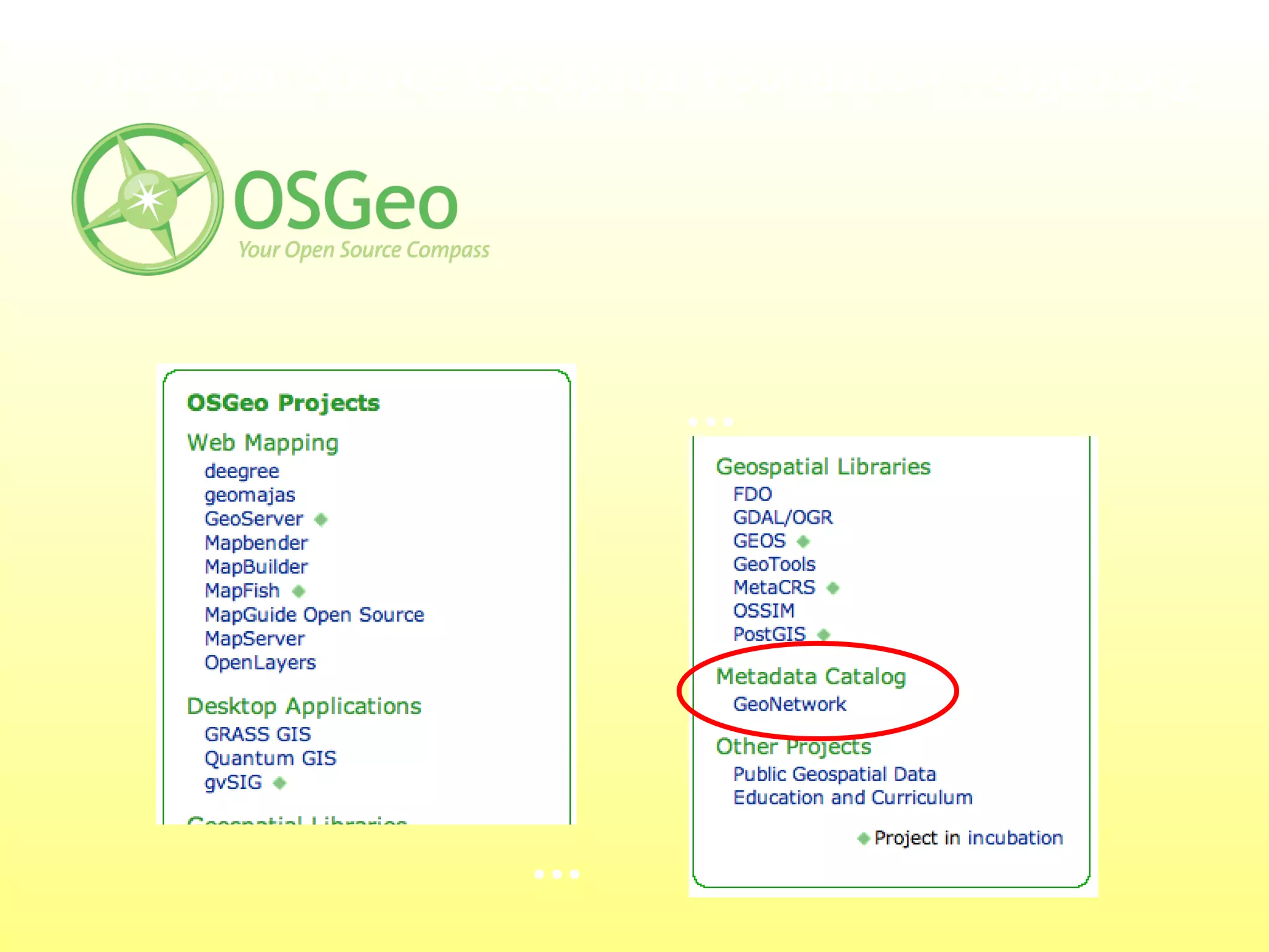
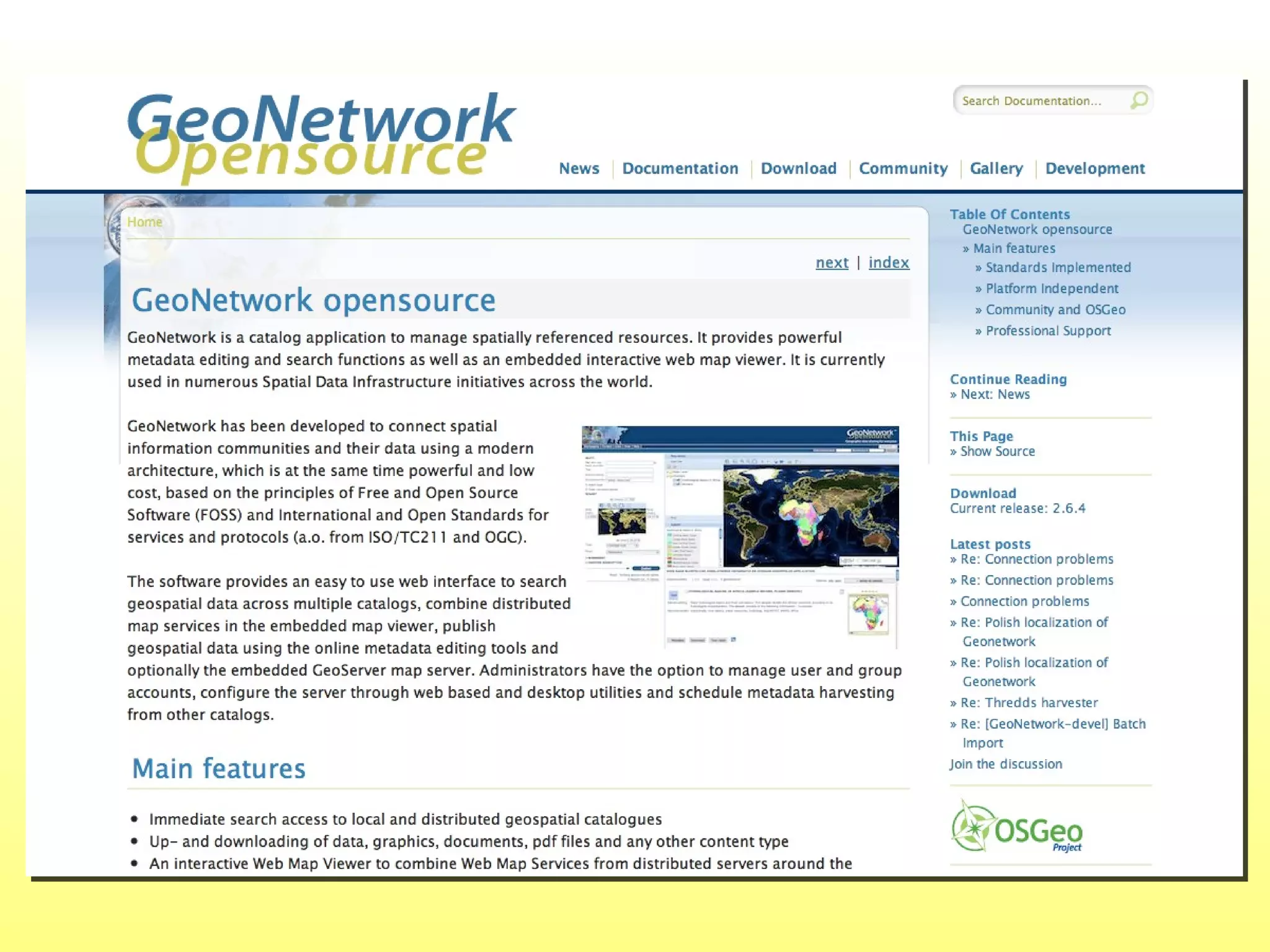
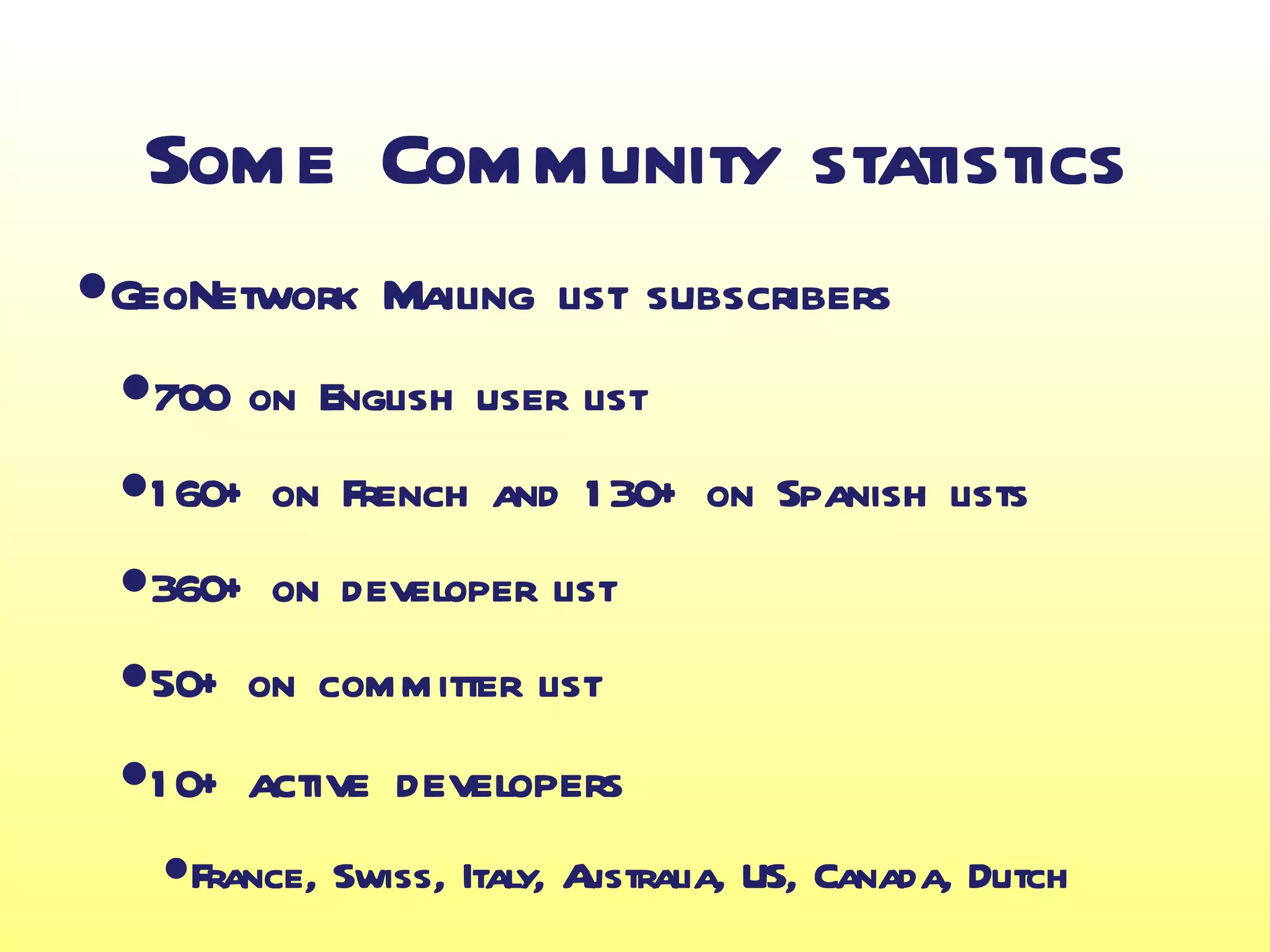
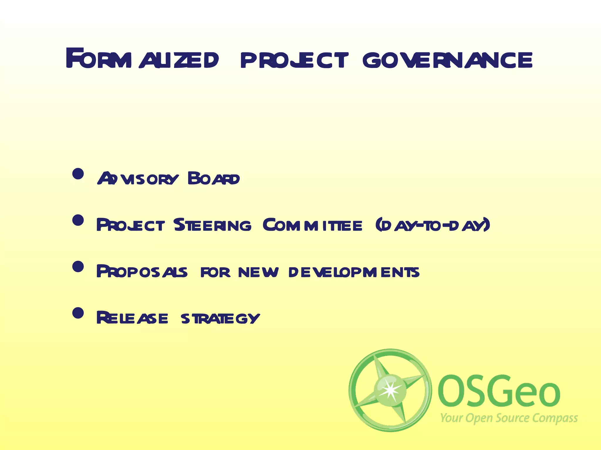
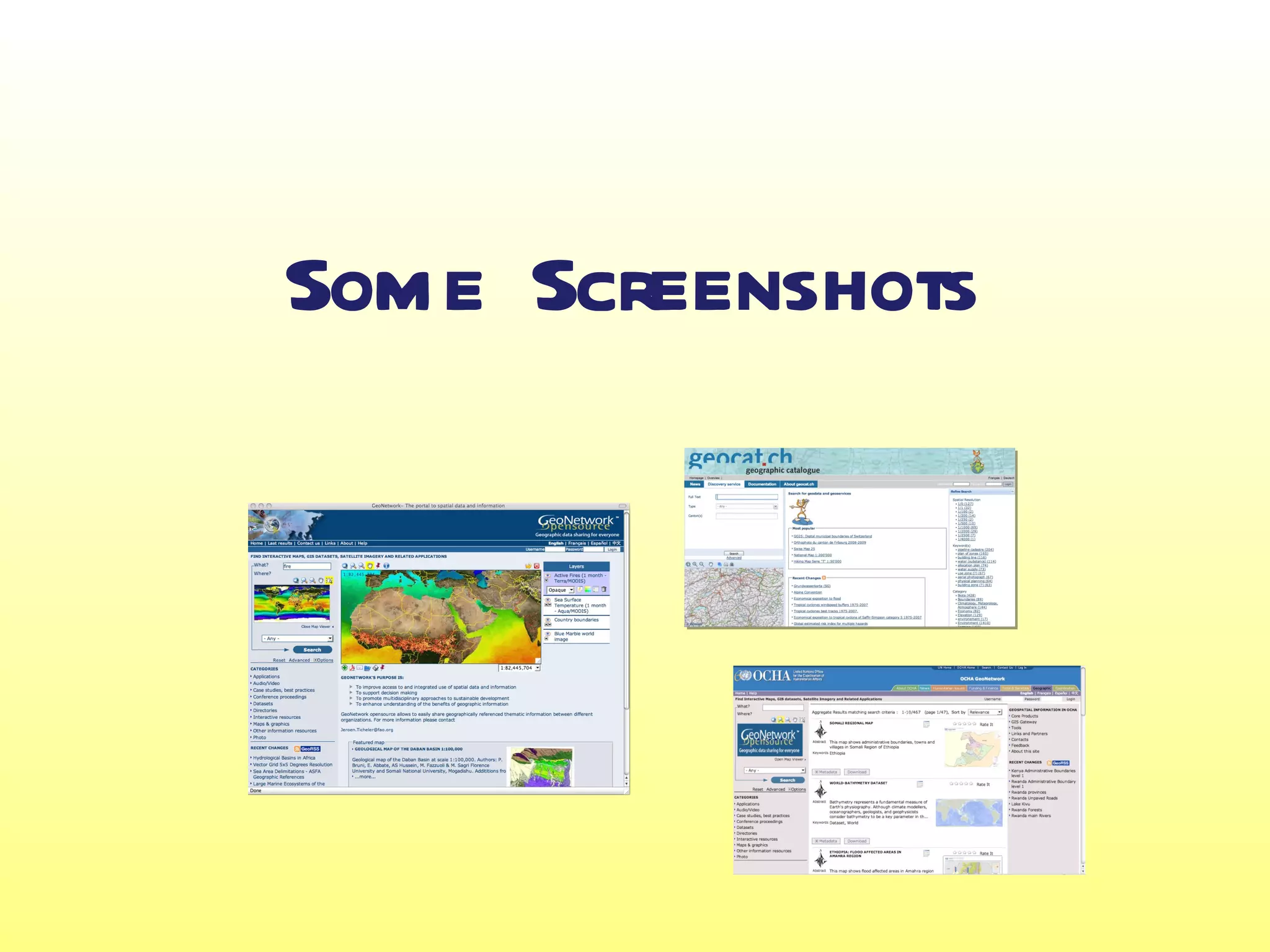
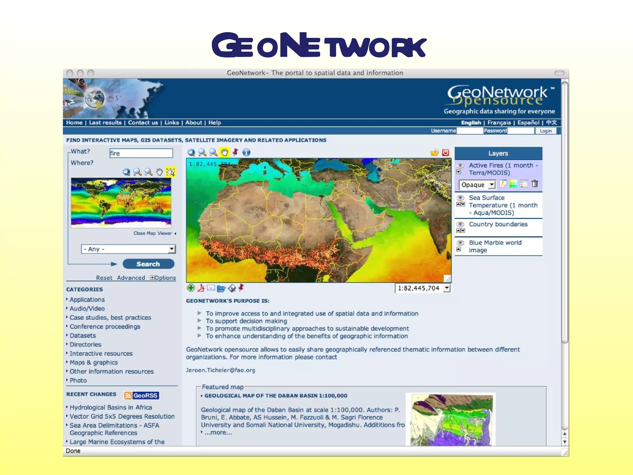
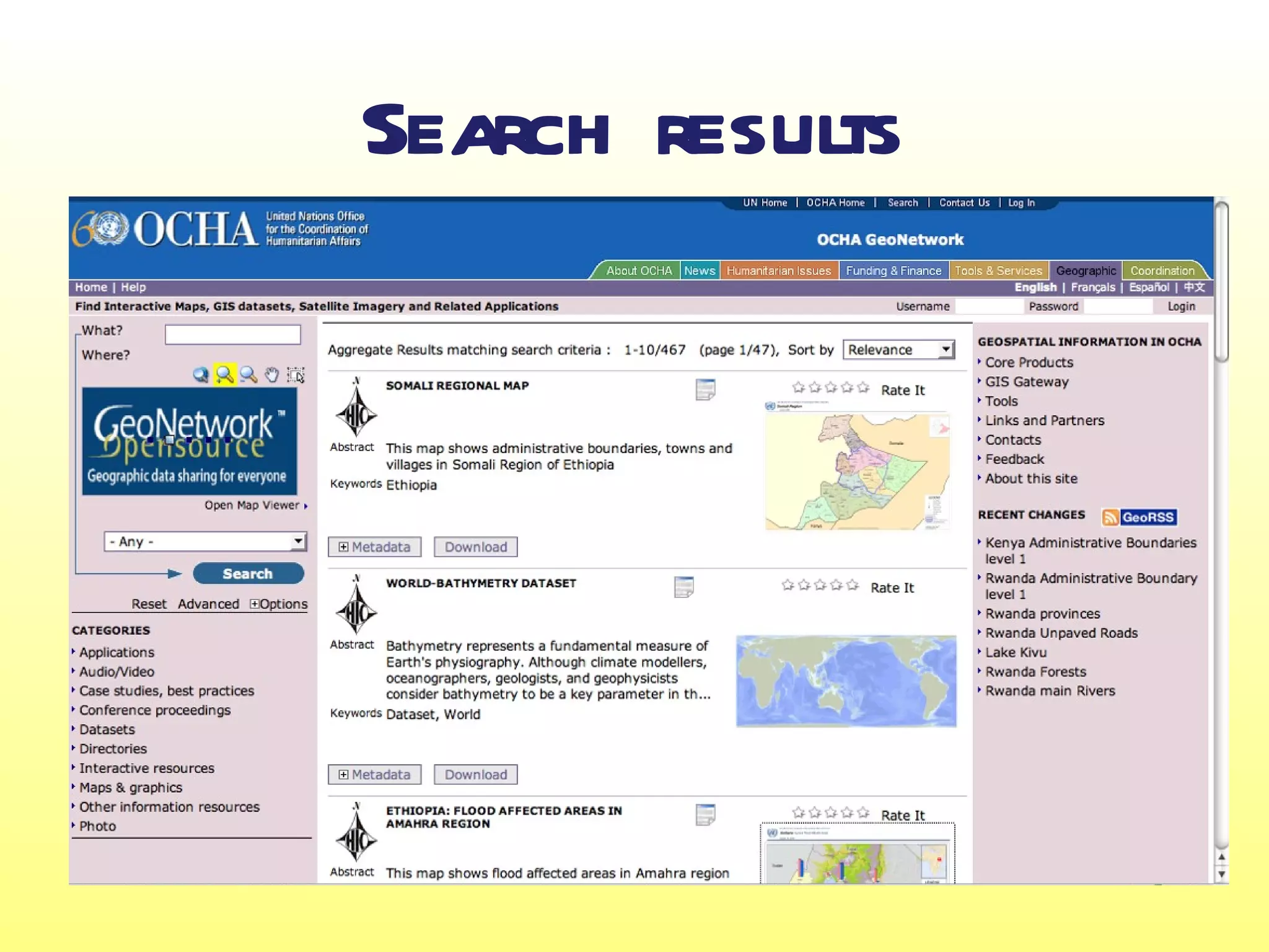
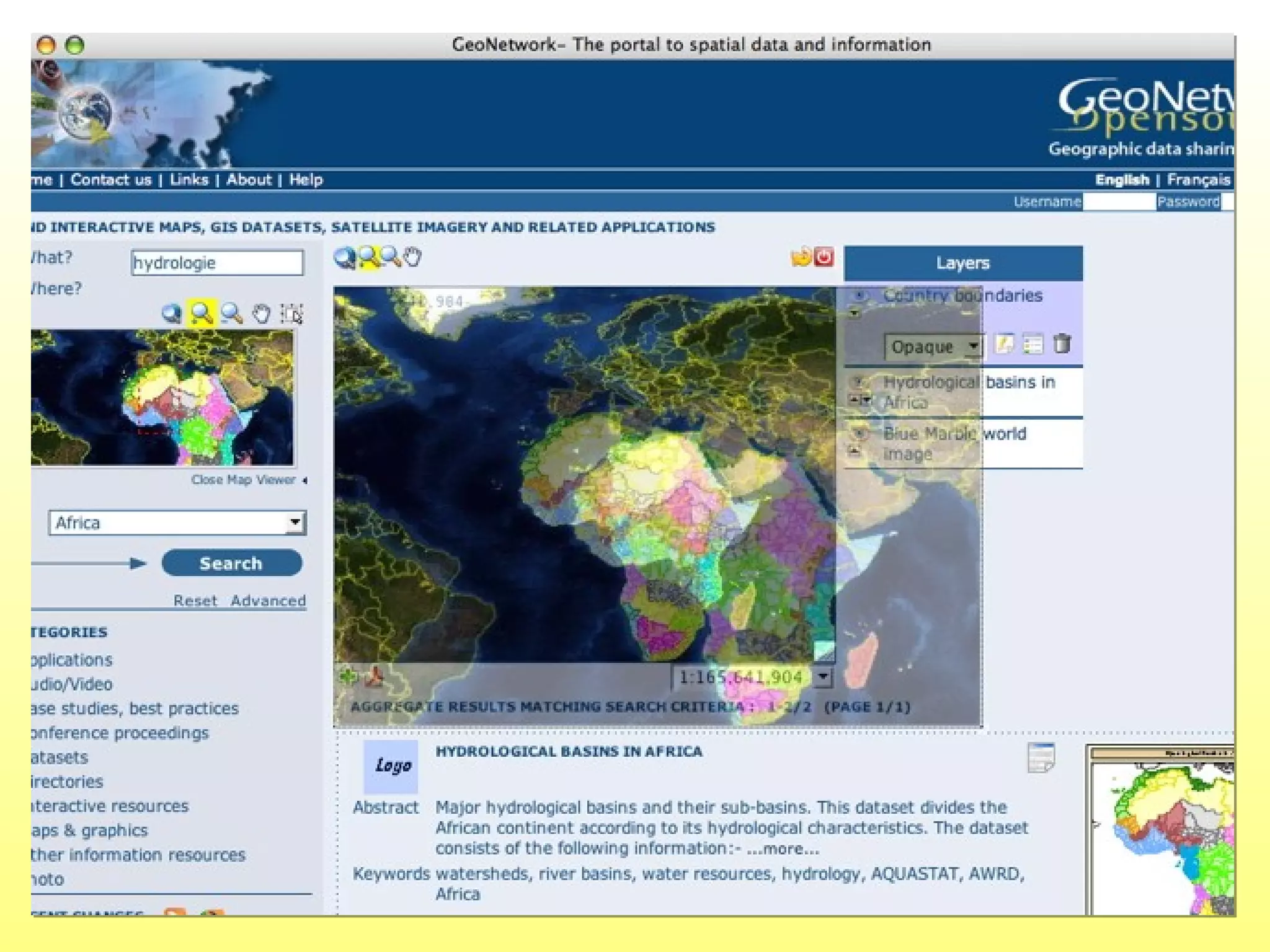
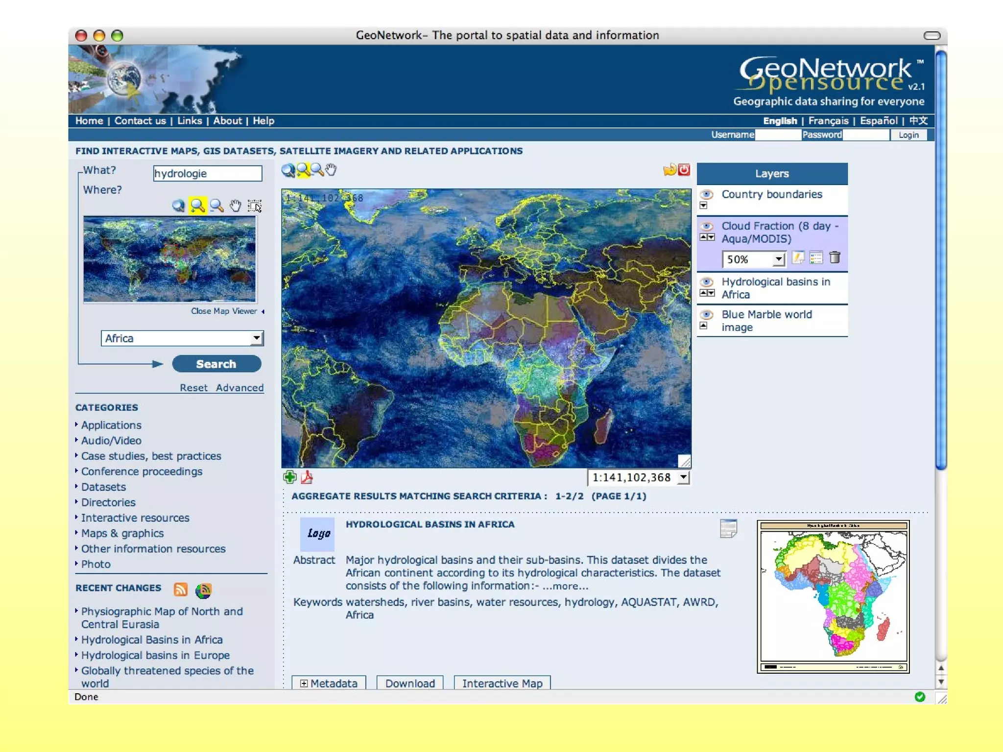
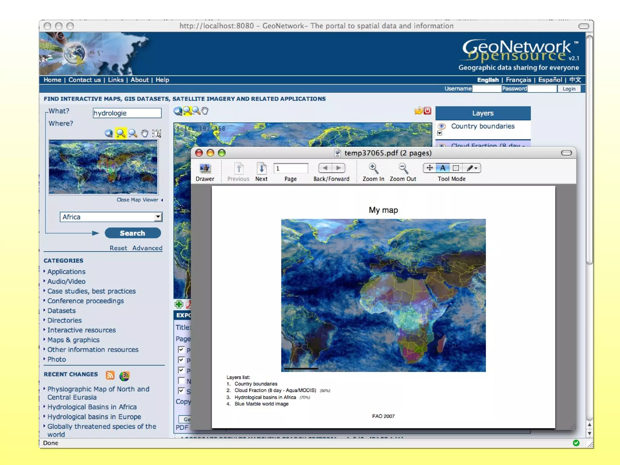
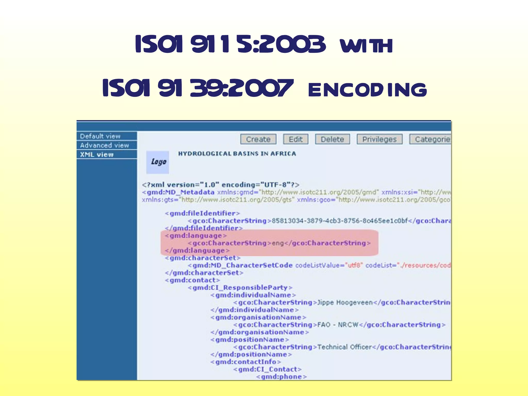
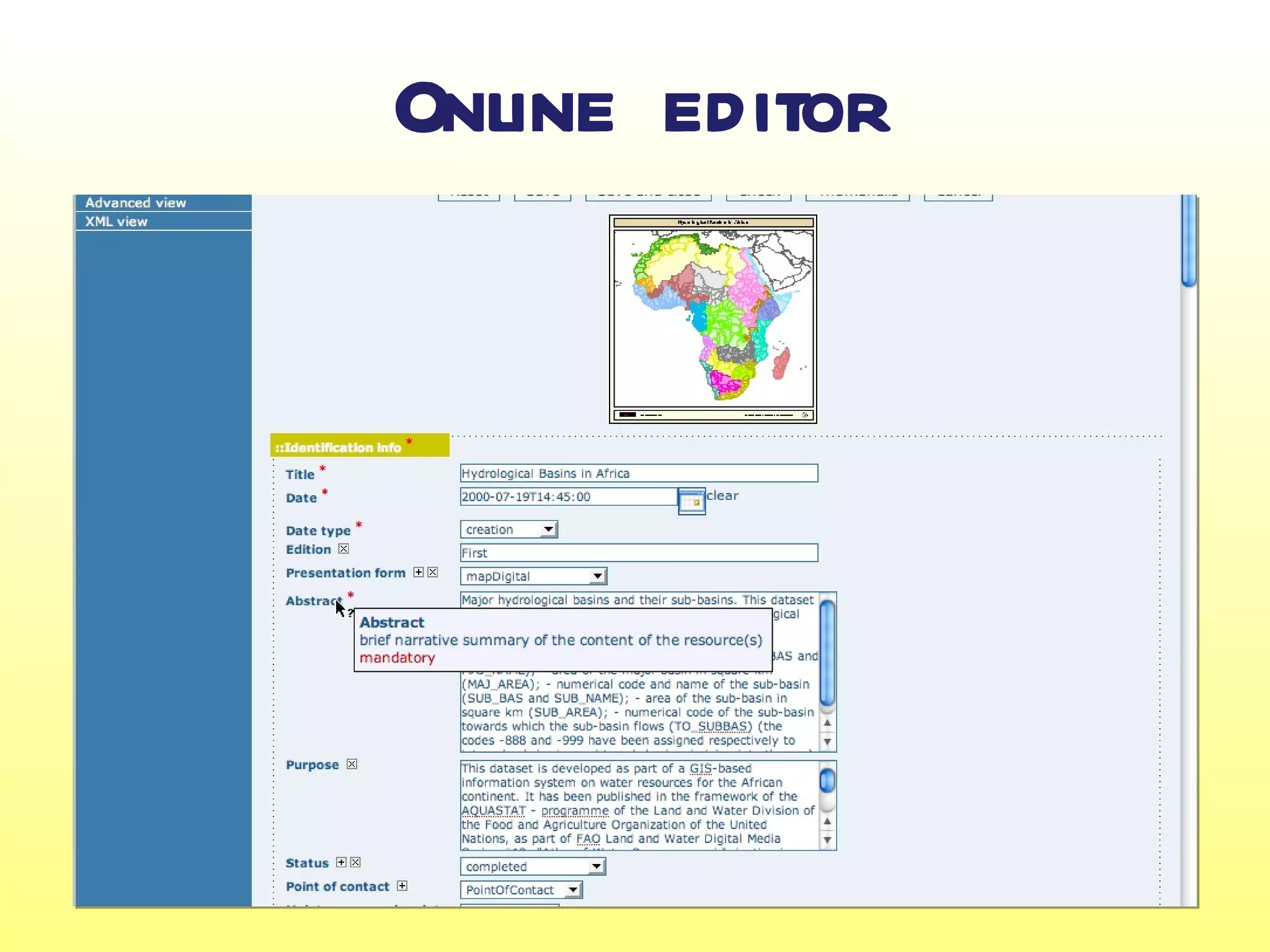
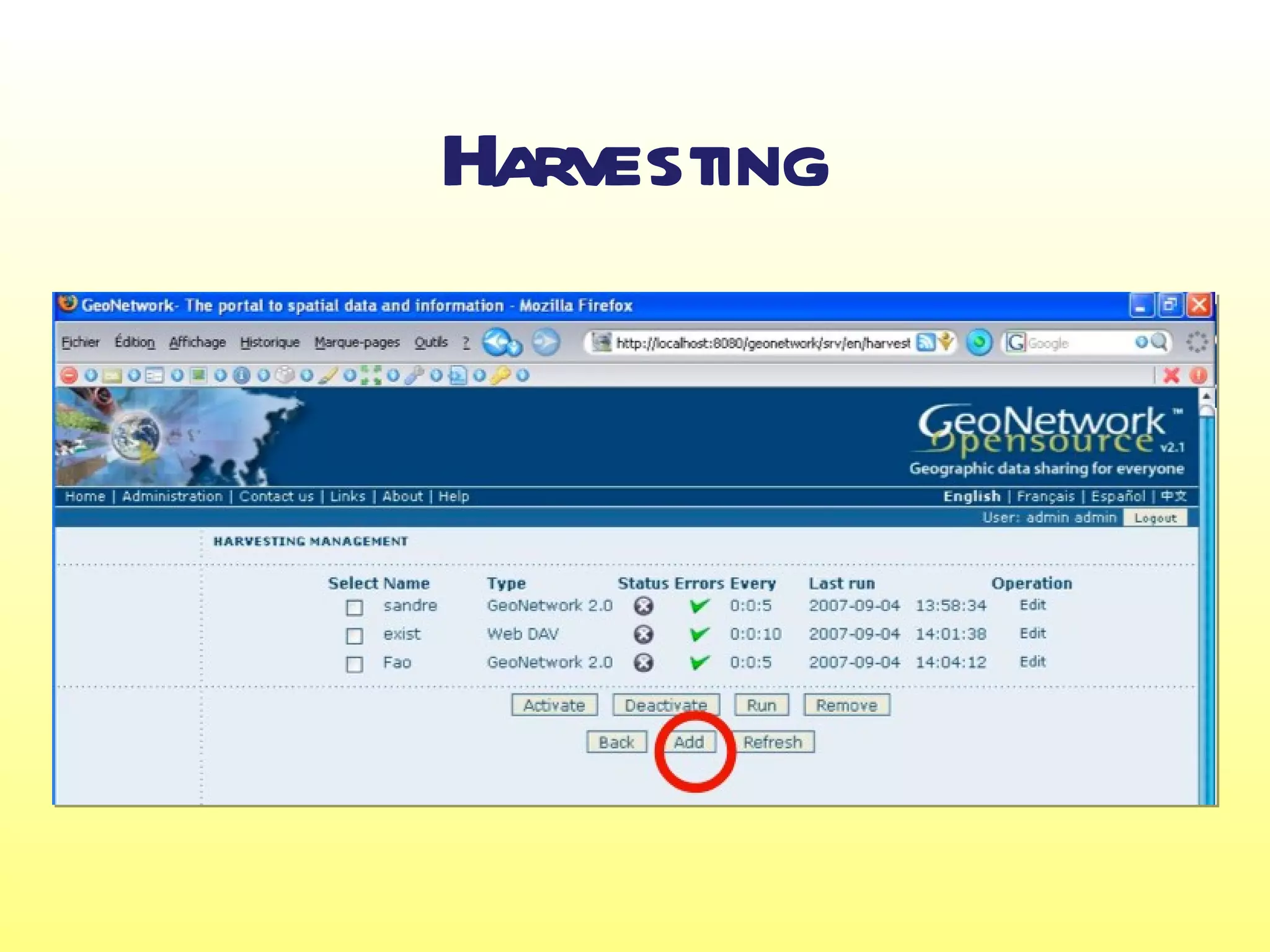
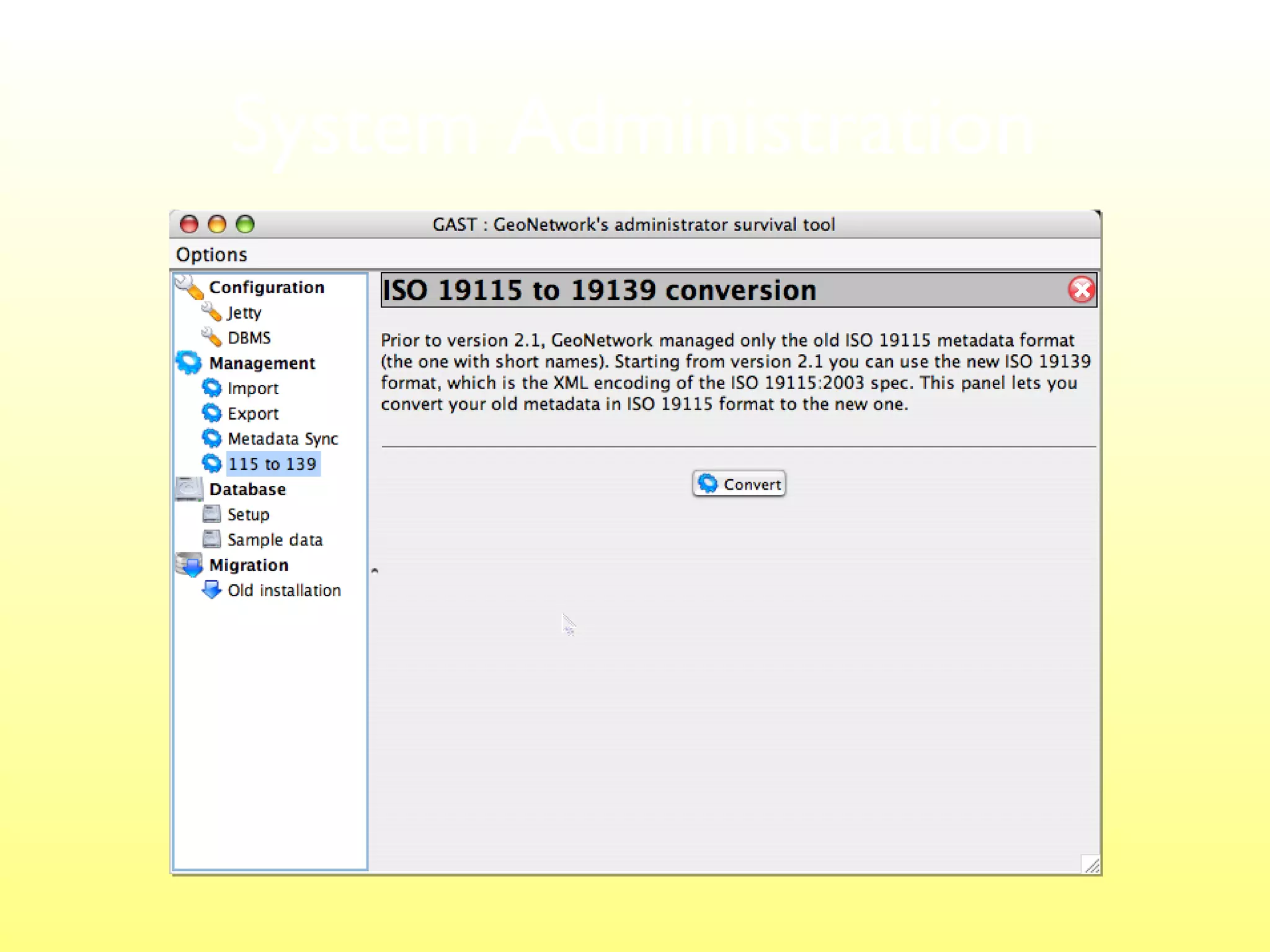
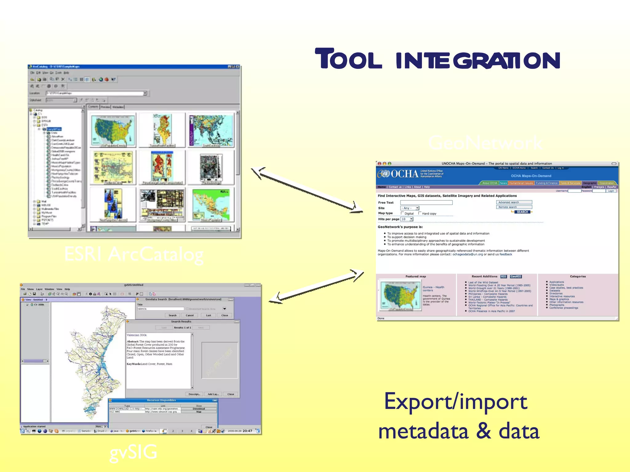
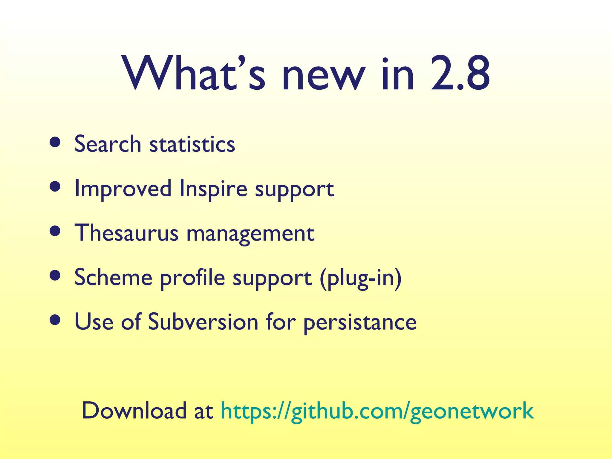
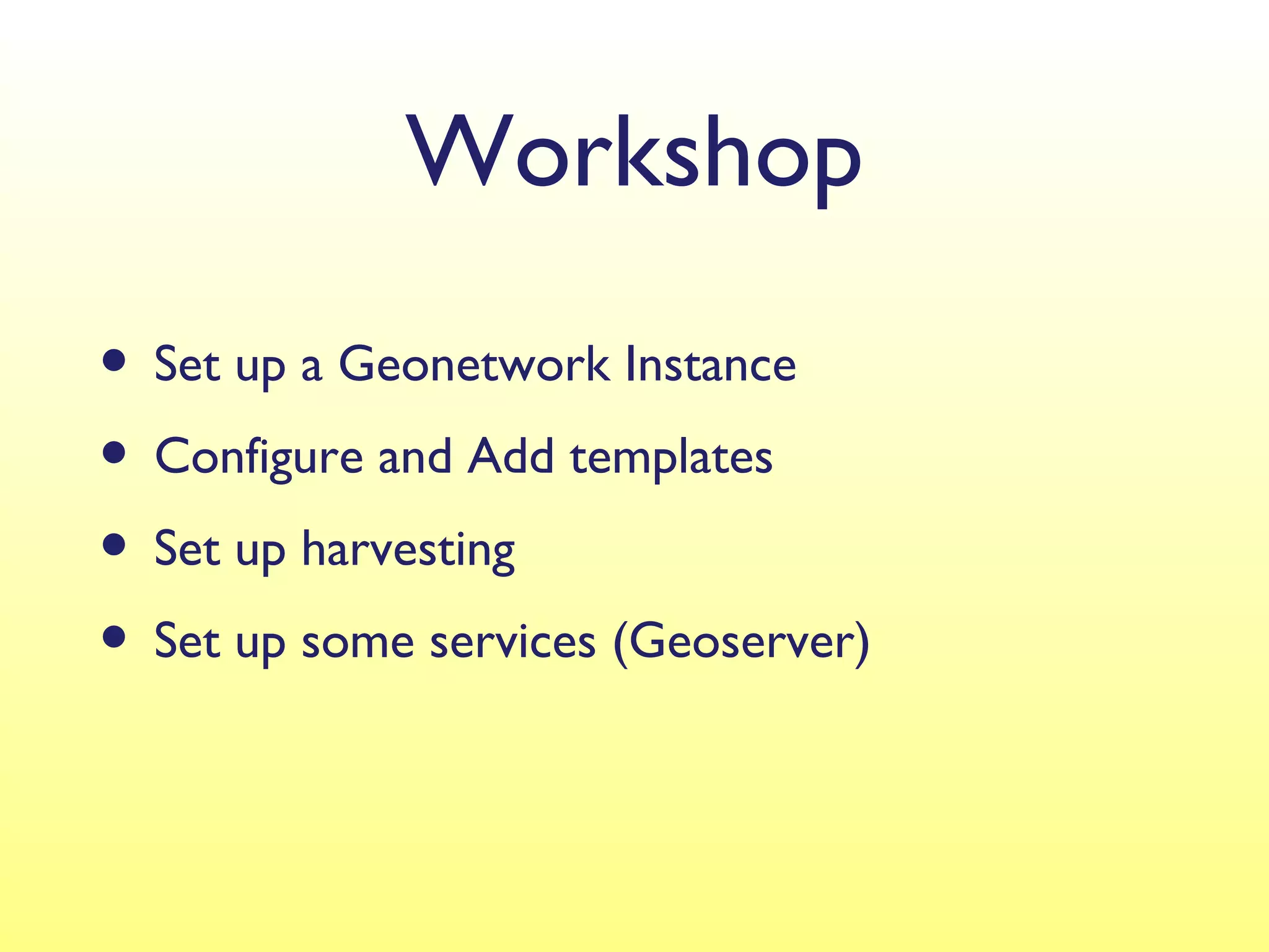
Introduction to GeoNetwork,
   or how to setup an SDI in 3 hours

     MapWindow Conference 2012 - Velp


@ pvgenuchten   @ geocat_ bv   #geonetwork
GeoCat bv
• Small company with employees in several locations (Spain,
  France, Netherlands)
• Founders and main contributors to the GeoNetwork OpenSource
  proj ect
• We offer consultancy, support and customisation for
  GeoNetwork (and related like GeoServer, Mapserver, PostGIS),
  GeoCat Bridge for A rcGIS Desktop, WebMap applications, GeoCat
  Live
• Our customers are:
  • 25% Dutch (water authorities, TNO, KWR, Kadaster)
  • 50% European (France, Swiss, Belgium, Scandinavian, UK)
  • 25% Global (US, Canada, Indonesia, FAO)
GeoNetwork OpenSource
• GeoNetwork is a Metadata catalog
• Used to store, manage en find metadata for spatial
  datasets
• GeoNetwork complies multiple standards
• GeoNetwork has an Mapviewer to directly combine
  located datasets
• Using harvesting several Geonetwork nodes can form a
  network. Harvesters can also be used to import metadata
  from WMS, Local file system, etc
• In a default install GeoServer is included
Dutch National Geo Registry
GeoNetwork opensource


                        FAO GeoNetwork

SwissTopo geocat.ch
GeoNetwork history at a Glimpse
•   Prototyping by FA (2000-2001 )
                     O

•   Version 1 by FA & WFP (released 2003)
                   O

•   Version 2 by FA WFP & UNEP (released 2005)
                   O,

•   Version 2.1 (released September 2007)

•   Version 2.2 (released A 2008)
                           pril

•   Version 2.4 (released J 2009)
                          uly

•   Version 2.6 (September 201 0)

•   Version 2.8 and 3.0 in progress (under development)
Users

• UN: FAO, WFP, UNEP, WHO, OCHA, UNHCR
• Other: CGIAR, ESA, GMFS, FGDC, JRC
• Numerous National, Regional and local geo portals
• ESA HMA, GEOSS related GEOportal project
National INSPIRE Catalogs in Europe
based on
The glue in a
Spatial Data Infrastructure
A interactive map library
 n
    on the Internet
Build on Standards,
Standards, Standards, Standards, Standards, ...
The Basic Building Blocks


• ISO TC211   Standards


• OGC Standards
  (Open Geospatial Consortium)
Standards
• Metadata
    • ISO1 911 5:2003, ISO1 911 9:2005, ISO1 91 39:2007, FGDC, Dublin Core
•    Catalog interfaces
    • OGC CSW 2.0 (client & server)
    • Z39.50/ISO23950 (client & server)
    • OAI-PMH (client & server)
    • Geo-OpenSearch (server)
    • GeoRSS (server)
    • WebDAV (client)
•    Web Mapping Client
    • WMS, WMTS, WFS, WMC
Catalog
Interfaces
Catalogue interoperability

• Full OGC Catalog v2.0 support
  (ISO profile) (Reference implementation for OGC)

• Open Archive Initiative support                (OAI-MPH)

• RSS and GeoRSS newsfeeds
• OpenSearch with GEO extension
• Metadata harvesting & synchronization
Technologies
●
    J language (platform independent)
    ava
●
    Servlet environment (Tomcat, J
                                 etty, ...)
●
    XML data representation (J
                             DOM)
●
    XSL templates for presentation (XA N)
                                      LA
●
    J for database access (runs on any compliant DBMS)
    DBC
●
    Lucene search capabilities
●
    XML Schema for metadata editing
●
    J
    avaScript
Users


• Search in multiple catalogues through one
  website
• File download
• Data visualization through web map viewer
Data Providers


• Standardized process to document and publish
• Online metadata editor
• Different metadata standards
• Different sharing / security levels
• File upload
Administrators

• Easy to install
• Easy to maintain
• Groups and users management
• Harvesting management
• Migration support
• Active user and developer communities
Open Source Software
Development & Community
The Open Source Geospatial Foundation - osgeo.org


                          ...


                   ...
Some Community statistics
•GeoNetwork Mailing list subscribers
 •~00 on English user list
   7
 •1 60+ on French and 1 30+ on Spanish lists
 •360+ on developer list
 •50+ on committer list
 •1 0+ active developers
   •France, Swiss, Italy, Australia, US, Canada, Dutch
Formalized proj governance
              ect

• Advisory Board
• Project Steering Committee (day-to-day)
• Proposals for new developments
• Release strategy
Some Screenshots
GeoNetwork
Search results
ISO1 911 5:2003 with
ISO1 91 39:2007 encoding
Online editor
Harvesting
System Administration
Tool integration
                          GeoNetwork


ESRI ArcCatalog


                      Export/import
                      metadata & data
    gvSIG
What’s new in 2.8
• Search statistics
• Improved Inspire support
• Thesaurus management
• Scheme profile support (plug-in)
• Use of Subversion for persistance
   Download at https://github.com/geonetwork
Workshop
• Set up a Geonetwork Instance
• Configure and Add templates
• Set up harvesting
• Set up some services (Geoserver)

GeoNetwork workshop introduction mapwindow conference 2012 Velp

  • 1.
    Introduction to GeoNetwork, or how to setup an SDI in 3 hours MapWindow Conference 2012 - Velp @ pvgenuchten @ geocat_ bv #geonetwork
  • 2.
    GeoCat bv • Smallcompany with employees in several locations (Spain, France, Netherlands) • Founders and main contributors to the GeoNetwork OpenSource proj ect • We offer consultancy, support and customisation for GeoNetwork (and related like GeoServer, Mapserver, PostGIS), GeoCat Bridge for A rcGIS Desktop, WebMap applications, GeoCat Live • Our customers are: • 25% Dutch (water authorities, TNO, KWR, Kadaster) • 50% European (France, Swiss, Belgium, Scandinavian, UK) • 25% Global (US, Canada, Indonesia, FAO)
  • 3.
    GeoNetwork OpenSource • GeoNetworkis a Metadata catalog • Used to store, manage en find metadata for spatial datasets • GeoNetwork complies multiple standards • GeoNetwork has an Mapviewer to directly combine located datasets • Using harvesting several Geonetwork nodes can form a network. Harvesters can also be used to import metadata from WMS, Local file system, etc • In a default install GeoServer is included
  • 4.
    Dutch National GeoRegistry GeoNetwork opensource FAO GeoNetwork SwissTopo geocat.ch
  • 5.
    GeoNetwork history ata Glimpse • Prototyping by FA (2000-2001 ) O • Version 1 by FA & WFP (released 2003) O • Version 2 by FA WFP & UNEP (released 2005) O, • Version 2.1 (released September 2007) • Version 2.2 (released A 2008) pril • Version 2.4 (released J 2009) uly • Version 2.6 (September 201 0) • Version 2.8 and 3.0 in progress (under development)
  • 6.
    Users • UN: FAO,WFP, UNEP, WHO, OCHA, UNHCR • Other: CGIAR, ESA, GMFS, FGDC, JRC • Numerous National, Regional and local geo portals • ESA HMA, GEOSS related GEOportal project
  • 7.
    National INSPIRE Catalogsin Europe based on
  • 8.
    The glue ina Spatial Data Infrastructure
  • 9.
    A interactive maplibrary n on the Internet
  • 10.
    Build on Standards, Standards,Standards, Standards, Standards, ...
  • 11.
    The Basic BuildingBlocks • ISO TC211 Standards • OGC Standards (Open Geospatial Consortium)
  • 12.
    Standards • Metadata • ISO1 911 5:2003, ISO1 911 9:2005, ISO1 91 39:2007, FGDC, Dublin Core • Catalog interfaces • OGC CSW 2.0 (client & server) • Z39.50/ISO23950 (client & server) • OAI-PMH (client & server) • Geo-OpenSearch (server) • GeoRSS (server) • WebDAV (client) • Web Mapping Client • WMS, WMTS, WFS, WMC
  • 13.
  • 14.
    Catalogue interoperability • FullOGC Catalog v2.0 support (ISO profile) (Reference implementation for OGC) • Open Archive Initiative support (OAI-MPH) • RSS and GeoRSS newsfeeds • OpenSearch with GEO extension • Metadata harvesting & synchronization
  • 15.
    Technologies ● J language (platform independent) ava ● Servlet environment (Tomcat, J etty, ...) ● XML data representation (J DOM) ● XSL templates for presentation (XA N) LA ● J for database access (runs on any compliant DBMS) DBC ● Lucene search capabilities ● XML Schema for metadata editing ● J avaScript
  • 16.
    Users • Search inmultiple catalogues through one website • File download • Data visualization through web map viewer
  • 17.
    Data Providers • Standardizedprocess to document and publish • Online metadata editor • Different metadata standards • Different sharing / security levels • File upload
  • 18.
    Administrators • Easy toinstall • Easy to maintain • Groups and users management • Harvesting management • Migration support • Active user and developer communities
  • 19.
  • 20.
    The Open SourceGeospatial Foundation - osgeo.org ... ...
  • 22.
    Some Community statistics •GeoNetworkMailing list subscribers •~00 on English user list 7 •1 60+ on French and 1 30+ on Spanish lists •360+ on developer list •50+ on committer list •1 0+ active developers •France, Swiss, Italy, Australia, US, Canada, Dutch
  • 23.
    Formalized proj governance ect • Advisory Board • Project Steering Committee (day-to-day) • Proposals for new developments • Release strategy
  • 24.
  • 25.
  • 26.
  • 30.
    ISO1 911 5:2003with ISO1 91 39:2007 encoding
  • 31.
  • 32.
  • 33.
  • 34.
    Tool integration GeoNetwork ESRI ArcCatalog Export/import metadata & data gvSIG
  • 35.
    What’s new in2.8 • Search statistics • Improved Inspire support • Thesaurus management • Scheme profile support (plug-in) • Use of Subversion for persistance Download at https://github.com/geonetwork
  • 36.
    Workshop • Set upa Geonetwork Instance • Configure and Add templates • Set up harvesting • Set up some services (Geoserver)

Editor's Notes

  • #17 GEONETWORK TARGETS THREE MAIN CATEGORIES OF USERS: SIMPLE USERS DATA PROVIDERS ADMINISTRATORS FOR EACH OF THEM A NUMBER OF VERY USEFUL TOOLS IS MADE AVAILABLE. FOR THE SIMPLE USERS: Metadata catalogue search is applied on the local GEONETWORK database Remote metadata search is performed real time (live) on publicly visible metadata clearinghouses, if Z.3950 protocol compliant, or on A SINGLE GEONETWORK NODE THAT PROVIDES PERIODIC METADATA HARVESTING (i.e. it periodically harvests the metadata from other public geonetwork nodes). The file download tool allows the download those data that providers make available The web viewer is INTERMAP that allows for a quick and interactive access to local and distributed data
  • #18 GEONETWORK TARGETS THREE MAIN CATEGORIES OF USERS: SIMPLE USERS DATA PROVIDERS ADMINISTRATORS FOR EACH OF THEM A NUMBER OF VERY USEFUL TOOLS IS MADE AVAILABLE. FOR THE DATA PROVIDERS: An easy metadata editor that supports the main geographic metadata standards: ISO19115, FGDC and DUBLIN CORE A very useful administration tool to grant different levels of accessibility to the data on the catalogue: metadata available/unvailable for search data available/unvailable for download metadata available/unvailable for edit A tool to upload data on the catalogue