Download to read offline


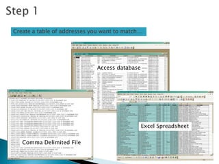

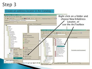


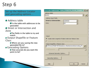


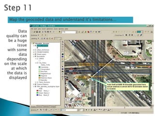

Geocoding is the process of matching address data from a table to locations on a geographic layer. This involves creating an address locator, adding the table to be geocoded in ArcGIS, selecting the address locator, and setting geocoding options like spelling sensitivity, minimum match scores, and offset distances. The geocoded addresses are then output to a new layer and can be mapped to understand data quality limitations.