Fulfilling Maxar Technologies' purpose with the Maxar News Bureau
•
2 likes•604 views

Through the Maxar News Bureau, Maxar Technologies and its space brands are able to generate brand exposure through media coverage and fulfill our purpose of Building a Better World. Dig into our presentation and learn more.

Recommended
Recommended
More Related Content
Similar to Fulfilling Maxar Technologies' purpose with the Maxar News Bureau
Similar to Fulfilling Maxar Technologies' purpose with the Maxar News Bureau (20)
Recently uploaded
Recently uploaded (20)
Fulfilling Maxar Technologies' purpose with the Maxar News Bureau
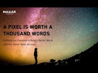
- 1. A Pixel is Worth a Thousand Words Fulfilling our Purpose to Build a Better World with the Maxar News Bureau
- 2. 2 • Communicating your company’s Purpose • What is the Maxar News Bureau? • How satellite imagery has been used in the media • Examples of how satellite imagery and geospatial data from Maxar has been used in the media and how this supports our purpose to Build a Better World AGENDA
- 3. 3 Purpose is a powerful force.
- 4. 4 The allure of being “pulled” toward a meaningful end state rather than being “pushed” there is captivating, energizing and fulfilling all at the same time. Companies today realize they must serve a purpose higher than themselves—higher than simply increasing their profit margin—if they want to not only attain but retain top talent since millennials are driven by purpose rather than paycheck, as cited by a Forbes article.
- 5. 5
- 6. 6 What is the Maxar News Bureau? The Maxar News Bureau is a partnership program between Maxar Technologies and respected news media organizations.
- 7. 7 What is the Maxar News Bureau? DigitalGlobe, a Maxar company, provides satellite imagery and analytics that are powerful complements to good journalism, providing indisputable truth at a time when credibility is critical. Satellite images show a research center in Syria before and after U.S., U.K. and French forces launched a missile strike in April 2018.
- 8. 8 The News Bureau provides access to Maxar’s full spectrum of imagery, analytic capabilities and expertise to our media partners. We do not generate revenue from News Bureau partners. The benefits of the News Bureau to Maxar and its portfolio of companies are brand exposure, differentiation of our capabilities and fulfillment of our purpose of Building a Better World.
- 9. 9 How satellite imagery has been used in the media
- 10. 10 First use of satellite imagery in a breaking news story
- 11. 11 The first time satellite imagery was used in a breaking news story was in 1986 well before there was a license available in the U.S. to commercialize Earth Observation technology. FrenchSPOT imageof ChernobylReactor Site Image from May 1, 1986
- 12. 12 Broadcasting Magazine – Nov. 24, 1986
- 13. 13 The use of the Chernobyl Reactor Site image captivated the news media in 1986 • Later the same year, this cartoon was drawn for a broadcasting magazine that used the word “remote sensing”
- 14. 14 The use of the Chernobyl Reactor Site image captivated the news media in 1986 • Later the same year, this cartoon was drawn for a broadcasting magazine that used the word “remote sensing” • If this was a technology that could be made available to the news media on a wide scale, it could change the way we report the news and understand changes on our planet.
- 15. 15 First public image from IKONOS, DigitalGlobe’s first commercial satellite
- 16. 16 It wasn’t until 13 years later, the first U.S. image was shown in mainstream media from an American commercial company. Image collectedby DigitalGlobe’s IKONOS satellite October13,1999. A New Era in the Sky A photograph of Washington, D.C. is the first high-resolution image of Earth taken by a commercial satellite to be made public. CAPTIONREADS:
- 17. 17 America under attack: a defining moment for the commercial imagery industry BEFORE AFTER TRADE CENTER SITE
- 18. 18 A watershed moment that changed our industry was right after 9/11 when the airspace was cleared above the Twin Towers site for days. This satellite image was the only available overhead picture the public saw of the devastation.
- 19. 19 A watershed moment that changed our industry was right after 9/11 when the airspace was cleared above the Twin Towers site for days. This satellite image was the only available overhead picture the public saw of the devastation. What is even more interesting is this was six years before Google Earth existed.
- 20. 20 How the current media climate is affecting News Bureau partnerships
- 21. 21 For the first time media is the least trusted institution globally.” “
- 22. 22 Sixty-three percent of respondents say they do not know how to tell good journalism from rumor or falsehoods or if a piece of news was produced by a respected media organization.
- 23. 23 Sixty-three percent of respondents say they do not know how to tell good journalism from rumor or falsehoods or if a piece of news was produced by a respected media organization. The lack of faith in media has also led to an inability to identify the truth, trust government leaders and trust business. Source:Edelman Trust Barometer, Feb.2018
- 24. 24 Partnerships are even more valuable to media for storytelling than ever before.
- 25. 25 Partnerships are even more valuable to media for storytelling than ever before.• Present day, one of the things that’s changed is trust in the media has plummetted, particularly in the last three years. • While trust in government is at an all time low, we’re seeing a small uptick in the level of trust in business.
- 26. 26 How geospatial data has been leveraged to support Maxar’s purpose of Building a Better World
- 27. 27 Aiding in AP investigation that frees 2,000 slaves in the 21st century
- 28. 28 DigitalGlobe provided the satellite image that served as the smoking gun that allowed the government to take action against boats that were using slaves to illegally catch fish off Papua New Guinea. • Because of the combination of high-quality and high- resolution detail in the image, two trawlers loading slave- caught seafood onto a refrigerated cargo ship were caught from space. • The AP investigation ultimately won a 2016 Pulitzer Prize for their work …
- 29. 29 …and reunited slaves with their families
- 30. 30 Using geospatial data to reveal the truth about the atrocity in Cameroon
- 31. 31 • In July 2018, a horrifying video of two women and two young children being led away at gunpoint by a group of Cameroonian soldiers went viral.
- 32. 32 • In July 2018, a horrifying video of two women and two young children being led away at gunpoint by a group of Cameroonian soldiers went viral. • Initially, the government of Cameroon dismissed the video and denied the incident occurred in their country.
- 33. 33 • In July 2018, a horrifying video of two women and two young children being led away at gunpoint by a group of Cameroonian soldiers went viral. • Initially, the government of Cameroon dismissed the video and denied the incident occurred in their country. • The Maxar News Bureau provided satellite imagery and geospatial data to help BBC News Africa determine where the atrocity happened, when it happened and who was involved.
- 34. 34 Watch the video: BBC finds truth behind this woman’s killing
- 35. 35 “AP finds evidence for graves, Rohingya massacre in Myanmar” Feb. 1, 2018
- 36. 36 DigitalGlobe satellite imagery along with video of homes reduced to ash helps the AP to confirm a Rohingya village in Myanmar has been wiped out.
- 37. 37 “Myanmar bulldozes what was left of Rohingya Muslim villages” DEC. 20, 2017 FEB. 13, 2018 VILLAGE OF ZONE KAR YAR, MYANMAR
- 38. 38 Additional DigitalGlobe satellite imagery provided to the AP confirms Myanmar’s government bulldozes the burned remains of the Rohingya Muslim villages in an attempt to destroy evidence of mass atrocities against the country’s Rohingya Muslim minority.
- 39. 39 Following natural disasters such as the Carr wildfire in California, Maxar releases open data for humanitarian response and to educate the public about the impacts.
- 40. 40 “A Fire tornado Hit Their Neighborhood. This is all That’s Left.” Aug. 4, 2018
- 41. 41 The New York Times combined DigitalGlobe satellite imagery along with ground photos from the fire and augmented reality to illustrate the impact of the Carr Fire in California.
- 43. 43 Hurricane Florence: Flooded farmland and oil slick in Currie, NC Collected Sept. 19, 2018 Following Hurricane Florence, pre- and post- event satellite imagery has been shared with first responders including Team Rubicon, American Red Cross and Net Hope to aid in disaster response and clean up efforts.
- 44. 44 At Maxar Technologies, we believe that insights unlock infinite possibilities. And what inspires us, what keeps us pushing beyond the limits of what’s currently possible, is our primary purpose: To create the connections and intelligence that power a better world. − Howard Lance,MaxarTechnologiesPresidentand CEO
- 45. We play at the nexus of the new space economy betterworld.maxar.com