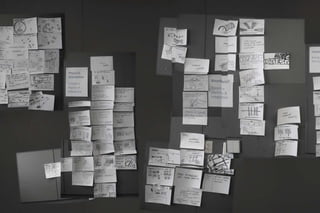
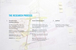
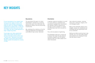
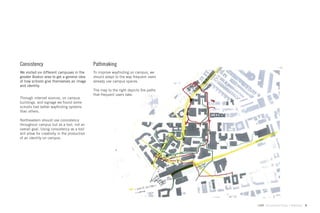
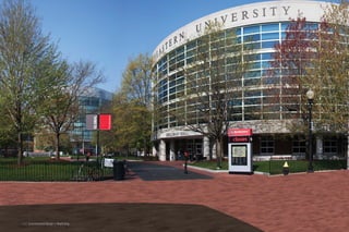
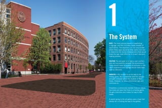
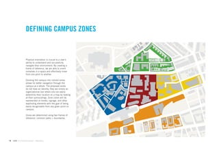
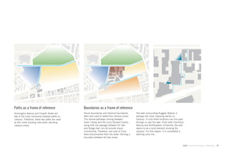
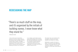
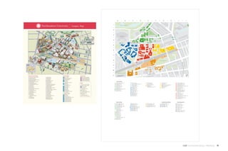
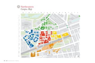
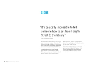
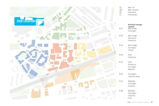
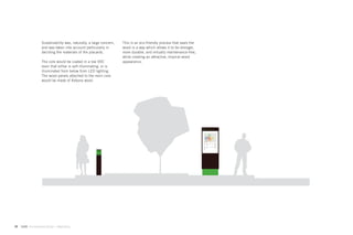
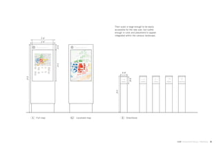
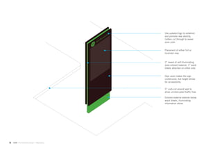
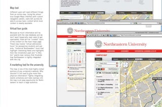
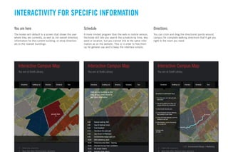
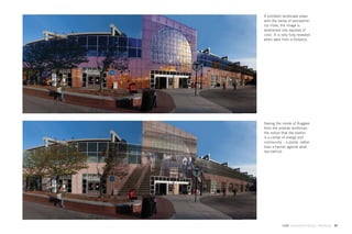
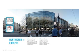
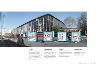
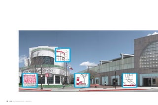
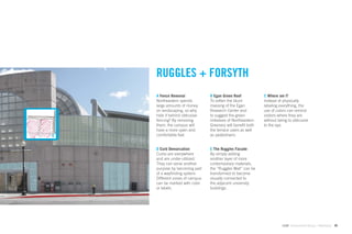
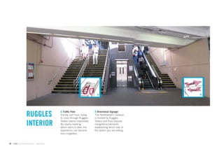
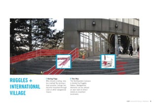
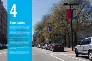
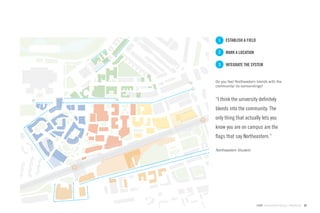
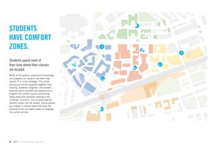
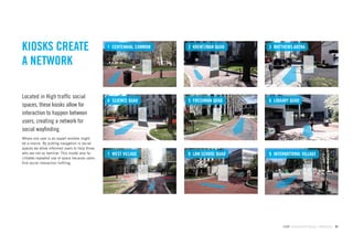
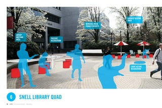
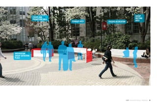
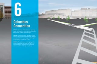
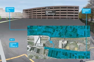
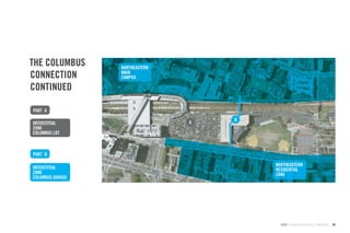
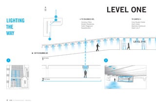
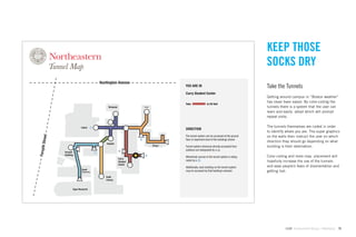
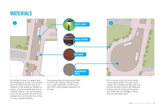
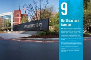
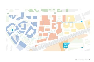
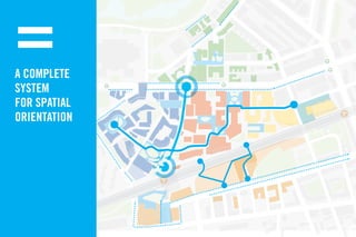
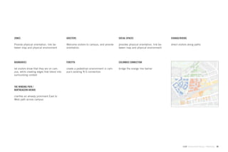
The document discusses redesigning the wayfinding system at Northeastern University. It begins by outlining the research process, which included discipline-based knowledge gathering, human-centered research, and synthesis. Key insights from the research included the importance of boundaries, orientation, consistency, and pathmaking for users. The solution proposes dividing the campus into color-coded zones for navigation. It also redesigns the campus map with a grid layout, color-coded zones, and landmark buildings labeled for reference. The new map orients the campus with major paths running horizontally and vertically and expands to show surrounding Boston landmarks for additional context.
![TYPOGRAPHY
ITC New Baskerville and
Helvetica are the official
fonts of the University.
()*+,-./0123456789:;<=>?@A
Helvetica Neue serves
as an informative and
HIJKLMNOPQRSTUVWXYZ[]^_`a
readable display face. It
is economical in terms
of space and the bold
weight can be read at great Helvetica Neue Bold Condensed
distances.
New Baskerville is used
for the University ID and )*+,-./0123456789:;=?@AB
IJKLMNOPQRSTUVWXYZ[]^_`ab
materials that require a
more formal presentation.
!
New Baskerville Roman
)*+,-./0123456789:;=?@AB
IJKLMNOPQRSTUVWXYZ[]^_`ab
!
New Baskerville Italic
14 GdAM Environmental Design + Wayfinding](https://image.slidesharecdn.com/finalbook-100501093232-phpapp02/85/Final-Wayfinding-Book-14-320.jpg)


![UX Heuristics for Large Environments [DRAFT]](https://cdn.slidesharecdn.com/ss_thumbnails/stlarchitectsuxheuristics12182019-200409181649-thumbnail.jpg?width=640&height=640&fit=bounds)


![Info design presentation[1]](https://cdn.slidesharecdn.com/ss_thumbnails/infodesignpresentation1-111201130643-phpapp01-thumbnail.jpg?width=640&height=640&fit=bounds)
