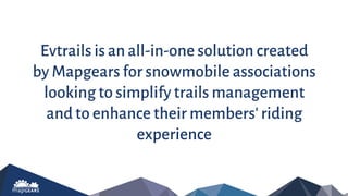
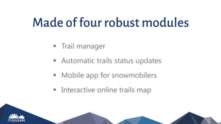
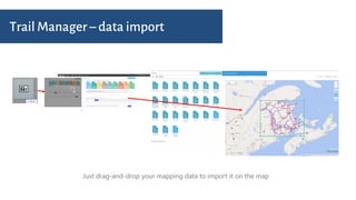
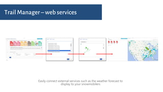
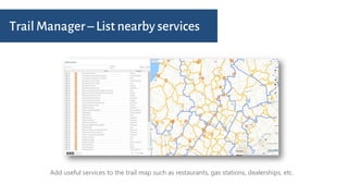
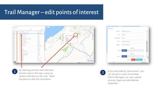
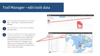
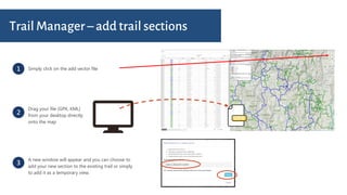
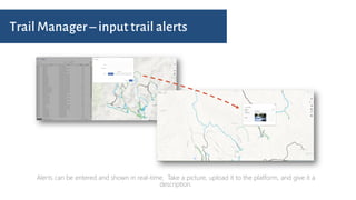
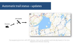
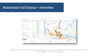
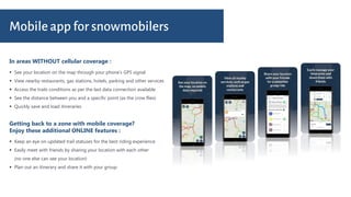
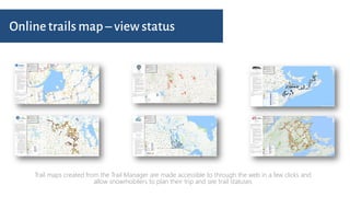
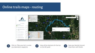
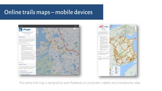
evtrails is an all-in-one solution created by Mapgears for snowmobile associations looking to simplify trails management and to enhance their members' riding experience
Visit us at www.evtrails.com to learn more!
2. Evtrails is an all-in-one solution created
by Mapgears for snowmobile associations
looking to simplify trails management
and to enhance their members' riding
experience
3. Trail manager
Automatic trails status updates
Mobile app for snowmobilers
Interactive online trails map
Made of four robust modules
5. Trail Manager – web services
Easily connect external services such as the weather forecast to
display to your snowmobilers
6. Trail Manager – List nearby services
Add useful services to the trail map such as restaurants, gas stations, dealerships, etc.
7. 1
By selecting the item from left hand
browser area or the map, a pop-up
window will open on the map. Select
the pencil to edit the information
2
If you have editing “permissions”, you
can edit all or some of the fields.
District Managers can even upload
pictures, logos and add Website
hyperlinks.
Trail Manager – edit points of interest
8. 1
Select the appropriate Application by going to
App > Select App - Trail Status for District
Manager
2
Once selected: Go to upper right and Select >
the Play button
3
Once you are within the Trail Status application
for District Managers, you can select Filters to
select specific areas to add or change the
individual trail or a group of trails at the
same time. If there is no change in trail
status, you can simply select the “Update
data” button and declare no change of trail
status in the entire region.
Trail Manager – edit trails data
9. 1 Simply click on the add vector file
2
Drag your file (GPX, KML)
from your desktop directly
onto the map
3
A new window will appear and you can choose to
add your new section to the existing trail or simply
to add it as a temporary view.
Trail Manager – add trail sections
10. Trail Manager – input trail alerts
Alerts can be entered and shown in real-time. Take a picture, upload it to the platform, and give it a
description.
11. Automatic trail status – updates
By equipping groomers with GPS devices, trails can be updated automatically based on the time
elapsed since the last cleaning
12. Automatic trail status – overview
Follow the status of your assets and colleagues in real-time for better control over operations and to
react quickly in case of an accident
13. In areas WITHOUT cellular coverage :
Mobile app for snowmobilers
See your location on the map through your phone’s GPS signal
View nearby restaurants, gas stations, hotels, parking and other services
Access the trails conditions as per the last data connection available
See the distance between you and a specific point (as the crow flies)
Quickly save and load itineraries
Getting back to a zone with mobile coverage?
Enjoy these additional ONLINE features :
Keep an eye on updated trail statuses for the best riding experience
Easily meet with friends by sharing your location with each other
(no one else can see your location)
Plan out an itinerary and share it with your group
14. Online trails map – view status
Trail maps created from the Trail Manager are made accessible to through the web in a few clicks and
allow snowmobilers to plan their trip and see trail statuses
15. 1 Click on “Plan your trip” so enter
you destination waypoints.
Save your favorite trip and
share them with friends
3
Online trails maps - routing
2 View all the directions for the trip
on the left panel
16. Online trails maps – mobile devices
The online trail map is designed to work flawlessly on computers, tablets and smartphones alike.
17. Wish to see more ?
Visit us at www.evtrails.com to see live
examples of our clients’ online maps