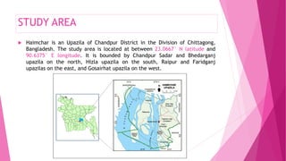
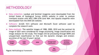
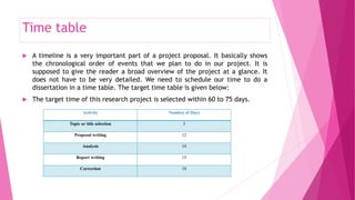
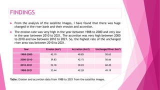
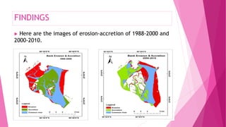
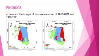
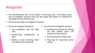

This document summarizes a student's dissertation on analyzing Meghna River bank erosion in Haimchar Upazila, Chandpur, Bangladesh using GIS and remote sensing techniques. The student discusses the background of river bank erosion in Bangladesh, states the problem and objectives of the study, which is to identify and assess Meghna River bank erosion and recommend mitigation measures. The methodology describes using satellite imagery from 1988 to 2021 to analyze erosion and accretion. Key findings show the highest erosion from 1988 to 2000, and highest accretion from 2000 to 2010, with the most stable river area from 2010 to 2021. Mitigation measures discussed include structural options like planting trees and constructing embankments, and non-structural like dredging and


