Electoral Area C OCP and Zoning Bylaw Review Open house
•Download as PPTX, PDF•
1 like•3,542 views

The SLRD is conducting a review of the current Electoral Area C Official Community Plan (OCP) and Zoning Bylaw. The Review is being conducted mainly to enhance agriculture, strengthen protections for agricultural uses in the Agricultural Land Reserve (ALR) and ensure that ALR land is used for farming.

Recommended
More Related Content
What's hot
What's hot (20)
Similar to Electoral Area C OCP and Zoning Bylaw Review Open house
Similar to Electoral Area C OCP and Zoning Bylaw Review Open house (20)
Recently uploaded
Recently uploaded (20)
Electoral Area C OCP and Zoning Bylaw Review Open house
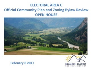
- 1. ELECTORAL AREA C Official Community Plan and Zoning Bylaw Review OPEN HOUSE February 8 2017
- 2. Where Is Electoral Area C?
- 3. What is an Official Community Plan (OCP)? It is a policy document that states a community’s identity and includes objectives, goals and priorities for its growth and vision • It includes valuable aspects of the community to be preserved areas or land use issues it wants to improve its desired approach to managing pressures for change forecasts for change that affect land use control • It guides all other policies and plans in the District integrated with other community strategies and plans for transportation, sustainability, waste management housing and recreation • It contain statements, policies and maps to guide future staff and Board land use decision-making for the use of land the review of new development proposals the direction for regulatory policies such as zoning and development
- 4. Contents of an Official Community Plan Statements and map designations for: • the location, amount, type and density of different types of land uses: residential, commercial, industrial, institutional, agricultural, recreation, public utilities, parks, waste treatment and disposal sites and sand and gravel deposits • where new development should go and what form should it take Policies for: • preserving, protecting, restoring and enhancing the natural environment, ecosystems and biological diversity • Identifying land that is subject to hazardous conditions or environmentally sensitive to development and control its use; • Targets for the reduction of greenhouse gas emissions and local government policies and actions • Location and phasing of any major road, sewer and water systems; • Social well-being and social development; • Housing policies including types of housing for current and future needs needed for and affordable housing • Maintaining and enhancing farming on land in a farming area
- 5. What is a Zoning Bylaw? • Local government law to implement the OCP by regulating land use • Must conform to Official Community Plan • Can be amended • Enforcement: fines for contravention, compliance order, denial or revoking of building or occupancy permit Purpose of a Zoning Bylaw • Safety, Consistency, Certainty regarding what can/cannot occur on a lot • Prevent or restrict building on perilous land (steep, marshy, flood plain, etc.) • Keep uses or activity apart that do not work well together - Restrict use of land • Ensuring orderly development and efficient use of infrastructure • Establish or maintain community character and amenity • Regulate the type of construction and the height, bulk, location, size, floor area, spacing, character and use of buildings or structures • Loading and parking facilities • Signs – sometimes • It is not a Building Code, a Noise, or Property Standards Regulation
- 6. Contents of a Zoning Bylaw • Definitions • Regulations for all areas – e.g. parking and loading standards by use or type • land use zones – agricultural, residential, industrial, mixed use, etc. – Permitted uses, prohibited uses – Maximum densities, floor areas, lot coverage, building heights, landscaping requirements – Minimum and maximum building setbacks – Other performance standards • exceptions • maps that indicate where particular rules or standards apply • Amending procedures
- 7. Why are we doing this and why now? 1. Better Agricultural and agriculture land policy Ensure that local and regional land use policies and bylaws reflect and support the vision and priorities in the Pemberton Valley Agricultural Area Plan (PVAAP) SLRD Board directions to staff • October 28, 2015 develop OCP and Zoning Bylaw amendments to protect farming on lands adjacent to farmland, and regulate the size and siting of residential uses in the ALR • July 22, 2015 implement the Pemberton Valley Agricultural Area Plan (PVAAP) as much as possible 2. They are old and need updating Normal review after 5 to 10years • OCP: 1999 • Zoning Bylaw: 2002 3. Ensure consistency in form and content among SLRD OCPs and Zoning and Development Review
- 8. What is Staying the Same? • Village of Pemberton and Indian Reserves excluded • Most non-agricultural economic development policies retained • No significant changes to land use or zoning area boundaries • Regional policies in the Area C OCP • Policies Common to all plans – Strong Biodiversity and Natural Environment policies – Resource Management Lands policies – Watershed Protection policies – Transportation policies • Direct most non-farm employment and business uses to Pemberton • Direct most social service and community uses to Pemberton • Permit Utilities everywhere
- 9. Old Wine in New Bottles – Format Changes, Re- wording, Re-structuring Clearer OCP distinction between general policies and land use policies • better guidance for zoning and development review processes Consolidation of Zones • 5 Tourist Commercial Zones reduced to 2 • rationalization and renaming of Rural zones to Rural Residential Zones • clarification of bed and breakfast polices – must be operated by occupant Policies Common to all plans reformatted to be consistent with other SLRD Plans and Bylaws • Strong biodiversity and Natural Environment policies • Resource Management Lands polices • Watershed Protection policies • Transportation policies Mt Currie Commercial Area guidelines become a Development Permit Area Convert Land Use Contracts to Zoning
- 10. New Proposals • Stronger policies to support agriculture and keep agricultural land in production • Integrate Pemberton Valley Agricultural Area Plan (PVAAP) into Planning policies and regulations • Create Separate Development Permit Section and improved development guidelines, including for near farm areas • Stronger policy for mobile home parks as affordable housing • Require short term accommodations (BnB, AirBnB) to be operated by occupant
- 11. Protect Rural Character and Farm Cultural Landscape OCP Policies proposed • Protect the appearance and character of the rural and agricultural landscape • Direct high density and multifamily development to municipalities and existing resort areas • Development encouraged to to retain and maximize the viewscapes • Identify, protect and conserve important cultural heritage resources, including archaeological resources and cultural heritage landscapes • Identify cultural heritage landscapes, where the arrangement of buildings, structures, rights-of-way, vegetation and open space represents distinctive cultural processes in the historical use of land • Prevent negative “visual impact” from development Ensure that new development in the rural area maintains the rural character of the area and supports a functioning working landscape
- 12. Proposals for Consistent Thorough and Evidence- based Decision-Making Criteria in Agricultural Areas Apply the ALC criteria for making decisions, recommendations and OCPs, Zoning Bylaws and Development Permit Area guidelines • Agricultural potential of subject & adjacent parcels • Agriculture capability rating (CL) • Agricultural suitability & current land / agricultural use • Does proposal benefit / support / restrict farming? • Impact on existing or potential farm uses • Good and bad precedents or examples? • Regional & community planning objectives • Alternate location outside ALR • Local government & AAC recommendations
- 13. Proposed Agriculture Land Policy decision making criteria Require the following criteria and considerations to be used when setting policies for land use and for reviewing applications for land use changes and development in agricultural areas • Recognize the important role of the ALR in preserving land for agricultural use • Protect and preserve farm land and soil having agricultural capability • Encourage and support the appropriate utilization of land for agricultural purposes • Does it support food production and a strong, profitable agriculture sector? • The intrusion of residential development and into agricultural areas is a potential problem that should be guarded against • Discourage the presence of other non-farm uses in agricultural areas • The impact of non-farm development in or adjacent to agricultural areas is s a potential problem that will be guarded against • All accessory or ancillary uses are supplementary and secondary to agricultural activity and must be linked to the primary agricultural activity of the farm • Special events and agritourism and commercial businesses (with the exception of home occupations) must be linked to an agricultural activity on the farm unless specifically permitted in the ALR • Require Agricultural Impact Assessment for non-farm use applications, prepared by qualified and licensed professional such as an agrologist • Does it contribute to food security?
- 14. Farm Residential Footprint or “Home Plate” SLRD Board July 22, 2015 resolved: THAT with respect to commercial events in the Pemberton Valley, SLRD staff to review the District of Kent’s regimes/processes with respect to agriculture (i.e. “home plate” considerations) for their applicability to the SLRD. Recommended by Ministry of Agriculture and Agricultural Land Commission Adopted in Area D – consistency Over 75% already comply in Pemberton Valley
- 15. Proposed Farm Residential Footprint or “Home Plate” General Requirements 1. All residential and non-farm uses must be located within the farm residential footprint area. 2. No non-agricultural or non-farm use outside the farm residential footprint. Siting Requirements 3. Maximum area 2,000 m2. 4. Up to 2,500 m2A with containing an approved farm employee residence. 5. The maximum depth for a farm residential footprint is 85 m, measured from the road 6. One boundary must be located at a property line fronting on a road from which vehicular access is obtained. 7. The rear building face of must not be less than 10 m from the rear of the farm residential footprint.
- 16. Increase Minimum Parcel Size in Agricultural Areas The existing 2 hectare minimum parcel size protects 3% of agricultural land from further subdivision – Pemberton Meadows The proposed 40 hectare minimum parcel size protects 75% of agricultural land from further subdivision – Pemberton Meadows
- 17. Proposed Minimum Parcel Size in Agricultural Areas The existing 2 hectare minimum parcel size protects 3% of agricultural land from further subdivision – Pemberton Meadows 0% 3% Protected 5% 10% 19% 41% 22% Total Area by Parcel Size 0-2ha 2-4ha 4-10ha 10-20ha 20-40ha 40-80ha 80+ha The proposed 40 hectare minimum parcel size protects 75% of agricultural land from further subdivision – Pemberton Meadows 37% 41% 22% Unprotected Total Area by Parcel Size 0-40ha 40-80ha 80+ ha
- 18. “Gathering for an Event” July 2016: ALC Regulations amended to define and permit new use: a “gathering for an event”. Definition of “gathering for an event” (i) a wedding, unless paragraph (iii)(2) applies, (ii) a music festival, or (iii) an event, other than (1) an event held for the purpose of agritourism, or (2) the celebration, by residents of the farm and those persons whom they invite, of a family event for which no fee or other charge is payable in connection with the event by invitees. Conditions for a “gathering for an event” must be met: (i) the farm must be located on land classified as a farm under the Assessment Act; (ii) permanent facilities must not be constructed or erected in connection with the event; (iii) parking for those attending the event must be available on the farm, but must not be permanent nor interfere with the farm's agricultural productivity; (iv) no more than 150 people attending the event; (v) maximum 24 hours duration; (vi) maximum of 10 gatherings for an event on the farm within a single calendar year.” Proposal Amend the Zoning Bylaw to incorporate revised Regulations.
- 19. Housekeeping • Clearer, more consistent definitions • Consolidation of existing Zoning amendments into the Zoning Bylaw • Delete policies that have been implemented • Delete polices re: Olympic development • Zone Boundary clean up and simplification • Delete unused non-conforming use permissions in zoning • Delete unused OCP designations and zones – Industrial OCP designation – Independent Power Project Zone – no local government jurisdiction – Special Planning Area – entire area transferred to Village of Pemberton • OCP statements acknowledging Conformity with ALR Regulations, the Local Government Act and Regional Growth Strategy
- 20. Land Use Contracts Provincial legislation requires: • Terminate all Land Use Contracts by 2024 • Replace with zoning by 2022 3 Recreational Communities Land Use Contracts • McGillivray Falls • Ponderosa Estates • Birkenhead Lake Estates Proposal • Transform land use controls and site plans to a Community plan zone for each • Leave Land Use Contracts in place until they expire in 2024 Edwards Kia Ora Court (Mobile home park) Proposal • designate and zone as mobile home park • retain Mobile Home Park Bylaw as a community plan 4D Ranch (permits 3 houses and a planer mill on ALR land in use in Ag zone) Proposal • Retain permission in a site specific by law exception • delete Land Use Contract
- 21. Location of Land Use Contract Zones
- 22. What Happens Next? • A first draft of the proposed Electoral Area C OCP and Zoning Bylaw is intended to be presented to the SLRD Board at their March 2017 meeting • Once the SLRD Board has given the proposed Plan and zoning bylaw first reading, a copy will be posted on the SLRD website for public comment and referred to other governments and agencies for their comments • As an initial estimate, the public hearing might occur in May 2017 • More information and updates on the project, including staff reports and bylaws will be posted on the Area C OCP and Zoning Review project page here: http://www.slrd.bc.ca/inside-slrd/current-projects-initiatives/area-c-ocp- zoning-pemberton-valley-agricultural-area-plan-implementation