
Recommended
More Related Content
Similar to ECDIS.basic course stcw solas from Arab academy pdf
Similar to ECDIS.basic course stcw solas from Arab academy pdf (20)
Recently uploaded
Recently uploaded (20)
ECDIS.basic course stcw solas from Arab academy pdf
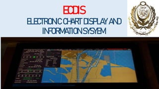
- 1. ECDIS ELECTRONIC CHART DISPLAY AND INFORMATION SYSYEM
- 2. INTRODUCTION Electronic Nautical Charts (ENC) and Electronic Chart Display and Information Systems (ECDIS) The mandatory carriage of ECDIS, as required by SOLAS regulation V/19.2.10, is subject to a staged entry into force between 1 July 2012 and 1 July 2018. where an ECDIS is being used to meet the chart carriage requirements of SOLAS, it must: 1- be type-approved; 2- use up-to-date electronic nautical charts (ENCs); 3- be maintained so as to be compatible with the latest applicable International Hydrographic Organization (IHO) standards; and 4- have adequate, independent backup arrangements in place.
- 3. ONBOARD ECDIS UPDATES ECDIS should meet IMO performance standards ECDIS must be type approved ECDIS must be type approved and meet IMO/SOLAS approved performance standards if it is to be used to meet the chart carriage requirements as outlined in SOLAS regulation V/19.2.1.4
- 4. MAINTENANCE OF ECDIS SOFTWARE Licensing The ENCs in AVCS are provided under a license agreement that allows their use for defined periods of time. AVCS Folios and ENC Units may be added to an AVCS license at any time for periods of 3, 6, 9 or 12 months.
- 6. Updating AVCS using the internet The AVCS Online Updating Service (AVCS OUS) uses software to provide immediate access to the latest digital chart updates for subscribers of the AVCS service. The service is complimentary to the DVDs available for AVCS and offers quick access to the most up-to-date information. • all AVCS customers supply with weekly electronic updates via Internet download or DVD. • To obtain AVCS updates via the Internet, you can use public FTP website with the following login credentials (the username and password details are case sensitive). • FTP://ukho.gov.uk • Username: ukhopublic • Password: Public12345
- 7. Continual delivery of updates Most ENC updates are now available from UKHO as soon as they are ready and therefore can be displayed on ECDIS many days earlier than the AVCS weekly batch release.
- 8. AVCS Base Release Schedule and Distribution of ENC Producers
- 9. AVCS Base Release Schedule and Distribution of ENC Producers
- 10. AVCS permits Each permit is unique and is the method which gives the user access to the required ENCs. The ENC Permits are supplied in a zipped file and the contents of this file will depend on the user’s bridge configuration, as each AVCS license allows for use on more than one ECDIS. When extracted, one or more set of permit files (PERMIT.TXT and ENC.PMT) will be copied automatically into folder(s) named MASTER, BACKUP, RESERVE1, RESERVE2 and RESERVE3 etc depending on the number of ECDIS configured on the bridge.
- 11. Pay as you Sail (PAYS) PAYS subscriptions provide your vessel with permits for the majority of the AVCS portfolio, so they are available for voyage planning. Where the Producer allows their ENCs to be included in the PAYS Service, you avoid having to purchase them individually. You are only charged for their use when your vessel tracks across the coverage of each ENC. The ENC data must still be loaded onto your ECDIS either manually or automatically.
- 12. ADMIRALTY Information Overlay (AIO) The AIO is a worldwide digital dataset that is designed to be displayed over ENCs in ECDIS and other chart display systems to provide additional information during passage planning. The Overlay displays ADMIRALTY paper chart Temporary & Preliminary Notices to Mariners (T&P NMs) where temporary information has not been encoded by the producer into the underlying ENC.
- 13. Updating AIO The AIO is refreshed every week, as part of the AVCS Weekly Update and is available as a weekly cumulative disc, ISO and zip file, as well as a week-only zip file for download. Cumulative files contain the base edition and all the updates to date, so you only need to load the most recent version.
- 14. Using AIO You should have AIO active on your ECDIS screen during passage planning. Use the ENCs and route checking in the normal way, noting any features that are described in the pick report as being temporary. Check your route with the ECDIS date set to the planned passage time. ENC Preliminary (EP) NMs highlight navigationally significant differences between ENCs and ADMIRALTY paper charts.
- 15. PERFORMANCE ANNUAL TEST PROCEDURE FOR (ECDIS) manufacturer-recommended tests and checks, which correspond to IMO’s requirements for ECDIS as laid down in SOLAS regulations V/19.2 and V/27, MSC.232(82) and MSC.1/Circ.1503/Rev.2 (NOV2022) Where a ship’s ECDIS back-up arrangements are met by a second independent ECDIS according to the safety equipment certificate, then the performance test procedure should be carried out on the back-up ECDIS installation. The manufacturer should provide sufficient supporting materials (for example - performance test manual, relevant checklists and test programs, software tools for automated tests and/or data collection) in order to facilitate the performance test procedure. The results of the performance test procedure should be recorded
- 19. ECDIS operating with Edition 4.0 of the IHO Presentation Library ECDIS must be maintained to the latest IHO standards. For a graphical way to establish that the ECDIS is up to date, the mariner can use ECDIS Chart 1 to review the new symbols introduced in IHO S-52 Presentation Library Edition 4.0. ECDIS Chart 1 is a legend of the entire set of symbols that may be used within an ENC, and is installed on all type-approved ECDIS systems
- 22. Dual Fuel ECDIS As a consequence, new ECDIS systems to be brought into the market at the time then S-101 ENC coverage starts (2024) have to be capable to process both formats: S-57 ENCs and S-101 ENCs in parallel.
- 23. Standardization within the S-100 hydrographic domain
- 24. CHART ACCURACY ECDIS DATA RELIABILITY (Category Zone of Confidence (CATZOC) depends on: • Position accuracy • Depth accuracy • Seafloor Coverage • Typical Survey Characteristics
- 26. CATZOC Category Zone of Confidence • In coastal shipping areas the most common assessments likely to be encountered are: • ZOC B – around 40% of the world’s coastal waters; • ZOC C – around 30% of the world’s coastal waters; • ZOC D – around 10% of the world’s coastal waters; and • ZOC U – around 15% of the world’s coastal waters.
- 29. How to use CATZOC Information Let us say we have planned a passage in an area with CATZOC category of 3 stars (zone of confidence “C”). This is one part of our passage that passes from a known danger by 0.4 NM.
- 30. As the CATZOC category is 3 stars (zone of confidence “C”), there could be position error of up to 500 meters in showing the position of this danger. 500 Meters is approximately equal to 0.3 NM. How to use CATZOC Information
- 31. Consideration for Depth accuracy 1. Available depth in this area is 9.3 Meters. 2. Vessel’s maximum draft is 7.2 meters. 3. Vessel expected to experience squat of 0.8 meters. 4. The company requires the vessel to maintain UKC of 10% of the maximum draft (including squat). 5. vessel need to pass through this area which has the least depth of 8.8 meters.
- 32. Consideration for Depth accuracy
- 34. CATZOC (zone of confidence “B”), there can be an error in depths up to 1 meters + 2% of depth. Consideration for Depth accuracy
- 35. Available depth in this area is 9.3 Meters (zone of confidence “B”)= 1 meters + 2% of depth. 9.3m x 2% = 0.17m the error in depths can be up to 1.17 meters (1 + 0.17 meters). So we need to assume that the minimum depth in this area is 8.13 meters only, 1.17 meters being the error in-depth reading Consideration for Depth accuracy
- 36. ECDIS Safety Settings There are 4 safety settings 1. Safety contour Setting 2. Shallow contour settings 3. Deep contour setting 4. Safety Depth setting
- 37. Shallow Contour setting A contour is a line separating a minimum depth area. For example a 10 meter contour will be a line that separates waters below and above 10 meters depths. The contours are in the value of 5, 10, 15, 20, 30 and so on. ECDIS Safety Settings
- 39. Shallow Contour setting This is the value of depth below which it is definite for the vessel to get aground. The shallow contour value need to be equal to or more than the draft of the vessel. The shallow contour area is not navigable (NO GO AREA). ECDIS Safety Settings
- 40. Safety Contour setting Safety contour is the contour line above which we can navigate without any water depth concern. Vessel’s draft is 9 meters and at maximum speed, the expected squat is 1.1 meters. The company require the vessel to have UKC of 10% of the draft. vessel would need 11 meters of water depth to navigate if we enter 11 meters as safety contour setting, it will show 15 meters contour as the safety contour. ECDIS Safety Settings
- 41. Safety Depth setting Safety depth is the depth of the water we can safely navigate. Safety Depth: The spot soundings below the specified value entered for safety depth will appear bold. These are not required to generate any alarms. When the vessels planned passage is within the Safety Contour these spot soundings provide a visual indication to the navigator and must be used to create No Go Areas using User Map Lines capable of generating an alarm. Minimum Settings: Setting should be based on vessel’s dynamic draft. Dynamic draft = Present maximum static draft + All allowances (Squat + Sinkage due to Density + Allowance for Sea State + Heel Correction + Seasonal variation + other allowances). ECDIS Safety Settings
- 43. Deep water contour The deep water contour to show the maximum anchoring depths where vessel can drop anchor. So if your vessel can anchor maximum 105 meters depth, you can set the deep water contour to 100 meters. ECDIS Safety Settings
- 44. EXAMPLE vessel’s draft is 9 meters and vessel require 14 meters depth to comply with company’s UKC policy. 1. Shallow contour: 9 meters 2. Safety depth: 14 meters 3. Safety Contour: 15 meters 4. Deep Contour: 50 meters ECDIS Safety Settings
- 45. If you notice, for safety contour ECDIS has taken the 20 meter contour because 15 meter contour is not available. 1.Shallow contour: 9 meters 2.Safety depth: 14 meters 3.Safety Contour: 15 meters 4.Deep Contour: 50 meters
- 46. ECDIS Capabilities and Limitations
- 48. 1- Can you show me the last passage plan on ECDIS? The passage needs to be accurate must follow all the company requirements and must be in accordance with the industry guidelines. • The route • Parallel index lines • No-Go Areas (not excessively marked) • Wheel over position • Abort point • Marking of bridge watch levels • Position plotting interval and method at each leg • Security levels and the points where vessels need to be hardened. • Point for notice to the engine room and calling the master • MARPOL ARERAS. (ECA)
- 49. 2- What procedure you follow when the route crosses safety contour? On ECDIS, the unsafe depths (depths less than safety depths) are shown in dark black color and safe depths are shown in grey color. ECDIS is supposed to give an alarm when the vessel crosses a safety contour. But after the vessel has crossed safety contour there would be no alarm in case the vessel is about to run into danger such as crossing an unsafe depth. Method 1: After crossing safety contour, Navigator needs to be more alert and ensure that the vessel does not run over a depth lesser than safety depth. Method 2: where during the planning stage, 2nd mate draws a line with a manual update separating the safe and unsafe areas.
- 50. 3- What is scamin and how do you use it? This is to give an option to the navigator to de-clutter the screen so that it is more user-friendly during the navigation. During the passage planning stage, we do not want to miss any of the features or buoy, etc as we do not want to have our courses run over these. So during the planning stage, we are expected to keep the SCAMIN off. During navigation, we can keep the SCAMIN to “on” to declutter the ECDIS screen however if we need to go away from our intended route for some reason, we must turn off the SCAMIN to review the area.