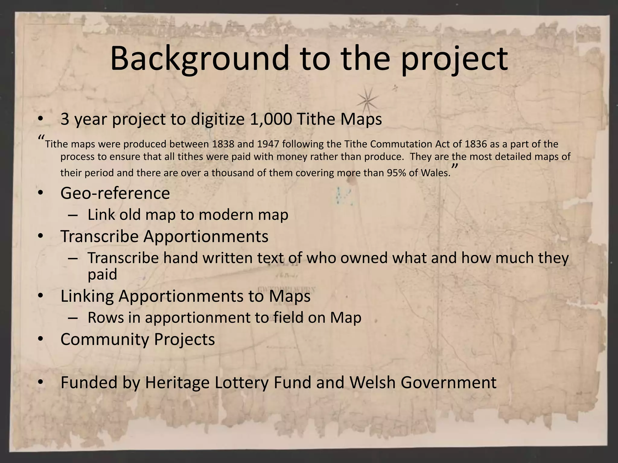
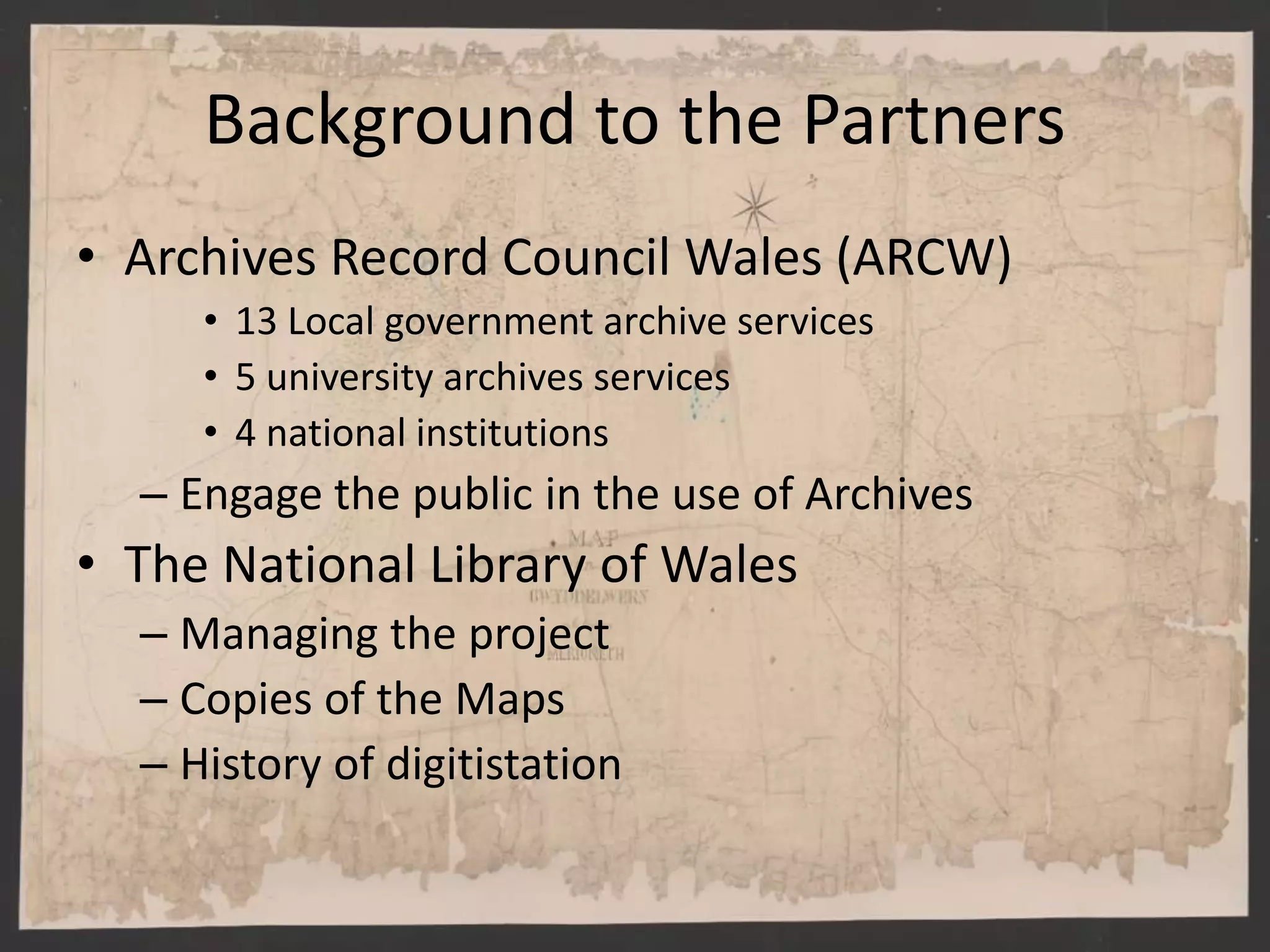
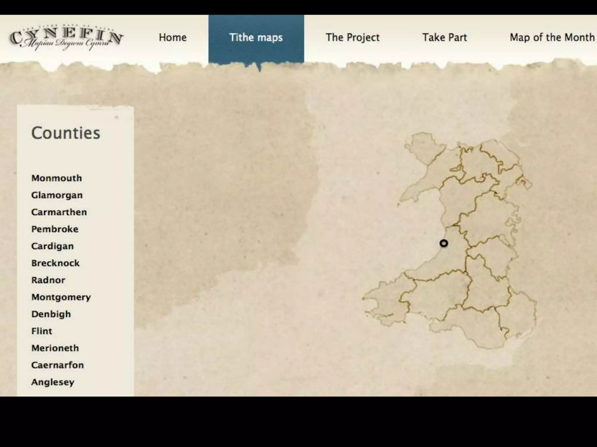
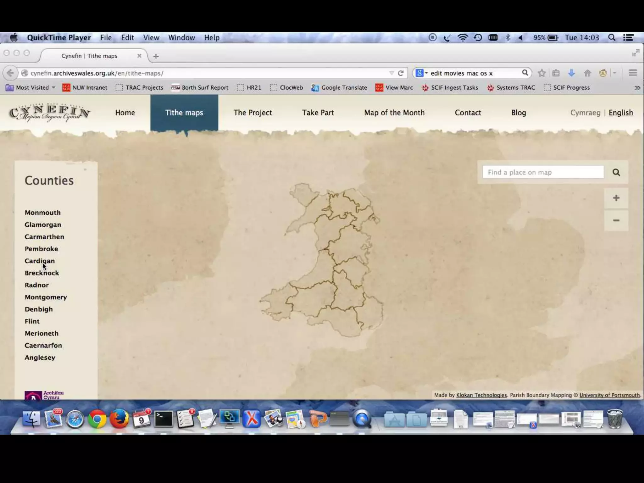
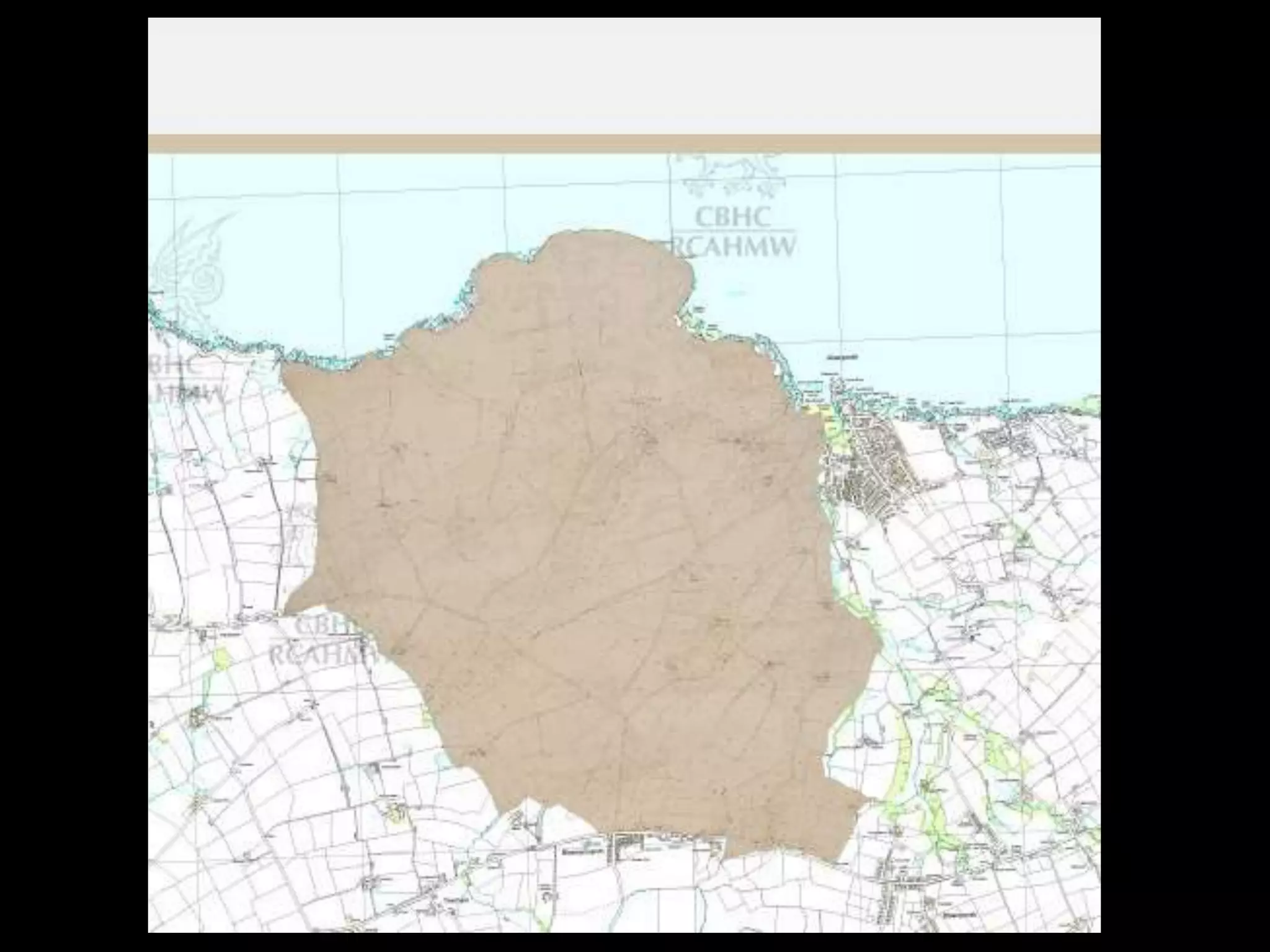
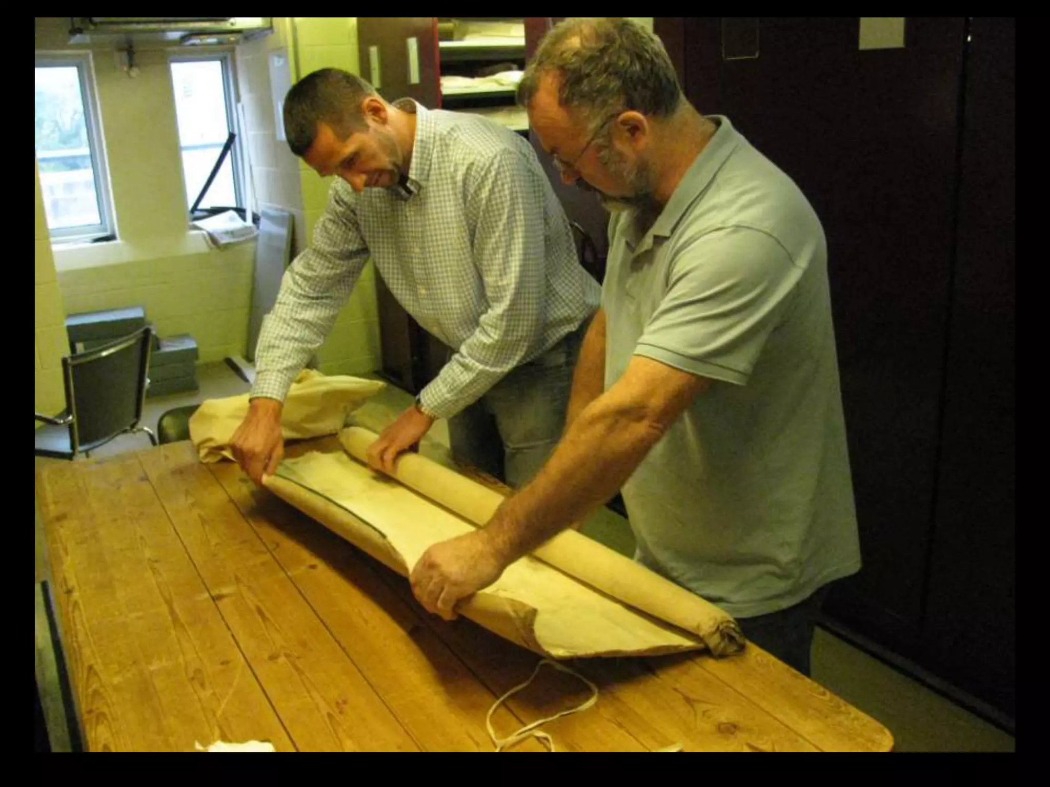
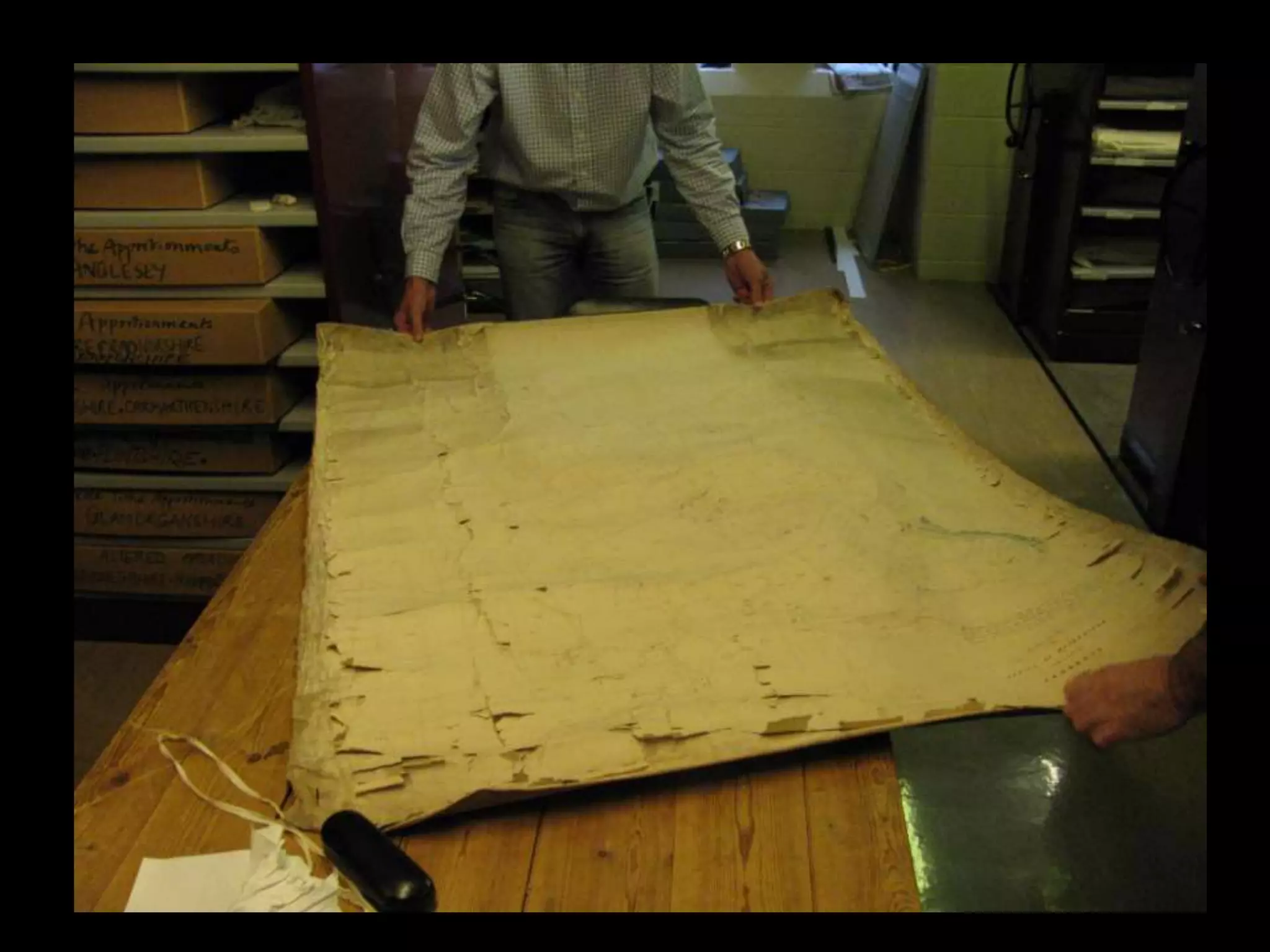
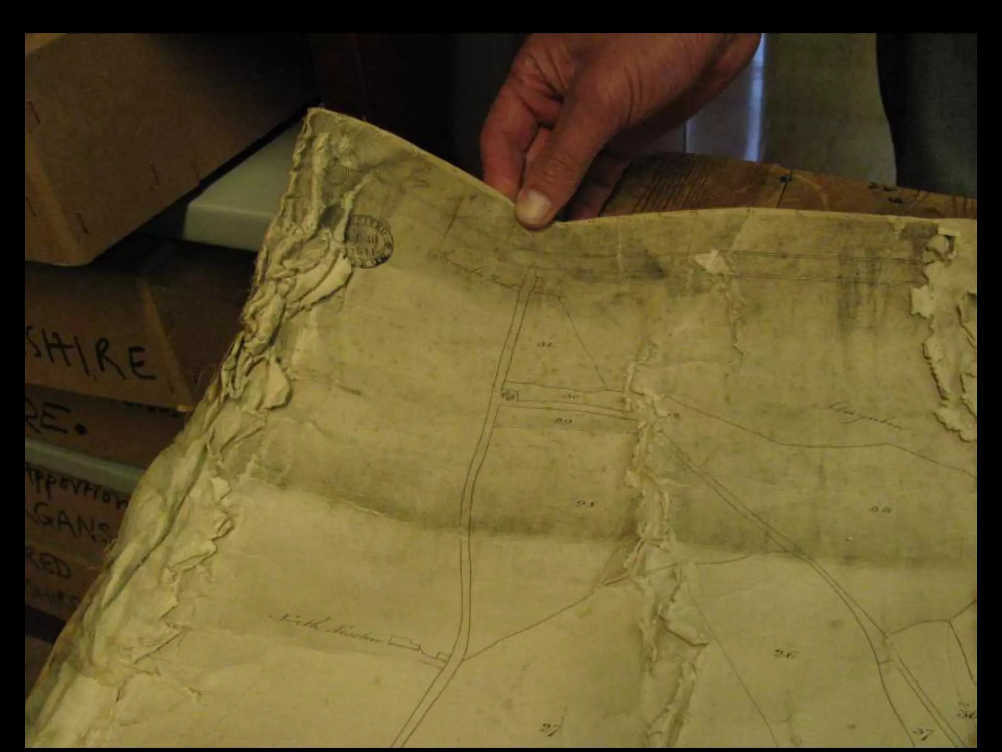
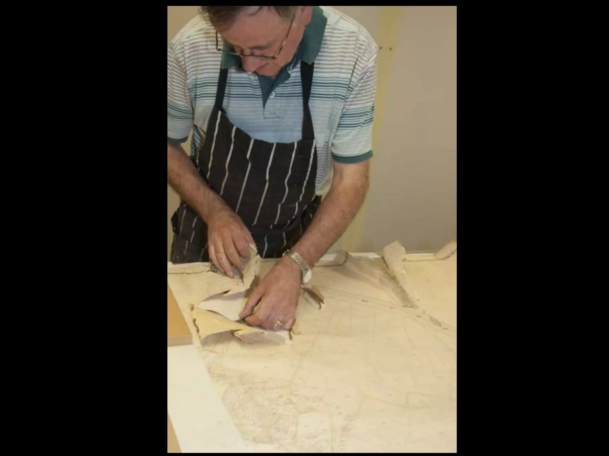
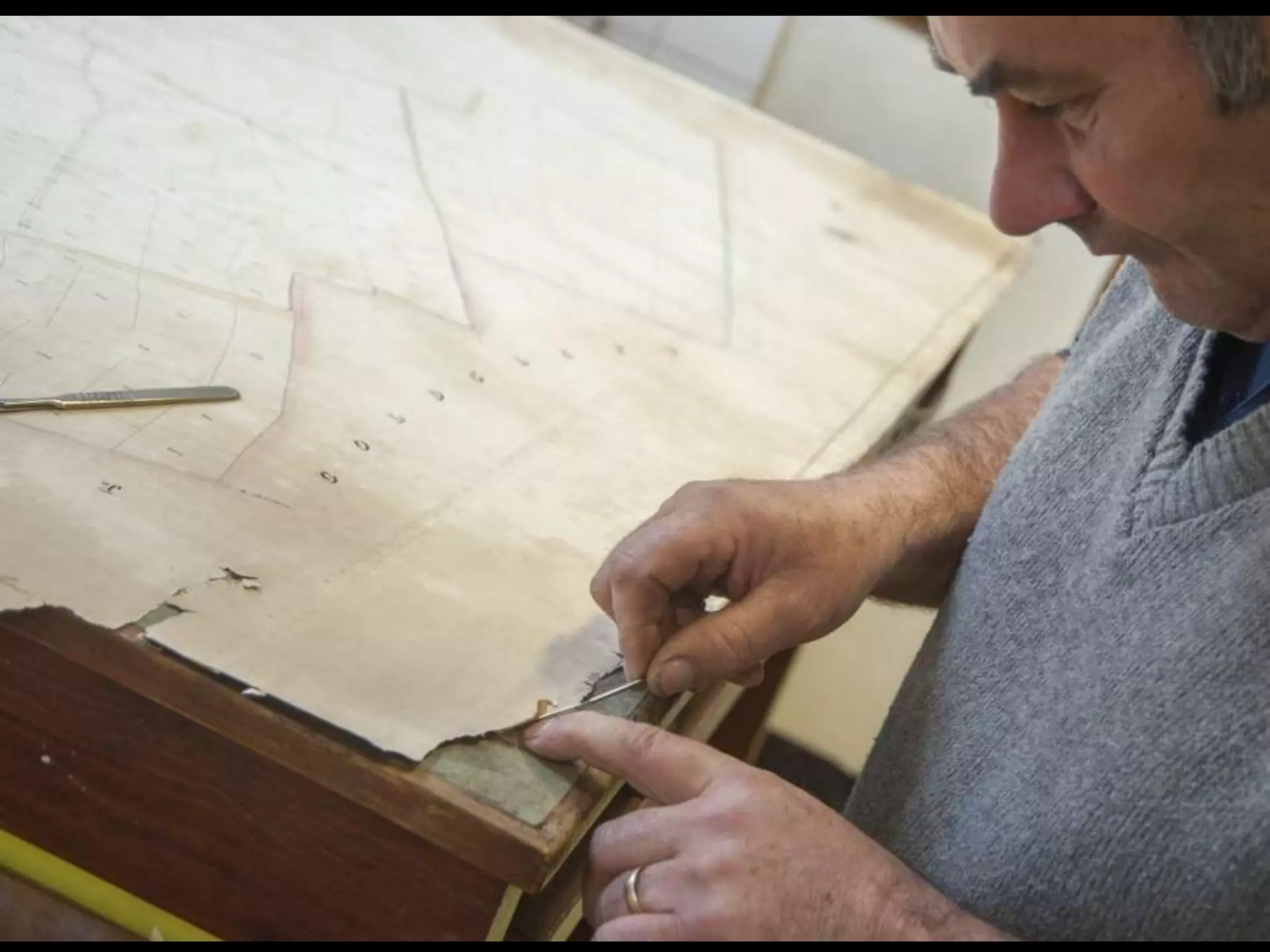
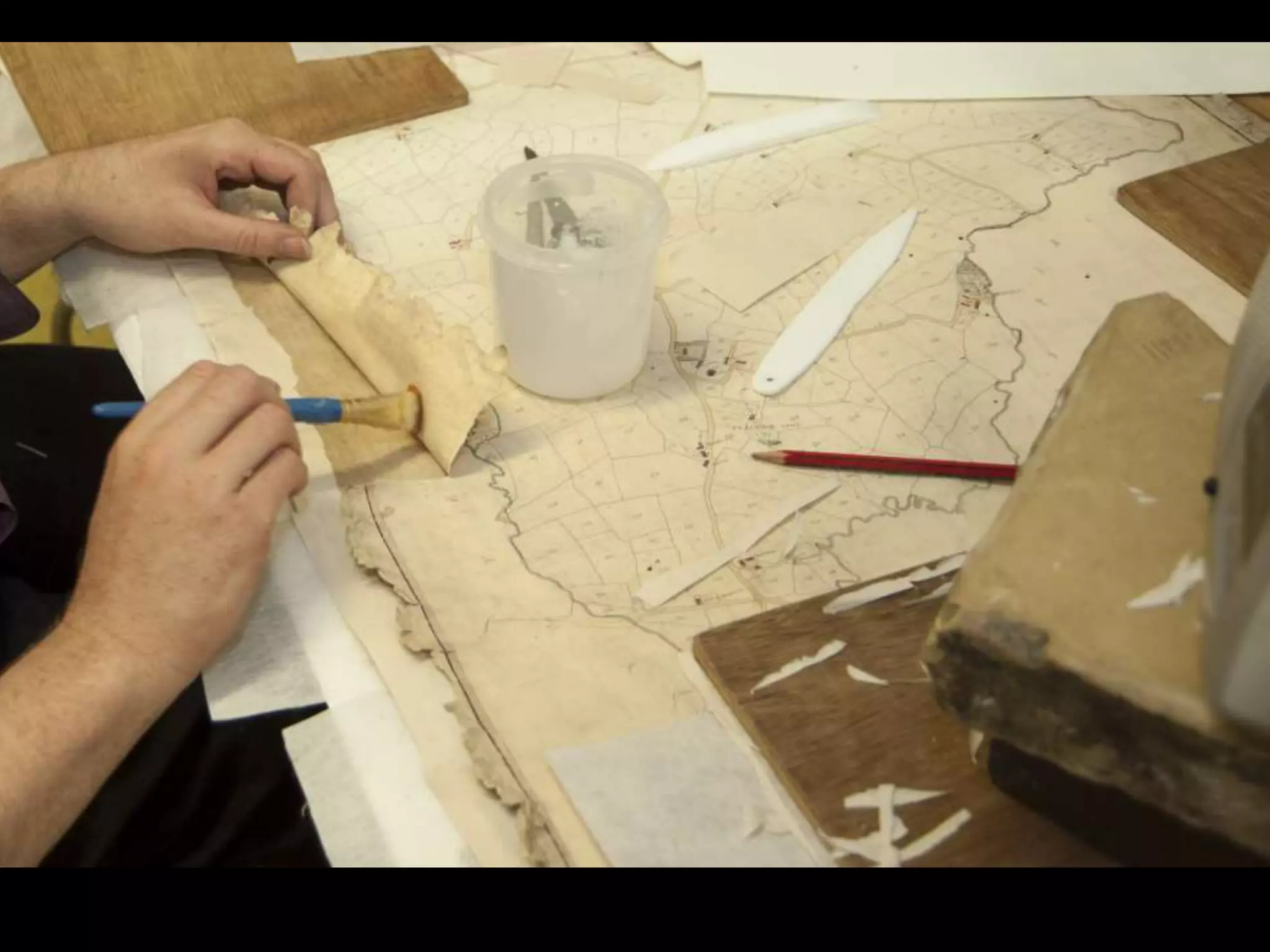
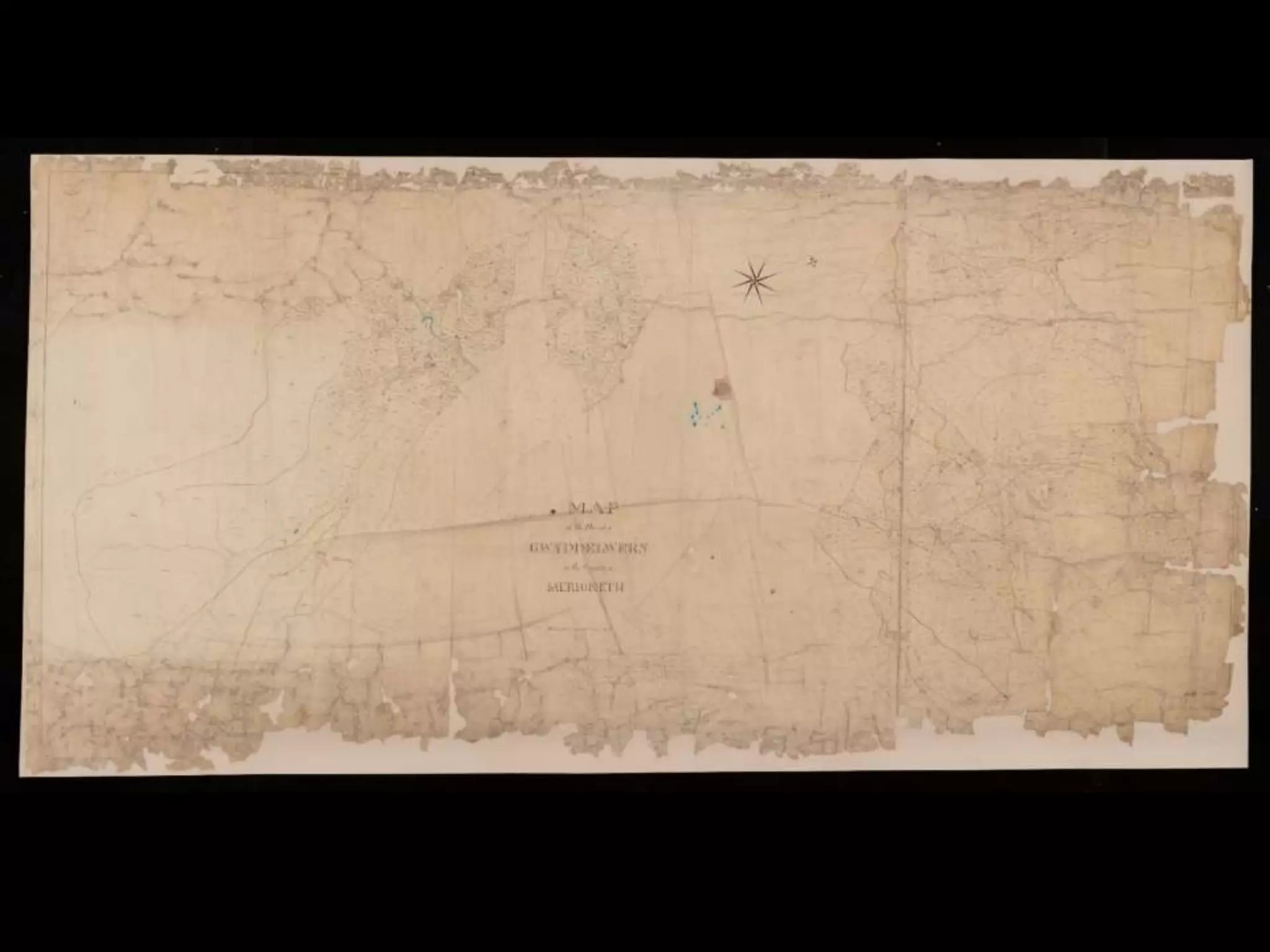
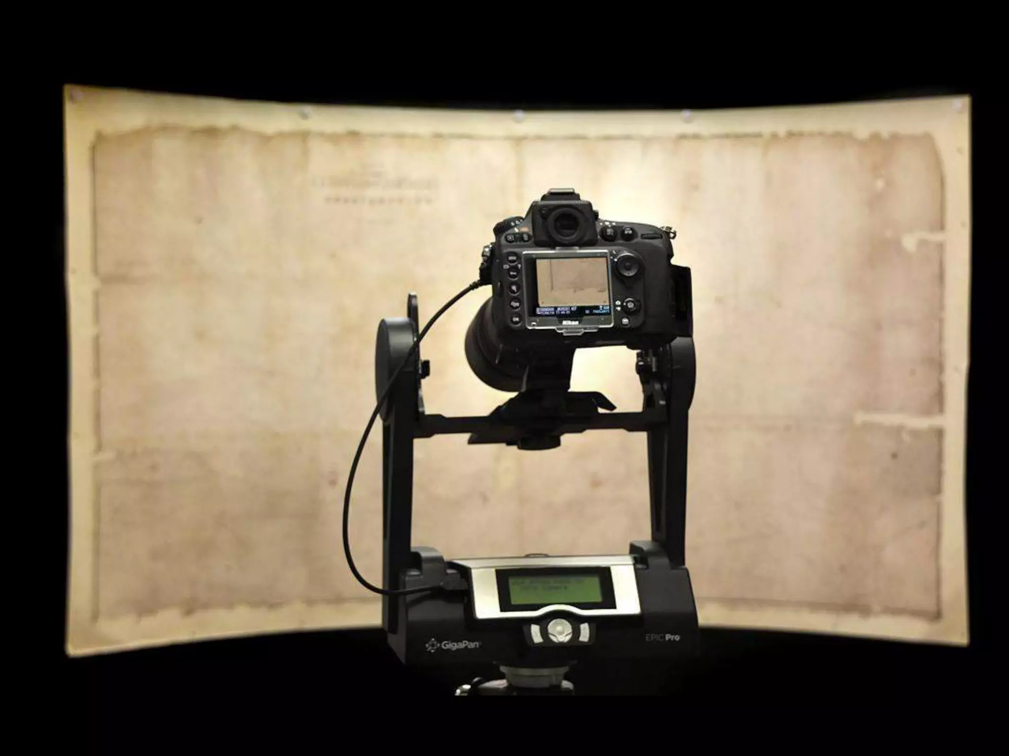
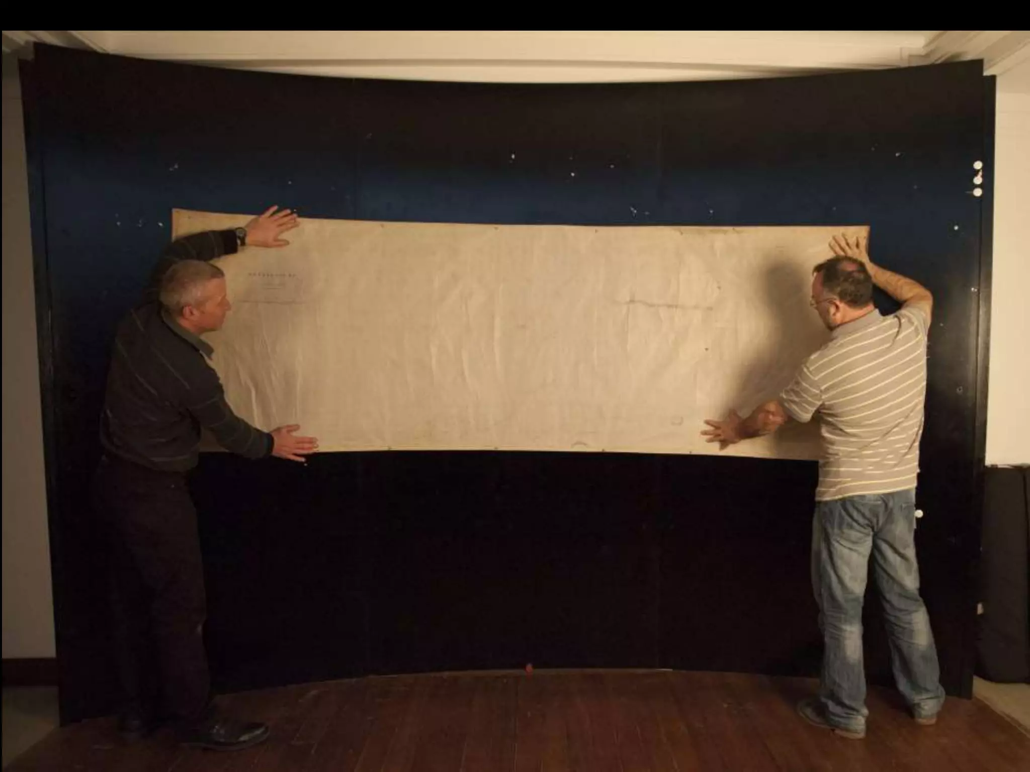
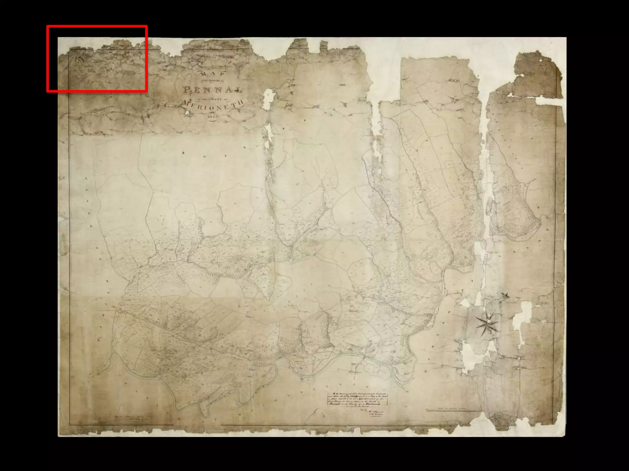
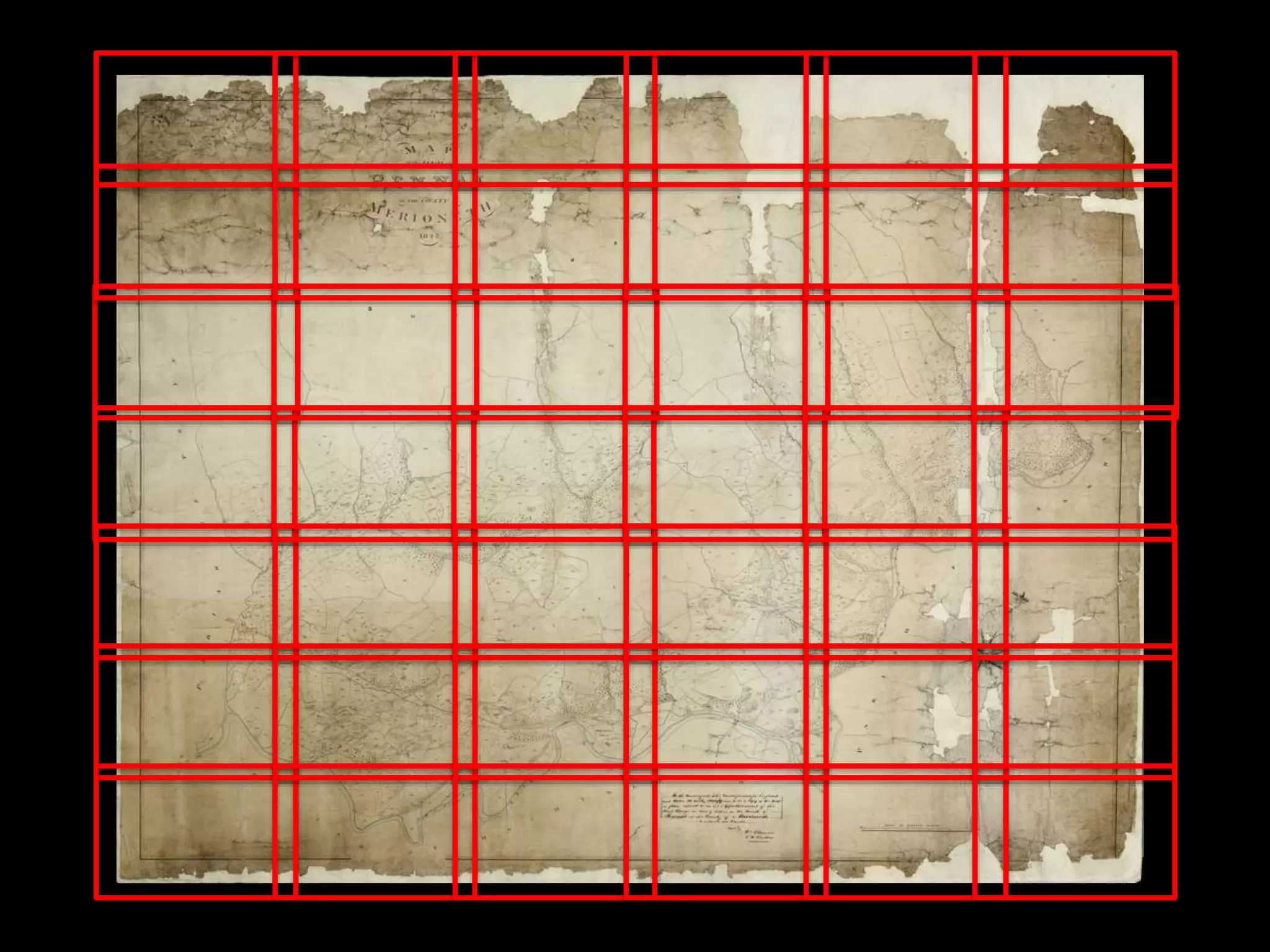
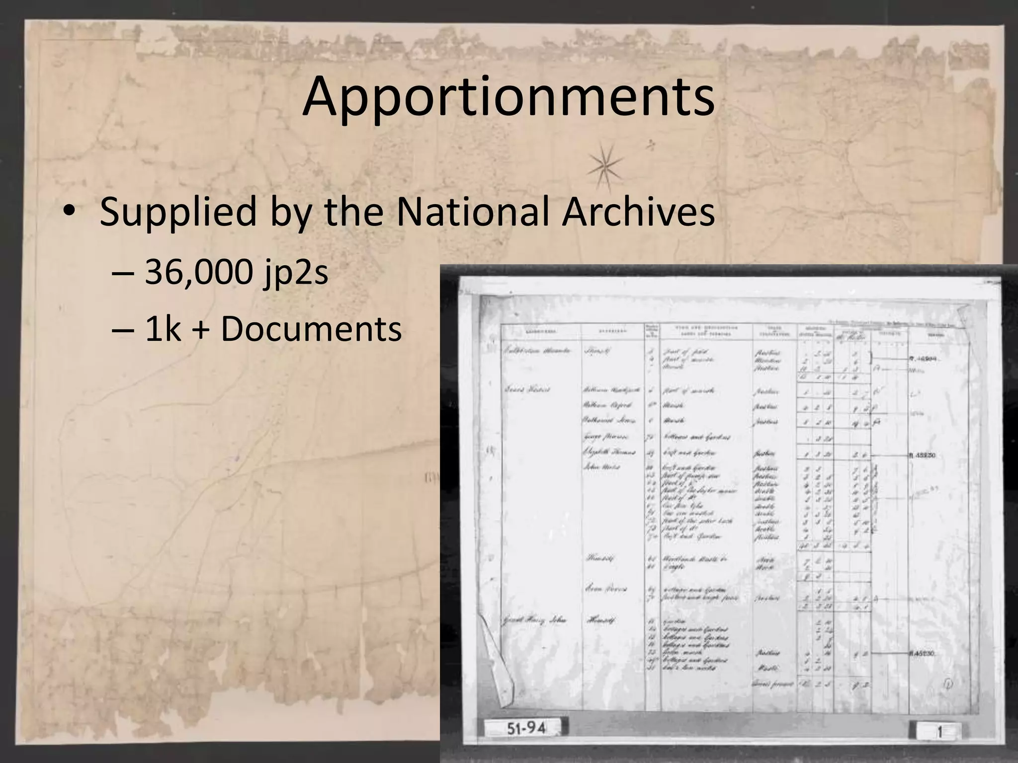
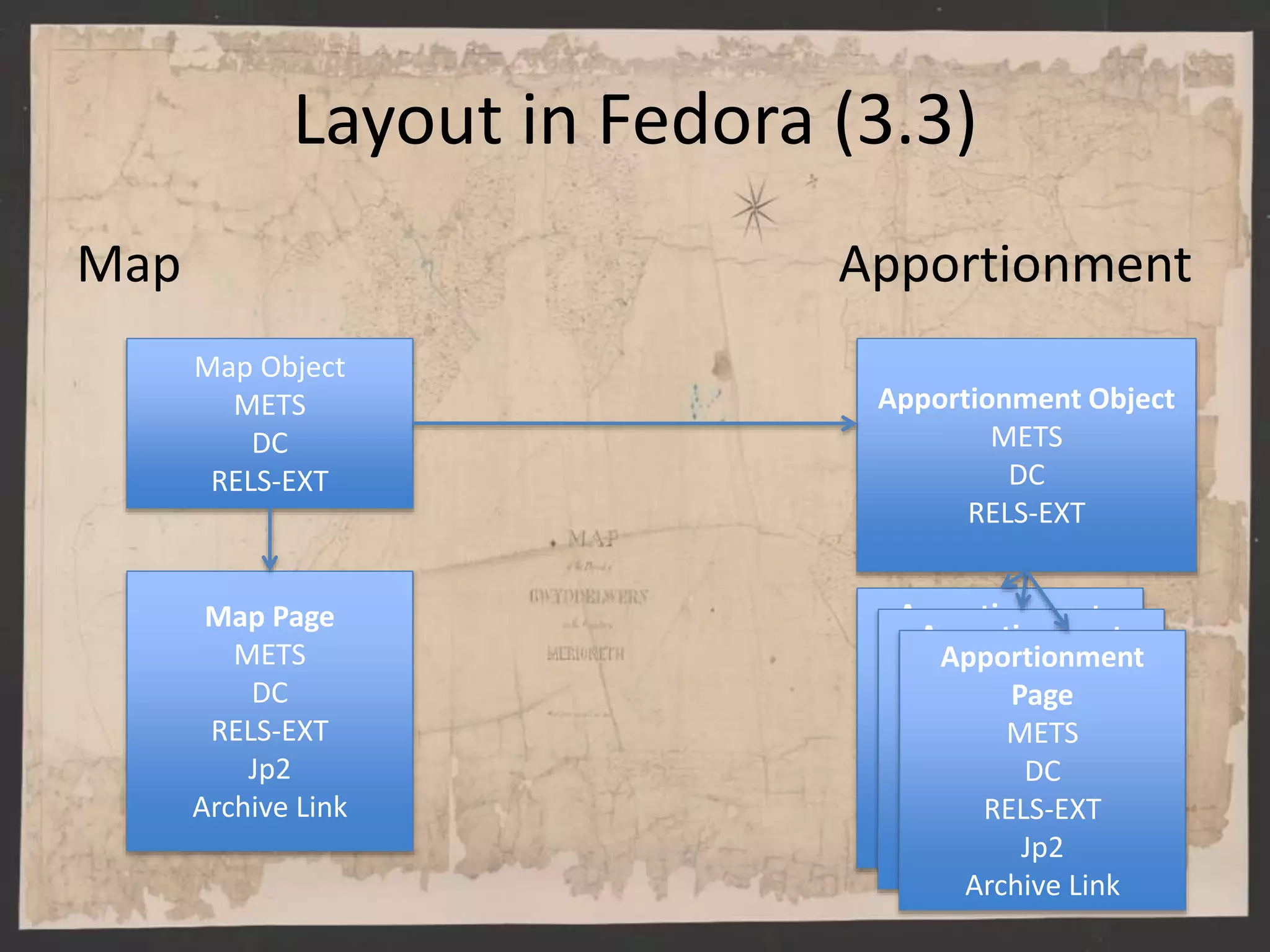
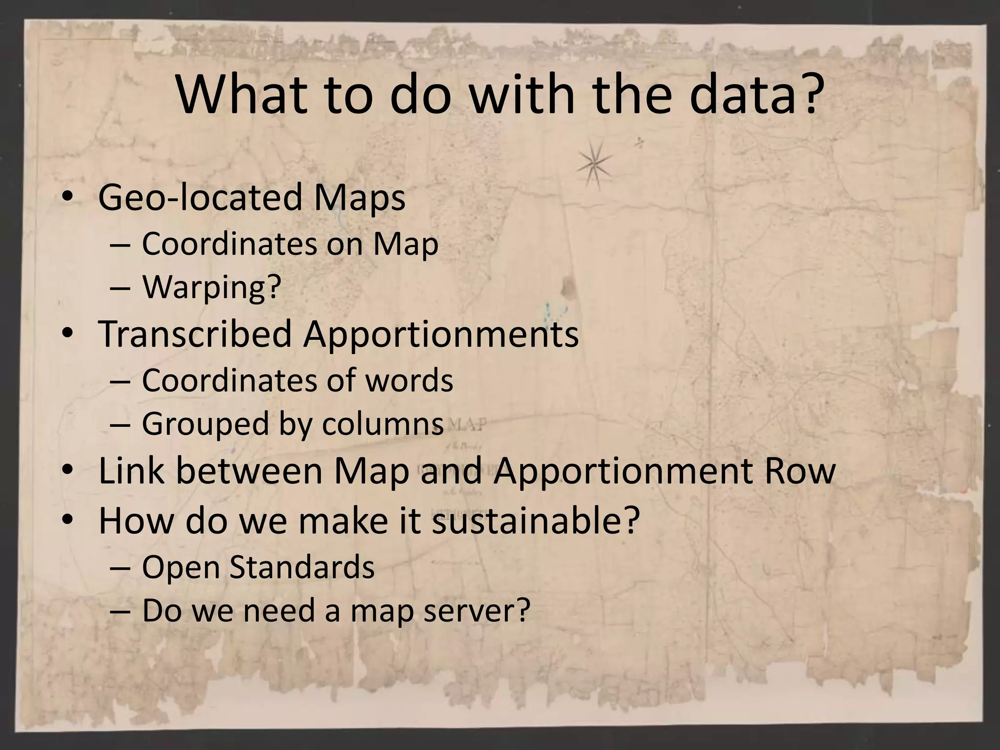
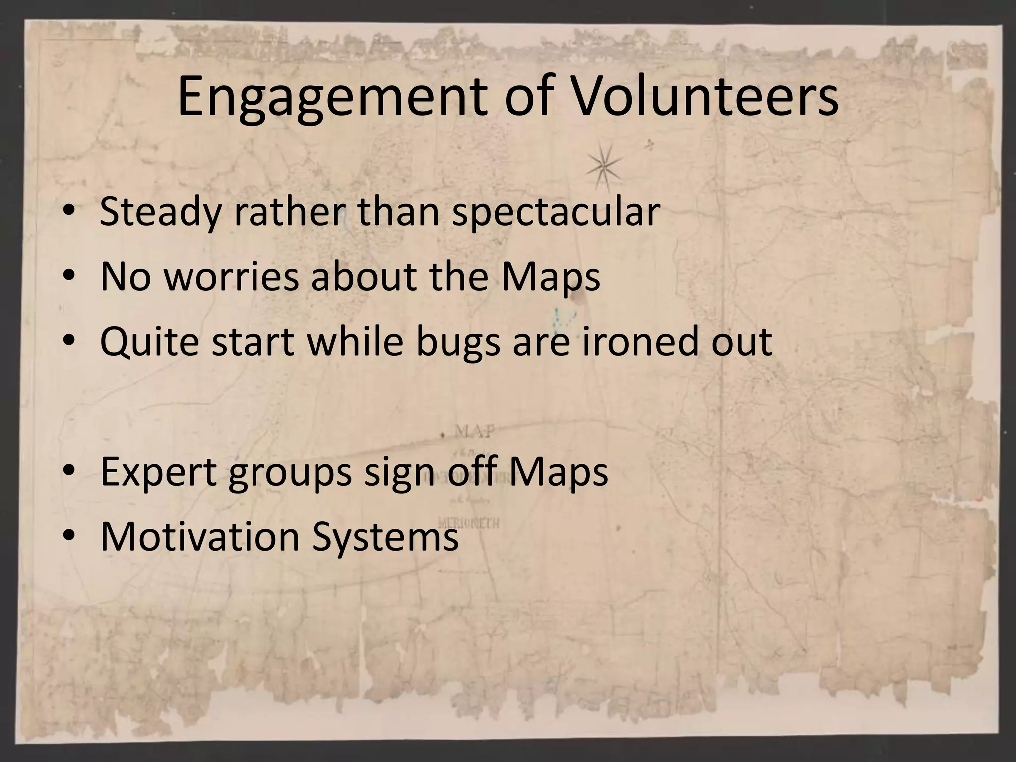
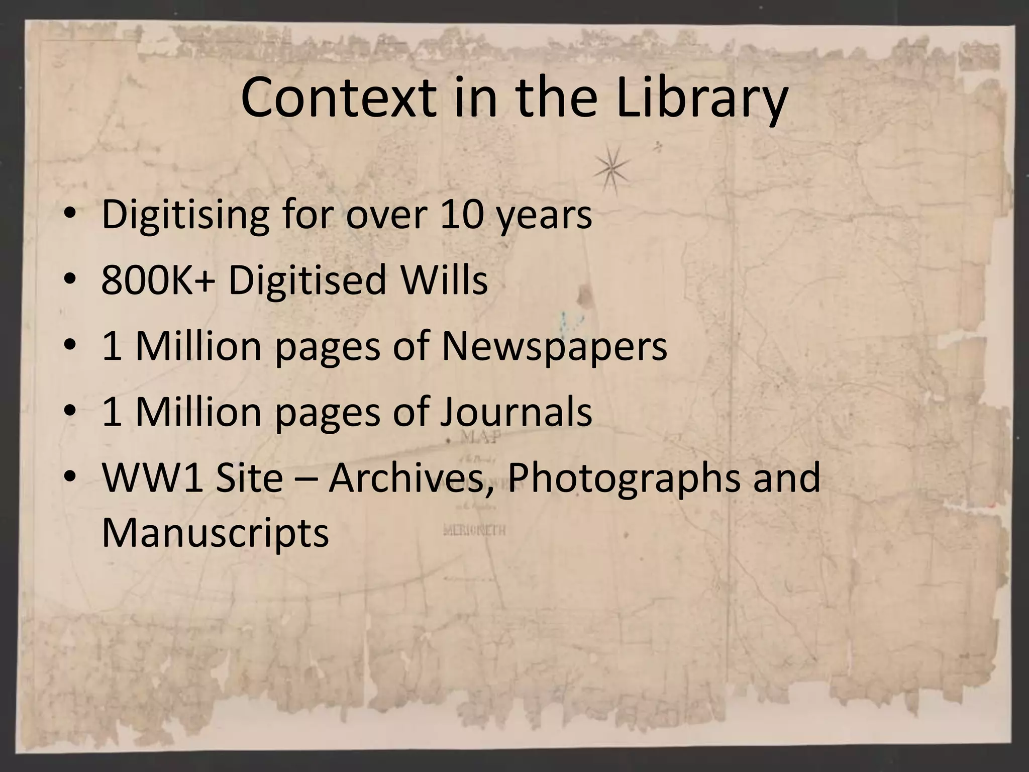
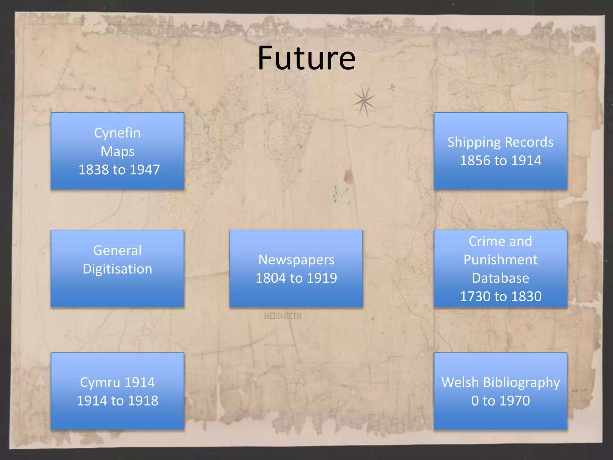
Cynefin: A Sense of Place
@CynefinProject
@glenrobson
National Library of Wales
Background to the project
• 3 year project to digitize 1,000 Tithe Maps
“Tithe maps were produced between 1838 and 1947 following the Tithe Commutation Act of 1836 as a part of the
process to ensure that all tithes were paid with money rather than produce. They are the most detailed maps of
their period and there are over a thousand of them covering more than 95% of Wales.”
• Geo-reference
– Link old map to modern map
• Transcribe Apportionments
– Transcribe hand written text of who owned what and how much they
paid
• Linking Apportionments to Maps
– Rows in apportionment to field on Map
• Community Projects
• Funded by Heritage Lottery Fund and Welsh Government
Background to the Partners
• Archives Record Council Wales (ARCW)
• 13 Local government archive services
• 5 university archives services
• 4 national institutions
– Engage the public in the use of Archives
• The National Library of Wales
– Managing the project
– Copies of the Maps
– History of digitistation
• Based in Switzerland
• Developed Georeferencer
• Old Maps Online
• Works with organizations like the British Library, NLS
and others
• http://www.klokantech.com/cultural-heritage/
Conservation
Digitisation
Apportionments
• Supplied by the National Archives
– 36,000 jp2s
– 1k + Documents
Layout in Fedora (3.3)
Map Apportionment
Map Object
METS
DC
RELS-EXT
Map Page
METS
DC
RELS-EXT
Jp2
Archive Link
Apportionment Object
METS
DC
RELS-EXT
Apportionment
Page
METS
DC
RELS-EXT
Jp2
Archive Link
Apportionment
Page
METS
DC
RELS-EXT
Jp2
Archive Link
Apportionment
Page
METS
DC
RELS-EXT
Jp2
Archive Link
IIIF
• After a meeting in February re-wrote tender
documents to mandate IIIF
• Share images and metadata (Presentation API)
Layout in Fedora with IIIF
Map Apportionment
Map Object
Map Page
Apportionment Object
Apportionment
PageApportionment
PageApportionment
Page
Manifest
Canvas
Manifest
Canvas
Image API Image API
Collection
• Counties
• Parish
• Pointers to Map & Apportionment
Benefits of IIIF
• No transfer of images
• Changes can be made straight away.
• No loss of control of images
• Presentation API means no custom connector
• Can display items in our own Resource
Discovery Solutions
Map in Welcome Viewer
What to do with the data?
• Geo-located Maps
– Coordinates on Map
– Warping?
• Transcribed Apportionments
– Coordinates of words
– Grouped by columns
• Link between Map and Apportionment Row
• How do we make it sustainable?
– Open Standards
– Do we need a map server?
Engagement of Volunteers
• Steady rather than spectacular
• No worries about the Maps
• Quite start while bugs are ironed out
• Expert groups sign off Maps
• Motivation Systems
Context in the Library
• Digitising for over 10 years
• 800K+ Digitised Wills
• 1 Million pages of Newspapers
• 1 Million pages of Journals
• WW1 Site – Archives, Photographs and
Manuscripts
Aims of the NLW Research Programme
UNDERSTANDING
USE
Understand use of
existing digital content
ENHANCING
CONTENT
Identify ways of
making existing digital
content more useful for
research, teaching or
community
engagement
DEVELOPING NEW
DIGITAL CONTENT
develop new digital
content that addresses
specific research or
education needs, in
partnership with
academics and other
key stakeholders
Bringing Digital Humanities to the Digital Library
Activities: NLW Research Programme in Digital Collections
PhD students developed in partnership with HEIs
and based at NLW
Funded projects and activities with national and
international collaborators
New projects in development, and funding
applications
National and international networks
Programme of workshop, publications and
activities around digital collections and research
Future
Cynefin
Maps
1838 to 1947
Newspapers
1804 to 1919
Cymru 1914
1914 to 1918
General
Digitisation
Shipping Records
1856 to 1914
Crime and
Punishment
Database
1730 to 1830
Welsh Bibliography
0 to 1970
Future
Cynefin
Maps
1838 to 1947
Newspapers
1804 to 1919
Cymru 1914
1914 to 1918
General
Digitisation
Shipping Records
1856 to 1914
Crime and
Punishment
Database
1730 to 1830
Welsh Bibliography
0 to 1970
Future
Cynefin
Maps
1838 to 1947
Newspapers
1804 to 1919
Cymru 1914
1914 to 1918
General
Digitisation
Shipping Records
1856 to 1914
Crime and
Punishment
Database
1730 to 1830
Welsh Bibliography
0 to 1970
www.walesatwar.org
Funded by
Summary
• Engaging users and using the crowd to
enhance content
• Sharing data using IIIF
• Telling stories though linked data
• http://cynefin.archiveswales.org.uk/
• http://cymru1914.org/en
• http://welshnewspapers.llgc.org.uk

Cynefin: A Sense of Place

  • 1.
    Cynefin: A Senseof Place @CynefinProject @glenrobson National Library of Wales
  • 2.
    Background to theproject • 3 year project to digitize 1,000 Tithe Maps “Tithe maps were produced between 1838 and 1947 following the Tithe Commutation Act of 1836 as a part of the process to ensure that all tithes were paid with money rather than produce. They are the most detailed maps of their period and there are over a thousand of them covering more than 95% of Wales.” • Geo-reference – Link old map to modern map • Transcribe Apportionments – Transcribe hand written text of who owned what and how much they paid • Linking Apportionments to Maps – Rows in apportionment to field on Map • Community Projects • Funded by Heritage Lottery Fund and Welsh Government
  • 3.
    Background to thePartners • Archives Record Council Wales (ARCW) • 13 Local government archive services • 5 university archives services • 4 national institutions – Engage the public in the use of Archives • The National Library of Wales – Managing the project – Copies of the Maps – History of digitistation
  • 5.
    • Based inSwitzerland • Developed Georeferencer • Old Maps Online • Works with organizations like the British Library, NLS and others • http://www.klokantech.com/cultural-heritage/
  • 8.
  • 16.
  • 19.
    Apportionments • Supplied bythe National Archives – 36,000 jp2s – 1k + Documents
  • 20.
    Layout in Fedora(3.3) Map Apportionment Map Object METS DC RELS-EXT Map Page METS DC RELS-EXT Jp2 Archive Link Apportionment Object METS DC RELS-EXT Apportionment Page METS DC RELS-EXT Jp2 Archive Link Apportionment Page METS DC RELS-EXT Jp2 Archive Link Apportionment Page METS DC RELS-EXT Jp2 Archive Link
  • 21.
    IIIF • After ameeting in February re-wrote tender documents to mandate IIIF • Share images and metadata (Presentation API)
  • 22.
    Layout in Fedorawith IIIF Map Apportionment Map Object Map Page Apportionment Object Apportionment PageApportionment PageApportionment Page Manifest Canvas Manifest Canvas Image API Image API Collection • Counties • Parish • Pointers to Map & Apportionment
  • 23.
    Benefits of IIIF •No transfer of images • Changes can be made straight away. • No loss of control of images • Presentation API means no custom connector • Can display items in our own Resource Discovery Solutions
  • 24.
  • 25.
    What to dowith the data? • Geo-located Maps – Coordinates on Map – Warping? • Transcribed Apportionments – Coordinates of words – Grouped by columns • Link between Map and Apportionment Row • How do we make it sustainable? – Open Standards – Do we need a map server?
  • 26.
    Engagement of Volunteers •Steady rather than spectacular • No worries about the Maps • Quite start while bugs are ironed out • Expert groups sign off Maps • Motivation Systems
  • 27.
    Context in theLibrary • Digitising for over 10 years • 800K+ Digitised Wills • 1 Million pages of Newspapers • 1 Million pages of Journals • WW1 Site – Archives, Photographs and Manuscripts
  • 30.
    Aims of theNLW Research Programme UNDERSTANDING USE Understand use of existing digital content ENHANCING CONTENT Identify ways of making existing digital content more useful for research, teaching or community engagement DEVELOPING NEW DIGITAL CONTENT develop new digital content that addresses specific research or education needs, in partnership with academics and other key stakeholders Bringing Digital Humanities to the Digital Library
  • 31.
    Activities: NLW ResearchProgramme in Digital Collections PhD students developed in partnership with HEIs and based at NLW Funded projects and activities with national and international collaborators New projects in development, and funding applications National and international networks Programme of workshop, publications and activities around digital collections and research
  • 32.
    Future Cynefin Maps 1838 to 1947 Newspapers 1804to 1919 Cymru 1914 1914 to 1918 General Digitisation Shipping Records 1856 to 1914 Crime and Punishment Database 1730 to 1830 Welsh Bibliography 0 to 1970
  • 33.
    Future Cynefin Maps 1838 to 1947 Newspapers 1804to 1919 Cymru 1914 1914 to 1918 General Digitisation Shipping Records 1856 to 1914 Crime and Punishment Database 1730 to 1830 Welsh Bibliography 0 to 1970
  • 34.
    Future Cynefin Maps 1838 to 1947 Newspapers 1804to 1919 Cymru 1914 1914 to 1918 General Digitisation Shipping Records 1856 to 1914 Crime and Punishment Database 1730 to 1830 Welsh Bibliography 0 to 1970
  • 35.
  • 36.
    Summary • Engaging usersand using the crowd to enhance content • Sharing data using IIIF • Telling stories though linked data • http://cynefin.archiveswales.org.uk/ • http://cymru1914.org/en • http://welshnewspapers.llgc.org.uk

Editor's Notes

  • #17 Original map condition:Map was paper panels pasted on cloth, in a fragile condition and dirty, many folds and parts of the paper loose from the cloth. Parts had been lost and the cloth edges were very fragils. Conservation work:Careful cleaning with brush and special eraser. Verification of fastness of ink and pigments. Flatten by humidification (if ink/colours allow), paste the loose papers back with wheat starch paste. Add additional cloth parts to support the edges of the map.Some maps need a new cloth backing, again applied using wheat starch paste. Where necessary missing paper parts are infilled with a suitable conservation paper. Maps are allowed to dry between felts and under a few weights
  • #24 maximum of around 4.5M x 3.5M. Digitisation of the maps is being carried out using a Nikon D800E DSLR Camera with a 300mm f/4 ED IF prime lens. The Nikon D800E was chosen specifically because of its lack of a low pass filter, to achieve the sharpest results with maximum amount of detail. A 300mm lens was chosen to increase the working distance between the map and the camera to minimise distortion, while still achieving an optical 400ppi (pixels per inch) The camera is mounted on a GigaPan Epic Pro twin axis automated tripod head. The Epic Pro was originally designed to automatically capture large panoramic landscapes - however, we have re-purposed it to capture all of the detail within a single large map. After calibration, the GigaPan head captures up to 80 overlapping images of every part of the map. These separate tiles are subsequently stitched together to create a single 400ppi image of the entire map. Our largest maps create images up to 5GB in size.
  • #25 To combat the issues of distortion and reduced depth of field, we constructed a specially designed curved wall. The curve in the wall ensures that the distance from focal plane to camera remains consistent in the horizontal axis, while the depth of field attained from the small aperture manages the inconsistency on the vertical axis. The wall is constructed of a wooden structure with a metal skin, to allow the use of high powered Neodymium magnets to hold the maps in place during capture.
  • #41 Tell stories through linked data
  • #42 Tell stories through linked data
  • #43 Tell stories through linked data