Downloaded 16 times


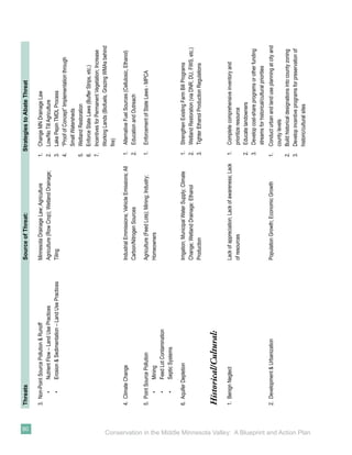
![Tensions Grow
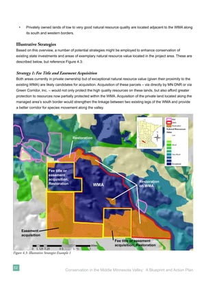
Understanding current demographics and
tensions between cultures in the Minnesota
Valley necessitates a review of the past two
centuries and interactions between Euro-American
explorers, missionaries, traders, settlers, the U.S.
government, and the Dakota who lived in the area.
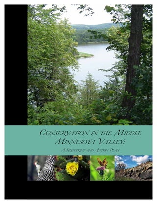
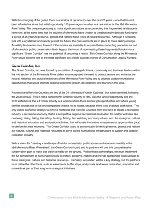
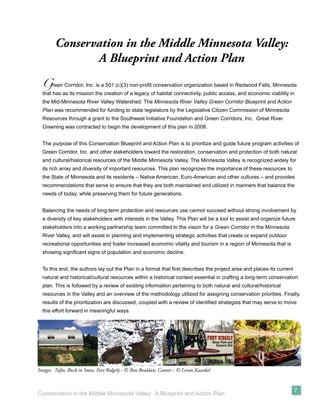
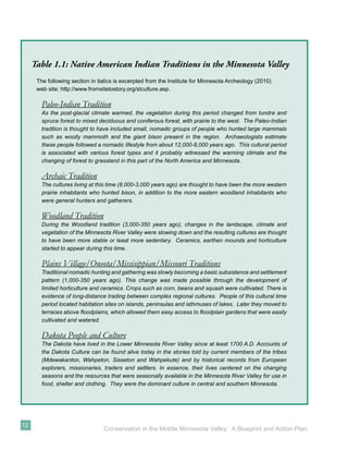
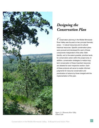
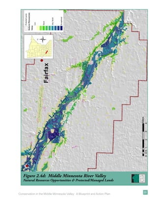
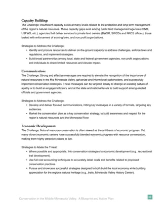
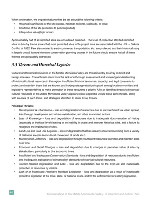
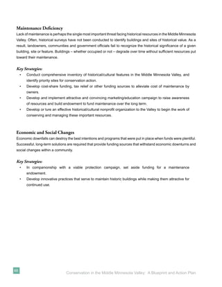
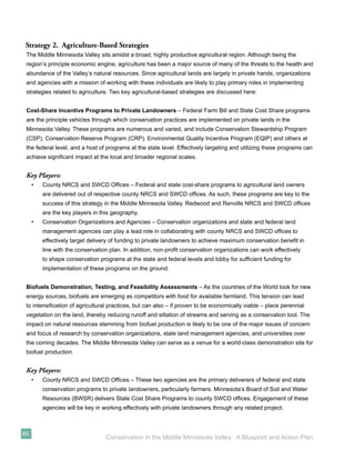
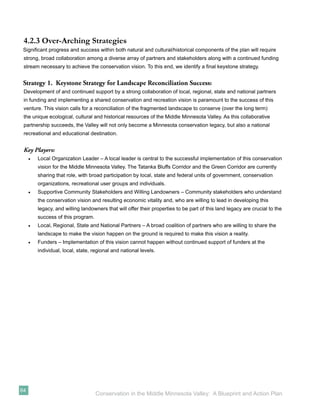
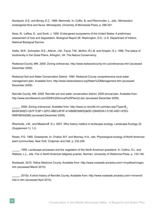
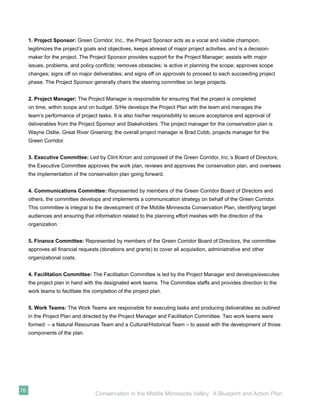
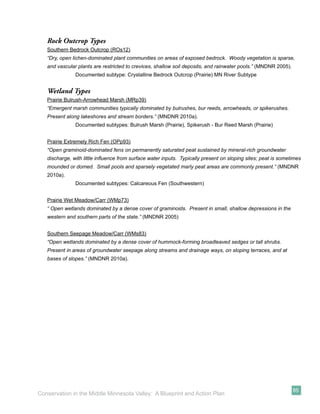
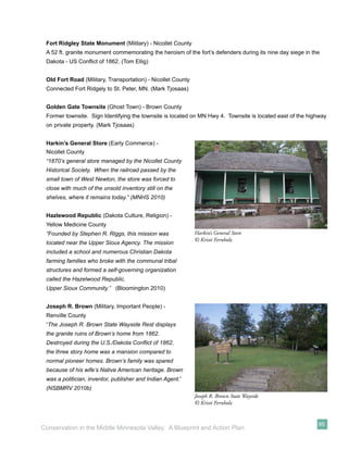
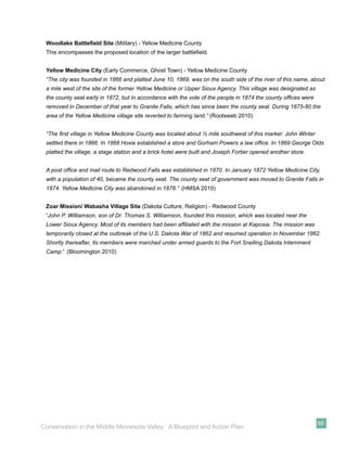
In the mid-1800s, numerous treaties were signed
between the Dakota and U.S. Government that
resulted in the ceding of large portions of Dakota
land to the United States. Of these, the most
significant occurred in 1851 with the treaties of
Traverse des Sioux and Mendota. The former
(between the United States and upper bands of
Dakota [Sisseton and Wahpeton]) and the latter
(between the United States and lower bands of
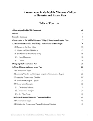
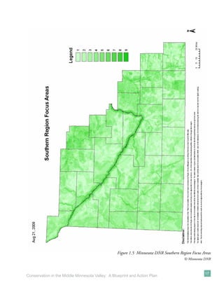
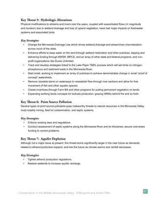
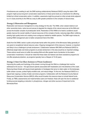
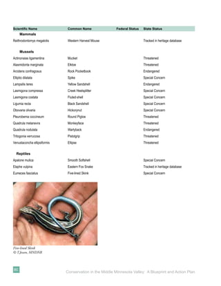
Dakota [Mdewakanton and Wahpekute]) resulted Figure 1.4: Treaty of Traverse des Sioux 1851
in the ceding of 24 million acres of land to the U.S. ©Minnesota Historical Society
Government, thereby confining tribes to a 20-mile
wide reservation along the Minnesota River (10
miles laterally in both directions from the river) (Figure 1.4). In 1858, the tribes ceded the 10-mile strip on the
north side of the Minnesota.
With the signing of the two treaties, the U.S. Government promised payments of approximately $3 million and
annuities for the ceded lands; in addition, Upper Sioux (near present-day Granite Falls) and the Lower Sioux
(near Morton) agencies were created at this time.
The culmination of unfulfilled treaties, reservation encroachment, continued western expansion, and crop
blight in the spring/summer of 1862 was the tipping point in the Valley. In August 1862, Dakota leaders
were convinced by tribal members that it was time to rise up against the settlers (Meyer 1993; Neill 1882).
The resulting war lasted for barely more than a month, but resulted in hundreds of casualties among Euro-
Americans and Dakota alike. The war ended with a decisive battle at Wood Lake and the release of 262 captive
white women and children at Camp Release. Many of the Dakota fled to Dakota Territory and north into Canada
to escape capture or death. After the war, all treaties with the Dakota were declared null and void by the United
States government and all Dakota were effectively banned from the state.
13
Conservation in the Middle Minnesota Valley: A Blueprint and Action Plan](https://image.slidesharecdn.com/conservationinthemiddlemnvalleylowresolution-13105863048649-phpapp01-110713145309-phpapp01/85/Conservation-In-The-Middle-Mn-Valley-23-320.jpg)
![Minnesota Scenic River Regulations
Both Redwood (Redwood County 2009) and Renville (Renville County 2009) counties have land use
ordinances that apply to the State of Minnesota’s Scenic River Regulations.
Permitted uses of land within the scenic river district of both counties are largely identical, and include
opportunities for governmental campgrounds, public access and trails, agriculture and forestry, sewage
treatment facilities, private roads, single family residential housing, and governmental open space recreational
uses.
Conditional uses (those requiring a conditional use permit), although largely similar between the two counties,
have some notable differences. Private campgrounds, temporary docks, private open space recreational uses,
public roads and mining are considered conditional uses in both counties.
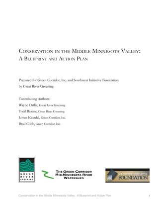
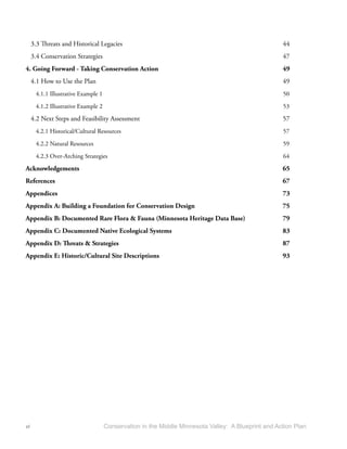
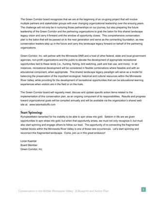
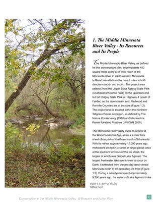
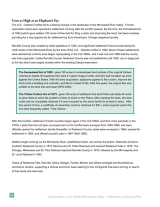
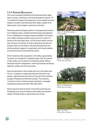
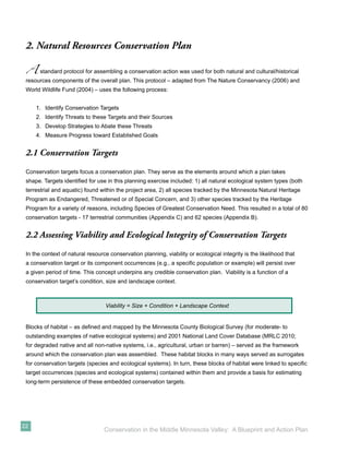
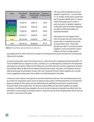
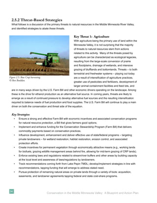
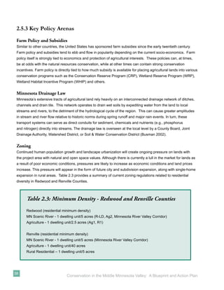
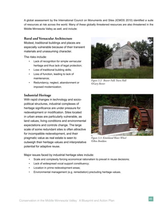
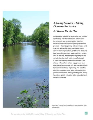
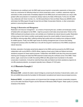
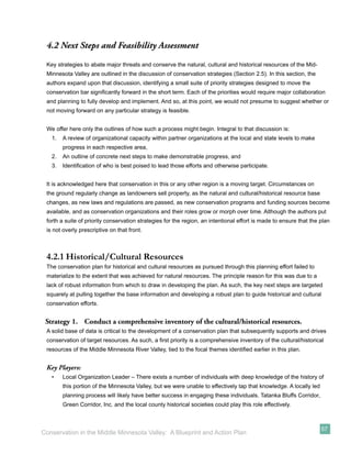
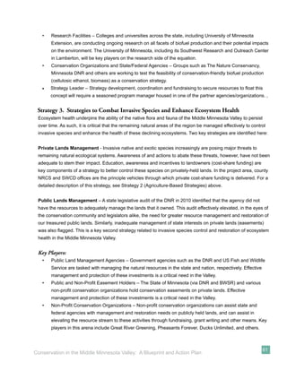
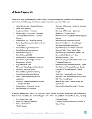
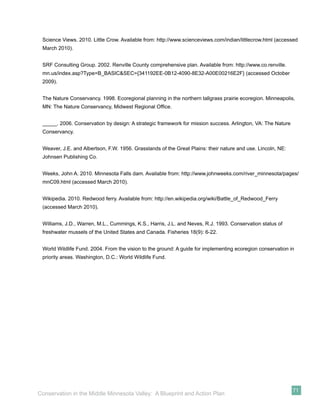
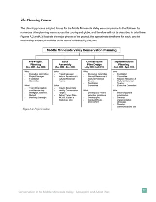
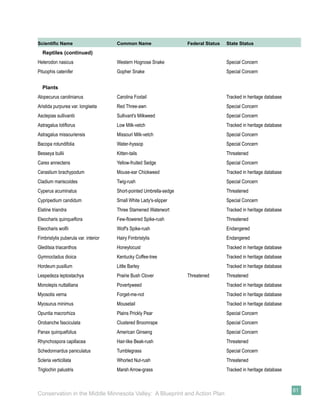
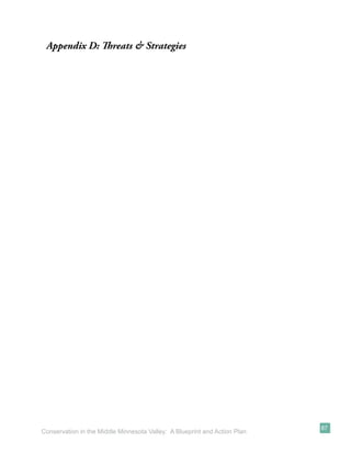
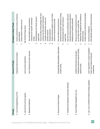
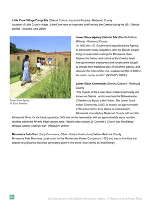
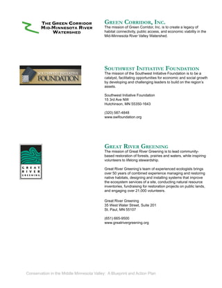
Table 2.4: County Zoning Differences
Principle differences in Scenic River zoning between the two counties fall in the following areas:
Conditional Use Redwood County Renville County
Livestock operations Not listed >300 animal units
Transmission corridors Not listed Power lines and pipelines
Zoning Dimensions
Lot width at building line 250 feet 300 feet
Subdivisions
Land unsuitability Not addressed None for unsuitable lands
Planned unit development Not addressed If clustering allows for better
protection of ag land, open
space, scenic views, wetlands
and other features.
Agriculture and Rural Residential Regulations
Lands within the project area outside of the Minnesota Scenic River District (i.e., uplands beyond the Valley
proper) are also subject to zoning restrictions. Again, differences between Redwood and Renville Counties
occur relative to minimum lot size for new residential development. Redwood County provides a minimum
residential lot size of 2.5 acres, while Renville County requires a lot size of no less than 5 acres [rural
residential] (Biko 2007, SRF 2002).
39
Conservation in the Middle Minnesota Valley: A Blueprint and Action Plan](https://image.slidesharecdn.com/conservationinthemiddlemnvalleylowresolution-13105863048649-phpapp01-110713145309-phpapp01/85/Conservation-In-The-Middle-Mn-Valley-49-320.jpg)

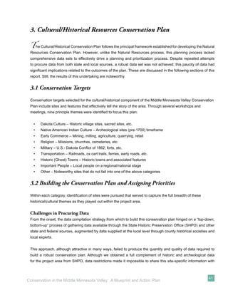
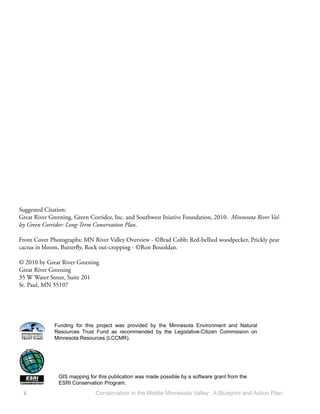
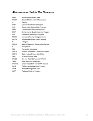
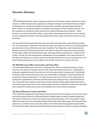
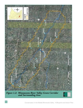
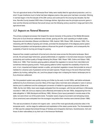
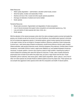
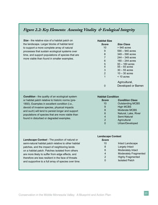
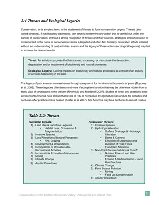
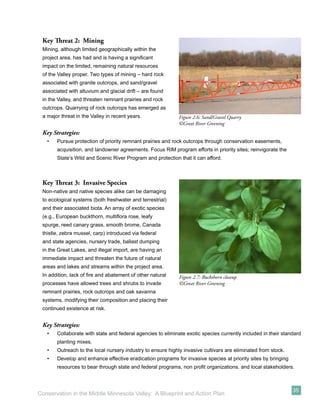
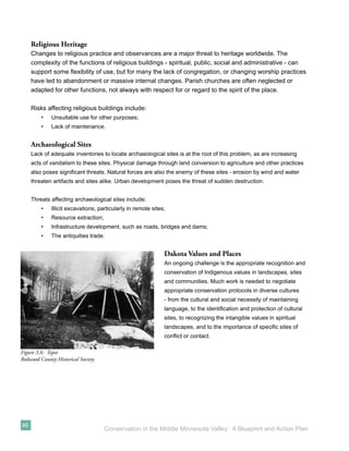
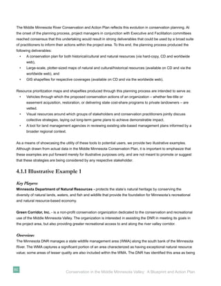
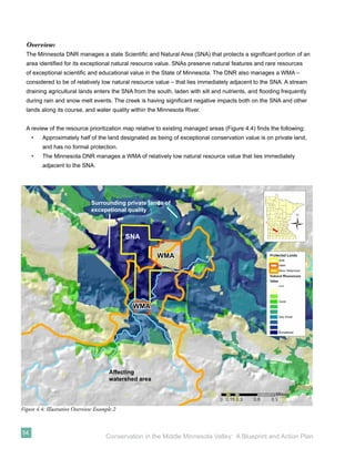
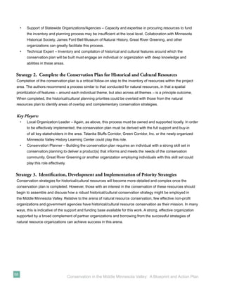
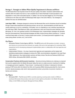
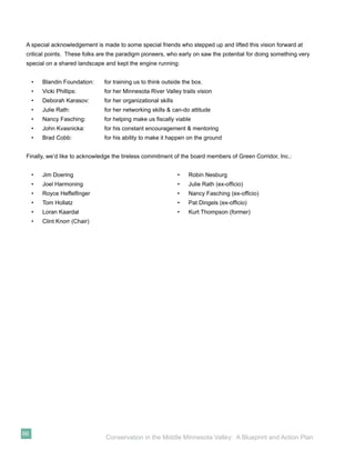
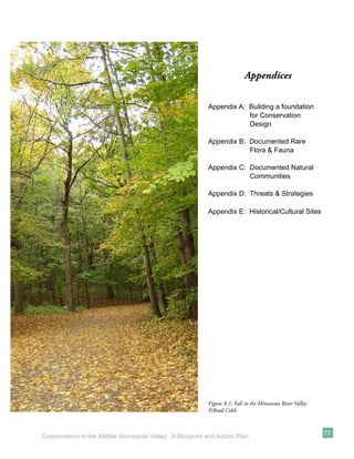
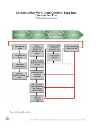
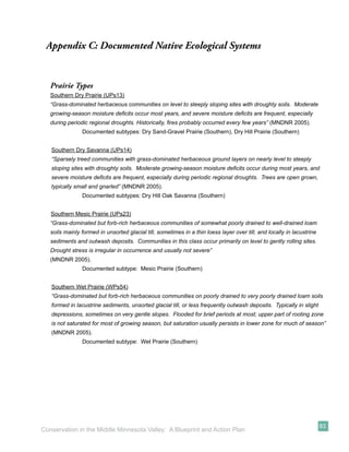
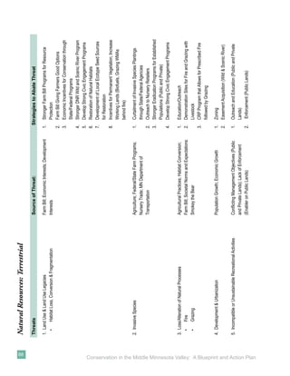
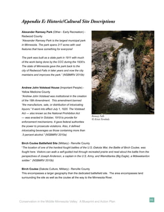
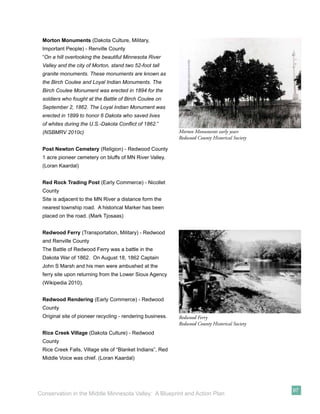
![Figure 3.1: Minnesota River Valley Green Corridor
Historical/Cultural Opportunities
[Adjust Map color layout]
42
Conservation in the Middle Minnesota Valley: A Blueprint and Action Plan](https://image.slidesharecdn.com/conservationinthemiddlemnvalleylowresolution-13105863048649-phpapp01-110713145309-phpapp01/85/Conservation-In-The-Middle-Mn-Valley-52-320.jpg)
![Foster, D., Swanson, F., Aber, J., Burke, I., Brokaw, N., Tilman, D., and Knapp, A. 2007. The importance of land-
use legacies to ecology and conservation. BioScience 53 (1): 77-88.
Green, J.C. 1988. Birds: introduction. In: Coffin, B. and Pfannmuller, L., eds. Minnesota’s endangered flora and
fauna. Minneapolis: University of Minnesota Press, p.253-255.
Harding, J.S., Benfield, E.F., Bolstad, P.V., Helfman, G.S., and Jones, E.D.B. 1998. Stream biodiversity: the
ghost of land use past. Proceedings of the National Academy of Sciences 95: 14843–14847.
Historical Marker Society of America. 2010. Yellow Medicine City. Available from: http://www.historicmarkers.
com/component/content/article/3324-yellow-medicine/84109-yellow-medicine-city (accessed: April 2010).
Institute for Minnesota Archaeology. 2010. Stories: Upper Mississippi cultural timeline. Available from: http://
www.fromsitetostory.org/stculture.asp (accessed: April 2010).
International Council on Monuments and Sites (ICMOS). Heritage at risk: Trends; threats and risk (2001-2002).
Available from: http://www.international.icomos.org/risk/2001/synthesis.htm (accessed: April 2010).
Krenz, G. and Leitch, J. 1993. A river runs north: Managing an international river. Red River Water Resources
Council.
Lant, C.L., Kraft, S.E. and Gillman, K.R. 1995. The 1990 farm bill and water quality in Corn Belt watersheds:
Conserving remaining wetlands and restoring farmed wetlands. Journal of Soil and Water Conservation 50:
201-205.
Marschner, F.J. 1974. The original vegetation of Minnesota, a map compiled in 1930 by F.J. Marschner under
the direction of M.L. Heinselman of the U.S. Forest Service [map]. 1:500,000. St. Paul, MN: Cartography
Laboratory of the Department of Geography, University of Minnesota.
Meyer, R.W. 1993. History of the Santee Sioux: United States Indian policy on trial. Lincoln: University of
Nebraska Press.
Minnesota Board of Soil and Water Resources. 2010. History of wetland regulation and conservation in
Minnesota. Available from: http://www.bwsr.state.mn.us/wetlands/wca/history.html (accessed: April 2010).
Minnesota Department of Natural Resources. 2005. Field guide to native plant communities of Minnesota: The
eastern broadleaf forest province. St. Paul, MN: Ecological Land Classification Program, Minnesota County
Biological Survey, and Natural Heritage and Nongame Research Program.
68
Conservation in the Middle Minnesota Valley: A Blueprint and Action Plan](https://image.slidesharecdn.com/conservationinthemiddlemnvalleylowresolution-13105863048649-phpapp01-110713145309-phpapp01/85/Conservation-In-The-Middle-Mn-Valley-78-320.jpg)
![_____. 2007a. Minnesota River State Trail Master Plan. Saint Paul, MN: Division of Trails Waterways,
Minnesota Department of Natural Resources. Available from: http://www.dnr.state.mn.us/state_trails/master_
plans.html (accessed October 2009).
_____. 2007b. Native plant communities and rare species of the Minnesota River Valley counties. St. Paul,
MN: Minnesota County Biological Survey, Division of Ecological Resources, Minnesota Department of Natural
Resources.
_____. 2009a. Wild and scenic rivers program. Available from: http://www.dnr.state.mn.us/waters/watermgmt_
section/wild_scenic/index.html (accessed November 2009).
_____. 2010. Prairie parkland province. Available from: http://www.dnr.state.mn.us/ecs/251/index.html
(accessed: April 2010).
_____. 2010a. Ecological system summaries. Available from: http://www.dnr.state.mn.us/npc/wetlandgrassland.
html (accessed: April 2010).
Minnesota Historical Society. 2010. State historic sites, south: Harkin store. Available from: http.//www.mnhs.
org/places/sites/hs/ (accessed: April 2010).
Minnesota Land Management Information Center (MLMS). n.d. Original public land survey plat maps of
Minnesota [maps]. Available from: http://www.mngeo.state.mn.us/glo/Index.htm.
Multi-Resolution Land Characteristics Consortium (MRLC). 2010. National land cover data base. Available from:
http://www.mrlc.gov/.
National Park Service. 2009. The Homestead Act of 1862. Available from: http://www.nps.gov/home/
historyculture/upload/MW,pdf,Homestead%20Act,txt.pdf (accessed November 2009).
National Scenic Byway Minnesota River Valley. 2010a. Discovery sites. Available from: http://www.mnrivervalley.
com/sites/sites.php (accessed March 2010).
_____. 2010b. Discovery sites: Granite Falls to Redwood Falls. Available from: http://www.mnrivervalley.com/
sites/sites.new.php?itinid=4 (accessed March 2010).
_____. 2010c. Discovery sites: Redwood Falls to New Ulm. Available from: http://www.mnrivervalley.com/sites/
sites.new.php?itinid=5 (accessed March 2010).
Neill, E.D. 1882. History of the Minnesota valley. Minneapolis, MN: North Star Publishing Co.
69
Conservation in the Middle Minnesota Valley: A Blueprint and Action Plan](https://image.slidesharecdn.com/conservationinthemiddlemnvalleylowresolution-13105863048649-phpapp01-110713145309-phpapp01/85/Conservation-In-The-Middle-Mn-Valley-79-320.jpg)


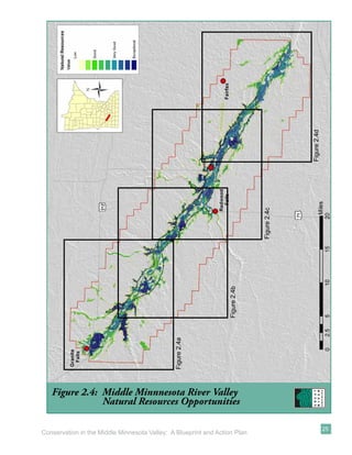
This document presents a conservation blueprint and action plan for the Middle Minnesota River Valley. It identifies the valley's important natural and cultural resources that have developed over thousands of years and were shaped by climate, fire, grazing and Native American inhabitants. The plan establishes conservation priorities and strategies to protect these resources in the face of threats like habitat loss and fragmentation. The strategies include land acquisition, easements, restoration and education to reconnect habitat blocks while providing recreational opportunities that support ecotourism and the local economy. The plan aims to balance resource conservation with public use for current and future generations.


![5G Explained! A High Level Overview [Introduction]](https://cdn.slidesharecdn.com/ss_thumbnails/5gexplainedahighleveloverview-260119165306-cc137a3e-thumbnail.jpg?width=640&height=640&fit=bounds)


