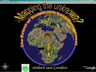
Cn tu12 3_isric_wocat-lada-desire_mapping_vanlynden
•Download as PPTX, PDF•
0 likes•208 views
This document discusses methods for mapping land degradation and sustainable land management. It describes a method jointly revised by LADA and DESIRE that places more emphasis on impacts to ecosystem services and direct and indirect causes of degradation. This method is being tested in several countries at national and local levels. The document also outlines some challenges in mapping degradation, such as how to visualize combinations of degradation types in a mapping unit and how to display complex data on impacts to ecosystem services. Additional challenges include area calculations and analysis, quantification and verification of results, and using remote sensing and modeling to improve the mapping system.
Report
Share
Report
Share

Recommended
Vintage matthew pt9_3.4.12
The mother of James and John asked Jesus if her sons could sit at his right and left hands in his kingdom. Jesus said they did not know what they were asking and being at his right or left was not his to grant. When the other disciples heard, they were indignant with the two brothers. Jesus then taught his disciples that to be great in the kingdom, one must serve others.
Spanish gasoline safetypowerpoint
La gasolina puede causar graves daños si no se maneja correctamente. El único uso seguro de la gasolina es como combustible para motores. Se deben tomar precauciones al almacenar, transportar y usar gasolina, y conocer los primeros auxilios básicos en caso de accidentes.
Planeta tierra
Este documento describe un viaje imaginario que aumenta y disminuye la escala desde 1 metro hasta distancias cósmicas y el tamaño de partículas subatómicas. El viaje ilustra cómo las leyes del universo son constantes en todas las escalas y busca promover la humildad y la conciencia sobre la fragilidad de la Tierra.
Practica De Quimica
Este documento presenta las instrucciones para dos prácticas de laboratorio sobre seguridad en el laboratorio y métodos de separación de mezclas. Explica las reglas básicas de seguridad en el laboratorio, como el uso de batas y lentes. También describe los materiales de laboratorio y sus usos. Luego detalla cinco mezclas preparadas y tres métodos físicos para separarlas: imán para separar arena y limaduras de hierro, filtración para separar harina y agua, y decantación para separar agua y aceite. Final
Bilan acier 2010 2011
Présentation du bilan d'une semaine d'expérimentation sur l'acier aux GAIA. Ecole National d'Architecture de Grenoble, Master Rollet - M1. 2010/2011
Instagram Hong Kong - July 2012
Hong Kong in July 2012 saw widespread protests against the government's plan to introduce moral and national education in schools. Thousands of residents marched in the streets and argued the curriculum promoted Chinese propaganda and patriotism over Hong Kong's local identity and values. The protests led the government to eventually suspend the curriculum plan.
Stewart Elgie Presentation - Commission for Environmental Cooperation: Greeni...
Stewart Elgie Presentation - Commission for Environmental Cooperation: Greeni...Sustainable Prosperity
The document discusses the concept of a green economy and how to transition towards one. It defines a green economy as one that improves human well-being and reduces inequality while not exposing future generations to environmental risks. It argues that a green economy is needed for both environmental and economic reasons, as current resource use is unsustainable. Key policies to transition include pricing environmental costs, government subsidies and regulations, and infrastructure investment. Metrics to measure progress combine economic and environmental performance.The Cost of Action and of Inaction Against Land Degradation
The Cost of Action and of Inaction Against Land DegradationInternational Food Policy Research Institute (IFPRI)
IFPRI Policy Seminar “Economics of Land Degradation and Improvement--A Global Assessment for Sustainable Development” held on December 3, 2015. Presentation by Ephraim Nkonya, Senior Research Fellow, IFPRI.Recommended
Vintage matthew pt9_3.4.12
The mother of James and John asked Jesus if her sons could sit at his right and left hands in his kingdom. Jesus said they did not know what they were asking and being at his right or left was not his to grant. When the other disciples heard, they were indignant with the two brothers. Jesus then taught his disciples that to be great in the kingdom, one must serve others.
Spanish gasoline safetypowerpoint
La gasolina puede causar graves daños si no se maneja correctamente. El único uso seguro de la gasolina es como combustible para motores. Se deben tomar precauciones al almacenar, transportar y usar gasolina, y conocer los primeros auxilios básicos en caso de accidentes.
Planeta tierra
Este documento describe un viaje imaginario que aumenta y disminuye la escala desde 1 metro hasta distancias cósmicas y el tamaño de partículas subatómicas. El viaje ilustra cómo las leyes del universo son constantes en todas las escalas y busca promover la humildad y la conciencia sobre la fragilidad de la Tierra.
Practica De Quimica
Este documento presenta las instrucciones para dos prácticas de laboratorio sobre seguridad en el laboratorio y métodos de separación de mezclas. Explica las reglas básicas de seguridad en el laboratorio, como el uso de batas y lentes. También describe los materiales de laboratorio y sus usos. Luego detalla cinco mezclas preparadas y tres métodos físicos para separarlas: imán para separar arena y limaduras de hierro, filtración para separar harina y agua, y decantación para separar agua y aceite. Final
Bilan acier 2010 2011
Présentation du bilan d'une semaine d'expérimentation sur l'acier aux GAIA. Ecole National d'Architecture de Grenoble, Master Rollet - M1. 2010/2011
Instagram Hong Kong - July 2012
Hong Kong in July 2012 saw widespread protests against the government's plan to introduce moral and national education in schools. Thousands of residents marched in the streets and argued the curriculum promoted Chinese propaganda and patriotism over Hong Kong's local identity and values. The protests led the government to eventually suspend the curriculum plan.
Stewart Elgie Presentation - Commission for Environmental Cooperation: Greeni...
Stewart Elgie Presentation - Commission for Environmental Cooperation: Greeni...Sustainable Prosperity
The document discusses the concept of a green economy and how to transition towards one. It defines a green economy as one that improves human well-being and reduces inequality while not exposing future generations to environmental risks. It argues that a green economy is needed for both environmental and economic reasons, as current resource use is unsustainable. Key policies to transition include pricing environmental costs, government subsidies and regulations, and infrastructure investment. Metrics to measure progress combine economic and environmental performance.The Cost of Action and of Inaction Against Land Degradation
The Cost of Action and of Inaction Against Land DegradationInternational Food Policy Research Institute (IFPRI)
IFPRI Policy Seminar “Economics of Land Degradation and Improvement--A Global Assessment for Sustainable Development” held on December 3, 2015. Presentation by Ephraim Nkonya, Senior Research Fellow, IFPRI.Análisis económico de algunos impactos del cambio climático en Europa: un enf...
Análisis económico de algunos impactos del cambio climático en Europa: un enf...EOI Escuela de Organización Industrial
A lo largo de estas jornadas, expertos nacionales e internacionales en el tema analizan la situación actual, tendencias futuras y principales retos que plantean los esquemas de reducción de emisiones y los mercados de carbono como herramientas en la lucha contra el calentamiento global, especialmente después de la cumbre de Copenhague.
Antontio Soria, Jefe de la Unidad de Economía, Cambio Climático y Transporte, de IPTS (Institute
for Prospective Technological Studies), participa con la ponencia "Análisis económico de algunos impactos del cambio climático en Europa: un enfoque sectorial".GEOtop 2008
The document discusses the development and applications of the GEOtop model for investigating hydrological processes. It summarizes the evolution of GEOtop from initial versions that used simple bucket and kinematic wave approaches (GEOtop 0.5) to later versions that integrated full energy balances, Richards' equation for soil moisture, and snow cover modeling (GEOtop 0.875). The document also presents example applications of GEOtop for modeling evapotranspiration, hydrological balances, and soil moisture patterns to demonstrate its ability to provide insights into various hydrological problems at small scales.
2014 04 10 2nd unccd scientific conference eld-session_unep - with notes
The document outlines the objectives and approaches of the UNCCD Working Group on Economic Valuation of Options and Outcomes, which aims to establish global land degradation scenarios, identify response policies and interventions, and evaluate the costs of action versus inaction through multi-scale assessment and mapping of ecosystem services benefits over different time periods and regions. The Working Group will develop a database on valuation evidence, synthesize peer-reviewed studies up to 2005, and identify needed experts and resources to carry out the analysis of response options and trade-offs across agricultural, carbon, water, and flood impacts.
A Soil Erosion Indicator for Supporting Agricultural, Environmental and Clima...
Soil erosion is one of the eight threats in the Soil Thematic Strategy, the main policy
instrument dedicated to soil protection in the European Union (EU). During the last decade, soil
erosion indicators have been included in monitoring the performance of the Common Agricultural
Policy (CAP) and the progress towards the Sustainable Development Goals (SDGs). This study comes
five years after the assessment of soil loss by water erosion in the EU [Environmental science & policy 54,
438–447 (2015)], where a soil erosion modelling baseline for 2010 was developed. Here, we present an
update of the EU assessment of soil loss by water erosion for the year 2016. The estimated long-term
average erosion rate decreased by 0.4% between 2010 and 2016.
Workshop Trade-off Analysis - CGIAR_19 Feb 2013_CRP 1.1_Anthony Whitbread
This document summarizes the "Dryland Systems" program, which focuses on improving food security and livelihoods in dryland areas. It targets vulnerable populations dependent on agricultural systems in developing countries. The program focuses on two strategic research themes: 1) reducing vulnerability and increasing resilience to shocks, and 2) sustainably intensifying production to improve food security and income. It aims to use systems analysis approaches and modeling tools at various scales to understand key tradeoffs and interventions. Models are used from the plant to regional scales to simulate impacts and inform the program.
Longdoz Bernard: Drought 2018: impacts of stomatal and non stomatal limitatio...
Longdoz Bernard: Drought 2018: impacts of stomatal and non stomatal limitatio...Integrated Carbon Observation System (ICOS)
1) The 2018 European drought caused significant reductions in photosynthesis (GPP) at most forest flux tower sites, primarily through non-stomatal limitations rather than stomatal limitations.
2) Analysis showed a reduction in the maximum carboxylation rate (Vcmax, a measure of biochemical capacity) when relative extractable water (REW) dropped below 0.4, indicating decreased photosynthetic activity due to drought effects on biochemical processes rather than on stomatal conductance.
3) The degree of limitation (DoL) analysis demonstrated that non-stomatal mechanisms, likely including decreased mesophyll conductance and biochemical effects, were the dominant short-term reason for reduced GPP during the 2018Prognosverktyg i regional skala Julien Moeys
This document describes MACRO-SE, a tool for scenario-based pesticide risk assessments at the regional scale. MACRO-SE embeds the pesticide fate model MACRO within an R software package along with new GIS datasets for Sweden. It allows for flexible parameterization and modeling of over 230 pesticide fate simulations per crop combination. Test cases performed for Skåne, Sweden showed spatially variable pesticide losses to drains, ditches, and groundwater based on soil properties. Ongoing work includes integrating climate change impacts and validating model results against pesticide monitoring data.
So1.2. LDN indicator Land Productivity - Hakki Emrah Erdogan
Regional Workshops on UNCCD reporting for countries (March-May 2018), Land Productivity, Hakki Emrah Erdogan
Presentation slides preliminary discussions on solid waste management
The document discusses solid waste management between heterogeneous economic agents. It notes that global solid waste generation is expected to increase from 1.3 billion tonnes per year currently to 2.2 billion tonnes by 2025. Costs of waste management will also rise significantly. The document presents analytical frameworks and models for analyzing factors like waste generation, collection, treatment, disposal, and recycling among different stakeholders.
Cn tu12 6_isric_glada_mapping_of_desire_study_sites_bai
Global land degradation was assessed using satellite data on net primary productivity (NPP) from 1981-2006. Hotspots of degradation covered 25% of global land area, particularly in Africa south of the equator, Southeast Asia, southern China, and northern Australia. Degradation correlated with forest and grassland land uses. Though the analysis has limitations, it indicates large-scale trends that require further local verification of degradation drivers.
Impact of sustainable land and watershed management (slwm) practices in the b...
Ethiopian Development Research Institute and International Food Policy Research Institute (IFPRI/EDRI), Tenth International Conference on Ethiopian Economy, July 19-21, 2012. EEA Conference Hall
02Degraded Land Areas.pdf
- Degraded land areas are defined as areas where biological or economic productivity has been reduced or lost due to pressures including land use and management practices.
- Sustainable Development Goal 15 aims to protect and sustainably manage terrestrial ecosystems and combat land degradation by 2030. Target 15.3 focuses on restoring degraded land and achieving land degradation neutrality.
- The UNCCD has developed a methodology using the SEPAL platform to calculate indicator 15.3.1, which measures the proportion of degraded land, using sub-indicators of trends in productivity, land cover, and soil organic carbon. SEPAL allows users to efficiently process satellite data to assess and monitor land degradation.
Interpretation of Landscape Values, Typology and Quality Using Methods of Spa...
Interpretation of Landscape Values, Typology and Quality Using Methods of Spa...Universität Salzburg
The main result of this work consists in determined ecological significant areas of habitats that are under protection´s system of Natura 2000 Sites. The patches quantification of habitats is the partial result that influences process of determination of ecological significance. The interpretative process examines land cover patches by the set of landscape metrics for the area, size, density and shape (NP, PD, MPS, PSSD and MSI). The output values could express a spatial processes in the landscape, such as perforation, dissection, fragmentation, shrinkage or attrition. The final ecological significance of the study area-Sitno Natura 2000 site-is at degree 3, what means that the area is represented by moderately significant land cover patches-habitats. It indicates the same value as the one at the initial level. According to the value of the ecological significance, the study area has been diversified into three zones, where each one indicates specific level of conservation. The zones and the final degree of the ecological significance of habitats are retroactively compared to historical and cultural human development that started in this area as early as in 1st century BC. Theoretically, such a long period of intense human impacts on the local environment should completely destroy natural environment. Nevertheless, this area demonstrates rather good natural ecosystems conditions and well functioning ecological processes within the habitats. The human impact is now observed only in small range of size not more than 1,50% from total area of Sitno Natura 2000 Site. It can be explained, first, by low population density within the study area comparing to other EU areas, secondly, by accurate usage of the living area by the local population in general, and thirdly, by high resilience of the elements of landscapes towards any human impacts.Current estimates of land-related global emissionsand mitigation potentials/s...
1) Agriculture is responsible for 44% of global methane emissions and 81% of nitrous oxide emissions according to estimates.
2) The natural response of land to human-induced environmental change is estimated to be -11.2 ± 2.6 GtCO2e per year, partially offsetting net anthropogenic emissions.
3) Agriculture, forestry, and other land use activities account for 23% of total net anthropogenic greenhouse gas emissions according to estimates, releasing 12 GtCO2e per year.
Ece4510 notes08
Frequency response analysis studies how a linear system responds to sinusoidal inputs. It has advantages over root locus analysis such as being able to infer performance from plots, handle time delays correctly, and work with measured data when no model is available. A frequency response shows how the amplitude and phase of the system's output changes with the input frequency. Bode plots on logarithmic scales are commonly used to display a system's frequency response based on its transfer function.
Turner user2012
1) The document describes using diagonal reference models to analyze the effect of social mobility on long-term limiting illness using data from the UK ONS Longitudinal Survey.
2) Diagonal reference models estimate the effects of stable and mobile social classes on health outcomes. The models were fit separately for men and women using the gnm package in R.
3) The results found higher odds of long-term illness for lower social classes, and that the effect of social mobility was to dilute health inequalities, with larger effects for stable lower classes.
Enforcement and inequality in collective payments to conserve tropical forests
This study examined the effectiveness, efficiency, and equity of different monitoring and sanctioning strategies (public monitoring, external/government sanctions, and internal/community sanctions) for collective payments for ecosystem services (PES) programs. The study used framed field experiments with 720 participants across villages in Indonesia, Peru and Brazil.
The results showed that government sanctions were most effective at reducing deforestation but community sanctions had mixed and sometimes negative impacts on equity. Public monitoring alone had little impact. Inequality in wealth reduced effectiveness, efficiency and equity outcomes in some sites but not others, depending on local context factors. Overall, monitoring and external enforcement generally improved conservation outcomes, but there were also trade-offs between effectiveness and equity/efficiency that
Cascade eu reporting - erik van den elsen v.1.0.rh
The document discusses EU reporting requirements and procedures for the CASCADE project. It outlines the 18-month reporting periods, components of periodic and final reports, and the online reporting system used for financial and scientific reporting. It describes the roles of coordinators, work package leaders, and participants in jointly producing the reports through the system. Finally, it provides the deadlines for the 2013 reporting period, with partner contributions due to the coordinator by June 18th and report submission to the EU by July 12th.
Cn 7 wed13_alterra_finances_feedback_vandenelsen
This document summarizes the finances of the DESIRE project. It discusses that spending up to year 3 was 66% of the budget. It also notes that payments from the EU were delayed, leaving the consortium without funding for 15 months. Finally, it provides attention points for the next reporting period, including requirements for personnel costs, equipment costs, and submitting the correct Form-C to the EU.
Cn 1 th14_wb2_indicators_karavitis
This document describes a methodology for defining and assessing land desertification risk using simple indicators. Researchers analyzed data from over 1,600 field sites across 17 study areas to identify important indicators for various degradation processes. Multiple regression analysis was used to develop models for assessing desertification risk from water erosion, tillage erosion, soil salinization, water stress, overgrazing and forest fires. The results identified the most important indicators for evaluating desertification risk from each process.
Cn 2 th14_inida_assessment of land degradation_baptista
This document summarizes a study assessing land degradation indicators in the Ribeira Seca watershed on Santiago Island, Cape Verde. The study aims to evaluate desertification risks using an integrated approach. Data was collected from 103 survey points and analyzed using indicators based on the DPSIR framework. Results show that almost 90% of the area has high sensitivity to desertification due to steep slopes, low vegetation cover, and high population density. While soil conservation techniques have been implemented, the indicators reveal they are not fully addressing the risks. The study demonstrates that indicators are useful for comparing desertification risks across locations and evaluating mitigation strategies.
Cn 3 th14_eeza_slm_measures_in_spain_sole_benet
1) The document describes a study evaluating sustainable land management techniques at a farm in semi-arid southeast Spain, including green manure, reduced tillage, water harvesting systems, mulching, and reduced tillage for cereals.
2) Preliminary results show that water harvesting increases soil water content and almond yields, while green manure also increases almond yields and reduces soil and water loss compared to conventional practices.
3) Final conclusions on the effects of these techniques on sediment yields are uncertain due to challenges calculating runoff contribution areas from laser scan data. Mulching also did not clearly improve outcomes so far.
More Related Content
Similar to Cn tu12 3_isric_wocat-lada-desire_mapping_vanlynden
Análisis económico de algunos impactos del cambio climático en Europa: un enf...
Análisis económico de algunos impactos del cambio climático en Europa: un enf...EOI Escuela de Organización Industrial
A lo largo de estas jornadas, expertos nacionales e internacionales en el tema analizan la situación actual, tendencias futuras y principales retos que plantean los esquemas de reducción de emisiones y los mercados de carbono como herramientas en la lucha contra el calentamiento global, especialmente después de la cumbre de Copenhague.
Antontio Soria, Jefe de la Unidad de Economía, Cambio Climático y Transporte, de IPTS (Institute
for Prospective Technological Studies), participa con la ponencia "Análisis económico de algunos impactos del cambio climático en Europa: un enfoque sectorial".GEOtop 2008
The document discusses the development and applications of the GEOtop model for investigating hydrological processes. It summarizes the evolution of GEOtop from initial versions that used simple bucket and kinematic wave approaches (GEOtop 0.5) to later versions that integrated full energy balances, Richards' equation for soil moisture, and snow cover modeling (GEOtop 0.875). The document also presents example applications of GEOtop for modeling evapotranspiration, hydrological balances, and soil moisture patterns to demonstrate its ability to provide insights into various hydrological problems at small scales.
2014 04 10 2nd unccd scientific conference eld-session_unep - with notes
The document outlines the objectives and approaches of the UNCCD Working Group on Economic Valuation of Options and Outcomes, which aims to establish global land degradation scenarios, identify response policies and interventions, and evaluate the costs of action versus inaction through multi-scale assessment and mapping of ecosystem services benefits over different time periods and regions. The Working Group will develop a database on valuation evidence, synthesize peer-reviewed studies up to 2005, and identify needed experts and resources to carry out the analysis of response options and trade-offs across agricultural, carbon, water, and flood impacts.
A Soil Erosion Indicator for Supporting Agricultural, Environmental and Clima...
Soil erosion is one of the eight threats in the Soil Thematic Strategy, the main policy
instrument dedicated to soil protection in the European Union (EU). During the last decade, soil
erosion indicators have been included in monitoring the performance of the Common Agricultural
Policy (CAP) and the progress towards the Sustainable Development Goals (SDGs). This study comes
five years after the assessment of soil loss by water erosion in the EU [Environmental science & policy 54,
438–447 (2015)], where a soil erosion modelling baseline for 2010 was developed. Here, we present an
update of the EU assessment of soil loss by water erosion for the year 2016. The estimated long-term
average erosion rate decreased by 0.4% between 2010 and 2016.
Workshop Trade-off Analysis - CGIAR_19 Feb 2013_CRP 1.1_Anthony Whitbread
This document summarizes the "Dryland Systems" program, which focuses on improving food security and livelihoods in dryland areas. It targets vulnerable populations dependent on agricultural systems in developing countries. The program focuses on two strategic research themes: 1) reducing vulnerability and increasing resilience to shocks, and 2) sustainably intensifying production to improve food security and income. It aims to use systems analysis approaches and modeling tools at various scales to understand key tradeoffs and interventions. Models are used from the plant to regional scales to simulate impacts and inform the program.
Longdoz Bernard: Drought 2018: impacts of stomatal and non stomatal limitatio...
Longdoz Bernard: Drought 2018: impacts of stomatal and non stomatal limitatio...Integrated Carbon Observation System (ICOS)
1) The 2018 European drought caused significant reductions in photosynthesis (GPP) at most forest flux tower sites, primarily through non-stomatal limitations rather than stomatal limitations.
2) Analysis showed a reduction in the maximum carboxylation rate (Vcmax, a measure of biochemical capacity) when relative extractable water (REW) dropped below 0.4, indicating decreased photosynthetic activity due to drought effects on biochemical processes rather than on stomatal conductance.
3) The degree of limitation (DoL) analysis demonstrated that non-stomatal mechanisms, likely including decreased mesophyll conductance and biochemical effects, were the dominant short-term reason for reduced GPP during the 2018Prognosverktyg i regional skala Julien Moeys
This document describes MACRO-SE, a tool for scenario-based pesticide risk assessments at the regional scale. MACRO-SE embeds the pesticide fate model MACRO within an R software package along with new GIS datasets for Sweden. It allows for flexible parameterization and modeling of over 230 pesticide fate simulations per crop combination. Test cases performed for Skåne, Sweden showed spatially variable pesticide losses to drains, ditches, and groundwater based on soil properties. Ongoing work includes integrating climate change impacts and validating model results against pesticide monitoring data.
So1.2. LDN indicator Land Productivity - Hakki Emrah Erdogan
Regional Workshops on UNCCD reporting for countries (March-May 2018), Land Productivity, Hakki Emrah Erdogan
Presentation slides preliminary discussions on solid waste management
The document discusses solid waste management between heterogeneous economic agents. It notes that global solid waste generation is expected to increase from 1.3 billion tonnes per year currently to 2.2 billion tonnes by 2025. Costs of waste management will also rise significantly. The document presents analytical frameworks and models for analyzing factors like waste generation, collection, treatment, disposal, and recycling among different stakeholders.
Cn tu12 6_isric_glada_mapping_of_desire_study_sites_bai
Global land degradation was assessed using satellite data on net primary productivity (NPP) from 1981-2006. Hotspots of degradation covered 25% of global land area, particularly in Africa south of the equator, Southeast Asia, southern China, and northern Australia. Degradation correlated with forest and grassland land uses. Though the analysis has limitations, it indicates large-scale trends that require further local verification of degradation drivers.
Impact of sustainable land and watershed management (slwm) practices in the b...
Ethiopian Development Research Institute and International Food Policy Research Institute (IFPRI/EDRI), Tenth International Conference on Ethiopian Economy, July 19-21, 2012. EEA Conference Hall
02Degraded Land Areas.pdf
- Degraded land areas are defined as areas where biological or economic productivity has been reduced or lost due to pressures including land use and management practices.
- Sustainable Development Goal 15 aims to protect and sustainably manage terrestrial ecosystems and combat land degradation by 2030. Target 15.3 focuses on restoring degraded land and achieving land degradation neutrality.
- The UNCCD has developed a methodology using the SEPAL platform to calculate indicator 15.3.1, which measures the proportion of degraded land, using sub-indicators of trends in productivity, land cover, and soil organic carbon. SEPAL allows users to efficiently process satellite data to assess and monitor land degradation.
Interpretation of Landscape Values, Typology and Quality Using Methods of Spa...
Interpretation of Landscape Values, Typology and Quality Using Methods of Spa...Universität Salzburg
The main result of this work consists in determined ecological significant areas of habitats that are under protection´s system of Natura 2000 Sites. The patches quantification of habitats is the partial result that influences process of determination of ecological significance. The interpretative process examines land cover patches by the set of landscape metrics for the area, size, density and shape (NP, PD, MPS, PSSD and MSI). The output values could express a spatial processes in the landscape, such as perforation, dissection, fragmentation, shrinkage or attrition. The final ecological significance of the study area-Sitno Natura 2000 site-is at degree 3, what means that the area is represented by moderately significant land cover patches-habitats. It indicates the same value as the one at the initial level. According to the value of the ecological significance, the study area has been diversified into three zones, where each one indicates specific level of conservation. The zones and the final degree of the ecological significance of habitats are retroactively compared to historical and cultural human development that started in this area as early as in 1st century BC. Theoretically, such a long period of intense human impacts on the local environment should completely destroy natural environment. Nevertheless, this area demonstrates rather good natural ecosystems conditions and well functioning ecological processes within the habitats. The human impact is now observed only in small range of size not more than 1,50% from total area of Sitno Natura 2000 Site. It can be explained, first, by low population density within the study area comparing to other EU areas, secondly, by accurate usage of the living area by the local population in general, and thirdly, by high resilience of the elements of landscapes towards any human impacts.Current estimates of land-related global emissionsand mitigation potentials/s...
1) Agriculture is responsible for 44% of global methane emissions and 81% of nitrous oxide emissions according to estimates.
2) The natural response of land to human-induced environmental change is estimated to be -11.2 ± 2.6 GtCO2e per year, partially offsetting net anthropogenic emissions.
3) Agriculture, forestry, and other land use activities account for 23% of total net anthropogenic greenhouse gas emissions according to estimates, releasing 12 GtCO2e per year.
Ece4510 notes08
Frequency response analysis studies how a linear system responds to sinusoidal inputs. It has advantages over root locus analysis such as being able to infer performance from plots, handle time delays correctly, and work with measured data when no model is available. A frequency response shows how the amplitude and phase of the system's output changes with the input frequency. Bode plots on logarithmic scales are commonly used to display a system's frequency response based on its transfer function.
Turner user2012
1) The document describes using diagonal reference models to analyze the effect of social mobility on long-term limiting illness using data from the UK ONS Longitudinal Survey.
2) Diagonal reference models estimate the effects of stable and mobile social classes on health outcomes. The models were fit separately for men and women using the gnm package in R.
3) The results found higher odds of long-term illness for lower social classes, and that the effect of social mobility was to dilute health inequalities, with larger effects for stable lower classes.
Enforcement and inequality in collective payments to conserve tropical forests
This study examined the effectiveness, efficiency, and equity of different monitoring and sanctioning strategies (public monitoring, external/government sanctions, and internal/community sanctions) for collective payments for ecosystem services (PES) programs. The study used framed field experiments with 720 participants across villages in Indonesia, Peru and Brazil.
The results showed that government sanctions were most effective at reducing deforestation but community sanctions had mixed and sometimes negative impacts on equity. Public monitoring alone had little impact. Inequality in wealth reduced effectiveness, efficiency and equity outcomes in some sites but not others, depending on local context factors. Overall, monitoring and external enforcement generally improved conservation outcomes, but there were also trade-offs between effectiveness and equity/efficiency that
Similar to Cn tu12 3_isric_wocat-lada-desire_mapping_vanlynden (17)
Análisis económico de algunos impactos del cambio climático en Europa: un enf...
Análisis económico de algunos impactos del cambio climático en Europa: un enf...
2014 04 10 2nd unccd scientific conference eld-session_unep - with notes
2014 04 10 2nd unccd scientific conference eld-session_unep - with notes
A Soil Erosion Indicator for Supporting Agricultural, Environmental and Clima...
A Soil Erosion Indicator for Supporting Agricultural, Environmental and Clima...
Workshop Trade-off Analysis - CGIAR_19 Feb 2013_CRP 1.1_Anthony Whitbread
Workshop Trade-off Analysis - CGIAR_19 Feb 2013_CRP 1.1_Anthony Whitbread
Longdoz Bernard: Drought 2018: impacts of stomatal and non stomatal limitatio...
Longdoz Bernard: Drought 2018: impacts of stomatal and non stomatal limitatio...
So1.2. LDN indicator Land Productivity - Hakki Emrah Erdogan
So1.2. LDN indicator Land Productivity - Hakki Emrah Erdogan
Presentation slides preliminary discussions on solid waste management
Presentation slides preliminary discussions on solid waste management
Cn tu12 6_isric_glada_mapping_of_desire_study_sites_bai
Cn tu12 6_isric_glada_mapping_of_desire_study_sites_bai
Impact of sustainable land and watershed management (slwm) practices in the b...
Impact of sustainable land and watershed management (slwm) practices in the b...
Interpretation of Landscape Values, Typology and Quality Using Methods of Spa...
Interpretation of Landscape Values, Typology and Quality Using Methods of Spa...
Current estimates of land-related global emissionsand mitigation potentials/s...
Current estimates of land-related global emissionsand mitigation potentials/s...
Enforcement and inequality in collective payments to conserve tropical forests
Enforcement and inequality in collective payments to conserve tropical forests
More from Erik van den Elsen
Cascade eu reporting - erik van den elsen v.1.0.rh
The document discusses EU reporting requirements and procedures for the CASCADE project. It outlines the 18-month reporting periods, components of periodic and final reports, and the online reporting system used for financial and scientific reporting. It describes the roles of coordinators, work package leaders, and participants in jointly producing the reports through the system. Finally, it provides the deadlines for the 2013 reporting period, with partner contributions due to the coordinator by June 18th and report submission to the EU by July 12th.
Cn 7 wed13_alterra_finances_feedback_vandenelsen
This document summarizes the finances of the DESIRE project. It discusses that spending up to year 3 was 66% of the budget. It also notes that payments from the EU were delayed, leaving the consortium without funding for 15 months. Finally, it provides attention points for the next reporting period, including requirements for personnel costs, equipment costs, and submitting the correct Form-C to the EU.
Cn 1 th14_wb2_indicators_karavitis
This document describes a methodology for defining and assessing land desertification risk using simple indicators. Researchers analyzed data from over 1,600 field sites across 17 study areas to identify important indicators for various degradation processes. Multiple regression analysis was used to develop models for assessing desertification risk from water erosion, tillage erosion, soil salinization, water stress, overgrazing and forest fires. The results identified the most important indicators for evaluating desertification risk from each process.
Cn 2 th14_inida_assessment of land degradation_baptista
This document summarizes a study assessing land degradation indicators in the Ribeira Seca watershed on Santiago Island, Cape Verde. The study aims to evaluate desertification risks using an integrated approach. Data was collected from 103 survey points and analyzed using indicators based on the DPSIR framework. Results show that almost 90% of the area has high sensitivity to desertification due to steep slopes, low vegetation cover, and high population density. While soil conservation techniques have been implemented, the indicators reveal they are not fully addressing the risks. The study demonstrates that indicators are useful for comparing desertification risks across locations and evaluating mitigation strategies.
Cn 3 th14_eeza_slm_measures_in_spain_sole_benet
1) The document describes a study evaluating sustainable land management techniques at a farm in semi-arid southeast Spain, including green manure, reduced tillage, water harvesting systems, mulching, and reduced tillage for cereals.
2) Preliminary results show that water harvesting increases soil water content and almond yields, while green manure also increases almond yields and reduces soil and water loss compared to conventional practices.
3) Final conclusions on the effects of these techniques on sediment yields are uncertain due to challenges calculating runoff contribution areas from laser scan data. Mulching also did not clearly improve outcomes so far.
Cn 4 th14_iswc_selecting_slm_technologies_using_stakeholders_wangfei
This document describes two stakeholder workshops conducted as part of the DESIRE initiative project in China's Loess Plateau region. The first workshop had 17 stakeholders and aimed to build understanding of land degradation issues and identify existing strategies. It improved awareness of land and water cycles. The second workshop had 21 stakeholders and used the WOCAT tools to select and evaluate promising strategies, including checkdams and converting grassland, to implement using criteria like environmental and economic impacts. The workshops demonstrated that stakeholder input and the WOCAT method can effectively select soil and water conservation practices, with balanced consideration of all options and criteria needed.
Cn 5 th14_inia_mitigatio_of_water_erosion_martinez
1) The study evaluated the effects of no-tillage systems and other soil conservation practices on mitigating water erosion in the Mediterranean climatic zone of central Chile.
2) Results showed that no-tillage systems significantly reduced runoff, soil losses, and nutrient losses compared to conventional tillage. Soil water content was also higher under no-tillage systems.
3) Specifically, no-tillage with subsoiling resulted in the highest crop yields, especially during drier years, by increasing water infiltration and reducing soil compaction compared to other treatments.
Cn 6 th14_aveiro_modelling_runoff_and_erosion_in_a_fire-prone_environment_coelho
This document summarizes research that used the PESERA model to simulate runoff and erosion in fire-prone environments in Portugal. The study areas have experienced extensive wildfires that damaged vegetation and increased erosion. The model was modified to account for fire impacts such as biomass and soil organic matter reduction. Simulation results showed that erosion response to fires depends strongly on rainfall intensity after fires. Prescribed fires reduced total erosion but not necessarily small wildfire frequency. A temperature rise scenario increased fire frequency and severity but total erosion rates were not higher due to more rapid post-fire vegetation regrowth.
Cn 8 th14_bot_botswana_perspectives_atlopheng
The document summarizes the DESIRE approach and stakeholder engagement activities in Botswana. It describes the semi-arid study site and recurrent drought problems. It then discusses how stakeholders were mobilized through workshops and field visits to identify appropriate technologies for piloting, including community game ranching, rainwater harvesting, biogas plants, and solar cookers. Stakeholders then participated in evaluating the suggested projects. Information was disseminated to local communities through various means, including translated newsletters and posters, as internet and literacy access was limited in the area. A video was also produced to communicate views to other stakeholders in Botswana.
Cn 9 th14_ngo_growi_symbiosis_in_drylands_werfftenbosch
This document summarizes the key lessons from the DESIRE project on scientist-NGO collaboration for addressing desertification. It finds that while scientists and NGOs speak different languages and have different motivations, combining scientific knowledge with practical experience can help address challenges like desertification. The DESIRE project showed that communication is important to overcome perceptions and work at different paces. Moving forward, collaboration could be improved by more structured efforts, rewarding impacts beyond publications, and integrating communication into research from the beginning. Partners should recognize each other's contributions and be patient through open communication.
Cn 11 thu14_ngo_achievements_of_ng_os_burger
The document summarizes activities from the 5th Plenary meeting of DESIRE in China in October 2010. It discusses DESIRE contributions to the UNCCD process by building links and participating in strategic meetings. DESIRE also set up a global policy influencing strategy focused on UNCCD, climate change, and migration. Specific products included fact sheets and policy briefs from study sites. Planned future activities included testing the fact sheets, preparing for COP10 and CRIC9, collaborating with other organizations, and publishing policy papers.
Cn 13 th14_wb6_dissemination_training_geeson
The document provides guidance on disseminating information from a project called DESIRE to different stakeholder audiences. It discusses identifying the target audience and complexity of information needed, choosing appropriate formats, translating materials, and determining dissemination methods. Key steps include identifying stakeholder groups and their information needs, assembling packages of materials adapted for each group, and planning timelines to implement dissemination methods like exhibitions, videos, or written reports. The document also provides guidelines on formatting DESIRE dissemination products consistently and acknowledging funding sources.
Cn 14 th14_wb4_dissemination_ideas_jetten
The document discusses ideas for disseminating the results of the WB4 project to various stakeholders. It suggests providing an overview of the project and technologies tested, as well as the positive and negative ecological, socio-economic, and socio-cultural effects observed rather than expectations. Results should be communicated to local farmers using their terminology and to policymakers discussing policy objectives. Icons and symbols are proposed to illustrate techniques for potentially illiterate farmers. Tables are suggested to summarize results in different categories and quantify impacts.
Cn 16 th14_ngo_writing_policy_messages_werfftenbosch
The document discusses policy brief topics and advocacy strategies that were presented at the 5th Plenary meeting in China in October 2010. Policy briefs were presented on sustainable land management and land degradation issues for 14 different countries. The document then discusses tools for advocacy, including informal and official, soft and hard approaches. It outlines a seven step process for developing an effective lobbying strategy using science and research. Finally, it provides guidance on writing a policy brief, including determining the topic, forming a thesis statement, providing context and evidence, and concluding memorably.
Cn 1 wed13_isric_feedback_on_wb1_sessions_vanlynden
The document discusses feedback from a WB1 session on mapping issues and drivers and policies related to sustainable development sites. Follow up activities include distributing maps to study sites for review, writing an explanatory note on the mapping method, and publishing papers on the mapping and drivers/policies work. Challenges addressed include how to visualize combinations of degradation types in mappings and how to display complex impact data. Next steps include addressing these challenges, performing area calculations and analysis, improving quantification and verification, and using remote sensing and modeling.
Cn 2 wed13_aua_feedback_on_wb2_sessions_karavitis
WB2 did not hold any sessions as planned due to flight problems which delayed travel. No further details were provided on the nature of the flight problems or what sessions were intended. The document provides a high-level status update but no next steps or actions are outlined.
Cn 3 wed13_cde_feedback_on_wb3_sessions_schwlich
The document provides feedback on the World Overview of Conservation Approaches and Technologies (WOCAT) workshop 3 (WB3) methodology for assessing sustainable land management (SLM) technologies and approaches. It summarizes the results of 15 study sites that applied the methodology. Key findings include: 1) Over 40 SLM technologies and 20 approaches were reviewed by experts. 2) The methodology provided a valuable contribution from Mediterranean and dryland regions but information was sometimes not concise. 3) Most technologies focused on cropland but represented a variety of SLM measures. 4) Criteria for assessment focused heavily on ecological impacts but also considered economic and socio-cultural factors. 5) The methodology engaged stakeholders but had some weaknesses including
Cn 5 wed13_medes_wb6_feedback_on_wb6_sessions_geeson
The document discusses dissemination of results from the DESIRE project. It describes adding content to the Harmonized Information System (HIS) such as scientific papers, materials in local languages for stakeholders, and links to other websites. Partners are asked to submit dissemination plans by January 2011 describing how their results can be presented to different audiences. The HIS is being expanded to provide a complete record of each study site, including desertification issues, strategies tested, conclusions, and recommendations. Partners are encouraged to supply a variety of materials for different stakeholder groups.
Cn 6 wed13_ngo_feedback_on_ngo_sessions_burger
The document summarizes feedback from NGOs Both ENDS and CARI at the 5th Plenary meeting in China in October 2010 regarding the DESIRE project. It discusses: 1) outcomes of UNCCD reporting processes and DESIRE input, 2) general observations on policy work in study sites, and 3) proposed topics for policy briefs in each study site focusing on sustainable land management and combating land degradation.
Cn 8 wed13_leeds_feedback_on_wb5_sessions_fleskens
The document summarizes a panel review meeting that discussed the DESMICE model for assessing the cost effectiveness of desertification mitigation strategies. Data was received from some study sites but not others. DESMICE can be used to evaluate the effects of land management strategies on a regional scale by combining it with the PESERA soil risk model. The document provides examples of how DESMICE evaluates strategies in different locations by modeling their biophysical and economic impacts at varying spatial scales. Financial and cost-effectiveness analyses are performed to inform potential adoption of strategies under different policy scenarios.
More from Erik van den Elsen (20)
Cascade eu reporting - erik van den elsen v.1.0.rh
Cascade eu reporting - erik van den elsen v.1.0.rh
Cn 2 th14_inida_assessment of land degradation_baptista
Cn 2 th14_inida_assessment of land degradation_baptista
Cn 4 th14_iswc_selecting_slm_technologies_using_stakeholders_wangfei
Cn 4 th14_iswc_selecting_slm_technologies_using_stakeholders_wangfei
Cn 5 th14_inia_mitigatio_of_water_erosion_martinez
Cn 5 th14_inia_mitigatio_of_water_erosion_martinez
Cn 6 th14_aveiro_modelling_runoff_and_erosion_in_a_fire-prone_environment_coelho
Cn 6 th14_aveiro_modelling_runoff_and_erosion_in_a_fire-prone_environment_coelho
Cn 9 th14_ngo_growi_symbiosis_in_drylands_werfftenbosch
Cn 9 th14_ngo_growi_symbiosis_in_drylands_werfftenbosch
Cn 16 th14_ngo_writing_policy_messages_werfftenbosch
Cn 16 th14_ngo_writing_policy_messages_werfftenbosch
Cn 1 wed13_isric_feedback_on_wb1_sessions_vanlynden
Cn 1 wed13_isric_feedback_on_wb1_sessions_vanlynden
Cn 5 wed13_medes_wb6_feedback_on_wb6_sessions_geeson
Cn 5 wed13_medes_wb6_feedback_on_wb6_sessions_geeson
Cn 8 wed13_leeds_feedback_on_wb5_sessions_fleskens
Cn 8 wed13_leeds_feedback_on_wb5_sessions_fleskens
Recently uploaded
How Barcodes Can Be Leveraged Within Odoo 17
In this presentation, we will explore how barcodes can be leveraged within Odoo 17 to streamline our manufacturing processes. We will cover the configuration steps, how to utilize barcodes in different manufacturing scenarios, and the overall benefits of implementing this technology.
Stack Memory Organization of 8086 Microprocessor
The stack memory organization of 8086 microprocessor.
How to Predict Vendor Bill Product in Odoo 17
This slide will guide us through the process of predicting vendor bill products based on previous purchases from the vendor in Odoo 17.
مصحف القراءات العشر أعد أحرف الخلاف سمير بسيوني.pdf
مصحف أحرف الخلاف للقراء العشرةأعد أحرف الخلاف بالتلوين وصلا سمير بسيوني غفر الله له
Chapter wise All Notes of First year Basic Civil Engineering.pptx
Chapter wise All Notes of First year Basic Civil Engineering
Syllabus
Chapter-1
Introduction to objective, scope and outcome the subject
Chapter 2
Introduction: Scope and Specialization of Civil Engineering, Role of civil Engineer in Society, Impact of infrastructural development on economy of country.
Chapter 3
Surveying: Object Principles & Types of Surveying; Site Plans, Plans & Maps; Scales & Unit of different Measurements.
Linear Measurements: Instruments used. Linear Measurement by Tape, Ranging out Survey Lines and overcoming Obstructions; Measurements on sloping ground; Tape corrections, conventional symbols. Angular Measurements: Instruments used; Introduction to Compass Surveying, Bearings and Longitude & Latitude of a Line, Introduction to total station.
Levelling: Instrument used Object of levelling, Methods of levelling in brief, and Contour maps.
Chapter 4
Buildings: Selection of site for Buildings, Layout of Building Plan, Types of buildings, Plinth area, carpet area, floor space index, Introduction to building byelaws, concept of sun light & ventilation. Components of Buildings & their functions, Basic concept of R.C.C., Introduction to types of foundation
Chapter 5
Transportation: Introduction to Transportation Engineering; Traffic and Road Safety: Types and Characteristics of Various Modes of Transportation; Various Road Traffic Signs, Causes of Accidents and Road Safety Measures.
Chapter 6
Environmental Engineering: Environmental Pollution, Environmental Acts and Regulations, Functional Concepts of Ecology, Basics of Species, Biodiversity, Ecosystem, Hydrological Cycle; Chemical Cycles: Carbon, Nitrogen & Phosphorus; Energy Flow in Ecosystems.
Water Pollution: Water Quality standards, Introduction to Treatment & Disposal of Waste Water. Reuse and Saving of Water, Rain Water Harvesting. Solid Waste Management: Classification of Solid Waste, Collection, Transportation and Disposal of Solid. Recycling of Solid Waste: Energy Recovery, Sanitary Landfill, On-Site Sanitation. Air & Noise Pollution: Primary and Secondary air pollutants, Harmful effects of Air Pollution, Control of Air Pollution. . Noise Pollution Harmful Effects of noise pollution, control of noise pollution, Global warming & Climate Change, Ozone depletion, Greenhouse effect
Text Books:
1. Palancharmy, Basic Civil Engineering, McGraw Hill publishers.
2. Satheesh Gopi, Basic Civil Engineering, Pearson Publishers.
3. Ketki Rangwala Dalal, Essentials of Civil Engineering, Charotar Publishing House.
4. BCP, Surveying volume 1
Elevate Your Nonprofit's Online Presence_ A Guide to Effective SEO Strategies...
Whether you're new to SEO or looking to refine your existing strategies, this webinar will provide you with actionable insights and practical tips to elevate your nonprofit's online presence.
THE SACRIFICE HOW PRO-PALESTINE PROTESTS STUDENTS ARE SACRIFICING TO CHANGE T...
The recent surge in pro-Palestine student activism has prompted significant responses from universities, ranging from negotiations and divestment commitments to increased transparency about investments in companies supporting the war on Gaza. This activism has led to the cessation of student encampments but also highlighted the substantial sacrifices made by students, including academic disruptions and personal risks. The primary drivers of these protests are poor university administration, lack of transparency, and inadequate communication between officials and students. This study examines the profound emotional, psychological, and professional impacts on students engaged in pro-Palestine protests, focusing on Generation Z's (Gen-Z) activism dynamics. This paper explores the significant sacrifices made by these students and even the professors supporting the pro-Palestine movement, with a focus on recent global movements. Through an in-depth analysis of printed and electronic media, the study examines the impacts of these sacrifices on the academic and personal lives of those involved. The paper highlights examples from various universities, demonstrating student activism's long-term and short-term effects, including disciplinary actions, social backlash, and career implications. The researchers also explore the broader implications of student sacrifices. The findings reveal that these sacrifices are driven by a profound commitment to justice and human rights, and are influenced by the increasing availability of information, peer interactions, and personal convictions. The study also discusses the broader implications of this activism, comparing it to historical precedents and assessing its potential to influence policy and public opinion. The emotional and psychological toll on student activists is significant, but their sense of purpose and community support mitigates some of these challenges. However, the researchers call for acknowledging the broader Impact of these sacrifices on the future global movement of FreePalestine.
Gender and Mental Health - Counselling and Family Therapy Applications and In...
A proprietary approach developed by bringing together the best of learning theories from Psychology, design principles from the world of visualization, and pedagogical methods from over a decade of training experience, that enables you to: Learn better, faster!
Geography as a Discipline Chapter 1 __ Class 11 Geography NCERT _ Class Notes...
Geography as discipline
Mule event processing models | MuleSoft Mysore Meetup #47
Mule event processing models | MuleSoft Mysore Meetup #47
Event Link:- https://meetups.mulesoft.com/events/details/mulesoft-mysore-presents-mule-event-processing-models/
Agenda
● What is event processing in MuleSoft?
● Types of event processing models in Mule 4
● Distinction between the reactive, parallel, blocking & non-blocking processing
For Upcoming Meetups Join Mysore Meetup Group - https://meetups.mulesoft.com/mysore/YouTube:- youtube.com/@mulesoftmysore
Mysore WhatsApp group:- https://chat.whatsapp.com/EhqtHtCC75vCAX7gaO842N
Speaker:-
Shivani Yasaswi - https://www.linkedin.com/in/shivaniyasaswi/
Organizers:-
Shubham Chaurasia - https://www.linkedin.com/in/shubhamchaurasia1/
Giridhar Meka - https://www.linkedin.com/in/giridharmeka
Priya Shaw - https://www.linkedin.com/in/priya-shaw
Benner "Expanding Pathways to Publishing Careers"
This presentation was provided by Rebecca Benner, Ph.D., of the American Society of Anesthesiologists, for the second session of NISO's 2024 Training Series "DEIA in the Scholarly Landscape." Session Two: 'Expanding Pathways to Publishing Careers,' was held June 13, 2024.
BIOLOGY NATIONAL EXAMINATION COUNCIL (NECO) 2024 PRACTICAL MANUAL.pptx
Practical manual for National Examination Council, Nigeria.
Contains guides on answering questions on the specimens provided
Recently uploaded (20)
مصحف القراءات العشر أعد أحرف الخلاف سمير بسيوني.pdf
مصحف القراءات العشر أعد أحرف الخلاف سمير بسيوني.pdf
SWOT analysis in the project Keeping the Memory @live.pptx
SWOT analysis in the project Keeping the Memory @live.pptx
Chapter wise All Notes of First year Basic Civil Engineering.pptx
Chapter wise All Notes of First year Basic Civil Engineering.pptx
Elevate Your Nonprofit's Online Presence_ A Guide to Effective SEO Strategies...
Elevate Your Nonprofit's Online Presence_ A Guide to Effective SEO Strategies...
THE SACRIFICE HOW PRO-PALESTINE PROTESTS STUDENTS ARE SACRIFICING TO CHANGE T...
THE SACRIFICE HOW PRO-PALESTINE PROTESTS STUDENTS ARE SACRIFICING TO CHANGE T...
Gender and Mental Health - Counselling and Family Therapy Applications and In...
Gender and Mental Health - Counselling and Family Therapy Applications and In...
Geography as a Discipline Chapter 1 __ Class 11 Geography NCERT _ Class Notes...
Geography as a Discipline Chapter 1 __ Class 11 Geography NCERT _ Class Notes...
Mule event processing models | MuleSoft Mysore Meetup #47
Mule event processing models | MuleSoft Mysore Meetup #47
NEWSPAPERS - QUESTION 1 - REVISION POWERPOINT.pptx
NEWSPAPERS - QUESTION 1 - REVISION POWERPOINT.pptx
BIOLOGY NATIONAL EXAMINATION COUNCIL (NECO) 2024 PRACTICAL MANUAL.pptx
BIOLOGY NATIONAL EXAMINATION COUNCIL (NECO) 2024 PRACTICAL MANUAL.pptx
Cn tu12 3_isric_wocat-lada-desire_mapping_vanlynden
- 2. 2 Degradation: What do we know...? A lot!
- 3. 3 And much is being done about it... € $ ¥ £ € $ ¥ £ € $ ¥ £ € $ ¥ £ € $ ¥ £ € $ € $ ¥
- 5. 5
- 6. 6
- 7. 7
- 8. 8 Land Use System (LUS) Type Area trend Intensity trend Mapping Land Degradation and SLM • Method jointly revised with LADA and DESIRE • More emphasis on impact on Ecosystem Services, direct and indirect causes • Being tested in 6 LADA pilot countries (national level) • Applied in 18 DESIRE study sites (local level) • Additionally tested in Tajikistan and Switzerland (village level) Mapping Unit
- 9. 9 Degradation / Mapping unit SLM / Mapping unit Type Name / Group / Measure Extent (area) Extent (area) Degree Effectiveness Impact on ecosystem services (type and level) Impact on ecosystem services (type and level) Direct causes Indirect causes Degradation addressed Recommendation Mapping Degradation and Conservation
- 10. 10
- 11. 11
- 12. 12
- 13. 13
- 14. 14
- 15. 15
- 16. 16
- 17. 17
- 18. 18
- 19. 19 Some challenges! • How to visualise “dominant” degradation (or conservation) types in case of combinations or multiple types / unit: Mapping Unit ID a) Type b) Extent c) Degree d) Rate i ii iii 13 Wt Wg Wo 30 2 0 13 Ha Hg Hq 70 3 -99 14 Wt Wg Wo 30 2 0 14 Ha Hg Hq 60 3 0 15 Ha Hg Hq 60 3 0 15 Wt Wg Wo 30 2 0 • Show each combination? ( too many legend units) • Show dominant types only ( what is dominant: highest degree, highest extent,…) • …?
- 20. 20 Some (more) challenges Degradation g) Impact on ecosystem services P1-1; E3-1; E6-1; S6-1 P1-1; P2-1; E1-1; E6-1; S6-2; E5-1 P1-1; P2-1; E1-1; E6-1; S6-2; E5-1 P1-2; P2-2; E1-2; E6-2; S6-2; E5-1 Conservation g) Impact on ecosystem services P2+1, E1+1, S7+1 E3+1, E4+1, E6+1 E1+2, S3+1, P3-1 P2+1, E1+2, S7+2 • How to display complex multiple data like Impact on ES? 5-URBAN 0 50 100 BIOMASS (ACC) BIOMASS (Y) SOIL HEALTH WATER Q/QBIODIVERSITY ECONOMIC BENEFIT SOCIAL BENEFIT 4-SUST. AGRICULTURE 0 50 100 BIOMASS (ACC) BIOMASS (Y) SOIL HEALTH WATER Q/QBIODIVERSITY ECONOMIC BENEFIT SOCIAL BENEFIT Sustainable Agriculture Urbanisation
- 21. 21 Some (remaining) challenges • Area calculations and summary/analysis • Quantification and verification • Use RS and modelling to improve the system Sustainable Agriculture Urbanisation
- 22. 22 Websites – www.desire-project.eu – www.wocat.net – www.fao.org/nr/lada/ – www.isric.org Thank you