Claudia Spinnato, Panoptes
•Download as PPTX, PDF•
2 likes•906 views

The document discusses using drones equipped with thermal and visible light cameras called mT-Panoptes to conduct inspections of solar farms. Some key points: - mT-Panoptes can detect overheated panels and components using thermal imaging to find issues not visible to the naked eye. - It uses both thermal and visible light cameras simultaneously to cross-reference findings and clarify observations. - On-board software automatically geotags readings and generates a report mapping any anomalies detected, saving significant time over manual post-processing.

Recommended
More Related Content
Similar to Claudia Spinnato, Panoptes
Similar to Claudia Spinnato, Panoptes (20)
More from sUAS News
More from sUAS News (20)
Recently uploaded
Recently uploaded (20)
Claudia Spinnato, Panoptes
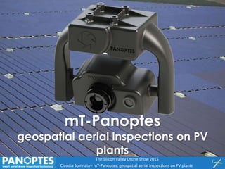
- 1. A. D’Argenio - mT-Panoptes geospatial aerial inspections on PV Claudia Spinnato - mT-Panoptes: geospatial aerial inspections on PV plants The Silicon Valley Drone Show 2015 mT-Panoptes geospatial aerial inspections on PV plants
- 2. A. D’Argenio - mT-Panoptes geospatial aerial inspections on PV Claudia Spinnato - mT-Panoptes: geospatial aerial inspections on PV plants The Silicon Valley Drone Show 2015 Technical Inspections by UAVs
- 3. A. D’Argenio - mT-Panoptes geospatial aerial inspections on PV Claudia Spinnato - mT-Panoptes: geospatial aerial inspections on PV plants The Silicon Valley Drone Show 2015 Technical Inspections by UAVs
- 4. A. D’Argenio - mT-Panoptes geospatial aerial inspections on PV Claudia Spinnato - mT-Panoptes: geospatial aerial inspections on PV plants The Silicon Valley Drone Show 2015 Solar Farms Inspections by UAVs
- 5. A. D’Argenio - mT-Panoptes geospatial aerial inspections on PV Claudia Spinnato - mT-Panoptes: geospatial aerial inspections on PV plants The Silicon Valley Drone Show 2015 solar farms inspections by UAVs preventive inspections to check if some elements - arrays, modules, cells - do not work well and thus are overheated
- 6. A. D’Argenio - mT-Panoptes geospatial aerial inspections on PV Claudia Spinnato - mT-Panoptes: geospatial aerial inspections on PV plants The Silicon Valley Drone Show 2015 What is needed Why is needed UAV surveying thermal eye observing differences in temperature and detecting overheated elements (clearer in the thermography) coupled eye in the visible band complementing thermal observations for clarifying eg shadows – and evidencing some crack or rubbish panels binocular vision observing the same scene by different bands at the time: both thermal and visible sensor on board live viewing following the survey better recording on board analyzing the acquired data later traditional way of thermal surveying by UAV on solar farms
- 7. A. D’Argenio - mT-Panoptes geospatial aerial inspections on PV Claudia Spinnato - mT-Panoptes: geospatial aerial inspections on PV plants The Silicon Valley Drone Show 2015 big solar farms are monotonous landscapes to evidence overheated elements, i.e. hot spots, also in cells each thermal video frame will not contain anything more than …
- 8. A. D’Argenio - mT-Panoptes geospatial aerial inspections on PV Claudia Spinnato - mT-Panoptes: geospatial aerial inspections on PV plants The Silicon Valley Drone Show 2015 …modules… …modules… … and still modules! for huge solar farms the post-processing time to locate the detected anomalies over the map is so much that the benefit of the fast aerial surveys are lost! location aware system can help
- 9. A. D’Argenio - mT-Panoptes geospatial aerial inspections on PV Claudia Spinnato - mT-Panoptes: geospatial aerial inspections on PV plants The Silicon Valley Drone Show 2015 What is needed Why is needed UAV surveying thermal eye observing differences in temperature and detecting overheated (clearer in the thermography) coupled eye in the visible band Complementing thermal observations for clarifying doubts - eg shadows evidencing some crack or rubbish on panels binocular vision observing the same scene by different bands: both thermal and visible on board live viewing following the survey better recording on board analyzing the acquired data later new way of inspecting • helps in surveying • helps in post-processing • automatically produces the right survey Report traditional way of thermal surveying by UAV on solar farms
- 10. A. D’Argenio - mT-Panoptes geospatial aerial inspections on PV Claudia Spinnato - mT-Panoptes: geospatial aerial inspections on PV plants The Silicon Valley Drone Show 2015 multi-sensor system all you need is already on board… … and inside: its Solar Inspector GEO hearth mT-Panoptes
- 11. A. D’Argenio - mT-Panoptes geospatial aerial inspections on PV Claudia Spinnato - mT-Panoptes: geospatial aerial inspections on PV plants The Silicon Valley Drone Show 2015 Live video and on-board recording HD camcorder HR thermal core mT-Panoptes two channel multi-sensor for thermographic geospatial inspections of PV plants with light RPAS
- 12. A. D’Argenio - mT-Panoptes geospatial aerial inspections on PV Claudia Spinnato - mT-Panoptes: geospatial aerial inspections on PV plants The Silicon Valley Drone Show 2015 KEY FEATURES • Plug & Play • Specific for UAV use • Independent by any UAV • Geospatial software with domain experience inside - locating anomalies on the map - automatic generation of the survey Report • Getting started in surveys quickly: - easy to use - fast initial training also in remote
- 13. A. D’Argenio - mT-Panoptes geospatial aerial inspections on PV Claudia Spinnato - mT-Panoptes: geospatial aerial inspections on PV plants The Silicon Valley Drone Show 2015 ADVANTAGES Fully exploiting geospatial content of data • Speed up the delivery of the results • Useful for large PV field and roofs • Real alternative to conventional survey methods • More efficient than "traditional" drone inspections • Strategic for O&M contracts linked to
- 14. A. D’Argenio - mT-Panoptes geospatial aerial inspections on PV Claudia Spinnato - mT-Panoptes: geospatial aerial inspections on PV plants The Silicon Valley Drone Show 2015 Hardware FEATURE TIR IMAGER VISIMAGER Detector Detector Uncooled microbolometer CMOS sensor Optical Format (4:3) 16/9 Resolution 640 (H) x 512 (V); 324 (H) x 256 (V) 1280 (H) x 720 (W) Pixel size 17 μm x 17 μm - Frame rate 9 Hz 30-60 fps Temp. measur. range -40 °C to 160 °C (High Gain) -40 °C to 550 °C (Low Gain) - Temp. meas. accuracy ±0,2 °C - Lens and View angle 13 mm F 1.25 / 45°; 9 mm F 1.25 / 48° - / 142° Sensivity < 50 mK (NEdT) Spectral response 7 – 13.5 μm Visible range Data Output PAL / NTSC video PAL / NTSC video Interfaces Video Out Coaxial connector - Data USB 2 USB 2 Physical Dimensions 76 x 52 x 60 mm Weight 260 g Other Case Polyamide based material carbon filled
- 15. A. D’Argenio - mT-Panoptes geospatial aerial inspections on PV Claudia Spinnato - mT-Panoptes: geospatial aerial inspections on PV plants The Silicon Valley Drone Show 2015 Panoptes Viewer Video live view Recording Review Data location on plant map Raster base maps (e.g. orthophotos) Solar Inspector – targeted solution Key features: Data analysis tools Annotation tools Thermal anomalies maps Coverage maps Automatic report generation Software
- 16. A. D’Argenio - mT-Panoptes geospatial aerial inspections on PV Claudia Spinnato - mT-Panoptes: geospatial aerial inspections on PV plants The Silicon Valley Drone Show 2015 Software interface Map Area Video Area Project Area Annotation Area Flight controls Timeline Area
- 17. A. D’Argenio - mT-Panoptes geospatial aerial inspections on PV Claudia Spinnato - mT-Panoptes: geospatial aerial inspections on PV plants The Silicon Valley Drone Show 2015 mT-Panoptes in action
- 18. A. D’Argenio - mT-Panoptes geospatial aerial inspections on PV Claudia Spinnato - mT-Panoptes: geospatial aerial inspections on PV plants The Silicon Valley Drone Show 2015 Standard work flow Operation assessment Preparation Base maps collection Flight planning Survey Data acquisition Real time annotation Post processing Data analysis Reporting Survey Data acquisition Real time annotation Post processing Data analysis Reporting
- 19. A. D’Argenio - mT-Panoptes geospatial aerial inspections on PV Claudia Spinnato - mT-Panoptes: geospatial aerial inspections on PV plants The Silicon Valley Drone Show 2015 survey Report
- 20. A. D’Argenio - mT-Panoptes geospatial aerial inspections on PV Claudia Spinnato - mT-Panoptes: geospatial aerial inspections on PV plants The Silicon Valley Drone Show 2015 examples of evidenced criticalities OVERHEATED STRING ANOMALY IN THIN FILM PANELS HOT SPOTS HOT SPOT FALSEPOSITIVE PATCHWORK CONFIGURATION
- 21. A. D’Argenio - mT-Panoptes geospatial aerial inspections on PV Claudia Spinnato - mT-Panoptes: geospatial aerial inspections on PV plants The Silicon Valley Drone Show 2015 Somewhere in Southern Italy … plant power: 0,5 MW flight time: 7 min time to report: 1 hour
- 22. A. D’Argenio - mT-Panoptes geospatial aerial inspections on PV Claudia Spinnato - mT-Panoptes: geospatial aerial inspections on PV plants The Silicon Valley Drone Show 2015 Panoptes Srl Palermo, ITALY - info@panoptes.it - www.panoptes.it