Download to read offline
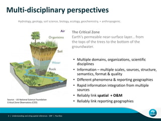
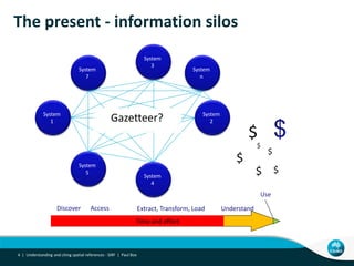

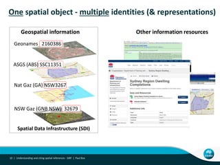
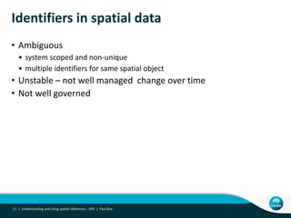
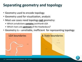
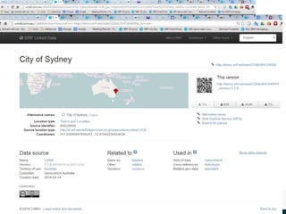
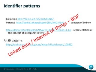


The document outlines the Spatial Identifier Reference Framework (SIRF), which aims to standardize how spatial references are understood and cited in research, addressing challenges related to ambiguity and disconnection in current spatial identifier systems. It discusses the critical nature of spatial information across multiple disciplines and the need for reliable connections between spatial objects, identities, and their metadata. Furthermore, the document emphasizes the importance of linked data to improve the accessibility and governance of spatial information.


![How Big Brands are Taking Your Traffic in Alberta [Data Inside].pptx](https://cdn.slidesharecdn.com/ss_thumbnails/howbigbrandsaretakingyourtrafficinalbertadatainside-260123180142-42d276f3-thumbnail.jpg?width=640&height=640&fit=bounds)


