Download to read offline

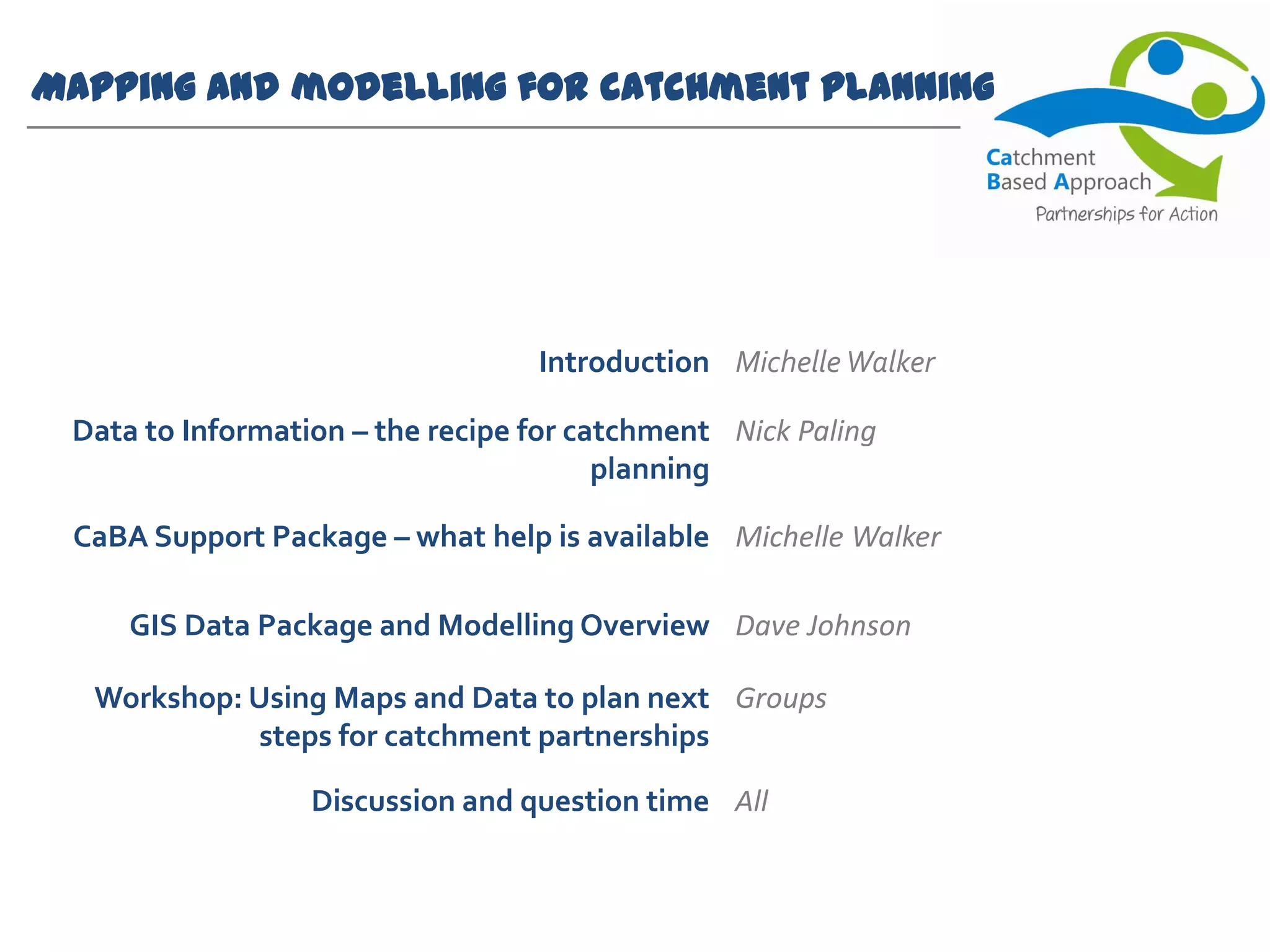
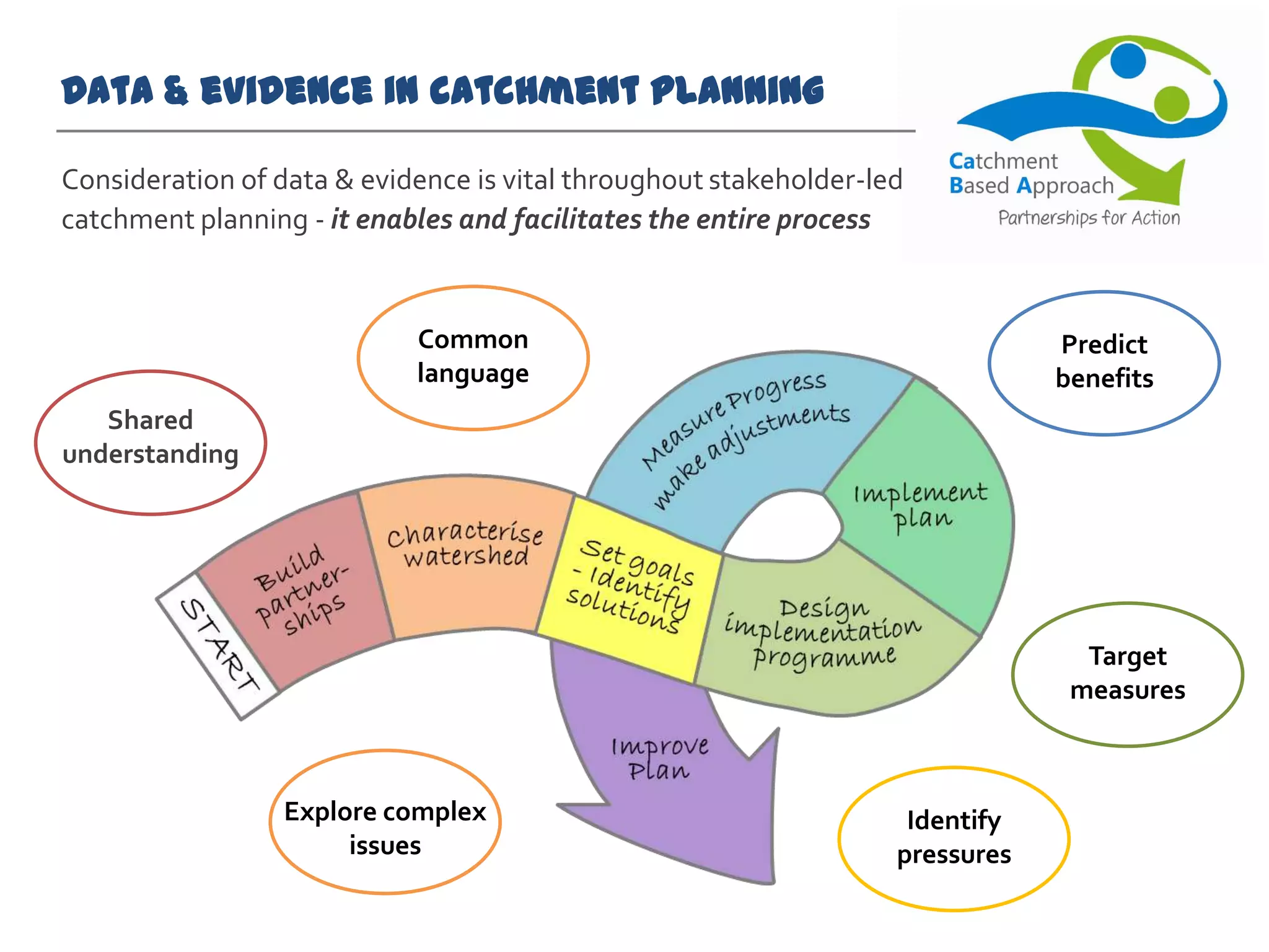
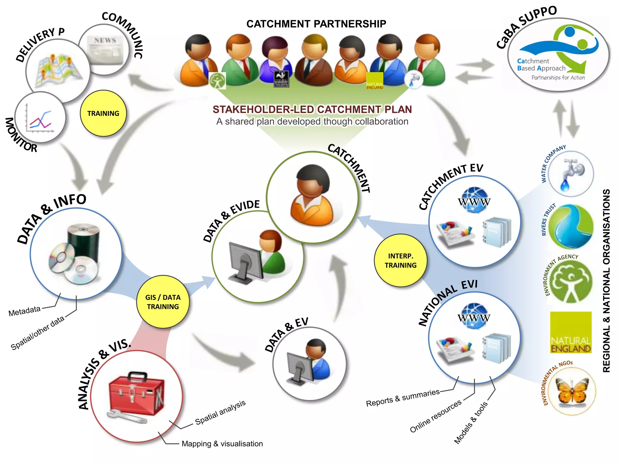


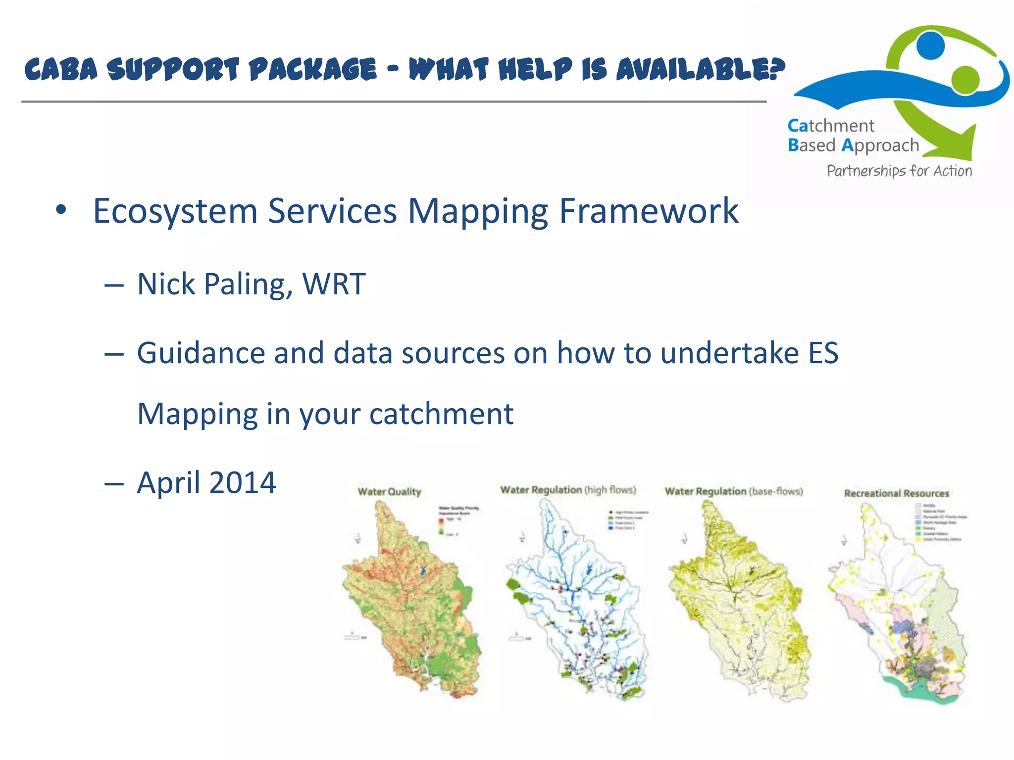


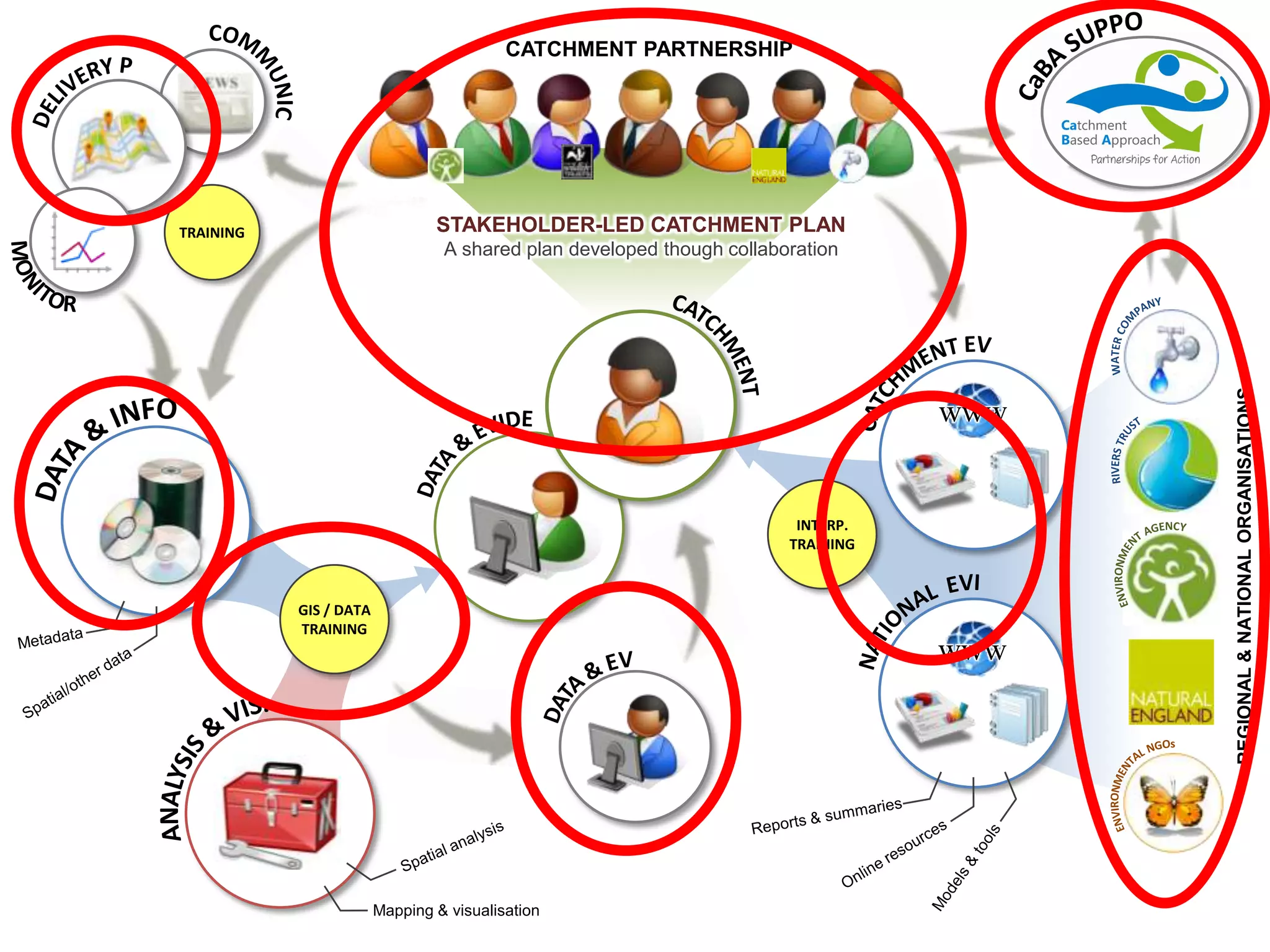


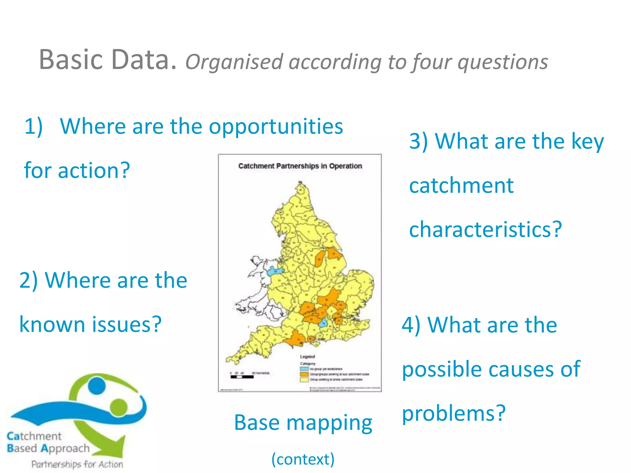
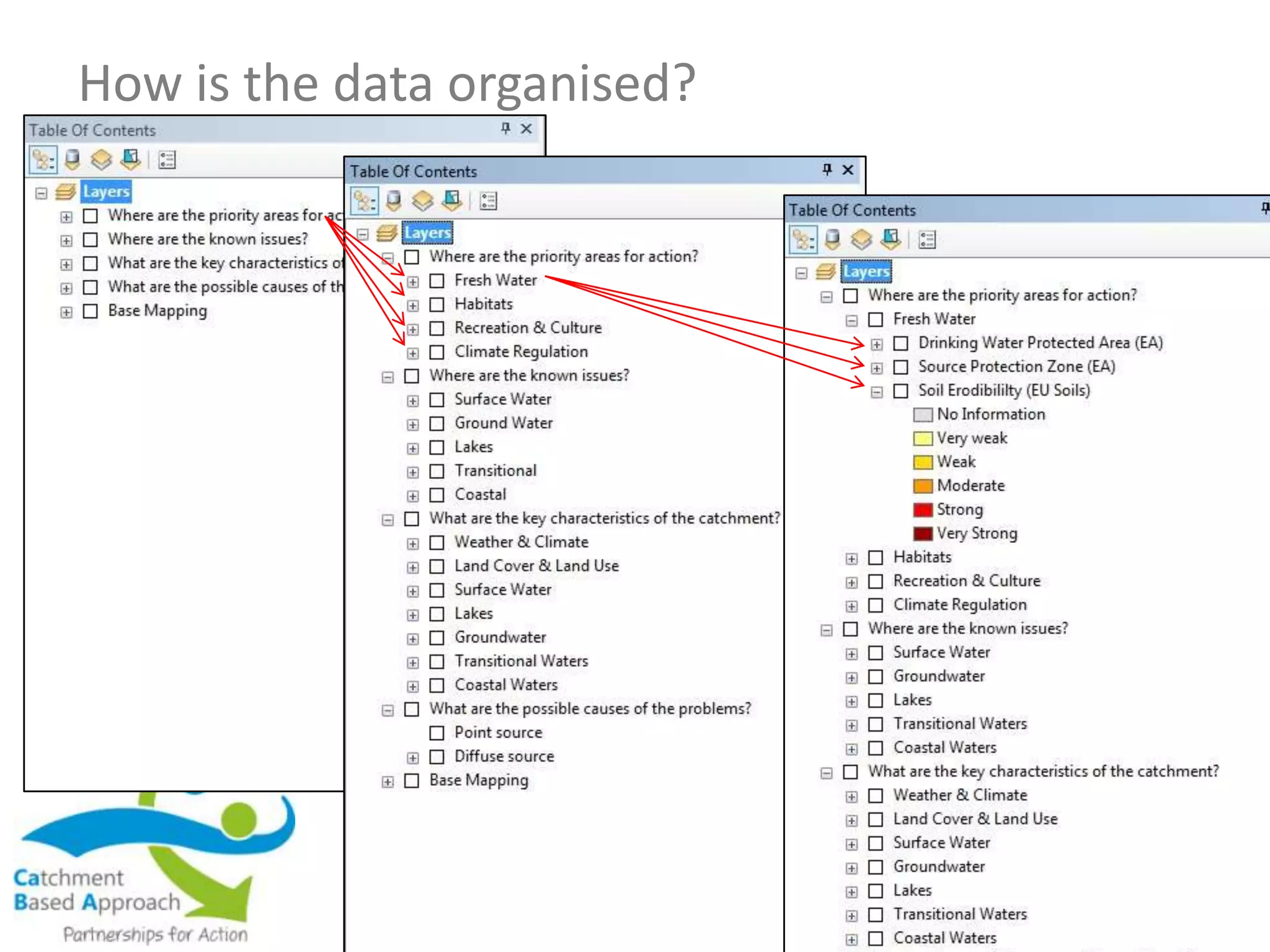

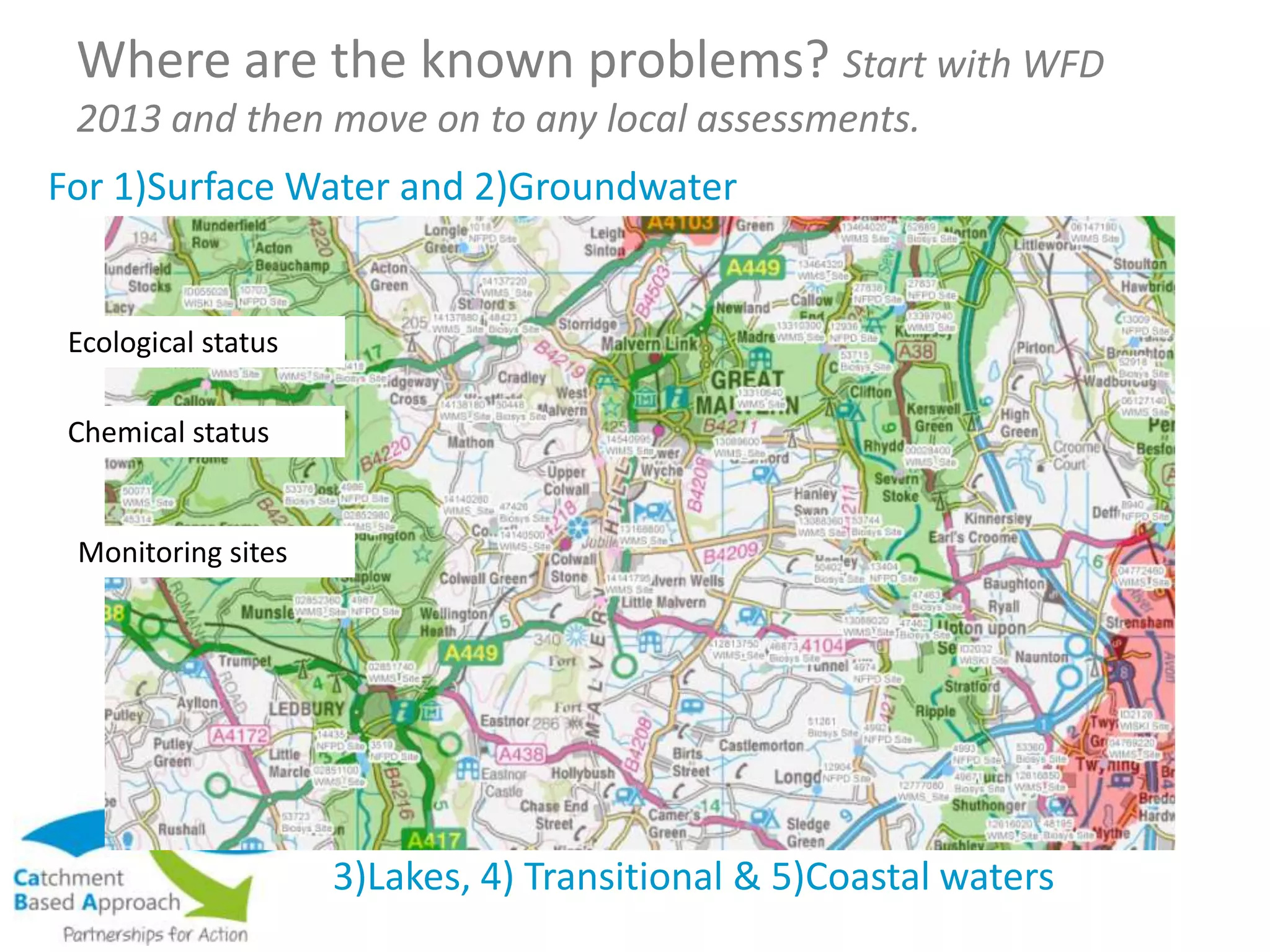


The document outlines the CABA workshops focused on mapping and modeling for catchment planning, held in February and March 2014. It discusses various support packages available, including GIS training, web mapping portals, and data user groups to facilitate stakeholder-led catchment partnerships. Key topics include the importance of data sharing, the use of modeling tools for decision-making, and strategies to address catchment-specific issues.


