This document summarizes genetic research on the endangered fairy shrimp species Branchinecta sandiegonensis. DNA sequencing of B. sandiegonensis samples from across its range revealed two distinct evolutionary groups that warrant separate conservation status designations. Pools in undisturbed areas often contained genetically unique populations. The research aimed to better understand connectivity between pools historically and currently to inform conservation of these fragmented vernal pool habitats.
Viktor Lewynsky has over 44 years of experience in fisheries management, aquatic ecology, statistics, and environmental management in Canada and the US. He has held positions with various government agencies and research organizations, focusing on areas such as fisheries surveys, population dynamics, habitat evaluations, and environmental training. He now works independently as a fisheries consultant through his own company, providing professional services to government, industry, First Nations, and other groups.
Recommendations for a Drought Resistant FloridaFinola87v
The document provides recommendations for improving drought resilience in Florida. It summarizes ideas from six work groups on topics like agricultural irrigation, landscape irrigation, water pricing, indoor water use, and more. Some key recommendations include having the state require water audits and conservation plans for its facilities, forming a working group between water management districts to improve drought responses, and expanding programs to replace inefficient toilets and appliances to save indoor water. Implementing the recommendations would help reduce water usage and make the state better prepared for future droughts.
Water: The Potential Consequences of Global Warming for Water Resources in USAEric832w
This document summarizes the key findings of a report on the potential impacts of climate change on U.S. water resources:
1) Climate change is expected to impact water resources through rising temperatures, changes in precipitation patterns, and more extreme events. This could affect water supplies, agriculture, ecosystems and increase flood and drought risks.
2) Evidence suggests some hydrologic systems are already being affected by a changing climate, through trends like rising temperatures, changes in precipitation, shrinking snowpacks and glaciers, and shifting streamflow patterns.
3) Climate change poses risks and challenges for managed water systems like infrastructure and agriculture. Adaptation will be needed to ensure resilient water management in the face of a non-station
The document summarizes the Gila River Basin Native Fishes Conservation Program, which was established to conserve native fishes and manage against nonnative fishes in the Gila River basin in response to Endangered Species Act biological opinions. The program provides over $16 million over 30 years for conservation actions of priority native fish species and control of nonnative species. It is directed by the U.S. Fish and Wildlife Service and U.S. Bureau of Reclamation, in cooperation with state wildlife agencies, and focuses on recovery of federally-listed species through projects to prevent extinction, replicate rare populations, and control threats from nonnative species.
This document summarizes a study that assessed the risk of cancer from consumption of blue crabs caught in the Newark Bay Complex in New Jersey. High levels of dioxins were found in crabs in the early 1990s, leading to a ban on catching and selling crabs from the area. However, surveys from 1995 to 2005 found that people were still regularly catching crabs recreationally and consuming them, exposing themselves chronically to dioxin compounds. By combining data on crab consumption patterns with dioxin levels measured in crabs, the study estimated a lifetime cancer risk above 1 in 1000 for regular consumers and above 1 in 100 for those with higher estimated exposure. The ongoing consumption of crabs from this contaminated site continues to
This document summarizes a study that examined fish assemblages in reference and restored tidal freshwater marshes in the San Francisco Estuary. The study compared fish assemblages between one reference marsh and three restored marshes between 1998-1999. Fish were sampled using beach seines and purse seines in different habitats, including open water, submerged aquatic vegetation, offshore areas, tidal sloughs, and marsh edges. Overall, fish assemblages were dominated by introduced species and did not differ significantly between reference and restored marshes. However, fish assemblages did vary between habitats with and without submerged aquatic vegetation, and between offshore and nearshore habitats, with native fishes found more often in tidal sloughs
This study analyzed the stomach contents and stable isotope ratios of over 960 juvenile fish and their potential food sources from pelagic and littoral habitats in the tidal freshwater region of the San Francisco Estuary. The results showed evidence of two predominant food web pathways. Pelagic fish and some littoral fish relied on a zooplankton-phytoplankton trophic pathway, while the majority of littoral fish had diets and carbon isotope ratios consistent with energy from submerged aquatic vegetation and epiphytic macroalgae. Analysis with a mixing model revealed that littoral fish obtained the overall majority of their nutrition from consuming grazer amphipods. Examining both stable isot
This document summarizes a study on the rockfish resources of the south central California coast. Researchers from California Polytechnic State University placed observers on party boats from 2003-2005 to record catch data by species, including catch per unit effort and mean size. They supplemented this with historical catch data from 1980-1998 from the California Department of Fish and Game and Pacific Gas & Electric. The study aims to analyze population trends over the past 25 years for various rockfish species in the region and compare sizes over time. Preliminary results found fluctuating catch rates but no consistent declining trends, except for bocaccio rockfish. Mean sizes were generally above maturity levels.
The Sacramento-San Joaquin Delta is under threat due to increasing water demands and changing environmental conditions. The Bay Delta Conservation Plan aims to protect endangered species and restore water supplies through habitat conservation and restoration. It also establishes an adaptive management program to address changing conditions over time. The BDCP seeks to balance the needs of the environment, agriculture and growing urban populations through a comprehensive strategy.
This document summarizes research on spatial and temporal patterns of the algae Pseudo-nitzschia in central California and how they relate to regional oceanography. Major blooms occurred in 1991, 1995, 1998, 2000, and 2002. Blooms often initiated in southern California and appeared to propagate northward. Laboratory experiments showed blooms were generally nitrogen limited rather than limited by silicon or iron. Large-scale blooms are inconsistent with local oceanographic drivers and may be influenced more by latitudinal changes in regional conditions. Monitoring programs have difficulty predicting blooms due to thin subsurface layers of algae that are difficult to detect.
This paper examines fish species that have disappeared from catches around Bohol Island, Philippines over the period 1950-2007 based on interviews with local fishers. Generalized least squares tests showed steep declines to zero in catch for many species. Twenty of the 21 disappeared species were moderate to large bodied fish, including giant grouper and African pompano. Six were slow growing and four were late maturing. Species with large body size and high fishing pressure may be particularly vulnerable to overexploitation. Traditional ecological knowledge from fishers can provide long term catch data and inform conservation priorities when scientific data is limited.
AQUATIC GENETIC RESOURCES AND CLIMATE CHANGE_CleanPatrick White
This document provides an overview of the importance of aquatic genetic resources in the context of climate change. It discusses how aquatic ecosystems and the organisms they support play a key role in global carbon and nutrient cycles. Aquatic genetic resources underpin global aquaculture and fisheries, which together provide about half of the world's food fish and are important for food security, nutrition, and livelihoods. Climate change poses challenges for these resources and the sectors that depend on them through impacts like warming, acidification, and changes to freshwater availability. The roles of aquatic genetic resources in adapting to and mitigating climate change impacts are discussed.
This document reviews literature on recreational fishers' perspectives on establishing and managing marine protected areas (MPAs). It finds that while some recreational fishers support MPAs to increase fish populations, others oppose them as interfering with fishing. Views differ based on factors like how attached people are to the area. More research is needed on how displacement may affect fishers and how to best involve fishers in decision-making around MPA establishment and management.
- Researchers measured benthic and planktonic primary production along a nutrient gradient in Green Bay, Lake Michigan.
- Benthic production decreased with increasing nutrients, while planktonic production increased with nutrients.
- Near the Fox River mouth, planktonic production dominated (95%), but farther away production was split between benthic and planktonic (40% benthic).
- Autotrophic structure, or the balance between benthic and planktonic production, varied significantly based on nutrient levels and bathymetry across Green Bay.
Freshwater protected areas and defining a conservation blueprint for desert f...University of Washington
This document summarizes a study that aimed to identify priority areas for conserving freshwater fish diversity in the Lower Colorado River Basin. The study developed species distribution models for 40 native and non-native fish species. Using these models and metrics of taxonomic, functional, and phylogenetic diversity, a conservation prioritization algorithm identified the top conservation priorities. The study found opportunities for conservation but also trade-offs between different diversity targets and challenges from contemporary and future threats.
This document summarizes a study that used NDVI data to identify and map potential groundwater dependent ecosystems (GDEs) in south-central Texas. The researchers conducted seasonal and inter-annual NDVI analyses to determine pixels with different groundwater dependence potentials. K-means clustering classified pixels from the inter-annual NDVI difference images as high, low, or partial potential for GDEs. The results identified areas in the mid to lower part of the study site as having high potential to access groundwater. The study demonstrates the ability of remote sensing to identify GDEs and informs water resource management.
This document provides a water quality assessment report for 6 ponds at Wintergreen Resort in Virginia. A partnership between Lynchburg College and the Wintergreen Property Owners Association was established to assess the ponds and develop a management plan. In the spring and summer of 2015, Lynchburg College students collected data on the ponds' watersheds, water quality, aquatic vegetation, fish populations, and more. The report summarizes the findings, which show the ponds have varying levels of nutrient loading and biological productivity influenced by surrounding land use. A multi-year management plan is proposed to address issues in individual ponds and establish sustainable fisheries through actions like mitigating degradation sources and manipulating fish species and habitats.
This document is the Endangered Species Act of 1973. It establishes protections for species listed as endangered or threatened. Key points:
1) It finds that various species of fish, wildlife and plants have been rendered extinct due to lack of conservation as the economy developed.
2) The purposes are to conserve ecosystems endangered and threatened species depend on and establish a program to conserve listed species and implement treaties.
3) It defines key terms like "endangered species," "threatened species," and "take" and outlines the process for determining what species should be listed as endangered or threatened.
Waterbird Conservation for the AmericasSotirakou964
This document provides a framework for conserving waterbird populations throughout the Americas. It sets broad goals such as advocating continent-wide monitoring, regional conservation planning, and national/local action. The plan aims to weave together resources, science, and stakeholders to achieve sustainable waterbird populations and habitat management across their ranges. It emphasizes initial priorities like seabirds and colonial nesters in northern areas, with plans to expand coverage over time. Implementation will rely on partnerships across geographic and organizational boundaries to coordinate waterbird conservation efforts internationally, nationally, regionally, and locally throughout the Americas.
The three national wildlife refuges in the Lower Florida Keys are the National Key Deer Refuge, Great White Heron National Wildlife Refuge, and Key West National Wildlife Refuge. These refuges, totaling over 6,600 acres, extend from East Bahia Honda Key west to the Marquesas Keys. They provide habitat for endangered species like the Key deer and protect wildlife from human disturbance. Management utilizes tools like remote sensing, law enforcement, and zone restrictions to monitor the environment and resources, enforce regulations, and restrict public access in sensitive areas to protect nesting and feeding birds.
Presentation at the TWCA mid year conference 2012 www.twca.org
Carlos Peña, Principal Engineer Operations
International Boundary and Water Commission,
United States Section
Has the earth sixth mass extinction already arrived 2011 barnoskyhenrycr80
This document reviews methods for comparing modern extinction rates to background and mass extinction rates from the fossil record. It finds that current extinction rates are higher than expected based on fossil data, indicating a sixth mass extinction is underway. Methods discussed include comparing modern rates to estimated background rates from fossils, modeling expected future losses, and assessing the percentage of species lost to determine the severity of the extinction crisis. The authors conclude that conservation measures are needed given extinction rates exceed background levels.
1) The study assessed the effects of varying degrees of agricultural land use on benthic macroinvertebrate communities in 15 headwater streams in Jersey County, Illinois. Land use/land cover was calculated at the watershed, 150m buffer, and 50m buffer scales.
2) Family diversity and richness were low across all sites. A total of 20 taxa were identified, of which only 4 were EPT taxa. Hydropsychidae had a strong positive correlation with percent agriculture. Principal component analysis showed trends in macroinvertebrate functional feeding groups.
3) While common bioassessment metrics like biotic indices did not correlate well with land use, percent Hydropsychidae may be an effective metric for
This document summarizes a study of water quality in the Kentucky River watershed from 2001-2006. The author thanks their advisors Dr. Buddhi Gyawali, Jeremy Sandifer, and Ms. Cynthia Rice for guidance. The study analyzed how land use, such as agriculture, mining, and urbanization, impacted water quality. High levels of metals and nutrients were found near mining and urban areas, while low dissolved oxygen levels occurred by agricultural land. The author used GIS data and trend analysis to link changes in water quality parameters to land activities affecting the watershed.
This curriculum vitae outlines the educational and professional background of Bhawan Singh. He holds a B.A., M.A., and Ph.D. from the University of Manitoba and McGill University. He has over 27 years of experience as a professor at the University of Montreal and has consulted on climate change. He has extensive training and accreditation in areas related to climate change such as greenhouse gas inventories, climate modeling, and low emissions development.
This report summarizes a 7-year study of the nearshore fish fauna in Bonne Bay, Newfoundland from 2002-2008. 31 fish species from 17 families were documented. Both juvenile and adult Atlantic cod were present, suggesting a local "bay cod" population. Acadian redfish and striped wolfish, a species protected under Canadian law, also inhabit the bay. Fish assemblages varied between different benthic habitats. The study provides a baseline for conservation efforts in the nationally protected bay, which supports diverse fish communities and species.
Domingo G. Ochavillo has over 20 years of experience as a fisheries biologist and chief fisheries scientist. He currently serves as the Chief Fisheries Biologist for the American Samoa Department of Marine and Wildlife Resources, where he supervises various fisheries programs and provides technical advice on fisheries management. He also serves on the Statistical and Scientific Committee of the Western Pacific Regional Fisheries Management Council. Ochavillo has a PhD in Marine Biology and Oceanography from the University of Southern California and has authored several peer-reviewed publications on fisheries research in American Samoa and the Philippines.
Cassondra R. Thomas has over 17 years of experience in biogeochemistry and nutrient cycling in wetland environments. She holds a PhD in Environmental Sciences and has extensive experience modeling material and energy flows within estuarine systems. Her research has focused on phosphorus and nitrogen cycling in prescribed burns in the Everglades and carbon sequestration in scrub oak systems. She has also examined the effects of fiddler crab burrows on salt marsh biogeochemistry and created models of nitrogen cycling in Atlantic coast salt marshes and the Neuse River Estuary.
G115 Virtual Field Trip #2 Coastal Exploration Page 1 G.docxhanneloremccaffery
G115 Virtual Field Trip #2: Coastal Exploration Page 1
G115 VIRTUAL FIELD TRIP #2: COASTAL EXPLORATION
I N T R O D U C T I O N *
This virtual fieldtrip is actually two fieldtrips, and it takes you first to the west coast and then to the east coast to
compare coastal features and processes, including wave action, beach sand source and movement, coastal bluff and
dunes, and human interferences. The first fieldtrip is to the shoreline of San Diego North County in Southern California,
and your trip guide is Chris Metzler, earth science professor at MiraCosta College (Fieldtrip 1). The second fieldtrip is to
northeast shore of Florida, near the town of Marineland, and your trip guide is Joann Mossa, geography professor at the
University of Florida (Fieldtrip 2).
Read this entire worksheet carefully and completely to ensure full credit for this assignment. Instructions for submitting
the Virtual Field Trip questions and Essay can be found at the end of this document.
*This field trip was adapted from http://seascisurf.com/geo_virtual_fieldtrip_west-east_coast_shores.pdf
F I R S T , W H E RE A RE W E ?
Go to maps.google.com, and search for “San Diego, CA” and “Marineland, FL”.
1. On the blank map here, mark a star near San Diego, California AND in the Marineland, Florida:
2. What ocean borders the California Coast? ___________________________________________________________
3. What ocean borders the northeast Florida Coast? _____________________________________________________
4. Go to this site (https://goo.gl/maps/NWcnELEQC9E2) and zoom and pan around the map. Also look at the
photos, linked to the right side of the satellite imagery. What does the coastline near Marineland, FL look like?
5. Go to this site (https://goo.gl/maps/2a2vUUanZkR2) and zoom and pan around the map. Also look at the
photos, linked to the right side of the satellite imagery. What does the coastline near San Diego, CA look like?
http://seascisurf.com/geo_virtual_fieldtrip_west-east_coast_shores.pdf
https://goo.gl/maps/NWcnELEQC9E2
https://goo.gl/maps/2a2vUUanZkR2
G115 Virtual Field Trip #2: Coastal Exploration Page 2
PH Y S I C A L C H A R A C T E RI S T I C S O F T H E T W O A RE A S
Please review the two links below to learn about the physical characteristics of the California and northeastern Florida
Coasts. You will have to look around the pages, and click some of the links within, to find all of the characteristics.
• San Diego, California coastal conditions: https://www.wunderground.com/marine-
weather/PZ/750.html?map=wave
• Marineland, Florida coastal conditions: https://www.wunderground.com/MAR/AM/454.html
Fill in the table below with the data from these sites:
San Diego, California Marineland, Florida
Sea surface temperature
Average wave size (make an
estimate, include units on your
answer)
Time of high and low tide (include
the date of your observation)
Wind direction and ...
This document summarizes research characterizing participation in non-commercial fishing and other shore-based recreational activities on St. Croix, US Virgin Islands. Researchers conducted interviews with fishers (n=100) to understand demographics, fishing behavior, target species, and gear used. They also performed two counts of participation at 64 shoreline sites, estimating numbers involved in fishing and other activities like walking and sunbathing. Results showed squirrelfish, grunts and jacks as most caught species. Fishing was mostly for subsistence and recreation. Handlines were the dominant gear. Counts estimated higher fishing participation on weekends versus weekdays. Certain shoreline types and areas had more fishing and recreation activities. The research tested methods for
Sea Levels Affecting Marshes Model Using SLAMM to Conserve Rhode Island’s Coa...riseagrant
This document summarizes information presented at a workshop on using the Sea Level Affecting Marshes Model (SLAMM) to project impacts of sea level rise on coastal wetlands in Rhode Island. Key points include:
- Tidal marshes provide important ecosystem services like habitat, water filtration, and flood protection. Rhode Island has lost over 50% of its historic salt marshes.
- Sea levels are rising faster in Rhode Island due to climate change, increasing the risk of wetland loss and property damage from flooding. The SLAMM model projects significant wetland loss under scenarios of 1, 3, and 5 feet of sea level rise.
- The SLAMM projections will help identify vulnerable wetlands and
This document provides an introduction to soil surveys and their use for agronomic purposes. It discusses the key concepts of soil horizons and soil formation. Soils form distinct layers or horizons over time due to interactions between climate, organisms, parent material, landscape position, and time. The main horizons include the O, A, E, B, C, and R horizons. Soil formation is influenced by five main factors - parent material, climate, living organisms, landscape position, and time. Together these factors determine the type of soil that develops in a particular location.
1) The BEAMR methodology was developed to assess marginal reef habitats characterized by impoverished communities and biogeographic limits. It uses quadrat sampling to characterize communities through functional groups rather than indicator species.
2) BEAMR was used to monitor the efficacy of an artificial reef constructed as mitigation for a beach nourishment project in Broward County, FL that would impact natural hardbottom. Over time, the artificial reef community became increasingly similar to the natural hardbottom community.
3) BEAMR monitoring found that while the beach construction caused a disturbance, it did not significantly change the temporal patterns of functional groups on experimental transects compared to control transects.
This study evaluated the impact of cover crops and conventional tillage on carbon output from olive orchards in Spain. Eight experimental fields with different slopes, soil types, and cover management were monitored over multiple years. Results showed that cover crops promoted higher average soil coverage of 65.7% compared to 22.4% with conventional tillage. This led to lower runoff and erosion with cover crops, reducing carbon losses by an average of 76.4% due to decreases of 36.4% in runoff and 85.6% in erosion. Additionally, carbon output under cover crops was less influenced by rainfall patterns than under conventional tillage. The study concludes cover crops are effective at reducing carbon losses from olive orchards.
This document discusses the inadequate protection of vernal pools in Connecticut. It finds that while Connecticut's Inlands Wetlands and Watercourses Act regulates vernal watercourses, it does not specifically define or recognize vernal pools as distinct habitats, and fails to protect the surrounding upland areas that are important for vernal pool ecosystems. Implementation of wetlands regulations is also inconsistent because it is left to individual towns, rather than having statewide standards. The document argues that Connecticut should strengthen its protections for vernal pools by adopting consistent statewide standards that specifically define and conserve vernal pool habitats and their surrounding areas.
This study examined how the chisel-toothed kangaroo rat (Dipodomys microps) persisted in its original location despite changes to its habitat during the last glacial maximum. Stable isotope analysis of carbon and nitrogen in D. microps bone collagen from the past 8,000 years was used to explore diet variability over time. Results indicated that D. microps consumed plants other than its presumed specialist food of Atriplex confertifolia and also consumed some animal protein. Analysis of body size showed populations did not experience shifts in average size over time but responded to changing conditions by shifting their dietary niche, as shown by fluctuating isotope values. This ability to behaviorally and physiologically adapt to climate change helps
This study examined variations in surface soil organic carbon at the Duckabush River Delta in Washington state. Soil samples were taken along transects at different elevations and salinity levels across three zones. Organic carbon content and density generally increased with elevation. Zone 1 near the shore had the lowest carbon levels, while zones 2 and 3 further inland had higher carbon content and density, driven by higher bulk density and higher silt content in the soil. Estimated surface soil organic carbon stocks were 52.9, 93.9, and 106.3 Mg/ha for zones 1-3 respectively. While similar to other ecosystems, intertidal wetlands may sequester carbon at higher rates, making them important for climate change
Wesley Daniel (of Michigan State University), presented at the Adapting Forested Watersheds to Climate Change Workshop, at The Waters, Minocqua, WI on March 15-16, 2017. The workshop was hosted by the Northern Institute of Applied Climate Science (NIACS), USDA Climate Hubs, and the Wisconsin Initiative on Climate Change Impacts (WICCI). Details at www.forestadaptation.org/water.
Climate Change and Biodiversity: Implications for Bay Area Conservation by Da...OpenSpaceCouncil
This document summarizes a workshop on climate change impacts on biodiversity in the San Francisco Bay Area. Key points include:
- Climate models project the Bay Area climate to warm significantly by the late 21st century, increasing temperatures, drought conditions, and wildfire risk.
- Multiple vegetation models predict future climates will favor shrub and grasslands over forests as some tree species approach the limits of their climate tolerances.
- Vegetation transitions are expected to be patchy across the landscape and depend on factors like local propagule sources and disturbance regimes.
- Maintaining a diversity of habitats and vegetation types can help support species' ability to shift ranges under climate change.
This document summarizes a pilot project to re-engineer coral reefs off the coast of Grenada for coastal protection. The project involved (1) modeling wave dynamics and sea level rise scenarios, (2) designing and constructing pilot submerged breakwater structures made of quarry stone and concrete blocks with relocated corals, and (3) monitoring the structures to evaluate their ability to attenuate waves and reduce coastal flooding, with the goal of demonstrating the role of coral reefs in coastal protection. Over 1,500 person-hours and $7,000 per meter were required to construct the 30-meter pilot structures, which were then monitored to evaluate lessons learned for improving coastal resilience through similar nature-based solutions.
This document analyzes water samples from 258 wells in fractured sandstone basins in Mali. Statistical analysis identifies three classes of groundwater: 1) Normal carbonate calcium magnesium water. 2) Contaminated water high in iron and nitrates likely of anthropogenic origin. 3) Saline water high in sodium, chlorides and potassium. Principal component analysis identifies correlations between ions indicating water-rock interactions and some contamination from human activities like agriculture. The study provides baseline data on groundwater quality in the region.
IJERA (International journal of Engineering Research and Applications) is International online, ... peer reviewed journal. For more detail or submit your article, please visit www.ijera.com
This study assessed the ecological health of High Bank Creek three years after dam removal by comparing it to nearby Cedar Creek. Macroinvertebrates and fish were surveyed to evaluate the stream health. Twenty-six fish species were found in High Bank Creek compared to nine in Cedar Creek. Several metrics showed improved conditions in High Bank Creek, such as higher fish biodiversity index and presence of species previously absent. However, some metrics like macroinvertebrate richness were lower, possibly due to ongoing disturbance. Overall the dam removal appeared successful in restoring the fish community, and further stabilization was expected to improve conditions over time.
This document discusses the importance of water storage for hydropower, sustainable development, and poverty eradication. It argues that reservoirs provide essential services like water regulation, supply, and flood control. While some groups oppose dams and reservoirs due to environmental concerns, reservoirs offer similar ecological benefits to natural lakes and allow for renewable hydropower. The document asserts that without infrastructure investments in water storage, goals like universal access to water and electricity cannot be achieved.
This document summarizes two studies evaluating the environmental impacts of Flaming Gorge Dam operations. The first study assessed the effects of overwinter double-peaking flows on trout behavior downstream, finding that trout activity increased in response to flow fluctuations. The second study examined the effects on endangered pikeminnow nursery habitat, finding that backwater characteristics are affected by flow levels and each backwater is unique annually due to sediment transport. Video recordings and topographic surveys were used to monitor fish behaviors and backwater features across varying dam operations.
This thesis proposes a resilient coastal strategy called "The Irie Coast" for Montego Bay, Jamaica. It begins with an introduction and literature review on oceans, cities, coral reefs and the threats facing the Caribbean region. An inventory and analysis of Montego Bay's existing urban and marine contexts is presented. The proposal section illustrates a master plan for a continuous green and blue network along the coastline that aims to improve shoreline protection, habitat restoration and community resilience through an integrated strategy.
This document summarizes an undergraduate student report on mapping stream water nutrients in the Bucca Bucca Creek catchment area impacted by blueberry horticulture in Coffs Harbour, Australia. Water and nutrient samples were collected from 40 sites in the catchment and analyzed for parameters including nitrogen, phosphorus, pH and dissolved oxygen. Nitrates + nitrites (NOX) exceeded Australian water quality guidelines at 3 sites correlated with nearby blueberry farms, suggesting these farms contribute significant NOX pollution. The nutrient management of these 3 polluting farms requires further investigation to protect local habitats and prevent long-term waterway pollution and eutrophication.
The document proposes the Northern Redwoods Oceanic External Array Proposal "D" which was developed based on input from conservation and fishing communities. It places emphasis on enhancing biodiversity through marine protected areas. The proposal includes 17.4% of the study region in different types of marine protected areas ranging from highly protected areas to areas with lower protection. It defines several areas of special importance to protect and outlines the proposal's goals which include using science guidelines and minimizing socioeconomic impacts.
Similar to Bohonak_A._J._2005._Genetic_testing_of_t-1 (20)
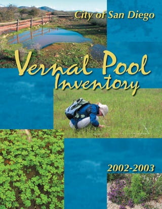
2. THE CITY OF SAN DIEGO
The City of San Diego is pleased to provide you with a copy of its 2002-2003
Vernal Pool Inventory. This inventory builds off of seminal work completed by R.
Mitchel Beauchamp (1979) and Dr. Ellen Bauder (1986), as well as over 2500 hours of
City staff conducting site specific vernal pool surveys.
This inventory was the product of a grant from the U.S. Fish and Wildlife Service
to improve understanding ofthe current distribution and conservation status of vernal
pools within the jurisdiction or ownership of the City of San Diego. The inventory will
serve as the foundation for the Citywide Vernal Pool Management Plan currently
underway.
While the inventory focused on identifying the location and size ofvernal pool
basins, and five sensitive vernal pool plants, it is my hope that it will serve as the basis
for future monitoring and research efforts. Because all ofthe information was collected
with a sub-meter differential Global Positioning System and stored in a Geographic
Information System, the data can be easily aggregated with other vernal pool inventories
currently underway by the County of San Diego and Marine Corps Air Station Miramar.
This will allow a regional perspective on the status ofthese unique ecosystems.
It is my sincere belief that through proper management, vernal pool habitat can be
protected, enhanced and restored. While we cannot undo the tremendous loss ofvernal
pool habitat that has occurred over the last century, we can strive to maintain and manage
what remains. It is in this light that the Inventory and the pending Citywide Vernal Pool
Management Plan are presented for your use.
Sincerely,
Keith A. Greer, Deputy Planning Director
DIVERSITY
Planning Department
202 C Street, MS 5A • San Diego, CA 92101-3865
Tel (619) 236-6479 Fax (619) 236-6478
3. ACKNOWLEDGEMENTS
City Staff
Keith Greer, Deputy Planning Director
Holly Cheong, Environmental Biologist
Randy Rodriguez, Associate Planner
Melanie Johnson, Associate Planner
Chad Kane, Assistant Planner
Richard Brown, Cover Designer
Betsy Miller, Biologist Intern
Khalil Martinez, GIS Intern
David Rousso, Planning Intern
Consultants
Dr. Andrew Bohonak, San Diego State University
Dr. Marie Simovich, University of San Diego
Dr. Bonnie Ripley, University of San Diego
Dr. Robert Fisher, USGS-B.R.D.
Brian Yang, USGS-B.R.D.
Larry Sward, Helix Environmental
Greg Mason, Helix Environmental
Keli Balo, Helix Environmental
Christina Schaffer, EDAW
Robert MacAller, RECON
This information is available in alternative formats upon request.
Printed on recycled paper.
4. Table of Contents
Section Page
1. Introduction ………………………………………………….. 1
1.1 Background ……………………………………………. 1
1.2 Purpose of Project …………………………………....... 3
2. Methods ………………………………………………............. 4
2.1 Research on Existing Vernal Pool Inventories ……......... 4
2.2 Field Data Collection ………………………..……….... 4
2.3 Limitations …………………………………………..... 6
3. Results ………………………………………………………… 8
3.1 Inventory Summary ………………………………….… 8
3.2 Results by Site ……………………………………….… 12
3.2.1 Del Mar Mesa …………………………………. 13
3.2.1.a. Li Collins (H 40) ……………………... 13
3.2.1.b Greystone Torrey Highlands (H 39) …… 14
3.2.1.c Rhodes (H 18-23) ……………………. 15
3.2.1.d Del Mar Mesa (H series, H 1-15) …….. 17
3.2.1.e Shaw Texas (H 17) …………………… 20
3.2.2 Carmel Mountain (H 31-32, H 38) …………….. 22
3.2.3 Mira Mesa …………………………………….. 24
3.2.3.a Mesa Norte (B 11) …………………… 24
3.2.3.b Tierra Alta (B 5-6) …………………... 25
3.2.3.c Lopez Ridge (B 7-8) ………………….. 26
3.2.3.d Crescent Heights (B 7-8) ……………… 27
3.2.3.e Fieldstone (C 17-18) ………………….. 28
3.2.3.f Winterwood (C 10-16) ………………… 30
3.2.3.g Mira Mesa Market Center (C 27) ……… 31
3.2.3.h Maddox (C 28) ………………………… 32
3.2.3.i Parkdale Carroll Canyon (D 5-8) …….. 34
3.2.3.j Carroll Canyon Preserve (D 5-8) ………. 35
3.2.3.k Arjons (I 1) …………………………….. 37
3.2.4 Nobel Drive ……………………………………... 39
3.2.4.a Pueblo Lands (I 12) ……………………. 39
3.2.4.b Bob Baker (I 6 B) ……………………… 40
3.2.4.c Bob Baker 2 (I 6 C) ……………………. 41
3.2.4.d Nobel Research Park (X 7) …………….. 43
3.2.4.e Nobel Drive (X 5) ……………………… 45
3.2.5 Kearny Mesa …………………………………… 47
3.2.5.a Cubic (U 19) …………………………… 48
3.2.5.b Miramar (EE, FF, GA, GG, HH, RR) .… 49
3.2.5.c Magnatron (U 15) ………………………. 49
i
5. 3.2.5.d Sander (U 15) …………………………... 50
3.2.5.e General Dynamics (N 8) ………………. 52
3.2.5.f Montgomery Field (N 1-6) …………....... 54
3.2.5.g Serra Mesa Library (N 7) ………………. 57
3.2.6 Mission Trails Regional Park ……………………. 59
3.2.6.a Mission Trails Regional Park (Q 2) ……. 59
3.2.6.b Murphy Canyon (G 1) ………………….. 63
3.2.7 Urban San Diego …………………………………. 63
3.2.7.a Kelton (S 4) …………………………….. 63
3.2.7.b Chollas Lake ……………………………. 64
3.2.8 Otay Lakes ……………………………………….. 64
3.2.8.a Proctor Valley (R 1) ……………………. 64
3.2.8.b Otay Lakes (K 3, 5, 10, 13) …………….. 65
3.2.9 Otay Mesa ………………………………………... 67
3.2.9.a Robinhood Ridge (J 4-5) ……………….. 68
3.2.9.b J 4 ………………………………………. 69
3.2.9.c Hidden Trails (J 2 W, J 31) …………….. 71
3.2.9.d J 2 W ……………………………………. 72
3.2.9.e J 3 ……………………………………….. 73
3.2.9.f Sweetwater High School (J 33) …………. 75
3.2.9.g West Otay A + B (J 32) …………………. 77
3.2.9.h J 34 ……………………………………… 80
3.2.9.i Recon South (J 14) ……………………… 81
3.2.9.j 905 (J 14) ……………………………….. 82
3.2.9.k J 11 East ………………………………… 84
3.2.9.l J 11 West ……………………………….. 86
3.2.9.m J 12 ……………………………………… 87
3.2.9.n J 13 East ………………………………… 88
3.2.9.o J 13 North ………………………………. 90
3.2.9.p J 13 South ………………………………. 92
3.2.9.q J 14 ……………………………………… 94
3.2.9.r Arnie’s Point (J 15) …………………….. 95
3.2.9.s J 16-18 …………………………………. 96
3.2.9.t Wruck Canyon (J 16-18) ……………….. 97
3.2.9.u J 21 ……………………………………… 98
3.2.9.v J 27 ……………………………………… 99
3.2.9.w J 28 East ………………………………… 101
3.2.9.x J 29-30 …………………………………. 102
3.2.9.y Brown Field (J 35) …………………….. 103
3.2.9.z Otay Mesa Road Helix (J 2 S) ………….. 104
3.2.9.aa Otay Mesa Road Recon (J 2 W) ……….. 106
3.2.9.bb Otay Mesa Road Pardee (J 2 S, J 2 W) … 108
3.2.9.cc Recon Cal Terraces (J 2 N, J 2 S, J 2 W) . 110
3.2.10 Marron Valley (MM 1) ………………………….. 112
3.3 B. sandiegonensis Genetic Research …………………….. 114
ii
7. List of Figures
Figure Page
1. Regional Distribution of San Diego Vernal Pools …………………… 2
2. Precipitation in San Diego County for the 2002-2003 Rainfall Year .. 6
3. Histogram of Vernal Pool Basin Area ……………………………….. 8
List of Appendices
Appendix
A. Survey Dates and Staff
B. Fairy Shrimp Protocol Surveys
C. Lambert Coordinate Maps
D. Vernal Pool Indicators by Site
E. Facultative Wetland Species by Site
F. Upland Species by Site
G. Sensitive Species by Site
H. Preliminary Results of Fairy Shrimp Genetics Study
iv
9. Bohonak San Diego fairy shrimp genetic analysis 2005 final report
1 of 10
MSCP vernal pool inventory
City of San Diego (USFWS)
Conservation genetics of the endangered fairy shrimp species Branchinecta sandiegonensis
Andrew J. Bohonak, Department of Biology, San Diego State University
August 12. 2005
This is the final report for the contract “Genetic testing of the endangered fairy shrimp
species Branchinecta sandiegonensis” to Andrew J. Bohonak from the City of San Diego. This
contract was set up in late 2002 and work for the project officially began January 1, 2003. The
contract ended in June 2005. Marie A. Simovich (University of San Diego), a subcontractee and
full collaborator on this project. Simovich is permitted by USFWS for work on B.
sandiegonensis, and Bohonak is listed under that permit.
A scientific publication based on the data summarized here will be submitted for
publication. A copy of this manuscript will be provided to Keith Greer (City of San Diego) and
Jonathan Snapp-Cook (U.S. Fish and Wildlife Service).
Summary
A genetic study based on mtDNA sequencing of B. sandiegonensis from across its range
found two evolutionary significant units “ESUs” that should be strongly considered for unique
conservation status. Pool complexes that are in undisturbed areas are often genetically unique.
Motivation
Worldwide changes in land use (primarily agriculture and urbanization) have led to a
global loss of temporary wetlands. In southern California, it is estimated that 95% of the vernal
pools have been lost (Bauder 1998 and references therein). The threats to these naturally
fragmented habitats are compounded by their inherent natural isolation at both local and regional
scales. (Local metapopulations of ponds are found in areas where hydrologic conditions
facilitate pool formation. Regionally, these pool complexes are separated kilometers or tens of
kilometers by geologically unfavorable terrain.) Contemporary and historical connectivity
between pools at these two scales is largely a matter of speculation (Bohonak & Jenkins, 2003).
Because the continued loss of vernal pools may interact in complex ways with future climate
change, there are many uncertainties concerning the persistence of vernal pool habitats, their
associated ecosystem services and the endangered species they maintain (Pyke 2004).
Fairy shrimp (Crustacea: Branchiopoda: Anostraca) are relatively large crustacean
zooplankton (> 10 mm) restricted almost entirely to temporary wetlands worldwide. At least
five Anostracan species are listed on the U.S. Endangered Species list, with more under
consideration. Over 30 fairy shrimp are considered threatened or endangered worldwide. This
project examined population genetic structure in the federally endangered fairy shrimp
Branchinecta sandiegonensis in order to gain insight into contemporary and historical
connectivity among pools and pool complexes, and make conservation recommendations.
10. Bohonak San Diego fairy shrimp genetic analysis 2005 final report
2 of 10
Prior to this study, only allozymes had been used to study genetic structure in this species
(Davies et al. 1997), and there are no DNA-level population genetic studies for any fairy shrimp.
Davies et al. (1997) found significant genetic differentiation among 10 pools for B.
sandiegonensis using allozymes, and evidence for a “temporal Wahlund effect” within pools.
(The importance of overlapping generations created by the fairy shrimp cyst bank may be
reflected in heterozygote deficiencies within each pond.) The goal of this study was to expand
coverage to include the majority of the species range, including all pool complexes on City of
San Diego property. The choice of mitochondrial DNA sequence variation over allozymes for
this study reflects the higher degree of precision that can be obtained with mtDNA sequencing.
Also, sequence-level variation permits a wider range of analyses that can be used to separate
contemporary and historical processes such as allopatric isolation and gene flow.
Methods
Fairy shrimp were collected as adults or cysts, or hatched from sediment samples by
Marie A. Simovich. Individuals were collected from across southern California, identified to
species according to Eriksen and Belk (1999), and stored in 95% ethanol or at -80° C until
analysis. A map containing the collection locations (City and non-City) is provided in Figure 1.
We chose to sample additional ponds not specifically located on City of San Diego property, so
that our results represent the dispersal biology and evolutionary history of this species across its
entire range. These additional samples were analyzed using funds obtained by Bohonak and
Simovich from other sources.
Protocol for amplifying a 658 bp portion of the mitochondrial gene cytochrome oxidase I
(COI) was adapted from existing lab protocol for arthropods. (Bohonak has developed universal
primers similar to LCO-1490 and HCO-2198 of Folmer et al. 1994). PCR products were cycle
sequenced using BigDye v. 3 termination (Perkin-Elmer) and sequenced on an ABI 377
automated sequencer or and ABI 3100 sequencer. Sequence alignments were conducted by eye
using the program Sequencher. (Alignment is largely trivial, since COI is a protein-coding gene,
and no insertions or deletions were detected.) Some individuals were cycle sequenced in both
directions.
Evolutionary relationships among haplotypes were determined using maximum
parsimony with PAUP 4.0 (Swofford 2001), and with network parsimony reconstruction as
implemented in TCS (Clement et al. 2000). General population genetics summary statistics were
calculated using PAUP.
Results
General summary statistics
DNA was analyzed from 316 individual B. sandiegonensis from 75 pools in 30 “pool
complexes”. (A pool complex is a local metapopulation of hydrologically linked pools). An
additional 31 fairy shrimp from other species (B. coloradensis, B. lynchi, B. lindahli) were also
sequenced for use in comparative studies and as outgroups. From the 316 B. sandiegonensis
sequenced, 50 unique haplotypes (“alleles”) have been found. (Each allele is a sequence that
differs from all other alleles by one or more base pairs.) The average divergence between all
11. Bohonak San Diego fairy shrimp genetic analysis 2005 final report
3 of 10
alleles is 1.65%, and the maximum divergence is 3.04%. Of 657 bp sequenced from the CO I
gene, 478 are constant, 132 are parsimony informative, and 47 are parsimony uninformative.
Haplotype distributions
Table 1 summarizes allele distributions within and among pools, pool complexes and
geographic regions. (Note: Although the City’s original labeling scheme called geographic
regions “Complexes” and local metapopulation of hydrologically connected pools “Sites”, I refer
to a local hydrologically linked set of pools a “complex" in this report.) For clarity, Table 1 lists
pools nested within complexes, nested within regions.
There are two dominant features in this data set. First, the numbers generally fall out
along a diagonal, indicating that pool complexes are often fixed for unique haplotypes found
nowhere else in the species. There is a high degree of endemicity apparent within local groups
of hydrologically linked pools, and genetic differentiation among regions is high. This is
particularly obvious in areas such as Ramona, Otay Mesa, Otay Lakes and Marron Valley, which
have less influence from development and recreation than sites in Mira Mesa and Del Mar.
Second, two groups of haplotypes can be distinguished: “A” and “B”. Alleles within
group A or B differ from each other by relatively few mutational differences (avg. 0.78%
divergence, maximum 1.52%). Divergence between A and B is much more pronounced (avg.
2.52% between pairs of alleles, maximum 3.04%). This indicates that individuals from Group A
and B have been isolated from one another biologically for many thousands (or perhaps millions)
of years with little or no dispersal or hybridization.
Pools in the Nobel, Mira Mesa, Del Mar and the Montgomery Field/General Dynamics
areas tend to have more alleles than pools in areas that are relatively pristine (e.g., Otay Lakes,
Marron Valley, Ramona, Murphy Canyon: see Table 1).
Geographic and phylogenetic analysis
A maximum parsimony analysis was conducted with PAUP (100 bootstraps, heuristic
search), using 6 sequences from B. lynchi, B. lindahli and B. coloradensis as outgroups. The
consensus tree and bootstrap values are presented in Figure 2. B. sandiegonensis is
monophyletic in 100% of the bootstraps, supporting the designation of this species as it is
currently recognized. Clades A and B are monophyletic 91% and 92% of the time, respectively,
indicating that these are also likely to be real evolutionary units. The sister species to B.
sandiegonensis cannot be determined with this particular analysis; it is unclear whether the
addition of more genes or the use of a model-based analysis (e.g., Bayesian estimation of the
phylogeny) would be needed to resolve this question.
Specific conclusions
These analyses indicate that:
1) B. sandiegonensis represents a monophyletic taxon (i.e., a “good species” from an
evolutionary perspective) in this data set. It is monophyletic in 100% of the bootstraps
conducted. Additional genetic and morphological analyses of the genus will be needed to
resolve additional taxonomic issues. I recommend maintaining the current nomenclature at
this time.
12. Bohonak San Diego fairy shrimp genetic analysis 2005 final report
4 of 10
2) There is considerable genetic variation within this species.
3) There is high mtDNA divergence among vernal pool “complexes” that are, in some cases,
only tens of kilometers apart.
4) It is obvious that gene flow between pool complexes is lower in areas that are less impacted
by development and recreation (e.g., vernal pool complexes in Ramona, Otay Mesa, Otay
Lakes and Marron Valley). The simplest conclusion is that human activities tend to
artificially homogenize natural populations of B. sandiegonensis and increase (rather than
decrease) the genetic variation in any particular pool. Consequently, local adaptation to the
unique hydrological, biological and chemical aspects of each pool complex may be hindered
in these areas.
5) There is a deep split between clades “A” and “B”. The clades are reciprocally monophyletic
on most trees.
6) Clades A and B have unusual allopatric distributions (outlined in Figure 1), which do not
correspond to any known current or past geologic features.
7) Only 4 individual fairy shrimp of 316 analyzed violate the generalized distributions of clade
A and B in Figure 1. (Note the outlying “1”s in Table 1.) These appear to represent very
recent introductions of shrimp:
a) from {Nobel Drive, Del Mar, Mira Mesa or Carmel Mountain} into {Ramona}
b) from {Nobel Drive, Del Mar, or Mira Mesa} into {Sander}
c) from {Marron Valley} into {Mission Trails}
We recommend that all vernal pool researchers and consultants thoroughly clean their boots
and nets after visiting each site.
8) There is some phylogenetic structure within clades A and B that indicates long-standing
geographic isolation. For example, haplotypes A16 and A26, restricted to the border region,
form a monophyletic group. The same is true for:
{A17, A18, A23} restricted to Marron Valley and Otay Mesa,
{A19, A20, A21, A22} restricted to Del Mar,
{B5, B17} found only in Ramona and Pendleton
{B21, B14, B15, B16}. B21 is found only San Onofre; the others are restricted to Miramar.
9) Haplotype A25, found only in Costa Mesa, is most similar to haplotypes found in Otay Mesa,
possibly indicating a long distance dispersal event.
10) Evolutionary significant units “ESUs” that should be considered for conservation include the
two major clades (A and B) and many individual pool complexes. According to some
interpretations of the ESU concept, every pool complex that is genetically unique could be
considered an ESU worthy of separate consideration. Full scientific acceptance of this would
likely require additional genetic analyses with other markers and studies demonstrating
morphological, physiological and/or ecological divergence as well.
Caveats
The taxonomic status of Branchinecta sandiegonensis is outside the scope of this study.
13. Bohonak San Diego fairy shrimp genetic analysis 2005 final report
5 of 10
Literature cited
Avise, JC. 2000. Phylogeography: the history and formation of species. Harvard University
Press.
Bauder, ET & S McMillan. 1998. Current distribution and historical extent of vernal pools in
southern California and northern Baja California, Mexico. pp. 56-70 in Witham, CW et
al., eds. Ecology, conservation and management of vernal pool ecosystems. California
Native Plant Society.
Bohonak, A. J. 2002. IBD (Isolation By Distance): a program for analyses of isolation by
distance. Journal of Heredity 93: 153-154.
Bohonak, AJ & DG Jenkins. 2003. Ecological and evolutionary significance of dispersal by
freshwater invertebrates. Ecol. Letters 6: 782-796.
Clement, M, D Posada & KA Crandall. 2000. TCS: a computer program to estimate gene
genealogies. Mol. Ecol. 9: 1657-1659.
Davies, CP, MA Simovich & SA Hathaway. 1997. Population genetic structure of a California
endemic branchiopod, Branchinecta sandiegonensis. Hydrobiol. 359: 149-158.
Eriksen, CH & D Belk. 1999. Fairy shrimps of California's puddles, pools, and playas. Mad
River Press.
Folmer, O, M Black, W Hoeh, R Lutz & R Vrijenhoek. 1994. DNA primers for amplification of
mitochondrial cytochrome c oxidase subunit I from diverse metazoan invertebrates. Mol.
Mar. Biol. Biotechnol. 3: 294-299.
Huelsenbeck, JP & F Ronquist. 2004. MrBayes: Bayesian inference of phylogeny.
Posada, D., and K. A. Crandall. 1998. MODELTEST: Testing the model of DNA substitution.
Bioinformatics 14: 817-818. v.3.7.
Posada, D, KA Crandall & AR Templeton. 2000. GeoDis: A program for the cladistic nested
analysis of the geographical distribution of genetic haplotypes. Mol. Ecol. 9: 487-488.
Pyke, CR. 2004. Habitat loss confounds climate change impacts. Frontiers Ecol. Env. 2: 178-
182.
Schneider, S, J-M Kueffer, D Roessli & L Excoffier. 1998. Arlequin: a software for population
genetic data analysis. v. 1.1
Swofford, DL. 2002. PAUP: phylogenetic analysis using parsimony. v. 4.0b10
Templeton, AR. 1998. Nested clade analyses of phylogeographic data: testing hypotheses about
gene flow and population history. Mol. Ecol. 7: 413-418.
14. Bohonak San Diego fairy shrimp genetic analysis 2005 final report
6 of 10
Table 1: Haplotype distributions within and among pool “complexes” (local metapopulations of
hydrologically linked pools).
Figure 1: Geographic distribution of samples, with the primary distributions of clades A and B
circled. Only 4 individuals violate these primary distributions (see Table 1). Black dots indicate
ponds sampled.
Figure 2: mtDNA gene tree for Branchinecta sandiegonensis. (Maximum parsimony tree, 50%
majority consensus, nodes indicate bootstrap support).