

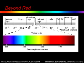
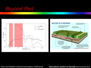
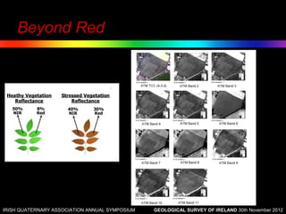
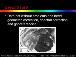


The document discusses the applications of multispectral remote sensing in geoarchaeology, emphasizing the differential reflectance of earth materials across the electromagnetic spectrum, particularly in the infrared. It outlines the principles, instruments, and methods employed in this technology, as well as its potential for enhancing the understanding of fluvial environments and anthropogenic features. Future advancements in high-resolution satellite imagery are also highlighted, along with the importance of image processing techniques for effective data analysis.


