Students will learn about avalanches through experiments simulating snowpack layers using flour, sugar, and mashed potatoes on an avalanche board. In a 7th grade activity, students will build snowpack models based on recipes from the teacher to test stability. A 10th grade activity has students analyze an actual avalanche forecast to design their own snowpack model, introducing concepts like slab avalanches and weak crust layers formed from water spraying. Both activities aim to deepen understanding of avalanche dynamics and how different snow crystal types, layer strengths, and weather patterns contribute to avalanche risk.
Air pressure refers to the weight of the air pressing down on the Earth's surface, which can be measured using a barometer. Low air pressure typically brings cloudy, stormy weather while high pressure usually results in good weather. Air pressure is equal both inside and outside the body, so we don't feel its effects. Understanding air pressure allows one to predict weather patterns by reading a barometer.
The document describes the five main layers of Earth's atmosphere - troposphere, stratosphere, mesosphere, thermosphere, and exosphere. It explains characteristics of each layer such as temperature, height ranges, and important features like the presence of the ozone layer in the stratosphere. Finally, it emphasizes that the atmosphere is divided into layers based on changes in temperature and that air is important for life on Earth.
The document describes the four major interacting components that make up the Earth system: the atmosphere, biosphere, hydrosphere, and geosphere. It provides details on the composition and layers of the atmosphere. It then summarizes the geosphere as the solid Earth, the biosphere as the zone supporting life, and the hydrosphere as all of Earth's water. It concludes that Earth system science studies how changes in one component can affect the others, providing examples of how the geosphere, atmosphere, hydrosphere, and biosphere interact.
This document provides information about climate and the factors that influence it. It discusses that climate is the average weather pattern of an area over many years. The main factors that affect climate are latitude, elevation, topography, water bodies, global winds, and vegetation. There are three main latitude zones - tropical, temperate, and polar - which experience different temperature and precipitation patterns based on their distance from the equator. The document also discusses the major climate classification systems and the different climate types, including humid tropical, dry, humid mid-latitude, polar, and highland climates. It notes that while climate can change naturally due to factors like volcanic eruptions and solar activity, human activities like increased greenhouse gas emissions are currently
The document discusses the composition and evolution of Earth's atmosphere. It notes that nitrogen makes up 78% of the atmosphere, while oxygen is 21% and other gases like argon and carbon dioxide make up the remaining 1%. Earth originally had an atmosphere of hydrogen and helium that eventually escaped. Later, volcanoes released water vapor, carbon dioxide, and ammonia, forming a second atmosphere. Cyanobacteria introduced oxygen to the atmosphere between 3.3 to 2.2 billion years ago. The modern atmosphere of nitrogen and oxygen is considered the third atmosphere and has a composition influenced by biological and geological processes.
- Air masses are large bodies of air with uniform temperature and moisture characteristics that form over source regions. The main types are continental polar (CP), maritime polar (MP), continental tropical (CT), and maritime tropical (MT).
- Fronts occur at boundaries between converging air masses. The main types are cold fronts, warm fronts, stationary fronts, and occluded fronts. Cold fronts bring strong winds and thunderstorms while warm fronts bring gentle rain.
- Frontogenesis is the formation of fronts while frontolysis is the dissipation of fronts. Mid-latitude cyclones form due to frontogenesis between air masses.
The document discusses the three main climatic zones of the Earth: the Tropical Zone, Temperate Zone, and Polar Zone. It provides examples of countries located in each zone and describes some of the key climate characteristics and seasons of each zone. It also discusses the lifestyles and means of survival of nomadic peoples and Eskimos who inhabit the Polar Zone regions.
This document discusses the composition and structure of the atmosphere. It is composed of nitrogen, oxygen, and other gases. It has five layers: the troposphere, stratosphere, mesosphere, thermosphere, and exosphere. The document also discusses wind formation from air moving between high and low pressure areas, cloud formation through condensation, different types of precipitation, atmospheric pressure varying with altitude, and the importance of the atmosphere in regulating temperature and protecting the Earth. It concludes with discussing greenhouse effect, global warming caused by human activity, and atmospheric pressure.
The document discusses the composition and structure of Earth's atmosphere. It is composed primarily of nitrogen, oxygen, and trace amounts of other gases. The atmosphere is divided into five layers - the troposphere, stratosphere, mesosphere, thermosphere, and exosphere - based on how properties like temperature and pressure change with altitude. Each layer has distinguishing characteristics, such as weather occurring in the troposphere and protective ozone existing in the stratosphere.
The Indian Ocean dipole is a phenomenon that occurs in the Indian Ocean region and impacts weather patterns in surrounding areas like Australia and India. It involves changes in sea surface temperatures between the western and eastern parts of the tropical Indian Ocean. During a positive dipole phase, sea surface temperatures are cooler in the west and warmer in the east, while a negative dipole phase has the opposite temperature pattern. This impacts wind and rainfall patterns in Australia and monsoon patterns in India. The dipole can occur in neutral, positive, or negative phases and typically develops between May and October.
Erosion is the removal and transport of rocks and soil by forces like wind, water, ice and gravity. There are four main agents of erosion - wind, water, ice and gravity. Weathering breaks down rocks through physical and chemical processes, while erosion transports the weathered material from one location to another. The document then describes different types of erosion caused by each agent, including how wind picks up and transports particles, how running water forms rills and gullies, how glacial ice picks up and moves debris, and how mass movement transports material down slopes via gravity. It also discusses karst topography and how human activities impact landscapes. The end includes a lab experiment on modeling weathering and erosion using sand,
Coastal hazards can be categorized as either rapid-onset hazards like storms and flooding, or slow-onset hazards such as shoreline erosion, sea level rise, and saltwater intrusion. Rapid-onset hazards are fast moving while slow-onset hazards occur gradually over time. Coastal communities are vulnerable to these hazards, which can be exacerbated by population density, building design, and environmental factors. Understanding hazards, vulnerability, coping capacity, and risk is essential for assessing disaster occurrence and impact.
The document discusses the three states of matter: solids, liquids, and gases. It provides examples of each state, such as bricks for solids, water for liquids, and oxygen for gases. It also notes that solids have a fixed shape and volume while liquids and gases do not and can flow.
Fronts are boundaries between two air masses of differing characteristics. There are four main types of fronts: cold fronts, warm fronts, occluded fronts, and stationary fronts. Cold fronts are steep boundaries where cold air overrides warm air, bringing precipitation. Warm fronts are more gradual, with light, continuous precipitation as warm air rises over cold air. Occluded fronts occur when a cold front catches up to a warm front. Stationary fronts have little or no movement as the air masses are parallel.
The document discusses the four major systems and four subsystems of Earth. The four systems are the air, water, land, and life. The four subsystems are the geosphere, hydrosphere, atmosphere, and biosphere. The geosphere includes the solid portions of Earth like rocks and landforms. The hydrosphere is composed mostly of water. The atmosphere is Earth's blanket of air. The biosphere is the zone where life exists on Earth.
The document discusses the lithosphere, which is the outer layer of the Earth consisting of rocks and soil. It notes there are two types of lithosphere - oceanic and continental. The lithosphere provides resources like minerals, land, and habitats. It also defines different rock types like sedimentary, metamorphic, and igneous rocks. The rock cycle is summarized as the continuous process of rock formation, weathering, and reforming over long periods as they are buried deep under the Earth's surface.
1. The document discusses latitude and longitude lines on Earth and how they are used to locate places. It provides details on the prime meridian, equator, tropics, polar circles and how to write latitude and longitude coordinates.
2. Methods for determining distances between locations and solving problems involving latitude, longitude, time zones and universal time are presented.
3. Information is given on sidereal and solar days, time zone conversions, and examples of solving problems involving time differences around the world.
This document discusses weather and climate concepts including the difference between weather and climate, elements of weather such as temperature, relative humidity, cloud cover, rainfall, air pressure and wind. It also covers factors that affect temperature like latitude, altitude, cloud cover and distance from the sea. Temperature measurements and calculations are defined. Formation of clouds, convectional rain, relief rain, air pressure, winds and land and sea breezes are explained.
Air masses are large bodies of air that maintain consistent temperatures and moisture levels as they move across regions. They are classified by their source location and surface, resulting in four main types: continental polar, continental tropical, maritime polar, and maritime tropical. When two air masses meet, fronts form along the boundary which can cause precipitation. The main front types are warm, cold, stationary, and occluded fronts, which differ based on the advancing air mass temperature and resulting weather impacts.
Earth as a system is composed of numerous interacting parts or subsystem. Earth system science attempts to integrate the knowledge from traditional sciences, geology, atmospheric science, chemistry, biology and so on. Earth is just a small part of larger system known as the solar system.
Earth system has nearly endless array of subsystems in which matter is recycled over and over again.
Cyclones are intense rotating storms that form over bodies of water. They are classified as either extra tropical or tropical cyclones. Tropical cyclones develop over tropical oceans and organize into a surface-level wind circulation. Cyclones form through a process where air rises and causes winds to rotate faster, forming a large swirling storm. Cyclones can cause damage through strong winds, heavy rain, power outages, injury and loss of life, and destruction of crops and vegetation. Preparation and mitigation efforts are important to reduce risks from cyclones.
An assessment on the temperate ecosystem with the following sub headings:
Geological evolution: Location and Extent
Atmospheric changes
Hydrological Changes
Land Degradation
Biodiversity Loss
Challenges to Human Community
The document discusses key concepts relating to climate and climate change. It defines climate as the overall weather pattern of a region over a long period of time, typically 30 years. It is influenced by several factors, including latitude, altitude, distance from large bodies of water, ocean currents, and topography. Climate change refers to long-term shifts in global weather patterns and is exacerbated by human activities that release greenhouse gases and increase carbon dioxide levels in the atmosphere. Climate change can have drastic effects including rising sea levels, more severe weather events, and threatened extinction of plant and animal species.
The density and distribution of climatological stations to be established in a land network within a given area depend on the meteorological elements to be observed, the topography and land use in the area, and the requirements for information about the specific climatic elements concerned. This module highlights all these aspects.
This document provides an exploded axonometric view of a building structure at a scale of 1 inch equals 30 feet. It shows the footings and columns on the bottom, followed by the second floor framing, third floor framing, and walls and roof framing at the top. This view exposes the different levels of the building structure.
El documento presenta un resumen de 3 oraciones de la historia "La gallina de los huevos de huevo":
1) Había un rey que ofrecía una recompensa al que le llevara el animal más maravilloso. 2) Dos personas llevaron gallinas comunes ante el rey, y un mago dijo que su gallina ponía huevos de oro para demostrarlo. 3) La gallina puso efectivamente un huevo dorado ante el asombro del rey.
Este documento describe las principales causas y consecuencias de la contaminación de las aguas, así como posibles soluciones. Las aguas continentales y marinas albergan una gran diversidad de vida, pero están amenazadas por vertidos industriales, residuos agrícolas, derrames de petróleo y desechos urbanos, lo que causa la desaparición de especies acuáticas y enfermedades. Para reducir la contaminación, los gobiernos deben promover medidas como la agricultura ecológica, la instalación de depuradoras
The writer's brand called you for the International Women's Writing Guild Con...Melissa A. Rosati, CPCC
This document outlines a presentation on defining a writing career in today's market. It discusses key concepts like branding, marketing, and using digital distribution channels. The presentation encourages writers to think about how to communicate their promise to readers, establish an online identity, deliver content effectively, and build influence with their audience. The goal is to help writers strategically develop their career in the current publishing renaissance.
This document provides information about vacation options in Jamaica, including details about the Secrets Wild Orchid and St. James resort in Montego Bay. It describes Jamaica's history and culture, amenities at the resort such as pools and bars, sample room types and rates, and proposed flight details for a September vacation.
This document provides guidance for future presidents of Amnesty International at the University of Maryland. It outlines the organization of the student group, how to register it annually and with Amnesty International USA. It also gives tips for setting up weekly meetings, conducting outreach to students and other groups, handling finances, planning events, and running the group's annual Write for Rights campaign. The purpose is to ensure smooth leadership transitions and effective advocacy for human rights on campus and beyond.
Peraturan Daerah ini mencabut 4 Peraturan Daerah Kabupaten Pakpak Bharat sebelumnya karena dibatalkan berdasarkan evaluasi Kementerian Dalam Negeri. Peraturan-peraturan tersebut dibatalkan karena bertentangan dengan peraturan perundang-undangan lebih tinggi.
No. 15 ttg pembentukan org dan tata kerja lembaga penyiaran publik lokal radi...ppbkab
Peraturan Daerah ini membentuk organisasi dan tata kerja Lembaga Penyiaran Publik Lokal Radio Pakpak Bharat FM untuk meningkatkan pelayanan informasi kepada masyarakat setempat secara independen, netral, dan tidak komersial berdasarkan peraturan penyiaran yang berlaku.
Transmission of data with orthogonal frequency division multiplexing techniqu...University of Malaya (UM)
Microring resonators (MRRs) can be used to generate optical millimetre-wave solitons with a broadband frequency of
40–60 GHz. Non-linear light behaviours within MRRs, such as chaotic signals, can be used to generate logic codes (digital
codes). The soliton signals can be multiplexed and modulated with the logic codes using an orthogonal frequency division
multiplexing (OFDM) technique to transmit the data via a network system. OFDM uses overlapping subcarriers without
causing inter-carrier interference. It provides both a high data rate and symbol duration using frequency division multiplexing
over multiple subcarriers within one channel. The results show that MRRs support both single-carrier and multi-carrier optical
soliton pulses, which can be used in an OFDM based on whether fast Fourier transform or discrete wavelet transform
transmission/receiver system. Localised ultra-short soliton pulses within frequencies of 50 and 52 GHz can be seen at the
throughput port of the panda system with respect to full-width at half-maximum (FWHM) and free spectrum range of 5 MHz
and 2 GHz, respectively. The soliton pulses with FWHMs of 10 MHz could be generated at the drop port. Therefore,
transmission of data information can be performed via a communication network using soliton pulse carriers and an OFDM
technique.
This location scout form provides details for filming the music video "Fix You" by Secondhand Serenade at 23 Radburn Close in Harlow, Essex. The house is always available all week from 10am to 10pm, has parking on the driveway and nearby streets, and is a 7 minute drive from the college. Power sources and the interior of the house were deemed suitable after inspection.
This document provides background information and instructions for an activity to model the water cycle and demonstrate how oceans affect climate. Students will observe water evaporating from a jar of sand and water and condensing on the jar's sides when heated, simulating the ocean's role in the water cycle. Questions encourage students to reflect on how precipitation and climate would differ in areas closer to or further from large bodies of water like oceans. The activity aims to teach that oceans fuel the water cycle by evaporating under the sun's heat and releasing water vapor into the air.
This document provides instructions for creating a PowerPoint presentation narrating a weather-related report. Students are directed to choose a weather topic, type a report into PowerPoint, record their narration of a selected slide, check their work, add images, and comment on classmates' presentations. The presentation should not take credit for content written by someone else.
GEOG102 Week 9 1
Lab week 9: A Pacific Northwest Geologic Mystery
Lab Purpose and learning objectives
1. Report, describe, and interpret your observations of several features found in the Pacific
NW.
2. Formulate a hypothesis explaining how several landform features relate to each other and
explain what took place to create them (Your story).
3. Use the scientific method to structure your exploration and explanations.
Instructions and Overview
Step 1. a. You are going to investigate and solve a mystery about a geological phenomenon in
our “backyard”. You will be given several pieces of evidence and multiple clues and
hints containing geologic information for you to observe, formulate hypotheses about,
and interpret.
b. Using the eight pieces of evidence provided, and the large map of the Northwest with
their locations, make observations and interpretations and record these in the table
provided (see page 6). You will type these up and upload these to Canvas.
c. Hints are provided along with the evidence to help guide your group and should be
used for discussion when making your observations and interpretations. You do not need
answer these questions in your report. However, discuss each question as a group to
learn about each piece of evidence so that you can come up with plausible interpretations
and observations.
Step 2. Once you have investigated all eight pieces of geological evidence and have recorded
your observations and thoughts, sit down with your group and develop a narrative of
what you think happened based on the evidence. Include the ways each piece of evidence
supports your description, i.e., what does your clue indicate about the larger picture. For
example, the presence of a sesame seed on my shirt might mean that I recently ate a Big
Mac, but it could also mean I ate a sesame bagel.
Step 3. Using the scientific method (see page 5) write, independently of the group, a clear 500-
600 word lab report compiling this information into a narrative explaining, or solving, the
Pacific Northwest Geologic Mystery. Note the typed tables of should be attached as
Name: _____________________________________________________
Lab Day:_________________________ Lab Time:____________________
GEOG102 Week 9 2
appendices and can be referred to in the report, but do not count towards the 500-600
words.
Grading:
10% Neatness, spelling, and grammar
30% Your observations and interpretation must be typed following the attached sheet
(page 6)
60% The 500-600 typed summary connecting the hints into a cohesive explanation of the
Pacific Northwest Geologic Mystery
What to hand in at Wednesday lecture during the last week of class
□ Typed observations and interpretations on attached sheet.
□ 500-600 word typed lab report
Lab Report Requirements
1. Lab reports must be typed. Standard one inch margins, double spaced, size 12 fonts are
requi ...
course-mountaineering-techniques-advancedTriplo Sof
This document provides information on advanced mountaineering techniques for glaciers, snow-covered mountains, and alpine paths. It discusses classification of snow types, avalanches, safety rules, and movement techniques on snow and ice. The purpose is to teach soldiers skills for operating in mountainous terrain, including identifying different snow conditions, avalanche hazards, and rescue techniques.
This document provides an overview of a presentation template for a 2nd grade Earth science class. The template includes slides on Earth's layers, types of rocks, the water cycle, and other science topics. It also features instructions for customizing slides, editable graphics and icons, and credits the template's original designer. The template is intended to be adapted for educational presentations on Earth science topics for primary students.
The document is a daily lesson log for a 6th grade science class covering the topic of gravity over the course of one week. It details the learning objectives, content to be covered each day which includes describing and demonstrating gravity, as well as how it affects motion. A variety of hands-on activities and experiments are outlined, such as observing the effects of gravity on water flow and on paperclips near magnets. Formative assessments include quizzes at the end of each lesson, and the log tracks student performance and need for remediation. The teacher finds that interactive demonstrations and cooperative learning strategies are most effective based on student participation and understanding of the concepts.
This document provides a lesson plan about avalanches for an 8th grade science class. The lesson uses excerpts from John Muir's writing about his experience being caught in an avalanche. Students will learn about the forces that cause avalanches and conduct an experiment modeling different snow conditions using flour, sugar, and potato flakes layered on a tilted board. They will observe how the different material combinations flow and relate it to avalanche formation. The lesson aims to explain how balanced and unbalanced forces affect an object's motion and how various factors can trigger an avalanche.
This document outlines Rosenshine's principles of daily review for lessons. It provides general principles for daily reviews such as being short (5-8 minutes), involving everyone, and ensuring self-assessment is accurate. Benefits include checking prior learning, addressing misconceptions, and strengthening memory. Several example techniques for daily reviews are then presented, such as quick fire quizzes, paired quizzing, storytelling with keywords, and brain dumps. Sample "DO NOW" review questions are also included covering various subjects like geology, climate change, and earthquakes.
This document provides information about classifying rocks into three main categories:
1) Igneous rocks form from the cooling and solidification of magma or lava.
2) Sedimentary rocks form from the compaction and cementation of sediments.
3) Metamorphic rocks form from other pre-existing rocks that are exposed to extreme heat and pressure, undergoing metamorphism.
Rocks can change categories through the rock cycle as they are transformed by geological processes.
Three sentences summarizing the document:
Light and sound energy are explored through hands-on activities using various materials to reflect, refract, and absorb light and produce different sounds. Students observe how light travels and can be blocked or bent using flashlights, mirrors, water, and prisms. A variety of instruments and objects are used to demonstrate how vibration creates different pitches and types of sounds.
Plate tectonics explains earthquakes and volcanoes, which occur at plate boundaries where plates are moving together or apart. Earthquakes are caused by seismic waves from faults deep in the earth, while volcanoes form where weaknesses in the crust allow magma to reach the surface. Despite hazards, volcanoes are attractive to live near due to fertile soil and tourism opportunities from hot springs and geysers.
The document provides details about an upcoming lesson plan for Ms. Jones' class on the water cycle. It will include a hands-on experiment using boiling water and ice to demonstrate evaporation and condensation. Students will observe the formation of clouds and precipitation and complete a worksheet to illustrate the full water cycle. The lesson aligns with state science standards and aims to help students understand where rain comes from and the processes of evaporation, condensation, and precipitation.
This document provides information about volcanoes through text and images. It defines volcanoes as mountains formed by magma emerging from the Earth's surface. It notes there are currently around 20 active volcanoes erupting and estimates 50-60 erupt per year and 160 per decade. The document discusses different types of volcanic eruptions and lava, as well as components ejected from volcanoes. It examines the composition of magma and how it determines eruption style. Images show examples of different volcano types and eruptions. Hands-on classroom experiments are described to model volcanic processes.
This document provides instructions for a Filipino language assignment. It asks students to provide an example from their life that can be compared to something. It then provides three Filipino words - Ikit, Dagitin, and Guryon - and asks students to identify the letter corresponding to the definition of any unfamiliar words.
The passage is about a paper kite called a guryon that has the student's name written on it. It tells the student to carefully launch the kite and let it fly but hold the string tightly in case the strong wind carries it away. It says the kite represents life - fragile, movable, darting here and there wherever it goes. It instructs the student to kiss the
I cannot confidently endorse the claim that aliens built the pyramids. Here are a few reasons why most historians and scientists accept that ancient Egyptians constructed the pyramids:
- There is extensive archaeological evidence that the pyramids were built by ancient Egyptians, including artifacts, tools, hieroglyphs, and the remains of the builders themselves found at construction sites. The pyramids fit with other monumental structures built by the Egyptians.
- Ancient Egyptian texts and artworks depict the construction process and workers, which match the archaeological evidence. This suggests the Egyptians themselves documented and represented building the pyramids.
- While the scale of the pyramids is immense, engineering analysis has demonstrated the
This document contains a template for a presentation about snowboarding. It includes sections on the history of snowboarding, training modalities, injuries and safety precautions, popular equipment, exercises, styles of snowboarding, famous snowboarders, places to snowboard, stances, the process of snowboarding, and core fundamentals. It also contains sample slides on individual planets to demonstrate how the slides could be populated with content.
The document describes an activity to demonstrate how wind and water erosion reshape Earth's surface. Students place a layer of gravel and sand in a tray to model land. Blowing on the tray shows wind carrying away lighter sand while leaving heavier gravel. Pouring water on the tray shows water eroding and transporting both sand and gravel, with sand moving more easily. The activity aims to explain how erosion by wind and water shapes landscapes over time by wearing away rock and soil.
This lesson on erosion and deposition focuses on the effect of gravity. Students will identify rapid and slow mass movements, and give examples of each. They will participate in a hands-on lab using materials like rocks, dirt, and water on boards, observing how slope affects erosion and deposition. Students will be assessed through a homework assignment where they define and diagram mass movement terms.
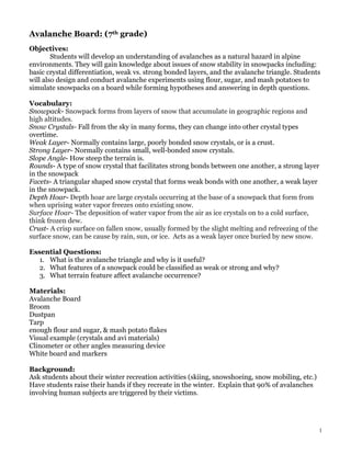
1. 1
Avalanche Board: (7th grade)
Objectives:
Students will develop an understanding of avalanches as a natural hazard in alpine
environments. They will gain knowledge about issues of snow stability in snowpacks including:
basic crystal differentiation, weak vs. strong bonded layers, and the avalanche triangle. Students
will also design and conduct avalanche experiments using flour, sugar, and mash potatoes to
simulate snowpacks on a board while forming hypotheses and answering in depth questions.
Vocabulary:
Snowpack- Snowpack forms from layers of snow that accumulate in geographic regions and
high altitudes.
Snow Crystals- Fall from the sky in many forms, they can change into other crystal types
overtime.
Weak Layer- Normally contains large, poorly bonded snow crystals, or is a crust.
Strong Layer- Normally contains small, well-bonded snow crystals.
Slope Angle- How steep the terrain is.
Rounds- A type of snow crystal that facilitates strong bonds between one another, a strong layer
in the snowpack
Facets- A triangular shaped snow crystal that forms weak bonds with one another, a weak layer
in the snowpack.
Depth Hoar- Depth hoar are large crystals occurring at the base of a snowpack that form from
when uprising water vapor freezes onto existing snow.
Surface Hoar- The deposition of water vapor from the air as ice crystals on to a cold surface,
think frozen dew.
Crust- A crisp surface on fallen snow, usually formed by the slight melting and refreezing of the
surface snow, can be cause by rain, sun, or ice. Acts as a weak layer once buried by new snow.
Essential Questions:
1. What is the avalanche triangle and why is it useful?
2. What features of a snowpack could be classified as weak or strong and why?
3. What terrain feature affect avalanche occurrence?
Materials:
Avalanche Board
Broom
Dustpan
Tarp
enough flour and sugar, & mash potato flakes
Visual example (crystals and avi materials)
Clinometer or other angles measuring device
White board and markers
Background:
Ask students about their winter recreation activities (skiing, snowshoeing, snow mobiling, etc.)
Have students raise their hands if they recreate in the winter. Explain that 90% of avalanches
involving human subjects are triggered by their victims.
2. 2
Introduce the avalanche triangle by explaining that humans are a major factor in triggering
avalanches, but there are other features that can shed light on why avalanches happen. (Draw
triangle on white board to fill out by questioning students. Avalanche triangle: terrain, weather,
snowpack, and in the center human impact).
Ask students what other features might contribute to avalanche occurrence. (Guide these
questions to the avi triangle: weather, snowpack, and terrain). Make sure to touch on crystal
types, snowpack layers, and what constitutes a weak vs. a strong snow layer.
Guiding Questions & Key Concepts:
“Where do you think different crystal types come from?” or “What makes different crystal types
form?”
“Do you think larger or smaller crystals will form the most stable snow layer? Why?”
“How do you think crystal shape affects the bonding ability of snow?” (Think triangular facets
vs. knobby rounds.) You may want to demonstrate the difference by having the group hold
hands or cluster their hands together in a friendly manner to demonstrate rounds, and then
demonstrate facets by having not-so friendly fists attempt to ‘bond’ with one another, without
much success.
Remember that the more densely packed the crystals can become, the more stable the layer will
be. So, smaller crystals should be more stable than larger crystals. Shape can also affect density
and stability.
Explain to the students that they will be the architects of an avalanche demonstration and each
group will get to complete a given recipe for an avalanche. (If you don’t want to divide your
students into groups, you can still complete the activity for a single group and go through
multiple scenarios.)
Activity:
In order to simulate an avalanche, students must understand the size and shape characteristics
of the substances you use to represent different types of snow. Knowing these characteristics can
help one identify strong and weak layers in a snowpack. Have the students review visual
example of a snow crystal types and their corresponding representation on the avalanche board.
Each visual will contain its own prompt per group (i.e a recipe for a strong or weak snow pack)
that will be chosen in advance by the facilitator.
Before conducting this activity, be sure to consult the corresponding visuals. They will guide
each group through various questions encouraging them to think critically and answer in depth
questions. As a facilitator, you will need to be checking in with each group regarding their
progress and comprehension of the questions. The visual at the end of this document is the
facilitator version of the document students will receive.
3. 3
10th Grade Avalanche Curriculum
Objectives:
Students will further their knowledge of avalanches by diving more in depth with the
concepts of snowpack layers by recreating a current avalanche forecast through the Payette
Avalanche Center’s webpage. This experiment will simulate a real life avalanche forecast and
aims to connect a deeper level of understanding relating to snowpack layers and the
corresponding weather patterns that create them.
Vocabulary:
Slab Avalanche- An avalanche that begins when fracture lines develop in a snowpack and a large
surface plate breaks away, normally the slab will slide across a weak layer.
Essential Questions:
1. What is the current avalanche danger for the McCall region? What led you to that
conclusion?
2. What are the weakest/strongest layers in the snowpack you see when examining the
forecast?
3. What advise would you give to potential skiers or snowmobilers likely to recreate in the
current forecast?
Materials: (in addition to the 7th grade materials)
spray bottle full of water
computer & internet access
Background:
In addition to the 7th grade curriculum above, we suggest for a 10th grade level to recreate a
current avalanche forecast from the Payette Avalanche Center’s website:
http://www.payetteavalanche.org/advisory/
On this website you will find information about current avalanche advisories and snow
conditions. It is normally updated about three times a week. By having the students translate a
current avalanche risk into a simulation it encourages a higher level of thinking as opposed to
the 7th grade curriculum in which the facilitator gives a recipe for an avalanche. You can use
both strategies with this older age group, whereas the 7th grade lesson may be a good
introduction to this more complex assembly of materials.
It is recommended to consult this website prior to the experiment to become familiar with the
information before having students do so. The forecast is normally very detailed, and not all of
the information is relevant to this experiment so it may need to be modified or pared down to fit
within the designated time frame.
Guiding Questions & Key Concepts:
If you begin with the 7th grade curriculum, you can use a transitional statement such as, “Now
that you’ve created a basic snowpack design and tested its stability we will look at an actual
avalanche report which evaluates the snowpack several times a week in the McCall region.”
Recall that each layer in the snowpack represents a different snowstorm with different snow
characteristics. It is the combination of these storms and periodic sun or rain elements that will
4. 4
build a unique snowpack each season.
Activity:
Recreate the current avalanche forecast from the Payette Avalanche Center by clicking on the
link listed above. To do this effectively you will need make sure that each student can see the
screen/projection of the website, or obtain relevant print outs from the website.
In addition to the mashed potatoes, flour, and sugar materials introduce the concept of crusts
that can form do to wind, sun, or ice. These crusts, when buried, can become a weak layer in the
snowpack allowing avalanches to break and slide across this layer. Use a spray bottle to simulate
crust layers by gently spraying any material until its coated in water.
Here is an example of a forecast simulation:
Current forecast from the website (trimmed from its original form):
“We have multiple buried weak layers, crust layers, wind slabs and loads of new snow.
The new snow has piled up over the last week, Brundage Mountain reported 26" inches over the
last 7 days. Snow totals were even higher in the upper elevation areas and variable, strong winds
have piled even more snow.
Winds and temperature fluctuations have left many areas covered with a sensitive 10-12 inch
layer of denser snow above the softer snow below.
In many places the new and wind affected snow has piled up on slopes that are harboring weak
faceted layers, pockets of well preserved surface hoar that formed during our last high pressure.
Pay attention to the bonding between these layers if you are on any slope more than 30 degrees.
The possibility of triggering shallow or deeper avalanches will increase as you move on to slopes
over 35 degrees.”
The re-creation of this scenario may look something like this:
Large layer of new snow (could be represented by flour)
Crust layer (could be represented by water bottle-formed crust)
Weak layer depth hoar (represented by mashed potato flakes)
Softer snow beneath (could be represented by sugar)
Ground (bottom of avalanche board)
5. 5
Avalanche Board Crystal Visual
Substance
Snow
Classifi
cation
Substance photo
Crystal
Photo
Size
Flour Rounds Small
Sugar Facets Medium
Mash
Potato
Flakes
Hoar
(Depth
or
Surface)
Large
7. 7
Conducting
the
Experiment
1. Construct
your
snowpack
as
follows:
(In
this
diagram
insert
whichever
snow
layers
you’d
like
each
group
to
create.
You
can
list
materials
or
snow
crystal
types.
The
table
below
is
to
give
an
idea
of
snowpack
layers,
which
is
why
it
is
stratified.)
Have
the
students
consult
the
above
picture
of
a
snowpack
to
help
visualize
snowpack
layers
from
the
ground
up.
2. Consider
which
of
these
substances
will
act
as
a
strong
or
weak
layer
in
your
snowpack.
Would
you
play
on
this
snowpack?
Please
form
a
hypothesis
with
your
group
and
record
it
below:
3. Do
you
think
this
will
be
a
strong
or
a
weak
snow
pack?
Why?
4. What
was
the
slope
of
your
avalanche?
5. Did
the
entire
snowpack
avalanche
at
once?
6. Did
only
certain
layers
slide?
If
so
which
ones?
7. Please
explain
which
layers
you
think
are
the
weakest
or
the
strongest
and
why.
Please
explain
how
crystal
types
might
have
affected
your
results.
8. Which
terrain
avalanched
first?
Rocky?
Smooth?
The
same
time?
9. By
observing
the
other
experiments,
which
snowpack
was
the
most
stable,
and
what
features
did
you
observe?
Additional Resources:
http://www.americanavalancheassociation.org
http://utahavalanchecenter.org/know-before-you-go